Recent searches
Loading...
1382-154 - Office Center 1000 building, in the form of a former 1,000 LTL banknote (the Lithuanian litas), by architect Rimas Adomaitis, Kaunas, Lithuania, Europe
83-10781 - The huge Kailasa (Kailash) Temple, Ellora, Maharashtra State, India"Cut from the rock in the Hindu section of the world-heritage cave temples at Ellora, a project which took 150 years and entailed the removal of 200,000 tons of rock"
832-374654 - A worker vacuums oil from behind a containment boom on the Kalamazoo River during the cleanup of a major oil spil in which 800, 000 gallons of oil spilled from an Enbridge Energy Partners pipeline, Battle Creek, Michigan, USA
832-374655 - Workers place containment boom on the Kalamazoo River to contain an oil spill during which 800, 000 gallons of oil spilled from an Enbridge Energy Partners pipeline, Battle Creek, Michigan, USA
832-374653 - A worker vacuums oil from behind a containment boom on the Kalamazoo River during the cleanup of a major oil spil in which 800, 000 gallons of oil spilled from an Enbridge Energy Partners pipeline, Battle Creek, Michigan, USA
252-4317 - Giant's Causeway on the Causeway coast, 37,000 hexagonal basalt columns, UNESCO World Heritage Site, County Antrim, Ulster, Northern Ireland, United Kingdom, Europe
763-968 - The famous railroad that climbs from Cuzco at 11,000 to Puno at 14,000 on Lake Titicaca, Altiplano, Peru
788-280 - Aerial view of World’s largest cattle feedlot (120,000 head). Monfort beef, CO
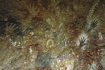
797-1852 - ARGENTINA Patagonia Cueva de las Manos Cave of the Hands. Prehistoric rock paintings of human hands in red black and orange 13 000 to 9 500 years old.
911-10905 - In mid January 2015, a three day period of excessive rain brought unprecedented floods to the small poor African country of Malawi. It displaced nearly quarter of a million people, devastated 64,000 hectares of land, and killed several hundred people. This shot shows solar powered lamps in a refugee camp near Chikwawa.
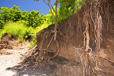
911-10899 - In mid January 2015, a three day period of excessive rain brought unprecedented floods to the small poor African country of Malawi. It displaced nearly quarter of a million people, devastated 64,000 hectares of land, and killed several hundred people. This shot shows tree roots exposed as the river bank was washed away near Chikwawa.
832-153706 - 4 time champion Hans Gatt massaging his dogs, 36-hour layover, Dawson City, Yukon Quest 1, 000-mile International Sled Dog Race 2010, Yukon Territory, Canada
832-136088 - The Creation Museum, which presents the fundamentalist Christian view, based on the book of Genesis, that God created the earth 6, 000 years ago, denying evolution, Petersburg, Kentucky, USA
832-136193 - The Golden Spike Tower with observation deck and visitor center at Union Pacific Railroad's Bailey Yard, the largest rail yard in the world which handles 14, 000 rail cars every day, North Platte, Nebraska, USA
306-4166 - St. Pierre Bay, with Mont Pelee behind, scene of 1902 volcanic disaster, which killed 30,000 people, Martinique, Windward Islands, West Indies, Caribbean, Central America
832-124597 - 18-storey apartment building by Walter Gropius, Gropius City, satellite settlements, large housing estate, satellite town with 18, 000 homes, Neukoelln, Berlin, Germany, Europe
911-10893 - In mid January 2015, a three day period of excessive rain brought unprecedneted floods to the small poor African country of Malawi. It displaced nearly quarter of a million people, devastated 64,000 hectares of alnd, and killed several hundred people. This shot shows a food being ferried across a river near Phalombe after the bridge was washed away.
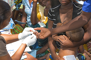
911-10939 - In mid January 2015, a three day period of excessive rain brought unprecedented floods to the small poor African country of Malawi. It displaced nearly quarter of a million people, devastated 64,000 hectares of land, and killed several hundred people. This shot shows A Medicin Sans Frontieres clinic in Makhanga testing local people for malaria, many of whom proved positive for the disease, as a result of the drying up flood waters providing ideal breeding grounds for mosquitoes.
911-10940 - January 2015 saw a three day period of excessive rain which brought unprecedented floods to the small poor African country of Malawi. It displaced nearly quarter of a million people, devastated 64,000 hectares of land, and killed several hundred people. This shot shows A Medicin Sans Frontieres clinic in Makhanga testing local people, many of whom now have malaria, as a result of the drying up flood waters providing ideal breeding grounds for mosquitoes.
911-10900 - In mid January 2015, a three day period of excessive rain brought unprecedneted floods to the small poor African country of Malawi. It displaced nearly quarter of a million people, devastated 64,000 hectares of alnd, and killed several hundred people. This shot shows a displaced women carrying water in the refugee camp of Chiteskesa refugee camp, near Mulanje.
857-69490 - Camel traders and herders sit in a tea hut in a camel market in El Obeid, Sudan on February 16, 2006. Yussuf Gamaa, 2nd from L, is a camel herder from Darfur. About 150,000 camels cross over from Sudan into Egypt every year, the majority as cattle as an inexpensive source of protein. Today the camel is both the caravan and the cargo. Camels from this market will travel the Forty Days Road or Darb el-Arbein a 1,200 mile desert trail into Egypt and the oldest trade route in the Sahara. Desert nomads like Yussuf depend on the profitable camel trade for their livelihood.
857-70414 - Jen Dwyer holds a photograph of her grandmother while taking part in the All Souls Procession in Tucson, Arizona, November 6, 2002. Inspired by Mexico's Dia de los Muertos holiday, over 10,000 participants gather on the streets of downtown Tucson for a two-mile long human-powered procession that ends in the finalizing action of burning a large urn filled with the hopes, offerings and wishes for those who have passed.
857-69416 - Survivors look for any signs of relatives and friends May 17 in Beichuan, China. The death toll in China's worst earthquake in 30 years could top 80, 000 according to the government.
857-65518 - An elephant carries felled teak logs to stacking piles for pickup. Near the village of Cochin in Kerala, India, Asian elephants are used to log teak from a commercial plantation. The domestication and use of elephants in India is a tradition over 4,000 years old.
857-69403 - A rescue worker waters his dog May 17 in Beichuan, China. The death toll in China's worst earthquake in 30 years could top 80, 000 according to the government.
857-47321 - Dhaka, Bangladesh - July 2011: Street traffic in Dhaka. With over 400, 000 rickshaws running the streets on Dhaka every day the Bangladeshi capital has been described as the "Rickshaw capital of the world.
857-33520 - A Pashtun girl holds her younger brother, in the Meira camp for earthquake survivors in the Northwest Frontier Province, Pakistan. The Meira Tent camp (also called Mera, or Maria camp), is located on the Indus River in the Battagram district. The camp, the largest for displaced people in Pakistan, hosts over 21,000 earthquake survivors, primarily from the Allai valley in Pakistan's NWFP, one of the areas worst-hit by the October 8, 2005 earthquake.
857-33527 - An adolescent Pashtun girl shields her face as she carries water through the streets of the Meira camp for earthquake survivors, Northwest Frontier Province, Pakistan. The conservative code of the Pashtun tribe of the area dictate that girls must cover themselves, including their faces, after their first period. The crowded life in the camp has made such rules difficult to follow. The Meira Tent camp (also called Mera, or Maria camp), is located on the Indus River in the Battagram district. The camp, the largest for displaced people in Pakistan, hosts over 21,000 earthquake survivors, primarily from the Allai valley in Pakistan's NWFP, one of the areas worst-hit by the October 8, 2005 earthquake.
857-33522 - In the Meira camp for earthquake survivors, two Pashtun men sit by piles of family possesions, waiting for the truck which will take them from the camp, where they have spent the winter, back to their devastated mountain village, in the Northwest Frontier Province, Pakistan. The Pakistani army, which runs the camp, has mandated that the camps be cleared by early April, despite the fact that many families are afraid or unprepared to return to their devastated homes. The Meira Tent camp (also called Mera, or Maria camp), is located on the Indus River in the Battagram district. The camp, the largest for displaced people in Pakistan, hosts over 21,000 earthquake survivors, primarily from the Allai valley in Pakistan's NWFP, one of the areas worst-hit by the October 8, 2005 earthquake.
857-19812 - Cave paintings at Estancia La Maria, Argentina. They are between 4,500 and 13,000 years old.
975-136 - from 35,000 feet in the air, the Sahara Desert looks more like the surface of Mars. Sahara Desert, Libya, North Africa
857-33992 - Striking Mongol features distinguish the face of Hamir Mohammed, his daughter and grandson (who is blind), all living in the ruins of the Qala-i-Dokthar (Daughter's Castle), outside of the town of Bamiyan, August 30, 2002. Most of the old town was destroyed and up to 20,000 people of the region might have perished when Bamiyan fell to the Taliban in 2001. Bamiyan Valley is located in the Hazarajat at the edge of the Koh-i-Baba range , the end of the Hindu Kush. Bamiyan was a prosperous Buddhist kingdom on the ancient Silk Road until the 10th century, when the region was converted to Islam; in the 12th century, it was destroyed by Ghengis Khan. Most of the people of this region are of the Hazara tribe, and are Shi'a Moslems who have been persecuted for centuries by many of the Pashtun rulers of Afghanistan, who are from the Sunni sect. They most recently suffered at the hand of the Taliban, who tried for years to ethnically cleanse the region of its Shi'a people
857-13837 - Aerials of the Paducah Gaseos Diffusion Plant, KY. There are 38,000 cylinders of depleted uranium (uranium tetrafloride UF6) which is the waste from the enrichment process of uranium.
1061-17 - Rainbow Lorikeet Trichoglossus haematodus captive adult.Bird Paradise, Hayle, Cornwall, UK. more info: status; least concern but heavy trapping of wild birds, more than 100,000 have been traded on the international market since 1981.
797-12311 - Germany, Berlin, Mitte, The Bunker based on plans of the architect Karl Bonatz, it was constructed in 1943 by Nazi Germany to shelter up to 3,000 Reichsbahn train passengers, Christian Boros purchased the bunker for his private collection of contemporary art.
911-10368 - Lake Success near Porterville, Bakersfield is at 7% capacity. Bakersfield is now the driest city in the USA. Most of California is in exceptional drought, the highest level of drought classification. 428,000 acres of agricultural land have been taken out of production due to lack of water, thousands of agricultural workers have lost their jobs and one third of all children in California go to bed hungry.
911-10346 - Dead and dying Almond trees in Almond groves in Wasco in the Central Valley of California after the irrigation water ran out following the four year long drought in the Western USA. 80% of the world's almonds are grown in California, and it takes 1.1 gallons of water to grow each nut. Many farms have run out of water, and $2.2 Billion has been wiped off the agricultue sector annually. Currently one third of all children in California go to be hungry, as a direct result of job losses connected to the drought. 428,000 acres of farmland have been taken out of production as a result of the drought, in the Central Valley.
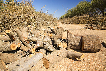
911-10341 - Almond groves being chopped down as there is no longer water available to irrigate them, in Wasco in the Central Valley of California following the four year long drought in the Western USA. 80% of the world's almonds are grown in California, and it takes 1.1 gallons of water to grow each nut. Many farms have run out of water, and $2.2 Billion has been wiped off the agricultue sector annually. Currently one third of all children in California go to be hungry, as a direct result of job losses connected to the drought. 428,000 acres of farmland have been taken out of production as a result of the drought, in the Central Valley.
911-10367 - Dying Olive trees that no longer have water to irrigate them near Bakersfield, California, USA. Following an unprecedented four year long drought, Bakersfield is now the driest city in the USA. Most of California is in exceptional drought, the highest level of drought classification. 428,000 acres of agricultural land have been taken out of production due to lack of water, thousands of agricultural workers have lost their jobs and one third of all children in California go to bed hungry.
911-10342 - Irrigation pipes near Wasco in the Central Valley of California following the four year long drought in the Western USA. Many farms have run out of water, and $2.2 Billion has been wiped off the agricultue sector annually. Currently one third of all children in California go to be hungry, as a direct result of job losses connected to the drought. 428,000 acres of farmland have been taken out of production as a result of the drought, in the Central Valley.
911-10336 - Almond groves in Wasco in the Central Valley of California that are vulnerable following the four year long drought in the Western USA. 80% of the world's almonds are grown in California, and it takes 1.1 gallons of water to grow each nut. Many farms have run out of water, and $2.2 Billion has been wiped off the agricultue sector annually. Currently one third of all children in California go to be hungry, as a direct result of job losses connected to the drought. 428,000 acres of farmland have been taken out of production as a result of the drought, in the Central Valley.
911-10340 - Almond groves being chopped down as there is no longer water available to irrigate them, in Wasco in the Central Valley of California following the four year long drought in the Western USA. 80% of the world's almonds are grown in California, and it takes 1.1 gallons of water to grow each nut. Many farms have run out of water, and $2.2 Billion has been wiped off the agricultue sector annually. Currently one third of all children in California go to be hungry, as a direct result of job losses connected to the drought. 428,000 acres of farmland have been taken out of production as a result of the drought, in the Central Valley.
911-10357 - Dead and dying grape vines in Bakersfield, California, USA. Following an unprecedented four year long drought, Bakersfield is now the driest city in the USA. Most of California is in exceptional drought, the highest level of drought classification. 428,000 acres of agricultural land have been taken out of production due to lack of water, thousands of agricultural workers have lost their jobs and one third of all children in California go to bed hungry.
911-10364 - A water charity in Porterville supplying bottled water to houses who have had no running water for over five months, near Bakersfield, California, USA. Hoses in the East of Porterville, many of which are on private wells, have run completely out of water as the water table has dropped catastrophically. Following an unprecedented four year long drought, Bakersfield is now the driest city in the USA. Most of California is in exceptional drought, the highest level of drought classification. 428,000 acres of agricultural land have been taken out of production due to lack of water, thousands of agricultural workers have lost their jobs and one third of all children in California go to bed hungry.
911-10360 - Abandoned dead and dying Orange trees that no longer have water to irrigate them near Bakersfield, California, USA. Following an unprecedented four year long drought, Bakersfield is now the driest city in the USA. Most of California is in exceptional drought, the highest level of drought classification. 428,000 acres of agricultural land have been taken out of production due to lack of water, thousands of agricultural workers have lost their jobs and one third of all children in California go to bed hungry.
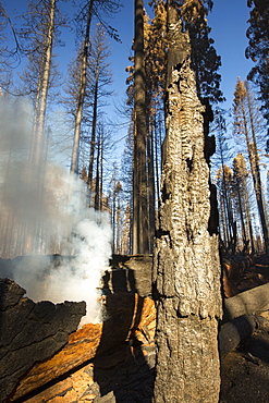
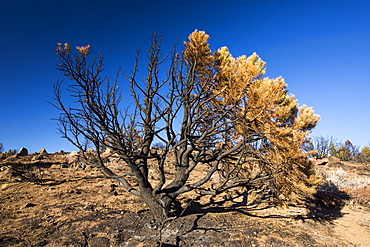
911-10420 - The King Fire that burned 97,717 acres of the El Dorado National Forest in California, USA. Following an unprecedented four year long drought, wild fires are much more common. Most of California is in exceptional drought, the highest level of drought classification. 428,000 acres of agricultural land have been taken out of production due to lack of water, thousands of agricultural workers have lost their jobs and one third of all children in California go to bed hungry.
911-10425 - Foscheck fire retardent dropped on a wild fire near Hawkins Peak above coleville in California, USA. Following an unprecedented four year long drought, wild fires are much more common. Most of California is in exceptional drought, the highest level of drought classification. 428,000 acres of agricultural land have been taken out of production due to lack of water, thousands of agricultural workers have lost their jobs and one third of all children in California go to bed hungry.
911-10414 - The King Fire that burned 97,717 acres of the El Dorado National Forest in California, USA. Following an unprecedented four year long drought, wild fires are much more common. Most of California is in exceptional drought, the highest level of drought classification. 428,000 acres of agricultural land have been taken out of production due to lack of water, thousands of agricultural workers have lost their jobs and one third of all children in California go to bed hungry.
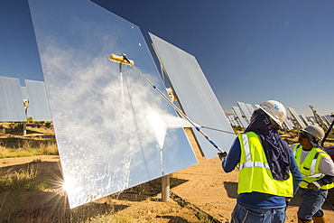
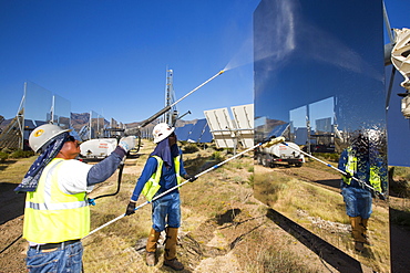
911-10692 - Workers washing the heliostats to maximise reflective power at the Ivanpah Solar Thermal Power Plant in California''s Mojave Desert is currently the largest solar thermal plant in the world. It generates 392 megawatts (MW) and deploys 173,500 heliostats that reflect the suns rays onto three solar towers. It covers 4,000 acres of desert.
911-10693 - Workers washing the heliostats to maximise reflective power at the Ivanpah Solar Thermal Power Plant in California''s Mojave Desert is currently the largest solar thermal plant in the world. It generates 392 megawatts (MW) and deploys 173,500 heliostats that reflect the suns rays onto three solar towers. It covers 4,000 acres of desert.
911-10807 - The old whaling station at Grytviken on South Georgia. In its 58 years of operation, it handled 53,761 slaughtered whales, producing 455,000 tons of whale oil and 192,000 tons of whale meat.
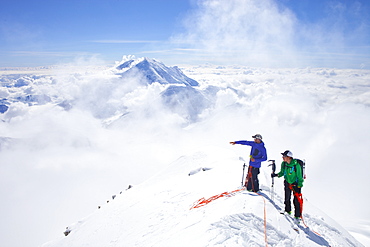
857-88775 - High Mountain Rangers Tom Ditola and David Weber are taking a rest on the West Rib on Mount McKinley, Alaska. Mount Hunter in the background. They are above the clouds in blue sky and the sun is shining. Mount McKinley, native name Denali, is the highest mountain peak in North America, with a summit elevation of 20,321 feet (6,194 m) above sea level. At some 18,000 feet (5,500 m), the base-to-peak rise is considered the largest of any mountain situated entirely above sea level. Measured by topographic prominence, it is the third most prominent peak after Mount Everest and Aconcagua. Located in the Alaska Range in the interior of the U.S. state of Alaska, McKinley is the centerpiece of Denali National Park and Preserve. Every climbing season High Mountain Rangers of the Denali National Park Service are called to help climbers in need. If possible the patient is brought down to base camp on foot, only in life threatening conditions a helicopter is called to evacuate the patient to a hospital in Anchorage.
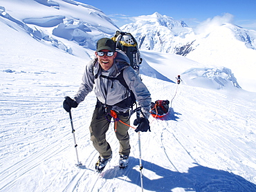
857-88779 - Mountain ranger Brian Scheele on this way to Windy Corner on Mount McKinley, also know as Denali, in Alaska. He is pulling a sled, that together with his heavy backpack is containing all the gear like tents, clothing and food. Every climbing season High Mountain Rangers of the Denali National Park Service are called to help climbers in need. If possible the patient is brought down to Basecamp on foot, only in life threatening conditions a helicopter is called to evacuate the patient to a hospital in Anchorage. Mount McKinley, native name Denali, is the highest mountain peak in North America, with a summit elevation of 20,321 feet (6,194 m) above sea level. At some 18,000 feet (5,500 m), the base-to-peak rise is considered the largest of any mountain situated entirely above sea level. Measured by topographic prominence, it is the third most prominent peak after Mount Everest and Aconcagua. Located in the Alaska Range in the interior of the U.S. state of Alaska, McKinley is the centerpiece of Denali National Park and Preserve.
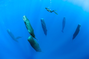
860-287912 - Snorkeler photographing a pod of Sleeping sperm whale (Physeter macrocephalus) Researchers first saw this unusual sleep behavior in sperm whales in 2008. The scientists in that study found that sperm whales dozed in this upright drifting posture for about 10 to 15 minutes at a time, Vulnerable (IUCN). The sperm whale is the largest of the toothed whales. Sperm whales are known to dive as deep as 1,000 meters in search of squid to eat. Dominica, Caribbean Sea, Atlantic Ocean. Photo taken under permit n°RP 16-02/32 FIS-5.
857-94721 - Nimoa Island - here the island mission will impress. The five-sided church features murals of island life and all mission buildings are surrounded by well maintained paths and gardens filled with flowering plants. Edged by jungle-covered mountains, postcard beaches and crystal clear waters - an island paradise indeed! The Louisiade Archipelago is a string of ten larger volcanic islands frequently fringed by coral reefs, and 90 smaller coral islands located 200 km southeast of New Guinea, stretching over more than 160 km and spread over an ocean area of 26,000 km? between the Solomon Sea to the north and the Coral Sea to the south. The aggregate land area of the islands is about 1,790 km? (690 square miles), with Vanatinai (formerly Sudest or Tagula as named by European claimants on Western maps) being the largest. Sideia Island and Basilaki Island lie closest to New Guinea, while Misima, Vanatinai, and Rossel islands lie further east. The archipelago is divided into the Local Level Government (LLG) areas Loui!
857-94719 - Nimoa Island - here the island mission will impress. The five-sided church features murals of island life and all mission buildings are surrounded by well maintained paths and gardens filled with flowering plants. Edged by jungle-covered mountains, postcard beaches and crystal clear waters - an island paradise indeed! The Louisiade Archipelago is a string of ten larger volcanic islands frequently fringed by coral reefs, and 90 smaller coral islands located 200 km southeast of New Guinea, stretching over more than 160 km and spread over an ocean area of 26,000 km? between the Solomon Sea to the north and the Coral Sea to the south. The aggregate land area of the islands is about 1,790 km? (690 square miles), with Vanatinai (formerly Sudest or Tagula as named by European claimants on Western maps) being the largest. Sideia Island and Basilaki Island lie closest to New Guinea, while Misima, Vanatinai, and Rossel islands lie further east. The archipelago is divided into the Local Level Government (LLG) areas Louisiade Rural (western part, with Misima), and Yaleyamba (western part, with Rossell and Tagula islands. The LLG areas are part of Samarai-Murua District district of Milne Bay. The seat of the Louisiade Rural LLG is Bwagaoia on Misima Island, the population center of the archipelago.
857-94715 - Nimoa Island - here the island mission will impress. The five-sided church features murals of island life and all mission buildings are surrounded by well maintained paths and gardens filled with flowering plants. Edged by jungle-covered mountains, postcard beaches and crystal clear waters - an island paradise indeed! The Louisiade Archipelago is a string of ten larger volcanic islands frequently fringed by coral reefs, and 90 smaller coral islands located 200 km southeast of New Guinea, stretching over more than 160 km and spread over an ocean area of 26,000 km? between the Solomon Sea to the north and the Coral Sea to the south. The aggregate land area of the islands is about 1,790 km? (690 square miles), with Vanatinai (formerly Sudest or Tagula as named by European claimants on Western maps) being the largest. Sideia Island and Basilaki Island lie closest to New Guinea, while Misima, Vanatinai, and Rossel islands lie further east.
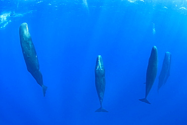
860-287906 - Pod of Sleeping sperm whale (Physeter macrocephalus) Researchers first saw this unusual sleep behavior in sperm whales in 2008. The scientists in that study found that sperm whales dozed in this upright drifting posture for about 10 to 15 minutes at a time, Vulnerable (IUCN). The sperm whale is the largest of the toothed whales. Sperm whales are known to dive as deep as 1,000 meters in search of squid to eat. Dominica, Caribbean Sea, Atlantic Ocean. Photo taken under permit n°RP 16-02/32 FIS-5.
860-287905 - Pod of sperm whale, (Physeter macrocephalus), Vulnerable (IUCN), The sperm whale is the largest of the toothed whales. Sperm whales are known to dive as deep as 1,000 meters in search of squid to eat. Image has been shot in Dominica, Caribbean Sea, Atlantic Ocean. Photo taken under permit n°RP 16-02/32 FIS-5.
857-94722 - Children playing with a outrigger canoe in the village of Hessessai Bay at PanaTinai (Panatinane)island in the Louisiade Archipelago in Milne Bay Province, Papua New Guinea. The island has an area of 78 km2. The Louisiade Archipelago is a string of ten larger volcanic islands frequently fringed by coral reefs, and 90 smaller coral islands located 200 km southeast of New Guinea, stretching over more than 160 km and spread over an ocean area of 26,000 km? between the Solomon Sea to the north and the Coral Sea to the south. The aggregate land area of the islands is about 1,790 km? (690 square miles), with Vanatinai (formerly Sudest or Tagula as named by European claimants on Western maps) being the largest. Sideia Island and Basilaki Island lie closest to New Guinea, while Misima, Vanatinai, and Rossel islands lie further east. The archipelago is divided into the Local Level Government (LLG) areas Louisiade Rural (western part, with Misima), and Yaleyamba (western part, with Rossell and Tagula islands. The LLG areas are part of Samarai-Murua District district of Milne Bay. The seat of the Louisiade Rural LLG is Bwagaoia on Misima Island, the population center of the archipelago.PanaTinai (Panatinane) is an island in the Louisiade Archipelago in Milne Bay Province, Papua New Guinea.
857-94718 - Nimoa Island - here the island mission will impress. The five-sided church features murals of island life and all mission buildings are surrounded by well maintained paths and gardens filled with flowering plants. Edged by jungle-covered mountains, postcard beaches and crystal clear waters - an island paradise indeed! The Louisiade Archipelago is a string of ten larger volcanic islands frequently fringed by coral reefs, and 90 smaller coral islands located 200 km southeast of New Guinea, stretching over more than 160 km and spread over an ocean area of 26,000 km? between the Solomon Sea to the north and the Coral Sea to the south. The aggregate land area of the islands is about 1,790 km? (690 square miles), with Vanatinai (formerly Sudest or Tagula as named by European claimants on Western maps) being the largest. Sideia Island and Basilaki Island lie closest to New Guinea, while Misima, Vanatinai, and Rossel islands lie further east. The archipelago is divided into the Local Level Government (LLG) areas Louisiade Rural (western part, with Misima), and Yaleyamba (western part, with Rossell and Tagula islands. The LLG areas are part of Samarai-Murua District district of Milne Bay. The seat of the Louisiade Rural LLG is Bwagaoia on Misima Island, the population center of the archipelago.
857-94717 - Nimoa Island - here the island mission will impress. The five-sided church features murals of island life and all mission buildings are surrounded by well maintained paths and gardens filled with flowering plants. Edged by jungle-covered mountains, postcard beaches and crystal clear waters - an island paradise indeed! The Louisiade Archipelago is a string of ten larger volcanic islands frequently fringed by coral reefs, and 90 smaller coral islands located 200 km southeast of New Guinea, stretching over more than 160 km and spread over an ocean area of 26,000 km? between the Solomon Sea to the north and the Coral Sea to the south. The aggregate land area of the islands is about 1,790 km? (690 square miles), with Vanatinai (formerly Sudest or Tagula as named by European claimants on Western maps) being the largest. Sideia Island and Basilaki Island lie closest to New Guinea, while Misima, Vanatinai, and Rossel islands lie further east. The archipelago is divided into the Local Level Government (LLG) areas Loui!
860-287914 - Free diver is swimming over a pod of Sleeping sperm whale (Physeter macrocephalus) Researchers first saw this unusual sleep behavior in sperm whales in 2008. The scientists in that study found that sperm whales dozed in this upright drifting posture for about 10 to 15 minutes at a time, Vulnerable (IUCN). The sperm whale is the largest of the toothed whales. Sperm whales are known to dive as deep as 1,000 meters in search of squid to eat. Dominica, Caribbean Sea, Atlantic Ocean. Photo taken under permit n°RP 16-02/32 FIS-5.
860-287915 - Sperm whale mother and calf, (Physeter macrocephalus), Vulnerable (IUCN), The sperm whale is the largest of the toothed whales. Sperm whales are known to dive as deep as 1,000 meters in search of squid to eat. Image has been shot in Dominica, Caribbean Sea, Atlantic Ocean. Photo taken under permit n°RP 16-02/32 FIS-5.
860-287904 - Pod of sperm whale socializing, (Physeter macrocephalus), Vulnerable (IUCN), The sperm whale is the largest of the toothed whales. Sperm whales are known to dive as deep as 1,000 meters in search of squid to eat. Image has been shot in Dominica, Caribbean Sea, Atlantic Ocean. Photo taken under permit n°RP 16-02/32 FIS-5.
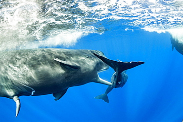
860-287921 - Sub-adult sperm whale try to move away a calf to to mate with a female, (Physeter macrocephalus), Vulnerable (IUCN), The sperm whale is the largest of the toothed whales. Sperm whales are known to dive as deep as 1,000 meters in search of squid to eat. Image has been shot in Dominica, Caribbean Sea, Atlantic Ocean. Photo taken under permit n°RP 16-02/32 FIS-5.
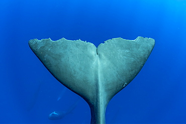
860-287913 - Tail of sperm whale, (Physeter macrocephalus). Vulnerable (IUCN). The sperm whale is the largest of the toothed whales. Sperm whales are known to dive as deep as 1,000 meters in search of squid to eat. Image has been shot in Dominica, Caribbean Sea, Atlantic Ocean. Photo taken under permit n°RP 16-02/32 FIS-5.
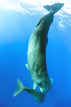
860-287911 - Sleeping sperm whale, (Physeter macrocephalus), Vulnerable (IUCN), The sperm whale is the largest of the toothed whales. Sperm whales are known to dive as deep as 1,000 meters in search of squid to eat. Image has been shot in Dominica, Caribbean Sea, Atlantic Ocean. Photo taken under permit n°RP 16-02/32 FIS-5.
860-287900 - Couple of sperm whale, (Physeter macrocephalus), Vulnerable (IUCN), The sperm whale is the largest of the toothed whales. Sperm whales are known to dive as deep as 1,000 meters in search of squid to eat. Image has been shot in Dominica, Caribbean Sea, Atlantic Ocean. Photo taken under permit n°RP 16-02/32 FIS-5.
860-287908 - Sperm whale mother and calf, (Physeter macrocephalus), Vulnerable (IUCN), The sperm whale is the largest of the toothed whales. Sperm whales are known to dive as deep as 1,000 meters in search of squid to eat. Image has been shot in Dominica, Caribbean Sea, Atlantic Ocean. Photo taken under permit n°RP 16-02/32 FIS-5.
860-287910 - Pod of Sleeping sperm whale (Physeter macrocephalus) Researchers first saw this unusual sleep behavior in sperm whales in 2008. The scientists in that study found that sperm whales dozed in this upright drifting posture for about 10 to 15 minutes at a time, Vulnerable (IUCN). The sperm whale is the largest of the toothed whales. Sperm whales are known to dive as deep as 1,000 meters in search of squid to eat. Dominica, Caribbean Sea, Atlantic Ocean. Photo taken under permit n°RP 16-02/32 FIS-5.
860-287920 - Sub-adult sperm whale try to move away a calf to to mate with a female, (Physeter macrocephalus), Vulnerable (IUCN), The sperm whale is the largest of the toothed whales. Sperm whales are known to dive as deep as 1,000 meters in search of squid to eat. Image has been shot in Dominica, Caribbean Sea, Atlantic Ocean. Photo taken under permit n°RP 16-02/32 FIS-5.
860-287902 - Sub-adult sperm whale try to move away a calf to to mate with a female, (Physeter macrocephalus), Vulnerable (IUCN), The sperm whale is the largest of the toothed whales. Sperm whales are known to dive as deep as 1,000 meters in search of squid to eat. Image has been shot in Dominica, Caribbean Sea, Atlantic Ocean. Photo taken under permit n°RP 16-02/32 FIS-5.
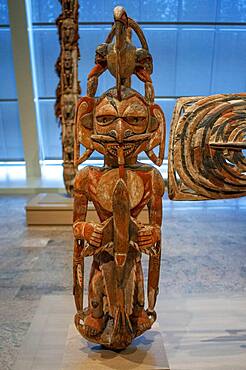
1350-2073 - New Ireland Malagan funerary statue in at the Metropolitan Museum of Art museum, New York, USA. New Ireland is part of the Bismarck Archipelago, situated north of New Guinea, and has an estimated population of 100,000. The Dutch first encountered the island in 1616, and today New Ireland is a province of Papua New Guinea. Nineteen different languages are spoken on the island, and it is divided by a chain of mountains into three distinct regions: northern, central, and southeastern. The art of New Ireland traditionally centered on mortuary ceremonies and feasts to honor the dead. In northern New Ireland, the name given to these elaborate ceremonies is malagan, which is also the term used for the carved and painted sculptures associated with the ceremonies.
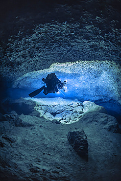
860-292443 - Tek rebreather diver at a depth of 70 meters with a DPV specially equipped with 60,000 lumen lighting and 12 Gopro to carry out a 3D survey of a karstic cave submerged for over 14,000 years, Passe Bateau Sud, Mayotte Lagoon
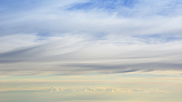
1178-44374 - Layers of clouds from altitude 31,000 feet at sunrise
1243-543 - Panoramic view of vineyards and mountains near Wellington, a town in the Western Cape Winelands, a 45-minute drive from Cape Town, in South Africa with a population of approximately 62,000
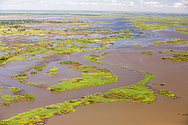
911-10936 - In mid January 2015, a three day period of excessive rain brought unprecedented floods to the small poor African country of Malawi. It displaced nearly quarter of a million people, devastated 64,000 hectares of land, and killed several hundred people. This shot taken from the air on a flight to Makhanga, which two months on, is still cut off by the floods when all rail and road connections were washed away, is looking down on the flood waters still sat on the flood plain.
857-69413 - Rescue workers look for survivors May 17 in Beichuan, China. The death toll in China's worst earthquake in 30 years could top 80, 000 according to the government.
911-10366 - Grubbed out Olive trees that no longer have water to irrigate them near Bakersfield, California, USA. Following an unprecedented four year long drought, Bakersfield is now the driest city in the USA. Most of California is in exceptional drought, the highest level of drought classification. 428,000 acres of agricultural land have been taken out of production due to lack of water, thousands of agricultural workers have lost their jobs and one third of all children in California go to bed hungry.
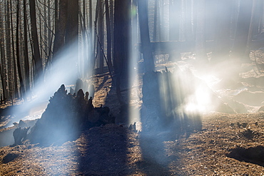
911-10415 - Shafts of sunlight highlight the smoke from the King Fire that burned 97,717 acres of the El Dorado National Forest in California, USA. Following an unprecedented four year long drought, wild fires are much more common. Most of California is in exceptional drought, the highest level of drought classification. 428,000 acres of agricultural land have been taken out of production due to lack of water, thousands of agricultural workers have lost their jobs and one third of all children in California go to bed hungry.
911-10362 - A water charity in Porterville supplying bottled water to houses who have had no running water for over five months, near Bakersfield, California, USA. Hoses in the East of Porterville, many of which are on private wells, have run completely out of water as the water table has dropped catastrophically. Following an unprecedented four year long drought, Bakersfield is now the driest city in the USA. Most of California is in exceptional drought, the highest level of drought classification. 428,000 acres of agricultural land have been taken out of production due to lack of water, thousands of agricultural workers have lost their jobs and one third of all children in California go to bed hungry.
911-10796 - Pylons carrying solar electric from the Copper Mountain Solar 3 project, is a 250-megawatt solar power plant that produces enough energy to power 80, 000 homes, in Nevada, USA.
857-94716 - Nimoa Island - here the island mission will impress. The five-sided church features murals of island life and all mission buildings are surrounded by well maintained paths and gardens filled with flowering plants. Edged by jungle-covered mountains, postcard beaches and crystal clear waters - an island paradise indeed! The Louisiade Archipelago is a string of ten larger volcanic islands frequently fringed by coral reefs, and 90 smaller coral islands located 200 km southeast of New Guinea, stretching over more than 160 km and spread over an ocean area of 26,000 km? between the Solomon Sea to the north and the Coral Sea to the south. The aggregate land area of the islands is about 1,790 km? (690 square miles), with Vanatinai (formerly Sudest or Tagula as named by European claimants on Western maps) being the largest. Sideia Island and Basilaki Island lie closest to New Guinea, while Misima, Vanatinai, and Rossel islands lie further east. The archipelago is divided into the Local Level Government (LLG) areas Loui!
857-94720 - Nimoa Island - here the island mission will impress. The five-sided church features murals of island life and all mission buildings are surrounded by well maintained paths and gardens filled with flowering plants. Edged by jungle-covered mountains, postcard beaches and crystal clear waters - an island paradise indeed! The Louisiade Archipelago is a string of ten larger volcanic islands frequently fringed by coral reefs, and 90 smaller coral islands located 200 km southeast of New Guinea, stretching over more than 160 km and spread over an ocean area of 26,000 km? between the Solomon Sea to the north and the Coral Sea to the south. The aggregate land area of the islands is about 1,790 km? (690 square miles), with Vanatinai (formerly Sudest or Tagula as named by European claimants on Western maps) being the largest. Sideia Island and Basilaki Island lie closest to New Guinea, while Misima, Vanatinai, and Rossel islands lie further east. The archipelago is divided into the Local Level Government (LLG) areas Louisiade Rural (western part, with Misima), and Yaleyamba (western part, with Rossell and Tagula islands. The LLG areas are part of Samarai-Murua District district of Milne Bay. The seat of the Louisiade Rural LLG is Bwagaoia on Misima Island, the population center of the archipelago.
860-290424 - Sperm whale, (Physeter macrocephalus). Vulnerable (IUCN). The sperm whale is the largest of the toothed whales. Sperm whales are known to dive as deep as 1,000 meters in search of squid to eat. Pelagos Sanctuary for Mediterranean Marine Mammals, Mediterranean Sea
1196-194 - Anuradha Koirala holds up her CNN Hero of the Year 2010 award as she is warmly greeted upon her return. Tribhuwan International Airport, Kathmandu, Nepal. A woman whose group has rescued more than 12,000 women and girls from sex slavery has been named the 2010 CNN Hero of the Year. Anuradha Koirala was chosen by the public in an online poll that ran for eight weeks on CNN.com. ?Human trafficking is a crime, a heinous crime, a shame to humanity,? Koirala said after being introduced as one of the top 10 CNN Heroes of 2010. ?I ask everyone to join me to create a society free of trafficking. We need to do this for all our daughters
817-78353 - Rainwater harvesting project in villages of Kozhikode District, Thamarassery Diocese Centre for Overall Development (COD), Individual houses are equipped with rain gutters and a pipe which fills a 10,000 litre concrete tank, Funded by CNEWA, Kerala,
832-136191 - An eastbound train hauling coal from western strip mines passes through the Union Pacific Railroad's Bailey Yard, the largest rail yard in the world which handles 14, 000 rail cars every day, North Platte, Nebraska, USA
911-10337 - Almond groves being chopped down as there is no longer water available to irrigate them, in Wasco in the Central Valley of California following the four year long drought in the Western USA. 80% of the world's almonds are grown in California, and it takes 1.1 gallons of water to grow each nut. Many farms have run out of water, and $2.2 Billion has been wiped off the agricultue sector annually. Currently one third of all children in California go to be hungry, as a direct result of job losses connected to the drought. 428,000 acres of farmland have been taken out of production as a result of the drought, in the Central Valley.
911-10422 - The King Fire that burned 97,717 acres of the El Dorado National Forest in California, USA. Following an unprecedented four year long drought, wild fires are much more common. Most of California is in exceptional drought, the highest level of drought classification. 428,000 acres of agricultural land have been taken out of production due to lack of water, thousands of agricultural workers have lost their jobs and one third of all children in California go to bed hungry.
911-10418 - The King Fire that burned 97,717 acres of the El Dorado National Forest in California, USA. Following an unprecedented four year long drought, wild fires are much more common. Most of California is in exceptional drought, the highest level of drought classification. 428,000 acres of agricultural land have been taken out of production due to lack of water, thousands of agricultural workers have lost their jobs and one third of all children in California go to bed hungry.
911-10424 - Foscheck fire retardent dropped on a wild fire near Hawkins Peak above coleville in California, USA. Following an unprecedented four year long drought, wild fires are much more common. Most of California is in exceptional drought, the highest level of drought classification. 428,000 acres of agricultural land have been taken out of production due to lack of water, thousands of agricultural workers have lost their jobs and one third of all children in California go to bed hungry.
911-10419 - The King Fire that burned 97,717 acres of the El Dorado National Forest in California, USA. Following an unprecedented four year long drought, wild fires are much more common. Most of California is in exceptional drought, the highest level of drought classification. 428,000 acres of agricultural land have been taken out of production due to lack of water, thousands of agricultural workers have lost their jobs and one third of all children in California go to bed hungry.
911-10423 - A wild fire near Hawkins Peak above coleville in California, USA. Following an unprecedented four year long drought, wild fires are much more common. Most of California is in exceptional drought, the highest level of drought classification. 428,000 acres of agricultural land have been taken out of production due to lack of water, thousands of agricultural workers have lost their jobs and one third of all children in California go to bed hungry.
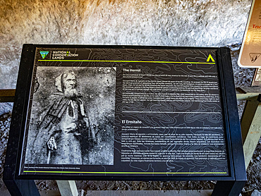
1112-8718 - La Cueva rock shelter is an archeological site occupied from almost 5,000 BC, Dripping Springs Trail, Las Cruces, New Mexico, United States of America, North America
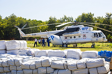
911-10948 - In mid January 2015, a three day period of excessive rain brought unprecedented floods to the small poor African country of Malawi. It displaced nearly quarter of a million people, devastated 64,000 hectares of land, and killed several hundred people. This shot shows A Russian Mi8 helicopter being used by the United Nations, World Food Program to deliver food aid to areas still cut off by the flooding around Makhanga and Bangula.
832-154700 - The start - finish line at Michigan International Speedway which features a two-mile race track and seats nearly 120, 000 fans for NASCAR races, Brooklyn, Michigan, USA, America
911-10417 - The King Fire that burned 97,717 acres of the El Dorado National Forest in California, USA. Following an unprecedented four year long drought, wild fires are much more common. Most of California is in exceptional drought, the highest level of drought classification. 428,000 acres of agricultural land have been taken out of production due to lack of water, thousands of agricultural workers have lost their jobs and one third of all children in California go to bed hungry.
911-10687 - Electric cars being recharged at the Ivanpah Solar Thermal Power Plant in California''s Mojave Desert is currently the largest solar thermal plant in the world. It generates 392 megawatts (MW) and deploys 173,500 heliostats that reflect the suns rays onto three solar towers. It covers 4,000 acres of desert.


