Recent searches
Loading...
1383-26 - Paramount Chief Chitimukulu arriving to start the Ukusefya Pa Ng'wena Ceremony
83-10721 - Rock cut reclining statue of the Buddha preparing to enter nirvana, in cave 26, a chaitya in the Buddhist cave site at Ajanta, carved from a gorge in the Waghore River, Ajanta, Maharashtra State, India.
612-26 - Portrait of a policeman standing outside Buckingham Palace, looking at the camera, London, England, United Kingdom, Europe
377-26 - Portrait of a little girl in traditional dress, in Kyoto, Japan, Asia
737-121 - Close-up, side view of a female nude statuewith gold headdress in front of the building, art nouveau period, Otto Wagner Villa No 26, Penzing, Vienna, Austria, Europe
737-124 - Close-up of a statue of a female nude in the garden, art nouveau period, Otto Wagner Villa No 26, Penzing, Vienna, Austria, Europe
744-26 - Opaque blue glass-paste funerary headrest with gold frieze, from the tomb of the pharaoh Tutankhamun, discovered in the Valley of the Kings, Thebes, Egypt, North Africa, Africa
743-26 - Three meerkats (suricates), Suricata suricatta, Addo National Park, South Africa, Africa
756-26 - White Cloud scenic area, Huang Shan (Yellow Mountain), UNESCO World Heritage Site, Anhui Province, China, Asia
718-26 - Portrait of a Tobas warrior, the Devil dance (La Diablada), carnival, Oruro, Bolivia, South America
1173-26 - Snowshoe hare, Arctic National Wildlife Refuge, Alaska, Arctic National Wildlife Refuge, Alaska, USA
769-26 - Cross Bath, Thermae Bath Spa, Bath, Avon, England, United Kingdom, Europe
776-26 - Carlisle Bay Beach, Bridgetown, Barbados, West Indies, Caribbean, Central America
832-349684 - Markt Schwaben, GER, 26. June 2006 - A car passes a sign which marks the begin of a speed limited zone in Markt Schwaben Bavaria Germany.
1198-26 - Northern goshawk. Accipiter gentilis. Close-up of and shoulders, captive. Scotland, uk.
1167-26 - Pinnacles and hoodoos with fog extending into clouds of a partial temperature inversion, Bryce Canyon National Park, Utah, United States of America, North America
724-1729 - Maman a 21st century bronze sculpture of a spider, 9.25m high with a sac of 26 eggs, by Louis Bourgeois, in front of the Cathedral and Basilica of Notre Dame built between 1839 and 1885, Ottawa, Ontario, Canada, North America
1381-26 - Indian Cormorant, indian shag (Phalacrocorax fuscicollis) above water on trunk tree with opened wings.
799-26 - Cotton grass growing on the moorland at Dunkery Hill, Exmoor National Park, Somerset, England, United Kingdom, Europe
802-26 - A climber ascending a cave archway at Foxhole, Gower Peninsula, Wales, United Kingdom, Europe
807-26 - Landa Mission, UNESCO World Heritage Site, one of five Sierra Gorda missions designed by Franciscan Fray Junipero Serra, QuerŽtaro, Mexico, North America
812-26 - Rorbuer on stilts at dusk with lighthouse, Lofoten Islands, Norway, Scandinavia, Europe
1163-26 - Mythical temple guard (Yaksha), Wat Phra Kaew, Bangkok, Thailand.
831-26 - Vallugabahn cable car from summit of Valluga in St. Anton am Arlberg in winter snow, Austrian Alps, Austria, Europe
1319-26 - A camel trader in the famous Sam Sand dunes in Jaisalmer region of Rajasthan state, India, Asia
832-150067 - 26 meter high statue of the goddess Janraisig or Avalokiteshvara, Gandan Monastery, Migjid Janraisig Sueme, Gandan Khiid, Ulaanbaatar, Mongolia, Asia
1126-26 - Westerkerk Tower and Prinsengracht Canal, Amsterdam, Netherlands, Europe
821-26 - Caged birds, pet and bird market, Paris, France, Europe
836-26 - Basilica of Sacre-Coeur, Montmartre, Paris, France, Europe
846-26 - Waterfront restaurant in the evening, Port de Pollenca (Puerto Pollensa), Mallorca (Majorca), Balearic Islands, Spain, Mediterranean, Europe
847-26 - Looking down onto the little Zagorian village of Kipi on a misty morning in Autumn, just after sunrise, Epirus, Greece, Europe
851-26 - Portrait of a Uros Indian woman, Islas Flotantes (Floating Islands), Lake Titicaca, Peru, South America
911-122 - Meltwater from the Russell Glacier that drains the Greenland Ice Sheet 26 km inland from Kangerlussuaq, Greenland, Polar Regions
989-26 - Wigeon (Anas penelope) flock in flight over frozen, flooded marshland on a foggy winter morning, with some drakes calling, Greylake RSPB reserve, Somerset Levels, UK.
10-26 - Close-up of Vietnamese coffee, with froth of beaten egg and sugar, Vietnam, Indochina, Southeast Asia, Asia
1012-26 - Orca (Orcinus orca) swimming underwater.
Water is very dark because the orca enter Norwegian fjords in middle of winter to feed on herring.
Svolvaer, Norway
(restrictred resolution - please contact us)
908-26 - Basking Shark (Cetorhinus maximus) Cornwall, UK
Restricted resolution (Please contact us)
(RR)
1001-26 - European tree cricket (Oecanthus pellucens);North West Bulgaria;Europe;Slow shutter speed in combination with wirelessly controlled macro flash
1176-26 - The Stade, net huts (net shops) and funicular railway in the centre of Old Town, Hastings, East Sussex, England, United Kingdom, Europe
1185-26 - Brown bear (grizzly) (Ursus arctos), Montana, United States of America, North America
1243-26 - Downtown Milan as seen through the roof of the city's famous Duomo cathedral, Milan, Lombardy, Italy, Europe
1238-26 - Entrance gate of Kiyomizu-dera Temple during snow storm, UNESCO World Heritage Site, Kyoto, Japan, Asia
1263-26 - The 5-star hotel resort of Aman Sveti Stefan set on a small islet on the Adriatic coast, 6 km from Budva, Montenegro, Europe
857-94721 - Nimoa Island - here the island mission will impress. The five-sided church features murals of island life and all mission buildings are surrounded by well maintained paths and gardens filled with flowering plants. Edged by jungle-covered mountains, postcard beaches and crystal clear waters - an island paradise indeed! The Louisiade Archipelago is a string of ten larger volcanic islands frequently fringed by coral reefs, and 90 smaller coral islands located 200 km southeast of New Guinea, stretching over more than 160 km and spread over an ocean area of 26,000 km? between the Solomon Sea to the north and the Coral Sea to the south. The aggregate land area of the islands is about 1,790 km? (690 square miles), with Vanatinai (formerly Sudest or Tagula as named by European claimants on Western maps) being the largest. Sideia Island and Basilaki Island lie closest to New Guinea, while Misima, Vanatinai, and Rossel islands lie further east. The archipelago is divided into the Local Level Government (LLG) areas Loui!
857-94719 - Nimoa Island - here the island mission will impress. The five-sided church features murals of island life and all mission buildings are surrounded by well maintained paths and gardens filled with flowering plants. Edged by jungle-covered mountains, postcard beaches and crystal clear waters - an island paradise indeed! The Louisiade Archipelago is a string of ten larger volcanic islands frequently fringed by coral reefs, and 90 smaller coral islands located 200 km southeast of New Guinea, stretching over more than 160 km and spread over an ocean area of 26,000 km? between the Solomon Sea to the north and the Coral Sea to the south. The aggregate land area of the islands is about 1,790 km? (690 square miles), with Vanatinai (formerly Sudest or Tagula as named by European claimants on Western maps) being the largest. Sideia Island and Basilaki Island lie closest to New Guinea, while Misima, Vanatinai, and Rossel islands lie further east. The archipelago is divided into the Local Level Government (LLG) areas Louisiade Rural (western part, with Misima), and Yaleyamba (western part, with Rossell and Tagula islands. The LLG areas are part of Samarai-Murua District district of Milne Bay. The seat of the Louisiade Rural LLG is Bwagaoia on Misima Island, the population center of the archipelago.
857-94715 - Nimoa Island - here the island mission will impress. The five-sided church features murals of island life and all mission buildings are surrounded by well maintained paths and gardens filled with flowering plants. Edged by jungle-covered mountains, postcard beaches and crystal clear waters - an island paradise indeed! The Louisiade Archipelago is a string of ten larger volcanic islands frequently fringed by coral reefs, and 90 smaller coral islands located 200 km southeast of New Guinea, stretching over more than 160 km and spread over an ocean area of 26,000 km? between the Solomon Sea to the north and the Coral Sea to the south. The aggregate land area of the islands is about 1,790 km? (690 square miles), with Vanatinai (formerly Sudest or Tagula as named by European claimants on Western maps) being the largest. Sideia Island and Basilaki Island lie closest to New Guinea, while Misima, Vanatinai, and Rossel islands lie further east.
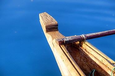
857-94722 - Children playing with a outrigger canoe in the village of Hessessai Bay at PanaTinai (Panatinane)island in the Louisiade Archipelago in Milne Bay Province, Papua New Guinea. The island has an area of 78 km2. The Louisiade Archipelago is a string of ten larger volcanic islands frequently fringed by coral reefs, and 90 smaller coral islands located 200 km southeast of New Guinea, stretching over more than 160 km and spread over an ocean area of 26,000 km? between the Solomon Sea to the north and the Coral Sea to the south. The aggregate land area of the islands is about 1,790 km? (690 square miles), with Vanatinai (formerly Sudest or Tagula as named by European claimants on Western maps) being the largest. Sideia Island and Basilaki Island lie closest to New Guinea, while Misima, Vanatinai, and Rossel islands lie further east. The archipelago is divided into the Local Level Government (LLG) areas Louisiade Rural (western part, with Misima), and Yaleyamba (western part, with Rossell and Tagula islands. The LLG areas are part of Samarai-Murua District district of Milne Bay. The seat of the Louisiade Rural LLG is Bwagaoia on Misima Island, the population center of the archipelago.PanaTinai (Panatinane) is an island in the Louisiade Archipelago in Milne Bay Province, Papua New Guinea.
1286-26 - Chiang Mai Flower Festival 2018, Chiang Mai, Thailand, Southeast Asia, Asia
857-94718 - Nimoa Island - here the island mission will impress. The five-sided church features murals of island life and all mission buildings are surrounded by well maintained paths and gardens filled with flowering plants. Edged by jungle-covered mountains, postcard beaches and crystal clear waters - an island paradise indeed! The Louisiade Archipelago is a string of ten larger volcanic islands frequently fringed by coral reefs, and 90 smaller coral islands located 200 km southeast of New Guinea, stretching over more than 160 km and spread over an ocean area of 26,000 km? between the Solomon Sea to the north and the Coral Sea to the south. The aggregate land area of the islands is about 1,790 km? (690 square miles), with Vanatinai (formerly Sudest or Tagula as named by European claimants on Western maps) being the largest. Sideia Island and Basilaki Island lie closest to New Guinea, while Misima, Vanatinai, and Rossel islands lie further east. The archipelago is divided into the Local Level Government (LLG) areas Louisiade Rural (western part, with Misima), and Yaleyamba (western part, with Rossell and Tagula islands. The LLG areas are part of Samarai-Murua District district of Milne Bay. The seat of the Louisiade Rural LLG is Bwagaoia on Misima Island, the population center of the archipelago.
857-94717 - Nimoa Island - here the island mission will impress. The five-sided church features murals of island life and all mission buildings are surrounded by well maintained paths and gardens filled with flowering plants. Edged by jungle-covered mountains, postcard beaches and crystal clear waters - an island paradise indeed! The Louisiade Archipelago is a string of ten larger volcanic islands frequently fringed by coral reefs, and 90 smaller coral islands located 200 km southeast of New Guinea, stretching over more than 160 km and spread over an ocean area of 26,000 km? between the Solomon Sea to the north and the Coral Sea to the south. The aggregate land area of the islands is about 1,790 km? (690 square miles), with Vanatinai (formerly Sudest or Tagula as named by European claimants on Western maps) being the largest. Sideia Island and Basilaki Island lie closest to New Guinea, while Misima, Vanatinai, and Rossel islands lie further east. The archipelago is divided into the Local Level Government (LLG) areas Loui!
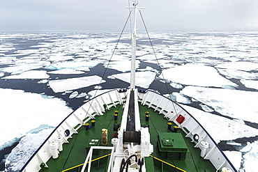
832-380490 - Expedition Boat navigating through melting pack ice, Arctic Ocean, 81° North and 26° East, Svalbard Archipelago, Norway, Europe
1366-1179 - Europe, Netherlands, South Holland, Lisse. April 26, 2022. Orange wooden shoes in front of the entrance to Keukenhof Garden.
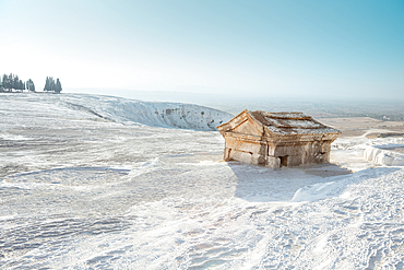
1378-26 - Necropolis. tomb on a travertine rocks in the ancient Hierapolis. Pamukkale, Turkey
1382-26 - bike self-service station in front of the Church of St. Casimir, Vilnius, Lithuania, Europe
1384-26 - Sculpture of winged Mayan Angel on tall column, the seafront Malecon, Campeche city, Campeche State, Mexico
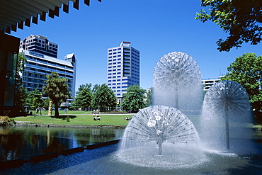
698-26 - Town Hall fountain, Christchurch, Canterbury, South Island, New Zealand, Pacific
857-94716 - Nimoa Island - here the island mission will impress. The five-sided church features murals of island life and all mission buildings are surrounded by well maintained paths and gardens filled with flowering plants. Edged by jungle-covered mountains, postcard beaches and crystal clear waters - an island paradise indeed! The Louisiade Archipelago is a string of ten larger volcanic islands frequently fringed by coral reefs, and 90 smaller coral islands located 200 km southeast of New Guinea, stretching over more than 160 km and spread over an ocean area of 26,000 km? between the Solomon Sea to the north and the Coral Sea to the south. The aggregate land area of the islands is about 1,790 km? (690 square miles), with Vanatinai (formerly Sudest or Tagula as named by European claimants on Western maps) being the largest. Sideia Island and Basilaki Island lie closest to New Guinea, while Misima, Vanatinai, and Rossel islands lie further east. The archipelago is divided into the Local Level Government (LLG) areas Loui!
857-94720 - Nimoa Island - here the island mission will impress. The five-sided church features murals of island life and all mission buildings are surrounded by well maintained paths and gardens filled with flowering plants. Edged by jungle-covered mountains, postcard beaches and crystal clear waters - an island paradise indeed! The Louisiade Archipelago is a string of ten larger volcanic islands frequently fringed by coral reefs, and 90 smaller coral islands located 200 km southeast of New Guinea, stretching over more than 160 km and spread over an ocean area of 26,000 km? between the Solomon Sea to the north and the Coral Sea to the south. The aggregate land area of the islands is about 1,790 km? (690 square miles), with Vanatinai (formerly Sudest or Tagula as named by European claimants on Western maps) being the largest. Sideia Island and Basilaki Island lie closest to New Guinea, while Misima, Vanatinai, and Rossel islands lie further east. The archipelago is divided into the Local Level Government (LLG) areas Louisiade Rural (western part, with Misima), and Yaleyamba (western part, with Rossell and Tagula islands. The LLG areas are part of Samarai-Murua District district of Milne Bay. The seat of the Louisiade Rural LLG is Bwagaoia on Misima Island, the population center of the archipelago.
1379-26 - Poppy fields overlooking Poly Joke in Cornwall
581-26 - Close-up of two sunflower heads in the Spanish sun, Spain, Europe
832-398020 - MAHESHWAR, INDIA, APRIL 26: Indian woman performs morning pooja on sacred river Narmada ghats on April 26, 2011 in Maheshwar, Madhya Pradesh, India. To Hindus Narmada is one of 5 holy rivers of India
857-91102 - Sept 26, 2008 Fishing offshore, Big Sur California on the MV Nikki J using the "hook and line", or "long-line" method of sustainable fishing. Crew: David Anderson & Brian Long Fishing for Black Gill Rock Fish and Sable Fish or "Black Cod". A new wave in sustainable commercial fishing is pushing fisherman to switch from higher impact methods of harvesting fish like trawling- to hook and line or long line harvest, United States of America
1366-1178 - Europe, Netherlands, South Holland, Lisse. April 26, 2022. Orange and purple tulips with bluebells at Keukenhof Gardens.
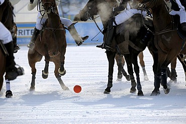
832-143735 - Polospieler kaempfen um den Ball, Poloturnier, 26. St. Moritz Polo World Cup on Snow, St. Moritz, Upper Engadin, Engadin, Grisons, Switzerland, Europe
1281-26 - Green Yaksha statue at Wat Rong Suea Ten (Blue Temple) in Chiang Rai, Thailand, Southeast Asia, Asia
794-26 - The ruins of Sao Paulo Cathedral (St. Pauls Cathedral) in central Macau, Macau, China, Asia
1130-1791 - 1919-26 A Type Bt Thornycroft Truck, Basingstoke, Hampshire, England, United Kingdom, Europe
1366-1174 - Europe, Netherlands, South Holland, Lisse. April 26, 2022. A pond in the forest at Keukenhof Gardens.
1366-1175 - Europe, Netherlands, South Holland, Lisse. April 26, 2022. Yellow and red tulips at Keukenhof Gardens.
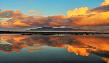
1376-26 - Reflections from Sandscale Haws Nature Reserve, view across the Duddon Estuary towards Black Combe, Cumbrian Coast, Cumbria, England, United Kingdom, Europe
1372-26 - Sunset panoramic view of the white cliffs of Jodogahama, Miyako Bay, the sea of northern Honshu, Iwate prefecture, Japan, Asia
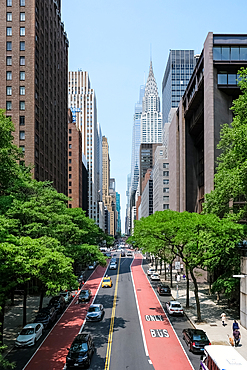
1373-26 - View of 42nd Street, a significant crosstown avenue, from the Tudor City Overpass (Tudor City Btidge), Manhattan borough of New York City, United States of America, North America
1370-26 - A religious offering of colorful petals, paints, powders, and more near a shrine in Bhaktapur, Nepal, Asia
1366-1171 - Europe, Netherlands, South Holland, Lisse. April 26, 2022. A river of bluebell flowers at Keukenhof Gardens.
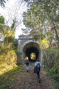
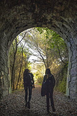
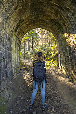
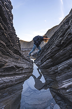
832-404327 - Deba, Gipuzkoa Spain, January 26, 2020: Two young men in a tunnel on the coast between Deba and Zumaia
832-404328 - Deba, Gipuzkoa Spain », January 26, 2020: Two young men in a tunnel on the coast between Deba and Zumaia
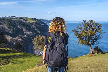
832-404332 - Deba, Gipuzkoa Spain », January 26, 2020: Two young people walking along the beautiful coast from Deba to Zumaia
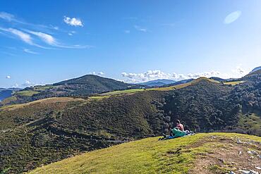
832-404333 - Deba, Gipuzkoa Spain », January 26, 2020: A happy young woman upstairs at the Sakoneta geopark viewpoint
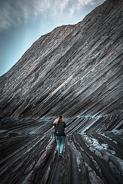
832-404335 - Deba, Gipuzkoa Spain », January 26, 2020: A young woman visiting the geopark of the Sakoneta coast
832-248373 - Frumptarn Barnsley band Barnsley UK, 26. International Guggenmusiktreffen, Guggenmusik folk music festival, 14th and 15th of February 2009, Schwaebisch Gmuend, Baden-Wuerttemberg, Germany, Europe
1366-361 - Thebes, Luxor, Egypt. February 26, 2022. Seated man in front of contemporary murals on in Luxor.
832-404329 - Deba, Gipuzkoa Spain », January 26, 2020: Two young men in a tunnel on the coast between Deba and Zumaia
832-404331 - Deba, Gipuzkoa Spain », January 26, 2020: A family eating peacefully on the beautiful coast from Deba to Zumaia
832-404334 - Deba, Gipuzkoa Spain », January 26, 2020: A young woman exploring the geopark of the Sakoneta coast one morning
832-398019 - MAHESHWAR, INDIA, APRIL 26: Indian woman performs morning pooja on sacred river Narmada ghats on April 26, 2011 in Maheshwar, Madhya Pradesh, India. To Hindus Narmada is one of 5 holy rivers of India
747-26 - Interior of the Great Mosque (Mezquita) and cathedral, UNESCO World Heritage Site, Cordoba, Andalucia (Andalusia), Spain, Europe
832-398021 - MAHESHWAR, INDIA, APRIL 26, 2011: Indian women doing morning pooja on ghats of sacred Narmada river. Maheshwar, Madhya Pradesh, India, Asia
1298-26 - The upper Falls of Acharn near Aberfeldy in late autumn, Perthshire, Scotland, United Kingdom, Europe
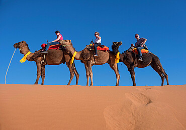
1353-26 - Tourists riding camels in the Erg Chebbi Desert, Sahara Desert, Morocco, North Africa, Africa
1366-1173 - Europe, Netherlands, South Holland, Lisse. April 26, 2022. Yellow and pink tulips along a pond at Keukenhof Gardens.
832-398022 - MAHESHWAR, INDIA, APRIL 26: Indian woman performs morning pooja on sacred river Narmada ghats on April 26, 2011 in Maheshwar, Madhya Pradesh, India. To Hindus Narmada is one of 5 holy rivers of India
1067-26 - Ornate ghost pipefish (Solenostomus paradoxus) Juvenile fish floating over volcanic sand. Komodo, Indonesia, Pacific Ocean.
971-26 - Japanese tourists tasting whale meat in fish market, Bergen, Norway (RR)
1109-26 - Balinese people at a religious Hindu Festival, Besakih Temple (Mother Temple of Besakih), Bali, Indonesia, Southeast Asia, Asia
1246-26 - A sweeping winter view of the majestic hills and mountains of Moidart in the Ardnamurchan Peninsula, the Scottish Highlands, Scotland, United Kingdom, Europe
1366-1172 - Europe, Netherlands, South Holland, Lisse. April 26, 2022. A river of bluebell flowers at Keukenhof Gardens.
1366-1176 - Europe, Netherlands, South Holland, Lisse. April 26, 2022. Red tulips and bluebells at Keukenhof Gardens.


