Recent searches
Loading...
59-1484 - Lycian rock tombs (circa 400 BC), near Fethiye, Turkey, Eurasia
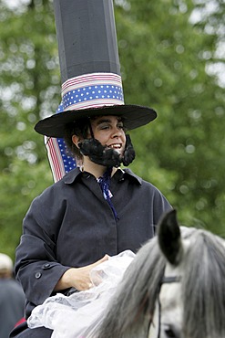
832-370321 - Man in Abraham Lincoln costume, Fourth of July celebrations (Independence Day) in Gustavus: population 400, Alaska, USA, North America
733-400 - Jidai Matsuri, Festival of the Ages, procession, Kyoto city, Honshu, Japan, Asia
17-4384 - Chanwar Palki Walon-Ki Haveli (mansion), 400 years old, restored to its original state, Anokhi Museum, Amber, near Jaipur, Rajasthan state, India, Asia
17-4386 - Chanwar Palki Walon-Ki Haveli (mansion), 400 years old, restored to its original state, Anokhi Museum, Amber, near Jaipur, Rajasthan state, India, Asia
17-4484 - Chanwar Palki Walon-Ki Haveli (mansion), 400 years old, restored to its original state, Anokhi Museum, Amber, near Jaipur, Rajasthan state, India, Asia
17-4548 - Chanwar Palki Walon-Ki Haveli (mansion), 400 years old, restored to its original state, Anokhi Museum, Amber, near Jaipur, Rajasthan state, India, Asia
832-319169 - USA, United States of America, Alaska, Gustavus: 4th July, Independence day party in Gustavus, a village with 400 residents. After a short parade, they fly the flag, sing the national anthem. Followed by a BBQ, funny contests like bubble gum blowing, hors
832-319171 - USA, United States of America, Alaska, Gustavus: 4th July, Independence day party in Gustavus, a village with 400 residents. After a short parade, they fly the flag, sing the national anthem. Followed by a BBQ, funny contests like bubble gum blowing, hors
832-319194 - USA, United States of America, Alaska, Gustavus: 4th July, Independence day party in Gustavus, a village with 400 residents. After a short parade, they fly the flag, sing the national anthem. Followed by a BBQ, funny contests like bubble gum blowing, hors
832-319182 - USA, United States of America, Alaska, Gustavus: 4th July, Independence day party in Gustavus, a village with 400 residents. After a short parade, they fly the flag, sing the national anthem. Followed by a BBQ, funny contests like bubble gum blowing, hors
819-400 - The Basilica of Santa Maria del Popolo, an Augustinian church in Rome, Piazza del Popolo, Rome, Italy, Lazio, Italy, Europe
857-92992 - Tunisia, Ksar Ouled Soltane, former fortress and its 400 Ghorfas
816-400 - Spring Ak Balyk, the Pamirs, Tajikistan, Central Asia
807-400 - Frida Kahlo museum, Coyoacan, Mexico City, Mexico, North America
823-400 - Aerial view of intensive agriculture on Virunga foothills, Rwanda, Africa
799-400 - Narrowboats on the Monmouthshire and Brecon Canal near Llanfrynach, Brecon Beacons National Park, Powys, Wales, United Kingdom, Europe
1176-400 - Devotees paying obeisance at the Shwedagon pagoda complex in Yangon (Rangoon), Myanmar (Burma), Southeast Asia
857-70183 - The Florida Ivory millipede (Spirobolida: Spirobolidae) a class of arthropod is thought to be among the first animals to have colonized land during the Silurian geologic period. The millipede's most obvious feature is its large number of legs. contrary to the Latin derivative of their name (thousand foot) the common species have between 80 and 400 legs.
857-47321 - Dhaka, Bangladesh - July 2011: Street traffic in Dhaka. With over 400, 000 rickshaws running the streets on Dhaka every day the Bangladeshi capital has been described as the "Rickshaw capital of the world.
1199-400 - Female Orangutan Sumatra with babies (Pongo abelii), Indonesia, Southeast Asia
1245-400 - Moais in Ahu Tongariki, Rapa Nui National Park, UNESCO World Heritage Site, Easter Island, Chile, South America
1216-400 - The Broken Heart of Rodel, Rodel, Isle of Harris, Outer Hebrides, Scotland, United Kingdom, Europe
1372-400 - Colorful houses kyanjin gompa, Lang Tang Valley Trek, Himalayas, Nepal. Towering summits of Langtang Lirung in the backround
1384-400 - Tagine dish on white plate with potato carrot aubergine courgette and beef, Morocco, north Africa
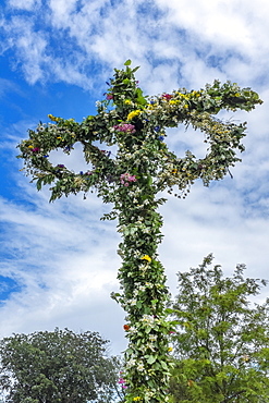
10-400 - Maypole decorated with flowers in celebration of Midsummer's Day, Sweden's most celebrated festival, Sweden, Scandinavia, Europe
641-9103 - Egremnoi Beach, 400 steps down to beach, said to be one of the top beaches in Europe, on west coast of Lefkada (Lefkas), Ionian Islands, Greek Islands, Greece, Europe
1131-400 - Lello and Irmao bookshop, Spiral stairs, Oporto, Portugal, Europe
857-86021 - Hikers setup camp on a beach along the Colorado River near the plumeting 180-foot Deer Creek Falls in the Grand Canyon outside of Fredonia, Arizona November 2011. The 21.4-mile loop starts at the Bill Hall trailhead on the North Rim and descends 2000-feet in 2.5-miles through Coconino Sandstone to the level Esplanada then descends further into the lower canyon through a break in the 400-foot-tall Redwall to access Surprise Valley. Hikers connect Thunder River and Tapeats Creek to a route along the Colorado River and climb out Deer Creek.
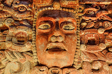
801-3792 - El Frisco de Placeres, (400-600 AD), from Los Placersos, Campeche, National Museum of Anthropology, Mexico City, Mexico
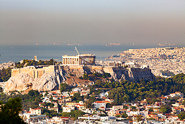
1265-400 - View over city to the Acropolis, Athens, Greece, Europe
860-292268 - Antelope Canyon. The Upper Antelope Canyon, 2 to 3 m wide and 400 m long, managed by the Navajo Indian tribe, Arizona, USA.
1278-400 - Habsburg coat of arms emblem with sculptures on the roof of Hofburg Palace - Reich Chancellery wing - in Vienna, Austria.
801-906 - Petroglyph National Monument, petroglyphs carved into volcanic rock by American Indians 400 to 700 years ago, New Mexico, United States of America, North America
17-4232 - Restored traditional Pol house, an all wood structure, with wood carved facade, some 300 to 400 years old, Ahmedabad, Gujarat state, India, Asia
800-400 - Couple walking along Humewood beachfront, Port Elizabeth, Eastern Cape, South Africa, Africa
1361-400 - Car travels the icy and empty road crossing the boreal snowy forest at sunrise, Swedish Lapland, Sweden, Scandinavia, Europe
801-3793 - El Frisco de Placeres, (400-600 AD), from Los Placersos, Campeche, National Museum of Anthropology, Mexico City, Mexico
860-292267 - Tourists visiting the Upper Antelope Canyon, 2 to 3 m wide and 400 m long, managed by the Navajo Indian tribe. Antelope Canyon. Arizona. USA.
860-292269 - The Upper Antelope Canyon, 2 to 3 m wide and 400 m long, managed by the Navajo Indian tribe. Antelope Canyon. Arizona. USA.
987-400 - Revolving blades of a 2.3 megawatt wind turbine, Blacklaw Windfarm, South Lanarkshire, Scotland
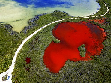
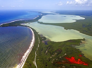
1350-6623 - Aerial view of Punta Allen Sian Ka'an Reserve, Yucatan Peninsula, Mexico. Red lagoon near Boca Paila Bridge.
In the language of the Mayan peoples who once inhabited this region, Sian Ka'an means Origin of the Sky. Located on the east coast of the Yucatán peninsula, this biosphere reserve contains tropical forests, mangroves and marshes, as well as a large marine section intersected by a barrier reef. It provides a habitat for a remarkably rich flora and a fauna comprising more than 300 species of birds, as well as a large number of the region's characteristic terrestrial vertebrates, which cohabit in the diverse environment formed by its complex hydrological system.
Along its roughly 120 kilometres of coastline, the property covers over 400,000 hectares of land ranging from sea level to only ten m.a.s.l. The property boasts diverse tropical forests, palm savannah, one of the most pristine wetlands in the region, lagoons, extensive mangrove stands, as well as sandy beaches and dunes. The 120,000 hectares of marine area protect a valuable part of the Mesoamerican Barrier Reef and seagrass beds in the shallow bays. The lush green of the forests and the many shades of blue of the lagoons and the Caribbean Sea under a wide sky offer fascinating visual impressions.
1306-400 - Three Guanaco in Pinturas Canyon, Patagonia, Argentina, South America
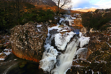
1365-400 - River Coupall in winter, Rannoch Moor, Scotland, UK
748-400 - African elephant, Loxodonta africana, Chobe National Park, Chobe River, Botswana, Africa
801-1094 - Casa Grande (Great House) Ruins National Monument, home to the Sonora Desert people, founded near 400 AD, abandoned about 1450 AD, Coolidge, Arizona, United States of America, North America
857-86023 - Male hiker filters water on a cliff-pinched patio near Deer Creek Falls in the Grand Canyon outside of Fredonia, Arizona November 2011. The 21.4-mile loop starts at the Bill Hall trailhead on the North Rim and descends 2000-feet in 2.5-miles through Coconino Sandstone to the level Esplanada then descends further into the lower canyon through a break in the 400-foot-tall Redwall to access Surprise Valley. Hikers connect Thunder River and Tapeats Creek to a route along the Colorado River and climb out Deer Creek.
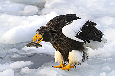
1185-400 - Stellers Sea Eagle (Haliaeetus pelagious), Rausu, Hokkaido, Japan, Asia
1360-400 - Church of Our Lady of the Marsh, Sterzing, Sudtirol (South Tyrol) (Province of Bolzano), Italy, Europe
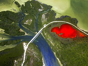
1350-6620 - Aerial view of Punta Allen Sian Ka'an Reserve, Yucatan Peninsula, Mexico. Red lagoon near Boca Paila Bridge.
In the language of the Mayan peoples who once inhabited this region, Sian Ka'an means Origin of the Sky. Located on the east coast of the Yucatán peninsula, this biosphere reserve contains tropical forests, mangroves and marshes, as well as a large marine section intersected by a barrier reef. It provides a habitat for a remarkably rich flora and a fauna comprising more than 300 species of birds, as well as a large number of the region's characteristic terrestrial vertebrates, which cohabit in the diverse environment formed by its complex hydrological system.
Along its roughly 120 kilometres of coastline, the property covers over 400,000 hectares of land ranging from sea level to only ten m.a.s.l. The property boasts diverse tropical forests, palm savannah, one of the most pristine wetlands in the region, lagoons, extensive mangrove stands, as well as sandy beaches and dunes. The 120,000 hectares of marine area protect a valuable part of the Mesoamerican Barrier Reef and seagrass beds in the shallow bays. The lush green of the forests and the many shades of blue of the lagoons and the Caribbean Sea under a wide sky offer fascinating visual impressions.
1196-71 - The 400 year-old stone and mud brick house of the Lunpo Alchi (minister of Alchi village) towers above farmhouses topped with fodder, and sits below a latho (god place) marking the presence of a local god. Ladakh, India
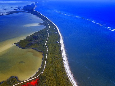
1350-6627 - Aerial view of Punta Allen Sian Ka'an Reserve, Yucatan Peninsula, Mexico. Red lagoon near Boca Paila Bridge.
In the language of the Mayan peoples who once inhabited this region, Sian Ka'an means Origin of the Sky. Located on the east coast of the Yucatán peninsula, this biosphere reserve contains tropical forests, mangroves and marshes, as well as a large marine section intersected by a barrier reef. It provides a habitat for a remarkably rich flora and a fauna comprising more than 300 species of birds, as well as a large number of the region's characteristic terrestrial vertebrates, which cohabit in the diverse environment formed by its complex hydrological system.
Along its roughly 120 kilometres of coastline, the property covers over 400,000 hectares of land ranging from sea level to only ten m.a.s.l. The property boasts diverse tropical forests, palm savannah, one of the most pristine wetlands in the region, lagoons, extensive mangrove stands, as well as sandy beaches and dunes. The 120,000 hectares of marine area protect a valuable part of the Mesoamerican Barrier Reef and seagrass beds in the shallow bays. The lush green of the forests and the many shades of blue of the lagoons and the Caribbean Sea under a wide sky offer fascinating visual impressions.
1350-6616 - Aerial view of Punta Allen Sian Ka'an Reserve, Yucatan Peninsula, Mexico.
In the language of the Mayan peoples who once inhabited this region, Sian Ka'an means Origin of the Sky. Located on the east coast of the Yucatán peninsula, this biosphere reserve contains tropical forests, mangroves and marshes, as well as a large marine section intersected by a barrier reef. It provides a habitat for a remarkably rich flora and a fauna comprising more than 300 species of birds, as well as a large number of the region's characteristic terrestrial vertebrates, which cohabit in the diverse environment formed by its complex hydrological system.
Along its roughly 120 kilometres of coastline, the property covers over 400,000 hectares of land ranging from sea level to only ten m.a.s.l. The property boasts diverse tropical forests, palm savannah, one of the most pristine wetlands in the region, lagoons, extensive mangrove stands, as well as sandy beaches and dunes. The 120,000 hectares of marine area protect a valuable part of the Mesoamerican Barrier Reef and seagrass beds in the shallow bays. The lush green of the forests and the many shades of blue of the lagoons and the Caribbean Sea under a wide sky offer fascinating visual impressions.
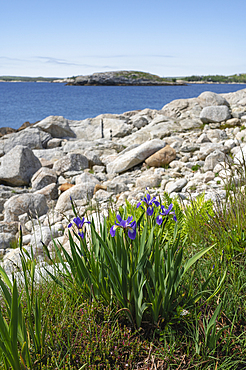
1241-400 - Wild Iris flowers on the rocky coastline by the Atlantic Ocean, Dr. Bill Freedman Nature Preserve, Nature Conservancy of Canada, Nova Scotia, Canada, North America
857-86013 - Hikers walk along Deer Creek Narrows in the Grand Canyon outside of Fredonia, Arizona November 2011. The 21.4-mile loop starts at the Bill Hall trailhead on the North Rim and descends 2000-feet in 2.5-miles through Coconino Sandstone to the level Esplanada then descends further into the lower canyon through a break in the 400-foot-tall Redwall to access Surprise Valley. Hikers connect Thunder River and Tapeats Creek to a route along the Colorado River and climb out Deer Creek.
1218-400 - The Italian fishing village of Portofino, Liguria, Italy, Europe
857-86000 - Hikers on the sandstone Esplanade of the Thunder River Trail below the North Rim of the Grand Canyon outside Fredonia, Arizona November 2011. The 21.4-mile loop descends 2000-feet in 2.5-miles through Coconino Sandstone from the Bill Hall trailhead to connect the Thunder River and Deer Creeks trails. Hikers descend into the lower canyon through a break in the 400-foot-tall Redwall to access Surprise Valley, Deer Creek, Tapeats Creek via Thunder River and even the Colorado River.
857-86022 - Hikers setup camp on a beach along the Colorado River near the plumeting 180-foot Deer Creek Falls in the Grand Canyon outside of Fredonia, Arizona November 2011. The 21.4-mile loop starts at the Bill Hall trailhead on the North Rim and descends 2000-feet in 2.5-miles through Coconino Sandstone to the level Esplanada then descends further into the lower canyon through a break in the 400-foot-tall Redwall to access Surprise Valley. Hikers connect Thunder River and Tapeats Creek to a route along the Colorado River and climb out Deer Creek.
17-4146 - Restored 400 year old merchant's haveli, an all stone structure, Chanwar Palki Walon-ki Haveli also known as Amber Havali, Amber, near Jaipur, Rajasthan state, India, Asia
911-400 - Emergency flare to attract incoming Sea King Helicopter, Lake District, Cumbria, England, United Kingdom, Europe
826-400 - Kingston Bridge spans the River Thames at Kingston-upon-Thames, a suburb of London, England, United Kingdom, Europe
1283-400 - View to Lokrum Island at sunset, Dubrovnik, Croatia, Europe
801-1095 - Casa Grande (Great House) Ruins National Monument, home to the Sonora Desert people, founded near 400 AD, abandoned about 1450 AD, Coolidge, Arizona, United States of America, North America
1350-6625 - Aerial view of Punta Allen Sian Ka'an Reserve, Yucatan Peninsula, Mexico. Red lagoon near Boca Paila Bridge.
In the language of the Mayan peoples who once inhabited this region, Sian Ka'an means Origin of the Sky. Located on the east coast of the Yucatán peninsula, this biosphere reserve contains tropical forests, mangroves and marshes, as well as a large marine section intersected by a barrier reef. It provides a habitat for a remarkably rich flora and a fauna comprising more than 300 species of birds, as well as a large number of the region's characteristic terrestrial vertebrates, which cohabit in the diverse environment formed by its complex hydrological system.
Along its roughly 120 kilometres of coastline, the property covers over 400,000 hectares of land ranging from sea level to only ten m.a.s.l. The property boasts diverse tropical forests, palm savannah, one of the most pristine wetlands in the region, lagoons, extensive mangrove stands, as well as sandy beaches and dunes. The 120,000 hectares of marine area protect a valuable part of the Mesoamerican Barrier Reef and seagrass beds in the shallow bays. The lush green of the forests and the many shades of blue of the lagoons and the Caribbean Sea under a wide sky offer fascinating visual impressions.
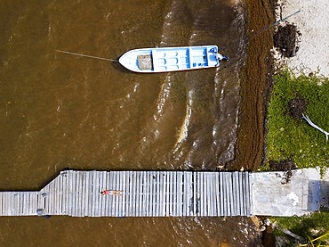
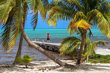
1350-6615 - Palms and old pier in Punta Allen Sian Ka'an Reserve, Yucatan Peninsula, Mexico.
In the language of the Mayan peoples who once inhabited this region, Sian Ka'an means Origin of the Sky. Located on the east coast of the Yucatán peninsula, this biosphere reserve contains tropical forests, mangroves and marshes, as well as a large marine section intersected by a barrier reef. It provides a habitat for a remarkably rich flora and a fauna comprising more than 300 species of birds, as well as a large number of the region's characteristic terrestrial vertebrates, which cohabit in the diverse environment formed by its complex hydrological system.
Along its roughly 120 kilometres of coastline, the property covers over 400,000 hectares of land ranging from sea level to only ten m.a.s.l. The property boasts diverse tropical forests, palm savannah, one of the most pristine wetlands in the region, lagoons, extensive mangrove stands, as well as sandy beaches and dunes. The 120,000 hectares of marine area protect a valuable part of the Mesoamerican Barrier Reef and seagrass beds in the shallow bays. The lush green of the forests and the many shades of blue of the lagoons and the Caribbean Sea under a wide sky offer fascinating visual impressions.
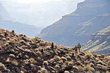
857-86003 - Hikers descend into Surprise Valley to access the lower canyon through a break in the 400-foot-tall Redwall on the Thunder River Trail in the Grand Canyon outside of Fredonia, Arizona November 2011. The 21.4-mile loop starts at the Bill Hall trailhead on the North Rim and descends 2000-feet in 2.5-miles through Coconino Sandstone to the level Esplanada then descends further into the lower canyon to access Thunder River, Tapeats Creek and Deer Creek.
17-4391 - Chanwar Palki Walon-Ki Haveli (mansion), 400 years old, restored to its original state, Anokhi Museum, Amber, near Jaipur, Rajasthan state, India, Asia
847-400 - Quiver tree (kokerboom) (Aloe dichotoma) at the Quiver Tree Forest, Keetmanshoop, Namibia, Africa
1195-12 - Kenya,dadaab refugees camp, somalian border gtz hospital ,the camps were set up around the town of dadaab beginning in 1991 when civil wars erupted on a grand scale in somalia (16 rival factions were involved). The wars, along with a prolonged drought, forced more than 900,000 somalis to flee to neighboring countries. Approximately 400,000 of them, many of whom were in a serious state of exhaustion and starvation, took refuge in kenya. Since then, a majority have returned to their country. However, some 131,000 somalis remain in kenya, and 110,000 are in dadaab, along with some sudanese, ugandans, and about 3,000 ethiopians women waiting the receive care from gtz ngo at the local hospital
746-70092 - Middle East, Jordan, Dead Sea, 400 metres below sea level
802-400 - The wild coastline near Seixal, northwest Madeira, Portugal, Atlantic Ocean, Europe
741-400 - Asdu Island, North Male Atoll, Maldives, Indian Ocean, Asia
857-92991 - Tunisia, Ksar Ouled Soltane, former fortress and its 400 Ghorfas
931-400 - Whale shark (rincodon typus) A swimmer with a whale shark.Gulf of California
857-86011 - Hikers walk along Deer Creek Narrows in the Grand Canyon outside of Fredonia, Arizona November 2011. The 21.4-mile loop starts at the Bill Hall trailhead on the North Rim and descends 2000-feet in 2.5-miles through Coconino Sandstone to the level Esplanada then descends further into the lower canyon through a break in the 400-foot-tall Redwall to access Surprise Valley. Hikers connect Thunder River and Tapeats Creek to a route along the Colorado River and climb out Deer Creek.
857-86025 - Hikers follow a route along the Colorado River that connect Tapeats Creek and Thunder River to Deer Creek in the Grand Canyon outside of Fredonia, Arizona November 2011. The 21.4-mile loop starts at the Bill Hall trailhead on the North Rim and descends 2000-feet in 2.5-miles through Coconino Sandstone to the level Esplanada then descends further into the lower canyon through a break in the 400-foot-tall Redwall to access Surprise Valley. Hikers connect Thunder River and Tapeats Creek to a route along the Colorado River and climb out Deer Creek.
762-400 - Canoeing on Hoe Lake, Boundary Waters Canoe Area Wilderness, Superior National Forest, Minnesota, United States of America, North America
801-904 - Petroglyph National Monument, petroglyphs carved into volcanic rock by American Indians 400 to 700 years ago, New Mexico, United States of America, North America
857-63642 - An adult Bald Eagle (Haliaeetus leucocephalus) assumes the sentry position as one of its juviniles prepares to fledge from the nest on the gulf coast of Florida. The symbol of America was removed from the endangered species list in the lower 48 , a status it has held since 1967, after its numbers increases from just over 400 nesting pair ro about 10,000 in the lower 48.
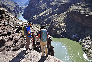
857-86016 - Hikers overlook the Colorado River as they exit the Deer Creek Narrows in the Grand Canyon outside of Fredonia, Arizona November 2011. The 21.4-mile loop starts at the Bill Hall trailhead on the North Rim and descends 2000-feet in 2.5-miles through Coconino Sandstone to the level Esplanada then descends further into the lower canyon through a break in the 400-foot-tall Redwall to access Surprise Valley. Hikers connect Thunder River and Tapeats Creek to a route along the Colorado River and climb out Deer Creek.
1198-400 - King cormorant (phalacrocorax atriceps) also known as imperial cormorant or blue-eyed shag, falkland islands, close-up of head showing blue eye ring
1161-400 - Honey bees swarming in a plum tree in the Cotswolds, UK
489-1454 - Boeing 747-400 Jumbo jet airliner of Cathay Pacific Airways at Hong Kong International Airport at night, Hong Kong, China, Asia
801-907 - Petroglyph National Monument, petroglyphs carved into volcanic rock by American Indians 400 to 700 years ago, New Mexico, United States of America, North America
801-897 - Petroglyph National Monument, petroglyphs carved into volcanic rock by American Indians 400 to 700 years ago, New Mexico, United States of America, North America
1195-9 - Kenya,dadaab refugees camp, somalian border gtz hospital ,the camps were set up around the town of dadaab beginning in 1991 when civil wars erupted on a grand scale in somalia (16 rival factions were involved). The wars, along with a prolonged drought, forced more than 900,000 somalis to flee to neighboring countries. Approximately 400,000 of them, many of whom were in a serious state of exhaustion and starvation, took refuge in kenya. Since then, a majority have returned to their country. However, some 131,000 somalis remain in kenya, and 110,000 are in dadaab, along with some sudanese, ugandans, and about 3,000 ethiopians women waiting the receive care from gtz ngo at the local hospital
857-86015 - Hikers walk along Deer Creek Narrows in the Grand Canyon outside of Fredonia, Arizona November 2011. The 21.4-mile loop starts at the Bill Hall trailhead on the North Rim and descends 2000-feet in 2.5-miles through Coconino Sandstone to the level Esplanada then descends further into the lower canyon through a break in the 400-foot-tall Redwall to access Surprise Valley. Hikers connect Thunder River and Tapeats Creek to a route along the Colorado River and climb out Deer Creek.
857-86007 - Hikers cook dinner along Deer Creek Narrows in the Grand Canyon outside of Fredonia, Arizona November 2011. The 21.4-mile loop starts at the Bill Hall trailhead on the North Rim and descends 2000-feet in 2.5-miles through Coconino Sandstone to the level Esplanada then descends further into the lower canyon through a break in the 400-foot-tall Redwall to access Surprise Valley. Hikers connect Thunder River and Tapeats Creek to a route along the Colorado River and climb out Deer Creek.
1225-400 - A Fernando Botero sculpture at the Museo Botero, Bogota, Colombia, South America
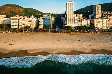
1243-400 - Aerial drone view of Leme Beach and Copacabana Beaches at sunrise with Princesa Isabel Avenue at centre, UNESCO World Heritage Site, Rio de Janeiro, Brazil, South America
1353-400 - Y Lliwedd, Llyn Llydaw and the Miners Track route to Snowdon in winter, Cwm Dyli, Eryri, Snowdonia National Park, North Wales, United Kingdom, Europe
1359-400 - Tree reflecting in Taung Tha Man Lake near U-Bein bridge at sunset, Amarapura, Mandalay, Myanmar (Burma), Asia
801-902 - Petroglyph National Monument, petroglyphs carved into volcanic rock by American Indians 400 to 700 years ago, New Mexico, United States of America, North America
1184-400 - Old cannons in front of the Citadelle Laferriere, UNESCO World Heritage Site, Cap Haitien, Haiti, Caribbean, Central America
801-901 - Petroglyph National Monument, petroglyphs carved into volcanic rock by American Indians 400 to 700 years ago, New Mexico, United States of America, North America
1195-1 - Kenya,dadaab refugees camp, somalian border gtz hospital ,the camps were set up around the town of dadaab beginning in 1991 when civil wars erupted on a grand scale in somalia (16 rival factions were involved). The wars, along with a prolonged drought, forced more than 900,000 somalis to flee to neighboring countries. Approximately 400,000 of them, many of whom were in a serious state of exhaustion and starvation, took refuge in kenya. Since then, a majority have returned to their country. However, some 131,000 somalis remain in kenya, and 110,000 are in dadaab, along with some sudanese, ugandans, and about 3,000 ethiopians women waiting the receive care from gtz ngo at the local hospital . wounds due to boiling water for tea . lots of kids get burned by open flames fires into the camp as they play around without parents control

