Recent searches
Loading...
1383-78 - The Kulamba Traditional Ceremony of the Chewa people takes place every year on the last Saturday in August near Katete. The Chewa who also live in Mozambique and Malawi come to pay homage to their Chief Kalonga Gaia Uni.
1384-78 - University of Yucatan building, Universidad Autonomy de Yucatan, Merida, Yucatan State, Mexico
607-78 - Portrait of a Lion (Panthera leo), Okavango Delta, Botswana
755-78 - Buddhist stupa known as Boudha at Bodhanath, Kathmandu, Nepal. Taken at Lhosar, the Tibetan new year, hence the abundance of new prayer flags.
765-78 - Statues of pharaohs in the Temple of Amun (Amon), Temple of Karnak, Thebes, UNESCO World Heritage Site, Egypt, North Africa, Africa
718-78 - Caldera Colorado, volcanic landscape, Parque Nacional de Timanfaya, Lanzarote, Canary Islands, Spain, Europe
744-78 - Unguent box in the shape of a double cartouche, from the tomb of the pharaoh Tutankhamun, discovered in the Valley of the Kings, Thebes, Egypt, North Africa, Africa
749-78 - Young boy stands by colourfully painted Victorian bathing hut in False Bay, Cape Town, South Africa, Africa
1102-78 - Presidential Palace, Ploshtad Nezavisimost, former Communist Party Head Quarters, Sofia, Bulgaria, Europe
795-78 - Legong dancer in action smiling, Bali, Indonesia, Southeast Asia, Asia
806-78 - Village of Eze, Provence, Cote d'Azur, French Riviera, France, Europe
813-78 - Interior, Central Railway Station, Dresden, Saxony, Germany, Europe
823-78 - Aerial image of mudflats at sunset, Solway Firth, border between Cumbria in England and Dumfries and Galloway in Scotland, United Kingdom, Europe
826-78 - The Indo-Saracenic style Vidhana Soudha (Karnataka State Legislative Assembly) in Bangalore, Karnataka, India, Asia
1158-78 - Aguerd Oudad, Tafraoute, Anti Atlas, Morocco, North Africa, Africa
971-78 - African forest elephant (Loxodonta cyclotis) bull standing at the edge of the forest, Loango National Park, Ogooue-Maritime, Gabon, Africa
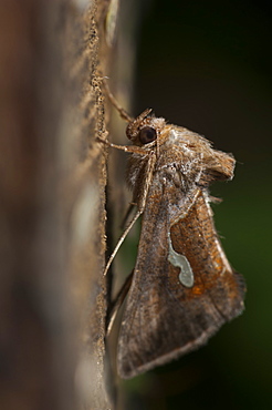
1001-78 - Dewick's plusia (Macdunnoghia confusa) (Noctuidae), Bulgaria, Europe
846-78 - Medieval houses, St. Cirq Lapopie, Lot, Midi-Pyrenees, France, Europe
847-78 - The 10th century Jain Parsvanatha temple at Khajuraho, UNESCO World Heritage Site, Madhya Pradesh, India, Asia
940-78 - Female black flying-fox (Pteropus alecto) in care following barbed wire entanglement, Hopkins Creek, New South Wales, Australia, Pacific
908-78 - Parrotfish (Scarus sp.).
Mabul, Sipadan, Borneo, Malaysia, Indo-Pacific.
(RR)
1022-78 - Horseshoe leatherjacket (meuschenia hippocrepis), wild, day, marine protected area, diving off Rottnest Island, Western Australia, Indian Ocean.
1103-78 - Spotted porcelain crab (Neopetrolisthes), in an anemone, Philippines, Southeast Asia, Asia
989-78 - Common frog (grass frog) (Rana temporaria) in damp meadow, Wiltshire, England, United Kingdom, Europe
1179-78 - Waves on the smooth rocks of the Capo Testa Peninsula, by Santa Teresa di Gallura, Sardinia, Italy, Mediterranean, Europe
1213-78 - Sunrise at Eastbourne Pier, Eastbourne, East Sussex, England, United Kingdom, Europe
1267-78 - Aerial view of Brisbane city after dark, Brisbane, Queensland, Australia, Pacific
857-94722 - Children playing with a outrigger canoe in the village of Hessessai Bay at PanaTinai (Panatinane)island in the Louisiade Archipelago in Milne Bay Province, Papua New Guinea. The island has an area of 78 km2. The Louisiade Archipelago is a string of ten larger volcanic islands frequently fringed by coral reefs, and 90 smaller coral islands located 200 km southeast of New Guinea, stretching over more than 160 km and spread over an ocean area of 26,000 km? between the Solomon Sea to the north and the Coral Sea to the south. The aggregate land area of the islands is about 1,790 km? (690 square miles), with Vanatinai (formerly Sudest or Tagula as named by European claimants on Western maps) being the largest. Sideia Island and Basilaki Island lie closest to New Guinea, while Misima, Vanatinai, and Rossel islands lie further east. The archipelago is divided into the Local Level Government (LLG) areas Louisiade Rural (western part, with Misima), and Yaleyamba (western part, with Rossell and Tagula islands. The LLG areas are part of Samarai-Murua District district of Milne Bay. The seat of the Louisiade Rural LLG is Bwagaoia on Misima Island, the population center of the archipelago.PanaTinai (Panatinane) is an island in the Louisiade Archipelago in Milne Bay Province, Papua New Guinea.
1284-78 - Bagan Golden Palace after sunset, Bagan (Pagan), Myanmar (Burma), Asia
1304-78 - Bo-Kaap, located in between the city centre and the foot of Signal Hill, Cape Town, South Africa, Africa
1314-78 - Blonde tourist woman in bikini holding hand of partner at Anse Caiman Beach with natural pool in La Digue, Seychelles, Indian Ocean, Africa
1382-78 - tree-lined path,Krimulda,around Sigulda,Gauja National park,Vidzeme Region,Latvia,Baltic region,Northern Europe
1185-78 - Indian eagle owl (Bubo bengalensis), Herefordshire, England, United Kingdom, Europe
505-78 - Durdle Door, Dorset, England, United Kingdom, Europe
1263-78 - Hlosi Game Lodge during a spectacular sunset over the Amakhala Game Reserve on the Eastern Cape, South Africa, Africa
1111-78 - Caci man performing a traditional whip dance with bamboo shield and leather whip, western Flores, Indonesia, Southeast Asia, Asia
799-78 - Sign above the famous Grapes public house where many of the Titanic workers frequented, Southampton, Hampshire, England, United Kingdom, Europe
1369-78 - Aerial vertical view of old volcano and asphalt road, near to Myvatn lake on a summer day, Iceland, Polar Regions
1287-78 - The gorge at Finnich Glen (Devils Pulpit) near Killearn, Stirlingshire, Scotland, United Kingdom, Europe
1104-78 - Souk Shark Shopping Center and Marina with new Central Bank of Kuwait in distance, Kuwait City, Kuwait, Middle East
1163-78 - Machhapuchhare (Fish Tail), 6993m, Annapurna Conservation Area, Nepal, Himalayas, Asia
1372-78 - Rural autumn landscape, Highway with autumnal forest hills, Hokkaido, Japan, Asia
1131-78 - Priest holding relics from the Bete Medhane Alem Church, Lalibela, Amhara region, Northern Ethiopia, Africa
1315-78 - Straw hats for sale in Vinales, Cuba, West Indies, Caribbean, Central America
1376-78 - Panoramic view from Finsthwaite Heights, towards the Northern fells beyond Windermere, Lake District National Park, UNESCO World Heritage Site, Cumbria, England, United Kingdom, Europe
1171-78 - Naxi minorities and young urban professionals from other parts of China in Dayan, Old Town of Lijiang, UNESCO World Heritage Site, Lijiang, Yunnan, China, Asia
1012-78 - Map Pufferfish & diver. Layang Layang, Malaysia
1228-78 - Portnablagh, Atlantic Coast, County Donegal, Ulster, Republic of Ireland, Europe
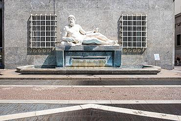
1373-78 - View of the Fountain of Po in Via Roma, executed by Umberto Baglioni, 1893-1965, and placed in 1939, the allegorical statue represents the River Po with a man lying on a pedestal, from which water flows, Turin, Piedmont, Italy, Europe
981-78 - Neil Lucas with underwater time lapse system on the wreck of the 'Blue Plunder'. Bahamas.
748-78 - Polar Bear with cubs, (Ursus maritimus), Churchill, Manitoba, Canada
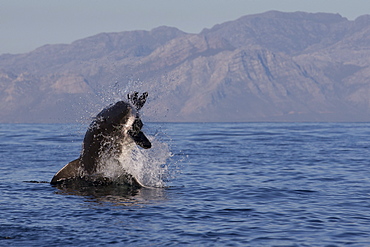
938-78 - Great white shark (Carcharodon carcharias), Seal Island, False Bay, Simonstown, Western Cape, South Africa, Africa
857-19702 - Alex Nicks takes local children for a ride off of Faaite, one of the 78 Tuamotu atolls.
1160-78 - Pic Lombarduccio reflecting in Lac de Melo, Gorges de la Restonica, Haute Corse, Corsica, France, Mediterranean, Europe
841-78 - Queen of the parade, Carnaval Santa Cruz, Tenerife, Canary Islands, Spain, Europe
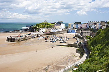
835-78 - Tenby Harbour, Tenby, Pembrokeshire, Wales, United Kingdom, Europe
1241-78 - Close up portrait of a wild Rocky Mountain Bighorn Sheep (Ovis canadensis), Jasper National Park, Canada, North America
1286-78 - Long-tail boat on Rawai Beach, Phuket, Thailand, Southeast Asia, Asia
1262-78 - Buddhist prayers, Bagan (Pagan), Myanmar (Burma), Asia
1283-78 - View from Lovrijenac Fortress to the city walls of the old town of Dubrovnik and Lokrum Island, Dubrovnik, Croatia, Europe
1278-78 - Remains of the Casa di Pansa (House of Pansa), pool in the peristyle with Ionic capitals at the atrium, Pompeii, UNESCO World Heritage Site, Campania, Italy, Europe
1184-78 - Otter Point at sunset, Lake Malawi National Park, UNESCO World Heritage Site, Cape Maclear, Malawi, Africa
1238-78 - Momoyama castle during cherry blossom season, Kyoto, Japan, Asia
1167-78 - Reflection in the clearing fog, Lago Pehoe, Torres del Paine National Park, Patagonia, Chile, South America
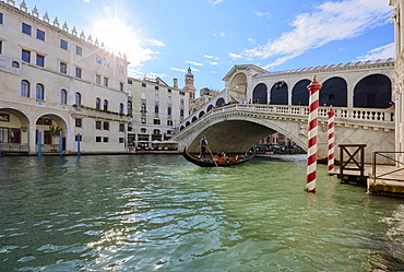
1248-78 - A gondolier rowing under Rialto Bridge in Venice, UNESCO World Heritage Site, Veneto, Italy, Europe
733-78 - Skaftafell glacier in the south of the island, Skaftafell National Park, Iceland
825-78 - Starfruit (carambola) (Averrhoa carambola), a star shaped fruit when cut, grown in tropical conditions
844-78 - Butchers Shop, Bologna, Emilia Romagna, Italy, Europe
1306-78 - St Mary's Church, Astbury near Congleton in winter at night, Cheshire, England, United Kingdom, Europe
1311-78 - View of Sedona and Cathedral Rock from the summit of Scheurman Mountain, Sedona, Arizona, United States of America, North America
485-78 - Canterbury Cathedral, Canterbury, Kent, England, UK
809-78 - Statue of Confucius in the Shanghai Confucius temple, Shanghai, China, Asia
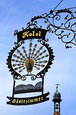
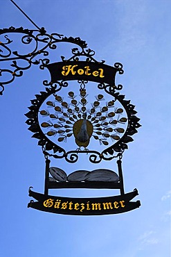
832-167943 - Elaborate advertising sign "Hotel Pfauen" hotel peacock, in the back an old gate tower, Hauptstr. 78, Endingen am Kaiserstuhl, Baden-Wuerttemberg, Germany, Europe
849-78 - The famous cobbled street of Gold Hill in Shaftesbury, Dorset, England, United Kingdom, Europe
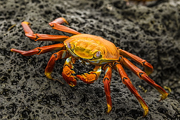
1320-78 - Fiddler Crab on a rocky beach, Isabela Island, Galapagos, Ecuador, South America
1276-78 - View of Vancouver skyline and False Creek in autumn, Vancouver, British Columbia, Canada, North America
1345-78 - Igreja Matriz Nossa Senhora dos Remédios (First Church of Our Lady of the Remedies) is the largest church in Paraty, Rio de Janeiro State, Brazil
764-78 - Storm cloud, White Sands National Monument, New Mexico, United States of America, North America
794-78 - Typical shop selling cooked chicken hanging on display, Wan Chai, Hong Kong Island, Hong Kong, China, Asia
774-78 - Food for sale at the Three Little Gorges, Daning River, Chongqing province, China, Asia
762-78 - Tulip bulb fields, near Noordwijk, Holland, The Netherlands
792-78 - Restaurant, timbered buildings, La Petite France, Strasbourg, Alsace, France, Europe
824-78 - Wakeboarding in Antigua, West Indies, Caribbean, Central America
1366-78 - Faiyum, Egypt. February 19, 2022. Building decorated with murals in the village of Faiyum.
1361-78 - Aerial panoramic view of the Kirkjufell mountain at Snaefellsnes Peninsula, Vesturland region, West of Iceland, Iceland, Polar Regions
1242-78 - At this burial cliff, condolence signs from past funerals and coffin carriers shaped like traditional Torajan houses are left below the crypts and tao-taos, Tana Toraja, Sulawesi, Indonesia, Southeast Asia, Asia
918-78 - Horbyebreen, Billefjorden, Spitsbergen, Svalbard, Norway, Scandinavia, Europe
1125-78 - Koala bear, Melbourne, Victoria, Australia, Pacific
1298-78 - Ingleborough seen from a limestone boulder on Twistleton Scar, Yorkshire Dales National Park, North Yorkshire, England, United Kingdom, Europe
812-78 - Businessmen drinking in hotel bar at dusk, Hong Kong, China, Asia
1209-78 - Twistleton Scar End in snow, Ingleton, Yorkshire Dales, Yorkshire, England, United Kingdom, Europe
832-167946 - Elaborate advertising sign "Hotel Pfauen" hotel peacock, Hauptstr. 78, Endingen am Kaiserstuhl, Baden-Wuerttemberg, Germany, Europe
911-78 - PhD scientist Ian Bartholomew taking measurements as part of a study to measure the speed of the Russell Glacier near Kangerlussuaq, Greenland, Polar Regions
1195-78 - Hardest hit was a 650 kilometers stretch of the somali coastline between garacad (mudung region) and xaafuun (bari region), which forms part of the puntland province near the horn of africa. The tsunami resulted in the death of some 300 people and extensive destruction of shelters, houses and water sources as well as fishing gear. The livelihoods of many people residing in towns and small villages along the somali indian ocean coastline, particularly in the northern regions, were devastated
1275-78 - Temple of Literature, the Imperial Academy, Vietnam's first national university, Hanoi, Vietnam, Indochina, Southeast Asia, Asia
1350-79 - The Belt and Sword region of Orion, with the Orion Nebula, Messiesr 42 and 43, at bottom. Below the left star of the Belt, Alnitak, is the famous Horsehead Nebula, while above it is NGC 2024, aka the Flame Nebula. At very top left is Messier 78, while part of Barnard's Loop arc across the field at left. The field is filled with other faint red emission and blue reflection nebulas. The large loose open cluster Collinder 70 surrounds the middle star of the Belt, Alnilam.


