Recent searches
Loading...
722-200 - Statues of Hindu deities on view in front of a roadside trader's shop in Bhubaneswar, Odisha.
1384-200 - Sculpture of seated Mexican bandit, Isla Mujeres, Caribbean Coast, Cancun, Quintana Roo, Mexico - head seems to be missing!
206-2529 - Hope Town, 200 year old settlement on Elbow Cay, Abaco Islands, Bahamas, Caribbean, West Indies
83-10781 - The huge Kailasa (Kailash) Temple, Ellora, Maharashtra State, India"Cut from the rock in the Hindu section of the world-heritage cave temples at Ellora, a project which took 150 years and entailed the removal of 200,000 tons of rock"
485-200 - Rural road in the Beinn Edra Range, near Staffin, Isle of Skye, Scotland, United Kingdom, Europe
83-11796 - 1950s Buick outside Dr Wilkinson's Mud & Mineral Baths on Lincoln Avenue in Calistoga, Napa Valley, Northern California, UsaLincoln Avenue in Calistoga at the head of the Napa Valley, north of San Francisco, famous for it's 200 wineries
772-200 - Market during Buddhist festival (Tsechu), Thimphu, Bhutan, Asia
763-619 - Gold Artifacts Mochica Culture, 200-800AD, Classic Period gold breastplate (pectoral) in human and animal form Rafael Herrera Museum, Lima, Peru
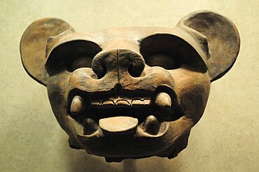
763-617 - Mochica Culture, 200-800AD, Classic Period supreme feline deity mask in copper and bone Museo Rafael Herrera collection, Lima, Peru
763-634 - Precolumbian Ceramics Nazca Culture, 200-800AD vase showing a mother giving birth with mythical portraits in the collection of the Museo Amano, Lima, Peru
749-200 - Torch ginger flower, St. Lucia, Windward Islands, West Indies, Caribbean, Central America
770-200 - Mousa Broch, best preserved of all brochs, standing 12-13 m high, in perfect state, due to its isolation, Mousa Island, Shetland Islands, Scotland, United Kingdom, Europe
755-200 - Te Apiti Wind Farm, on the lower Ruahine Ranges, near Palmerston North, Manawatu, North Island, New Zealand, Pacific
794-200 - Woman wearing traditional veil, Doha, Qatar, Middle East
832-313733 - Lufthansa Airbus A320-200, with special painting for the Football WC, Koeln-Bonn airport, Cologne, North Rhine-Westphalia, Germany
1104-200 - View of Yerevan and Mount Ararat from Cascade, Yerevan, Armenia, Central Asia, Asia
799-200 - Golden corn field with tree near Chulmleigh, Mid Devon, England, United Kingdom, Europe
795-200 - Oia, Santorini, Cyclades, Greek Islands, Greece, Europe
822-200 - Big Step retail complex in Amerika-mura (American Village), center of youth culture in Osaka, Japan, Asia
825-200 - Ile Havre-Aubert, one of the Iles de la Madeleine (Magdalen Islands), in the Gulf of St. Lawrence, Quebec, Canada, North America
817-133288 - Vasija erotica ritual de la cultura Moche, Norte de Peru (200 aC - 700 d.C), Museo de Arqueologia Rafael Larco, Lima, Peru.
832-154673 - Unemployed residents of the Detroit area lined up to apply for 200 jobs at a new Meijer store, Rochester Hills, Michigan, USA
832-136138 - A solar photovoltaic facility, built on top of a former landfill at the U.S. Army's Fort Carson uses contaminated land to generate renewable energy and generates 3, 200 megawatt-hours of power every year, Colorado Springs, Colorado, USA
832-136137 - A solar photovoltaic facility, built on top of a former landfill at the U.S. Army's Fort Carson uses contaminated land to generate renewable energy and generates 3, 200 megawatt-hours of power every year, Colorado Springs, Colorado, USA
832-107468 - Jukebox, Phonoramic 200 from Tonomat, 1957, 50's exhibition, Deutsches Museum, Munich, Bavaria, Germany, Europe
1001-200 - Soldier beetle (Cantharis rustica), South West Bulgaria, Europe
817-412312 - Chavin nailed head Chavin culture 900 BC-200 BC Peru
757-200 - Olympic mountain range, Olympic National Park, UNESCO World Heritage Site, Washington State, United States of America, North America
847-200 - Group of tourists at the Kiosk of Trajan at the Philae Temples, UNESCO World Heritage Site, Nubia, Egypt, North Africa, Africa
857-69490 - Camel traders and herders sit in a tea hut in a camel market in El Obeid, Sudan on February 16, 2006. Yussuf Gamaa, 2nd from L, is a camel herder from Darfur. About 150,000 camels cross over from Sudan into Egypt every year, the majority as cattle as an inexpensive source of protein. Today the camel is both the caravan and the cargo. Camels from this market will travel the Forty Days Road or Darb el-Arbein a 1,200 mile desert trail into Egypt and the oldest trade route in the Sahara. Desert nomads like Yussuf depend on the profitable camel trade for their livelihood.
857-61923 - Hillary Clinton speaking to a crowd at the Manchester School of Technology. Her speech outlined what she called a new progressive plan to address growing income inequality in America. She spoke to about 200 people. At the end of her speech she shook a few hands, posed for photos and departed.
857-32208 - Bart Bledsoe walks a 100ft long and 200 foot high slackline set up at Torrent Falls near Slade, KY.
857-25417 - The Eagle Lady, 81-year old Jean Keene, attracts bald eagles (Haliaeetus leucocephalus) every winter morning regardless of weather with her banquet of surplus fish. Keene has fed a gathering of eagles at the Homer Spit Campground in Alaska every winter morning for 25 years. What started out as just 2 eagles eventually became 200 to 300 of the magnificent birds.
857-15255 - Two young altar boys fill a 200-year-old incensor for a reenactment of the washing of the apostles' feet by Jesus on Holy Thursday in Ouro Preto, a colonial Brazilian city noted for its baroque architecture.
965-200 - Bengal Tiger (Panthera tigris tigris), wild adult male, critically endangered. Bandhavgarh Tiger Reserve, India.
1194-200 - Watatulu tribals at catholic mass, tanzania. - with father dan ohman in a hut in mwankale
803-200 - Tenzing Norgye Memorial Stupa with Mount Everest in the background on the right and Lhotse on the left, Himalayas, Nepal, Asia
1226-200 - Alternative festive Christmas lights in Carnaby Street, Soho, London, England, United Kingdom, Europe
857-94721 - Nimoa Island - here the island mission will impress. The five-sided church features murals of island life and all mission buildings are surrounded by well maintained paths and gardens filled with flowering plants. Edged by jungle-covered mountains, postcard beaches and crystal clear waters - an island paradise indeed! The Louisiade Archipelago is a string of ten larger volcanic islands frequently fringed by coral reefs, and 90 smaller coral islands located 200 km southeast of New Guinea, stretching over more than 160 km and spread over an ocean area of 26,000 km? between the Solomon Sea to the north and the Coral Sea to the south. The aggregate land area of the islands is about 1,790 km? (690 square miles), with Vanatinai (formerly Sudest or Tagula as named by European claimants on Western maps) being the largest. Sideia Island and Basilaki Island lie closest to New Guinea, while Misima, Vanatinai, and Rossel islands lie further east. The archipelago is divided into the Local Level Government (LLG) areas Loui!
857-94719 - Nimoa Island - here the island mission will impress. The five-sided church features murals of island life and all mission buildings are surrounded by well maintained paths and gardens filled with flowering plants. Edged by jungle-covered mountains, postcard beaches and crystal clear waters - an island paradise indeed! The Louisiade Archipelago is a string of ten larger volcanic islands frequently fringed by coral reefs, and 90 smaller coral islands located 200 km southeast of New Guinea, stretching over more than 160 km and spread over an ocean area of 26,000 km? between the Solomon Sea to the north and the Coral Sea to the south. The aggregate land area of the islands is about 1,790 km? (690 square miles), with Vanatinai (formerly Sudest or Tagula as named by European claimants on Western maps) being the largest. Sideia Island and Basilaki Island lie closest to New Guinea, while Misima, Vanatinai, and Rossel islands lie further east. The archipelago is divided into the Local Level Government (LLG) areas Louisiade Rural (western part, with Misima), and Yaleyamba (western part, with Rossell and Tagula islands. The LLG areas are part of Samarai-Murua District district of Milne Bay. The seat of the Louisiade Rural LLG is Bwagaoia on Misima Island, the population center of the archipelago.
857-94715 - Nimoa Island - here the island mission will impress. The five-sided church features murals of island life and all mission buildings are surrounded by well maintained paths and gardens filled with flowering plants. Edged by jungle-covered mountains, postcard beaches and crystal clear waters - an island paradise indeed! The Louisiade Archipelago is a string of ten larger volcanic islands frequently fringed by coral reefs, and 90 smaller coral islands located 200 km southeast of New Guinea, stretching over more than 160 km and spread over an ocean area of 26,000 km? between the Solomon Sea to the north and the Coral Sea to the south. The aggregate land area of the islands is about 1,790 km? (690 square miles), with Vanatinai (formerly Sudest or Tagula as named by European claimants on Western maps) being the largest. Sideia Island and Basilaki Island lie closest to New Guinea, while Misima, Vanatinai, and Rossel islands lie further east.
1237-200 - Edinburgh Castle, UNESCO World Heritage Site, Edinburgh, Scotland, United Kingdom, Europe
857-94722 - Children playing with a outrigger canoe in the village of Hessessai Bay at PanaTinai (Panatinane)island in the Louisiade Archipelago in Milne Bay Province, Papua New Guinea. The island has an area of 78 km2. The Louisiade Archipelago is a string of ten larger volcanic islands frequently fringed by coral reefs, and 90 smaller coral islands located 200 km southeast of New Guinea, stretching over more than 160 km and spread over an ocean area of 26,000 km? between the Solomon Sea to the north and the Coral Sea to the south. The aggregate land area of the islands is about 1,790 km? (690 square miles), with Vanatinai (formerly Sudest or Tagula as named by European claimants on Western maps) being the largest. Sideia Island and Basilaki Island lie closest to New Guinea, while Misima, Vanatinai, and Rossel islands lie further east. The archipelago is divided into the Local Level Government (LLG) areas Louisiade Rural (western part, with Misima), and Yaleyamba (western part, with Rossell and Tagula islands. The LLG areas are part of Samarai-Murua District district of Milne Bay. The seat of the Louisiade Rural LLG is Bwagaoia on Misima Island, the population center of the archipelago.PanaTinai (Panatinane) is an island in the Louisiade Archipelago in Milne Bay Province, Papua New Guinea.
857-94718 - Nimoa Island - here the island mission will impress. The five-sided church features murals of island life and all mission buildings are surrounded by well maintained paths and gardens filled with flowering plants. Edged by jungle-covered mountains, postcard beaches and crystal clear waters - an island paradise indeed! The Louisiade Archipelago is a string of ten larger volcanic islands frequently fringed by coral reefs, and 90 smaller coral islands located 200 km southeast of New Guinea, stretching over more than 160 km and spread over an ocean area of 26,000 km? between the Solomon Sea to the north and the Coral Sea to the south. The aggregate land area of the islands is about 1,790 km? (690 square miles), with Vanatinai (formerly Sudest or Tagula as named by European claimants on Western maps) being the largest. Sideia Island and Basilaki Island lie closest to New Guinea, while Misima, Vanatinai, and Rossel islands lie further east. The archipelago is divided into the Local Level Government (LLG) areas Louisiade Rural (western part, with Misima), and Yaleyamba (western part, with Rossell and Tagula islands. The LLG areas are part of Samarai-Murua District district of Milne Bay. The seat of the Louisiade Rural LLG is Bwagaoia on Misima Island, the population center of the archipelago.
857-94717 - Nimoa Island - here the island mission will impress. The five-sided church features murals of island life and all mission buildings are surrounded by well maintained paths and gardens filled with flowering plants. Edged by jungle-covered mountains, postcard beaches and crystal clear waters - an island paradise indeed! The Louisiade Archipelago is a string of ten larger volcanic islands frequently fringed by coral reefs, and 90 smaller coral islands located 200 km southeast of New Guinea, stretching over more than 160 km and spread over an ocean area of 26,000 km? between the Solomon Sea to the north and the Coral Sea to the south. The aggregate land area of the islands is about 1,790 km? (690 square miles), with Vanatinai (formerly Sudest or Tagula as named by European claimants on Western maps) being the largest. Sideia Island and Basilaki Island lie closest to New Guinea, while Misima, Vanatinai, and Rossel islands lie further east. The archipelago is divided into the Local Level Government (LLG) areas Loui!
1382-200 - young waitress presenting a famous cake named Sakotis in a decorated version at Romnesa bakery-restaurant at Strigailiskis, Ignalina district, Aukstaitija National Park, Lithuania, Europe
857-94716 - Nimoa Island - here the island mission will impress. The five-sided church features murals of island life and all mission buildings are surrounded by well maintained paths and gardens filled with flowering plants. Edged by jungle-covered mountains, postcard beaches and crystal clear waters - an island paradise indeed! The Louisiade Archipelago is a string of ten larger volcanic islands frequently fringed by coral reefs, and 90 smaller coral islands located 200 km southeast of New Guinea, stretching over more than 160 km and spread over an ocean area of 26,000 km? between the Solomon Sea to the north and the Coral Sea to the south. The aggregate land area of the islands is about 1,790 km? (690 square miles), with Vanatinai (formerly Sudest or Tagula as named by European claimants on Western maps) being the largest. Sideia Island and Basilaki Island lie closest to New Guinea, while Misima, Vanatinai, and Rossel islands lie further east. The archipelago is divided into the Local Level Government (LLG) areas Loui!
857-94720 - Nimoa Island - here the island mission will impress. The five-sided church features murals of island life and all mission buildings are surrounded by well maintained paths and gardens filled with flowering plants. Edged by jungle-covered mountains, postcard beaches and crystal clear waters - an island paradise indeed! The Louisiade Archipelago is a string of ten larger volcanic islands frequently fringed by coral reefs, and 90 smaller coral islands located 200 km southeast of New Guinea, stretching over more than 160 km and spread over an ocean area of 26,000 km? between the Solomon Sea to the north and the Coral Sea to the south. The aggregate land area of the islands is about 1,790 km? (690 square miles), with Vanatinai (formerly Sudest or Tagula as named by European claimants on Western maps) being the largest. Sideia Island and Basilaki Island lie closest to New Guinea, while Misima, Vanatinai, and Rossel islands lie further east. The archipelago is divided into the Local Level Government (LLG) areas Louisiade Rural (western part, with Misima), and Yaleyamba (western part, with Rossell and Tagula islands. The LLG areas are part of Samarai-Murua District district of Milne Bay. The seat of the Louisiade Rural LLG is Bwagaoia on Misima Island, the population center of the archipelago.
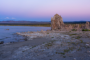
1372-200 - Rock formation at Mono lake with soft diffusive light after sunset
29-5052 - Airai Bai, sacred meeting house at heart of village, 200 years old, southern Babeldaob, Palau, Micronesia, Western Pacific Ocean, Pacific
801-3789 - Ceramic Figure (200-600 AD), from Tambas de Tiro, National Museum of Anthropology, Mexico City, Mexico
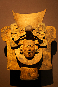
801-3797 - Goddess of Fertility (foreground), 200-900 AD, from Veracruz Area, National Museum of Anthropology, Mexico City, Mexico
801-3801 - Urn (100 BC - 200 AD), from Tomb 77, Monte Alban, National Museum of Anthropology, Mexico City, Mexico
1369-200 - Long exposure to capture the warm light during an autumn sunrise in the fisherman village of Hamnoy, Lofoten Islands, Nordland, Norway, Scandinavia, Europe
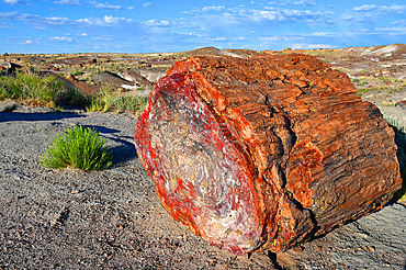
860-292276 - The Petrified Forest National Park is home to thousands of fossilized tree trunks approximately 200 million years old (Triassic period). Arizona. USA.
860-292474 - Giant Seychelles tortoise (Aldabrachelys gigantea), Turtle island, Prison island, Zanzibar. This island was used as a prison for slaves, and four giant Seychelles tortoises were introduced. Today, they are protected from poachers, and the oldest are between 170 and 200 years old.
581-200 - Aerial view over large river meander through Moscow, Russia, Europe
817-412314 - Stone mortar Chavin culture 900 BC-200 BC Peru
1219-200 - Lunar eclipse, a rare supermoon, blood moon composite phase in the night sky, United Kingdom, Europe
801-3798 - Olmec Colossal Head, 1,200-600 BC, from San Lorenzo, Veracruz, National Museum of Anthropology, Mexico City, Mexico
801-3799 - Olmec Colossal Head, 1,200-600 BC, from San Lorenzo, Veracruz, National Museum of Anthropology, Mexico City, Mexico
1373-200 - Interior of Corpus Domini Church, blending Neo-Romanesque, Neo-Byzantine, and Art Nouveau styles, completed in 1901, elevated to minor basilica status by Pope Pius XII, Milan, Lombardy, Italy, Europe
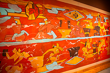
801-3740 - Mural of Drinkers, 200 AD, Replica, Museo de Sitio de Cholula, Cholula, State of Puebla, Mexico
1358-200 - Glass Beach, site of large quantities of sea glass, from shipwrecks and bottles thrown into the sea from the Royal Navy Dockyard over hundreds of years, Bermuda, Atlantic, North America
1265-200 - Farmhouse in green summer landscape near Crete Senesi, Tuscany, Italy, Europe
1235-200 - Ancient City of Hierapolis, Pamukkale, UNESCO World Heritage Site, Anatolia, Turkey, Asia Minor, Asia
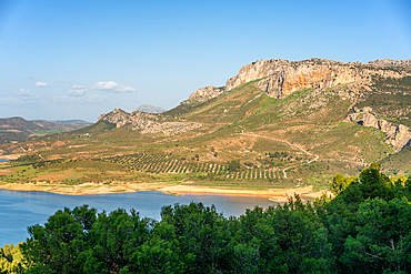
1346-200 - Landscape of Gobrantes and Guadalhorce water reservoir dam, Andalusia, Spain, Europe
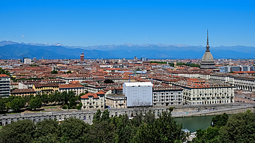
1373-137 - Cityscape from the Monte dei Cappuccini, a hill rising about 200 meters from the right bank of the River Po, in the Borgo Po district, Turin, Piedmont, Italy, Europe
1242-200 - Houses on stilts, Kompong Khleang floating village, on the Tonle Sap lake, Cambodia, Indochina, Southeast Asia, Asia
1310-200 - View along The Strip by night, illuminated Eiffel Tower at the Paris Hotel and Casino prominent, Las Vegas, Nevada, United States of America, North America
1373-144 - Cityscape from the Monte dei Cappuccini, a hill rising about 200 meters from the right bank of the River Po, in the Borgo Po district, Turin, Piedmont, Italy, Europe
832-372781 - The Roman Great Theatre of Pompeii, seating up to 5000 spectators the theatre was originally built in Hellenistic time, 200-150 B.C, Italy, Europe
10-200 - Kotor Old Town and fortifications at sunrise, Bay of Kotor, UNESCO World Heritage Site, Montenegro, Europe
817-395113 - Seljalandsfoss Waterfall, Iceland This waterfall drops 60 metres 200 ft over the cliffs There is a trail behind for easy access to walk behind the falls
979-6756 - A pod of approximately 200 melon-headed whales (Peponocephala electra) encountered off the island of Brava, Cape Verde Islands, in the north Atlantic Ocean
612-200 - The Red Cuillins near Broadford, Cuillin Hills, Isle of Skye, Highlands Region, Scotland, UK, Europe
1113-44384 - Staircase, Capitol, architect Elijah E. Myers, 200 East Colfax Avenue, Denver, Colorado, USA, North
817-412315 - Ceramic vessel Chavin culture 900 BC-200 BC Peru
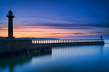
1228-200 - Sunset afterglow over Whitby West Pier and lighthouse, the North Yorkshire coast, Yorkshire, England, United Kingdom, Europe
1113-105986 - Silverback Guhonda is over 30 years old, two meters tall, weighs more than 200 kg and is the undisputed leader of the Sabyinyo group of gorillas in Volcanoes National Park, Northern Province, Rwanda, Africa
1361-200 - Full moon night over the illuminated medieval village of Giovinazzo with tourist marina in the foreground, Bari province, Adriatic Sea, Mediterranean Sea, Apulia, Italy, Europe
83-11926 - Cable car for visitors at the Sterling Winery near Calistoga, perched on a rock outcrop over in the Napa Valley north of San Francisco, famous for its 200 wineries, Napa Valley, Northern California, California, United States of America (USA), North America
770-1435 - High cliffs between 200 and 300m high, on west coast of Sandoy, Svartskorardrangur and Oknadalsdrangur sea stacks, Sandoy, Faroe Islands (Faroes), Denmark, Europe
801-882 - Canyon de Chelly National Monument, 200 year old rock paintings of the Spanish , Arizona, United States of America, North America
857-94714 - The Louisiade Archipelago is a string of ten larger volcanic islands frequently fringed by coral reefs, and 90 smaller coral islands located 200 km southeast of New Guinea, stretching over more than 160 km and spread over an ocean area of 26,000 km? between the Solomon Sea to the north and the Coral Sea to the south. The aggregate land area of the islands is about 1,790 km? (690 square miles), with Vanatinai (formerly Sudest or Tagula as named by European claimants on Western maps) being the largest. Sideia Island and Basilaki Island lie closest to New Guinea, while Misima, Vanatinai, and Rossel islands lie further east. The archipelago is divided into the Local Level Government (LLG) areas Louisiade Rural (western part, with Misima), and Yaleyamba (western part, with Rossell and Tagula islands. The LLG areas are part of Samarai-Murua District district of Milne Bay. The seat of the Louisiade Rural LLG is Bwagaoia on Misima Island, the population center of the archipelago.
1267-200 - Ely Cathedral, City of Ely, Cambridgeshire, England, United Kingdom, Europe
764-200 - Lion (Panthera leo) walking towards camera, Serengeti National Park, Tanzania, East Africa, Africa
615-698 - Jinar, 15 year old girl in front of a 200 year old beehive house in the desert, Ebla area, Syria, Middle East
1196-66 - These reindeer peoples' entire existence is based around their herds of reindeer, which provide milk, skins for clothes, horn for carving and medicine, transport and occasionally, meat. the tsaatan are part of the tuvan ethnic group, which inhabits the tuvan republic of russia. there are only about 200 tsaatan in total, spread over 100,000 sq km of northern mongolia. they are nomadic, often moving their small encampments every three to four weeks, searching for special types of grass and moss loved by the reindeer. the tsaatan are strong practitioners of shamanism. west taiga, northern mongolia
1176-200 - A giant Sukhothai era sitting Buddha, Wat Si Chum, Sukhothai Historical Park, UNESCO World Heritage Site, Thailand, Southeast Asia, Asia
1243-200 - St. Johann church, Santa Maddalena, Val di Funes, Dolomites, Bolzano province, Trentino-Alto Adige, Italy, Europe
857-94712 - The Louisiade Archipelago is a string of ten larger volcanic islands frequently fringed by coral reefs, and 90 smaller coral islands located 200 km southeast of New Guinea, stretching over more than 160 km and spread over an ocean area of 26,000 km? between the Solomon Sea to the north and the Coral Sea to the south. The aggregate land area of the islands is about 1,790 km? (690 square miles), with Vanatinai (formerly Sudest or Tagula as named by European claimants on Western maps) being the largest.Sideia Island and Basilaki Island lie closest to New Guinea, while Misima, Vanatinai, and Rossel islands lie further east. The archipelago is divided into the Local Level Government (LLG) areas Louisiade Rural (western part, with Misima), and Yaleyamba (western part, with Rossell and Tagula islands. The LLG areas are part of Samarai-Murua District district of Milne Bay. The seat of the Louisiade Rural LLG is Bwagaoia on Misima Island, the population center of the archipelago.
1278-200 - The Ladadika area at night with crowd in pedestrian zone of district famous for its bars and restaurants, Thessaloniki, Greece, Europe
733-200 - Taunggi hot air balloon festival, Taunggi, Myanmar (Burma), Asia
808-200 - Burj Khalifa, formerly the Burj Dubai (Dubai Tower), the tallest tower in the world at 818m, Downtown Burj Dubai, Dubai, United Arab Emirates, Middle East
797-10488 - Mexico, Federal District, Mexico City, Museo Nacional de Antropologia Vase 200 BC-500 AD in the form of an animal head.


