Recent searches
Loading...
809-8690 - Asian kitchen, Vietnamese pork and noodle soup (Hu tieu mi), France, Europe
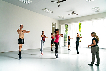
450-4647 - Dancers in rehearsal class of the Mi Compania Ballet Company, Havana, Cuba
450-4646 - Dancers in rehearsal class of the Mi Compania Ballet Company, Havana, Cuba
450-4641 - Dancers in rehearsal class of the Mi Compania Ballet Company, Havana, Cuba
450-4639 - Dancers in rehearsal class of the Mi Compania Ballet Company, Havana, Cuba
450-4638 - Dancers in rehearsal class of the Mi Compania Ballet Company, Havana, Cuba
450-4634 - Dancers in rehearsal class of the Mi Compania Ballet Company, Havana, Cuba
450-4631 - Dancers in rehearsal class of the Mi Compania Ballet Company, Havana, Cuba
450-4630 - Dancers in rehearsal class of the Mi Compania Ballet Company, Havana, Cuba
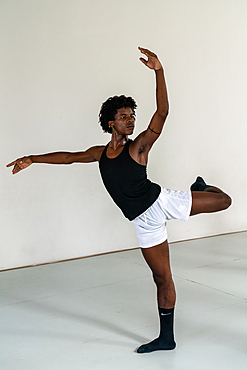
450-4624 - Dancer in rehearsal class of the Mi Compania Ballet Company, Havana, Cuba (Multiple Models and Property Releases) 13
450-4622 - Dancers in rehearsal class of the Mi Compania Ballet Company, Havana, Cuba
450-4620 - Dancer in rehearsal class of the Mi Compania Ballet Company, Havana, Cuba (Multiple Models and Property Releases) 12
1178-43459 - Road near brown agriculture crop field
1178-41899 - Abandoned suitcase in blue airport terminal
1350-4374 - Traditional S?mi arts and crafts. Inside the home of Tuula Airamo, a S?mi descendant, and Reindeer farmer, by Muttus Lake. Inari, Lapland, Finland
1350-4407 - Lake Pielpajârvi Wilderness Church, oldest S?mi church still in use in Inari Municipality, Lapland, Finland
1350-4383 - Tasty berries handmade cake. Inside the home of Tuula Airamo, a S?mi descendant, and Reindeer farmer, by Muttus Lake. Inari, Lapland, Finland
1350-4401 - Lake Pielpaj‰rvi Wilderness Church, oldest S?mi church still in use in Inari Municipality, Lapland, Finland
1350-4382 - Traditional S?mi arts and crafts. Inside the home of Tuula Airamo, a S?mi descendant, and Reindeer farmer, by Muttus Lake. Inari, Lapland, Finland
1350-4361 - In the Reindeer farm of Tuula Airamo, a S?mi descendant, by Muttus Lake. Inari, Lapland, Finland
1350-4372 - Traditional S?mi arts and crafts. Inside the home of Tuula Airamo, a S?mi descendant, and Reindeer farmer, by Muttus Lake. Inari, Lapland, Finland
1350-4356 - In the Reindeer farm of Tuula Airamo, a S?mi descendant, by Muttus Lake. Inari, Lapland, Finland
1350-4358 - In the Reindeer farm of Tuula Airamo, a S?mi descendant, by Muttus Lake. Inari, Lapland, Finland
1350-4357 - In the Reindeer farm of Tuula Airamo, a S?mi descendant, by Muttus Lake. Inari, Lapland, Finland
1350-4384 - Cup of tea and piece of berries handmade cake. Inside the home of Tuula Airamo, a S?mi descendant, and Reindeer farmer, by Muttus Lake. Inari, Lapland, Finland
1350-4369 - Traditional S?mi arts and crafts. Inside the home of Tuula Airamo, a S?mi descendant, and Reindeer farmer, by Muttus Lake. Inari, Lapland, Finland
1350-4408 - Lake Pielpajârvi Wilderness Church, oldest S?mi church still in use in Inari Municipality, Lapland, Finland
1350-4403 - Lake Pielpajârvi Wilderness Church, oldest S?mi church still in use in Inari Municipality, Lapland, Finland
1350-4377 - Traditional furry S?mi handmade shoes. Inside the home of Tuula Airamo, a S?mi descendant, and Reindeer farmer, by Muttus Lake. Inari, Lapland, Finland
1350-4379 - Traditional S?mi arts and crafts. Inside the home of Tuula Airamo, a S?mi descendant, and Reindeer farmer, by Muttus Lake. Inari, Lapland, Finland
1350-4364 - Young woman feeds a reindeer in the Reindeer farm of Tuula Airamo, a S?mi descendant, by Muttus Lake. Inari, Lapland, Finland
1350-4363 - Traditional reindeer sledge. In the Reindeer farm of Tuula Airamo, a S?mi descendant, by Muttus Lake. Inari, Lapland, Finland
1350-4381 - Traditional S?mi arts and crafts. Inside the home of Tuula Airamo, a S?mi descendant, and Reindeer farmer, by Muttus Lake. Inari, Lapland, Finland
1350-4362 - In the Reindeer farm of Tuula Airamo, a S?mi descendant, by Muttus Lake. Inari, Lapland, Finland
1350-4365 - In the Reindeer farm of Tuula Airamo, a S?mi descendant, by Muttus Lake. Inari, Lapland, Finland
1350-4366 - In the Reindeer farm of Tuula Airamo, a S?mi descendant, by Muttus Lake. Inari, Lapland, Finland
1350-4375 - Traditional furry S?mi handmade shoes. Inside the home of Tuula Airamo, a S?mi descendant, and Reindeer farmer, by Muttus Lake. Inari, Lapland, Finland
1350-4378 - Traditional furry S?mi handmade shoes. Inside the home of Tuula Airamo, a S?mi descendant, and Reindeer farmer, by Muttus Lake. Inari, Lapland, Finland
1350-4402 - Lake Pielpaj‰rvi Wilderness Church, oldest S?mi church still in use in Inari Municipality, Lapland, Finland
1350-4371 - Traditional S?mi arts and crafts. Inside the home of Tuula Airamo, a S?mi descendant, and Reindeer farmer, by Muttus Lake. Inari, Lapland, Finland
1350-4380 - Traditional S?mi arts and crafts. Inside the home of Tuula Airamo, a S?mi descendant, and Reindeer farmer, by Muttus Lake. Inari, Lapland, Finland
1350-4404 - Lake Pielpajârvi Wilderness Church, oldest S?mi church still in use in Inari Municipality, Lapland, Finland
1350-4360 - In the Reindeer farm of Tuula Airamo, a S?mi descendant, by Muttus Lake. Inari, Lapland, Finland
1350-4359 - In the Reindeer farm of Tuula Airamo, a S?mi descendant, by Muttus Lake. Inari, Lapland, Finland
1350-4406 - Lake Pielpaj‰rvi Wilderness Church, oldest S?mi church still in use in Inari Municipality, Lapland, Finland
1350-4370 - Traditional S?mi arts and crafts. Inside the home of Tuula Airamo, a S?mi descendant, and Reindeer farmer, by Muttus Lake. Inari, Lapland, Finland
1350-4373 - Traditional S?mi arts and crafts. Inside the home of Tuula Airamo, a S?mi descendant, and Reindeer farmer, by Muttus Lake. Inari, Lapland, Finland
1350-4367 - Bird feeder. In the Reindeer farm of Tuula Airamo, a S?mi descendant, by Muttus Lake. Inari, Lapland, Finland
1350-4387 - Old family picture. Inside the home of Tuula Airamo, a S?mi descendant, and Reindeer farmer, by Muttus Lake. Inari, Lapland, Finland
1350-4368 - Inside the home of Tuula Airamo, a S?mi descendant, and Reindeer farmer, by Muttus Lake. Inari, Lapland, Finland
1116-51783 - Snow plough moving fresh snow; Sault St. Marie, Michigan, United States of America
1116-51781 - Horse and buggy in a snowstorm; Sault St. Marie, Michigan, United States of America
1174-7469 - High angle close up of Mi Quang noodles, a Vietnamese specialty, Vietnam
1174-7468 - High angle close up of Mi Quang noodles, a Vietnamese specialty, Vietnam
832-381149 - Portrait of a water seller at the Jemaa el-Fnaa square in Marrakesh, Morocco, Africa
832-381836 - Djemaa el Fnaa square at dusk, Marrakech, Morocco, Africa
857-92934 - Ko Poda is an island off the west coast of Thailand, in Krabi Province, about 8 kilometres (5 mi) from Ao Nang. It is part of the Mu Ko Poda, or Poda Group Islands, which are under the administration of Hat Nopharat Thara-Mu Ko Phi Phi National Park. The group consists of Ko Poda, Ko Kai, Ko Mo and Ko Thap.
857-92936 - Ko Poda is an island off the west coast of Thailand, in Krabi Province, about 8 kilometres (5 mi) from Ao Nang. It is part of the Mu Ko Poda, or Poda Group Islands, which are under the administration of Hat Nopharat Thara-Mu Ko Phi Phi National Park. The group consists of Ko Poda, Ko Kai, Ko Mo and Ko Thap.
857-92935 - Ko Poda is an island off the west coast of Thailand, in Krabi Province, about 8 kilometres (5 mi) from Ao Nang. It is part of the Mu Ko Poda, or Poda Group Islands, which are under the administration of Hat Nopharat Thara-Mu Ko Phi Phi National Park. The group consists of Ko Poda, Ko Kai, Ko Mo and Ko Thap.
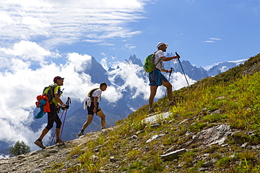
857-92685 - Three participants of the UTMB are running in the hills of Chamonix. The famous peaks of the Mont Blanc range are in the background. The Ultra-Trail du Mont-Blanc (also referred to as UTMB) is a single-stage mountain ultramarathon. It takes place once a year in the Alps, across France, Italy and Switzerland. The distance is approximately 166 kilometres (103 mi), with a total elevation gain of around 9,600 m. It is widely regarded as one of the most difficult foot races in Europe. It's certainly one of the largest with over two thousand starters. The combined participation in all of the events is approaching 10 thousand runners. While the best runners complete the loop in slightly more than 20 hours, most runners take 30 to 45 hours to reach the finish line.
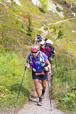
857-92684 - An elderly woman is running in the hills of Chamonix. She is close to finishing the extremely exhausting UTMB race. The Ultra-Trail du Mont-Blanc (also referred to as UTMB) is a single-stage mountain ultramarathon. It takes place once a year in the Alps, across France, Italy and Switzerland. The distance is approximately 166 kilometres (103 mi), with a total elevation gain of around 9,600 m. It is widely regarded as one of the most difficult foot races in Europe. It's certainly one of the largest with over two thousand starters. The combined participation in all of the events is approaching 10 thousand runners. While the best runners complete the loop in slightly more than 20 hours, most runners take 30 to 45 hours to reach the finish line.
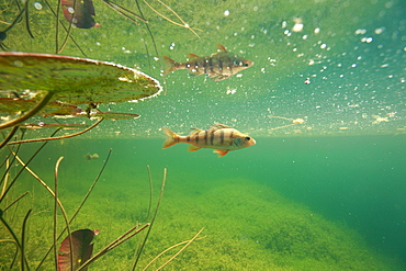
860-286136 - European Perch in a backwater of the River Ain, France
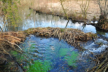
860-286131 - European Beaver dam on a backwater of the river Ain, France
857-87835 - A girl walks on a submerged log near Hiawatha National Forest MI.
1178-12537 - State Capitol Building in Lansing, Michigan, USA
1178-12538 - Lansing, Michigan - State Capitol Building at sunrise
1178-7017 - Lansing, Michigan - State Capitol Building at sunrise
1178-7019 - Lansing, Michigan - State Capitol Building at sunrise
832-124528 - MIL MI-24 Hind, Russian attack helicopter from the Hungarian Air Force painted like an eagle, Breitscheid Airshow 2010, Hesse, Germany, Europe
832-115963 - Statue of the poet Nez&mi, Baku, Azerbaijan, Caucasus, Middle East
832-60850 - Lively beach, seaside resort of Mi&dzyzdroje or Misdroy, Wolin Island, Baltic Sea, Western Pomerania, Poland, Europe, PublicGround
832-60851 - Lively beach, seaside resort of Mi&dzyzdroje or Misdroy, Wolin Island, Baltic Sea, Western Pomerania, Poland, Europe, PublicGround
832-60853 - A green lamp and solar panels on a pole, navigation light, aids to navigation, Mi&dzyzdroje beach resort, Misdroy, Wolin Island, Baltic Sea, West Pomeranian Voivodeship, Poland, Europe
832-60847 - Pier, seaside resort of Mi&dzyzdroje or Misdroy, Wolin Island, Baltic Sea, Western Pomerania, Poland, Europe, PublicGround
832-60849 - Amber Baltic Hotel, seaside resort of Mi&dzyzdroje or Misdroy, Wolin Island, Baltic Sea, Western Pomerania, Poland, Europe, PublicGround
832-60857 - Hotels on the coast, Mi&dzyzdroje beach resort, Misdroy, Wolin Island, Baltic Sea, West Pomeranian Voivodeship, Poland, Europe
832-40583 - Town of Mivagur, Vagar Island, Faroe Islands, island group in the North Atlantic, Denmark, Northern Europe
1113-80141 - Heliskiing Kamchatka, Sibiria, Russia, a MI-8 helicopter
817-408981 - Cemetery in Autumn Fall MI Resting place Michigan
817-408986 - Walking Suspension Bridge Over Water In Autumn Fall MI
817-408985 - Walking Suspension Bridge Over Water In Autumn Fall MI
857-11976 - Bend in the Kazym River as seen from a Russian built Mi-8 helicopter, Siberia, Russia
1188-107 - Cyprus. Abandoned houses along th Green Line in Nicosia dividing the Republic of Cyprus and Turkish controlled northern part. The United Nations Buffer Zone in Cyprus runs for more than 180.5?kilometres (112.2?mi) along what is known as the Green Line and has an area of 346?square kilometres (134?sq?mi). The zone partitions the island of Cyprus into a southern area effectively controlled by the government of the Republic of Cyprus (which is the de jure government for the entire island save for the British Sovereign Base Areas), and the northern area controlled by the Turkish army
1188-333 - Cyprus. Abandoned houses along th Green Line in Nicosia dividing the Republic of Cyprus and Turkish controlled northern part. The United Nations Buffer Zone in Cyprus runs for more than 180.5?kilometres (112.2?mi) along what is known as the Green Line and has an area of 346?square kilometres (134?sq?mi). The zone partitions the island of Cyprus into a southern area effectively controlled by the government of the Republic of Cyprus (which is the de jure government for the entire island save for the British Sovereign Base Areas), and the northern area controlled by the Turkish army
1188-285 - Cyprus. Abandoned houses along th Green Line in Nicosia dividing the Republic of Cyprus and Turkish controlled northern part. The United Nations Buffer Zone in Cyprus runs for more than 180.5?kilometres (112.2?mi) along what is known as the Green Line and has an area of 346?square kilometres (134?sq?mi). The zone partitions the island of Cyprus into a southern area effectively controlled by the government of the Republic of Cyprus (which is the de jure government for the entire island save for the British Sovereign Base Areas), and the northern area controlled by the Turkish army
817-358034 - White Island is an active andesite stratovolcano, situated 48 km 30 mi from the east coast of the North Island of New Zealand, in the Bay of Plenty
817-358035 - White Island is an active andesite stratovolcano, situated 48 km 30 mi from the east coast of the North Island of New Zealand, in the Bay of Plenty
817-147265 - Presidents White House Oval Office at Gerald R Ford Presidential Museum Grand Rapids Michigan MI
817-16407 - Pobre de mi' (official closing of the Festival), San Fermin Festival, Pamplona, Navarra, Spain
238-5746 - Standing Shiva from Mi Son, Cham art from the 8th century, Danang Museum, Vietnam, Indochina, Southeast Asia, Asia
767-395 - Kalamazoo, Michigan, United States of America, North America
767-394 - South Haven, Michigan, United States of America, North America
777-243 - Mi Casa restaurant, Cabo San Lucas, Baja California Sur, Mexico, North America
777-242 - Mi Casa restaurant, Cabo San Lucas, Baja California Sur, Mexico, North America
641-5894 - Michigan Avenue or The Magnificent Mile, famous for its shopping, Chicago, Illinois, USA
685-411 - Historic District, Mackinac Island, Michigan, United States of America, North America
767-52 - Grand Haven Lighthouse on Lake Michigan, Grand Haven, Michigan, United States of America, North America
83-7976 - Tower blocks, downtown, Detroit, Michigan, United States of America (USA), North America


