Recent searches
Loading...
1131-2000 - Flooded forest along the Amana River, Amazonas State, Brazil, South America
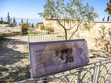
1112-7990 - Olive tree and sign commemorating the visit of Pope John Paul II on 20 March 2000 to the summit of Mount Nebo during his pilgrimage to the Holy Land, Jordan, Middle East
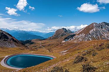
832-401516 - Reservoir in the mountains, South Tyrol. Merano 2000
832-401515 - Reservoir in the mountains, South Tyrol. Merano 2000
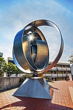
832-399577 - Artwork, Olympic Rings by Ruth Kiener-Flamm 1972, new version by Peter Schwenk 2000 in the former Olympic Village, Munich, Bavaria, Germany, Europe
1126-2000 - The Tabernacle Chapel of The Mosque (Mezquita) and Cathedral of Cordoba, UNESCO World Heritage Site, Cordoba, Andalusia, Spain, Europe
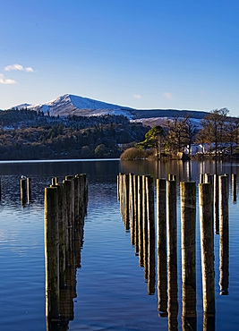
747-2000 - Poles, Grisedald Pike from Keswick Boat landings, Derwentwater, Keswick, Lake District National Park, UNESCO World Heritage Site, Cumbria, England, United Kingdom, Europe
1104-2000 - Portmeirion Village, Gwynedd, Wales, United Kingdom, Europe
83-13341 - Lava bombs erupt from one of many vents on volcano, active for at least 2000 years, Stromboli, Aeolian Islands, UNESCO World Heritage Site, Sicily, Italy, Mediterranean, Europe
83-13344 - Lava bombs erupt from multiple vents on volcano, active for at least 2000 years, Stromboli, Aeolian Islands, UNESCO World Heritage Site, Sicily, Italy, Mediterranean, Europe
83-13339 - Lava bombs erupt from multiple vents on volcano, active for at least 2000 years, Stromboli, Aeolian Islands, UNESCO World Heritage Site, Sicily, Italy, Mediterranean, Europe
83-13342 - Lava bombs erupt from multiple vents on volcano, active for at least 2000 years, Stromboli, Aeolian Islands, UNESCO World Heritage Site, Sicily, Italy, Mediterranean, Europe
83-13338 - Lava bombs erupt from multiple vents on volcano, active for at least 2000 years, Stromboli, Aeolian Islands, UNESCO World Heritage Site, Sicily, Italy, Mediterranean, Europe
83-13340 - Lava bombs erupt from multiple vents on this volcano, active for at least 2000 years, Stromboli, Aeolian Islands, UNESCO World Heritage Site, Sicily, Italy, Mediterranean, Europe
83-13343 - Lava bombs erupt from multiple vents on volcano, active for at least 2000 years, Stromboli, Aeolian Islands, UNESCO World Heritage Site, Sicily, Italy, Mediterranean, Europe
1292-2000 - Castellamare del Golfo, Sicily, Italy, Mediterranean, Europe
832-395056 - View from Gotland to the uninhabited island of Stora Karlsoe, Great Karls Island, Natura 2000 nature reserve, Baltic Sea, Gotland, Sweden, Europe
1348-4600 - Barcelona, Spain, True Colour Satellite Image. Barcelona, Spain. True colour satellite image of Barcelona, taken on 10 August 2000, using LANDSAT 7 data.
1348-4559 - Augustine Volcano, Alaska, Usa, True Colour Satellite Image. Augustine Volcano, Alaska, true colour satellite image. Augustine is a volcano 1227 m high conical-shaped island stratovolcano located in Alaska's Cook Inlet. Image taken on 16 August 2000 using LANDSAT data. Print size 30 x 30 cm.
1348-4560 - Volcano Tousside In 3D, Chad, True Colour Satellite Image. Pic Tousside, Chad, true colour satellite image. A recent volcano, known as the Pic Tousside, in the Tibesti Mountains in Northwestern tip of Chad (Africa). Composite image dated 2000-2002 using LANDSAT data.
1348-4484 - Dubai, United Arab Emirates, In 2000, True Colour Satellite Image. True colour satellite image of Dubai, United Arab Emirates. Image size A4, taken on 23 August 2000, using LANDSAT data.
1348-4570 - Weddell Sea, Antarctica, True Colour Satellite Image. Weddel Sea, Antarctica, true colour satellite image. Pack ice melting in spring time in the Weddel Sea, East of the Antarctica peninsula. Image taken on 21 February 2000 using LANDSAT data.
1348-4488 - Canton And Shenzen, China, In 2000, True Colour Satellite Image. True colour satellite image of the cities of Guangzhou (Canton) and Shenzen, China. Image in landscape format, taken on 14 September 2000, using LANDSAT data.
1348-4544 - Ardoukoba Volcano, Djibouti, True Colour Satellite Image. Ardoukoba, Djibouti, true colour satellite image. Ardoukoba is a volcano located close to Assal Lake in Djibouti. Image taken on 13 May 2000 using LANDSAT data. Print size 30 x 30 cm.
1348-4602 - Al Ayn, United Arab Emirates, True Colour Satellite Image. True colour satellite image of Al Ayn in the United Arab Emirates, located in the Emirate of Abu Dhabi. Image taken on 23 August 2000 using LANDSAT 7 data.
1348-4594 - Lisbon, Portugal, True Colour Satellite Image. Lisbon, Portugal. True colour satellite image of Lisbon, the capital city of Portugal. Image taken on 24 June 2000 using LANDSAT 7 data.
1348-4593 - New Orleans, Louisiana, Usa, True Colour Satellite Image. New Orleans, Louisiana, USA. True colour satellite image of the city of New Orleans, taken on 17 January 2000, using LANDSAT 7 data.
1348-4432 - Saint Lucia, True Colour Satellite Image. Saint Lucia, true colour satellite image taken on 16 October 2000, by the LANDSAT 7 satellite.
1348-4485 - Las Vegas, Nevada, Us, In 2000, True Colour Satellite Image. True colour satellite image of Las Vegas, Nevada, US. Image taken on 3 May 2000, using LANDSAT data.
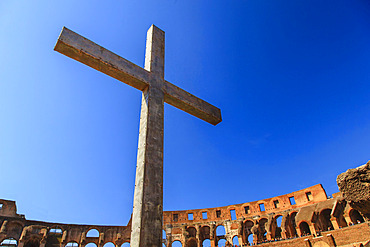
1116-52011 - Close-up of a Christian cross inside the Roman Colosseum against a blue sky, erected by the Pope in 2000 to commemorate Christian Martyrs; Rome, Lazio, Italy
1349-837 - Mars, Valles Marineris Canyon, Melas Chasma
1350-2292 - Pont du Gard, Languedoc Roussillon region, France, Unesco World Heritage Site. Roman Aqueduct crosses the River Gardon near Vers-Pon-du-Gard Languedoc-Roussillon with 2000 year old
1350-2000 - An Arctic Lupine (Lupinus arcticus) flowers in the forest after a rainfall. Yukon Territory, Canada
1349-44 - Full Moon, Earth's Horizon and Airglow, ISS Image
1349-27 - Full Moon, Earth's Horizon and Airglow from ISS
1349-26 - Full Moon, Earth's Horizon and Airglow from ISS
805-533 - Detail of carving inside one of the 18 Udayagiri caves, used as residences for Jain monks 2000 years ago, Bhubaneshwar, Orissa, India, Asia
805-532 - Carving on one of the 18 Udayagiri caves, residences for Jain monks in the time of King Kharavela 2000 years ago, Bhubaneshwar, Orissa, India, Asia
805-531 - Carving on one of the 18 Udayagiri caves, residences for Jain monks in the time of King Kharavela 2000 years ago, Bhubaneshwar, Orissa, India, Asia
849-2000 - Lago di Braies in the Italian Dolomites, Trento-Alto Adige, Italy, Europe
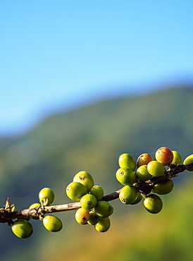
1245-2000 - Coffea cherries at Coffee Plantation, Blue Mountains, Saint Andrew Parish, Jamaica, West Indies, Caribbean, Central America
743-2000 - Leopard (Panthera pardus), Elephant Plains, Sabi Sand Game Reserve, South Africa, Africa
848-2000 - Exterior of St. Isaac's Cathedral at night, UNESCO World Heritage Site, St. Petersburg, Leningrad Oblast, Russia, Europe
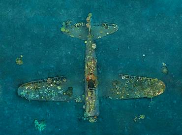
860-287442 - Tara Pacific expedition - november 2017 Kimbe Bay, papua New Guinea, Zero wreck: Coral growth on this wreck is from a period of 74 years ! D: 15 m The ZERO, is a Japanese WW2 fighter plane wreck. This Zero wreck was discovered in January 2000 by local William Nuli while he was freediving for sea cucumbers. He asked the Walindi Plantation Resort dive team if they might know what it was, and when they investigated they uncovered the intact wreck of a Zero fighter, resting on a sedimented bottom in 15 m depth. This World War II Japanese fighter is almost completely intact. The plane is believed to have been ditched, the pilot is believed to have survived, but was never found on the island. He never returned home. Maybe he disappeared in the jungle? On 26th December 1943, during the battle of Cape Gloucester, the Japanese pilot made an emergency landing, ditching his Mitsubishi A6M Zero plane into the sea approximately 100m off West New Britain Province. The plane was piloted by PO1 Tomiharu Honda of the 204st K?k?tai. His fate is unknown but it is believed the he made a controlled water landing after running out of fuel and survived. Although he failed to return to his unit, the plane was found with the throttle and trim controls both set for landing and the canopy was open. There are no visible bullet holes or other shrapnel damage and the plane is still virtually intact after over 70 years underwater. It is a A6M2 Model 21 Zero, made famous for its use in Kamikaze attacks by the Japanese Imperial Navy. The wreck has the Manufacture Number 8224 and was built by Nakajima in late August 1942.
860-287440 - Tara Pacific expedition - november 2017 Zero wreck, vertical view Orthomosaic from 3D photogrammetry (13500 x 10000 px). D: 15 m Kimbe Bay, papua New Guinea, Coral growth on this wreck is from a period of 74 years ! The ZERO, is a Japanese WW2 fighter plane wreck. This Zero wreck was discovered in January 2000 by local William Nuli while he was freediving for sea cucumbers. He asked the Walindi Plantation Resort dive team if they might know what it was, and when they investigated they uncovered the intact wreck of a Zero fighter, resting on a sedimented bottom in 15 m depth. This World War II Japanese fighter is almost completely intact. The plane is believed to have been ditched, the pilot is believed to have survived, but was never found on the island. He never returned home. Maybe he disappeared in the jungle? On 26th December 1943, during the battle of Cape Gloucester, the Japanese pilot made an emergency landing, ditching his Mitsubishi A6M Zero plane into the sea approximately 100m off West New Britain Province. The plane was piloted by PO1 Tomiharu Honda of the 204st K?k?tai. His fate is unknown but it is believed the he made a controlled water landing after running out of fuel and survived. Although he failed to return to his unit, the plane was found with the throttle and trim controls both set for landing and the canopy was open. There are no visible bullet holes or other shrapnel damage and the plane is still virtually intact after over 70 years underwater. It is a A6M2 Model 21 Zero, made famous for its use in Kamikaze attacks by the Japanese Imperial Navy. The wreck has the Manufacture Number 8224 and was built by Nakajima in late August 1942.
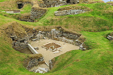
1167-2000 - Skara Brae Neolithic settlement in Orkney Islands, Scotland, Europe
860-286913 - Monoliths prepared in gneiss Lewis, erected about 2000 years BC.
832-382479 - Pont du Gard, 2000 year old Roman Aquaduct, Vers-Pont-du-Gard, Languedoc-Roussillon, France, Europe
1113-102619 - Gastein 2000, Bad Gastein, Salzburger Land, Austria, Europe
1226-658 - Dubai Opera, a 2000 seat performing arts centre, Dubai, United Arab Emirates, Middle East
1226-641 - Dubai Opera, a 2000 seat performing arts centre, Dubai, United Arab Emirates, Middle East
807-2000 - Big Sur Coastline, Pacific Ocean, California, United States of America, North America
1184-2000 - Woman with her baby on her back carrying a water canister on her head, Massangano, Cuanza Norte, Angola, Africa
746-88338 - The island of Unst, Replica of a viking vessel near Haroldswick. The ship was sailed from Sweden to Shetland in the year 2000 and is now owned by the Shetland Amenity Trust and is part of the Viking Unst Project. europe, central europe, northern europe, united kingdom, great britain, scotland, northern isles,shetland islands, May
746-79161 - capanna 2000 mountain refuge, arera mountain, italy
746-10296 - Bormio 2000 ski run, Bormio, Lombardy, Italy
1179-2000 - Genoese tower of granite rocks built as fortress of defense framed by blue sky, Porto, Southern Corsica, France, Mediterranean, Europe
801-2000 - Sunrise, Merrick Butte on left, Spearhead Mesa on right, Monument Valley Navajo Tribal Park, Utah, United States of America, North America
483-2000 - San Francisco church, Antigua, UNESCO World Heritage Site, Guatemala, Central America
757-296 - Kakku Pagoda Complex, tourist walks amongst more than 2000 pagodas, Shan state, Myanmar (Burma), Asia
765-2000 - Ruins of Roman temples at Area Sacra di Largo di Torre Argentina, Rome, UNESCO World Heritage Site, Lazio, Italy, Europe
785-2000 - Plaza Mayor and the imposing Gothic Cathedral of Segovia, Castilla y Leon, Spain, Europe
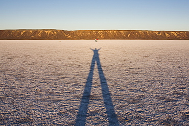
1109-2000 - Tourist selfie at Uyuni Salt Flats (Salar de Uyuni), Uyuni, Bolivia, South America
733-6800 - A 2000 year old Platan tree, independent Armenian enclave officially within Azerbaijan, Nagorno-Karabakh, Armenia, Caucasus, Central Asia, Asia
733-6799 - A 2000 year old Platan tree, independent Armenian enclave officially within Azerbaijan, Nagorno-Karabakh, Armenia, Caucasus, Central Asia, Asia
857-90888 - Tourists explore the natural salt flats on the shores of Laguna San Ignacio, Baja California Sur, Mexico. In 2000, thanks to national and international pressure, the Mexican government cancelled a joint venture with Mitsubishi subsidiary ESSA (Exportadora de Sal, S.A) to establish the largest industrial salt evaporation facility in the world. Designated as a UNESCO World Heritage site and part of the Vizcaino Biosphere Reserve, the lagoon is the last undeveloped gray whale birthing area on the planet, Mexico
857-89709 - Hikers setup camp on a beach along the Colorado River near the plumeting 180-foot Deer Creek Falls in the Grand Canyon outside of Fredonia, Arizona November 2011. The 21.4-mile loop starts at the Bill Hall trailhead on the North Rim and descends 2000-feet in 2.5-miles through Coconino Sandstone to the level Esplanada then descends further into the lower canyon through a break in the 400-foot-tall Redwall to access Surprise Valley. Hikers connect Thunder River and Tapeats Creek to a route along the Colorado River and climb out Deer Creek.
857-89713 - Female hiker cooks dinner on a cliff-pinched patio above camp and the Colorado River near Deer Creek Falls in the Grand Canyon outside of Fredonia, Arizona November 2011. The 21.4-mile loop starts at the Bill Hall trailhead on the North Rim and descends 2000-feet in 2.5-miles through Coconino Sandstone to the level Esplanada then descends further into the lower canyon through a break in the 400-foot-tall Redwall to access Surprise Valley. Hikers connect Thunder River and Tapeats Creek to a route along the Colorado River and climb out Deer Creek.
857-89701 - Hikers on the sandstone Esplanade of the Thunder River Trail below the North Rim of the Grand Canyon outside Fredonia, Arizona November 2011. The 21.4-mile loop descends 2000-feet in 2.5-miles through Coconino Sandstone from the Bill Hall trailhead to connect the Thunder River and Deer Creeks trails. Hikers descend into the lower canyon through a break in the 400-foot-tall Redwall to access Surprise Valley, Deer Creek, Tapeats Creek via Thunder River and even the Colorado River.
857-89710 - Hikers cook dinner on a cliff-pinched patio above camp and the Colorado River near Deer Creek Falls in the Grand Canyon outside of Fredonia, Arizona November 2011. The 21.4-mile loop starts at the Bill Hall trailhead on the North Rim and descends 2000-feet in 2.5-miles through Coconino Sandstone to the level Esplanada then descends further into the lower canyon through a break in the 400-foot-tall Redwall to access Surprise Valley. Hikers connect Thunder River and Tapeats Creek to a route along the Colorado River and climb out Deer Creek.
857-89708 - Hikers swim in the pool below 180-foot Deer Creek Falls in the Grand Canyon outside of Fredonia, Arizona November 2011. The 21.4-mile loop starts at the Bill Hall trailhead on the North Rim and descends 2000-feet in 2.5-miles through Coconino Sandstone to the level Esplanada then descends further into the lower canyon through a break in the 400-foot-tall Redwall to access Surprise Valley. Hikers connect Thunder River and Tapeats Creek to a route along the Colorado River and climb out Deer Creek.
857-89717 - Hikers follow a route along the Colorado River that connect Tapeats Creek and Thunder River to Deer Creek in the Grand Canyon outside of Fredonia, Arizona November 2011. The 21.4-mile loop starts at the Bill Hall trailhead on the North Rim and descends 2000-feet in 2.5-miles through Coconino Sandstone to the level Esplanada then descends further into the lower canyon through a break in the 400-foot-tall Redwall to access Surprise Valley. Hikers connect Thunder River and Tapeats Creek to a route along the Colorado River and climb out Deer Creek.

