Recent searches
Loading...
1231-70 - Camogli is a fishing village and tourist resort located on the west side of the peninsula of Portofino. Liguria, Italy, Europe
1384-75 - Plaza Grande city main square, Cathedral church of San Ildefonso, Merida, Yucatan State, Mexico completed 1598
1384-70 - Flamingo tour advertising at small coastal settlement on Gulf of Mexico, Celestun, Yucatan, Mexico
1382-75 - Sigulda Medieval Castle ruins,Sigulda,Vidzeme Region,Latvia,Baltic region,Northern Europe
1382-70 - stone sculpture by Indulis Ranka in the Folk Song park,Turaida Museum Reserve,Sigulda,Gauja National Park,Vidzeme Region,Latvia,Baltic region,Northern Europe
1383-75 - The Kulamba Traditional Ceremony of the Chewa people takes place every year on the last Saturday in August near Katete. The Chewa who also live in Mozambique and Malawi come to pay homage to their Chief Kalonga Gaia Uni.
1383-70 - The Kulamba Traditional Ceremony of the Chewa people takes place every year on the last Saturday in August near Katete. The Chewa who also live in Mozambique and Malawi come to pay homage to their Chief Kalonga Gaia Uni.
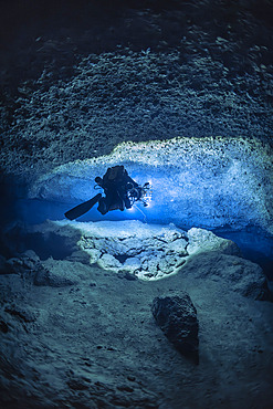
860-292443 - Tek rebreather diver at a depth of 70 meters with a DPV specially equipped with 60,000 lumen lighting and 12 Gopro to carry out a 3D survey of a karstic cave submerged for over 14,000 years, Passe Bateau Sud, Mayotte Lagoon
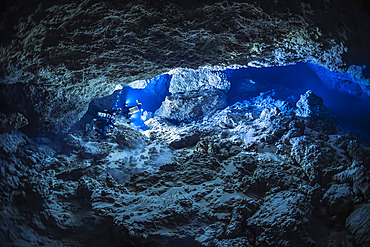
860-292440 - Cave diver in an underwater cave of karstic origin at a depth of 75 meters during the Gumbo La Baharini 2 expedition, which aimed to produce a complete 3D model of this karstic cave using photogrammetry. Passe Bateau Sud, Mayotte lagoon
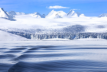
860-292394 - Landscape of Svalbard in Norway, also known as Spitsbergen. This territory stretches from latitude 75 to 80 degrees to the pack ice a few hundred kilometers from the North Pole. Melting ice, early global warming. Front of a glacier fracturing at the edge of a fjord.
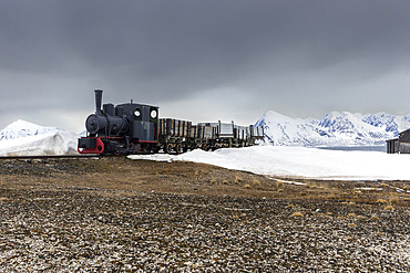
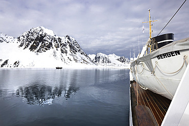
860-292393 - Landscape of Svalbard in Norway, also known as Spitsbergen. This territory stretches from latitude 75 to 80 degrees to the pack ice a few hundred kilometers from the North Pole. Melting ice, early global warming. Baie de la Madeleine here, a coastal landscape rising to 80 degrees latitude, where blocks of ice and small icebergs detached from glaciers drift on the water. Old steam train in front of Ny-Alesund weather station
860-292392 - Landscape of Svalbard in Norway, also known as Spitsbergen. This territory stretches from latitude 75 to 80 degrees to the pack ice a few hundred kilometers from the North Pole. Melting ice, premature global warming. Exploration boat in Baie de la Madeleine.
860-292391 - Landscape of Svalbard in Norway, also known as Spitsbergen. This territory stretches from latitude 75 to 80 degrees to the pack ice a few hundred kilometers from the North Pole. Melting ice, early global warming. Coastal scenery as you climb towards latitude 80 degrees. Trapper's hut, professional hunter's hut
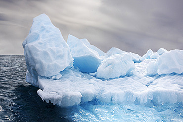
860-292390 - Landscape of Svalbard in Norway, also known as Spitsbergen. This territory stretches from latitude 75 to 80 degrees to the pack ice a few hundred kilometers from the North Pole. melting ice, early global warming. Baie de la Madeleine, a coastal landscape rising towards latitude 80 degrees, where blocks of ice and small icebergs detached from glaciers drift on the water.
860-292388 - Landscape of Svalbard in Norway, also known as Spitsbergen. This territory stretches from latitude 75 to 80 degrees to the pack ice a few hundred kilometers from the North Pole. Melting ice, premature global warming. Exploration boat in Madeleine Bay. Young explorer on deck.
860-292389 - Landscape of Svalbard in Norway, also known as Spitsbergen. This territory stretches from latitude 75 to 80 degrees to the pack ice a few hundred kilometers from the North Pole. Melting ice, premature global warming. Exploration boat in Magdalen Bay. Explorer sailboat.
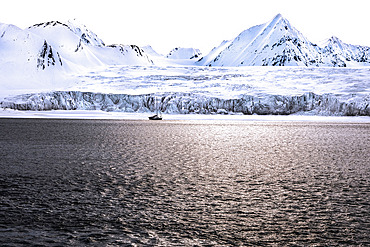
860-292387 - Landscape of Svalbard in Norway, also known as Spitsbergen. This territory stretches from latitude 75 to 80 degrees to the pack ice a few hundred kilometers from the North Pole. Melting ice, early global warming. Front of a glacier fracturing at the edge of a fjord. Explorers' sailboat at the ice edge
860-292386 - Landscape of Svalbard in Norway, also known as Spitsbergen. This territory stretches from latitude 75 to 80 degrees to the pack ice a few hundred kilometers from the North Pole. Melting ice, early global warming.
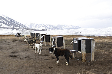
860-292340 - Dogsledding. Landscape of Svalbard in Norway, also known as Spitsbergen. This territory stretches from latitude 75 to 80 degrees to the pack ice a few hundred kilometers from the North Pole.
860-292339 - Landscape of Svalbard in Norway, also known as Spitsbergen. This territory stretches from latitude 75 to 80 degrees to the pack ice a few hundred kilometers from the North Pole.
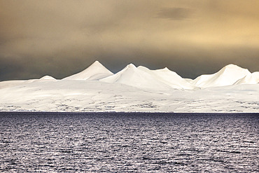
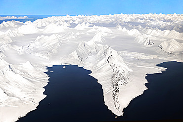
860-292338 - Aerial view over the snow-covered peaks of Svalbard. pointed peak known as spitzberg. latitude from 75 to 80 degrees, down to the pack ice near the north pole.
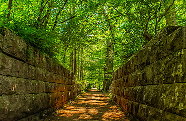
1376-75 - Early summer green canopy at Conishead Priory, Ulverston, Cumbria, England, United Kingdom, Europe
1376-70 - View at sunset towards the Irish Sea, Furness Peninsula and Cumbrian Coast, Sandy Gap, Walney Island, Lancashire, England, United Kingdom, Europe
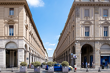
1373-75 - View of Via Roma, an iconic shopping street with luxury stores, from Piazza San Carlo, a square renowned for its Baroque architecture, Turin, Piedmont, Italy, Europe
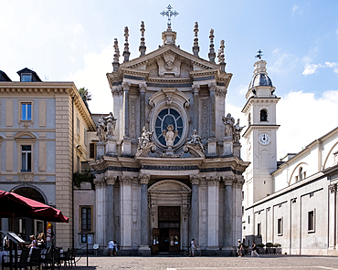
1373-70 - View of Santa Cristina, a Baroque style, Roman Catholic church that mirrors the adjacent church of San Carlo and faces the Piazza San Carlo, Turin, Piedmont, Italy, Europe
1235-75 - Victoria Gate (Il-Bieb Victoria), main entrance into the city of La Valetta, Malta, Europe
1235-70 - Salt pans in Marsaskala, Malta, Mediterranean, Europe
1372-75 - Stonehenge copy in Makomanai Takino Cemetery, Sapporo, Hokkaido, Japan, Asia
1369-75 - Aerial vertical view of old volcano and asphalt road, near to Myvatn lake on a summer day, Iceland, Polar Regions
1369-70 - Aerial view taken by drone of natural landscape in Landmannaugar area on a summer day, Iceland, Polar Regions
1372-70 - Close up of the upper body and head of a giant Buddha statue agains a blue sky, Hill of the Buddha, Sapporo, Hokkaido, Japan, Asia
860-291627 - Diver at the bottom of an underwater cave 75 metres deep and which has been flooded for thousands of years (- 20 000 years). Mayotte
860-291626 - Diver at the bottom of an underwater cave 75 metres deep and which has been flooded for thousands of years (- 20 000 years). Mayotte
832-401093 - The Austrian alphorn trio Klangholz plays the alphorn at the Augstsee on Mount Loser, Ausseerland, Salzkammergut, Austria, Europe
832-401091 - The Austrian alphorn trio Klangholz plays the alphorn at the Augstsee on Mount Loser, Ausseerland, Salzkammergut, Austria, Europe
832-401092 - The Austrian alphorn trio Klangholz plays the alphorn at the Augstsee on Mount Loser, Ausseerland, Salzkammergut, Austria, Europe
1361-75 - Lonely house above the basalt cliff near the harbour, Arnarstapi, Snaefellsjokull National Park, Snaefellsness peninsula, Vesturland, Western Iceland, Iceland, Polar Regions
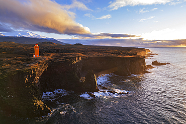
1361-70 - Aerial view of the orange Svortuloft lighthouse on top of the basalt cliffs at sunset, Snaefellsbaer, Snaefellsjokull National Park, Snaefellsens peninsula, Vesturland, West Iceland, Iceland, Polar Regions
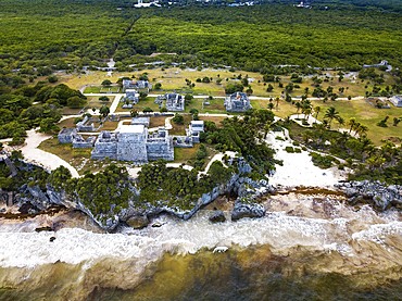
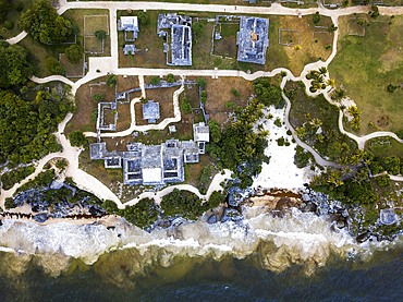
1350-6597 - Aerial views of El Castillo and the Ruins of the Mayan temple grounds at Tulum, Quintana Roo, Yucatan, Mexico. Tulum is the site of a pre-Columbian Mayan walled city which served as a major port for Coba, in the Mexican state of Quintana Roo. The ruins are situated on 12 meter 39 ft tall cliffs along the east coast of the Yucatán Peninsula on the Caribbean Sea in the state of Quintana Roo, Mexico. Tulum was one of the last cities built and inhabited by the Maya; it was at its height between the 13th and 15th centuries and managed to survive about 70 years after the Spanish began occupying Mexico. Old World diseases brought by the Spanish settlers appear to have resulted in very high fatalities, disrupting the society, and eventually causing the city to be abandoned.
1350-6599 - Aerial views of El Castillo and the Ruins of the Mayan temple grounds at Tulum, Quintana Roo, Yucatan, Mexico. Tulum is the site of a pre-Columbian Mayan walled city which served as a major port for Coba, in the Mexican state of Quintana Roo. The ruins are situated on 12 meter 39 ft tall cliffs along the east coast of the Yucatán Peninsula on the Caribbean Sea in the state of Quintana Roo, Mexico. Tulum was one of the last cities built and inhabited by the Maya; it was at its height between the 13th and 15th centuries and managed to survive about 70 years after the Spanish began occupying Mexico. Old World diseases brought by the Spanish settlers appear to have resulted in very high fatalities, disrupting the society, and eventually causing the city to be abandoned.
1365-75 - The Sage, Gateshead, Tyne and Wear, England, United Kingdom, Europe
1365-70 - Gateshead Millennium Bridge, Newcastle-upon-Tyne, Tyne and Wear, England, United Kingdom, Europe
1366-75 - Faiyum, Egypt. February 19, 2022. Wall decorated with murals in the village of Faiyum.
1366-70 - Faiyum, Egypt. February 19, 2022. Building decorated with murals in the village of Faiyum.
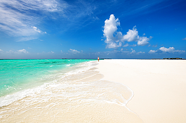
1352-75 - A man walking on a sanbank, Baa Atoll, Maldives
1352-70 - The National Gallery, Trafalgar Square, London England
1352-66 - RAF Red Arrows flypast during 2022 Trooping the Colour celebrations, marking the Queen official birthday and her 70 year Jubilee, London, England
1352-65 - RAF Red Arrows flypast during 2022 Trooping the Colour celebrations, marking the Queen official birthday and her 70 year Jubilee, London, England
1359-75 - Grand Canyon along Hermit Road on sunny day, Grand Canyon National Park, Arizona, USA
1359-70 - Popular rock formation (hoodoo) named Thor's Hammer taken from Navajo Loop Trail, Bryce Canyon National Park, Utah, USA
1358-75 - The Heel Stone and Stonehenge Prehistoric Monument, UNESCO World Heritage Site, near Amesbury, Wiltshire, England, United Kingdom, Europe
1358-70 - Wooden coastal sailing boats anchored at Nosy Be island, North West Madagascar, Indian Ocean, Africa
1178-43685 - Older Caucasian couple hugging outdoors
1360-75 - The small village of Pella, Orta lake, Novara district, Piedmont, Italian Lakes, Italy, Europe
1178-43111 - Couple swimming in luxury pool near ocean
1178-43331 - Older Caucasian couple walking on dirt path
1178-43399 - Black couple hugging in military cemetery
1178-43101 - Black women chopping vegetables in kitchen
1178-43332 - Older Caucasian couple hugging outdoors
1178-43398 - Multi-generation Black family hugging in military cemetery
1178-43400 - Black couple walking in military cemetery
1178-43043 - Older Caucasian woman relaxing on exercise mat
1178-43044 - Older Caucasian woman on exercise mat using digital tablet
1360-70 - The hills of Casatico in autumn, Langhirano, Parma, Emilia Romagna, Italy, Europe
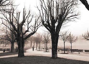
832-396803 - Misty lake promenade with walker, sepia colours, autumn landscape, Mondsee, Salzkammergut, Upper Austria, Austria, Europe
832-395837 - Farmer leading a sow on a farm, Bavaria, Germany, Europe
1353-75 - Cows wandering freely in the backstreets of Panjim City, Panjim (Panaji), Goa, India, Asia
1353-70 - The Archbishops House (Archbishops Palace), Althino, Panjim City, Panjim (Panaji), Goa, India, Asia
1178-41743 - Smiling man with arms crossed leaning on mantle
1178-41431 - Portrait of smiling family on outdoor bench
1178-41999 - Smiling Japanese mother and daughter posing near tree trunk
1178-41424 - Caucasian widow placing American flag at cemetery gravestone
1178-42249 - Hands of Hispanic man texting on cell phone
1178-41602 - Japanese woman sitting on bench at park
1178-42003 - Smiling Japanese mother and daughter posing at tree stump
1178-42432 - Caucasian grandfather holding baby grandson
1178-41194 - Serious Japanese woman wearing hat and eyeglasses
1178-41104 - Nurse texting on cell phone near patient
1178-41105 - Nurse texting on cell phone near patient
1178-41093 - Woman sitting on floor stretching arms
1178-42431 - Caucasian grandmother holding baby grandson
1178-41435 - Indian grandfather holding baby grandson
1178-41425 - Caucasian widow holding American flag in cemetery
1178-41740 - Man using digital tablet near window behind piano
1178-41438 - Multi-generation family posing on patio bench
1178-42433 - Caucasian baby boy holding finger of grandfather


