Recent searches
Loading...
743-90 - Lioness, Panthera leo, Kruger National Park, South Africa, Africa
1384-90 - Facade depicting conquering Spanish conquistadors, Casa de Montejo, Merida, Yucatan State, Mexico
1382-90 - aerial view over the Dauvaga River and the Central Market from St-Peter's church tower,Riga,Latvia,Baltic region, Northern Europe
1383-90 - The Kulamba Traditional Ceremony of the Chewa people takes place every year on the last Saturday in August near Katete. The Chewa who also live in Mozambique and Malawi come to pay homage to their Chief Kalonga Gaia Uni.
1231-37 - Arles Amphitheatre (les Arènes d'Arles), Built by the Romans in 90 AD.
1231-35 - Arles Amphitheatre (les Arènes d'Arles), Built by the Romans in 90 AD.
1231-34 - Arles Amphitheatre (les Arènes d'Arles), Built by the Romans in 90 AD.
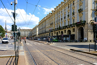
1373-90 - View of the streets surrounding Piazza Castello, a prominent city square in the city center, housing several city landmarks, museums, theaters, and cafes, Turin, Piedmont, Italy, Europe
1372-90 - Mount Hiyori rises above Oyunuma Lake in Hell Valley, Noboribetsu, Hokkaido, Japan, Asia
1369-90 - Aerial view of the eruption area near to Reykjavik, Icelandic southern coast, Iceland, Polar Regions
832-402860 - An elderly woman with the nurse looking through virtual reality glasses in the garden of a nursing home, vr glasses
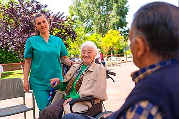
832-402859 - Portrait of an elderly woman with the nurse in the wheelchair in the garden of a nursing home or retirement home
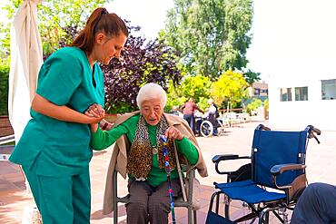
832-402858 - An elderly woman with the nurse in the wheelchair in the garden of a nursing home or retirement home, helping her to sit down
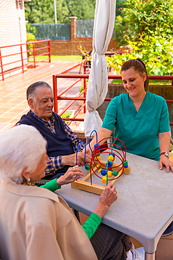
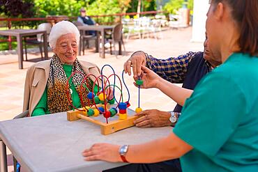
832-402856 - Two elderly people in the garden of a nursing home or retirement home playing with games to improve the mobility of the hands
832-402857 - Detail of the hands of two elderly people in the garden of a nursing home or retirement home holding hands in a moment of affection
832-402855 - Two elderly people in the garden of a nursing home or retirement home playing with games to improve mobility
832-402178 - Portrait of an elderly woman sitting on a chair in the garden of a nursing home in a wheelchair
832-402177 - An elderly man with the nurse on a walk through the garden of a nursing home greeting an elderly woman
832-402176 - Portrait of an elderly woman sitting on a chair in the garden of a nursing home in a wheelchair
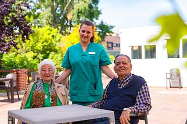
832-402174 - Portrait of two elderly people with the nurse in the garden of a nursing home or retirement home, old man and old woman
1352-90 - Whitstable, Kent, England, United Kingdom, Europe
1361-90 - Hiker with lantern standing in the snow in the frozen wood admiring Northern Lights (Aurora Borealis), Pallas-Yllastunturi National Park, Muonio, Lapland, Finland, Europe
1365-90 - Poros, Saronic Gulf, Greek Islands, Greece, Europe
1366-90 - Faiyum, Egypt. February 19, 2022. Wall decorated with murals in the village of Faiyum.
1364-90 - Summer Morning at the Charles River Esplanade
1359-90 - Olmsted Point with distant view of Half Dome rock formation, Yosemite National Park, California, USA
1358-90 - The War Memorial in the centre of Epernay, centre of Champagne production, Marne, France, Europe
1360-90 - The Courtyard of Honor, Palazzo Ducale, Urbino, Urbino and Pesaro district, Marche, Italy, Europe
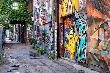
1353-90 - Toronto's Infamous Graffiti Alley in the Fashion District, Toronto, Ontario, Canada, North America
1178-41104 - Nurse texting on cell phone near patient
1178-41105 - Nurse texting on cell phone near patient
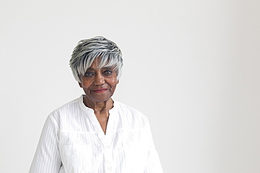
1178-38515 - Portrait of smiling older Black woman
1178-38512 - Portrait of older smiling Black woman
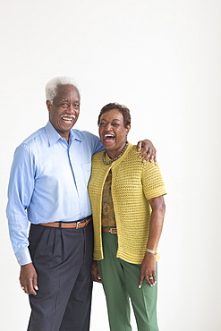
1178-38516 - Portrait of smiling older Black couple
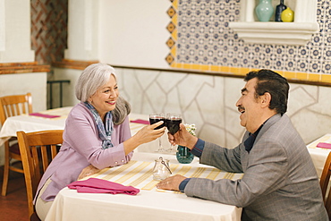
1178-37633 - Older couple toasting with wine in restaurant
1178-37634 - Older man proposing marriage to woman in restaurant
1178-38517 - Portrait of laughing older Black couple
1178-38518 - Smiling older Black man near the window
1178-38511 - Portrait of laughing older Caucasian woman
1116-51674 - Metal art depicting wild horses running across a ridge atop the Wild Horse Monument near the town of Vantage in Eastern Washington. Wanapum Lake formed by a dam on the Columbia River and the I-90 Bridge in the background; Vantage, Washington, United States of America
1351-90 - Aerial view of Civita di Bagnoregio, The Dying City, Lazio, Italy, Europe
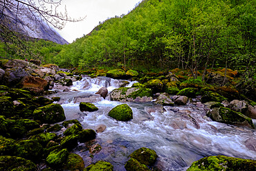
1339-90 - Cold water flows through a brook from the Briksdal glacier inside Jostedalsbreen National Park, Stryn, Vestland, Norway, Scandinavia, Europe
1178-32486 - Handicapped symbol painted on pavement
832-392646 - Figure of St. Wenceslas created 1380/90, figure often interpreted as Emperor Charles IV, St. Mary's Church, Sulzbach-Rosenberg, Upper Palatinate, Bavaria, Germany, Europe
1350-90 - The supernova remnant IC 443 in Gemini near the stars Mu (left) and Eta (right) Geminorum. Slight haze passing thru on some exposures added the star glows.
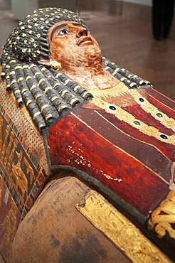
1350-2075 - Artemidora, A.D. 90-100. From Meir. Mummy. Metropolitan Museum of Art, New York, USA. The mask portrays a young woman lying flat as if upon her bier. Her hair is arranged in tiers of snail curls over her forehead. Alongside her face flows a black Egyptian-style wig, the long locks bound with narrow rings of gold in pharaonic fashion.
1345-90 - Serra Verde Express train from Curitiba, the touristic Paranagua-Curitiba Railway, Parana, Brazil
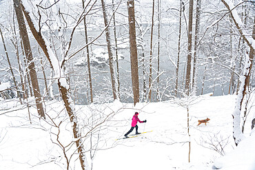
1343-90 - Jennifer Jordan and dog Jack cross country ski the Berma Road near Potomac, Maryland, United States of America, North America
1265-90 - The Hungarian Parliament Building and River Danube at night, UNESCO World Heritage Site, Budapest, Hungary, Europe
1336-90 - Happy border collie in a straw field, Emilia Romagna, Italy, Europe
1335-90 - Chinstrap penuin jumping out of water, Antarctica, Polar Regions
1331-90 - Prawns with white wine at sunset at a restaurant in Pefkos, Rhodes, Dodecanese, Greek Islands, Greece, Europe
1320-90 - An old wooden bridge located in the forest of the Soberania National Park, Panama, Central America
1318-90 - Windswept black sand with snow on top, Iceland, Polar Regions
1189-90 - Bow Fiddle Rock, Moray Firth, Moray, Scotland, United Kingdom, Europe
860-287761 - Holy oak of Virgin, circumference of 7,90 m to 1,20 m high, about 5OO years old, statuette of the Virgin, roadside, Bresilley, Haute Saone, France
1111-90 - Hot fresh red chilies for sale at market, Togian Islands, Indonesia, Southeast Asia, Asia
1315-90 - Street scene with vintage cars and the Gran Teatro de La Habana, Havana, Cuba, West Indies, Caribbean, Central America
1287-90 - White storks (Ciconia ciconia), nesting on the top of electric pylons, Algarve, Portugal, Europe
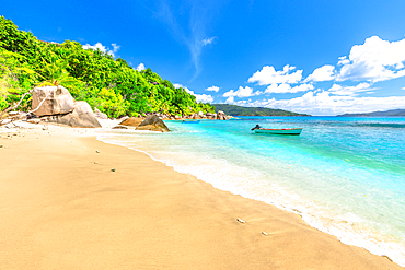
1314-90 - Felicite Island, peaceful landscape of Seychelles beach near La Digue, Seychelles, Indian Ocean, Africa
1311-90 - The Salt River Canyon north of Globe, Arizona, United States of America, North America
1310-90 - View from harbour to the town beach and palm-lined seafront promenade, Petrovac, Budva, Montenegro, Europe
1304-90 - Katskhi Pillar, Georgia, Central Asia, Asia
1186-90 - Schwabacher landing, Teton Range, Grand Teton National Park, Wyoming, United States of America, North America
1306-90 - Salford Quays Lift Bridge at night in Salford Quays, Manchester, England, United Kingdom, Europe
1300-90 - Kaptenbron or Captains bridge near Raoul Wallenbergs Park on the Sodra Forstadskanalen, Malmo, Skane county, Sweden, Europe
1295-90 - A passing weather front is attractively lit after sunset, with four SUP riders on the water, Orcombe Point, Exmouth, Devon, England, United Kingdom, Europe
1109-3597 - 90 Mile Beach, Northland, North Island, New Zealand, Pacific
1298-90 - Twr Mawr Lighthouse on Llanddwyn island, Anglesey, North Wales, United Kingdom, Europe
1299-90 - Morning in the park in Val Sozzine, Ponte di Legno, Brescia province, Lombardy, Italy, Europe
1247-90 - The sun sets over the City of London, London, England, United Kingdom, Europe
1292-90 - Sacro Monte Calvario, Chapel XX, Orta San Giulio, Piemonte (Piedmont), Italy, Europe
1297-90 - A typical street scene in Centro in Havana, Cuba, West Indies, Caribbean, Central America
1278-90 - Casa di Paquius Proculus mosaic, interior of House of Cuspius Pansa looking across atrium to tablinum and oecus, Pompeii, UNESCO World Heritage Site, Campania, Italy, Europe
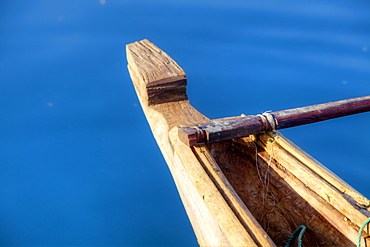
1276-90 - View of canoe boat dock in How Sound at Furry Creek off The Sea to Sky Highway near Squamish, British Columbia, Canada, North America
1275-90 - Dramatic sunrise at the Sydney Harbour, with a view of the Sydney Opera House, UNESCO World Heritage Site, Sydney, New South Wales, Australia, Pacific
1238-90 - Momoyama castle during cherry blossom season, Kyoto, Japan, Asia
1284-90 - A vintage American car driving across a street in Havana, Cuba, West Indies, Caribbean, Central America
1269-90 - Naviglio Grande after a snowfall, Milan, Lombardy, Northern Italy, Italy, Europe
1200-90 - Wildflower meadow of poppies, ox-eye daisy and cornflower, Monte Sibillini Mountains, Piano Grande, Umbria, Italy, Europe
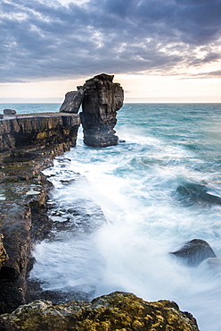
1272-90 - Pulpit Rock, Portland Bill, Isle of Portland, Jurassic Coast, UNESCO World Heritage Site, Dorset, England, United Kingdom, Europe
1283-90 - Christmas market outside the town hall at dusk, Hamburg, Germany, Europe
1262-90 - Street food of Kampot, Cambodia, Indochina, Southeast Asia, Asia
857-94717 - Nimoa Island - here the island mission will impress. The five-sided church features murals of island life and all mission buildings are surrounded by well maintained paths and gardens filled with flowering plants. Edged by jungle-covered mountains, postcard beaches and crystal clear waters - an island paradise indeed! The Louisiade Archipelago is a string of ten larger volcanic islands frequently fringed by coral reefs, and 90 smaller coral islands located 200 km southeast of New Guinea, stretching over more than 160 km and spread over an ocean area of 26,000 km? between the Solomon Sea to the north and the Coral Sea to the south. The aggregate land area of the islands is about 1,790 km? (690 square miles), with Vanatinai (formerly Sudest or Tagula as named by European claimants on Western maps) being the largest. Sideia Island and Basilaki Island lie closest to New Guinea, while Misima, Vanatinai, and Rossel islands lie further east. The archipelago is divided into the Local Level Government (LLG) areas Loui!
857-94720 - Nimoa Island - here the island mission will impress. The five-sided church features murals of island life and all mission buildings are surrounded by well maintained paths and gardens filled with flowering plants. Edged by jungle-covered mountains, postcard beaches and crystal clear waters - an island paradise indeed! The Louisiade Archipelago is a string of ten larger volcanic islands frequently fringed by coral reefs, and 90 smaller coral islands located 200 km southeast of New Guinea, stretching over more than 160 km and spread over an ocean area of 26,000 km? between the Solomon Sea to the north and the Coral Sea to the south. The aggregate land area of the islands is about 1,790 km? (690 square miles), with Vanatinai (formerly Sudest or Tagula as named by European claimants on Western maps) being the largest. Sideia Island and Basilaki Island lie closest to New Guinea, while Misima, Vanatinai, and Rossel islands lie further east. The archipelago is divided into the Local Level Government (LLG) areas Louisiade Rural (western part, with Misima), and Yaleyamba (western part, with Rossell and Tagula islands. The LLG areas are part of Samarai-Murua District district of Milne Bay. The seat of the Louisiade Rural LLG is Bwagaoia on Misima Island, the population center of the archipelago.
857-94718 - Nimoa Island - here the island mission will impress. The five-sided church features murals of island life and all mission buildings are surrounded by well maintained paths and gardens filled with flowering plants. Edged by jungle-covered mountains, postcard beaches and crystal clear waters - an island paradise indeed! The Louisiade Archipelago is a string of ten larger volcanic islands frequently fringed by coral reefs, and 90 smaller coral islands located 200 km southeast of New Guinea, stretching over more than 160 km and spread over an ocean area of 26,000 km? between the Solomon Sea to the north and the Coral Sea to the south. The aggregate land area of the islands is about 1,790 km? (690 square miles), with Vanatinai (formerly Sudest or Tagula as named by European claimants on Western maps) being the largest. Sideia Island and Basilaki Island lie closest to New Guinea, while Misima, Vanatinai, and Rossel islands lie further east. The archipelago is divided into the Local Level Government (LLG) areas Louisiade Rural (western part, with Misima), and Yaleyamba (western part, with Rossell and Tagula islands. The LLG areas are part of Samarai-Murua District district of Milne Bay. The seat of the Louisiade Rural LLG is Bwagaoia on Misima Island, the population center of the archipelago.
857-94722 - Children playing with a outrigger canoe in the village of Hessessai Bay at PanaTinai (Panatinane)island in the Louisiade Archipelago in Milne Bay Province, Papua New Guinea. The island has an area of 78 km2. The Louisiade Archipelago is a string of ten larger volcanic islands frequently fringed by coral reefs, and 90 smaller coral islands located 200 km southeast of New Guinea, stretching over more than 160 km and spread over an ocean area of 26,000 km? between the Solomon Sea to the north and the Coral Sea to the south. The aggregate land area of the islands is about 1,790 km? (690 square miles), with Vanatinai (formerly Sudest or Tagula as named by European claimants on Western maps) being the largest. Sideia Island and Basilaki Island lie closest to New Guinea, while Misima, Vanatinai, and Rossel islands lie further east. The archipelago is divided into the Local Level Government (LLG) areas Louisiade Rural (western part, with Misima), and Yaleyamba (western part, with Rossell and Tagula islands. The LLG areas are part of Samarai-Murua District district of Milne Bay. The seat of the Louisiade Rural LLG is Bwagaoia on Misima Island, the population center of the archipelago.PanaTinai (Panatinane) is an island in the Louisiade Archipelago in Milne Bay Province, Papua New Guinea.
857-94715 - Nimoa Island - here the island mission will impress. The five-sided church features murals of island life and all mission buildings are surrounded by well maintained paths and gardens filled with flowering plants. Edged by jungle-covered mountains, postcard beaches and crystal clear waters - an island paradise indeed! The Louisiade Archipelago is a string of ten larger volcanic islands frequently fringed by coral reefs, and 90 smaller coral islands located 200 km southeast of New Guinea, stretching over more than 160 km and spread over an ocean area of 26,000 km? between the Solomon Sea to the north and the Coral Sea to the south. The aggregate land area of the islands is about 1,790 km? (690 square miles), with Vanatinai (formerly Sudest or Tagula as named by European claimants on Western maps) being the largest. Sideia Island and Basilaki Island lie closest to New Guinea, while Misima, Vanatinai, and Rossel islands lie further east.
857-94719 - Nimoa Island - here the island mission will impress. The five-sided church features murals of island life and all mission buildings are surrounded by well maintained paths and gardens filled with flowering plants. Edged by jungle-covered mountains, postcard beaches and crystal clear waters - an island paradise indeed! The Louisiade Archipelago is a string of ten larger volcanic islands frequently fringed by coral reefs, and 90 smaller coral islands located 200 km southeast of New Guinea, stretching over more than 160 km and spread over an ocean area of 26,000 km? between the Solomon Sea to the north and the Coral Sea to the south. The aggregate land area of the islands is about 1,790 km? (690 square miles), with Vanatinai (formerly Sudest or Tagula as named by European claimants on Western maps) being the largest. Sideia Island and Basilaki Island lie closest to New Guinea, while Misima, Vanatinai, and Rossel islands lie further east. The archipelago is divided into the Local Level Government (LLG) areas Louisiade Rural (western part, with Misima), and Yaleyamba (western part, with Rossell and Tagula islands. The LLG areas are part of Samarai-Murua District district of Milne Bay. The seat of the Louisiade Rural LLG is Bwagaoia on Misima Island, the population center of the archipelago.
857-94721 - Nimoa Island - here the island mission will impress. The five-sided church features murals of island life and all mission buildings are surrounded by well maintained paths and gardens filled with flowering plants. Edged by jungle-covered mountains, postcard beaches and crystal clear waters - an island paradise indeed! The Louisiade Archipelago is a string of ten larger volcanic islands frequently fringed by coral reefs, and 90 smaller coral islands located 200 km southeast of New Guinea, stretching over more than 160 km and spread over an ocean area of 26,000 km? between the Solomon Sea to the north and the Coral Sea to the south. The aggregate land area of the islands is about 1,790 km? (690 square miles), with Vanatinai (formerly Sudest or Tagula as named by European claimants on Western maps) being the largest. Sideia Island and Basilaki Island lie closest to New Guinea, while Misima, Vanatinai, and Rossel islands lie further east. The archipelago is divided into the Local Level Government (LLG) areas Loui!
857-94716 - Nimoa Island - here the island mission will impress. The five-sided church features murals of island life and all mission buildings are surrounded by well maintained paths and gardens filled with flowering plants. Edged by jungle-covered mountains, postcard beaches and crystal clear waters - an island paradise indeed! The Louisiade Archipelago is a string of ten larger volcanic islands frequently fringed by coral reefs, and 90 smaller coral islands located 200 km southeast of New Guinea, stretching over more than 160 km and spread over an ocean area of 26,000 km? between the Solomon Sea to the north and the Coral Sea to the south. The aggregate land area of the islands is about 1,790 km? (690 square miles), with Vanatinai (formerly Sudest or Tagula as named by European claimants on Western maps) being the largest. Sideia Island and Basilaki Island lie closest to New Guinea, while Misima, Vanatinai, and Rossel islands lie further east. The archipelago is divided into the Local Level Government (LLG) areas Loui!
857-94714 - The Louisiade Archipelago is a string of ten larger volcanic islands frequently fringed by coral reefs, and 90 smaller coral islands located 200 km southeast of New Guinea, stretching over more than 160 km and spread over an ocean area of 26,000 km? between the Solomon Sea to the north and the Coral Sea to the south. The aggregate land area of the islands is about 1,790 km? (690 square miles), with Vanatinai (formerly Sudest or Tagula as named by European claimants on Western maps) being the largest. Sideia Island and Basilaki Island lie closest to New Guinea, while Misima, Vanatinai, and Rossel islands lie further east. The archipelago is divided into the Local Level Government (LLG) areas Louisiade Rural (western part, with Misima), and Yaleyamba (western part, with Rossell and Tagula islands. The LLG areas are part of Samarai-Murua District district of Milne Bay. The seat of the Louisiade Rural LLG is Bwagaoia on Misima Island, the population center of the archipelago.


