Recent searches
Loading...
743-160 - Male leopard, Panthera pardus, in captivity, Namibia, Africa
1382-160 - cognitive trail through sand dunes, Nagliai Nature Reserve, Curonian Spit, Lithuania, Baltic States, North Europe
722-160 - The Bodeguita del Medio, a popular restaurant-bar and music venue, made famous by Ernest Hemingway, in Calle Obispo in historic centre, Old Havana (Habana Vieja), Havana, Cuba, West Indies, Central America
1384-160 - Historic buildings on west side of main city square, Plaza de la Constitucion, Monte de Piedad, Mexico City, Mexico
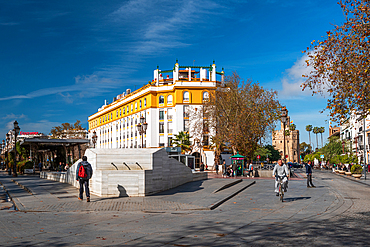
1372-160 - Fountain at Puerta Jerez, wth the Torre del Oro in the background, Seville, Andalusia, Spain, Europe
1369-160 - Magical winter light envelops the forest in Riisitunturi National Park, Posio, Finland, Europe
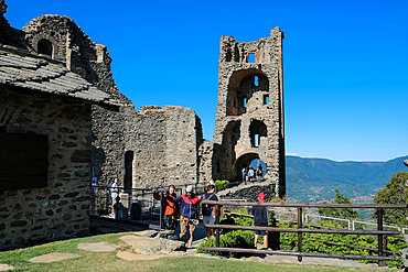
1373-160 - Detail of the Sacra di San Michele, (Saint Michael's Abbey), a religious complex on Mount Pirchiriano, on south side of the Val di Susa, municipality of Sant'Ambrogio di Torino, Metropolitan City of Turin, Piedmont, Italy, Europe
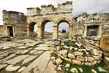
1235-160 - Ancient City of Hierapolis, Pamukkale, UNESCO World Heritage Site, Anatolia, Turkey, Asia Minor, Asia
1346-160 - Limestone rock formations in El Torcal de Antequera nature reserve, Andalusia, Spain, Europe
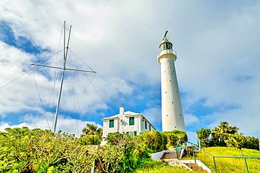
1358-160 - Gibb's Hill Lighthouse, built of cast iron in London and erected by the Royal Engineers in 1844, still in use, Southampton Parish, Bermuda, Atlantic, North America
1361-160 - Rear view of woman admiring the view of the coast along the Seven Sisters chalk cliffs, South Downs National Park, East Sussex, England, United Kingdom, Europe
1365-160 - Thunderstorms over south rim, from Cape Royal, north rim, Grand Canyon, Grand Canyon National Park, UNESCO World Heritage Site, Arizona, United States of America, North America
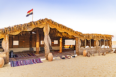
1366-160 - Faiyum Oasis, Egypt. February 20, 2022. Sun shelter building at Wadi el-Hitan paleontological site.
1213-160 - Sunrise at the harbour wall known as The Cobb in Lyme Regis, Dorset, England, United Kingdom, Europe
1359-160 - Colorful houses and coastline, Valparaiso, Chile
1360-160 - Expanse of vineyards in the autumn season, Oltre Po Pavese, Lombardy, Italy, Europe
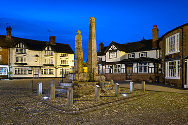
1353-160 - Ancient Saxon Crosses in the Market Place at night, Sandbach, Cheshire, England, United Kingdom, Europe
1351-160 - Colchis Fountain during a cloudy day in Kutaisi, Imereti, Georgia (Sakartvelo), Central Asia, Asia
1320-160 - The Geldingadalir Volcanic Eruption, Fagradalsfjall, Iceland, Polar Regions
1341-160 - El Badi Palace, Marrakech, Morocco, North Africa, Africa
1350-160 - The Sun setting into a pall of forest fire smoke over Alberta from fires in B.C. and elsewhere, on August 17, 2018. This shows the dimming and reddening of the Sun as it set, with it disappearing from view long before it reached the horizon.
1265-160 - Bokod Floating Village, Oroszlany, Hungary, Europe
1336-160 - Sunrise on Roussanou (St. Barbara) Monastery, Meteora, UNESCO World Heritage Site, Thessaly, Greece, Europe
1335-160 - Close up of pair of giraffe (Giraffa), South Luangwa National Park, Zambia, Africa
1111-160 - Harvesting rice and wheat, field workers, Bumthang village, Bhutan, Asia
1238-160 - Thirteenth century poet Abutsuni, Jidai festival, Kyoto, Japan, Asia
1318-160 - Girl wearing traditional dress and with face painted as catrinal holding candle in graveyard, Xoxocotlan, Oaxaca, Mexico, North America
1315-160 - Hiking around hoodoo sandstone formations in Bisti/De-Na-Zin Wilderness, New Mexico, United States of America, North America
1263-160 - The historic centre of Antwerp during the evening blue hour, Antwerp, Belgium, Europe
1311-160 - Watch Tower on Grand Canyon South Rim at twilight, Grand Canyon National Park, UNESCO World Heritage Site, Arizona, United States of America, North America
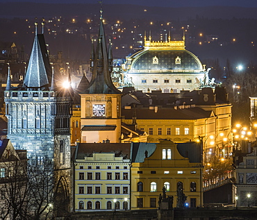
1200-160 - Charles Bridge East Tower and National Theatre at night, Prague, Czech Republic, Europe
1295-160 - Cloud formations and wet sand on the vast expanse of beach at Sandymouth, Bude, Cornwall, England, United Kingdom, Europe
1310-160 - Prickly pear cactus (Opuntia ficus-indica) growing on La Rocca, high above the Old Town, Cefalu, Palermo, Sicily, Italy, Mediterranean, Europe
971-160 - Black-browed albatross (Thalassarche melanophris) in flight low over the sea, showing full span of under wing, South Georgia, Polar Regions
1300-160 - Ostra Hamngatan at the city centre of Goteborg (Gothenburg), Vastra-Gotaland County, Sweden, Scandinavia, Europe
1186-160 - Hall of Mosses rainforest, Olympic National Park, UNESCO World Heritage Site, Washington State, United States of America, North America
1306-160 - The Reynisdrangar coastline and Sea Stacks, Reynisfjara, Vik, Iceland, Polar Regions
1247-160 - Sun rises behind the Taj Mahal, UNESCO World Heritage Site, Agra, Uttar Pradesh, India, Asia
1228-160 - Signpost and distant view of the Vale of York from Whitestone Cliff, North Yorkshire Moors, Yorkshire, England, United Kingdom, Europe
1241-160 - Wedge Pond in autumn, Kananaskis Country, Alberta, Canada, North America
1116-39950 - Bumphead parrotfish (Bolbometopon muricatum) are the largest species in this family and can reach 5 feet in length and over 160 pounds, Yap, Micronesia
1292-160 - View from the Castle, Leros Island, Dodecanese, Greek Islands, Greece, Europe
1278-160 - The Douro River banks with waterfront houses and boats seen from Dom Luis I Bridge, Porto, Portugal, Europe
1297-160 - A colourfully dressed participant in the Notting Hill Carnival, London, England, United Kingdom, Europe
1272-160 - Civita di Bagnoregio at sunset, Province of Viterbo, Lazio, Italy, Europe
1284-160 - Green vintage American car parked in front of cafe, Cienfuegos, UNESCO World Heritage Site, Cuba, West Indies, Caribbean, Central America
1269-160 - Flowering of crocus at Alp Flix, Sur, Surses, Parc Ela, Region of Albula, Canton of Graubunden, Switzerland, Europe
1276-160 - Waterfront, Chania, Crete, Greek Islands, Greece, Europe
1237-160 - Glasgow University, Glasgow, Scotland, United Kingdom, Europe
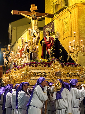
1242-160 - Antequera, known for traditional Semana Santa (Holy Week) processions leading up to Easter, Antequera, Andalucia, Spain, Europe
1264-160 - Winter in Monte Cucco Park, Apennines, Umbria, Italy, Europe
1283-160 - The National Theatre (Teatro Nacional) at dusk, San Jose, Costa Rica, Central America
1262-160 - Indonesian woman in carnival costume celebrating Malan's 101st year anniversary, Malang, East Java, Indonesia, Southeast Asia, Asia
1209-160 - Hjardarnes, Westfjords, Iceland, Polar Regions
1267-160 - Melbourne city skyline over Yarra River, Melbourne, Victoria, Australia, Pacific
857-94717 - Nimoa Island - here the island mission will impress. The five-sided church features murals of island life and all mission buildings are surrounded by well maintained paths and gardens filled with flowering plants. Edged by jungle-covered mountains, postcard beaches and crystal clear waters - an island paradise indeed! The Louisiade Archipelago is a string of ten larger volcanic islands frequently fringed by coral reefs, and 90 smaller coral islands located 200 km southeast of New Guinea, stretching over more than 160 km and spread over an ocean area of 26,000 km? between the Solomon Sea to the north and the Coral Sea to the south. The aggregate land area of the islands is about 1,790 km? (690 square miles), with Vanatinai (formerly Sudest or Tagula as named by European claimants on Western maps) being the largest. Sideia Island and Basilaki Island lie closest to New Guinea, while Misima, Vanatinai, and Rossel islands lie further east. The archipelago is divided into the Local Level Government (LLG) areas Loui!
857-94720 - Nimoa Island - here the island mission will impress. The five-sided church features murals of island life and all mission buildings are surrounded by well maintained paths and gardens filled with flowering plants. Edged by jungle-covered mountains, postcard beaches and crystal clear waters - an island paradise indeed! The Louisiade Archipelago is a string of ten larger volcanic islands frequently fringed by coral reefs, and 90 smaller coral islands located 200 km southeast of New Guinea, stretching over more than 160 km and spread over an ocean area of 26,000 km? between the Solomon Sea to the north and the Coral Sea to the south. The aggregate land area of the islands is about 1,790 km? (690 square miles), with Vanatinai (formerly Sudest or Tagula as named by European claimants on Western maps) being the largest. Sideia Island and Basilaki Island lie closest to New Guinea, while Misima, Vanatinai, and Rossel islands lie further east. The archipelago is divided into the Local Level Government (LLG) areas Louisiade Rural (western part, with Misima), and Yaleyamba (western part, with Rossell and Tagula islands. The LLG areas are part of Samarai-Murua District district of Milne Bay. The seat of the Louisiade Rural LLG is Bwagaoia on Misima Island, the population center of the archipelago.
857-94718 - Nimoa Island - here the island mission will impress. The five-sided church features murals of island life and all mission buildings are surrounded by well maintained paths and gardens filled with flowering plants. Edged by jungle-covered mountains, postcard beaches and crystal clear waters - an island paradise indeed! The Louisiade Archipelago is a string of ten larger volcanic islands frequently fringed by coral reefs, and 90 smaller coral islands located 200 km southeast of New Guinea, stretching over more than 160 km and spread over an ocean area of 26,000 km? between the Solomon Sea to the north and the Coral Sea to the south. The aggregate land area of the islands is about 1,790 km? (690 square miles), with Vanatinai (formerly Sudest or Tagula as named by European claimants on Western maps) being the largest. Sideia Island and Basilaki Island lie closest to New Guinea, while Misima, Vanatinai, and Rossel islands lie further east. The archipelago is divided into the Local Level Government (LLG) areas Louisiade Rural (western part, with Misima), and Yaleyamba (western part, with Rossell and Tagula islands. The LLG areas are part of Samarai-Murua District district of Milne Bay. The seat of the Louisiade Rural LLG is Bwagaoia on Misima Island, the population center of the archipelago.
857-94722 - Children playing with a outrigger canoe in the village of Hessessai Bay at PanaTinai (Panatinane)island in the Louisiade Archipelago in Milne Bay Province, Papua New Guinea. The island has an area of 78 km2. The Louisiade Archipelago is a string of ten larger volcanic islands frequently fringed by coral reefs, and 90 smaller coral islands located 200 km southeast of New Guinea, stretching over more than 160 km and spread over an ocean area of 26,000 km? between the Solomon Sea to the north and the Coral Sea to the south. The aggregate land area of the islands is about 1,790 km? (690 square miles), with Vanatinai (formerly Sudest or Tagula as named by European claimants on Western maps) being the largest. Sideia Island and Basilaki Island lie closest to New Guinea, while Misima, Vanatinai, and Rossel islands lie further east. The archipelago is divided into the Local Level Government (LLG) areas Louisiade Rural (western part, with Misima), and Yaleyamba (western part, with Rossell and Tagula islands. The LLG areas are part of Samarai-Murua District district of Milne Bay. The seat of the Louisiade Rural LLG is Bwagaoia on Misima Island, the population center of the archipelago.PanaTinai (Panatinane) is an island in the Louisiade Archipelago in Milne Bay Province, Papua New Guinea.
857-94715 - Nimoa Island - here the island mission will impress. The five-sided church features murals of island life and all mission buildings are surrounded by well maintained paths and gardens filled with flowering plants. Edged by jungle-covered mountains, postcard beaches and crystal clear waters - an island paradise indeed! The Louisiade Archipelago is a string of ten larger volcanic islands frequently fringed by coral reefs, and 90 smaller coral islands located 200 km southeast of New Guinea, stretching over more than 160 km and spread over an ocean area of 26,000 km? between the Solomon Sea to the north and the Coral Sea to the south. The aggregate land area of the islands is about 1,790 km? (690 square miles), with Vanatinai (formerly Sudest or Tagula as named by European claimants on Western maps) being the largest. Sideia Island and Basilaki Island lie closest to New Guinea, while Misima, Vanatinai, and Rossel islands lie further east.
857-94719 - Nimoa Island - here the island mission will impress. The five-sided church features murals of island life and all mission buildings are surrounded by well maintained paths and gardens filled with flowering plants. Edged by jungle-covered mountains, postcard beaches and crystal clear waters - an island paradise indeed! The Louisiade Archipelago is a string of ten larger volcanic islands frequently fringed by coral reefs, and 90 smaller coral islands located 200 km southeast of New Guinea, stretching over more than 160 km and spread over an ocean area of 26,000 km? between the Solomon Sea to the north and the Coral Sea to the south. The aggregate land area of the islands is about 1,790 km? (690 square miles), with Vanatinai (formerly Sudest or Tagula as named by European claimants on Western maps) being the largest. Sideia Island and Basilaki Island lie closest to New Guinea, while Misima, Vanatinai, and Rossel islands lie further east. The archipelago is divided into the Local Level Government (LLG) areas Louisiade Rural (western part, with Misima), and Yaleyamba (western part, with Rossell and Tagula islands. The LLG areas are part of Samarai-Murua District district of Milne Bay. The seat of the Louisiade Rural LLG is Bwagaoia on Misima Island, the population center of the archipelago.
857-94721 - Nimoa Island - here the island mission will impress. The five-sided church features murals of island life and all mission buildings are surrounded by well maintained paths and gardens filled with flowering plants. Edged by jungle-covered mountains, postcard beaches and crystal clear waters - an island paradise indeed! The Louisiade Archipelago is a string of ten larger volcanic islands frequently fringed by coral reefs, and 90 smaller coral islands located 200 km southeast of New Guinea, stretching over more than 160 km and spread over an ocean area of 26,000 km? between the Solomon Sea to the north and the Coral Sea to the south. The aggregate land area of the islands is about 1,790 km? (690 square miles), with Vanatinai (formerly Sudest or Tagula as named by European claimants on Western maps) being the largest. Sideia Island and Basilaki Island lie closest to New Guinea, while Misima, Vanatinai, and Rossel islands lie further east. The archipelago is divided into the Local Level Government (LLG) areas Loui!
857-94716 - Nimoa Island - here the island mission will impress. The five-sided church features murals of island life and all mission buildings are surrounded by well maintained paths and gardens filled with flowering plants. Edged by jungle-covered mountains, postcard beaches and crystal clear waters - an island paradise indeed! The Louisiade Archipelago is a string of ten larger volcanic islands frequently fringed by coral reefs, and 90 smaller coral islands located 200 km southeast of New Guinea, stretching over more than 160 km and spread over an ocean area of 26,000 km? between the Solomon Sea to the north and the Coral Sea to the south. The aggregate land area of the islands is about 1,790 km? (690 square miles), with Vanatinai (formerly Sudest or Tagula as named by European claimants on Western maps) being the largest. Sideia Island and Basilaki Island lie closest to New Guinea, while Misima, Vanatinai, and Rossel islands lie further east. The archipelago is divided into the Local Level Government (LLG) areas Loui!
857-94714 - The Louisiade Archipelago is a string of ten larger volcanic islands frequently fringed by coral reefs, and 90 smaller coral islands located 200 km southeast of New Guinea, stretching over more than 160 km and spread over an ocean area of 26,000 km? between the Solomon Sea to the north and the Coral Sea to the south. The aggregate land area of the islands is about 1,790 km? (690 square miles), with Vanatinai (formerly Sudest or Tagula as named by European claimants on Western maps) being the largest. Sideia Island and Basilaki Island lie closest to New Guinea, while Misima, Vanatinai, and Rossel islands lie further east. The archipelago is divided into the Local Level Government (LLG) areas Louisiade Rural (western part, with Misima), and Yaleyamba (western part, with Rossell and Tagula islands. The LLG areas are part of Samarai-Murua District district of Milne Bay. The seat of the Louisiade Rural LLG is Bwagaoia on Misima Island, the population center of the archipelago.
857-94712 - The Louisiade Archipelago is a string of ten larger volcanic islands frequently fringed by coral reefs, and 90 smaller coral islands located 200 km southeast of New Guinea, stretching over more than 160 km and spread over an ocean area of 26,000 km? between the Solomon Sea to the north and the Coral Sea to the south. The aggregate land area of the islands is about 1,790 km? (690 square miles), with Vanatinai (formerly Sudest or Tagula as named by European claimants on Western maps) being the largest.Sideia Island and Basilaki Island lie closest to New Guinea, while Misima, Vanatinai, and Rossel islands lie further east. The archipelago is divided into the Local Level Government (LLG) areas Louisiade Rural (western part, with Misima), and Yaleyamba (western part, with Rossell and Tagula islands. The LLG areas are part of Samarai-Murua District district of Milne Bay. The seat of the Louisiade Rural LLG is Bwagaoia on Misima Island, the population center of the archipelago.
1216-160 - Bagh Steinigidh, Isle of Harris, Outer Hebrides, Scotland, United Kingdom, Europe
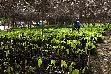
1270-160 - A man tends to small cocoa trees at a cocoa nursery in Ghana, West Africa, Africa
1202-160 - Windsurfing at Long Bay Beach, on the south coast of Providenciales, Turks and Caicos, in the Caribbean, West Indies, Central America
1243-160 - Sondrio, Valtellina, Lombardy, Italy, Europe
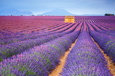
1251-160 - House in a lavender field at sunset, Plateau de Valensole, Alpes-de-Haute-Provence, Provence-Alpes-Cote d'Azur, France, Europe
1240-160 - Knowth, UNESCO World Heritage Site, County Meath, Leinster, Republic of Ireland, Europe
1245-160 - View of the Casa Rosada on Plaza de Mayo, Monserrat, City of Buenos Aires, Buenos Aires Province, Argentina, South America
1226-160 - Sheikh Zayed Mosque, Abu Dhabi, United Arab Emirates, Middle East
1219-160 - Juvenile golden eagle (Aquila chrysaetos), wings outstretched on the snow at the edge of a forest, Taiga Forest, Finland, Scandinavia, Europe
1225-160 - A Marma woman collecting chillies, Chittagong Hill Tracts, Bangladesh, Asia
1218-160 - Huka Falls, Lake Taupo, North Island, New Zealand, Pacific
1212-160 - Empty plate after a Full English breakfast, United Kingdom, Europe
1185-160 - Scottish wildcat (Felix silvestris), Devon, England, United Kingdom, Europe
1199-160 - Wai-O-Tapu Thermal Wonderland, Rotorua, North Island New Zealand, Pacific
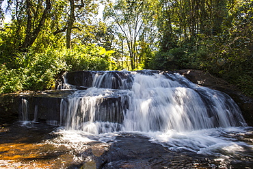
1184-160 - Mandala Falls flowing in the artificial lake on the Mulunguzi Dam, Zomba Plateau, Malawi, Africa
1171-160 - Red wooden Buddhist good luck charms and tropical vegetation, Hangzhou, Zhejiang, China, Asia
1176-160 - Giraldo Square (Praca do Giraldo) in the historic centre, Evora, UNESCO World Heritage Site, Alentejo, Portugal, Europe
1179-160 - The church of Sils-Baselgia, in a winter landscape covered in snow in Lower Engadine, from the banks of River Inn after sunrise, Graubunden, Switzerland, Europe
803-160 - View of the lake and town of Kandy, Sri Lanka, Asia
1132-160 - Vaulted ceiling of the Gothic Hall inside the Town Hall, Bruges, Belgium, Europe
1167-160 - Top-heavy hoodoo, pine trees and cliffs with snow and a cloudy sky, Agua Canyon, Bryce Canyon National Park, Utah, United States of America, North America
1125-160 - Desert zebra, Skeleton Coast, Namibia, Africa
1104-160 - Surp Gayane Church, UNESCO World Heritage Site, Echmiadziin, Armenia, Central Asia, Asia
824-160 - Tourists on the canopy walkway in Danum Valley, Sabah, Malaysian Borneo, Malaysia, Southeast Asia, Asia
1158-160 - Alta Rock Art, UNESCO World Heritage Site, Alta, Finnmark, Norway, Scandinavia, Europe
1161-160 - A bird resting on the back of a Common Plains Zebra (Grant's), Ngorongoro Crater, Tanzania
1160-160 - Mercedes Benz Museum, Stuttgart, Baden Wurttemberg, Germany, Europe
1131-160 - View over Botafogo and the Corcovado from the Sugar Loaf Mountain, Rio de Janeiro, Brazil, South America
990-160 - Approaching the boat from behind, this Minke whale (Balaenoptera acutorostrata) heaves its head out of the water. St. Lawrence estuary, Canada. Sequence 2/3.
1126-160 - Restaurant, Grand Place, UNESCO World Heritage Site, Brussels, Belgium, Europe
1001-160 - Longhorn moth (Nematopogon swammerdamella), Bettel, Luxembourg, Europe
989-160 - Overview of Roccapina Bay and the rocky south coast of Corsica from Cape Roccapina, Corsica, France, Mediterranean, Europe


