Recent searches
Loading...
1116-42452 - Wat Doi Kham Temple Buddha, Chiang Mai, Thailand
1116-42551 - The Sunset Over Sea Stacks, Cannon Beach, Oregon, United States Of America
1116-42710 - Wooden Monument Near Egilsstadir, Dedicated To Hakon Adalsteinsson, Nordur-Mulasysla, Iceland
1116-42654 - Abi Dhabi Skyline At Night, Abu Dhabi, United Arab Emirates
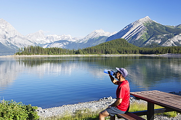
1116-42664 - A Man Drinks From A Water Bottle On The Edge Of A Lake Overlooking The Rocky Mountains, Kananaskis, Alberta, Canada
1116-42503 - The Sun Sets At Cape Meares Lighthouse, Oregon, United States Of America
1116-42591 - Coral And Seaweed On Tunnels Beach At Low Tide, Kauai, Hawaii, United States Of America
1116-42520 - A Large Natural Arch Found At Ecola State Park, Cannon Beach, Oregon, United States Of America
1116-42563 - Original King Kamehameha I Statue, Big Island, Hawaii, United States Of America
1116-42535 - Detail Of Ferris Wheel In Divo Ostrov Amusement Park, St. Petersburg, Russia
1116-42451 - Wat Doi Kham Temple Buddha, Chiang Mai, Thailand
1116-42423 - Seeing Into The Clear Rocky Water At Sunset At Cave Point In Sturgeon Bay, Wisconsin, United States Of America
1116-42415 - A Sailboat Sails In The Gulf Islands On A Sunny Day, British Columbia, Canada
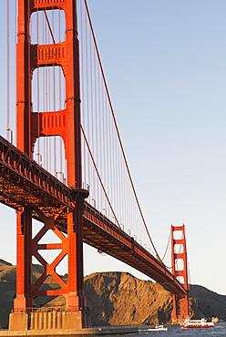
1116-42447 - Tour Boats Cross Under Golden Gate Bridge, Viewed From Fort Point At The Entrance To San Francisco Bay, Marin Headlands Visible In Background, San Francisco, California, United States Of America
1116-42386 - Winter Scene Of A City Plaza At Dusk, Calgary, Alberta, Canada
1116-42346 - A Windsock Against A Blue Sky, Locarno, Ticino, Switzerland
1116-42393 - Two Young Women In Bathing Suits Posing On The Beach At Sunset, Tarifa, Cadiz, Andalusia, Spain
1116-42345 - A Windsock Against A Blue Sky, Locarno, Ticino, Switzerland
1174-5559 - Yellow school buses parked diagonally, Bradenton, Florida, United States of America
1174-4961 - Two animals, Giraffa camelopardalis, stand in an open clearing, clear sky, black and white image, Londolozi Game Reserve, Sabi Sands, Greater Kruger National Park, South Africa
1116-42035 - A Dock Leading Out Into The Lake At Sunrise, Pigeon Lake, Alberta, Canada
1116-41867 - View of the mountains on an hawaiian island from the sandy shore, Hawaii united states of america
857-96020 - View of sign of store under clear sky in Lakeview, California, USA
857-96019 - Side view of single camper trailer in desert under clear sky, Summer Lake, Oregon, USA
1116-41681 - A view of la perouse bay with clear water and coral with kooholawae in the distance, Maui hawaii united states of america
857-95903 - Clear sky over silhouette of person walking along lakeshore at dusk, Mandalay, Mandalay District, Myanmar
857-95820 - View of sea of Marmara and Istanbul skyline under clear sky, Turkey
857-95830 - Viewing telescope against clear sky at sunset on Triumphal Arch, Paris, France
857-95886 - View of infinity pool in resort near Dead Sea under clear sky, Madaba Governorate, Jordan
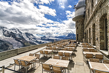
857-95844 - Tables and chairs on terrace of weather station on top of Gornegrat summit,  Zermatt, Valais, Switzerland
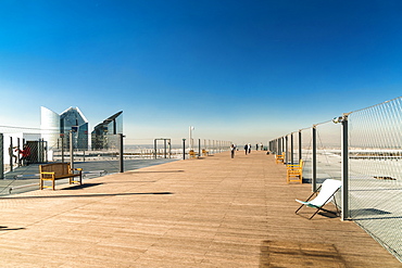
857-95834 - Boardwalk under clear sky, Arch of Defense, Paris, France
857-95831 - View of the famous building of Eiffel Tower against clear sky, Paris, France
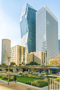
857-95828 - Modern architecture at La Defense district under clear sky, Paris, Ile-de-France, France
857-95586 - Gornegrat gondola station with train going back to Zermatt from summit downwards, Â Zermatt, Valais, Switzerland
1116-41555 - Woman On Public Dock Clear Lake, Canada, Manitoba, Riding Mountain National Park
1116-41600 - Two Sandy Snorkel Sets Rest At The Waters Edge On A Tropical Beach.
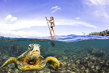
1116-41504 - A green sea turtle (Chelonia mydas), an endangered species, surfaces for a breath in front of a stand-up paddle board off the coast of Maui, Maui, Hawaii, United States of America
857-95247 - Woman sitting on jetty on lakeshore under clear sky with mountains in background, Annecy, Haute-Savoie,
857-95245 - View of fountain in lake at Lumphini Park under clear sky and skyline of city of Bangkok, Thailand
857-95293 - Rear view of couple standing at observation point in natural setting under clear sky, Vancouver, British Columbia, Canada
1116-41093 - Wood Stork Flying To Nest Carrying Greenery, Florida, Usa
1116-40930 - Bald Eagle (Haliaeetus Leucocephalus) In Flight
1116-40374 - Cape Kiwanda, Oregon, United States Of America
1116-40376 - Low Tide At Cape Kiwanda, Oregon, United States Of America
1116-40390 - View Of Control Tower Out The Window Of A Commercial Airplane
1116-40087 - Split view of West Maui Mountains with reef fish, Maui, Hawaii, United States of America
851-729 - Mount Fuji, UNESCO World Heritage Site, and Lake Kawaguchiko with clear blue skies, Yamanashi Prefecture, Honshu, Japan, Asia
851-730 - Mount Fuji with a clear blue sky at sunset, UNESCO World Heritage Site, Yamanashi Prefecture, Honshu, Japan, Asia
857-94715 - Nimoa Island - here the island mission will impress. The five-sided church features murals of island life and all mission buildings are surrounded by well maintained paths and gardens filled with flowering plants. Edged by jungle-covered mountains, postcard beaches and crystal clear waters - an island paradise indeed! The Louisiade Archipelago is a string of ten larger volcanic islands frequently fringed by coral reefs, and 90 smaller coral islands located 200 km southeast of New Guinea, stretching over more than 160 km and spread over an ocean area of 26,000 km? between the Solomon Sea to the north and the Coral Sea to the south. The aggregate land area of the islands is about 1,790 km? (690 square miles), with Vanatinai (formerly Sudest or Tagula as named by European claimants on Western maps) being the largest. Sideia Island and Basilaki Island lie closest to New Guinea, while Misima, Vanatinai, and Rossel islands lie further east.
857-94621 - An illuminated tent sits next to a campfire on a river bed under a clear night sky with stars.
1174-4416 - A cyclist riding along a country road on a clear sunny winter day. Shadow on the road surface.
1174-4414 - A cyclist riding along a country road on a clear sunny winter day.
1174-4415 - A cyclist riding along a country road on a clear sunny winter day.
321-5609 - Clear sea, blue sky and over-water villas, Coco Palm Resort, Dhuni Kolhu, Baa Atoll, Republic of Maldives, Indian Ocean, Asia
321-5612 - White sand beach, clear sea and over-water villas, Coco Palm resort, Dhuni Kolhu, Baa Atoll, Republic of Maldives, Indian Ocean, Asia
321-5606 - Over-water villas, crystal clear sea and blue sky, Coco Palm, Dhuni Kolhu, Baa Atoll, Republic of Maldives, Indian Ocean, Asia
321-5607 - Over-water villas, crystal clear sea and blue sky, Coco Palm, Dhuni Kolhu, Baa Atoll, Republic of Maldives, Indian Ocean, Asia
321-5613 - Crystal clear sea and blue sky, Coco Palm resort, Dhuni Kolhu, Baa Atoll, Republic of Maldives, Indian Ocean, Asia
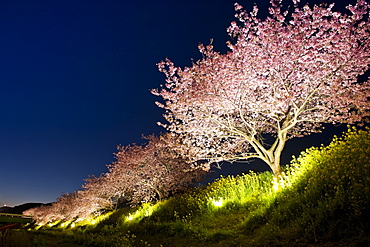
1172-3235 - Cherry Blossoms Of Minami, Shizuoka, Japan
1178-26008 - USA, North Carolina, Surf City, Clear sky over beach
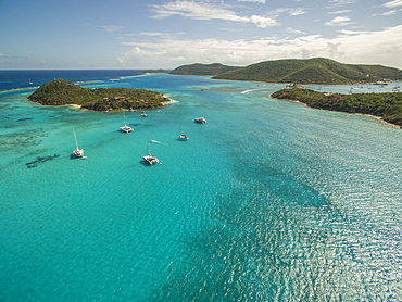
857-93482 - A Sailboat Rests In The Clear Waters Near Prickly Pear Island In The British Virgin Islands
857-93481 - Sailboats Rest In The Clear Waters Near Prickly Pear Island In The British Virgin Islands
857-93483 - A Catamaran Rests In The Clear Waters Near Sandy Cay In The British Virgin Islands
1116-39206 - Hawaii, Maui, Wailua Falls, Couple Look At Waterfall, Foliage, Blue Sky Panoramic C1640
1116-39205 - Hawaii, Kauai, Polihale Beach Panoramic View With Few Visitors Sunbathing Distance C1544
1116-39217 - French Polynesia, Bora Bora, Chairs And Umbrella On Deserted Beach, Blue Sky, Water, White Sand
1116-39221 - Hawaii, Big Island, Kailua-Kona, Kahaluu, St, Peter's Catholic Church
1179-1664 - Purple sky at sunset and wooden huts are reflected in the clear water of Kochelsee, Schlehdorf, Bavaria, Germany, Europe
1179-1651 - Purple sky at sunset and wooden huts are reflected in the clear water of Kochelsee, Schlehdorf, Bavaria, Germany, Europe
1179-1632 - The clear sky is reflected in the blue alpine lake, Muottas Muragl, Samedan, Canton of Graubunden, Engadine, Switzerland, Europe
1179-1636 - The clear sky is reflected in the blue alpine lake, Muottas Muragl, Samedan, Canton of Graubunden, Engadine, Switzerland, Europe
1179-1630 - The clear sky is reflected in the blue alpine lake, Muottas Muragl, Samedan, Canton of Graubunden, Engadine, Switzerland, Europe
1178-25911 - Italy, Liguria, Sestri Levante, Clear sky over sea, view from hill
1184-539 - Very clear turquoise waters on Monuriki Island (Cast Away Island), Mamanuca Islands, Fiji, South Pacific
1184-520 - Crystal clear water in the Utwe lagoon, UNESCO Biosphere Reserve, Kosrae, Federated States of Micronesia, South Pacific
1233-40 - Tourists enjoy the clear waters of Koh Tao, Thailand, Southeast Asia, Asia
1178-25625 - Underwater view of palm trees against clear sky
1178-25624 - Underwater view of palm trees against clear sky
1116-39072 - Schloss Belvedere palace, Weimar, Thuringia, Germany
1179-1238 - Summer flowers framed by clear water, Fredvang, Flakstad municipality, Nordland county, Lofoten Islands, Artic, Northern Norway, Scandinavia, Europe
857-92893 - Crystal clear Caribbean water and bright blue skies provide a perfect scene with sailboats moored off of Honeymoon Beach, St. John, USVI.
911-10892 - A windmill at Cley Next the Sea, North Norfolk, UK, with Blakeney church in the background at sunset.
1178-25478 - Fan Pier waterfront at sunrise, USA, Massachusetts, Boston, Fan Pier Waterfront
1178-25310 - Illuminated French Cathedral against clear sky, Germany, Berlin, Gendarmenmarkt
1113-99740 - Crystal clear water at the beach at Petrovac near Budva, Adriatic coastline, Montenegro, Western Balkan, Europe
1178-24886 - Woman in swimming pool, St. John, US Virgin Islands
1167-768 - Hardwick Hall, near Chesterfield, reflected in pond under a clear blue sky, Derbyshire, England, United Kingdom, Europe
857-88899 - A couple float on their backs in clear teal Caribbean water.
1178-24512 - View of road sign and mountain in winter, Colorado
1174-3510 - A jet with a clear condensation or vapour trail or contrail across a dark blue sky


