Recent searches
Loading...
857-89710 - Hikers cook dinner on a cliff-pinched patio above camp and the Colorado River near Deer Creek Falls in the Grand Canyon outside of Fredonia, Arizona November 2011. The 21.4-mile loop starts at the Bill Hall trailhead on the North Rim and descends 2000-feet in 2.5-miles through Coconino Sandstone to the level Esplanada then descends further into the lower canyon through a break in the 400-foot-tall Redwall to access Surprise Valley. Hikers connect Thunder River and Tapeats Creek to a route along the Colorado River and climb out Deer Creek.
857-89708 - Hikers swim in the pool below 180-foot Deer Creek Falls in the Grand Canyon outside of Fredonia, Arizona November 2011. The 21.4-mile loop starts at the Bill Hall trailhead on the North Rim and descends 2000-feet in 2.5-miles through Coconino Sandstone to the level Esplanada then descends further into the lower canyon through a break in the 400-foot-tall Redwall to access Surprise Valley. Hikers connect Thunder River and Tapeats Creek to a route along the Colorado River and climb out Deer Creek.
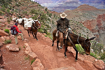
857-89692 - Female hiker waits for pack horses to pass on the South Kaibab Trail in Grand Canyon National Park north of Williams, Arizona May 2011. The South Kaibab Trail starts on the south rim of the Colorado Plateau and follows a ridge out to Skeleton Point allowing for 360-degree views of the canyon then down to the Colorado River. At the Colorado River the trail connects with the North Kaibab trail as part of the Arizona Trail system, that crosses the state of Arizona from Mexico to Utah.
857-89717 - Hikers follow a route along the Colorado River that connect Tapeats Creek and Thunder River to Deer Creek in the Grand Canyon outside of Fredonia, Arizona November 2011. The 21.4-mile loop starts at the Bill Hall trailhead on the North Rim and descends 2000-feet in 2.5-miles through Coconino Sandstone to the level Esplanada then descends further into the lower canyon through a break in the 400-foot-tall Redwall to access Surprise Valley. Hikers connect Thunder River and Tapeats Creek to a route along the Colorado River and climb out Deer Creek.
857-89712 - Male hiker filters water on a cliff-pinched patio near Deer Creek Falls in the Grand Canyon outside of Fredonia, Arizona November 2011. The 21.4-mile loop starts at the Bill Hall trailhead on the North Rim and descends 2000-feet in 2.5-miles through Coconino Sandstone to the level Esplanada then descends further into the lower canyon through a break in the 400-foot-tall Redwall to access Surprise Valley. Hikers connect Thunder River and Tapeats Creek to a route along the Colorado River and climb out Deer Creek.
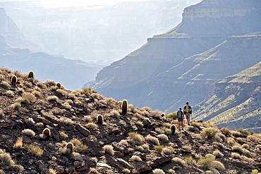
857-89700 - Hikers on the sandstone Esplanade of the Thunder River Trail below the North Rim of the Grand Canyon outside Fredonia, Arizona November 2011. The 21.4-mile loop descends 2000-feet in 2.5-miles through Coconino Sandstone from the Bill Hall trailhead to connect the Thunder River and Deer Creeks trails. Hikers descend into the lower canyon through a break in the 400-foot-tall Redwall to access Surprise Valley, Deer Creek, Tapeats Creek via Thunder River and even the Colorado River.
857-89703 - Hikers past small waterfalls along Deer Creek Narrows in the Grand Canyon outside of Fredonia, Arizona November 2011. The 21.4-mile loop starts at the Bill Hall trailhead on the North Rim and descends 2000-feet in 2.5-miles through Coconino Sandstone to the level Esplanada then descends further into the lower canyon through a break in the 400-foot-tall Redwall to access Surprise Valley. Hikers connect Thunder River and Tapeats Creek to a route along the Colorado River and climb out Deer Creek.
857-89711 - Male hiker filters water on a cliff-pinched patio near Deer Creek Falls in the Grand Canyon outside of Fredonia, Arizona November 2011. The 21.4-mile loop starts at the Bill Hall trailhead on the North Rim and descends 2000-feet in 2.5-miles through Coconino Sandstone to the level Esplanada then descends further into the lower canyon through a break in the 400-foot-tall Redwall to access Surprise Valley. Hikers connect Thunder River and Tapeats Creek to a route along the Colorado River and climb out Deer Creek.
857-89702 - Hikers walk along Deer Creek Narrows in the Grand Canyon outside of Fredonia, Arizona November 2011. The 21.4-mile loop starts at the Bill Hall trailhead on the North Rim and descends 2000-feet in 2.5-miles through Coconino Sandstone to the level Esplanada then descends further into the lower canyon through a break in the 400-foot-tall Redwall to access Surprise Valley. Hikers connect Thunder River and Tapeats Creek to a route along the Colorado River and climb out Deer Creek.
857-89705 - Hikers walk along Deer Creek Narrows in the Grand Canyon outside of Fredonia, Arizona November 2011. The 21.4-mile loop starts at the Bill Hall trailhead on the North Rim and descends 2000-feet in 2.5-miles through Coconino Sandstone to the level Esplanada then descends further into the lower canyon through a break in the 400-foot-tall Redwall to access Surprise Valley. Hikers connect Thunder River and Tapeats Creek to a route along the Colorado River and climb out Deer Creek.
1178-2802 - Panorama of Golden Gate Bridge San Francisco California USA
1178-2806 - Traffic on the Golden Gate Bridge San Francisco California USA
1178-2801 - Golden Gate Bridge San Francisco California USA
1178-2805 - Golden Gate Bridge San Francisco California USA
1178-2804 - Golden Gate Bridge San Francisco California USA
857-86011 - Hikers walk along Deer Creek Narrows in the Grand Canyon outside of Fredonia, Arizona November 2011. The 21.4-mile loop starts at the Bill Hall trailhead on the North Rim and descends 2000-feet in 2.5-miles through Coconino Sandstone to the level Esplanada then descends further into the lower canyon through a break in the 400-foot-tall Redwall to access Surprise Valley. Hikers connect Thunder River and Tapeats Creek to a route along the Colorado River and climb out Deer Creek.
857-86023 - Male hiker filters water on a cliff-pinched patio near Deer Creek Falls in the Grand Canyon outside of Fredonia, Arizona November 2011. The 21.4-mile loop starts at the Bill Hall trailhead on the North Rim and descends 2000-feet in 2.5-miles through Coconino Sandstone to the level Esplanada then descends further into the lower canyon through a break in the 400-foot-tall Redwall to access Surprise Valley. Hikers connect Thunder River and Tapeats Creek to a route along the Colorado River and climb out Deer Creek.
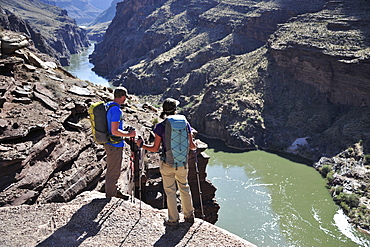
857-86016 - Hikers overlook the Colorado River as they exit the Deer Creek Narrows in the Grand Canyon outside of Fredonia, Arizona November 2011. The 21.4-mile loop starts at the Bill Hall trailhead on the North Rim and descends 2000-feet in 2.5-miles through Coconino Sandstone to the level Esplanada then descends further into the lower canyon through a break in the 400-foot-tall Redwall to access Surprise Valley. Hikers connect Thunder River and Tapeats Creek to a route along the Colorado River and climb out Deer Creek.
857-86021 - Hikers setup camp on a beach along the Colorado River near the plumeting 180-foot Deer Creek Falls in the Grand Canyon outside of Fredonia, Arizona November 2011. The 21.4-mile loop starts at the Bill Hall trailhead on the North Rim and descends 2000-feet in 2.5-miles through Coconino Sandstone to the level Esplanada then descends further into the lower canyon through a break in the 400-foot-tall Redwall to access Surprise Valley. Hikers connect Thunder River and Tapeats Creek to a route along the Colorado River and climb out Deer Creek.
857-86015 - Hikers walk along Deer Creek Narrows in the Grand Canyon outside of Fredonia, Arizona November 2011. The 21.4-mile loop starts at the Bill Hall trailhead on the North Rim and descends 2000-feet in 2.5-miles through Coconino Sandstone to the level Esplanada then descends further into the lower canyon through a break in the 400-foot-tall Redwall to access Surprise Valley. Hikers connect Thunder River and Tapeats Creek to a route along the Colorado River and climb out Deer Creek.
857-86013 - Hikers walk along Deer Creek Narrows in the Grand Canyon outside of Fredonia, Arizona November 2011. The 21.4-mile loop starts at the Bill Hall trailhead on the North Rim and descends 2000-feet in 2.5-miles through Coconino Sandstone to the level Esplanada then descends further into the lower canyon through a break in the 400-foot-tall Redwall to access Surprise Valley. Hikers connect Thunder River and Tapeats Creek to a route along the Colorado River and climb out Deer Creek.
857-86000 - Hikers on the sandstone Esplanade of the Thunder River Trail below the North Rim of the Grand Canyon outside Fredonia, Arizona November 2011. The 21.4-mile loop descends 2000-feet in 2.5-miles through Coconino Sandstone from the Bill Hall trailhead to connect the Thunder River and Deer Creeks trails. Hikers descend into the lower canyon through a break in the 400-foot-tall Redwall to access Surprise Valley, Deer Creek, Tapeats Creek via Thunder River and even the Colorado River.
857-86025 - Hikers follow a route along the Colorado River that connect Tapeats Creek and Thunder River to Deer Creek in the Grand Canyon outside of Fredonia, Arizona November 2011. The 21.4-mile loop starts at the Bill Hall trailhead on the North Rim and descends 2000-feet in 2.5-miles through Coconino Sandstone to the level Esplanada then descends further into the lower canyon through a break in the 400-foot-tall Redwall to access Surprise Valley. Hikers connect Thunder River and Tapeats Creek to a route along the Colorado River and climb out Deer Creek.
857-86007 - Hikers cook dinner along Deer Creek Narrows in the Grand Canyon outside of Fredonia, Arizona November 2011. The 21.4-mile loop starts at the Bill Hall trailhead on the North Rim and descends 2000-feet in 2.5-miles through Coconino Sandstone to the level Esplanada then descends further into the lower canyon through a break in the 400-foot-tall Redwall to access Surprise Valley. Hikers connect Thunder River and Tapeats Creek to a route along the Colorado River and climb out Deer Creek.
857-86027 - Hikers climb out of Surprise Valley to the North Rim of the Grand Canyon outside of Fredonia, Arizona November 2011. The 21.4-mile loop starts at the Bill Hall trailhead on the North Rim and descends 2000-feet in 2.5-miles through Coconino Sandstone to the level Esplanada then descends further into the lower canyon through a break in the 400-foot-tall Redwall to access Surprise Valley. Hikers connect Thunder River and Tapeats Creek to a route along the Colorado River and climb out Deer Creek.
857-86022 - Hikers setup camp on a beach along the Colorado River near the plumeting 180-foot Deer Creek Falls in the Grand Canyon outside of Fredonia, Arizona November 2011. The 21.4-mile loop starts at the Bill Hall trailhead on the North Rim and descends 2000-feet in 2.5-miles through Coconino Sandstone to the level Esplanada then descends further into the lower canyon through a break in the 400-foot-tall Redwall to access Surprise Valley. Hikers connect Thunder River and Tapeats Creek to a route along the Colorado River and climb out Deer Creek.
1174-2198 - A man giving a child a piggybank while trying to connect the leads for solar power panels, Cold Spring, New York, USA
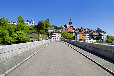
832-328544 - The old Rhine River Bridge connects the German and the Swiss part of the city, Laufenburg, Baden-Wuerttemberg, Germany, Europe
832-319060 - DEU, Federal Republic of Germany : Mobil phone with UMTS technology.
832-319029 - DEU, Federal Republic of Germany : Mobil phone with UMTS technology.
832-319058 - DEU, Federal Republic of Germany : Mobil phone with UMTS technology.
832-319067 - DEU, Federal Republic of Germany : Mobil phone with UMTS technology.
832-319052 - DEU, Federal Republic of Germany : Mobil phone with UMTS technology.
832-319074 - DEU, Federal Republic of Germany : Mobil phone with UMTS technology.
832-319053 - DEU, Federal Republic of Germany : Mobil phone with UMTS technology.
832-319026 - DEU, Federal Republic of Germany : Mobil phone with UMTS technology.
832-319056 - DEU, Federal Republic of Germany : Mobil phone with UMTS technology.
832-314627 - DEU, Federal Republic of Germany : Mobil phone with UMTS technology. |
832-298306 - Flying trunks of the viewing tower of the Gardening Exhibition Voecklabruck 2007, Germany
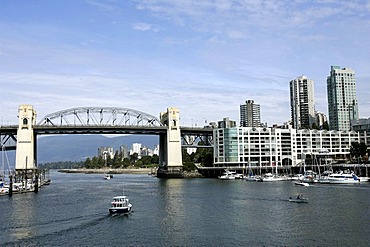
832-290481 - Burrard Street bridge over the English Bay and false creek connects Vancouver downtown with Granville Island, Vancouver, Granville Island, British Columbia, Canada
832-280006 - Highlight Towers, Munich, Upper Bavaria, Bavaria, Germany, Europe
832-273948 - Bridge of Oich, a steel bridge built across the Oich River circa 1854, close to Fort Augustus, belonging to the Caledonian Canal which connects the Atlantic Ocean and the North Sea, Scotland, Great Britain, Europe
832-269599 - Truck driving on an ice road, built by oil companies and used to connect individual oil drilling sites in winter, Prudhoe Bay, Alaska, USA
832-269600 - Truck driving on an ice road, built by oil companies and used to connect individual oil drilling sites in winter, Prudhoe Bay, Alaska, USA
832-261220 - Elevador de Santa Justa, an iron construction in the city centre, has an elevator which connects Baixa and Bairro Alto, historic centre of Lisbon, Lisboa, Portugal, Europe
832-254581 - Mainframe computer, computer center of a company, server connection of individual computer workstations to the server
832-253679 - Panorama of Oresund Bridge between Sweden and Denmark from the Swedish side near Lernacken, Sweden, Europe
832-247871 - Store Belt bridge connects Funen and Zealand, Denmark, Europe
832-247870 - Store Belt bridge connects Funen and Zealand, Denmark, Europe
1161-6374 - Traffic crossing causeway bridge connecting the island of Ile de Re with La Rochelle on the mainland in France
832-188445 - The ferry MF Friedrichshafen connects the two towns of Romanshorn, Switzerland, and Friedrichshafen, Bodenseekreis district, Baden-Wuerttemberg, Germany, Europe
832-188443 - The catamaran Ferdinand connects the two towns of Konstanz and Friedrichshafen, Bodenseekreis district, Baden-Wuerttemberg, Germany, Europe
990-152 - Two Minke whales (Balaenoptera acutorostrata) surfacing as a pair. Whales migrating to the St. Lawrence estuary, Canada, have to share their summer feeding ground with numerous freighters along the international seaway which connects Quebec City with the Atlantic ocean.
832-169064 - Phillip Island Bridge, Victoria, Australia
832-144894 - Pont du Gard, Roman aqueduct, Gard department, Provence, France, Europe
832-144885 - Pont du Gard at dawn, Roman aqueduct, Gard department, Provence, France, Europe
832-144893 - Pont du Gard, Roman aqueduct, Gard department, Provence, France, Europe
832-144892 - Pont du Gard, Roman aqueduct, Gard department, Provence, France, Europe
832-144891 - Pont du Gard, Roman aqueduct, Gard department, Provence, France, Europe
832-144889 - Pont du Gard at dawn, Roman aqueduct, Gard department, Provence, France, Europe
832-144887 - Pont du Gard at dawn, Roman aqueduct, Gard department, Provence, France, Europe
832-144890 - Pont du Gard, Roman aqueduct, Gard department, Provence, France, Europe
832-144899 - Pont du Gard at dawn, Roman aqueduct, Gard department, Provence, France, Europe
832-104483 - The historic wooden bridge over the Rhine was opened in 1816 and connects the German municipality of Gailingen and the Swiss municipality of Diessenhofen, district of Konstanz, Baden-Wuerttemberg, Germany, Europe
832-104542 - The ferry MF Vitte connects Ruegen Island with Hiddensee Island, district of Ruegen, Mecklenburg-Western Pomerania, Germany, Europa
832-113925 - Engine room of the Norrona ferry, which connects Esbjerg in Denmark, Torshavn on the Faroe Islands and Seydisfjoerdur, Seyisfjoerur in Iceland
832-113926 - Norrona ferry, which connects Esbjerg in Denmark, Torshavn on the Faroe Islands and Seydisfjoerdur, Seyisfjoerur in Iceland
832-104482 - The historic wooden bridge over the Rhine was opened in 1816 and connects the German municipality of Gailingen and the Swiss municipality of Diessenhofen, district of Konstanz, Baden-Wuerttemberg, Germany, Europe
832-56961 - Motorbike, Suzuki GSX-R 650 on the Hahntennjoch ridge, which connects the upper Inn valley and the Lech valley, Austria, Europe
1113-67757 - ticket Maglev, ticket, Transrapid, magnetic levitation, Joint, Venture, Siemens, connects Pudong Airport with downtown Shanghai, joint venture, German consortium
1116-29361 - Hawaii, Oahu, Hands around the trunk of a tree.
1116-30823 - Alaska, Aerial of Chugach Mountains and Copper River Delta.
1116-27966 - French Polynesia, Tuamotu Islands, Rangiroa Atoll, Woman lounging on beach, Luxury resort bungalows in background.
1116-27968 - French Polynesia, Tuamotu Islands, Rangiroa Atoll, Woman lounging on beach, Luxury resort bungalows in background, View from behind.
1116-27967 - French Polynesia, Tuamotu Islands, Rangiroa Atoll, Woman lounging on beach, Luxury resort bungalows in background.
1116-28768 - Oahu, Hawaii, Wedding couple smiling at each other, hands in the shape of a heart.
1116-27963 - French Polynesia, Tuamotu Islands, Rangiroa Atoll, Woman on beach near luxury resort.
1116-3126 - Confederation Bridge, Prince Edward Island, Canada
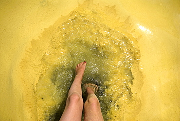
857-70302 - Feet dip in pollen covered lake water, Sebago Lake, Maine.
857-48190 - A crew of workers clears the tracks of the train that connects the Peruvian cities of Huancayo and Huancavelica. During the rainy season, January to March, the route is heavily affected by landslides.
857-27543 - Jaime Herraiz gets ready to connect on a handle pass.
920-674 - Hercilio Luz bridge at night, connects mainland to island of Florianopolis, Santa Catarina, Brazil, South America
911-7152 - The transformer substation that connects all the electric cable from each turbine, before sending the electricity ashore, Walney Offshore Wind Farm, Barrow in Furness, Cumbria, England, United Kingdom, Europe
911-7155 - The transformer substation that connects all the electric cable from each turbine, before sending the electricity ashore, Walney Offshore Wind Farm, Barrow in Furness, Cumbria, England, United Kingdom, Europe
911-7208 - The transformer substation that connects all the electric cable from each turbine, before sending the electricity ashore, Walney Offshore Wind Farm, Barrow in Furness, Cumbria, England, United Kingdom, Europe
911-7150 - The transformer substation that connects all the electric cable from each turbine, before sending the electricity ashore, Walney Offshore Wind Farm, Barrow in Furness, Cumbria, England, United Kingdom, Europe
911-7154 - The transformer substation that connects all the electric cable from each turbine, before sending the electricity ashore, Walney Offshore Wind Farm, Barrow in Furness, Cumbria, England, United Kingdom, Europe
911-7156 - The transformer substation that connects all the electric cable from each turbine, before sending the electricity ashore, Walney Offshore Wind Farm, Barrow in Furness, Cumbria, England, United Kingdom, Europe
752-1872 - Golden Gate Bridge, San Francisco, California, USA
83-7917 - Niagara Falls on the Niagara River that connects Lakes Ontario and Erie, American Falls on the left, and Horseshoe Falls on the right, New York State, United States of America (U.S.A.), North America


