Recent searches
Loading...
832-399139 - Lagotto Romagnolo mountain stream of the Oetschergraeben, bitch, truffle dog, Austria, Europe
832-393315 - Grassland in the Droemling, swans in the drainage ditch, Olor, lowland moor, lowland area, biosphere reserve, nature reserve, Kolonnenweg, Lochplattenweg, inner-German border installation, Gruenes Band, border path, near Oebisfelde, Boerde District
832-393314 - Grassland in the Droemling, drainage ditch, lowland moor, lowland area, biosphere reserve, nature reserve, Kolonnenweg, Lochplattenweg, inner-German border installation, Gruenes Band, border path, near Oebisfelde, Boerde County, Saxony-Anhalt, De
832-393316 - Grassland in the Droemling, drainage ditch, lowland moor, lowland area, biosphere reserve, nature reserve, Kolonnenweg, Lochplattenweg, inner-German border installation, Gruenes Band, border path, near Oebisfelde, Boerde County, Saxony-Anhalt, De
1350-1083 - Nijo castle,UNESCO World Heritage Site,Kyoto, Japan.
860-288929 - Davidson ditch: conduit bringing the water of excavators and prospectors, Steese highway, from Fox to Circle, Alaska
1200-432 - Flooded ditch and frost on coastal grazing marsh, Elmley National Nature Reserve, Isle of Sheppey, Kent, England, United Kingdom, Europe
832-388720 - Rockhopper Penguin (Eudyptes chrysocome), Saunders Island, Falkland Islands, Great Britain, South America. Photo: Matthias Graben, South America
1116-48408 - Arty image of derelict motor car in a ditch overgrown with moss and ferns, Vancouver Island, British Columbia, Canada
1174-6231 - Winding irrigation ditch through rolling hills in rural landscape, Palouse, Washington, USA
1174-6230 - Winding irrigation ditch through rolling hills in rural landscape, Palouse, Washington, USA
1172-5195 - Hirosaki Park Cherry Tree, Aomori Prefecture
832-382431 - Murnau Moor, Murnauer Moos, in front of the mountains Ettaler Mandl and Laber, Upper Bavaria, Bavaria, Germany, Europe
911-10748 - A raised bog being harvested for peat near Douglas water in the Southern Uplands of Scotland. Raised bogs re rare threatened habitats and important carbon sinks that should not be exploited.
1126-1291 - Auschwitz ll Birkenau Concentration Camp, UNESCO World Heritage Site, Brzezinka, Poland, Europe
1126-1290 - Auschwitz ll Birkenau Concentration Camp, UNESCO World Heritage Site, Brzezinka, Poland, Europe
857-86031 - Campers prepare dinner on the North Rim of the Grand Canyon before a hike down into the ditch outside of Fredonia, Arizona November 2011.
1167-342 - Storm approaches, autumn (fall) leaves and drainage ditch with Mormon Row barn, Grand Teton National Park, Wyoming, United States of America, North America
832-277295 - Castle Kurzweil zamek Kratochvile southern Bohemian region Chzech Republic
832-277300 - Castle Kurzweil zamek Kratochvile southern Bohemian region Chzech Republic
832-277406 - Marktbreit upon the river Main Lower Franconia Bavaria Germany painter's corner
832-277294 - Castle Kurzweil zamek Kratochvile southern Bohemian region Chzech Republic
832-277292 - Castle Kurzweil zamek Kratochvile southern Bohemian region Chzech Republic
832-277293 - Castle Kurzweil zamek Kratochvile southern Bohemian region Chzech Republic
832-276492 - Bad Pyrmont Niedersachsen Germany castle Pyrmont museum
817-448375 - D-Paderborn, Pader, Lippe, Alme, Westphalian Lowland, East Westphalia, North Rhine-Westphalia, NRW, D-Paderborn-Schloss Neuhaus, Schloss Neuhaus, Weser renaissance.
1161-2895 - Car forced off the road by flood water sweeping from field to field in Lyneham, Oxfordshire, England, United Kingdom
1161-2897 - Car abandoned in flood in Ascott-Under-Wychwood, The Cotswolds, Oxfordshire, England, UK
1161-2896 - Car forced off the road by flooding in Lyneham, Oxfordshire, England, United Kingdom
817-442180 - Two hikers walking the route alongside Hadrians Wall. While the wall has long since gone, you can see the Vallum (v shape ditch) to the right.
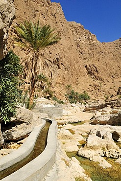
832-179596 - Falaj canal, irrigation system, of Wadi Shab, Hajar ash Sharqi Mountains, Sharqiya Region, Sultanate of Oman, Arabia, Middle East
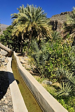
832-179588 - Traditional Falaj canal at Wadi Misfah, Hajar al Gharbi Mountains, Dhakiliya Region, Sultanate of Oman, Arabia, Middle East
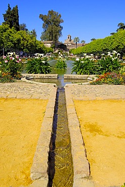
832-165135 - The gardens of Alcazar de los Reyes Cristianos, Alcazar of Catholic Kings, Cordoba, Andalusia, Spain, Europe
817-428124 - Courtyard of ArrayanesCourt of the Myrtles Comares Palace Nazaries palaces Alhambra, Granada Andalusia, Spain
817-427967 - Patio de la Acequia courtyard of irrigation ditch El Generalife La Alhambra Granada Andalusia
817-427970 - Patio de la Acequia courtyard of irrigation ditch El Generalife La Alhambra Granada Andalusia
817-427998 - Patio de la Acequia courtyard of irrigation ditch El Generalife La Alhambra Granada Andalusia
817-427973 - Patio de la Acequia courtyard of irrigation ditch El Generalife La Alhambra Granada Andalusia
817-427989 - Patio de la Acequia courtyard of irrigation ditch El Generalife La Alhambra Granada Andalusia
817-427971 - Patio de la Acequia courtyard of irrigation ditch El Generalife La Alhambra Granada Andalusia
817-427972 - Patio de la Acequia courtyard of irrigation ditch El Generalife La Alhambra Granada Andalusia
817-427969 - Patio de la Acequia courtyard of irrigation ditch El Generalife La Alhambra Granada Andalusia
817-427974 - Colonnade in Patio de la Acequia courtyard of irrigation ditch El Generalife La Alhambra Granada Andalusia
817-427984 - Patio de la Acequia courtyard of irrigation ditch El Generalife La Alhambra Granada Andalusia
817-427968 - Patio de la Acequia courtyard of irrigation ditch El Generalife La Alhambra Granada Andalusia
817-427992 - Patio de la Acequia courtyard of irrigation ditch El Generalife La Alhambra Granada Andalusia
832-99550 - Leitenwaal path, Schluderns, Vinschgau, Val Venosta, South Tyrol, Italy, Europe
817-416317 - Castle of fougeres, Ille et Vilaine, Brittany, France
817-416316 - Castle of fougeres, Ille et Vilaine, Brittany, France
817-413944 - Castle fougeres Ille et Vilaine, Brittany, France
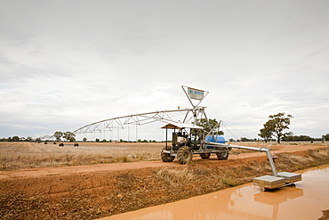
911-5848 - An irrigation ditch near Echuca, Victoria, Australia, Pacific
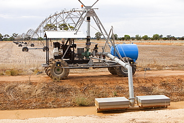
911-5892 - An irrigation ditch near Echuca, Victoria, Australia, Pacific
911-2100 - The Lyth Valley in South Cumbria, Cumbria, England, United Kingdom, Europe
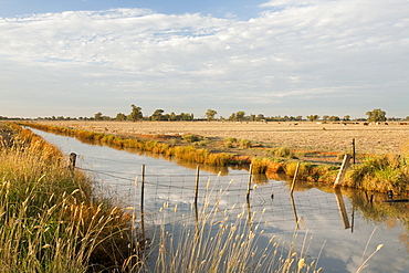
911-5853 - An irrigation ditch near Echuca, Victoria, Australia, Pacific
911-7360 - Drainage ditch in peat bog on Eaglesham Moor, Scotland, United Kingdom, Europe
911-6715 - Boggy moorland above Wet Sleddale with drainage ditches dug into the peat, known as gripping, to try and make the ground more suitable for sheep grazing, Cumbria, England, United Kingdom, Europe
911-5889 - An irrigation ditch near Echuca, Victoria, Australia, Pacific
911-5854 - An irrigation ditch near Echuca, Victoria, Australia, Pacific
911-5211 - A car skidded and crashed on an ice road in Eskdale, Cumbria, England, United Kingdom, Europe
817-350370 - Old reservoirs of fishes in the Certes domain Audenge Arcachon basin Gironde France
817-348173 - `Patio de los Arrayanes', Courtyard of the Myrtles, Comares Palace, Nazaries palaces, Alhambra, Granada, Andalusia, Spain
817-309966 - Manoel Fort stands on the of point of Manoel Island in Marsamxett Harbour Designed as a star fort much of its ditches and walls are formed by the native rock of the island It was built by the Knights of St John between 1723 and 1755 under the patronage. Manoel Fort stands on the of point of Manoel Island in Marsamxett Harbour Designed as a star fort much of its ditches and walls are formed by the native rock of the island It was built by the Knights of St John between 1723 and 1755 under the patronage of the Portuguese Grandmaster of the time, Manoel de Vilhena During the period of the British occupation of Malta, Fort Manoel was utilised by the Royal Navy It suffered considerable damage during the aerial bombing during WW2
817-292759 - Antwerp, architecture, Belgium, Europe, building, buildings, cathedral, church, city, ditch, dusk, EU, European, eve. Antwerp, architecture, Belgium, Europe, building, buildings, cathedral, church, city, ditch, dusk, EU, European, eve
817-283071 - Germany, Ratingen, Anger, Schwarzbach, Bergisches Land, Rhineland, North Rhine-Westphalia, NRW, moated castle Haus zum Haus at the Anger, ditch, Middle Ages
817-283042 - Germany, Ruethen, Haarstrang, nature reserve Arnsberg Forest, Sauerland, Westphalia, North Rhine-Westphalia, NRW, D-Ruethen-Kallenhardt, Glenne, Glenne valley, castle Koertlinghausen, moated castle, castle bridge, ditch, baroque
817-283072 - Germany, Ratingen, Anger, Schwarzbach, Bergisches Land, Rhineland, North Rhine-Westphalia, NRW, moated castle Haus zum Haus at the Anger, ditch, Middle Ages
817-244634 - D-Muenster, Westfalen, Muensterland, Nordrhein-WestfalenW, D-Muenster-Nienberge, Haus Rueschhaus, Graeftenhof, Adelssitz, Herrenhaus, Wasserschloss, Wassergraben, Architekt Johann Conrad Schlaun, Wohnhaus der Dichterin Annette von Droste-Huelshoff, Ba
817-244621 - D-Luedinghausen, Stever, Muensterland, Nordrhein-WestfalenW, Burg Vischering, Wasserburg, Ritterburg, Mittelalter, Muensterlandmuseum, D-Luedinghausen, Stever, Muensterland, North Rhine-WestphaliaW, Vischering Castle, water castle, knights castle,
817-33838 - D-Dortmund, Ruhrgebiet, Nordrhein-Westfalen, D-Dortmund-Bodelschwingh, Schloss Bodelschwingh, Wasserschloss, Wasserburg, Wasserspiegelung, Spiegelbild, Route der Industriekultur, D-Dortmund, Ruhr area, North Rhine-Westphalia, D-Dortmund-Bodelschwingh
817-33841 - D-Castrop-Rauxel, Ruhrgebiet, Nordrhein-Westfalen, D-Castrop-Rauxel-Bladenhorst, Schloss Bladenhorst, Wasserschloss, Torhaus, Schlossbruecke, Spaetrenaissance, Graefte, Route der Industriekultur, D-Castrop-Rauxel, Ruhr area, North Rhine-Westphalia, D
817-33377 - Germany, Hueckelhoven, Rur Valley, Lower Rhine, North Rhine-Westphalia, Hueckelhoven-Ratheim, manor house Hall in Ratheim, moated castle, mirror image, ditch
817-33840 - D-Castrop-Rauxel, Ruhrgebiet, Nordrhein-Westfalen, D-Castrop-Rauxel-Bladenhorst, Schloss Bladenhorst, Wasserschloss, Schlossturm, Spaetrenaissance, Graefte, Route der Industriekultur, D-Castrop-Rauxel, Ruhr area, North Rhine-Westphalia, D-Castrop-Rau
698-1296 - Drinking trough and traditional farmhouse, Tissington, Peak District National Park, Derbyshire, England, United Kingdom, Europe
120-1026 - Two elderly men washing in an irrigation ditch in a village in the Punjab, Pakistan, Asia
225-2987 - Castle at Castle Acre, Norfolk, England, United Kingdom, Europe
You reached the end of search results


