Recent searches
Loading...
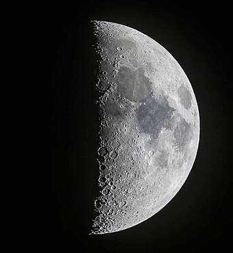
1350-83 - A panorama of the 7-day-old first quarter Moon on March 13, 2019, showing the full disk and extent of incredible detail along the terminator, the dividing line between the day and night sides of the Moon where the Sun is rising as seen from the surface of the Moon. Note the tiny points of light at the centres of some of the craters (particularly Alphonsus and Arzachel below centre) in the Southern Highlands from sunlight just catching the central peaks of those craters. At top in the north the slash of the Alpine Valley is obvious as well as the curve of the Apennine Mountains.
1350-84 - A mosaic of the 11-day-old gibbous Moon, on March 17, 2019, showing the full disk and extent of incredible detail along the terminator, the dividing line between the day and night sides of the Moon where the Sun is rising as seen from the surface of the Moon.
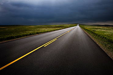
1178-30245 - USA, South Dakota, Badlands National Park, Storm clouds over road in prairie
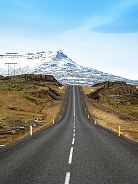
857-95862 - Route 1 (Ring Road) in southern of Iceland in front of snowcapped mountain, Road 1, South Iceland, Iceland
857-95813 - Empty Ring Road highway with black mountain in background, Borgarbyggd, Iceland
857-95808 - Empty Ring Road highway winding across mountain valley, Hringvegur, Iceland
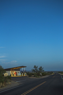
857-93676 - A Vintage Gas Station Glows Beside An Empty Desert Road At Dawn
857-93611 - A Cyclist Rides Over The Top Of A Climb With Snowy Mountains In The Background
1178-25866 - USA, New York State, New York City, Traffic in Lincoln Tunnel
1178-25871 - USA, New Jersey, Jersey City, Traffic in city street
857-92922 - Mother nature displays its colors over the quintessential New England road up to Mount Greylock.
857-88337 - Close up of a red stop sign in Yosemite National Park in California, USA.
1178-10378 - USA, Oregon, Boardman, Rolling landscape with empty road
1178-10456 - USA, Utah, Kanosh, Mid adult man carrying empty canister along empty road
1178-7648 - Mid adult woman carrying empty canister along empty road
1178-6603 - Empty road in diminishing perspective, Marion County, Oregon
1178-4373 - USA, Oregon, Boardman, Rolling landscape with empty road
1178-4372 - USA, Oregon, Boardman, Rolling landscape with empty road
1178-3738 - Cars in traffic jam, USA, New York State, New York City
1178-957 - Autumn landscape, Eastern Sierra California
1178-1687 - Oregon, Florence, Bike lane partially covered in snow, Florence, Oregon
1178-1688 - Oregon, Florence, Bike lane partially covered in snow, Florence, Oregon
1178-922 - Empty road in diminishing perspective, Marion County, Oregon
1188-107 - Cyprus. Abandoned houses along th Green Line in Nicosia dividing the Republic of Cyprus and Turkish controlled northern part. The United Nations Buffer Zone in Cyprus runs for more than 180.5?kilometres (112.2?mi) along what is known as the Green Line and has an area of 346?square kilometres (134?sq?mi). The zone partitions the island of Cyprus into a southern area effectively controlled by the government of the Republic of Cyprus (which is the de jure government for the entire island save for the British Sovereign Base Areas), and the northern area controlled by the Turkish army
1188-333 - Cyprus. Abandoned houses along th Green Line in Nicosia dividing the Republic of Cyprus and Turkish controlled northern part. The United Nations Buffer Zone in Cyprus runs for more than 180.5?kilometres (112.2?mi) along what is known as the Green Line and has an area of 346?square kilometres (134?sq?mi). The zone partitions the island of Cyprus into a southern area effectively controlled by the government of the Republic of Cyprus (which is the de jure government for the entire island save for the British Sovereign Base Areas), and the northern area controlled by the Turkish army
1188-285 - Cyprus. Abandoned houses along th Green Line in Nicosia dividing the Republic of Cyprus and Turkish controlled northern part. The United Nations Buffer Zone in Cyprus runs for more than 180.5?kilometres (112.2?mi) along what is known as the Green Line and has an area of 346?square kilometres (134?sq?mi). The zone partitions the island of Cyprus into a southern area effectively controlled by the government of the Republic of Cyprus (which is the de jure government for the entire island save for the British Sovereign Base Areas), and the northern area controlled by the Turkish army
1188-314 - Cyprus. Abandoned houses along th Green Line in Nicosia dividing the Republic of Cyprus and Turkish controlled northern part.
1188-103 - Cyprus. Abandoned houses along the Green Line in Nicosia dividing the Republic of Cyprus and Turkish controlled northern part
1188-474 - Cyprus. Abandoned houses along th Green Line in Nicosia dividing the Republic of Cyprus and Turkish controlled northern part.
1188-235 - Cyprus.Children play at school near Green Line in Nicosia dividing the Republic of Cyprus and Turkish controlled north
1188-53 - Cyprus.Children play at school near Green Line in Nicosia dividing the Republic of Cyprus and Turkish controlled north
1188-415 - Cyprus.Children play at school near Green Line in Nicosia dividing the Republic of Cyprus and Turkish controlled north
1188-427 - Cyprus.Children play at school near Green Line in Nicosia dividing the Republic of Cyprus and Turkish controlled north
815-594 - Hoover Dam plaque showing the dividing line between Nevada and Arizona states, United States of America, North America
788-15090 - Checkered flag on an information board, Le Mans, France
788-15430 - Road passing through a field, Loire Valley, France
788-15798 - High angle view of musee text written on a board, Le Mans, France
788-15995 - Road passing through a field, Loire Valley, France
788-16210 - Railroad crossing signboard at the roadside, Loire Valley, France
788-16367 - Road passing through a field, Loire Valley, France
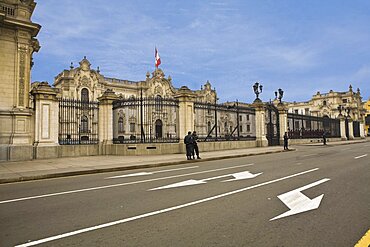
788-14761 - Security guards standing outside a palace, Government Palace, Lima, Peru
788-14749 - Road passing through a landscape, Arequipa-Puno, Peru
788-14690 - Rear view of a man riding a donkey loaded with hay
788-14686 - Road passing through a landscape, Arequipa-Puno, Peru
788-14685 - High angle view of cars moving on a road in front of a palace, Plaza-de-Armas, Arequipa, Peru
788-12567 - Bus on the road, Diamond Head, Waikiki Beach, Honolulu, Oahu, Hawaii Islands, USA
788-12324 - Road passing through a landscape, Honaunau, Kona Coast, Big Island, Hawaii Islands, USA
788-12300 - Traffic on the road with skyscrapers in the background, Honolulu, Oahu, Hawaii Islands, USA
788-12019 - Cars parked in front of a museum, Petit Palais, Paris, France
788-10790 - Contour plowed fields of golden wheat, Washington state
788-5286 - Facade of the National Archives Building, Washington DC, USA, Washington DC, USA
788-5283 - Low angle view of buildings on the roadside, Romanesque, Downtown, Washington DC, USA
788-8426 - Train moving on tracks along a road, Longfellow Bridge, Boston, Massachusetts, USA
788-8676 - Buildings along a road, M street, Georgetown, Washington DC, USA
788-9400 - Buildings along a road, M street, Georgetown, Washington DC, USA
788-9800 - Church on a road, San Francisco, California, USA
788-9947 - Low angle view of buildings, San Francisco, California, USA
788-366 - Buildings along the road side, Air and Space Museum, Washington DC, USA
788-3512 - Rainbow over buildings, Adare, Republic of Ireland
788-1337 - Hotel lit up at night, Hotel D'angleterre, Copenhagen, Denmark
788-1335 - Aerial view of buildings in a city lit up at night, Tivoli Gardens, Copenhagen, Denmark
788-9734 - High angle view of a bridge, Golden Gate Bridge, San Francisco, California, USA
788-10043 - High angle view of a bridge, Golden Gate Bridge, San Francisco, California, USA
752-1786 - High angle view of a road passing through a forest, Columbia River Highway, Rowena, Oregon, USA
752-1785 - High angle view of a road passing through a forest, Columbia River Highway, Rowena, Oregon, USA
752-1725 - Highway passing through an arid landscape, Monument Valley Tribal Park, Arizona, USA
