Recent searches
Loading...
83-11802 - The unusually eroded sandstone of Checkerboard Mesa in the 'sliprock country' landscape by the Zion-M.Carmel highway in the South Eeast of this stunning national park, Zion National Park, Utah, Usa
832-302898 - Dried-up Utah Juniper (Juniperus osteosperma) in the desert in front of sandstone mountains, eroded landscape along the Paria River, setting of many classic westerns, Grand Staircase Escalante National Monument, Utah, USA, North America
832-302897 - Sign marking a wilderness research area in the desert in front of sandstone mountains, eroded landscape along the Paria River, setting of many classic westerns, Grand Staircase Escalante National Monument, Utah, USA, North America
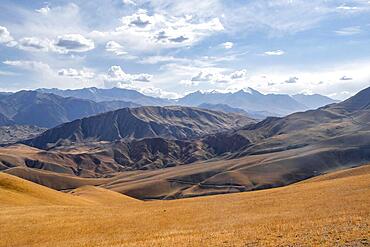
832-404010 - View over eroded mountainous landscape with brown hills, mountains and steppe, Chuy province, Kyrgyzstan, Asia
832-404012 - View over eroded mountainous landscape with brown hills, mountains and steppe, Chuy province, Kyrgyzstan, Asia
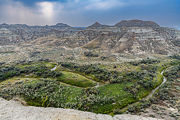
1184-9285 - Eroded landscape in the Dinosaur Provincial Park, UNESCO World Heritage Site, Alberta, Canada, North America
832-404011 - View over eroded mountainous landscape with brown hills, mountains and steppe, Chuy province, Kyrgyzstan, Asia
1184-9279 - Eroded landscape in the Dinosaur Provincial Park, UNESCO World Heritage Site, Alberta, Canada, North America
1184-9280 - Eroded landscape in the Dinosaur Provincial Park, UNESCO World Heritage Site, Alberta, Canada, North America
1184-9281 - Eroded landscape in the Dinosaur Provincial Park, UNESCO World Heritage Site, Alberta, Canada, North America
1184-9282 - Eroded landscape in the Dinosaur Provincial Park, UNESCO World Heritage Site, Alberta, Canada, North America
1184-9283 - Eroded landscape in the Dinosaur Provincial Park, UNESCO World Heritage Site, Alberta, Canada, North America
1184-9284 - Eroded landscape in the Dinosaur Provincial Park, UNESCO World Heritage Site, Alberta, Canada, North America
1184-9287 - Eroded landscape in the Dinosaur Provincial Park, UNESCO World Heritage Site, Alberta, Canada, North America
1184-9288 - Eroded landscape in the Dinosaur Provincial Park, UNESCO World Heritage Site, Alberta, Canada, North America
1184-8532 - Colourfully painted Buddhist stupa in front of mountain landscape, eroded landscape and houses of Garphu behind, Garphu, Kingdom of Mustang, Himalayas, Nepal, Asia
1184-8570 - Colourfully painted Buddhist stupa, in an eroded mountain landscape, Kingdom of Mustang, Himalayas, Nepal, Asia
1184-8569 - Eroded mountain landscape in the Kingdom of Mustang, Himalayas, Nepal, Asia
832-302899 - Dried-up Utah Juniper (Juniperus osteosperma) in the desert in front of sandstone mountains, eroded landscape along the Paria River, setting of many classic westerns, Grand Staircase Escalante National Monument, Utah, USA, North America
83-11924 - The eroded sandstone landscape of Monument Valley Tribal Park, a Navajo Nation reservation on the border with Utah, its scenery immortalised in many Western films, Monument Valley, Arizona, United States of America (USA), North America
832-385400 - Canyon landscape, eroded rocky landscape of the Grand Canyon, South Rim, Grand Canyon National Park, Arizona, USA, North America
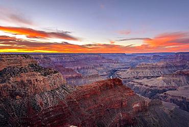
832-384098 - Gorge of the Grand Canyon at sunset, Colorado River, view from Hopi Point, eroded rock landscape, South Rim, Grand Canyon National Park, near Tusayan, Arizona, USA, North America
83-11773 - 306ft 'Landscape Arch', Arches National Park, Utah, Usa306ft 'Landscape Arch', the longest such landform in this spectacular park of eroded formations, including over 2000 arches
832-154372 - Eroded landscape around the volcano Ol Doinyo Lengai, 2960 m, Tanzania, Africa
83-11772 - 306ft 'Landscape Arch', Arches National Park, Utah, Usa306ft 'Landscape Arch', the longest such landform in this spectacular park of eroded formations, including over 2000 arches
641-5271 - Eroded landscape surrounding Goreme, Cappadocia, Anatolia, Turkey, Asia Minor, Asia
832-384097 - Gorge of the Grand Canyon at sunset, view from Hopi Point, eroded rock landscape, South Rim, Grand Canyon National Park, near Tusayan, Arizona, USA, North America
817-34663 - The hot-air balloon above eroded landscape at the edge of the Namib Desert, Namib-Naukluft Park, Namibia.
1178-17803 - Eroded tree, landscape in background, USA, Utah, Bryce Canyon
756-491 - Moon Land eroded cliffs, Lamayuru, Ladakh, Indian Himalayas, India, Asia
767-33 - Stone Spires, Rio Arriba County, New Mexico, United States of America, North America
94-1911 - Eroded mountains of the Valley of the Moon in the San Pedro de Atacama, Chile, South America
586-1340 - Soca River with clear emerald water flowing between eroded rocks in Trenta Valley in summer, Triglav National Park, Julian Alps, Slovenia, Europe
748-593 - Remarkable Rocks, Flinders Chase National Park, Kangaroo Island, South Australia, Australia, Pacific
252-9898 - The Pinnacle Desert, Nambung National Park near Perth, Western Australia
29-1295 - Anchored cliff wall, coast stabilisation, Sandown, Isle of Wight, England, United Kingdom, Europe
465-1145 - The Seven Colours mountain at Purmamaca near Tilcara in Argentina, South America
110-10144 - Rock arches known as the Faraglioni Stacks off the coast of the island of Capri, Campania, Italy, Europe
126-420 - Rice fields and terracing in a valley in the Shahrak region, Iran, Middle East
132-13 - Limestone pavement, Malham Cove, Malham, Yorkshire Dales National Park, North Yorkshire, England, United Kingdom, Europe
136-887 - The deep gorge of the Colorado River on the west rim of the Grand Canyon, UNESCO World Heritage Site, Arizona, United States of America, North America
390-1273 - Pinnacles and rock formations known as The Silent City, seen from Inspiration Point, with snow on the ground, in the Bryce Canyon National Park, Utah, United States of America, North America
390-892 - The Pont d'Arc, a natural rock arch over the Ardeche River, in the Ardeche Gorges, in the Ardeche region of the Rhone Alpes, France, Europe
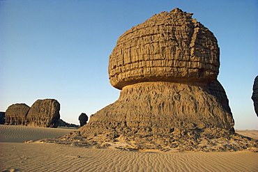
6-2352 - Wind eroded pinnacle rock showing strata, Tamegaout, Algeria, North Africa, Africa
478-482 - Durdle Door, near Lulworth, Dorset, England, UK, Europe
252-3011 - Rock formation in Canyonlands National Park, Utah, United States of America, North America
252-3110 - The moon above the rock formations known as The Mittens in the Navajo Reservation in Monument Valley, Utah, United States of America, North America
718-1197 - Praia do Camilo (Camilo beach) and coastline, Lagos, western Algarve, Algarve, Portugal, Europe
832-387613 - Puente del Inca, rock arch and old thermal bath of the sulphur spring above the Rio de las Cuevas, near Uspallata, Mendoza Province, Argentina, South America
136-15 - The Grand Canyon at sunset from the South Rim, UNESCO World Heritage Site, Arizona, United States of America, North America
149-5409 - Ilheus da Ribeira da Janela, (islands of the window river) off the north coast, near Ribeira da Janela, Madeira, Portugal, Atlantic, Europe
252-6203 - Panorma of eroded rock formations, The Pinnacle Desert, Nambung National Park, near Perth, Western Australia, Australia, Pacific
615-673 - Rock formations, Cappadocia, Anatolia, Turkey, Asia Minor, Asia
83-8063 - Part of the North Unit of Badlands National Park, carved out of the prairies by rapid water erosion of sediments, South Dakota, United States of America, North America
777-834 - Ballywalter Pier, Ards Peninsula, County Down, Ulster, Northern Ireland, United Kingdom, Europe
832-374822 - "Weird Rock", also "Dali Rock" or "The Tower", Brain Rocks of the Coyote Buttes South CBS, Cottonwood Teepees, eroded Navajo sandstone rocks with Liesegang bands or Liesegang rings, Pareah Paria Plateau, Vermilion Cliffs National Monument, Arizona, Utah,
832-371873 - Antelope Canyon, Page, Arizona, United States, EXCLUSIVE USAGE RESERVATION: TOURISM, ONLINE CATALOUGE, GLR, UNTILL MAY, 31ST 2013
83-12030 - Sea stacks and dramatic limestone cliffs at The Twelve Apostles, Port Campbell National Park, Great Ocean Road, Victoria, Australia, Pacific
83-12031 - Sea stacks and dramatic limestone cliffs at The Twelve Apostles, Port Campbell National Park, Great Ocean Road, Victoria, Australia, Pacific
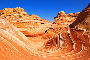
832-375669 - The Wave, rock formation in Coyote Buttes North, Paria Canyon-Vermilion Cliffs Wilderness, Utah, Arizona, USA
29-4725 - Arbol de Piedra, wind eroded rock near Laguna Colorada, Southwest Highlands, Bolivia, South America
832-374802 - Panoramic view, view at sunset from Alstrom Point to Lake Powell, Padre Bay with Gunsight Butte and Navajo Mountain, Bigwater, Glen Canyon National Recreation Area, Arizona, Southwestern USA, Utah, USA
832-374812 - The Wave, banded eroded Navajo sandstone rocks with Liesegang bands or Liesegang rings, North Coyote Buttes, CBN, Pareah Paria Canyon, Vermilion Cliffs National Monument, Arizona, Utah, Southwestern USA, USA
832-374793 - Lollipop Rock, Brain Rocks at White Pocket, eroded Navajo sandstone rocks with Liesegang bands or Liesegang rings, Pareah Paria Plateau, Vermillion Cliffs National Monument, Arizona, Utah, Southwestern USA, USA
832-371880 - Photographer Norbert Eisele-Hein at Spectra Point, Cedar Breaks National Monument, Dixie National Forest, Brian Head, Utah, USA
832-374727 - Tourist in The Wave, banded eroded Navajo sandstone rocks with Liesegang Bands, Liesegangen Rings, or Liesegang Rings, North Coyote Buttes, Paria Canyon, Vermillion Cliffs National Monument, Arizona, Utah, USA
832-374803 - Panoramic view, view at sunrise from Alstrom Point to Lake Powell, Padre Bay with Gunsight Butte and Navajo Mountain, Bigwater, Glen Canyon National Recreation Area, Arizona, Southwestern USA, Utah, USA
832-374797 - Panoramic view, Brain Rocks of the Coyote Buttes South CBS, Cottonwood Teepees, eroded Navajo sandstone rock formations with Liesegang bands or Liesegang rings, Pareah Paria Plateau, Vermilion Cliffs National Monument, Arizona, Utah, Southwestern USA
832-374789 - Teepees of the Paw Hole, eroded Navajo sandstone rocks at the entrance to the South Coyote Buttes, Pareah Paria Plateau, Vermillion Cliffs National Monument, Arizona, Utah, Southwestern USA, USA
832-374809 - The Wave, banded eroded Navajo sandstone rocks with Liesegang bands or Liesegang rings, North Coyote Buttes, CBN, Pareah Paria Canyon, Vermilion Cliffs National Monument, Arizona, Utah, Southwestern USA, USA
29-4623 - Wave-cut arch in limestone headland, Durdle Door, Jurassic Heritage Coast, UNESCO World Heritage Site, Isle of Purbeck, Dorset, England, United Kingdom, Europe
29-4635 - Wave-cut platform, and chalk cliffs, Flamborough South Landing, Yorkshire, England, United Kingdom, Europe
832-374813 - The Wave, banded eroded Navajo sandstone rocks with Liesegang bands or Liesegang rings, North Coyote Buttes, CBN, Pareah Paria Canyon, Vermilion Cliffs National Monument, Arizona, Utah, Southwestern USA, USA
832-374811 - The Wave, banded eroded Navajo sandstone rocks with Liesegang bands or Liesegang rings, North Coyote Buttes, CBN, Pareah Paria Canyon, Vermilion Cliffs National Monument, Arizona, Utah, Southwestern USA, USA
832-369665 - Tourists at Saklikent Gorge near Tlos and Fethiye, Lycian coast, Lycia, Mediterranean, Turkey, Asia Minor
485-8887 - Rough Tor Rocks, Bodmin Moor, near Camelford, Cornwall, England, United Kingdom, Europe
312-1908 - One of the crater lakes at Band-E-Amir (Dam of the King), Afghanistan's first National Park set up in 1973 to protect the five lakes, believed by locals to have been created by the Prophet Mohammed's son-in-law Ali, making them a place of pilgrimage, Afghanistan, Asia
29-3121 - Sedimentary rocks, clay, colour banded by iron oxides, horizontal Triassic Chinle Clay, Blue Mesa, Painted Desert, Arizona, United States of America, North America
312-2060 - Band-I-Zulfiqar the main lake, Band-E- Amir (Bandi-Amir) (Dam of the King) crater lakes, Afghanistan's first National Park, Bamian province, Afghanistan, Asia
748-221 - Antelope Canyon, a slot canyon, Upper Canyon, Page, Utah, United States of America, North America
149-5277 - A view of the Trypitos Arch on the south coast of Paxos, Ionian Islands, Greek Islands, Greece, Europe
772-1034 - Sunrise, Mesa Arch, Canyonlands National Park, Utah, United States of America, North America
770-160 - Limestone pavements near Chapel-le-Dale, Yorkshire Dales, National Park, Yorkshire, England, United Kingdom, Europe
770-169 - Buttertubs potholes, karstic erosion at Buttertubs Pass, between Wensleydale and Swaledale, Yorkshire Dales National Park, Yorkshire, England, United Kingdom, Europe
770-296 - Sunset at Eshaness basalt cliffs, with Moo Stack on left, and deeply eroded coast with caves, blowholes and stacks, Northmavine, Shetland Islands, Scotland, United Kingdom, Europe
733-2056 - Sunrise on North Arch and Tower Arch in the Windows section of Arches National Park, Utah, United States of America, North America
770-714 - Duncansby Head sea stacks, north-east tip of Scotland, Caithness, Highland region, Scotland, United Kingdom, Europe
770-725 - Sea stacks at Duncansby Head, near John O'Groats, north-west tip of Scotland, Caithness, Scotland, United Kingdom, Europe
741-2475 - Uluru (Ayers Rock), Uluru-Kata Tjuta National Park, UNESCO World Heritage Site, with the Olgas in the distance, Northern Territory, Australia, Pacific
557-2155 - Archaeological site of Qumran where Dead Sea scrolls discovered in caves in cliffs, Judean Desert, Israel, Middle East
667-2284 - Rock strata in cliffs in Paria River Valley, Grand Staircase-Escalante National Monument, near Page, Arizona, United States of America, North America
748-1167 - Remarkable Rocks, Flinders Chase National Park, Kangaroo Island, South Australia, Australia, Pacific
110-4394 - Gully erosion, Kauai, Hawaii, United States of America, Pacific, North America
485-5316 - Gordale Scar, Yorkshire Dales National Park, North Yorkshire, England, United Kingdom, Europe
485-5320 - Limestone pavement, Malham, Yorkshire Dales National Park, North Yorkshire, Yorkshire, England, United Kingdom, Europe
797-105 - BURKINA FASO Environment Flooding Bund low rock walls built to prevent soil erosion by flash floods. Stones are placed along the contours on gentle slopes. Sometimes the bunds are reinforced by planting tough grasses along the lines. The stones and grass encourage rain water to infiltrate the soil and reduce the amount of rain water that is lost by run-off. Any soil that has been eroded by run-off is trapped by the bund. Topsoil and organic matter e.g. leaf litter is deposited here.Bunds are placed 10 to 25 metres apart African Western Africa Ecology Entorno Environmental Environnement Green Issues
857-95701 - Landscape with Ayers Rock (Uluru) at sunset, Uluru, Northern Territory, Australia
832-291025 - Rock formations in El Ghessour, Tassili du Hoggar, Wilaya Tamanrasset, Sahara Desert, Algeria, North Africa
832-291034 - Rock window, rock formations at Youf Ahakit, Tassili du Hoggar, Wilaya Tamanrasset, Sahara Desert, Algeria, North Africa
832-291009 - Eroded rock formations rising out of desert sand dunes, ripples in Tin Akachaker, Tassili du Hoggar, Wilaya Tamanrasset, Sahara Desert, Algeria, North Africa


