Recent searches
Loading...
1373-346 - Detail of St. Peter's Square Doric colonnades, framing the entrance to the basilica and the elliptical area which precedes Saint Peter's Basilica in Vatican City, the papal enclave in Rome, showcasing intricate design elements and structural features.
1373-345 - Detail of St. Peter's Square Doric colonnades, framing the entrance to the basilica and the elliptical area which precedes Saint Peter's Basilica in Vatican City, the papal enclave in Rome, showcasing intricate design elements and structural features.
1373-343 - Detail of St. Peter's Square Doric colonnades, framing the entrance to the basilica and the elliptical area which precedes Saint Peter's Basilica in Vatican City, the papal enclave in Rome, showcasing intricate design elements and structural features.
1375-3 - Old buildings, recreations of the old structures around Dubai Creek, feature wind towers, in the Bastakia quarter, Dubai, United Arab Emirates, Middle East
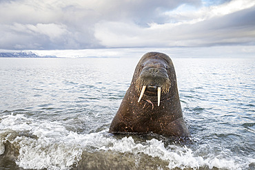
860-291893 - Atlantic walrus (Odobenus rosmarus) with its most prominent feature the long tusks, coming close to check the photographer, Spitsbergen, Svalbard, Norwegian archipelago, Norway, Arctic Ocean
832-403619 - Close up african girl covering her face
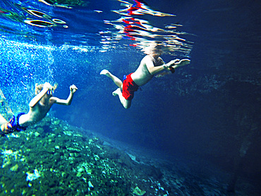
1350-6633 - Gran Cenote de Tulum in Yucatan Peninsula, Quintana Roo, Mexico. There are thousands of cenotes dotted all over Mexico���s Yucatan Peninsula, and their existence is as much a defining characteristic of the region as is the distinct geological feature from which they result. Once revered by the ancient Mayans as sacred wells, they are now magnets for tourists, adventurers, and explorers alike.
1306-1208 - Exchange Square and water feature in Manchester city centre, Manchester, England, United Kingdom, Europe
1350-6288 - Giant goose-neck barnacle (Pollicipes polymerus) in the rare "red-lips" variant, found in the turbulent waters of the Nakwakto Rapids (Seymour Inlet, BC, Canada), known to feature the strongest currents in the world.
1350-4697 - Strokkur geyser erupting, in the Geysir hot springs area, Haukadalur geothermal area, Southwest Iceland
1350-4951 - Strokkur geyser erupting, in the Geysir hot springs area, Haukadalur geothermal area, Southwest Iceland
832-395045 - Gateaux a la Broche, local speciality pastry, Argeles-Gazost, Hautes-Pyrenees, La Vallee des Gaves, Pyrenees, Occitanie region, France, Europe
832-393900 - French caramel cream in glass and yeast plait, Brittany, France, Europe
832-393901 - French caramel cream in glass and yeast plait, Brittany, France, Europe
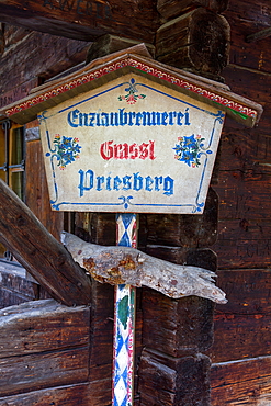
1113-106335 - Enzianstechen at the Priesberghütte, Berchtesgadener Land, Upper Bavaria, Bavaria, Germany
832-393423 - Historical photograph from 1956 of the Hoehenpark Killesberg, water features and exhibition hall, Stuttgart, Baden-Wuerttemberg, Germany, Europe
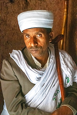
1350-2874 - Portrait of a man inside the rock hewn monolithic church of Bet Giyorgis (Church of St. George) in Lalibela, Ethiopia
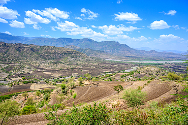
1350-2836 - A view down into the beautiful and fertile valleys near Debre Berhan, Ethiopia.
1350-2824 - Fields laying below the mountains near Debre Berhan, Ethiopia
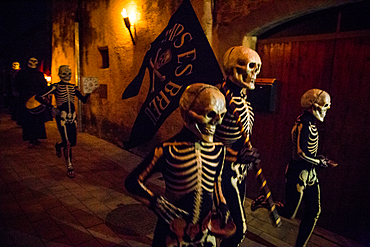
1350-2688 - Verges, a small town in the Northeast of Catalonia (Spain), during Easter celebrates the Procession of Verges with skeletons dancing on the sound of a drum, Roman soldiers, known as the 'Manages', and a representation of the life and crucifixion of Jesus Christ. The Procession features the Dance of Death, a tradition from the Middle Age associated with epidemics and plagues and the only one remaining in Spain Ten skeletons dance to the beat of a drum to remember that no one is exempt of death. The backdrop of the medieval walls and towers of Verges is key to this macabre staging.
1350-2831 - The rolling hillsides of Debre Berhan, Ethiopia.
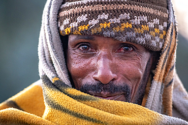
1350-2869 - Portrait of an Ethiopian woman outside of the rock hewn monolithic church of Bet Maryam (Church of St. Mary) in Lalibela, Ethiopia
1350-2693 - Verges, a small town in the Northeast of Catalonia (Spain), during Easter celebrates the Procession of Verges with skeletons dancing on the sound of a drum, Roman soldiers, known as the 'Manages', and a representation of the life and crucifixion of Jesus Christ. The Procession features the Dance of Death, a tradition from the Middle Age associated with epidemics and plagues and the only one remaining in Spain Ten skeletons dance to the beat of a drum to remember that no one is exempt of death. The backdrop of the medieval walls and towers of Verges is key to this macabre staging.
1350-2833 - A young woman poses outside of her house for a photograph, Debre Berhan, Ethiopia.
1350-2692 - Verges, a small town in the Northeast of Catalonia (Spain), during Easter celebrates the Procession of Verges with skeletons dancing on the sound of a drum, Roman soldiers, known as the 'Manages', and a representation of the life and crucifixion of Jesus Christ. The Procession features the Dance of Death, a tradition from the Middle Age associated with epidemics and plagues and the only one remaining in Spain Ten skeletons dance to the beat of a drum to remember that no one is exempt of death. The backdrop of the medieval walls and towers of Verges is key to this macabre staging.
1350-2695 - Verges, a small town in the Northeast of Catalonia (Spain), during Easter celebrates the Procession of Verges with skeletons dancing on the sound of a drum, Roman soldiers, known as the 'Manages', and a representation of the life and crucifixion of Jesus Christ. The Procession features the Dance of Death, a tradition from the Middle Age associated with epidemics and plagues and the only one remaining in Spain Ten skeletons dance to the beat of a drum to remember that no one is exempt of death. The backdrop of the medieval walls and towers of Verges is key to this macabre staging.
1350-2843 - Fields for farming purposes near Debre Berhan, Ethiopia
1350-2690 - Verges, a small town in the Northeast of Catalonia (Spain), during Easter celebrates the Procession of Verges with skeletons dancing on the sound of a drum, Roman soldiers, known as the 'Manages', and a representation of the life and crucifixion of Jesus Christ. The Procession features the Dance of Death, a tradition from the Middle Age associated with epidemics and plagues and the only one remaining in Spain Ten skeletons dance to the beat of a drum to remember that no one is exempt of death. The backdrop of the medieval walls and towers of Verges is key to this macabre staging.
1350-2830 - The sun setting over the mountains and valleys of Debre Berhan, Ethiopia.
1350-2691 - Verges, a small town in the Northeast of Catalonia (Spain), during Easter celebrates the Procession of Verges with skeletons dancing on the sound of a drum, Roman soldiers, known as the 'Manages', and a representation of the life and crucifixion of Jesus Christ. The Procession features the Dance of Death, a tradition from the Middle Age associated with epidemics and plagues and the only one remaining in Spain Ten skeletons dance to the beat of a drum to remember that no one is exempt of death. The backdrop of the medieval walls and towers of Verges is key to this macabre staging.
1350-2687 - Verges, a small town in the Northeast of Catalonia (Spain), during Easter celebrates the Procession of Verges with skeletons dancing on the sound of a drum, Roman soldiers, known as the 'Manages', and a representation of the life and crucifixion of Jesus Christ. The Procession features the Dance of Death, a tradition from the Middle Age associated with epidemics and plagues and the only one remaining in Spain Ten skeletons dance to the beat of a drum to remember that no one is exempt of death. The backdrop of the medieval walls and towers of Verges is key to this macabre staging.
1350-2689 - Verges, a small town in the Northeast of Catalonia (Spain), during Easter celebrates the Procession of Verges with skeletons dancing on the sound of a drum, Roman soldiers, known as the 'Manages', and a representation of the life and crucifixion of Jesus Christ. The Procession features the Dance of Death, a tradition from the Middle Age associated with epidemics and plagues and the only one remaining in Spain Ten skeletons dance to the beat of a drum to remember that no one is exempt of death. The backdrop of the medieval walls and towers of Verges is key to this macabre staging.
1350-2696 - Verges, a small town in the Northeast of Catalonia (Spain), during Easter celebrates the Procession of Verges with skeletons dancing on the sound of a drum, Roman soldiers, known as the 'Manages', and a representation of the life and crucifixion of Jesus Christ. The Procession features the Dance of Death, a tradition from the Middle Age associated with epidemics and plagues and the only one remaining in Spain Ten skeletons dance to the beat of a drum to remember that no one is exempt of death. The backdrop of the medieval walls and towers of Verges is key to this macabre staging.
1350-2832 - The rolling hillsides of Debre Berhan, Ethiopia.
1350-2697 - Verges, a small town in the Northeast of Catalonia (Spain), during Easter celebrates the Procession of Verges with skeletons dancing on the sound of a drum, Roman soldiers, known as the 'Manages', and a representation of the life and crucifixion of Jesus Christ. The Procession features the Dance of Death, a tradition from the Middle Age associated with epidemics and plagues and the only one remaining in Spain Ten skeletons dance to the beat of a drum to remember that no one is exempt of death. The backdrop of the medieval walls and towers of Verges is key to this macabre staging.
1350-2694 - Verges, a small town in the Northeast of Catalonia (Spain), during Easter celebrates the Procession of Verges with skeletons dancing on the sound of a drum, Roman soldiers, known as the 'Manages', and a representation of the life and crucifixion of Jesus Christ. The Procession features the Dance of Death, a tradition from the Middle Age associated with epidemics and plagues and the only one remaining in Spain Ten skeletons dance to the beat of a drum to remember that no one is exempt of death. The backdrop of the medieval walls and towers of Verges is key to this macabre staging.
1350-2873 - A pair of young men in shawls inside of Bet Giyorgis (Church of St. George) in Lalibela, Ethiopia
1350-2863 - Portrait of an Ethiopian woman outside of Bet Medhane Alem (Church of the World Savior) in Lalibela, Ethiopia
1349-926 - Saturn's Moon, Titan, Circular Feature at Xanadu
1350-43 - The 13.7-day-old Moon (a day before Full) with the south polar region tipped toward us in a favourable libration for viewing the southern regions and features. This was April 6, 2020. The large crater, Bailly, is on the southern limb, better seen here than at most similar phases, due to the favourable southern libration.
1350-44 - The 13.7-day-old Moon (a day before Full) with the south polar region tipped toward us in a favourable libration for viewing the southern regions and features. This was April 6, 2020. The large crater, Bailly, is on the southern limb, better seen here than at most similar phases, due to the favourable southern libration.
1350-48 - The 6.5-day-old Moon (approximately) with the Lunar X (below centre) and V (above centre) formations well lit on the terminator. This phase has an incredible amount of detail and variety of features visible along the terminator.
1350-46 - The 6.5-day-old Moon (approximately) with the Lunar X (below centre) and V (above centre) formations well lit on the terminator. This phase has an incredible amount of detail and variety of features visible along the terminator.
1335-120 - Snowscape of reflection of sky in thermal feature, Yellowstone National Park, UNESCO World Heritage Site, Wyoming, United States of America, North America
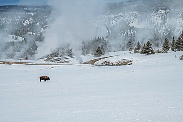
1335-135 - Lone American bison with steaming thermal features in the snow, Yellowstone National Park, UNESCO World Heritage Site, Wyoming, United States of America, North America
1335-124 - Lone American bison with steaming thermal features in the snow, Yellowstone National Park, UNESCO World Heritage Site, Wyoming, United States of America, North America
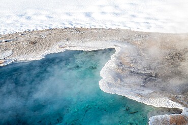
1335-116 - Blue thermal feature shrouded in fog, Yellowstone National Park, UNESCO World Heritage Site, Wyoming, United States of America, North America
1335-128 - Trees reflected in thermal feature in the snow, Yellowstone National Park, UNESCO World Heritage Site, Wyoming, United States of America, North America
1335-138 - Blue thermal feature in the fog and snow, Yellowstone National Park, UNESCO World Heritage Site, Wyoming, United States of America, North America
1335-121 - Snowscape of thermal feature with reflection, Yellowstone National Park, UNESCO World Heritage Site, Wyoming, United States of America, North America
1335-123 - Bright blue thermal feature in snow, Yellowstone National Park, UNESCO World Heritage Site, Wyoming, United States of America, North America
832-389753 - Meat sausages and skin with mustard, grilled, with cleaver, Switzerland, Europe
832-389516 - Vaudois grill snail, roasted, bratwurst, Switzerland, Europe
1202-330 - Granite boulders, a typical feature of the Isles of Scilly, seen along the shore in Pentle Bay, on the island of Tresco, Isles of Scilly, England, United Kingdom, Europe
1116-49017 - Female athlete navigating a slot canyon water feature, Hanksville, Utah, United States of America
1306-684 - Piazza della Rotunda and water feature near Pantheon, Rome, Lazio, Italy, Europe
1178-28769 - Norway, Senja, Panoramic view of Segla mountain at sunrise
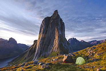
1178-28767 - Norway, Senja, Two tents near Segla mountain at sunset
1178-28768 - Norway, Senja, Man and two tents near Segla mountain at sunset
1178-28778 - Norway, Senja, Norwegian flag with fjord and mountains in background
1306-640 - Arch feature at Krakow Glowny the Old Main Railway Station in Krakow, Poland, Europe
1314-182 - Emu (Dromaius novaehollandiae), cultural icon of Australia, the bird features prominently in Indigenous Australian mythology, Northern Territory, Australia, Pacific
1314-183 - Front view of details of Emu (Dromaius novaehollandiae), a bird that features prominently in Indigenous Australian mythology, Northern Territory, Australia, Pacific
1202-189 - Granite boulders and a wind-gnarled hawthorn tree on Bench Tor, a typical landscape feature of Dartmoor National Park, Devon, England, United Kingdom, Europe
1202-190 - A massive granite boulder on Bench Tor, one of the classic features of Dartmoor National Park's landscape, Devon, England, United Kingdom, Europe
1116-46156 - Husky Sled Dog With Different Coloured Eyes, The Laurentians, Quebec, Canada
1116-44671 - A Family Enjoys An Afternoon In The Pool On A Sunny Afternoon, Fountain Valley, California, United States Of America
1306-280 - Water feature and architecture at night of luxury hotel, Saadiyat island, Abu Dhabi, United Arab Emirates, Middle East
857-95869 - Young woman hiker traversing alone massive sandstone features of Grand Canyons North Rim, Grand Canyon, Arizona, USA
1116-39778 - Magen David Synagogue, built in 1864. This sizeable Jewish Synagogue features two schools open to children on all faiths, Mumbai, Maharashtra, India
857-94717 - Nimoa Island - here the island mission will impress. The five-sided church features murals of island life and all mission buildings are surrounded by well maintained paths and gardens filled with flowering plants. Edged by jungle-covered mountains, postcard beaches and crystal clear waters - an island paradise indeed! The Louisiade Archipelago is a string of ten larger volcanic islands frequently fringed by coral reefs, and 90 smaller coral islands located 200 km southeast of New Guinea, stretching over more than 160 km and spread over an ocean area of 26,000 km? between the Solomon Sea to the north and the Coral Sea to the south. The aggregate land area of the islands is about 1,790 km? (690 square miles), with Vanatinai (formerly Sudest or Tagula as named by European claimants on Western maps) being the largest. Sideia Island and Basilaki Island lie closest to New Guinea, while Misima, Vanatinai, and Rossel islands lie further east. The archipelago is divided into the Local Level Government (LLG) areas Loui!
857-94720 - Nimoa Island - here the island mission will impress. The five-sided church features murals of island life and all mission buildings are surrounded by well maintained paths and gardens filled with flowering plants. Edged by jungle-covered mountains, postcard beaches and crystal clear waters - an island paradise indeed! The Louisiade Archipelago is a string of ten larger volcanic islands frequently fringed by coral reefs, and 90 smaller coral islands located 200 km southeast of New Guinea, stretching over more than 160 km and spread over an ocean area of 26,000 km? between the Solomon Sea to the north and the Coral Sea to the south. The aggregate land area of the islands is about 1,790 km? (690 square miles), with Vanatinai (formerly Sudest or Tagula as named by European claimants on Western maps) being the largest. Sideia Island and Basilaki Island lie closest to New Guinea, while Misima, Vanatinai, and Rossel islands lie further east. The archipelago is divided into the Local Level Government (LLG) areas Louisiade Rural (western part, with Misima), and Yaleyamba (western part, with Rossell and Tagula islands. The LLG areas are part of Samarai-Murua District district of Milne Bay. The seat of the Louisiade Rural LLG is Bwagaoia on Misima Island, the population center of the archipelago.
857-94718 - Nimoa Island - here the island mission will impress. The five-sided church features murals of island life and all mission buildings are surrounded by well maintained paths and gardens filled with flowering plants. Edged by jungle-covered mountains, postcard beaches and crystal clear waters - an island paradise indeed! The Louisiade Archipelago is a string of ten larger volcanic islands frequently fringed by coral reefs, and 90 smaller coral islands located 200 km southeast of New Guinea, stretching over more than 160 km and spread over an ocean area of 26,000 km? between the Solomon Sea to the north and the Coral Sea to the south. The aggregate land area of the islands is about 1,790 km? (690 square miles), with Vanatinai (formerly Sudest or Tagula as named by European claimants on Western maps) being the largest. Sideia Island and Basilaki Island lie closest to New Guinea, while Misima, Vanatinai, and Rossel islands lie further east. The archipelago is divided into the Local Level Government (LLG) areas Louisiade Rural (western part, with Misima), and Yaleyamba (western part, with Rossell and Tagula islands. The LLG areas are part of Samarai-Murua District district of Milne Bay. The seat of the Louisiade Rural LLG is Bwagaoia on Misima Island, the population center of the archipelago.
857-94715 - Nimoa Island - here the island mission will impress. The five-sided church features murals of island life and all mission buildings are surrounded by well maintained paths and gardens filled with flowering plants. Edged by jungle-covered mountains, postcard beaches and crystal clear waters - an island paradise indeed! The Louisiade Archipelago is a string of ten larger volcanic islands frequently fringed by coral reefs, and 90 smaller coral islands located 200 km southeast of New Guinea, stretching over more than 160 km and spread over an ocean area of 26,000 km? between the Solomon Sea to the north and the Coral Sea to the south. The aggregate land area of the islands is about 1,790 km? (690 square miles), with Vanatinai (formerly Sudest or Tagula as named by European claimants on Western maps) being the largest. Sideia Island and Basilaki Island lie closest to New Guinea, while Misima, Vanatinai, and Rossel islands lie further east.
857-94719 - Nimoa Island - here the island mission will impress. The five-sided church features murals of island life and all mission buildings are surrounded by well maintained paths and gardens filled with flowering plants. Edged by jungle-covered mountains, postcard beaches and crystal clear waters - an island paradise indeed! The Louisiade Archipelago is a string of ten larger volcanic islands frequently fringed by coral reefs, and 90 smaller coral islands located 200 km southeast of New Guinea, stretching over more than 160 km and spread over an ocean area of 26,000 km? between the Solomon Sea to the north and the Coral Sea to the south. The aggregate land area of the islands is about 1,790 km? (690 square miles), with Vanatinai (formerly Sudest or Tagula as named by European claimants on Western maps) being the largest. Sideia Island and Basilaki Island lie closest to New Guinea, while Misima, Vanatinai, and Rossel islands lie further east. The archipelago is divided into the Local Level Government (LLG) areas Louisiade Rural (western part, with Misima), and Yaleyamba (western part, with Rossell and Tagula islands. The LLG areas are part of Samarai-Murua District district of Milne Bay. The seat of the Louisiade Rural LLG is Bwagaoia on Misima Island, the population center of the archipelago.
857-94721 - Nimoa Island - here the island mission will impress. The five-sided church features murals of island life and all mission buildings are surrounded by well maintained paths and gardens filled with flowering plants. Edged by jungle-covered mountains, postcard beaches and crystal clear waters - an island paradise indeed! The Louisiade Archipelago is a string of ten larger volcanic islands frequently fringed by coral reefs, and 90 smaller coral islands located 200 km southeast of New Guinea, stretching over more than 160 km and spread over an ocean area of 26,000 km? between the Solomon Sea to the north and the Coral Sea to the south. The aggregate land area of the islands is about 1,790 km? (690 square miles), with Vanatinai (formerly Sudest or Tagula as named by European claimants on Western maps) being the largest. Sideia Island and Basilaki Island lie closest to New Guinea, while Misima, Vanatinai, and Rossel islands lie further east. The archipelago is divided into the Local Level Government (LLG) areas Loui!
857-94716 - Nimoa Island - here the island mission will impress. The five-sided church features murals of island life and all mission buildings are surrounded by well maintained paths and gardens filled with flowering plants. Edged by jungle-covered mountains, postcard beaches and crystal clear waters - an island paradise indeed! The Louisiade Archipelago is a string of ten larger volcanic islands frequently fringed by coral reefs, and 90 smaller coral islands located 200 km southeast of New Guinea, stretching over more than 160 km and spread over an ocean area of 26,000 km? between the Solomon Sea to the north and the Coral Sea to the south. The aggregate land area of the islands is about 1,790 km? (690 square miles), with Vanatinai (formerly Sudest or Tagula as named by European claimants on Western maps) being the largest. Sideia Island and Basilaki Island lie closest to New Guinea, while Misima, Vanatinai, and Rossel islands lie further east. The archipelago is divided into the Local Level Government (LLG) areas Loui!
857-94256 - A snowboarder doing a handplant on a feature in the terrain park.
1116-39250 - Monument of Prince Henry the Navigator, Dili, East Timor
485-9690 - Pulpit Rock Coastal Feature at Portland Bill, Isle of Portland, Jurassic Coast, UNESCO World Heritage Site, Dorset, England, United Kingdom, Europe
724-2517 - Infinity Tower features 495 apartments in a helical shape that swivels 90 degrees from the base to the top, Marina district, Dubai, United Arab Emirates, Middle East
1167-892 - Fox water feature at a mossy Shinto shrine surrounded by thick forest in summer, Fushimi Inari Taisha, Mount Inari, Kyoto, Japan, Asia
465-3436 - Leeks, chilli peppers in the kitchen gardens that feature seasonal vegetables at the Chateau de Villandry, UNESCO World Heritage Site, Loire Valley near Tours, Indre et Loire, Centre, France, Europe
465-3435 - The kitchen gardens feature seasonal vegetables at the Chateau de Villandry, UNESCO World Heritage Site, Loire Valley near Tours, Indre et Loire, Centre, France, Europe
465-3433 - Visitor at the kitchen gardens feature seasonal vegetables at the Chateau de Villandry, UNESCO World Heritage Site, Loire Valley near Tours, Indre et Loire, Centre, France, Europe
1178-25074 - Female friends jumping on beach, USA, Florida, Jupiter
1178-25077 - Female friends on beach, USA, Florida, Jupiter
1178-25093 - Female friends on beach, USA, Florida, Jupiter
1178-25078 - Female friends jumping on beach, USA, Florida, Jupiter
1178-25079 - Female friends jumping on beach, USA, Florida, Jupiter
1178-25438 - Young women photographing in forest, Costa Rica


