Recent searches
Loading...
1113-101418 - Ayurvedic foot massage in a hotel spa, Gokarna, Karnataka, India
1113-101361 - Pilgrim carrying holy water on his head while dancing, Mysore, Karnataka, India
1113-101415 - Man practicing yoga, Gokarna, Karnataka, India
801-1612 - Lower remains of the Colossus of Ramses II, The Ramesseum (Mortuary Temple of Ramese II), Luxor, West Bank, Thebes, UNESCO World Heritage Site, Egypt, North Africa, Africa
857-90940 - Corey Rich photographs Zach Fletcher while ice climbing in Lee Vining, CA, United States of America
857-90938 - Corey Rich photographs Zach Fletcher while ice climbing in Lee Vining, CA, United States of America
857-90936 - Corey Rich photographs Zach Fletcher while ice climbing in Lee Vining, CA, United States of America
857-90939 - Corey Rich photographs Zach Fletcher while ice climbing in Lee Vining, CA, United States of America
857-89709 - Hikers setup camp on a beach along the Colorado River near the plumeting 180-foot Deer Creek Falls in the Grand Canyon outside of Fredonia, Arizona November 2011. The 21.4-mile loop starts at the Bill Hall trailhead on the North Rim and descends 2000-feet in 2.5-miles through Coconino Sandstone to the level Esplanada then descends further into the lower canyon through a break in the 400-foot-tall Redwall to access Surprise Valley. Hikers connect Thunder River and Tapeats Creek to a route along the Colorado River and climb out Deer Creek.
857-89713 - Female hiker cooks dinner on a cliff-pinched patio above camp and the Colorado River near Deer Creek Falls in the Grand Canyon outside of Fredonia, Arizona November 2011. The 21.4-mile loop starts at the Bill Hall trailhead on the North Rim and descends 2000-feet in 2.5-miles through Coconino Sandstone to the level Esplanada then descends further into the lower canyon through a break in the 400-foot-tall Redwall to access Surprise Valley. Hikers connect Thunder River and Tapeats Creek to a route along the Colorado River and climb out Deer Creek.
857-89701 - Hikers on the sandstone Esplanade of the Thunder River Trail below the North Rim of the Grand Canyon outside Fredonia, Arizona November 2011. The 21.4-mile loop descends 2000-feet in 2.5-miles through Coconino Sandstone from the Bill Hall trailhead to connect the Thunder River and Deer Creeks trails. Hikers descend into the lower canyon through a break in the 400-foot-tall Redwall to access Surprise Valley, Deer Creek, Tapeats Creek via Thunder River and even the Colorado River.
857-89710 - Hikers cook dinner on a cliff-pinched patio above camp and the Colorado River near Deer Creek Falls in the Grand Canyon outside of Fredonia, Arizona November 2011. The 21.4-mile loop starts at the Bill Hall trailhead on the North Rim and descends 2000-feet in 2.5-miles through Coconino Sandstone to the level Esplanada then descends further into the lower canyon through a break in the 400-foot-tall Redwall to access Surprise Valley. Hikers connect Thunder River and Tapeats Creek to a route along the Colorado River and climb out Deer Creek.
857-89708 - Hikers swim in the pool below 180-foot Deer Creek Falls in the Grand Canyon outside of Fredonia, Arizona November 2011. The 21.4-mile loop starts at the Bill Hall trailhead on the North Rim and descends 2000-feet in 2.5-miles through Coconino Sandstone to the level Esplanada then descends further into the lower canyon through a break in the 400-foot-tall Redwall to access Surprise Valley. Hikers connect Thunder River and Tapeats Creek to a route along the Colorado River and climb out Deer Creek.
857-89717 - Hikers follow a route along the Colorado River that connect Tapeats Creek and Thunder River to Deer Creek in the Grand Canyon outside of Fredonia, Arizona November 2011. The 21.4-mile loop starts at the Bill Hall trailhead on the North Rim and descends 2000-feet in 2.5-miles through Coconino Sandstone to the level Esplanada then descends further into the lower canyon through a break in the 400-foot-tall Redwall to access Surprise Valley. Hikers connect Thunder River and Tapeats Creek to a route along the Colorado River and climb out Deer Creek.
857-89712 - Male hiker filters water on a cliff-pinched patio near Deer Creek Falls in the Grand Canyon outside of Fredonia, Arizona November 2011. The 21.4-mile loop starts at the Bill Hall trailhead on the North Rim and descends 2000-feet in 2.5-miles through Coconino Sandstone to the level Esplanada then descends further into the lower canyon through a break in the 400-foot-tall Redwall to access Surprise Valley. Hikers connect Thunder River and Tapeats Creek to a route along the Colorado River and climb out Deer Creek.
857-89700 - Hikers on the sandstone Esplanade of the Thunder River Trail below the North Rim of the Grand Canyon outside Fredonia, Arizona November 2011. The 21.4-mile loop descends 2000-feet in 2.5-miles through Coconino Sandstone from the Bill Hall trailhead to connect the Thunder River and Deer Creeks trails. Hikers descend into the lower canyon through a break in the 400-foot-tall Redwall to access Surprise Valley, Deer Creek, Tapeats Creek via Thunder River and even the Colorado River.
857-89703 - Hikers past small waterfalls along Deer Creek Narrows in the Grand Canyon outside of Fredonia, Arizona November 2011. The 21.4-mile loop starts at the Bill Hall trailhead on the North Rim and descends 2000-feet in 2.5-miles through Coconino Sandstone to the level Esplanada then descends further into the lower canyon through a break in the 400-foot-tall Redwall to access Surprise Valley. Hikers connect Thunder River and Tapeats Creek to a route along the Colorado River and climb out Deer Creek.
857-89711 - Male hiker filters water on a cliff-pinched patio near Deer Creek Falls in the Grand Canyon outside of Fredonia, Arizona November 2011. The 21.4-mile loop starts at the Bill Hall trailhead on the North Rim and descends 2000-feet in 2.5-miles through Coconino Sandstone to the level Esplanada then descends further into the lower canyon through a break in the 400-foot-tall Redwall to access Surprise Valley. Hikers connect Thunder River and Tapeats Creek to a route along the Colorado River and climb out Deer Creek.
857-89702 - Hikers walk along Deer Creek Narrows in the Grand Canyon outside of Fredonia, Arizona November 2011. The 21.4-mile loop starts at the Bill Hall trailhead on the North Rim and descends 2000-feet in 2.5-miles through Coconino Sandstone to the level Esplanada then descends further into the lower canyon through a break in the 400-foot-tall Redwall to access Surprise Valley. Hikers connect Thunder River and Tapeats Creek to a route along the Colorado River and climb out Deer Creek.
857-89705 - Hikers walk along Deer Creek Narrows in the Grand Canyon outside of Fredonia, Arizona November 2011. The 21.4-mile loop starts at the Bill Hall trailhead on the North Rim and descends 2000-feet in 2.5-miles through Coconino Sandstone to the level Esplanada then descends further into the lower canyon through a break in the 400-foot-tall Redwall to access Surprise Valley. Hikers connect Thunder River and Tapeats Creek to a route along the Colorado River and climb out Deer Creek.
801-1473 - Painted stucco frieze, 55 feet long, inside Structure I, Classic Period, Balamku, Mayan archaeological site, Peten Basin, Campeche, Mexico, North America
801-1474 - Painted stucco frieze, 55 feet long, inside Structure I, Classic Period, Balamku, Mayan archaeological site, Peten Basin, Campeche, Mexico, North America
801-1472 - Painted stucco frieze, 55 feet long, inside Structure I, Classic Period, Balamku, Mayan archaeological site, Peten Basin, Campeche, Mexico, North America
801-1471 - Painted stucco frieze, 55 feet long, inside Structure I, Classic Period, Balamku, Mayan archaeological site, Peten Basin, Campeche, Mexico, North America
989-402 - Male Tenerife lizard (Western Canaries lizard) (Gallotia galloti) raising its back feet after getting hot foraging, Tenerife, Canary Islands, Spain, Europe
809-6434 - Detail of feet of Wat Indravihan's standing Buddha, Bangkok, Thailand, Southeast Asia, Asia
795-536 - Hammock and palm tree, Maldives, Indian Ocean, Asia
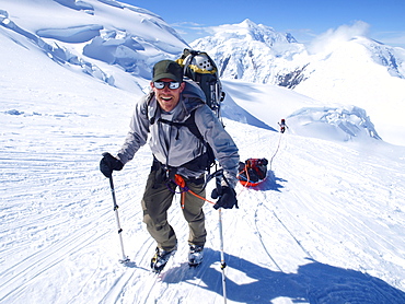
857-88779 - Mountain ranger Brian Scheele on this way to Windy Corner on Mount McKinley, also know as Denali, in Alaska. He is pulling a sled, that together with his heavy backpack is containing all the gear like tents, clothing and food. Every climbing season High Mountain Rangers of the Denali National Park Service are called to help climbers in need. If possible the patient is brought down to Basecamp on foot, only in life threatening conditions a helicopter is called to evacuate the patient to a hospital in Anchorage. Mount McKinley, native name Denali, is the highest mountain peak in North America, with a summit elevation of 20,321 feet (6,194 m) above sea level. At some 18,000 feet (5,500 m), the base-to-peak rise is considered the largest of any mountain situated entirely above sea level. Measured by topographic prominence, it is the third most prominent peak after Mount Everest and Aconcagua. Located in the Alaska Range in the interior of the U.S. state of Alaska, McKinley is the centerpiece of Denali National Park and Preserve.
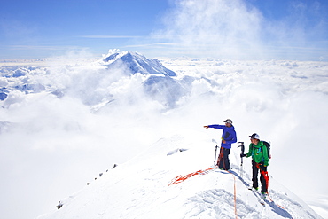
857-88775 - High Mountain Rangers Tom Ditola and David Weber are taking a rest on the West Rib on Mount McKinley, Alaska. Mount Hunter in the background. They are above the clouds in blue sky and the sun is shining. Mount McKinley, native name Denali, is the highest mountain peak in North America, with a summit elevation of 20,321 feet (6,194 m) above sea level. At some 18,000 feet (5,500 m), the base-to-peak rise is considered the largest of any mountain situated entirely above sea level. Measured by topographic prominence, it is the third most prominent peak after Mount Everest and Aconcagua. Located in the Alaska Range in the interior of the U.S. state of Alaska, McKinley is the centerpiece of Denali National Park and Preserve. Every climbing season High Mountain Rangers of the Denali National Park Service are called to help climbers in need. If possible the patient is brought down to base camp on foot, only in life threatening conditions a helicopter is called to evacuate the patient to a hospital in Anchorage.
857-88884 - Lemolo falls in Oregon plunges 165 feet into a large pool, the largest waterfall on the North Umpqua River.
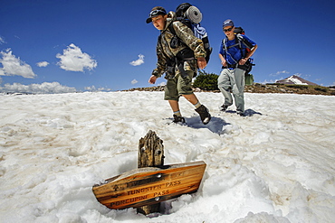
857-88022 - Boys hike past a trail sign buried in a late melting snow field, at about 11,000 feet below Tungsten Pass, on the fourth day of Troop 693's six day backpack trip through the High Uintas Wilderness Area, Uintas Range, Utah
1178-17242 - Roaring Brook Lake, Close up of legs of woman sitting on pier by lake
1178-16894 - Couple sitting on dock and splashing feet in lake
1178-14985 - USA, New York, New York City, close up of feet in yellow rubber boots in slush
1178-22954 - Feet of boy (4-5) and two adult people sticking out of boat
1178-14453 - Low section of person dancing in snow, New York City, USA
1178-23544 - Mexico, Quintana Roo, Yucatan, Tulum, Woman's feet, beach and sea, Mexico, Quintana Roo, Yucatan, Cancun
1178-11359 - USA, Arizona, Winslow, Woman sticking feet out of car window parked in desert
1178-9816 - Woman's feet on sand, Mexico, Quintana Roo, Yucatan, Cancun
1178-9461 - Man's feet on ferry boat, Massachusetts, USA
911-10444 - A Chinstrap Penguin, Pygoscelis antarctica, at Hannah Point on Livingston Island in the South Shetland Islands, Antarctic. Behind the penguin is lots of greenery, plants that are expanding as the Antarctic Peninsular warms as a result of climate change,
911-10433 - A Gentoo Penguin on Prion Island, South Georgia.
1178-6984 - Woman lying in scenic field with feet in air, Whitefish, Montana, USA
1178-9150 - Close-up of woman's feet having spa treatment
1178-5007 - Underwater shot of child’s feet, Florida, United States
1178-5445 - USA, Arizona, Winslow, Woman sticking feet out of car window parked in desert
1178-3399 - Close-up of sand-covered feet of young couple lying on blanket on beach reading, Jupiter, Florida
1178-5784 - USA, Arizona, Winslow, Human feet in sport shoes jumping
911-10456 - A woman drying her rice crop in the Sunderbans, Ganges, Delta, India, the area is very low lying and vulnerable to sea level rise.
911-10347 - An RV that until recently would be 40 feet underwater on the lake bed of Lake Isabella near Bakersfield, East of California's Central valley which is at less than 13% capacity following the four year long devastating drought. The reservoir has dropped so low, that the water level is below the outflow pipe.
911-10305 - An RV on the road near Badwater which is the lowest point in the USA being 282 feet below sea level in Death Valley. Death Valley is the lowest, hottest, driest place in the USA, with an average annual rainfall of around 2 inches, some years it does not receive any rain at all.
911-10283 - A sign at 100 feet below sea level in Death Valley which is the lowest, hottest, driest place in the USA, with an average annual rainfall of around 2 inches, some years it does not receive any rain at all.
911-10139 - Solar panels on the Cabanne D' Orny in the Swiss Alps, providing electricty for this off grid mountain hut at over 10,000 feet.
911-10048 - Women constructing solar cookers at the Barefoot College in Tilonia, Rajasthan, India. The Barefoot College is a worldwide charity, founded by Bunker Roy, its aims are, education, drinking water, electrification through solar power, skill development, health, women empowerment and the upliftment of rural people. The use of the cookers, vastly reduces the amount of fire wood women have to go out and collect from the forest.
911-10000 - A Wandering Albatross; Diomedea exulans, the bird with the largest wing span on the planet, at around 11 feet 6 inches, nesting on Prion Island, South Georgia, Southern Ocean.
911-10008 - A Wandering Albatross; Diomedea exulans, the bird with the largest wing span on the planet, at around 11 feet 6 inches, nesting on Prion Island, South Georgia, Southern Ocean.
911-9997 - A Wandering Albatross; Diomedea exulans, the bird with the largest wing span on the planet, at around 11 feet 6 inches, flying in the Drake Passage, Sub-Antarctic.
911-9999 - A Wandering Albatross; Diomedea exulans, the bird with the largest wing span on the planet, at around 11 feet 6 inches, nesting on Prion Island, South Georgia, Southern Ocean.
911-10046 - Women constructing solar cookers at the Barefoot College in Tilonia, Rajasthan, India. The Barefoot College is a worldwide charity, founded by Bunker Roy, its aims are, education, drinking water, electrification through solar power, skill development, health, women empowerment and the upliftment of rural people.
911-10002 - A Light Mantled Albatross, or Light Mantled Sooty Albatross, Phoebetria palpebrata, on South Georgia, on nesting cliffs at Grytviken.
911-10047 - Women constructing solar cookers at the Barefoot College in Tilonia, Rajasthan, India. The Barefoot College is a worldwide charity, founded by Bunker Roy, its aims are, education, drinking water, electrification through solar power, skill development, health, women empowerment and the upliftment of rural people. The use of the cookers, vastly reduces the amount of fire wood women have to go out and collect from the forest.
1113-98308 - Young woman sitting on a jetty at Lake Starnberg in twilight, Bavaria, Germany
797-10908 - Peru, Puno, Road going up to Abra La Raya at 14 000 feet.
797-11306 - Gambia, People, Two women crossing water in bare feet carrying walking stick and rice in bucket and straw on their heads.
797-11121 - Burundi, Cibitoke Province, Buganda, Ruhagurika Primary School boys playing marbles during their playtime outside Ruhagurika Catch-Up Class. Catch up classes were established by Concern Worldwide across a number of schools in Cibitoke to provide a second chance for children who had dropped out.
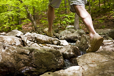
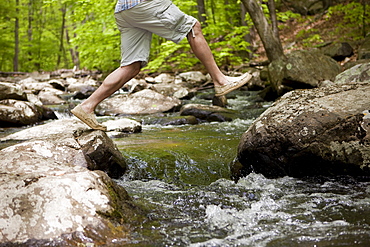
1174-2974 - Close up of a man's feet in hiking boots on a woodland path in summer, Gloucestershire, England
741-4815 - African jacana (Actophilornis africanus), Chobe National Park, Botswana, Africa
857-86011 - Hikers walk along Deer Creek Narrows in the Grand Canyon outside of Fredonia, Arizona November 2011. The 21.4-mile loop starts at the Bill Hall trailhead on the North Rim and descends 2000-feet in 2.5-miles through Coconino Sandstone to the level Esplanada then descends further into the lower canyon through a break in the 400-foot-tall Redwall to access Surprise Valley. Hikers connect Thunder River and Tapeats Creek to a route along the Colorado River and climb out Deer Creek.
857-86023 - Male hiker filters water on a cliff-pinched patio near Deer Creek Falls in the Grand Canyon outside of Fredonia, Arizona November 2011. The 21.4-mile loop starts at the Bill Hall trailhead on the North Rim and descends 2000-feet in 2.5-miles through Coconino Sandstone to the level Esplanada then descends further into the lower canyon through a break in the 400-foot-tall Redwall to access Surprise Valley. Hikers connect Thunder River and Tapeats Creek to a route along the Colorado River and climb out Deer Creek.
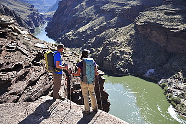
857-86016 - Hikers overlook the Colorado River as they exit the Deer Creek Narrows in the Grand Canyon outside of Fredonia, Arizona November 2011. The 21.4-mile loop starts at the Bill Hall trailhead on the North Rim and descends 2000-feet in 2.5-miles through Coconino Sandstone to the level Esplanada then descends further into the lower canyon through a break in the 400-foot-tall Redwall to access Surprise Valley. Hikers connect Thunder River and Tapeats Creek to a route along the Colorado River and climb out Deer Creek.
857-86021 - Hikers setup camp on a beach along the Colorado River near the plumeting 180-foot Deer Creek Falls in the Grand Canyon outside of Fredonia, Arizona November 2011. The 21.4-mile loop starts at the Bill Hall trailhead on the North Rim and descends 2000-feet in 2.5-miles through Coconino Sandstone to the level Esplanada then descends further into the lower canyon through a break in the 400-foot-tall Redwall to access Surprise Valley. Hikers connect Thunder River and Tapeats Creek to a route along the Colorado River and climb out Deer Creek.
857-86015 - Hikers walk along Deer Creek Narrows in the Grand Canyon outside of Fredonia, Arizona November 2011. The 21.4-mile loop starts at the Bill Hall trailhead on the North Rim and descends 2000-feet in 2.5-miles through Coconino Sandstone to the level Esplanada then descends further into the lower canyon through a break in the 400-foot-tall Redwall to access Surprise Valley. Hikers connect Thunder River and Tapeats Creek to a route along the Colorado River and climb out Deer Creek.


