Recent searches
Loading...
809-7441 - Altar of Confucius, Temple of Literature, a Confucian temple formerly a center of learning in Hanoi, Vietnam, Indochina, Southeast Asia, Asia
857-94717 - Nimoa Island - here the island mission will impress. The five-sided church features murals of island life and all mission buildings are surrounded by well maintained paths and gardens filled with flowering plants. Edged by jungle-covered mountains, postcard beaches and crystal clear waters - an island paradise indeed! The Louisiade Archipelago is a string of ten larger volcanic islands frequently fringed by coral reefs, and 90 smaller coral islands located 200 km southeast of New Guinea, stretching over more than 160 km and spread over an ocean area of 26,000 km? between the Solomon Sea to the north and the Coral Sea to the south. The aggregate land area of the islands is about 1,790 km? (690 square miles), with Vanatinai (formerly Sudest or Tagula as named by European claimants on Western maps) being the largest. Sideia Island and Basilaki Island lie closest to New Guinea, while Misima, Vanatinai, and Rossel islands lie further east. The archipelago is divided into the Local Level Government (LLG) areas Loui!
857-94720 - Nimoa Island - here the island mission will impress. The five-sided church features murals of island life and all mission buildings are surrounded by well maintained paths and gardens filled with flowering plants. Edged by jungle-covered mountains, postcard beaches and crystal clear waters - an island paradise indeed! The Louisiade Archipelago is a string of ten larger volcanic islands frequently fringed by coral reefs, and 90 smaller coral islands located 200 km southeast of New Guinea, stretching over more than 160 km and spread over an ocean area of 26,000 km? between the Solomon Sea to the north and the Coral Sea to the south. The aggregate land area of the islands is about 1,790 km? (690 square miles), with Vanatinai (formerly Sudest or Tagula as named by European claimants on Western maps) being the largest. Sideia Island and Basilaki Island lie closest to New Guinea, while Misima, Vanatinai, and Rossel islands lie further east. The archipelago is divided into the Local Level Government (LLG) areas Louisiade Rural (western part, with Misima), and Yaleyamba (western part, with Rossell and Tagula islands. The LLG areas are part of Samarai-Murua District district of Milne Bay. The seat of the Louisiade Rural LLG is Bwagaoia on Misima Island, the population center of the archipelago.
857-94718 - Nimoa Island - here the island mission will impress. The five-sided church features murals of island life and all mission buildings are surrounded by well maintained paths and gardens filled with flowering plants. Edged by jungle-covered mountains, postcard beaches and crystal clear waters - an island paradise indeed! The Louisiade Archipelago is a string of ten larger volcanic islands frequently fringed by coral reefs, and 90 smaller coral islands located 200 km southeast of New Guinea, stretching over more than 160 km and spread over an ocean area of 26,000 km? between the Solomon Sea to the north and the Coral Sea to the south. The aggregate land area of the islands is about 1,790 km? (690 square miles), with Vanatinai (formerly Sudest or Tagula as named by European claimants on Western maps) being the largest. Sideia Island and Basilaki Island lie closest to New Guinea, while Misima, Vanatinai, and Rossel islands lie further east. The archipelago is divided into the Local Level Government (LLG) areas Louisiade Rural (western part, with Misima), and Yaleyamba (western part, with Rossell and Tagula islands. The LLG areas are part of Samarai-Murua District district of Milne Bay. The seat of the Louisiade Rural LLG is Bwagaoia on Misima Island, the population center of the archipelago.
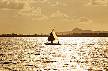
857-94722 - Children playing with a outrigger canoe in the village of Hessessai Bay at PanaTinai (Panatinane)island in the Louisiade Archipelago in Milne Bay Province, Papua New Guinea. The island has an area of 78 km2. The Louisiade Archipelago is a string of ten larger volcanic islands frequently fringed by coral reefs, and 90 smaller coral islands located 200 km southeast of New Guinea, stretching over more than 160 km and spread over an ocean area of 26,000 km? between the Solomon Sea to the north and the Coral Sea to the south. The aggregate land area of the islands is about 1,790 km? (690 square miles), with Vanatinai (formerly Sudest or Tagula as named by European claimants on Western maps) being the largest. Sideia Island and Basilaki Island lie closest to New Guinea, while Misima, Vanatinai, and Rossel islands lie further east. The archipelago is divided into the Local Level Government (LLG) areas Louisiade Rural (western part, with Misima), and Yaleyamba (western part, with Rossell and Tagula islands. The LLG areas are part of Samarai-Murua District district of Milne Bay. The seat of the Louisiade Rural LLG is Bwagaoia on Misima Island, the population center of the archipelago.PanaTinai (Panatinane) is an island in the Louisiade Archipelago in Milne Bay Province, Papua New Guinea.
857-94715 - Nimoa Island - here the island mission will impress. The five-sided church features murals of island life and all mission buildings are surrounded by well maintained paths and gardens filled with flowering plants. Edged by jungle-covered mountains, postcard beaches and crystal clear waters - an island paradise indeed! The Louisiade Archipelago is a string of ten larger volcanic islands frequently fringed by coral reefs, and 90 smaller coral islands located 200 km southeast of New Guinea, stretching over more than 160 km and spread over an ocean area of 26,000 km? between the Solomon Sea to the north and the Coral Sea to the south. The aggregate land area of the islands is about 1,790 km? (690 square miles), with Vanatinai (formerly Sudest or Tagula as named by European claimants on Western maps) being the largest. Sideia Island and Basilaki Island lie closest to New Guinea, while Misima, Vanatinai, and Rossel islands lie further east.
857-94719 - Nimoa Island - here the island mission will impress. The five-sided church features murals of island life and all mission buildings are surrounded by well maintained paths and gardens filled with flowering plants. Edged by jungle-covered mountains, postcard beaches and crystal clear waters - an island paradise indeed! The Louisiade Archipelago is a string of ten larger volcanic islands frequently fringed by coral reefs, and 90 smaller coral islands located 200 km southeast of New Guinea, stretching over more than 160 km and spread over an ocean area of 26,000 km? between the Solomon Sea to the north and the Coral Sea to the south. The aggregate land area of the islands is about 1,790 km? (690 square miles), with Vanatinai (formerly Sudest or Tagula as named by European claimants on Western maps) being the largest. Sideia Island and Basilaki Island lie closest to New Guinea, while Misima, Vanatinai, and Rossel islands lie further east. The archipelago is divided into the Local Level Government (LLG) areas Louisiade Rural (western part, with Misima), and Yaleyamba (western part, with Rossell and Tagula islands. The LLG areas are part of Samarai-Murua District district of Milne Bay. The seat of the Louisiade Rural LLG is Bwagaoia on Misima Island, the population center of the archipelago.
857-94721 - Nimoa Island - here the island mission will impress. The five-sided church features murals of island life and all mission buildings are surrounded by well maintained paths and gardens filled with flowering plants. Edged by jungle-covered mountains, postcard beaches and crystal clear waters - an island paradise indeed! The Louisiade Archipelago is a string of ten larger volcanic islands frequently fringed by coral reefs, and 90 smaller coral islands located 200 km southeast of New Guinea, stretching over more than 160 km and spread over an ocean area of 26,000 km? between the Solomon Sea to the north and the Coral Sea to the south. The aggregate land area of the islands is about 1,790 km? (690 square miles), with Vanatinai (formerly Sudest or Tagula as named by European claimants on Western maps) being the largest. Sideia Island and Basilaki Island lie closest to New Guinea, while Misima, Vanatinai, and Rossel islands lie further east. The archipelago is divided into the Local Level Government (LLG) areas Loui!
857-94716 - Nimoa Island - here the island mission will impress. The five-sided church features murals of island life and all mission buildings are surrounded by well maintained paths and gardens filled with flowering plants. Edged by jungle-covered mountains, postcard beaches and crystal clear waters - an island paradise indeed! The Louisiade Archipelago is a string of ten larger volcanic islands frequently fringed by coral reefs, and 90 smaller coral islands located 200 km southeast of New Guinea, stretching over more than 160 km and spread over an ocean area of 26,000 km? between the Solomon Sea to the north and the Coral Sea to the south. The aggregate land area of the islands is about 1,790 km? (690 square miles), with Vanatinai (formerly Sudest or Tagula as named by European claimants on Western maps) being the largest. Sideia Island and Basilaki Island lie closest to New Guinea, while Misima, Vanatinai, and Rossel islands lie further east. The archipelago is divided into the Local Level Government (LLG) areas Loui!
857-94714 - The Louisiade Archipelago is a string of ten larger volcanic islands frequently fringed by coral reefs, and 90 smaller coral islands located 200 km southeast of New Guinea, stretching over more than 160 km and spread over an ocean area of 26,000 km? between the Solomon Sea to the north and the Coral Sea to the south. The aggregate land area of the islands is about 1,790 km? (690 square miles), with Vanatinai (formerly Sudest or Tagula as named by European claimants on Western maps) being the largest. Sideia Island and Basilaki Island lie closest to New Guinea, while Misima, Vanatinai, and Rossel islands lie further east. The archipelago is divided into the Local Level Government (LLG) areas Louisiade Rural (western part, with Misima), and Yaleyamba (western part, with Rossell and Tagula islands. The LLG areas are part of Samarai-Murua District district of Milne Bay. The seat of the Louisiade Rural LLG is Bwagaoia on Misima Island, the population center of the archipelago.
857-94712 - The Louisiade Archipelago is a string of ten larger volcanic islands frequently fringed by coral reefs, and 90 smaller coral islands located 200 km southeast of New Guinea, stretching over more than 160 km and spread over an ocean area of 26,000 km? between the Solomon Sea to the north and the Coral Sea to the south. The aggregate land area of the islands is about 1,790 km? (690 square miles), with Vanatinai (formerly Sudest or Tagula as named by European claimants on Western maps) being the largest.Sideia Island and Basilaki Island lie closest to New Guinea, while Misima, Vanatinai, and Rossel islands lie further east. The archipelago is divided into the Local Level Government (LLG) areas Louisiade Rural (western part, with Misima), and Yaleyamba (western part, with Rossell and Tagula islands. The LLG areas are part of Samarai-Murua District district of Milne Bay. The seat of the Louisiade Rural LLG is Bwagaoia on Misima Island, the population center of the archipelago.
828-1024 - Skyline of the City of London, Tower 42, formerly Nat West Tower, and the Cheesegrater, London, England, United Kingdom, Europe
857-93698 - Hikers overlooking the Central Valley The Sutter Buttes, formerly known as the Marysville Buttes
1176-511 - Chhatrapati Shivaji Maharaj Vastu Sangrahalaya (CSMVS), formerly Prince of Wales Museum of Western India, Mumbai (Bombay), Maharashtra, India, Asia
749-2322 - An elevated view of the terracotta roofs and the bell tower of the Museo Nacional de la Lucha, formerly Iglesia y Convento de Sa, Trinidad, UNESCO World Heritage Site, Sancti Spiritus Province, Cuba, West Indies, Caribbean, Central America
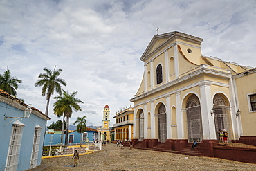
749-2325 - Plaza Mayor with the Iglesia Parroquial de la Santisima Trinidad and the Museo Nacional de la Lucha, formerly Iglesia y Convento, Trinidad, UNESCO World Heritage Site, Cuba, West Indies, Caribbean, Central America
749-2321 - Museo Nacional de la Lucha, formerly Iglesia y Convento de San Francisco. Trinidad, UNESCO World Heritage Site, Sancti Spiritus Province, Cuba, West Indies, Caribbean, Central America
749-2304 - An elevated view of the terracotta roofs and the bell tower of the Museo Nacional de la Lucha, formerly Iglesia y Convento de Sa, Trinidad, UNESCO World Heritage Site, Sancti Spiritus Province, Cuba, West Indies, Caribbean, Central America
1209-47 - The Vertigo Building, formerly The Old Shot Tower, Bristol, England, United Kingdom, Europe
785-1986 - Fountain and Cybele Palace, formerly the Palace of Communication, Plaza de Cibeles, Madrid, Spain, Europe
785-1992 - Fountain and Cybele Palace, formerly the Palace of Communication at night, Plaza de Cibeles, Madrid, Spain, Europe
1212-29 - Jardine House, formerly The Connaught Centre, the first skyscraper in Hong Kong and the tallest building in Asia when it was built in 1972, Hong Kong, China, Asia
764-5181 - Brown hyena (Hyaena brunnea) (formerly Parahyaena brunnea), Kgalagadi Transfrontier Park encompassing the former Kalahari Gemsbok National Park, South Africa, Africa
764-5173 - Brown hyena (Hyaena brunnea) (formerly Parahyaena brunnea), Kgalagadi Transfrontier Park encompassing the former Kalahari Gemsbok National Park, South Africa, Africa
764-5182 - Brown hyena (Hyaena brunnea) (formerly Parahyaena brunnea), Kgalagadi Transfrontier Park encompassing the former Kalahari Gemsbok National Park, South Africa, Africa
1113-100852 - Formerly recreation home of GDR, Alexisbad, Harz, Saxony-Anhalt, Germany, Europe
816-8492 - Renovated houses formerly the docks in Braye, Alderney, Channel Islands, United Kingdom, Europe
792-710 - The Butter Cross, built in 1744, formerly the town's buttermarket, Broad Street, Ludlow, Shropshire, England, United Kingdom. Europe
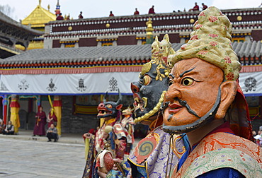
832-372357 - Tibetan Buddhism, religious Cham mask dance at the important Gelugpa monastery of Kumbum, Huangzhong, Xinning, Qinghai province, formerly known as Kokonur, Tibet, China, Asia
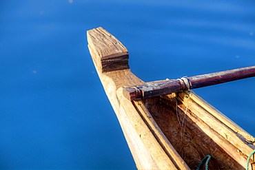
832-368342 - Rescue boat, Siglufjoerdur, Iceland, Northern Europe, Europe
832-369845 - Visitors to the new 412-meter high observation deck Skydeck, Willis Tower, formerly named Sears Tower, Chicago, Illinois, United States of America, USA
832-372813 - Three peasant women in traditional Ukrainian costume performing a countrified folk dance at the farmers\' museum in the formerly German inhabited Bessarabian village Friedenstal, today\'s Mirnopolje, Ukraine
832-373966 - Two Arctic foxes, white foxes, polar foxes or snow foxes (Vulpes lagopus formerly Alopex lagopus), adults fighting, social behaviour, in the snow, Montana, North America, USA
832-368865 - The sons of a dead man pray for a good reincarnation for their father at Har Ki Pauri Ghat in Haridwar, Uttarakhand, formerly Uttaranchal, India, Asia
832-371566 - Aerial view, ponds and puddles left by the melting glacier, on the northwestern edge of the Vatnajoekull glacier, Iceland, Europe
832-372405 - Sadhu, portrait, Kumbh Mela or Kumbha, Haridwar, Uttarakhand, formerly Uttaranchal, Indian Himalayas, North India, India, Asia
832-367480 - Dortmund U, U-Tower, kicker video installation, former Union Brewery, cultural centre, arts centre, landmark, Dortmund, North Rhine-Westphalia, Germany, Europe, PublicGround
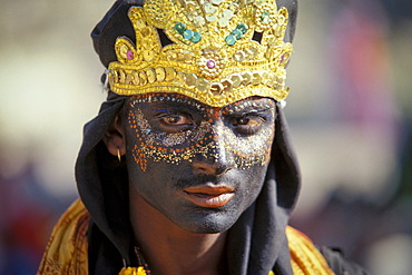
832-372414 - Young man dressed as the Hindu shepherd god Krishna, portrait, Kumbh or Kumbha Mela, Haridwar, Uttarakhand, formerly Uttaranchal, Indian Himalayas, North India, India, Asia
832-373967 - Arctic fox, white fox, polar fox or snow fox (Vulpes lagopus formerly Alopex lagopus), adult, foraging for food in the snow, Montana, North America, USA
832-373965 - Two Arctic foxes, white foxes, polar foxes or snow foxes (Vulpes lagopus formerly Alopex lagopus), adults fighting, social behaviour, in the snow, Montana, North America, USA
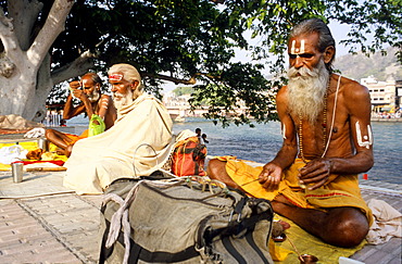
832-368867 - A small group of Sadhus doing their morning pooja at the ghats along the river Ganges in Haridwar, Uttarakhand, formerly Uttaranchal, India, Asia
832-372413 - Naked Naga-Sadhus taking a holy bath during the Kumbha or Kumbh Mela in the Ganges River, Har Ki Pauri-Ghat, a famous bathing ghat at Haridwar or Hardwar, Uttarakhand, formerly Uttaranchal, North India, India, Asia
832-372415 - Sadhu during a Hindu morning prayer in the Ganges River, Puja, Kumbh or Kumbha Mela, Har Ki Pauri Ghat, a famous bathing ghat at Haridwar or Hardwar, Uttarakhand, formerly Uttaranchal, North India, India, Asia
832-373964 - Arctic fox, white fox, polar fox or snow fox (Vulpes lagopus formerly Alopex lagopus), adult, foraging for food in the snow, Montana, North America, USA
832-372362 - Tibetan Buddhism, religious masked Cham dance, at the important Kumbum Monastery, Gelug or Gelug-pa yellow hat sect, Ta'er Monastery, Huangzhong, Xinning, Qinghai, formerly Amdo, Tibet, China, Asia
832-368866 - A priest is supporting a praying ritual for the good reincarnation of a dead person at Har Ki Pauri Ghat in Haridwar, Uttarakhand, formerly Uttaranchal, India, Asia
849-1287 - The Passerelle Leopold-Sedar-Senghor, formerly known as Passerelle Solferino (Pont de Solferino), a footbridge over the River Seine in the 7th arrondissement of Paris, France, Europe
1171-38 - Fu Guo Temple, Five Phoenix Building (formerly Buddhist Cloud Building) in spring, Lijiang, Yunnan, China, Asia
832-349259 - Sign, Astrid Lindgren's former apartment, Dalagatan 46, Stockholm, Sweden, Scandinavia, Europe
832-345164 - Wooden targets used by the Belgian army, former NS-Ordensburg Vogelsang (National Socialist estate), Eifel, North Rhine-Westphalia, Germany, Europe
832-341570 - Checkpoint Charlie, former border control point in Berlin, Germany, Europe
832-350667 - Wooden 19th century villa in the formerly classy baltic see resort Jurmala near Riga Latvia
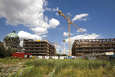
832-341572 - Construction site - Palast der Republik building in East Berlin, former GDR, the Berlin Cathedral (left) and telecommunications tower in the background, Berlin, Germany, Europe
832-345143 - Grounds of the former NS-Ordensburg Vogelsang (National Socialist estate), Van Dooren barracks, Eifel, North Rhine-Westphalia, Germany, Europe
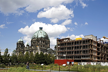
832-341571 - Construction site - Palast der Republik building in East Berlin, former GDR, and the Berlin Cathedral (left), Berlin, Germany, Europe
832-345163 - Staircase, former NS-Ordensburg Vogelsang (National Socialist estate), Eifel, North Rhine-Westphalia, Germany, Europe
832-350668 - Wooden 19th century villa in the formerly classy baltic see resort Jurmala near Riga Latvia
832-311790 - El Castillo, Tulum, Mexico, North America
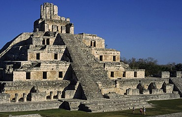
832-311817 - Edificio de los Cinco Pisos, Gran Acropolis, Edzna, Mexico, North America
832-311813 - Stairs to the top of the Nohoch-Mul pyramid, Coba, Mexico, North America
832-311783 - Edificio de los Cinco Pisos, Gran Acropolis, Edzna, Mexico, North America
832-311819 - Edificio de los Cinco Pisos, Gran Acropolis, Edzna, Mexico, North America
832-311814 - Stairs to the top of the Nohoch-Mul pyramid, Coba, Mexico, North America
832-311820 - Edificio de los Cinco Pisos, Gran Acropolis, Edzna, Mexico, North America
832-306997 - Lectern, Lutherhaus, Martin Luther's house and workplace, Wittenberg, Saxony-Anhalt, Germany
832-306996 - Lutherstube, interior, Martin Luther's house and workplace, Wittenberg, Saxony-Anhalt, Germany
832-304746 - Schloss Schoenbrunn (Schoenbrunn Palace) in wintertime, Vienna, Austria, Europe
832-304310 - Housing area in the former courtyard of the Heiliggeistkirche (Holy Ghost Church) in Stralsund, Mecklenburg-Western Pomerania, Germany, Europe
832-297225 - Jeeps in the dunes at Conception Bay, Diamond Area, Namibia
832-297212 - Jeeps in the dunes near Sylvia Hill, Diamond Area, Namibia
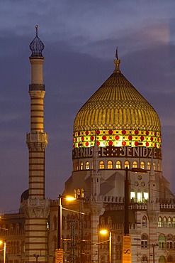
832-292231 - Yenidze (tobacco mosque), formerly factory of cigarettes Dresden Saxony Germany
832-292226 - Yenidze (tobacco mosque), formerly factory of cigarettes Dresden Saxony Germany
832-292229 - Yenidze (tobacco mosque), formerly factory of cigarettes Marien bridge Dresden Saxony Germany
832-292234 - Yenidze (tobacco mosque), formerly factory of cigarettes Dresden Saxony Germany
832-292233 - Yenidze (tobacco mosque), formerly factory of cigarettes Dresden Saxony Germany
832-292232 - Yenidze (tobacco mosque), formerly factory of cigarettes Dresden Saxony Germany
832-292399 - Abbey church, Valldemossa, Majorca, Spain
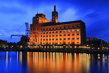
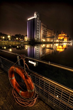
832-358967 - Innenhafen Harbour and the Business Kontor building, formerly the Werhahn Muehle or Werhahn Mill, Duisburg, North Rhine-Westphalia, Germany, Europe
832-279680 - Castle ruin, Saranda Kolones, archaeology, Paphos, Cyprus
832-279696 - Castle ruin, Saranda Kolones, archaeology, Paphos, Cyprus
832-279695 - Castle ruin, Saranda Kolones, archaeology, Paphos, Cyprus
832-279691 - Archaeology, House of Theseus, Paphos, Cyprus
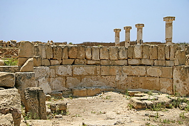
832-279689 - Archaeology, columns, Roman ruins, Paphos, Cyprus
832-279683 - Sanctuary of Aphrodite, Palaia Paphos, Paphos, Cyprus
832-359646 - Facade, countless satellite dishes at an apartment block known as the Pallasseum (formerly Berliner Sozialpalast, "Berlin Social Palace"), Schoeneberg district, Berlin, Germany, Europe
832-364738 - Roof detail: Chofah (Sky Tassell) at Phra Mondhop (library) in Wat Phra Kaeo (Temple of the Emerald Buddha) Grand Palace, Bangkok, Thailand, Southeast Asia, Asia
832-364757 - Restored wall murals (Ramakien) in Wat Phra Kaeo Grand Palace (Temple of the Emerald Buddha), Bangkok, Thailand, Southeast Asia, Asia
832-364739 - Golden Chedi (Phra Sri Ratana) in Wat Phra Kaeo Grand Palace (Temple of the Emerald Buddha), Bangkok, Thailand, Southeast Asia, Asia
832-364759 - Golden Chedi (Phra Sri Ratana) in Wat Phra Kaeo Grand Palace (Temple of the Emerald Buddha), Bangkok, Thailand, Southeast Asia, Asia
832-364748 - Kinnara (also called Kinari, Kinaree, Kinnaree, Ginnarie or Ginnaree), mythological bird creature, Wat Phra Kaeo Grand Palace (Temple of the Emerald Buddha), Bangkok, Thailand, Southeast Asia, Asia
832-269459 - Founders House, historic building in the Koreshan State Park, historic site, religious community, Estero, Florida, USA
832-264539 - Palazzo Pubblico, town hall, with Torre del Mangia, bell tower, and Chapel on Piazza del Campo, Siena, Tuscany, Italy, Europe
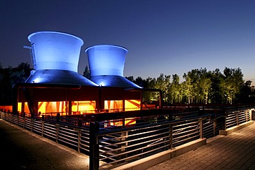
832-264844 - Westpark Bochum, North Rhine-Westphalia, Germany, Europe
832-264842 - Westpark Bochum, North Rhine-Westphalia, Germany, Europe
832-264845 - Westpark Bochum, North Rhine-Westphalia, Germany, Europe
832-264846 - Westpark Bochum, North Rhine-Westphalia, Germany, Europe
832-264843 - Westpark Bochum, North Rhine-Westphalia, Germany, Europe
832-254333 - Inner port of Duisburg at night, Duisburg, North Rhine-Westphalia, Germany, Europe
832-252103 - Facade of the parish house decorated with crests, former courthouse of the bailiffs, Cevio, Maggia Valley, Ticino, Switzerland, Europe


