Recent searches
Loading...
1243-544 - Aerial drone panoramic view of Parque dos Poetas in Oeiras, Lisbon, Portugal. The park extends over 25 hectares of green areas , embellished with more than 60 statues in honor of 60 poets, with capacity for 30 to 40 thousand visitors and free admission
1243-542 - Aerial drone panoramic view of Bo-Kaap, an area of Cape Town, South Africa formerly known as the Malay Quarter. It is a former racially segregated area, situated on the slopes of Signal Hill above the city centre
1243-537 - Aerial drone panoramic view of the V&A Waterfront is a mixed-use destination located in the oldest working harbour in the Southern Hemisphere. With Table Mountain as its backdrop, the 123-hectare neighbourhood is located within the Cape Town, South Africa
1243-533 - Aerial drone panoramic view of Northern residential suburbs in Cape Town, South Africa looking towards the south and Table Mountain
1243-532 - Aerial drone panoramic view capturing the cityscape of Cape Town, South Africa as dusk sets in, highlighting the downtown buildings with a warm glow against the silhouette of Table Mountain and Lion's Head
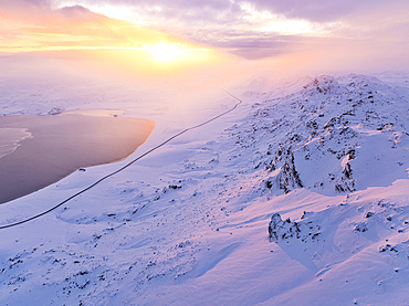
1369-231 - an amazing winter sunrise in Pallastunturi National Park shooted by drone, Pallastunturi, Finland, Europe
1369-232 - an amazing winter sunrise in Pallastunturi National Park shooted by drone, Pallastunturi, Finland, Europe
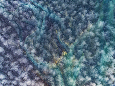
1369-228 - aerial abstract view taken by drone, of block of ice in the river near to Myllykosky mill, Oulanka National Park, Finland, Europe
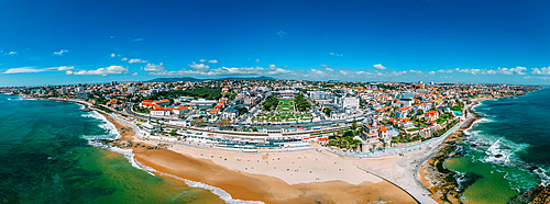
1243-527 - Aerial drone panoramic view of Tamariz beach and Estoril neighbourhood in the Portuguese Riviera 28km west of Lisbon. The iconic Casino Estoril is visible in the centre.
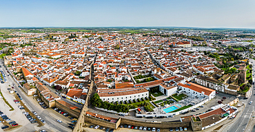
1243-526 - Aerial drone panoramic view of the historic Centre of Évora, Alentejo, Portugal. The city has roots go back to Roman times, reached its golden age in the 15th century, when it became the residence of the Portuguese kings
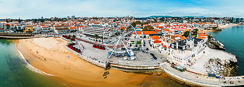
1243-525 - Aerial drone panoramic view of Ribeira beach in Cascais, Portugal with a ferris wheel set up during the winter months
795-717 - Aerial drone view of beautiful tropical island beach with palm trees in maldives
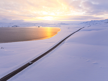
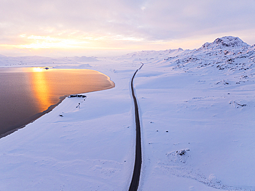
1369-220 - Aerial view by the drone of a car driving along the road that runs alongside Lake Kleifarvatn, during a magnificent winter sunset, Iceland, Polar Regions
1369-219 - Aerial view by drone of the coastal road near to Selfoss during a cold winter day, Selfoss, Iceland, Polar Regions
1369-218 - Aerial view by drone of the road that runs along Lake Kleifarvatn, during a magnificent winter sunset, Iceland, Polar Regions
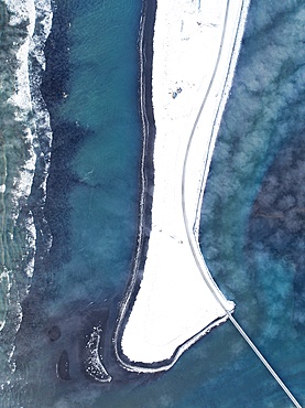
1369-216 - Aerial view taken by drone of Icelandic river, close to Southern coast, during a cold winter day, Iceland, Polar Regions
1369-215 - Aerial view taken by drone of the road that runs along Lake Kleifarvatn, during a magnificent winter sunset, Iceland, Polar Regions
1369-214 - Aerial view taken by the drone of a car driving along the road that runs alongside Lake Kleifarvatn, during a magnificent winter sunset, Iceland, Polar Regions
1351-256 - Aerial drone view of the Livonian Order Castle in Ventspils on the Venta River, Livonian Coast, Latvia, Baltic States, Europe
1351-255 - Aerial drone view of the Livonian Order Castle in Ventspils on the Venta River, Livonian Coast, Latvia, Baltic States, Europe
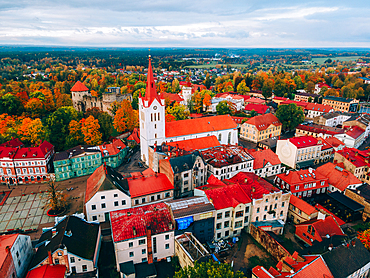
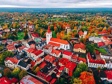
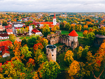
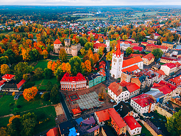
1351-251 - Aerial drone view of the Medieval Cesis Old Town, Cesis, Latvia, Baltics, Europe
1351-250 - Aerial drone view of the Medieval Cesis Old Town, Cesis, Latvia, Baltics, Europe
1351-249 - Aerial drone view of the Medieval Cesis Old Town, Cesis, Latvia, Baltics, Europe
1351-247 - Aerial drone View of Cesis Castle in the Medieval Cesis Old Town, Cesis, Latvia, Baltics, Europe
1351-248 - Aerial drone view of the Medieval Cesis Old Town, Cesis, Latvia, Baltics, Europe
1369-199 - Aerial view taken by drone of the center of Svolvaer, a famous fisherman's village in Lofoten Islands, Nordland, Norway, Scandinavia, Europe
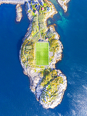
1369-198 - Aerial view taken by drone of Henningsvaer during an autumn day, famous fisherman's village in the Lofoten Islands, Nordland, Norway, Scandinavia, Europe
1369-196 - Amazing aerial view taken by drone of the Sakrisoy and Hamnoy Bay during a sunrise, Lofoten Islands, Nordland, Norway, Scandinavia, Europe
1369-197 - Aerial view taken by drone of Henningsvaer during an autumn day, famous fisherman's village in the Lofoten Islands, Nordland, Norway, Scandinavia, Europe
1369-195 - Amazing aerial view taken by drone of the Reine fjord during a sunrise, Reine, Moskenesoya, Lofoten Islands, Nordland, Norway, Scandinavia, Europe
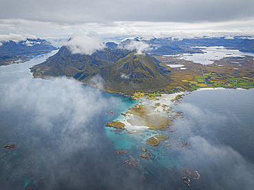
1369-194 - Aerial view taken by drone of Gimsoya Island during an autumn day, Lofoten Islands, Nordland, Norway, Scandinavia, Europe
1369-193 - Aerial view taken by drone of Henningsvaer during an autumn day, famous fisherman's village in the Lofoten Islands, Nordland, Norway, Scandinavia, Europe
1369-192 - Aerial view taken by drone of the coast of Gimsoya Island during an autumn day, Lofoten Islands, Nordland, Norway, Scandinavia, Europe
1369-190 - Aerial view taken by drone of the coast of Gimsoya Island during an autumn day, Lofoten Islands, Nordland, Norway, Scandinavia, Europe
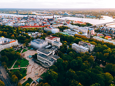
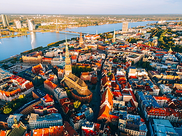
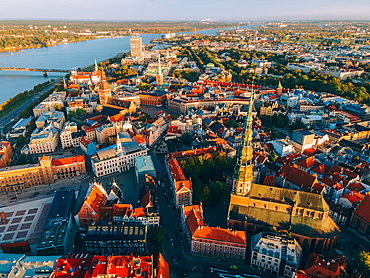
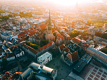
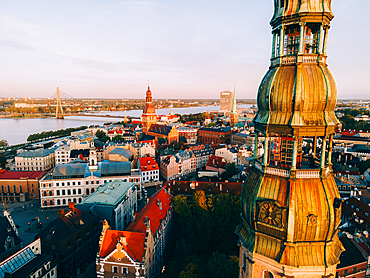
1351-240 - Aerial drone sunset view of Riga Old Town (Vecriga) Riga, Latvia, Europe
1351-239 - Aerial drone sunset view of Albert Street in the Art Nouveau District, Riga, Latvia, Europe
1351-238 - Aerial drone sunset view of Albert Street in the Art Nouveau District, Riga, Latvia, Europe
1351-237 - Aerial drone sunset view of Albert Street in the Art Nouveau District, Riga, Latvia, Europe
1351-236 - Aerial drone sunset view of the Art Nouveau District, Riga, Latvia, Europe
1351-235 - Aerial drone sunrise view of the Railway Bridge in Riga Old Town (Vecriga), Riga, Latvia, Europe
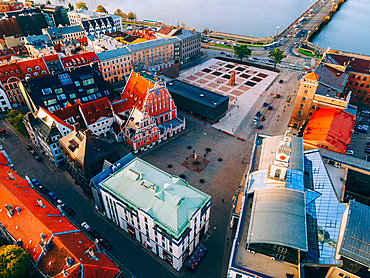
1351-234 - Aerial drone sunrise view of Rathausplatz and House of the Black Heads, Riga Old Town (Vecriga), UNESCO World Heritage Site, Riga, Latvia, Europe
1351-233 - Aerial drone sunrise view of Rathausplatz and House of the Black Heads, Riga Old Town (Vecriga), UNESCO World Heritage Site, Riga, Latvia, Europe
1351-232 - Aerial drone sunrise view of St. Peter's Church in Riga Old Town (Vecriga), UNESCO World Heritage Site, Riga, Latvia, Europe
1351-231 - Aerial drone sunrise view of St. Peter's Church and House of the Black Heads, Riga Old Town (Vecriga), UNESCO World Heritage Site, Riga, Latvia, Europe
1351-230 - Aerial drone sunrise view of St. Peter's Church and House of the Black Heads, Riga Old Town (Vecriga), UNESCO World Heritage Site, Riga, Latvia, Europe
1351-229 - Aerial drone sunrise view of Riga's Cathedral in Riga Old Town (Vecriga), UNESCO World Heritage Site, Riga, Latvia, Europe
1351-228 - Aerial drone sunrise view of St. Peter's Church in Riga Old Town (Vecriga), UNESCO World Heritage Site, Riga, Latvia, Europe
1361-415 - Drone shot of a blue SUV car standing in the middle of an empty frozen lake in the winter scenery of the Arctic Circle, Jokkmokk, Norrbotten, Swedish Lapland, Sweden, Scandinavia, Europe
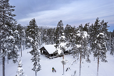
1361-411 - Drone view of a cyclist with fat bike standing in the middle of the tall-tree coniferous forest covered with snow in front of a mountain hut, Finnish Lapland, Finland, Scandinavia, Europe
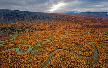
832-404454 - Drone shot, view of the valley Ladtjovagge with the meandering river Ladtjojakka, birch forests, autumn, intense colouring, Nikkaluokta, Kiruna, Gaellivare, Norrbottens laen, Lapland, Northern Sweden, Sweden, Europe
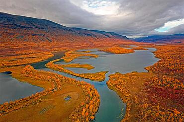
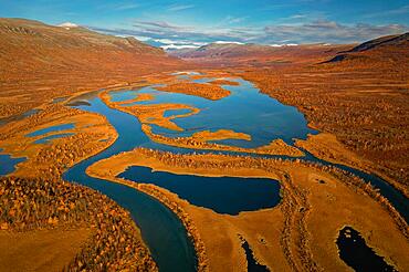
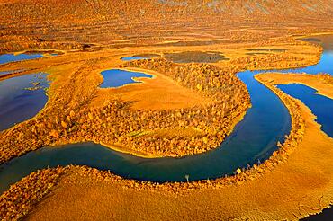
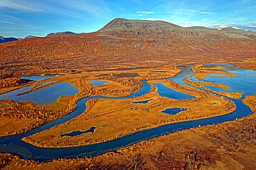
832-404453 - Drone shot, view of the valley Vistasvagge with the meandering river Vistasjakka and countless small lakes, birch forests, intense colouring, autumn, mountain landscape in the background, Nikkaluokta, Kiruna, Gaellivare, Norrbottens laen, Lapland, Northern Sweden, Sweden, Europe
832-404452 - Drone shot, view of the valley Vistasvagge with the meandering river Vistasjakka and countless small lakes, birch forests, autumn, intense colouring, mountain landscape in the background, Nikkaluokta, Kiruna, Gaellivare, Norrbottens laen, Lapland, Northern Sweden, Sweden, Europe
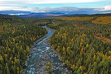
832-404451 - Drone shot, view of the river Kamajakka, coniferous forest and birch forest, autumn, Kvikkjokk, Jokkmokk, Norrbottens laen, Lapland, Northern Sweden, Sweden, Europe
832-404450 - Drone shot, view of the valley Vistasvagge with the meandering river Vistasjakka and countless small lakes, birch forests, autumn, intense colouring, Nikkaluokta, Kiruna, Gaellivare, Norrbottens laen, Lapland, Northern Sweden, Sweden, Europe
832-404449 - Drone shot, view of the valley Vistasvagge with the meandering river Vistasjakka and countless small lakes, birch forests, autumn, intense colouring, mountain landscape in the background, Nikkaluokta, Kiruna, Gaellivare, Norrbottens laen, Lapland, Northern Sweden, Sweden, Europe
832-404446 - Drone shot, view of the river Kamajakka, coniferous forest and birch forest, autumn, Sarek mountains in the background, Kvikkjokk, Jokkmokk, Norrbottens laen, Lapland, Northern Sweden, Sweden, Europe
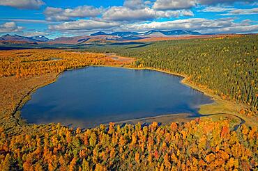
832-404445 - Drone shot, view of the Aenok marshland with lake, birch forests, deep colouring, autumn, intense colouring, Sarek mountains in the background, Kvikkjokk, Jokkmokk, Norrbottens laen, Lapland, Northern Sweden, Sweden, Europe
832-404443 - Drone shot, view of the Aenok marshland with river Kamajakka, birch forests, autumn, intense colours, Vallespiken mountain on the left, Sarek mountains in the background, Kvikkjokk, Jokkmokk, Norrbottens laen, Lapland, Northern Sweden, Sweden, Europe
1369-180 - Aerial view by drone of awesome mountain in Landmannalaugar area, Iceland, Polar Regions
1369-179 - Aerial view taken by drone of the Langhe vineyards, during a beautiful autumn day, UNESCO World Heritage Site, Cuneo province, Piedmont, Italy, Europe
1369-165 - Aerial view taken by drone of the famous village of Corniglia, Cinque Terre National Park, UNESCO World Heritage Site, La Spezia, Liguria, Italy, Europe
1369-163 - Aerial view taken by drone of Rocca Calascio castle during an autumn sunrise, National Park of Gran Sasso and Monti of Laga, Abruzzo, Italy, Europe
1369-162 - Aerial view taken from drone of the Langhe vineyards, on a beautiful autumn day, UNESCO World Heritage Site, Cuneo province, Piedmont, Italy, Europe
1131-2035 - Surrealist drone view of the Great Wall of China, AI Generated, China, Asia
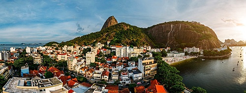
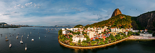
1243-484 - Aerial drone panorama of Urca neighbourhood and surrounding Botafogo and Guanabara Bay, UNESCO World Heritage Site, between the Mountain and the Sea, inscribed on the World Heritage List in 2012, Rio de Janeiro, Brazil, South America
1243-483 - Aerial drone panorama of Urca neighbourhood and surrounding Botafogo and Guanabara Bay, UNESCO World Heritage Site, between the Mountain and the Sea, inscribed on the World Heritage List in 2012, Rio de Janeiro, Brazil, South America
1243-482 - Aerial drone panorama of Urca neighbourhood and surrounding Botafogo and Guanabara Bay, UNESCO World Heritage Site, between the Mountain and the Sea, inscribed on the World Heritage List in 2012, Rio de Janeiro, Brazil, South America
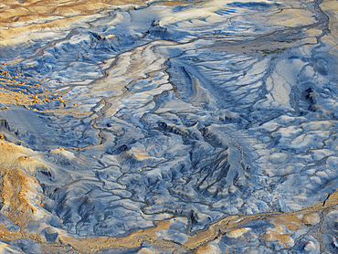
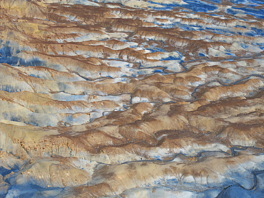
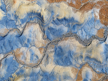
1369-143 - Aerial abstract view taken by drone of desert area near to Goblin Valley National Park during a sunny summer day, Utah, United States of America, North America
1369-141 - Aerial abstract view taken by drone of particular rocks formation during a sunny summer day, Utah, United States of America, North America
1369-139 - Aerial abstract view taken by drone of desert area near to Big Water during a sunny summer day, Utah, United States of America, North America
1369-140 - Aerial abstract view taken by drone of desert area near to Big Water during a sunny summer day, Utah, United States of America, North America
1369-138 - Aerial abstract view taken by drone of desert area near to Big Water during a sunny summer day, Utah, United States of America, North America
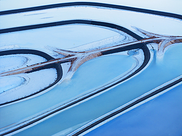
1369-137 - Aerial abstract view taken by drone of Potash Pond during a summer day, Moab, Utah, United States of America, North America
1369-130 - Aerial abstract view taken by drone of particular rock formation during a sunny summer day, Mexican Hat, Utah, United States of America, North America
1369-127 - Aerial abstract view taken by drone of Potash Pond during a summer day, Moab, Utah, United States of America, North America
1369-126 - Aerial abstract view taken by drone of Potash Pond during a summer day, Moab, Utah, United States of America, North America
1361-389 - Aerial shot of Scala dei Turchi staircase seen from a drone at sunrise, Realmonte, Agrigento province, Sicily, Italy, Mediterranean, Europe
1361-386 - The illuminated Temple of Concordia seen from a drone at dawn, Valley of the Temples, UNESCO World Heritage Site, Agrigento, Sicily, Italy, Mediterranean, Europe
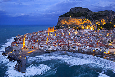
1361-383 - The illuminated fishing village of Cefalu with the rock on top of the old town seen from the drone at dusk, Cefalu, Palermo province, Tyrrhenian Sea, Sicily, Italy, Mediterranean, Europe
1361-380 - The illuminated Greek Temple of Hera seen from a drone, Valley of the Temples, UNESCO World Heritage Site, Agrigento, Sicily, Italy, Mediterranean, Europe
1361-361 - Aerial view of Suwehan white sandy beach with turquoise sea water and the big rock (sea stack) in the sea seen from a drone, Nusa Penida, Klungkung regency, Bali, Indonesia, Southeast Asia, Asia
1361-345 - Drone view of Zannone island on a cloudy day, Zannone island, Ponza municipality, Circeo National Park, Pontine archipelago, Tyrrhenian sea, Latina province, Latium (Lazio), Italy Europe
1243-474 - Aerial drone panoramic view of Braga, known for its religious heritage including Bom Jesus do Monte complex, and medieval Braga Cathedral, home to a Sacred Art Museum and Gothic-style Kings' Chapel, Braga, Minho, Portugal, Europe
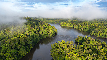
860-291980 - Drone view of the Amazon rainforest, Approuage River, French Guiana
1361-334 - View from the drone of a pine tree wood in autumn color, Valais canton, Switzerland, Europe
1361-326 - View from a drone of a car travelling an icy road among pine tree wood at sunrise, Swedish Lapland, Sweden, Scandinavia, Europe
1361-325 - Drone view of a car driving on an empty and frozen road in the white landscape of Swedish Lapland, Sweden, Scandinavia, Europe
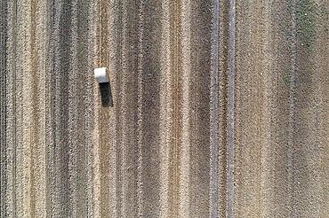
832-404095 - A roll of straw lies on a harvested field, image taken with drone, Egeln, Saxony-Anhalt, Germany, Europe
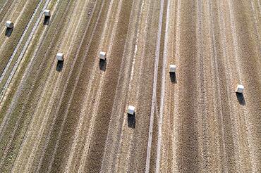
832-404094 - Rolls of straw lying on a harvested field, photograph taken with drone, Egeln, Saxony-Anhalt, Germany, Europe
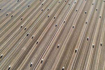
832-404093 - Rolls of straw lying on a harvested field, photograph taken with drone, Egeln, Saxony-Anhalt, Germany, Europe
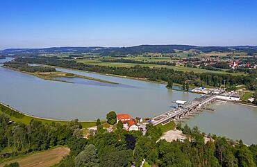
832-403992 - Drone shot, Inn power plant Ering Frauenstein, Frauenstein Castle, Mining, Inn, Innviertel, Upper Austria, Austria, Germany, Europe
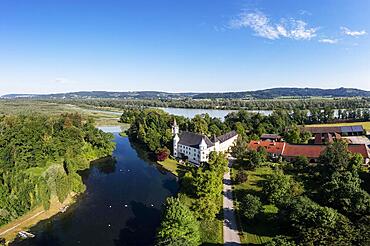
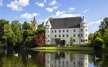
832-403991 - Drone shot, Renaissance castle, Hagenau Castle, Inn, Sankt Peter am Hart, Innviertel, Upper Austria, Austria, Europe
832-403990 - Drone shot, Renaissance castle, Hagenau Castle, Mattig estuary, Sankt Peter am Hart, Innviertel, Upper Austria, Austria, Europe
832-403988 - Drone shot, Renaissance castle, Hagenau Castle, Mattig estuary, Sankt Peter am Hart, Innviertel, Upper Austria, Austria, Europe
832-403989 - Drone shot, Renaissance castle, Hagenau Castle, Mattig estuary, Sankt Peter am Hart, Innviertel, Upper Austria, Austria, Europe
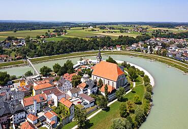
832-403985 - Drone shot, collegiate church, Laufen an der Salzach, Rupertiwinkel, Upper Bavaria, Bavaria, Germany, Europe
832-403984 - Drone shot, Abtsdorfer See with village Abtsdorf, Rupertiwinkel, Upper Bavaria, Bavaria, Germany, Europe
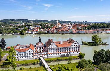
832-403977 - Drone shot, Neuburg am Inn Castle with view to Wenstein am Inn, Neuburg am Inn, Lower Bavaria, Bavaria, Germany, Austria, Europe
832-403976 - Drone shot, spa park with Europa Therme, Bad Fuessing, Lower Bavaria, Bavaria, Germany, Europe
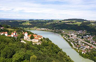
832-403970 - Drone shot, Neuhaus am Inn Castle with view to Schaerding, Neuhaus, Lower Bavaria, Bavaria, Germany, Austria, Europe


