Recent searches
Loading...
844-30878 - View of Rotes Rathaus (Town Hall) at sunset, Nikolai District, Berlin, Germany, Europe
832-395530 - Business buildings along the Spree river, Government district in Berlin Mitte, Berlin, Germany, Europe
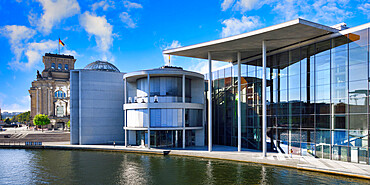
1131-1695 - Paul-Loebe Parliament building along the Spree River, Government district in Berlin Mitte, Berlin, Germany, Europe
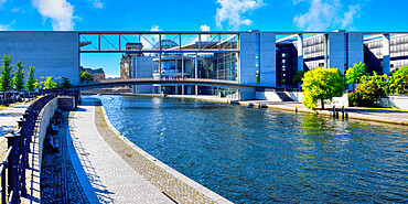
1131-1696 - Paul-Loebe Parliament building along the Spree River and footbridge, Government district in Berlin Mitte, Berlin, Germany, Europe
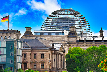
1131-1698 - Reichstag Building housing the German Bundestag, Government district, Tiergarten, Berlin, Germany, Europe
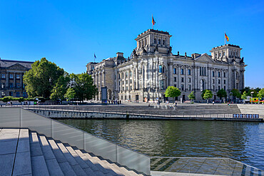
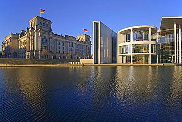
1131-1700 - Reichstag Building housing the Bundestag, along the Spree River, Government district, Tiergarten, Berlin, Germany, Europe
1131-1697 - Business buildings along the Spree River, Government district in Berlin Mitte, Berlin, Germany, Europe
832-394954 - German flag in the sunlight at the Elisabeth Lueders House in the government district, Berlin, Germany, Europe
1348-2898 - Students attending their open air classes at Doodhpathri in Budgam district, Kashmir, India.
1348-2899 - Students attending their open air classes at Doodhpathri in Budgam district, Kashmir, India.
1348-2901 - Students attending their open air classes at Doodhpathri in Budgam district, Kashmir, India.
1348-2900 - Students attending their open air classes at Doodhpathri in Budgam district, Kashmir, India.
1348-2902 - Students attending their open air classes at Doodhpathri in Budgam district, Kashmir, India.
832-389788 - Christmas tree at the Reichstag in the government district at sunrise, Berlin, Germany, Europe
832-386796 - Reichstag with waving German flag, night photograph, government district, Berlin, Germany, Europe
832-383834 - Reichstag bank with fireworks on New Year's Eve, Berlin, Germany, Europe
832-387702 - German flag on the Reichstag, in the first morning light, Berlin-Mitte, Berlin, Germany, Europe
832-383822 - Government district, Berlin, Germany, Europe
832-387703 - Reichstag and Paul Loebe House on the Spree, Morgenlicht, Berlin-Mitte, Berlin, Germany, Europe
832-387072 - Reichstag and government district, Berlin, Germany, Europe
832-386422 - Sultan's palace Al Alam, government quarter, Muscat, Oman, Asia
832-383835 - Reichstag banks and government district, Berlin, Germany, Europe
832-387701 - German flag on the Reichstag, morning light, Berlin-Mitte, Berlin, Germany, Europe
832-386423 - Sultan's palace Al Alam, flag of Oman, government quarter, Muscat, Oman, Asia
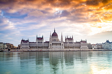
832-380634 - Parliament, Budapest, Hungary, Europe
832-381040 - Illuminated Federal Chancellery, Government District, Blue Hour, Berlin, Germany, Europe
832-379302 - The Royal Guards in red uniform on horses, The Life Guards, Household Cavalry Mounted Regiment, parade ground Horse Guards Parade, Changing of the Guard, Old Admiralty Building, Whitehall, Westminster, London, England, United Kingdom, Europe
832-379301 - The Royal Guards in red uniform on horses, The Life Guards, Household Cavalry Mounted Regiment, parade ground Horse Guards Parade, Changing of the Guard, Old Admiralty Building, Whitehall, Westminster, London, England, United Kingdom, Europe
832-378865 - Marie-Elisabeth-Luders House, Spreebogen, Schifffarmerdamm, Government District, Berlin, Germany, Europe
832-379300 - The Royal Guards in red uniform on horses, The Life Guards, Household Cavalry Mounted Regiment, parade ground Horse Guards Parade, Changing of the Guard, Old Admiralty Building, Whitehall, Westminster, London, England, United Kingdom, Europe
857-94720 - Nimoa Island - here the island mission will impress. The five-sided church features murals of island life and all mission buildings are surrounded by well maintained paths and gardens filled with flowering plants. Edged by jungle-covered mountains, postcard beaches and crystal clear waters - an island paradise indeed! The Louisiade Archipelago is a string of ten larger volcanic islands frequently fringed by coral reefs, and 90 smaller coral islands located 200 km southeast of New Guinea, stretching over more than 160 km and spread over an ocean area of 26,000 km? between the Solomon Sea to the north and the Coral Sea to the south. The aggregate land area of the islands is about 1,790 km? (690 square miles), with Vanatinai (formerly Sudest or Tagula as named by European claimants on Western maps) being the largest. Sideia Island and Basilaki Island lie closest to New Guinea, while Misima, Vanatinai, and Rossel islands lie further east. The archipelago is divided into the Local Level Government (LLG) areas Louisiade Rural (western part, with Misima), and Yaleyamba (western part, with Rossell and Tagula islands. The LLG areas are part of Samarai-Murua District district of Milne Bay. The seat of the Louisiade Rural LLG is Bwagaoia on Misima Island, the population center of the archipelago.
857-94718 - Nimoa Island - here the island mission will impress. The five-sided church features murals of island life and all mission buildings are surrounded by well maintained paths and gardens filled with flowering plants. Edged by jungle-covered mountains, postcard beaches and crystal clear waters - an island paradise indeed! The Louisiade Archipelago is a string of ten larger volcanic islands frequently fringed by coral reefs, and 90 smaller coral islands located 200 km southeast of New Guinea, stretching over more than 160 km and spread over an ocean area of 26,000 km? between the Solomon Sea to the north and the Coral Sea to the south. The aggregate land area of the islands is about 1,790 km? (690 square miles), with Vanatinai (formerly Sudest or Tagula as named by European claimants on Western maps) being the largest. Sideia Island and Basilaki Island lie closest to New Guinea, while Misima, Vanatinai, and Rossel islands lie further east. The archipelago is divided into the Local Level Government (LLG) areas Louisiade Rural (western part, with Misima), and Yaleyamba (western part, with Rossell and Tagula islands. The LLG areas are part of Samarai-Murua District district of Milne Bay. The seat of the Louisiade Rural LLG is Bwagaoia on Misima Island, the population center of the archipelago.
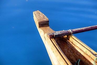
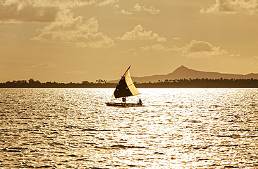
857-94722 - Children playing with a outrigger canoe in the village of Hessessai Bay at PanaTinai (Panatinane)island in the Louisiade Archipelago in Milne Bay Province, Papua New Guinea. The island has an area of 78 km2. The Louisiade Archipelago is a string of ten larger volcanic islands frequently fringed by coral reefs, and 90 smaller coral islands located 200 km southeast of New Guinea, stretching over more than 160 km and spread over an ocean area of 26,000 km? between the Solomon Sea to the north and the Coral Sea to the south. The aggregate land area of the islands is about 1,790 km? (690 square miles), with Vanatinai (formerly Sudest or Tagula as named by European claimants on Western maps) being the largest. Sideia Island and Basilaki Island lie closest to New Guinea, while Misima, Vanatinai, and Rossel islands lie further east. The archipelago is divided into the Local Level Government (LLG) areas Louisiade Rural (western part, with Misima), and Yaleyamba (western part, with Rossell and Tagula islands. The LLG areas are part of Samarai-Murua District district of Milne Bay. The seat of the Louisiade Rural LLG is Bwagaoia on Misima Island, the population center of the archipelago.PanaTinai (Panatinane) is an island in the Louisiade Archipelago in Milne Bay Province, Papua New Guinea.
857-94719 - Nimoa Island - here the island mission will impress. The five-sided church features murals of island life and all mission buildings are surrounded by well maintained paths and gardens filled with flowering plants. Edged by jungle-covered mountains, postcard beaches and crystal clear waters - an island paradise indeed! The Louisiade Archipelago is a string of ten larger volcanic islands frequently fringed by coral reefs, and 90 smaller coral islands located 200 km southeast of New Guinea, stretching over more than 160 km and spread over an ocean area of 26,000 km? between the Solomon Sea to the north and the Coral Sea to the south. The aggregate land area of the islands is about 1,790 km? (690 square miles), with Vanatinai (formerly Sudest or Tagula as named by European claimants on Western maps) being the largest. Sideia Island and Basilaki Island lie closest to New Guinea, while Misima, Vanatinai, and Rossel islands lie further east. The archipelago is divided into the Local Level Government (LLG) areas Louisiade Rural (western part, with Misima), and Yaleyamba (western part, with Rossell and Tagula islands. The LLG areas are part of Samarai-Murua District district of Milne Bay. The seat of the Louisiade Rural LLG is Bwagaoia on Misima Island, the population center of the archipelago.
857-94714 - The Louisiade Archipelago is a string of ten larger volcanic islands frequently fringed by coral reefs, and 90 smaller coral islands located 200 km southeast of New Guinea, stretching over more than 160 km and spread over an ocean area of 26,000 km? between the Solomon Sea to the north and the Coral Sea to the south. The aggregate land area of the islands is about 1,790 km? (690 square miles), with Vanatinai (formerly Sudest or Tagula as named by European claimants on Western maps) being the largest. Sideia Island and Basilaki Island lie closest to New Guinea, while Misima, Vanatinai, and Rossel islands lie further east. The archipelago is divided into the Local Level Government (LLG) areas Louisiade Rural (western part, with Misima), and Yaleyamba (western part, with Rossell and Tagula islands. The LLG areas are part of Samarai-Murua District district of Milne Bay. The seat of the Louisiade Rural LLG is Bwagaoia on Misima Island, the population center of the archipelago.
857-94712 - The Louisiade Archipelago is a string of ten larger volcanic islands frequently fringed by coral reefs, and 90 smaller coral islands located 200 km southeast of New Guinea, stretching over more than 160 km and spread over an ocean area of 26,000 km? between the Solomon Sea to the north and the Coral Sea to the south. The aggregate land area of the islands is about 1,790 km? (690 square miles), with Vanatinai (formerly Sudest or Tagula as named by European claimants on Western maps) being the largest.Sideia Island and Basilaki Island lie closest to New Guinea, while Misima, Vanatinai, and Rossel islands lie further east. The archipelago is divided into the Local Level Government (LLG) areas Louisiade Rural (western part, with Misima), and Yaleyamba (western part, with Rossell and Tagula islands. The LLG areas are part of Samarai-Murua District district of Milne Bay. The seat of the Louisiade Rural LLG is Bwagaoia on Misima Island, the population center of the archipelago.
975-317 - View of the Hotel sector south in Brasilia, the federal capital of Brazil and seat of government of the Federal District, Brasilia, Brazil, South America
746-88097 - Peninsula Tinganes with old town and the red houses of the government district. Torshavn (Thorshavn) the capital of the Faroe Islands on the island of Streymoy in the North Atlantic, Denmark, Northern Europe
746-88100 - Peninsula Tinganes with old town, government district and the western harbour. Torshavn (Thorshavn) the capital of the Faroe Islands on the island of Streymoy in the North Atlantic, Denmark, Northern Europe
746-88098 - Peninsula Tinganes with old town and the red houses of the government district. Torshavn (Thorshavn) the capital of the Faroe Islands on the island of Streymoy in the North Atlantic, Denmark, Northern Europe
746-88099 - Peninsula Tinganes with old town and the red houses of the government district. Torshavn (Thorshavn) the capital of the Faroe Islands on the island of Streymoy in the North Atlantic, Denmark, Northern Europe
746-88101 - Peninsula Tinganes with old town, government district and the western harbour. Torshavn (Thorshavn) the capital of the Faroe Islands on the island of Streymoy in the North Atlantic, Denmark, Northern Europe
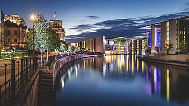
1113-102251 - Government district in the evening, Paul Loebe building, Spree, Berlin, Germany
857-92876 - A restaurant sells shark fin soup in Bangkok, Thailand, on April 25, 2015. Despite efforts by the Thai government to reduce consumption of the controversial delicacy, shark fin is still a common site at restaurants and markets in the Chinatown district.
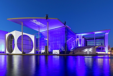
1131-696 - Glass facade of the Marie-Elisabeth-Lueders-Building, Government district, Berlin, Brandenburg, Germany, Europe
797-12147 - USA, Washington DC, Capitol Building,The building's dome with Statue of Freedom on top seen from Capitol Gardens.
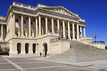
797-12155 - USA, Washington DC, Capitol Building, The House of Representatives.
797-12152 - USA, Washington DC, Capitol Building, Angular iew of the House of Representatives.
797-12154 - USA, Washington DC, Capitol Building, The House of Representatives reflected in the Capitol Visitor Centre roof.
797-12146 - USA, Washington DC, Capitol Building, Section of the building's dome with the American flag at half mast.
797-12151 - USA, Washington DC, Capitol Building, View from across the Capitol Reflecting Pool.
797-12149 - USA, Washington DC, Capitol Building, Close up of the building's dome from the west side.
797-12143 - USA, Washington DC, Capitol Building, The building's dome with the Statue of Freedom on top.
797-12150 - USA, Washington DC, Capitol Building, View from across the Capitol Reflecting Pool.
797-12145 - USA, Washington DC, Capitol Building, Section of the building's dome with the American flag at half mast.
797-12144 - USA, Washington DC, Capitol Building, The building's dome with the Statue of Freedom on top.
797-12153 - USA, Washington DC, Capitol Building, Angular iew of the House of Representatives.
797-12148 - USA, Washington DC, Capitol Building, View from the building's west side.
832-371443 - Grote Markt square, Civiele Griffie, records office and Stadhuis, city hall, old town of Bruges, UNESCO World Heritage Site, West Flanders, Flemish Region, Bruges, Belgium, Europe
832-369779 - State Capitol at Civic Center Park, Denver, Colorado, USA
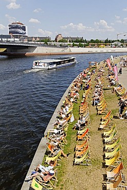
832-341845 - Capital Beach Bar on the bank of the Spree River, Regierungsviertel, government quarter, Berlin, Germany, Europe
832-341841 - Cyclists riding in front of Marie-Elisabeth-Lueders Haus, Regierungsviertel, government quarter, Berlin, Germany, Europe
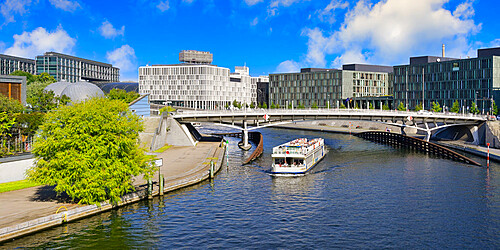
832-341838 - Tourist ship in front of Marie-Elisabeth-Lueders Haus, Regierungsviertel, government quarter, Berlin, Germany, Europe
832-334216 - Government of Upper Bavaria, Munich, Bavaria, Germany, Europe
832-301763 - City centre, financial district, view at Government House, Port Louis, Mauritius
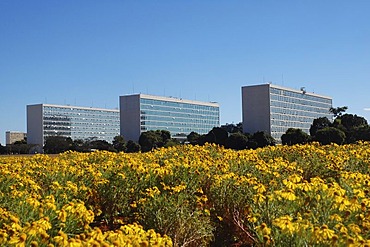
832-295828 - Ministries behind yellow flowers in Brasilia, Brazil
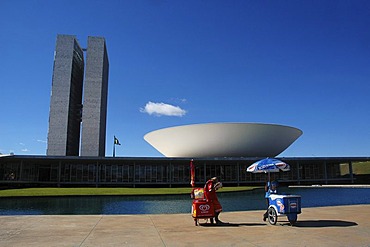
832-295829 - Iceman in front of the congress building (congresso nacional) in Brasilia, Brazil. The building was designed by the Architect Oscar Niemeyer.
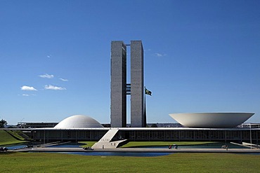
832-295873 - National Congress (Architect: Oscar Niemeyer), Brasilia, Brazil
832-294445 - Reichstag with place of the republic, Berlin, Germany
832-280027 - Government building, castle district, Budapest, Hungary, Europe
832-258289 - Tourists in front of the Reichstag building in autumn, seat of the German Bundestag, government district, Bezirk Mitte, Berlin, Germany, Europe
832-244416 - Aerial photograph, Arnsberg district government, district administration, Hochsauerland district, Arnsberg, Sauerland, North Rhine-Westphalia, Germany, Europe
832-228703 - State parliament building "Landtagsschiff", "State Parliament's Ship", Landhaus district, St. Poelten, Lower Austria, Austria, Europe
832-228704 - State parliament building "Landtagsschiff", "State Parliament's Ship", Landhaus district, St. Poelten, Lower Austria, Austria, Europe
832-222978 - Panoramic view, Duesseldorf Medienhafen media port, Neuer Zollhof with "Dancing Office Buildings" by F.O. Gehry, Rheinturm tower and Landtag parliament, Oberkasseler Bruecke bridge, in the front sport boats at the pier and water, Duesseldorf, state capita
832-219618 - Soldier in front of National Capitol, Capitolio Nacional, Bolivar Square, Plaza de Bolivar, Bogota, Colombia, South America
832-219770 - View from the television tower on the government district, architect Oscar Niemeyer, Brasilia, Distrito Federal state, Brazil, South America
832-219769 - View from the television tower on the government district, architect Oscar Niemeyer, Brasilia, Distrito Federal state, Brazil, South America
832-205002 - The Interior Ministry in the Moabit quarter, Mitte district, Berlin, Germany, Europe
832-197154 - Bundeskanzleramt Federal Chancellery, Regierungsviertel governmental district, capital Berlin, Germany, Europe
832-197153 - Bundeskanzleramt Federal Chancellery, Regierungsviertel governmental district, capital Berlin, Germany, Europe
832-164650 - Holocaust Memorial designed by architect Peter Eisenman, memorial to the murdered jews of Europe, with a view of the Quadriga on the Brandenburg Gate and the dome of the Reichstag parliament, Tiergarten district, Mitte district, Berlin, Germany, Europe
832-164485 - Bundespressestrand' city beach, salsa event, beach on the River Spree in the government district, Berlin, Germany, Europe
832-164676 - Bundeskanzleramt Federal Chancellery with Christmas tree, Regierungsviertel government district, Tiergarten district, Berlin, Germany, Europe
832-164756 - Marie-Elisabeth-Lueders-Haus building with the Spree river, parliament building with the Library of Parliament, Parliamentary Archives and the scientific service center of the German Parliament, Regierungsviertel government quarter, Tiergarten district, B
832-152550 - Otto von Wittelsbach monument, by Ferdinand von Miller the Younger, 1911, in front of the Staatskanzlei, Altstadt-Lehel district, Munich, Bavaria, Germany, Europe
832-152141 - District government of Braunschweig, Braunschweig, Lower Saxony, Germany, Europe
832-152271 - District government of Muenster, Muenster, Westphalia, North Rhine-Westphalia, Germany, Europe
832-144671 - Bundeskanzleramt, German Chancellery, Regierungsviertel government quarter, Tiergarten district, Berlin, Germany, Europe
832-141183 - Ministry of Foreign Affairs, Palacio Itamaraty, at night, architect Oscar Niemeyer, Brasilia, Distrito Federal, Brazilian Federal District, Brazil, South America
832-132014 - El Capitolio building, also known as National Capitol Building, Havana, historic district, Cuba, Caribbean, Central America
832-127091 - Marie-Elisabeth-Lueders-Haus building, river Spree at Schiffbauerdamm, Regierungsviertel government district, Berlin, Germany, Europe
832-128319 - Panoramic view of the Siegessaeule, Victory Column, towards east with the government district, the Reichstag building, Brandenburg Gate, TV Tower, skyscrapers in Potsdamer Platz, Potsdam Square, Mitte district, Berlin, Germany, Europe
832-126976 - Historic town centre, Embassy of the Federal Republic of Germany, Tallinn, formerly Reval, Estonia, Baltic States, Northern Europe
832-127090 - Passenger ship with tourists, Paul-Loebe-Haus building, river Spree at Schiffbauerdamm, Regierungsviertel government district, Berlin, Germany, Europe
832-119883 - Open air museum of the government district of Upper Bavaria, Glentleiten, Grossweil, Upper Bavaria, Germany, Europe


