Recent searches
Loading...
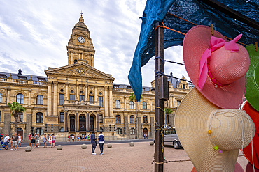
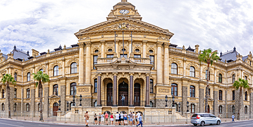
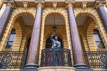
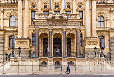
844-33761 - View of Nelson Mandela statue at Cape Town City Hall, Grand Parade, Cape Town, Western Cape, South Africa, Africa
844-33760 - View of Nelson Mandela statue at Cape Town City Hall, Grand Parade, Cape Town, Western Cape, South Africa, Africa
844-33759 - View of Nelson Mandela statue at Cape Town City Hall, Grand Parade, Cape Town, Western Cape, South Africa, Africa
844-33758 - View of Nelson Mandela statue at Cape Town City Hall, Grand Parade, Cape Town, Western Cape, South Africa, Africa
1113-107402 - Sheik Zayed Grand Mosque, Abu Dhabi, UAE
1241-304 - Halifax City Hall and Grand Parade, Downtown Halifax, Nova Scotia, Canada, North America
1160-4605 - Fountain at Grand Park and Town Hall, Los Angeles, California, United States of America, North America
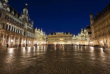
832-384609 - Town Hall, House of the Dukes of Brabant, Guild houses, Grand Place, Grote Markt, Evening twilight, Brussels, Belgium, Europe
794-944 - Central Station Hall, Grand Central Station, Manhattan, New York City, New York, United States of America, North America
1126-1832 - The Grand Hall of Lille Opera House, Lille, Nord, France, Europe
698-3391 - Grand Place and Brussels Hotel de Ville (Town Hall) at night, UNESCO World Heritage Site, Brussels, Belgium, Europe
1292-1427 - City Hall, Grand Place, Mons, Wallonia, Belgium, Europe
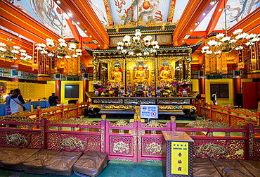
796-2423 - Grand Hall of Ten Thousand Buddhas at the The Big Buddha and Po Lin Monastery, Lantau Island, Hong Kong, China, Asia
796-2422 - Grand Hall of Ten Thousand Buddhas at the The Big Buddha and Po Lin Monastery, Lantau Island, Hong Kong, China, Asia
698-3264 - Busy marble concourse departure hall of Grand Central Terminal, Grand Central Station, Manhattan, New York, United States of America, North America
396-5208 - New Philharmonic Hall on Kirchberg in Luxembourg City, Grand Duchy of Luxembourg, Europe
396-4986 - New Philharmonic Hall on Kirchberg in Luxembourg City, Grand Duchy of Luxembourg, Europe
396-4989 - New Philharmonic Hall on Kirchberg in Luxembourg City, Grand Duchy of Luxembourg, Europe
396-4987 - European Court of Justice and New Philharmonic Hall on Kirchberg in Luxembourg City, Grand Duchy of Luxembourg, Europe
1226-240 - Sheikh Zayed Grand Mosque, Abu Dhabi, United Arab Emirates, Middle East
1226-239 - Sheikh Zayed Grand Mosque, Abu Dhabi, United Arab Emirates, Middle East
1226-125 - Sheikh Zayed Grand Mosque, Abu Dhabi, United Arab Emirates, Middle East
1226-122 - Sheikh Zayed Grand Mosque, Abu Dhabi, United Arab Emirates, Middle East
1226-124 - Sheikh Zayed Grand Mosque, Abu Dhabi, United Arab Emirates, Middle East
1226-114 - Sheikh Zayed Grand Mosque, Abu Dhabi, United Arab Emirates, Middle East
1226-121 - Sheikh Zayed Grand Mosque, Abu Dhabi, United Arab Emirates, Middle East
1226-120 - Sheikh Zayed Grand Mosque, Abu Dhabi, United Arab Emirates, Middle East
1226-98 - Sheikh Zayed Grand Mosque, Abu Dhabi, United Arab Emirates, Middle East
1226-116 - Sheikh Zayed Grand Mosque, Abu Dhabi, United Arab Emirates, Middle East
1226-118 - Sheikh Zayed Grand Mosque, Abu Dhabi, United Arab Emirates, Middle East
1226-119 - Sheikh Zayed Grand Mosque, Abu Dhabi, United Arab Emirates, Middle East
1226-117 - Sheikh Zayed Grand Mosque, Abu Dhabi, United Arab Emirates, Middle East
1226-103 - Sheikh Zayed Grand Mosque, Abu Dhabi, United Arab Emirates, Middle East
1226-107 - Sheikh Zayed Grand Mosque, Abu Dhabi, United Arab Emirates, Middle East
1226-113 - Sheikh Zayed Grand Mosque, Abu Dhabi, United Arab Emirates, Middle East
1226-106 - Sheikh Zayed Grand Mosque, Abu Dhabi, United Arab Emirates, Middle East
1226-115 - Sheikh Zayed Grand Mosque, Abu Dhabi, United Arab Emirates, Middle East
1226-101 - Sheikh Zayed Grand Mosque, Abu Dhabi, United Arab Emirates, Middle East
1226-112 - Sheikh Zayed Grand Mosque, Abu Dhabi, United Arab Emirates, Middle East
1226-111 - Sheikh Zayed Grand Mosque, Abu Dhabi, United Arab Emirates, Middle East
1226-109 - Sheikh Zayed Grand Mosque, Abu Dhabi, United Arab Emirates, Middle East
1226-108 - Sheikh Zayed Grand Mosque, Abu Dhabi, United Arab Emirates, Middle East
1226-105 - Sheikh Zayed Grand Mosque, Abu Dhabi, United Arab Emirates, Middle East
1226-110 - Sheikh Zayed Grand Mosque, Abu Dhabi, United Arab Emirates, Middle East
809-6778 - Main Prayer Hall. Sheikh Zayed Grand Mosque, Abu Dhabi, United Arab Emirates, Middle East
1184-273 - Grand market hall, Budapest, Hungary, Europe
1184-275 - Grand market hall, Budapest, Hungary, Europe
857-89709 - Hikers setup camp on a beach along the Colorado River near the plumeting 180-foot Deer Creek Falls in the Grand Canyon outside of Fredonia, Arizona November 2011. The 21.4-mile loop starts at the Bill Hall trailhead on the North Rim and descends 2000-feet in 2.5-miles through Coconino Sandstone to the level Esplanada then descends further into the lower canyon through a break in the 400-foot-tall Redwall to access Surprise Valley. Hikers connect Thunder River and Tapeats Creek to a route along the Colorado River and climb out Deer Creek.
857-89713 - Female hiker cooks dinner on a cliff-pinched patio above camp and the Colorado River near Deer Creek Falls in the Grand Canyon outside of Fredonia, Arizona November 2011. The 21.4-mile loop starts at the Bill Hall trailhead on the North Rim and descends 2000-feet in 2.5-miles through Coconino Sandstone to the level Esplanada then descends further into the lower canyon through a break in the 400-foot-tall Redwall to access Surprise Valley. Hikers connect Thunder River and Tapeats Creek to a route along the Colorado River and climb out Deer Creek.
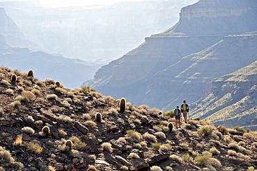
857-89701 - Hikers on the sandstone Esplanade of the Thunder River Trail below the North Rim of the Grand Canyon outside Fredonia, Arizona November 2011. The 21.4-mile loop descends 2000-feet in 2.5-miles through Coconino Sandstone from the Bill Hall trailhead to connect the Thunder River and Deer Creeks trails. Hikers descend into the lower canyon through a break in the 400-foot-tall Redwall to access Surprise Valley, Deer Creek, Tapeats Creek via Thunder River and even the Colorado River.
857-89710 - Hikers cook dinner on a cliff-pinched patio above camp and the Colorado River near Deer Creek Falls in the Grand Canyon outside of Fredonia, Arizona November 2011. The 21.4-mile loop starts at the Bill Hall trailhead on the North Rim and descends 2000-feet in 2.5-miles through Coconino Sandstone to the level Esplanada then descends further into the lower canyon through a break in the 400-foot-tall Redwall to access Surprise Valley. Hikers connect Thunder River and Tapeats Creek to a route along the Colorado River and climb out Deer Creek.
857-89708 - Hikers swim in the pool below 180-foot Deer Creek Falls in the Grand Canyon outside of Fredonia, Arizona November 2011. The 21.4-mile loop starts at the Bill Hall trailhead on the North Rim and descends 2000-feet in 2.5-miles through Coconino Sandstone to the level Esplanada then descends further into the lower canyon through a break in the 400-foot-tall Redwall to access Surprise Valley. Hikers connect Thunder River and Tapeats Creek to a route along the Colorado River and climb out Deer Creek.
857-89717 - Hikers follow a route along the Colorado River that connect Tapeats Creek and Thunder River to Deer Creek in the Grand Canyon outside of Fredonia, Arizona November 2011. The 21.4-mile loop starts at the Bill Hall trailhead on the North Rim and descends 2000-feet in 2.5-miles through Coconino Sandstone to the level Esplanada then descends further into the lower canyon through a break in the 400-foot-tall Redwall to access Surprise Valley. Hikers connect Thunder River and Tapeats Creek to a route along the Colorado River and climb out Deer Creek.
857-89712 - Male hiker filters water on a cliff-pinched patio near Deer Creek Falls in the Grand Canyon outside of Fredonia, Arizona November 2011. The 21.4-mile loop starts at the Bill Hall trailhead on the North Rim and descends 2000-feet in 2.5-miles through Coconino Sandstone to the level Esplanada then descends further into the lower canyon through a break in the 400-foot-tall Redwall to access Surprise Valley. Hikers connect Thunder River and Tapeats Creek to a route along the Colorado River and climb out Deer Creek.
857-89700 - Hikers on the sandstone Esplanade of the Thunder River Trail below the North Rim of the Grand Canyon outside Fredonia, Arizona November 2011. The 21.4-mile loop descends 2000-feet in 2.5-miles through Coconino Sandstone from the Bill Hall trailhead to connect the Thunder River and Deer Creeks trails. Hikers descend into the lower canyon through a break in the 400-foot-tall Redwall to access Surprise Valley, Deer Creek, Tapeats Creek via Thunder River and even the Colorado River.
857-89703 - Hikers past small waterfalls along Deer Creek Narrows in the Grand Canyon outside of Fredonia, Arizona November 2011. The 21.4-mile loop starts at the Bill Hall trailhead on the North Rim and descends 2000-feet in 2.5-miles through Coconino Sandstone to the level Esplanada then descends further into the lower canyon through a break in the 400-foot-tall Redwall to access Surprise Valley. Hikers connect Thunder River and Tapeats Creek to a route along the Colorado River and climb out Deer Creek.
857-89711 - Male hiker filters water on a cliff-pinched patio near Deer Creek Falls in the Grand Canyon outside of Fredonia, Arizona November 2011. The 21.4-mile loop starts at the Bill Hall trailhead on the North Rim and descends 2000-feet in 2.5-miles through Coconino Sandstone to the level Esplanada then descends further into the lower canyon through a break in the 400-foot-tall Redwall to access Surprise Valley. Hikers connect Thunder River and Tapeats Creek to a route along the Colorado River and climb out Deer Creek.
857-89702 - Hikers walk along Deer Creek Narrows in the Grand Canyon outside of Fredonia, Arizona November 2011. The 21.4-mile loop starts at the Bill Hall trailhead on the North Rim and descends 2000-feet in 2.5-miles through Coconino Sandstone to the level Esplanada then descends further into the lower canyon through a break in the 400-foot-tall Redwall to access Surprise Valley. Hikers connect Thunder River and Tapeats Creek to a route along the Colorado River and climb out Deer Creek.
857-89705 - Hikers walk along Deer Creek Narrows in the Grand Canyon outside of Fredonia, Arizona November 2011. The 21.4-mile loop starts at the Bill Hall trailhead on the North Rim and descends 2000-feet in 2.5-miles through Coconino Sandstone to the level Esplanada then descends further into the lower canyon through a break in the 400-foot-tall Redwall to access Surprise Valley. Hikers connect Thunder River and Tapeats Creek to a route along the Colorado River and climb out Deer Creek.
911-10184 - The Victoria Memorial Hall in Calcutta, Bengal, India, built to commemorate Queen Victoria.
808-1441 - The main concourse of Grand Central Station, Manhattan, New York, United States of America, North America
857-86011 - Hikers walk along Deer Creek Narrows in the Grand Canyon outside of Fredonia, Arizona November 2011. The 21.4-mile loop starts at the Bill Hall trailhead on the North Rim and descends 2000-feet in 2.5-miles through Coconino Sandstone to the level Esplanada then descends further into the lower canyon through a break in the 400-foot-tall Redwall to access Surprise Valley. Hikers connect Thunder River and Tapeats Creek to a route along the Colorado River and climb out Deer Creek.
857-86023 - Male hiker filters water on a cliff-pinched patio near Deer Creek Falls in the Grand Canyon outside of Fredonia, Arizona November 2011. The 21.4-mile loop starts at the Bill Hall trailhead on the North Rim and descends 2000-feet in 2.5-miles through Coconino Sandstone to the level Esplanada then descends further into the lower canyon through a break in the 400-foot-tall Redwall to access Surprise Valley. Hikers connect Thunder River and Tapeats Creek to a route along the Colorado River and climb out Deer Creek.
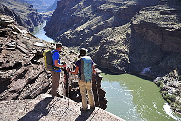
857-86016 - Hikers overlook the Colorado River as they exit the Deer Creek Narrows in the Grand Canyon outside of Fredonia, Arizona November 2011. The 21.4-mile loop starts at the Bill Hall trailhead on the North Rim and descends 2000-feet in 2.5-miles through Coconino Sandstone to the level Esplanada then descends further into the lower canyon through a break in the 400-foot-tall Redwall to access Surprise Valley. Hikers connect Thunder River and Tapeats Creek to a route along the Colorado River and climb out Deer Creek.
857-86021 - Hikers setup camp on a beach along the Colorado River near the plumeting 180-foot Deer Creek Falls in the Grand Canyon outside of Fredonia, Arizona November 2011. The 21.4-mile loop starts at the Bill Hall trailhead on the North Rim and descends 2000-feet in 2.5-miles through Coconino Sandstone to the level Esplanada then descends further into the lower canyon through a break in the 400-foot-tall Redwall to access Surprise Valley. Hikers connect Thunder River and Tapeats Creek to a route along the Colorado River and climb out Deer Creek.
857-86015 - Hikers walk along Deer Creek Narrows in the Grand Canyon outside of Fredonia, Arizona November 2011. The 21.4-mile loop starts at the Bill Hall trailhead on the North Rim and descends 2000-feet in 2.5-miles through Coconino Sandstone to the level Esplanada then descends further into the lower canyon through a break in the 400-foot-tall Redwall to access Surprise Valley. Hikers connect Thunder River and Tapeats Creek to a route along the Colorado River and climb out Deer Creek.
857-86013 - Hikers walk along Deer Creek Narrows in the Grand Canyon outside of Fredonia, Arizona November 2011. The 21.4-mile loop starts at the Bill Hall trailhead on the North Rim and descends 2000-feet in 2.5-miles through Coconino Sandstone to the level Esplanada then descends further into the lower canyon through a break in the 400-foot-tall Redwall to access Surprise Valley. Hikers connect Thunder River and Tapeats Creek to a route along the Colorado River and climb out Deer Creek.
857-86000 - Hikers on the sandstone Esplanade of the Thunder River Trail below the North Rim of the Grand Canyon outside Fredonia, Arizona November 2011. The 21.4-mile loop descends 2000-feet in 2.5-miles through Coconino Sandstone from the Bill Hall trailhead to connect the Thunder River and Deer Creeks trails. Hikers descend into the lower canyon through a break in the 400-foot-tall Redwall to access Surprise Valley, Deer Creek, Tapeats Creek via Thunder River and even the Colorado River.
857-86025 - Hikers follow a route along the Colorado River that connect Tapeats Creek and Thunder River to Deer Creek in the Grand Canyon outside of Fredonia, Arizona November 2011. The 21.4-mile loop starts at the Bill Hall trailhead on the North Rim and descends 2000-feet in 2.5-miles through Coconino Sandstone to the level Esplanada then descends further into the lower canyon through a break in the 400-foot-tall Redwall to access Surprise Valley. Hikers connect Thunder River and Tapeats Creek to a route along the Colorado River and climb out Deer Creek.
857-86007 - Hikers cook dinner along Deer Creek Narrows in the Grand Canyon outside of Fredonia, Arizona November 2011. The 21.4-mile loop starts at the Bill Hall trailhead on the North Rim and descends 2000-feet in 2.5-miles through Coconino Sandstone to the level Esplanada then descends further into the lower canyon through a break in the 400-foot-tall Redwall to access Surprise Valley. Hikers connect Thunder River and Tapeats Creek to a route along the Colorado River and climb out Deer Creek.
857-86027 - Hikers climb out of Surprise Valley to the North Rim of the Grand Canyon outside of Fredonia, Arizona November 2011. The 21.4-mile loop starts at the Bill Hall trailhead on the North Rim and descends 2000-feet in 2.5-miles through Coconino Sandstone to the level Esplanada then descends further into the lower canyon through a break in the 400-foot-tall Redwall to access Surprise Valley. Hikers connect Thunder River and Tapeats Creek to a route along the Colorado River and climb out Deer Creek.
857-86022 - Hikers setup camp on a beach along the Colorado River near the plumeting 180-foot Deer Creek Falls in the Grand Canyon outside of Fredonia, Arizona November 2011. The 21.4-mile loop starts at the Bill Hall trailhead on the North Rim and descends 2000-feet in 2.5-miles through Coconino Sandstone to the level Esplanada then descends further into the lower canyon through a break in the 400-foot-tall Redwall to access Surprise Valley. Hikers connect Thunder River and Tapeats Creek to a route along the Colorado River and climb out Deer Creek.
857-86003 - Hikers descend into Surprise Valley to access the lower canyon through a break in the 400-foot-tall Redwall on the Thunder River Trail in the Grand Canyon outside of Fredonia, Arizona November 2011. The 21.4-mile loop starts at the Bill Hall trailhead on the North Rim and descends 2000-feet in 2.5-miles through Coconino Sandstone to the level Esplanada then descends further into the lower canyon to access Thunder River, Tapeats Creek and Deer Creek.
1126-1267 - Town Hall Spire, Grand Place, UNESCO World Heritage Site, Brussels, Belgium, Europe
808-1241 - A gondola crossing the Grand Canal, Venice, UNESCO World Heritage Site, Veneto, Italy, Europe
808-1242 - A gondola crossing the Grand Canal, Venice, UNESCO World Heritage Site, Veneto, Italy, Europe
808-1252 - The Grand Canal and the domed Santa Maria Della Salute, Venice, UNESCO World Heritage Site, Veneto, Italy, Europe
808-1251 - Grand Canal, Venice, UNESCO World Heritage Site, Veneto, Italy, Europe
808-1257 - The Grand Canal and the domed Santa Maria Della Salute, Venice, UNESCO World Heritage Site, Veneto, Italy, Europe
826-601 - Town Hall Square, surrounded by grand, historic buildings, many now used as bars and cafes, in Tallinn, Estonia, Europe
826-604 - Town Hall Square, surrounded by grand, historic buildings, many now used as bars and cafes, in Tallinn, Estonia, Europe
832-343699 - Town Hall at the main square (French: Grand Place, Dutch: Grote Markt) in Brussels, Belgium, Europe
832-353171 - Six day race in Olympiahalle Munich Germany
832-350866 - Grand Hotel Europa Prague Wenceslas Square Czech Republic
832-353170 - Six day race in Olympiahalle Munich Germany
817-462334 - Wooden cart and the Great Hall at Grand Portage, Grand Portage National Monument, Minnesota.
817-461468 - Belgium; Brussels; Grand Place, City Hall, Hotel de Ville.
817-461469 - Belgium; Brussels; Grand Place, City Hall, Hotel de Ville.
817-461466 - Belgium; Brussels; Grand Place, City Hall, Hotel de Ville.
817-463166 - Exterior of the Great Hall, Grand Portage National Monument, Grand Portage, Minnesota, United States of America.
817-463165 - Exterior of the Great Hall with North West Company flag, Grand Portage National Monument, Grand Portage, Minnesota, United States of America.
817-462497 - The interior of the Grand Livadia Palace, summer palace of the last Russian Imperial family, the Greater Yalta, Crimea, Ukraine, Eastern Europe.
817-461465 - Belgium; Brussels; Grand Place, City Hall, Hotel de Ville.
817-461467 - Belgium; Brussels; Grand Place, City Hall, Hotel de Ville.
817-460838 - Hotel de Ville (City Hall) on Grand Place in Brussels.
832-268642 - Philharmonic hall, concert hall of the Philharmonique du Luxembourg, Luxembourg, Europe
832-252391 - Lobby, Grand-Hyatt, Jin-Mao-Tower, Shanghai, China, Asia
