Recent searches
Loading...
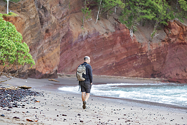
1116-52811 - View from behind of a man walking along the beach among the rocky sea cliffs looking out at the Pacific Ocean on the Road to Hana, Maui, Hawaii, United States of America
1350-6586 - Group of friends walking a coastal path next to Cala Varques in Mallorca, Spain
1350-5303 - Young female pilgrim walking the Way of Saint James (Camino de Santiago), Galicia, Spain
1350-5309 - Young female pilgrim walking the Way of Saint James (Camino de Santiago), Galicia, Spain
1350-5342 - Young woman faces blizzard while hiking in snowy day at Pe?alara, highest mountain peak in the mountain range of Guadarrama, Spain
1350-5346 - Young female pilgrim walking the Way of Saint James (Camino de Santiago), Galicia, Spain
1350-2315 - Porco's bay and Dois Irmaos islands, Fernando de Noronha national marine sanctuary, Pernambuco, Brazil (S. Atlantic)
832-388473 - Koppental hiking trail from Obertraun to Bad Aussee, river Koppentraun, railway tunnel of the old route, Salzkammergut, Upper Austria, Austria, Europe
1116-48307 - A boardwalk path leads hikers through the hiking route on the Vatnajokull National Park plateau, Iceland
1188-950 - Christian pilgrims on the Camino de Santiago (St. James' Way) route in France on their way to Spain, France, Europe
1188-951 - Christian pilgrims walking the Camino de Santiago (St. James' Way) route in Spain, Europe
1225-1295 - Hiking in typical mountainous terrain of the Dolomites range of the Alps on the Alta Via 1 trekking route near Rifugio Nuvolau, Belluno, Veneto, Italy, Europe
1225-1307 - Hiking in typical mountainous terrain of the Dolomites range of the Alps on the Alta Via 1 trekking route near Rifugio Nuvolau, Belluno, Veneto, Italy, Europe
1225-1294 - Walkers hiking through the Dolomites range of the Alps along the Alta Via 1 trekking route, Belluno, Veneto, Italy, Europe
1225-1293 - Hiking in typical mountainous terrain of the Dolomites range of the Alps on the Alta Via 1 trekking route near Rifugio Nuvolau, Belluno, Veneto, Italy, Europe
1225-1269 - Hikers beside the Moiry Glacier on the Walkers Haute Route from Chamonix to Zermatt, Swiss Alps, Valais, Switzerland, Europe
857-95997 - Climber traversing across the Au Sable River to access the climbing a route on Moss Cliff above Wilmington Notch, Adirondack Mountains, New York State, USA
857-96117 - Distant view of senior woman hiking on footpath in forest, Haute Route, Valais Canton, Switzerland
1225-1267 - Walkers descend from the top of Pic Peyreget while hiking the GR10 trekking trail, Pyrenees Atlantiques, France, Europe
1225-1253 - Walkers admire the view of Pic du Midi d'Ossau from the top of Col d'Ayous on the GR10 trekking route, Pyrenees Atlantiques, France, Europe
1225-1260 - Trekking on the GR20 in Corsica near the Aiguilles de Bavella towards Refuge d'Asinao, Corsica, France, Mediterranean, Europe
1225-1250 - Walkers descend from the top of Pic Peyreget while hiking the GR10 trekking trail, Pyrenees Atlantiques, France, Europe
1225-1262 - Trekking on the GR20 in Corsica near the Aiguilles de Bavella towards Refuge d'Asinao, Corsica, France, Mediterranean, Europe
1225-1259 - Trekking on the GR20 in Corsica near the Aiguilles de Bavella hiking towards Refuge d'Asinao, Corsica, France, Mediterranean, Europe
1225-1257 - Mont Blanc range seen from the Tour du Mont Blanc trekking route near Lac Blanc in the French Alps, Haute Savoie, Auvergne-Rhone-Alpes, France, Europe
1225-1256 - Hikers and the summit of Mont Blanc reflected in Lac Blanc on the Tour du Mont Blanc trekking route in the French Alps, Haute Savoie, Auvergne-Rhone-Alpes, France, Europe
1225-1249 - A hiker watches the sunset on the Pyrenees and a cloud inversion near Refuge Pombie along the GR10 trekking route, Pyrenees Atlantiques, France, Europe
1225-1254 - Walkers descend from the top of Col d'Ayous on the GR10 trekking route in the French Pyrenees, Pyrenees Atlantiques, France, Europe
1225-1247 - Camped beside Lac Gentau with views of Pic du Midi d'Ossau on the GR10 trekking route in the French Pyrenees, Pyrenees Atlantiques, France, Europe
1225-1258 - WIld camping on the GR5 trail or Grand Traverse des Alps near Refuge De Bellachat with views of the Mont Blanc, Chamonix, Haute Savoie, Auvergne-Rhone-Alpes, French Alps, France, Europe
1225-1252 - Taking in the view of Midi d'Ossau beyond Lac Gentau beside the GR10 trekking route in the French Pyrenees, Pyrenees Atlantiques, France, Europe
1225-1251 - Lac du Miey and Pic Midi d'Ossau seen from the GR10 hiking trail in the French Pyrenees, Pyrenees Atlantiques, France, Europe
1225-1248 - A hiker looks out at the Pyrenees mountains from the top of Col Peyreget while hiking the GR10 trekking trail, Pyrenees Atlantiques, France, Europe
1225-1261 - Trekking on the GR20 in Corsica near the Aiguilles de Bavella hiking towards Refuge d'Asinao, Corsica, France, Mediterranean, Europe
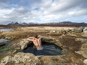
832-381829 - Young man in a hot spring, near Eyjar og Miklaholt, Vesturland, Iceland, Europe
832-382155 - Young man in a hot spring, near Eyjar og Miklaholt, Vesturland, Iceland, Europe
832-382192 - Snack plate with bacon, salami, gray cheese and horseradish on the Rossalm, Braies, Sexten Dolomites, South Tyrol, Italy, Europe
832-381999 - Man and woman, couple during Nordic Walking in the mountains, Rittner Horn, South Tyrol, Italy, Europe
832-381267 - Man in red jacket in front of Kvernufoss waterfall in a gorge, dramatic atmosphere, time exposure, near Skógafoss, Southurland, Iceland, Europe
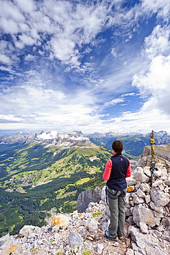
832-380276 - Hikers at summit cross, Kemater Alm, Kalkkögel, Tyrol, Austria, Europe
832-380733 - Hiker at Sattelsee lake at Greifenbergsattel, ascent to Greifenberg, Schladminger Höhenweg, Schladminger Tauern, Schladming, Styria, Austria, Europe
832-380422 - Hikers climbing through volcanic landscape, Volcano Etna, Province of Catania, Silzilia, Italy, Europe
832-380730 - Hiker on the Schladminger Höhenweg with rising clouds of fog, Schladminger Tauern, Schladming, Steiermark, Austria, Europe
832-380946 - Hikers on narrow footpath along a Levada watercourse, rainforest in fog, Caldeirao Verde, Queimadas, Madeira, Portugal, Europe
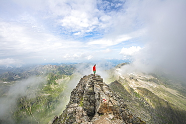
832-380732 - Hiker at the summit cross of Hochgolling, Schladminger Höhenweg, Schladminger Tauern, Schladming, Styria, Austria, Europe
832-380731 - Hiker on the summit of the Hochgolling with rising fog, Schladminger Höhenweg, Schladminger Tauern, Schladming, Steiermark, Austria, Europe
832-380840 - Hiker walking through forest with tree ferns, Abel Tasman National Park, Southland, New Zealand, Oceania
832-380841 - Hiker on walk through rainforest on Lake Matheson, Fox Glacier, West Coast, Southland, New Zealand, Oceania
832-380926 - Woman on volcano Leirhnjúkur, Krafla Volcanic area, Reykjahlíð, Mývatni, Island
832-380816 - Hiker on path, Rohrmoos-Untertal, Schladminger Tauern, Schladming, Styria, Austria, Europe
832-380817 - Female hiker on footpath in mountains, sun shines over ridge, ascend Greifenberg, Schladminger Tauern, Styria, Austria, Europe
832-380409 - Isar and Karwendel mountains, Isar nature trail, Krün, Mittenwald, Upper Bavaria, Bavaria, Germany, Europe
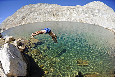
857-95087 - Man diving into La Salle Lake while hiking on a two-week trek of the Sierra High Route in the John Muir Wilderness in California. The 200-mile route roughly parallels the popular John Muir Trail through the Sierra Nevada Range of California from Kings Canyon National Park to Yosemite National Park.
1287-53 - A group of trekkers relaxing after a long day at New Shira Camp on the Machame Route up Mount Kilimanjaro, with the Shira Ridge in the background, Tanzania, East Africa, Africa
1287-52 - A group of trekkers with their local guide descending in Barranco Camp on the Machame Route on Mount Kilimanjaro, Tanzania, East Africa, Africa
1287-50 - A group of trekkers relaxing after a long day at New Shira Camp on the Machame Route to the summit of Mount Kilimanjaro, Tanzania, East Africa, Africa
1287-55 - A group of Trekkers on the Machame Route on Mount Kilimanjaro descending towards the clouds, Tanzania, East Africa, Africa
857-94592 - Two hikers are cheering with big local beers in the garden of the Arolla Kurhaus in the Swiss Alps. It is one of the places you can stay for the night half way the Haute Route, a classic multi day hike between Chamonix in France and Zermatt in Switzerland.
857-94595 - Trail running shoes are resting in the mountains of Switzerland. Halfway the Haute Route, a classic multi day hike in Switzerland.
857-94337 - A hiker is almost at the Cabane du Mont Fort, a mountain hut near Verbier. The sunset puts the sky in pink and purple colors. It rained all day, and cleared just before this picture. The hut is one of the places hikers stay at during the Haute Route, a classic hike between Chamonix in France and Zermatt in Switzerland.
857-93609 - Climbers Trace Ghostly Shapes Through The Starry Night On Mount Kilimanjaro's Rongai Route
1225-1135 - Trekking across a temporary bridge between Shomuthang and Robluthang on the Laya-Gasa trekking route, Gasa District, Bhutan, Asia
1225-50 - Trekkers make their way along an alternative route via Photse to Everest Base Camp, Himalayas, Nepal, Asia
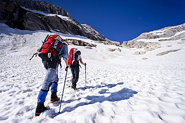
857-92627 - Three backpackers hike over snow in the Coast Mountain Range en route Joffre Peak in British Columbia, Canada, Pemberton, British Columbia, Canada
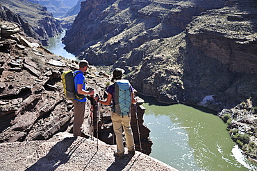
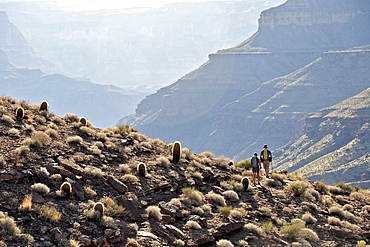
857-89717 - Hikers follow a route along the Colorado River that connect Tapeats Creek and Thunder River to Deer Creek in the Grand Canyon outside of Fredonia, Arizona November 2011. The 21.4-mile loop starts at the Bill Hall trailhead on the North Rim and descends 2000-feet in 2.5-miles through Coconino Sandstone to the level Esplanada then descends further into the lower canyon through a break in the 400-foot-tall Redwall to access Surprise Valley. Hikers connect Thunder River and Tapeats Creek to a route along the Colorado River and climb out Deer Creek.
857-90040 - Climber talking on a phone while hiking to a nearby climbing route, north Iceland.
857-89705 - Hikers walk along Deer Creek Narrows in the Grand Canyon outside of Fredonia, Arizona November 2011. The 21.4-mile loop starts at the Bill Hall trailhead on the North Rim and descends 2000-feet in 2.5-miles through Coconino Sandstone to the level Esplanada then descends further into the lower canyon through a break in the 400-foot-tall Redwall to access Surprise Valley. Hikers connect Thunder River and Tapeats Creek to a route along the Colorado River and climb out Deer Creek.
857-86011 - Hikers walk along Deer Creek Narrows in the Grand Canyon outside of Fredonia, Arizona November 2011. The 21.4-mile loop starts at the Bill Hall trailhead on the North Rim and descends 2000-feet in 2.5-miles through Coconino Sandstone to the level Esplanada then descends further into the lower canyon through a break in the 400-foot-tall Redwall to access Surprise Valley. Hikers connect Thunder River and Tapeats Creek to a route along the Colorado River and climb out Deer Creek.
857-86016 - Hikers overlook the Colorado River as they exit the Deer Creek Narrows in the Grand Canyon outside of Fredonia, Arizona November 2011. The 21.4-mile loop starts at the Bill Hall trailhead on the North Rim and descends 2000-feet in 2.5-miles through Coconino Sandstone to the level Esplanada then descends further into the lower canyon through a break in the 400-foot-tall Redwall to access Surprise Valley. Hikers connect Thunder River and Tapeats Creek to a route along the Colorado River and climb out Deer Creek.
857-86021 - Hikers setup camp on a beach along the Colorado River near the plumeting 180-foot Deer Creek Falls in the Grand Canyon outside of Fredonia, Arizona November 2011. The 21.4-mile loop starts at the Bill Hall trailhead on the North Rim and descends 2000-feet in 2.5-miles through Coconino Sandstone to the level Esplanada then descends further into the lower canyon through a break in the 400-foot-tall Redwall to access Surprise Valley. Hikers connect Thunder River and Tapeats Creek to a route along the Colorado River and climb out Deer Creek.
857-86015 - Hikers walk along Deer Creek Narrows in the Grand Canyon outside of Fredonia, Arizona November 2011. The 21.4-mile loop starts at the Bill Hall trailhead on the North Rim and descends 2000-feet in 2.5-miles through Coconino Sandstone to the level Esplanada then descends further into the lower canyon through a break in the 400-foot-tall Redwall to access Surprise Valley. Hikers connect Thunder River and Tapeats Creek to a route along the Colorado River and climb out Deer Creek.
857-86013 - Hikers walk along Deer Creek Narrows in the Grand Canyon outside of Fredonia, Arizona November 2011. The 21.4-mile loop starts at the Bill Hall trailhead on the North Rim and descends 2000-feet in 2.5-miles through Coconino Sandstone to the level Esplanada then descends further into the lower canyon through a break in the 400-foot-tall Redwall to access Surprise Valley. Hikers connect Thunder River and Tapeats Creek to a route along the Colorado River and climb out Deer Creek.
857-86025 - Hikers follow a route along the Colorado River that connect Tapeats Creek and Thunder River to Deer Creek in the Grand Canyon outside of Fredonia, Arizona November 2011. The 21.4-mile loop starts at the Bill Hall trailhead on the North Rim and descends 2000-feet in 2.5-miles through Coconino Sandstone to the level Esplanada then descends further into the lower canyon through a break in the 400-foot-tall Redwall to access Surprise Valley. Hikers connect Thunder River and Tapeats Creek to a route along the Colorado River and climb out Deer Creek.
857-86007 - Hikers cook dinner along Deer Creek Narrows in the Grand Canyon outside of Fredonia, Arizona November 2011. The 21.4-mile loop starts at the Bill Hall trailhead on the North Rim and descends 2000-feet in 2.5-miles through Coconino Sandstone to the level Esplanada then descends further into the lower canyon through a break in the 400-foot-tall Redwall to access Surprise Valley. Hikers connect Thunder River and Tapeats Creek to a route along the Colorado River and climb out Deer Creek.
857-86027 - Hikers climb out of Surprise Valley to the North Rim of the Grand Canyon outside of Fredonia, Arizona November 2011. The 21.4-mile loop starts at the Bill Hall trailhead on the North Rim and descends 2000-feet in 2.5-miles through Coconino Sandstone to the level Esplanada then descends further into the lower canyon through a break in the 400-foot-tall Redwall to access Surprise Valley. Hikers connect Thunder River and Tapeats Creek to a route along the Colorado River and climb out Deer Creek.
832-371076 - Ascent of Piz Boe Mountain on the Piazzetta Climbing Route, Dolomites, Alto Adige, Italy, Europe
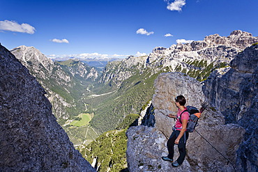
832-371083 - Hikers at the Latemar crossing, fixed rope route, Rosengarten group at back, Dolomites mountain range, South Tyrol, Italy, Europe
832-371084 - Climbers ascending Mt. Marmolada, Dolomites, Westgrat fixed rope route, Mt. Marmolada in the back, Trentino, Italy, Europe
832-371075 - Ascent of Piz Boe Mountain on the Piazzetta Climbing Route, Dolomites, Alto Adige, Italy, Europe
832-371077 - Ascent of Piz Boe Mountain on the Piazzetta Climbing Route, Dolomites, Alto Adige, Italy, Europe
832-371085 - Climbers ascending Mt. Marmolada, Dolomites, Westgrat fixed rope route, Mt. Marmolada in the back, Trentino, Italy, Europe
832-371089 - Climber crossing the Latemar massif, fixed rope route, Dolomites, on the Torre Diamantidi peak, in the back the Rosengarten group, South Tyrol, Italy, Europe
832-371097 - Mountain climber ascending Monte Piano climbing route, Alta Pusteria, in front of the Val di Landro Valley, Dolomites, Alto Adige, Italy, Europe
832-371099 - Mountain climber on the Herrensteig climbing route, Kofelwiesen alpine meadows, looking into the valley of Valle di Funes, Alto Adige, Italy, Europe
832-371081 - Hikers climbing Mt Marmolata, fixed rope route on west ridge, Dolomites mountain range, Italy, Europe
10-396 - A view of Lochan Meal An T-suidhe, taken from the Mountain Track (Tourist Route), Ben Nevis, Highlands, Scotland, United Kingdom, Europe
832-284933 - Emergency hut at the highland route Kaldidalur, Iceland
832-361154 - Hiking trail, Snezka, 1602 m, Giant Mountains, Czechia
832-366186 - Road to Santiago , event for the pilger , theatre style , Galicia , Santiago de Compostela , Spain , Europe
1113-95719 - Teenager climbing on the Paternkofel fixed rope route past the Frankfurter Wuerstel rock, via ferrata, Boedenseen, Hochpustertal, Dolomites, South Tyrol, Italy
832-262502 - Rock climbers on Hindelanger climbing route, Oberstdorf, Allgaeu, Bavaria, Germany, Europe
1161-5924 - Animal pawprints in the snow in arctic landscape at Kvaløysletta, Kvaloya Island, Tromso in Arctic Circle Northern Norway
1161-5935 - Animal pawprints in the snow in arctic landscape at Kvaløysletta, Kvaloya Island, Tromso in Arctic Circle Northern Norway
1161-5925 - Alaskan Huskies dog-sledding at Villmarkssenter wilderness centre on Kvaloya Island, Tromso in Arctic Circle Northern Norway
1161-5922 - Alaskan Huskies dog-sledding at Villmarkssenter wilderness centre on Kvaloya Island, Tromso in Arctic Circle, Northern Norway
1161-5918 - Alaskan Huskies dog-sledding at Villmarkssenter wilderness centre on Kvaloya Island, Tromso in Arctic Circle, Northern Norway
1161-5927 - Alaskan Huskies dog-sledding at Villmarkssenter wilderness centre on Kvaloya Island, Tromso in Arctic Circle Northern Norway
1161-5920 - Alaskan Huskies dog-sledding at Villmarkssenter wilderness centre on Kvaloya Island, Tromso in Arctic Circle, Northern Norway
