Recent searches
Loading...
1320-162 - The Geldingadalir Volcanic Eruption, Fagradalsfjall, Iceland, Polar Regions
1320-170 - The Geldingadalir Volcanic Eruption, Fagradalsfjall, Iceland, Polar Regions
1320-163 - The Geldingadalir Volcanic Eruption, Fagradalsfjall, Iceland, Polar Regions
1320-166 - The Geldingadalir Volcanic Eruption, Fagradalsfjall, Iceland, Polar Regions
1320-161 - The Geldingadalir Volcanic Eruption, Fagradalsfjall, Iceland, Polar Regions
1320-159 - The Geldingadalir Volcanic Eruption, Fagradalsfjall, Iceland, Polar Regions
1320-168 - The Geldingadalir Volcanic Eruption, Fagradalsfjall, Iceland, Polar Regions
746-90037 - Cityscape of Centuripe and in the background the erupting Volcano Etna, Sicily, Italy, Europe
746-90038 - Cityscape of Centuripe and in the background the erupting Volcano Etna, Sicily, Italy, Europe
746-90029 - Night eruption of Etna volcano seen from Zafferana Etnea village, Etna National Park, UNESCO, World Heritage Site, Sicily, Italy, Europe
832-394547 - Seagull, surf, Reynisfjara lava beach, near Vik i Myrdal, south coast, Iceland, Europe
832-394592 - Volcanic landscape, Odaoahraun, Icelandic highlands, Iceland, Europe
832-394583 - Solidified lava, lava desert, Icelandic highlands, Iceland, Europe
832-394636 - Backlight, sunset, dirt road leads through moss-covered volcanic landscape, Laki Crater or Lakagigar, Highlands, South Iceland, Suourland, Iceland, Europe
832-394553 - Colored rhyolite mountains, Graenihryggur, Landmannalaugar, Fjallabak, Icelandic highlands, Iceland, Europe
832-394584 - Solidified lava, lava flow, Odaoahraun, Icelandic highlands, Iceland, Europe
832-394551 - Domestic sheep (Ovis aries) in lava overgrown with Racomitrium elongatum, Ytra Hraun, near Kirkjubaejarklaustur, Kirkjubaejarklaustur, Skaftarhreppur municipality, Suourland region, Sudurland, Iceland, Europe
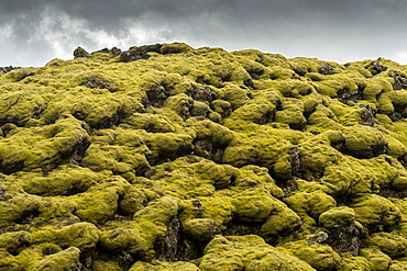
832-394552 - Lava overgrown by Elongated Rock Moss (Racomitrium elongatum), Ytra Hraun, near Kirkjubaejarklaustur, Kirkjubaejarklaustur, Skaftarhreppur municipality, Suourland region, Sudurland, Iceland, Europe
832-394595 - Green tent braced with lava rock, Askja volcano, Icelandic highlands, Iceland, Europe
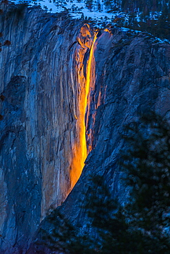
1178-37835 - Horsetail Falls in Yosemite National Park, Yosemite, California, United States
832-394013 - Aerial view, erupting volcano with lava fountains and lava field, crater with erupting lava and lava flow, Fagradalsfjall, Reykjanes Peninsula, Iceland, Europe
832-394166 - Glowing lava fountains, flowing partly down mountainside, dusk, Fagradalsfjall, Reykjanes, Grindavik, Iceland, Europe
832-394165 - Glowing lava fountains, partially flowing down mountainside, night shot, Fagradalsfjall, Reykjanes, Grindavik, Sudurnes, Iceland, Europe
832-393829 - River Gigjukvisl and Nupsa embedded in lava sand, Skaftafell, Austurland, Iceland, Europe
832-394169 - Glowing lava flows partly down mountainside, night shot, Fagradalsfjall, Reykjanes, Grindavik, Sudurnes, Iceland, Europe
832-394178 - Tent in front of volcanic cone and lava, barren landscape, Vogar, Hverfjall, Myvatn, Iceland, Europe
832-394011 - Aerial view, erupting volcano with lava fountains and lava field, crater with erupting lava and lava flow, Fagradalsfjall, Reykjanes Peninsula, Iceland, Europe
832-394014 - Aerial view, erupting volcano with lava fountains and lava field, crater with erupting lava and lava flow, Fagradalsfjall, Reykjanes Peninsula, Iceland, Europe
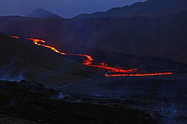
832-394163 - Glowing lava flows down mountainside, night shot, Fagradalsfjall, Reykjanes, Grindavik, Sudurnes, Iceland, Europe
832-394170 - Lava fountains bubbling in a volcanic crater, Fagradalsfjall, Reykjanes, Grindavik, Iceland, Europe
832-394012 - Aerial view, erupting volcano with lava fountains and lava field, crater with erupting lava and lava flow, Fagradalsfjall, Reykjanes Peninsula, Iceland, Europe
832-394015 - Aerial view, erupting volcano with lava fountains and lava field, crater with erupting lava and lava flow, Fagradalsfjall, Reykjanes Peninsula, Iceland, Europe
832-394164 - Glowing lava flows down mountainside, night shot, Fagradalsfjall, Reykjanes, Grindavik, Sudurnes, Iceland, Europe
832-394168 - Stone desert and active volcano in the background, Glowing lava fountains, Fagradalsfjall, Reykjanes, Grindavik, Sudurnes, Iceland, Europe
832-394016 - Aerial view, erupting volcano with lava fountains and lava field, crater with erupting lava and lava flow, Fagradalsfjall, Reykjanes Peninsula, Iceland, Europe
832-394167 - Glowing lava flows partly down mountainside, night shot, Fagradalsfjall, Reykjanes, Grindavik, Sudurnes, Iceland, Europe
1112-6312 - An adult San Cristobal lava lizard (Microlophus bivittatus), Punta Pitt on San Cristobal Island, Galapagos, Ecuador, South America
1112-6310 - An adult Galapagos lava lizard (Microlophus albemarlensis), North Seymour Island, Galapagos, Ecuador, South America
1112-6309 - An adult Galapagos lava lizard (Microlophus albemarlensis), North Seymour Island, Galapagos, Ecuador, South America
1112-6311 - An adult Galapagos lava lizard (Microlophus albemarlensis), North Seymour Island, Galapagos, Ecuador, South America
1112-6313 - An adult San Cristobal lava lizard (Microlophus bivittatus), Punta Pitt on San Cristobal Island, Galapagos, Ecuador, South America
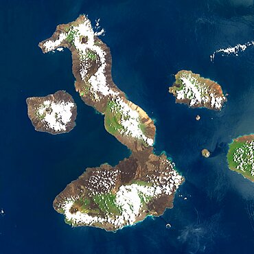
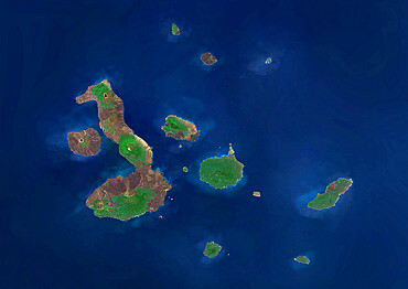
1348-4557 - Galapagos Volcanoes, Ecuador, True Colour Satellite Image. Galapagos Archipelago, Ecuador, true colour satellite image. Galapagos Archipelago is situated 1000 km West of the Ecuadorian coast. The largest and most volcanically active island in the archipelago is Isabela (6 volcanoes). On the left of image, the island of Fernandina (one volcano). Image taken on 16 March 2001 using LANDSAT data. Print size 30 x 30 cm.
1348-4573 - Easter Island, Chile, True Colour Satellite Image. Satellite image of Easter Island or Rapa Nui, territory of Chile, is an isolated island in the South Pacific ocean, West of Chile.The image used LANDSAT data.
1348-4559 - Augustine Volcano, Alaska, Usa, True Colour Satellite Image. Augustine Volcano, Alaska, true colour satellite image. Augustine is a volcano 1227 m high conical-shaped island stratovolcano located in Alaska's Cook Inlet. Image taken on 16 August 2000 using LANDSAT data. Print size 30 x 30 cm.
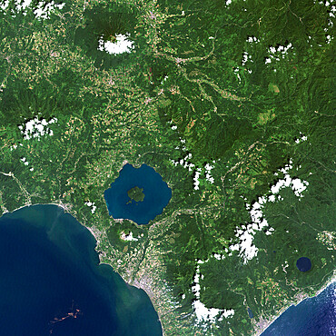
1348-4552 - Unzen Volcano In 2001, Japan, True Colour Satellite Image
1348-4560 - Volcano Tousside In 3D, Chad, True Colour Satellite Image. Pic Tousside, Chad, true colour satellite image. A recent volcano, known as the Pic Tousside, in the Tibesti Mountains in Northwestern tip of Chad (Africa). Composite image dated 2000-2002 using LANDSAT data.
1348-4549 - Long Island Volcano, Papua New Guinea, True Colour Satellite Image
1348-4588 - Galapagos Archipelago, Ecuador, True Colour Satellite Image. True colour satellite image of the Galapagos islands, province of Ecuador
1348-4545 - Ararat Volcano, Turkey, True Colour Satellite Image
1348-4550 - White Island Volcano'S Smoke Plume, New Zealand, True Colour Satellite Image
1348-4551 - Usu Volcano, Japan, True Colour Satellite Image
1348-2834 - Edge of Lava Flow Sign in Tongariro National Park, North Island, New Zealand
1348-4561 - Richat Structure, Mauritania, True Colour Satellite Image. Richat Structure, Mauritania, true colour satellite image
1348-4547 - Karymsky Volcano, Russia, True Colour Satellite Image. Karymsky volcano, Russia, true colour satellite image
1348-4554 - Kelimutu Volcano, Indonesia, True Colour Satellite Image
1348-4558 - Teide Volcano, Canary Islands, Spain, True Colour Satellite Image
1348-4568 - Mount Egmont, New-Zealand, True Colour Satellite Image
1348-4544 - Ardoukoba Volcano, Djibouti, True Colour Satellite Image. Ardoukoba, Djibouti, true colour satellite image. Ardoukoba is a volcano located close to Assal Lake in Djibouti. Image taken on 13 May 2000 using LANDSAT data. Print size 30 x 30 cm.
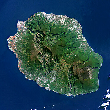
1348-4548 - Piton De La Fournaise Volcano, Reunion island, French overseas, true colour satellite image
1348-4556 - Mauna Loa Volcano, Hawai, Usa, True Colour Satellite Image
1348-4553 - Mount Etna'S Smoke Plume In 1987, Italy, True Colour Satellite Image
1348-4546 - Niuafo'Ou Volcano, Tonga Islands, True Colour Satellite Image
1348-4563 - Santorini Island, Greece, True Colour Satellite Image. Santorini island, Greece, true colour satellite image. Santorini island is part of the Cyclades archipelago, Southeast of Greece. Image taken on 8 August 1999 using LANDSAT data.
1348-4555 - Bromo Volcano, Java Island, Indonesia, True Colour Satellite Image
1112-6307 - Lava cactus (Brachycereus nesioticus), endemic to the Galapagos, Fernandina Island, Galapagos, UNESCO World Heritage Site, Ecuador, South America
1116-51217 - Ridgeback Slipper Lobster (Scyllarides haanii) hiding in its lair between lava rocks on Molokini Crater's backwall offshore of Maui; Molokini Crater, Maui, Hawaii, United States of America
1116-51190 - Footprints on the sand lead to the shore from the water's edge, with rugged lava rock lining the coastline; Kihei, Maui, Hawaii, United States of America
1116-51543 - Organ Pipes, iron rich lava formations, Damaraland; Kunene Region, Namibia
1116-51544 - Organ Pipes, iron rich lava formations, Damaraland; Kunene Region, Namibia
832-393512 - Mossy hills, crater landscape near Veioivoetn, Icelandic Highlands, Iceland, Europe
832-393507 - Coloured Rhyolite Mountains, Landmannalaugar, Highlands, Iceland, Europe
832-393506 - Rhyolite Mountains, Brennisteinsalda, Landmannalaugar, Highlands, Iceland, Europe
832-393650 - Lava fountains and volcanic craters, Fagradalsfjall, Rekyjanes, Iceland, Europe
832-393631 - Active volcano with lava fountains, volcanic crater, Fagradalsfjall, Geldingadalir, Reykjanes, Sudurnes, Iceland, Europe
832-393307 - Crater Lake Viti, Krafla, Skutustaoir, Norourland eystra, Iceland, Europe
832-393511 - Laugahraun Lava Field, Rhyolite Mountains, Landmannalaugar, Highlands, Iceland, Europe
832-393732 - Sulphur fields in front of volcanic craters, glowing lava fountains, steam and shimmering air Fagradal Falls, Reykjanes, Grindavik, Iceland, Europe
832-393730 - Sulphur fields and lava fields in front of volcanic craters, glowing lava fountains, steam and shimmering air Fagradal Falls, Reykjanes, Grindavik, Iceland, Europe
832-393731 - Sulphur fields in front of volcanic craters, glowing lava fountains, steam and shimmering air Fagradal Falls, Reykjanes, Grindavik, Iceland, Europe
860-289800 - Piton de la Fournaise, one of the most active volcanoes on the planet, Reunion, overseas department and region of the French Republic and an Indian Ocean island in East Africa
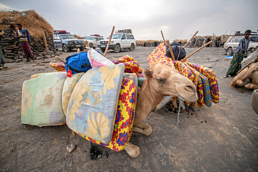
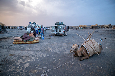
1350-2915 - Camels resting at a campsite at Erta Ale Volcano, a continuously active basaltic shield volcano and lava lake in the Afar Region of Ethiopia
1350-2964 - Bronze plaque pointing out mountain peaks seen from Dee Wright Observatory at McKenzie Pass in the Cascade Mountains of Oregon, with North Sister and Middle Sister volcanic peaks in the distance.
1350-2918 - Erta Ale Volcano is a continuously active basaltic shield volcano and lava lake in the Afar Region of Ethiopia
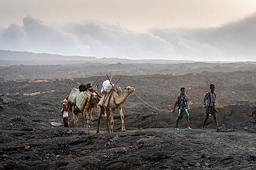
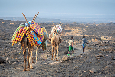
1350-2937 - A caravan of camels and tourists traversing the barren volcanic landscape surrounding the Erta Ale Volcano in the Afar Region of Ethiopia
1350-3044 - Lava from Pu'u O'o eruption entering the ocean; Hawaii Volcanoes National Park, Island of Hawaii.
1350-2917 - Apocalyptic look scenes as glowing red smoke pours out of Erta Ale Volcano, a continuously active basaltic shield volcano and lava lake in the Afar Region of Ethiopia
1350-2938 - A caravan of camels and tourists traversing the barren volcanic landscape surrounding the Erta Ale Volcano in the Afar Region of Ethiopia
1350-2919 - Houses of the Afar people in the Danakil Depression, Ethiopia
1350-2916 - Camels resting at a campsite at Erta Ale Volcano, a continuously active basaltic shield volcano and lava lake in the Afar Region of Ethiopia
1350-2934 - A camel for transporting supplies to camps at Erta Ale Volcano, a continuously active basaltic shield volcano and lava lake in the Afar Region of Ethiopia
1350-2935 - Primitively constructed huts near Erta Ale Volcano, a continuously active basaltic shield volcano and lava lake in the Afar Region of Ethiopia
1350-2389 - Lava flowing into the Pacific Ocean, Volcanoes National Park, Big Island, Hawaii
1350-2936 - Erta Ale Volcano is a continuously active basaltic shield volcano and lava lake in the Afar Region of Ethiopia
29-5617 - Fagradalsfjall volcano, eruption in July 2021, Reykjanes Peninsula, Iceland, Polar Regions
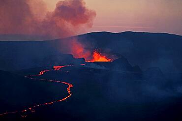
29-5618 - Fagradalsfjall volcano in July 2021, with typical lava advancing along the Natthagi valley, Reykjanes Peninsula, Iceland, Polar Regions
29-5616 - Fagradalsfjall volcano, active vent during the eruption of July 2021, Reykjanes Peninsula, Iceland, Polar Regions
1178-32011 - USA, Hawaii, Big Island, Kilauea, Vulcanologist in lava field on Klauea volcano


