Recent searches
Loading...
911-10074 - A Second world War lookout post leaning alarmingly and about to tumble over the edge of the cliff near Aldbrough on Yorkshires East Coast, UK. The coast is composed of soft boulder clays, very vulnerable to coastal erosion. This section of coast has been eroding since Roman times, with many villages having disappeared into the sea, and is the fastest eroding coast in Europe. Climate change is speeding up the erosion, with sea level rise, increased stormy weather and increased heavy rainfall events, all playing their part.
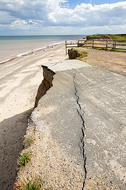
911-10071 - A collapsed coastal road at between Skipsea and Ulrome on Yorkshires East Coast, near Skipsea, UK. The coast is composed of soft boulder clays, very vulnerable to coastal erosion. This sectiion of coast has been eroding since Roman times, with many villages having disappeared into the sea, and is the fastest eroding coast in Europe. Climate change is speeding up the erosion, with sea level rise, increased stormy weather and increased heavy rainfall events, all palying their part.
911-10069 - Concrete sea defences at Beach Bank Caravan Park in Ulrome near Skipsea on Yorkshires East Coast, UK. The coast is composed of soft boulder clays, very vulnerable to coastal erosion. This section of coast has been eroding since Roman times, with many villages having disappeared into the sea, and is the fastest eroding coast in Europe. Climate change is speeding up the erosion, with sea level rise, increased stormy weather and increased heavy rainfall events, all playing their part.
911-10070 - A collapsed coastal road at near Aldbrough on Yorkshires East Coast, near Skipsea, UK. The coast is composed of soft boulder clays, very vulnerable to coastal erosion. This sectiion of coast has been eroding since Roman times, with many villages having disappeared into the sea, and is the fastest eroding coast in Europe. Climate change is speeding up the erosion, with sea level rise, increased stormy weather and increased heavy rainfall events, all palying their part.
911-10066 - A collapsed coastal road at Easingotn on Yorkshires East Coast, near Skipsea, UK. The coast is composed of soft boulder clays, very vulnerable to coastal erosion. This sectiion of coast has been eroding since Roman times, with many villages having disappeared into the sea, and is the fastest eroding coast in Europe. Climate change is speeding up the erosion, with sea level rise, increased stormy weather and increased heavy rainfall events, all palying their part.
911-10068 - A collapsed coastal road at between Skipsea and Ulrome on Yorkshires East Coast, near Skipsea, UK. The coast is composed of soft boulder clays, very vulnerable to coastal erosion. This sectiion of coast has been eroding since Roman times, with many villages having disappeared into the sea, and is the fastest eroding coast in Europe. Climate change is speeding up the erosion, with sea level rise, increased stormy weather and increased heavy rainfall events, all palying their part.
911-10072 - A collapsed coastal road at between Skipsea and Ulrome on Yorkshires East Coast, near Skipsea, UK. The coast is composed of soft boulder clays, very vulnerable to coastal erosion. This sectiion of coast has been eroding since Roman times, with many villages having disappeared into the sea, and is the fastest eroding coast in Europe. Climate change is speeding up the erosion, with sea level rise, increased stormy weather and increased heavy rainfall events, all palying their part.
911-10067 - A collapsed coastal road near Skipsea on Yorkshires East Coast, UK. The coast is composed of soft boulder clays, very vulnerable to coastal erosion. This sectiion of coast has been eroding since Roman times, with many villages having disappeared into the sea, and is the fastest eroding coast in Europe. Climate change is speeding up the erosion, with sea level rise, increased stormy weather and increased heavy rainfall events, all playing their part.
797-11779 - Greece, Attica, Athens, Greece, Attica, Athens, Stone seating in Odeon of Herodes Atticus, located on southwest slope of the Acropolis.
827-507 - Corner tower of the Bakan level, Angkor Wat Temple complex, UNESCO World Heritage Site, Angkor, Siem Reap, Cambodia, Indochina, Southeast Asia, Asia
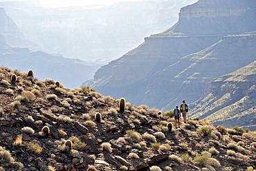
857-86011 - Hikers walk along Deer Creek Narrows in the Grand Canyon outside of Fredonia, Arizona November 2011. The 21.4-mile loop starts at the Bill Hall trailhead on the North Rim and descends 2000-feet in 2.5-miles through Coconino Sandstone to the level Esplanada then descends further into the lower canyon through a break in the 400-foot-tall Redwall to access Surprise Valley. Hikers connect Thunder River and Tapeats Creek to a route along the Colorado River and climb out Deer Creek.
857-86023 - Male hiker filters water on a cliff-pinched patio near Deer Creek Falls in the Grand Canyon outside of Fredonia, Arizona November 2011. The 21.4-mile loop starts at the Bill Hall trailhead on the North Rim and descends 2000-feet in 2.5-miles through Coconino Sandstone to the level Esplanada then descends further into the lower canyon through a break in the 400-foot-tall Redwall to access Surprise Valley. Hikers connect Thunder River and Tapeats Creek to a route along the Colorado River and climb out Deer Creek.
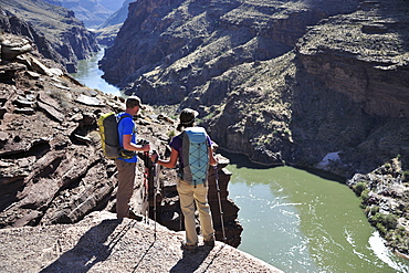
857-86016 - Hikers overlook the Colorado River as they exit the Deer Creek Narrows in the Grand Canyon outside of Fredonia, Arizona November 2011. The 21.4-mile loop starts at the Bill Hall trailhead on the North Rim and descends 2000-feet in 2.5-miles through Coconino Sandstone to the level Esplanada then descends further into the lower canyon through a break in the 400-foot-tall Redwall to access Surprise Valley. Hikers connect Thunder River and Tapeats Creek to a route along the Colorado River and climb out Deer Creek.
857-86021 - Hikers setup camp on a beach along the Colorado River near the plumeting 180-foot Deer Creek Falls in the Grand Canyon outside of Fredonia, Arizona November 2011. The 21.4-mile loop starts at the Bill Hall trailhead on the North Rim and descends 2000-feet in 2.5-miles through Coconino Sandstone to the level Esplanada then descends further into the lower canyon through a break in the 400-foot-tall Redwall to access Surprise Valley. Hikers connect Thunder River and Tapeats Creek to a route along the Colorado River and climb out Deer Creek.
857-86015 - Hikers walk along Deer Creek Narrows in the Grand Canyon outside of Fredonia, Arizona November 2011. The 21.4-mile loop starts at the Bill Hall trailhead on the North Rim and descends 2000-feet in 2.5-miles through Coconino Sandstone to the level Esplanada then descends further into the lower canyon through a break in the 400-foot-tall Redwall to access Surprise Valley. Hikers connect Thunder River and Tapeats Creek to a route along the Colorado River and climb out Deer Creek.
857-86013 - Hikers walk along Deer Creek Narrows in the Grand Canyon outside of Fredonia, Arizona November 2011. The 21.4-mile loop starts at the Bill Hall trailhead on the North Rim and descends 2000-feet in 2.5-miles through Coconino Sandstone to the level Esplanada then descends further into the lower canyon through a break in the 400-foot-tall Redwall to access Surprise Valley. Hikers connect Thunder River and Tapeats Creek to a route along the Colorado River and climb out Deer Creek.
857-86025 - Hikers follow a route along the Colorado River that connect Tapeats Creek and Thunder River to Deer Creek in the Grand Canyon outside of Fredonia, Arizona November 2011. The 21.4-mile loop starts at the Bill Hall trailhead on the North Rim and descends 2000-feet in 2.5-miles through Coconino Sandstone to the level Esplanada then descends further into the lower canyon through a break in the 400-foot-tall Redwall to access Surprise Valley. Hikers connect Thunder River and Tapeats Creek to a route along the Colorado River and climb out Deer Creek.
857-86007 - Hikers cook dinner along Deer Creek Narrows in the Grand Canyon outside of Fredonia, Arizona November 2011. The 21.4-mile loop starts at the Bill Hall trailhead on the North Rim and descends 2000-feet in 2.5-miles through Coconino Sandstone to the level Esplanada then descends further into the lower canyon through a break in the 400-foot-tall Redwall to access Surprise Valley. Hikers connect Thunder River and Tapeats Creek to a route along the Colorado River and climb out Deer Creek.
857-86027 - Hikers climb out of Surprise Valley to the North Rim of the Grand Canyon outside of Fredonia, Arizona November 2011. The 21.4-mile loop starts at the Bill Hall trailhead on the North Rim and descends 2000-feet in 2.5-miles through Coconino Sandstone to the level Esplanada then descends further into the lower canyon through a break in the 400-foot-tall Redwall to access Surprise Valley. Hikers connect Thunder River and Tapeats Creek to a route along the Colorado River and climb out Deer Creek.
857-86022 - Hikers setup camp on a beach along the Colorado River near the plumeting 180-foot Deer Creek Falls in the Grand Canyon outside of Fredonia, Arizona November 2011. The 21.4-mile loop starts at the Bill Hall trailhead on the North Rim and descends 2000-feet in 2.5-miles through Coconino Sandstone to the level Esplanada then descends further into the lower canyon through a break in the 400-foot-tall Redwall to access Surprise Valley. Hikers connect Thunder River and Tapeats Creek to a route along the Colorado River and climb out Deer Creek.
857-86003 - Hikers descend into Surprise Valley to access the lower canyon through a break in the 400-foot-tall Redwall on the Thunder River Trail in the Grand Canyon outside of Fredonia, Arizona November 2011. The 21.4-mile loop starts at the Bill Hall trailhead on the North Rim and descends 2000-feet in 2.5-miles through Coconino Sandstone to the level Esplanada then descends further into the lower canyon to access Thunder River, Tapeats Creek and Deer Creek.
832-376057 - Smoothly ground pebbles from the Isar River, Upper Bavaria, Germany, Europe
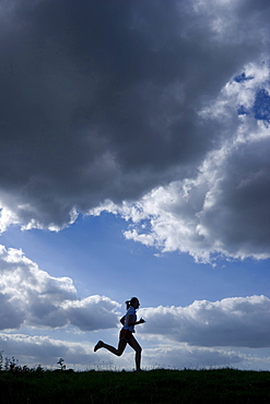
832-367396 - Running woman as a silhouette in front of a sky with dark clouds
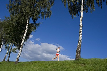
832-367398 - Running woman on a dam in front of blue sky
832-367394 - Running woman as a silhouette in front of a sky with dark clouds
832-367397 - Running woman on a dam in front of blue sky
832-367395 - Running woman as a silhouette in front of a sky with dark clouds
832-370430 - Ground level from the Roman period, landscape section, Varus Battle or Battle of the Teutoburg Forest, Kalkriese Museum and Park, Osnabruecker Land region, Lower Saxony, Germany, Europe
832-370429 - Ground level from the Roman period, landscape section, Varus Battle or Battle of the Teutoburg Forest, Kalkriese Museum and Park, Osnabruecker Land region, Lower Saxony, Germany, Europe
832-367400 - Running woman as a silhouette in front of a sky in back light
832-367399 - Running woman as a silhouette in front of a sky in back light
832-376908 - Water shortage in April 2007, Lake Sylvenstein, Upper Bavaria, Germany
1174-71 - Interior of a city coffee shop or cafe. Tables laid for meals.. Coffee cups and glasses. Bottles. Surface level.
1167-350 - Lake-level view of blue ice at the glacier face, Grey Glacier, Torres del Paine National Park, Patagonia, Chile, South America
1167-351 - Lake-level view of blue ice at the glacier face and iceberg, Grey Glacier, Torres del Paine National Park, Patagonia, Chile, South America
805-732 - Buddhist prayer flags around the gate to Sela mountain pass at 13700 feet above sea level, Arunachal Pradesh, India, Asia
29-5307 - Lake Assal, 151m below sea level, Djibouti, Africa
29-5306 - Lake Assal, 151m below sea level, Djibouti, Africa
826-590 - A Tripura tribesman performing a traditional dance wearing white robes, in their village in the Bandarban region of Bangladesh, Asiablack and white levels adjusted
841-1583 - Floating market, Damnoen Saduak, Ratchaburi Province, Thailand, Southeast Asia, Asiacropped to remove boat in top right corner and for stronger compostion, curves/levels adjustments, remove rubbish in water
832-342063 - Oderlandbahn train crossing a railway-crossing, Brandenburg, Germany, Europe
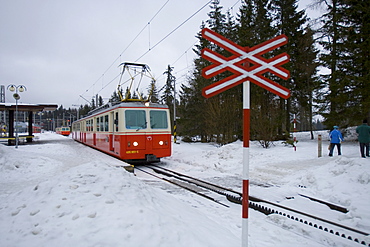
832-330313 - Tatra Electric Railway in the snow, Strbske Pleso, Slovakia, Europe
832-328296 - Ferry Ship MF Fritz Arnold - Baden Wuerttemberg, Germany Europe.
832-329178 - The Big Almaty lake is located in mountains Zailijskiy Ala Tau at height of 2510 m. above sea level, in territory of Ili Alatay national park in republic Kazakhstan.
832-328291 - The load floor from the ferry ship MF Tabor - Baden Wuerttemberg, Germany Europe.
832-329177 - The Big Almaty lake is located in mountains Zailijskiy Ala Tau at height of 2510 m. above sea level, in territory of Ili Alatay national park in republic Kazakhstan.
832-328290 - Ferry ship MF Tabor - Baden Wuerttemberg, Germany Europe.
832-322537 - Train passing a closed railroad crossing, Bingen, Hesse, Germany, Europe
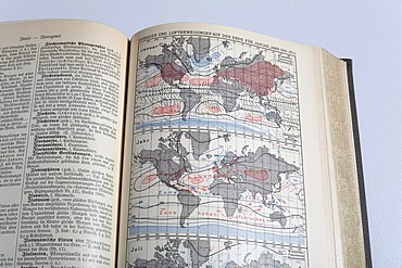
832-321258 - Picture of an isobar world map in an german encyclopedia from 1914
832-315183 - New city hall, The Hague, The Netherlands, Europe
832-313842 - Karstadt department store, Leipzig, Saxony, Germany
832-313845 - Karstadt department store, Leipzig, Saxony, Germany
832-313843 - Karstadt department store, Leipzig, Saxony, Germany
832-313819 - Main Railway station, Leipzig, Saxony, Germany
832-313846 - Karstadt department store, Leipzig, Saxony, Germany
832-307217 - Sign at sea level between Amman and the Dead Sea, Jordan
799-2560 - Misty Glastonbury Tor and the Somerset Levels from the Mendip Hills, Somerset, England, United Kingdom, Europe
799-2561 - The Somerset Levels covered in morning frost, Westbury-Sub-Mendip, Somerset, England, United Kingdom, Europe
799-2521 - Mist covered countryside of the Somerset Levels in autumn, Wells, Somerset, England, United Kingdom, Europe
832-298716 - Hotel details of Waidhofen / Ybbs, Austria, Lower Austria, Mostviertel-Region
832-298715 - Hotel details of Waidhofen / Ybbs, Austria, Lower Austria, Mostviertel-Region
747-1576 - High Level Bridge, designed by Robert Stevenson in 1847, finished in 1849, structure of wrought Iron, railway and road bridge across the River Tyne, Redheugh Bridge beyond, Tyne and Wear, England, United Kingdom, Europe
747-1573 - High Level Bridge, designed by Robert Stevenson in 1847, finished in 1849, structure of wrought iron, railway and road bridge across the River Tyne, and the Queen Elizabeth 2nd Metro Bridge, Tyne and Wear, England, United Kingdom, Europe
832-280521 - Mannheim, DEU, 23.08.2001, building of a Gas pipeline, natural gas pipeline in the Rhine level
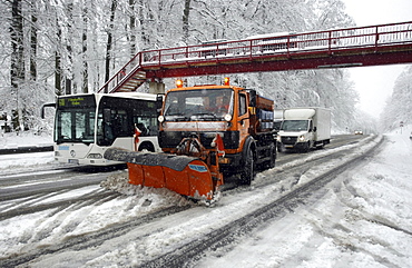
832-359856 - Snow plow clearing Highway B327 after a winter blizzard between Koblenz and Waldesch, Rhineland-Palatinate, Germany
832-359849 - Snowplough on the side of a highway in Germany, Europe
832-366613 - Former railway crossing, vineyard, Coonawarra, South Australia, Australia
1113-94920 - Old going concern convent Rizong, founded in 1833, situated 3450m above sea level, 76 km west of Leh, Ladakh, Jammu and Kashmir, India
1113-94113 - Interior view of BergeLodge in the evening, luxurious, romantic hideaway in Nesselwang 1500 m above sea level on the Alpspitze, Allgaeu, Bavaria, Europe
1113-94905 - Monk looking out of a painted window, inner shrine at convent Rizong, founded in 1833, situated 3450m above sea level, 76 km west of Leh, Ladakh, Jammu and Kashmir, India
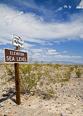
832-270407 - A sign announces sea level in Death Valley National Park, Death Valley, California, USA
832-270498 - Lake Mead behind Hoover Dam, the white ring around the reservoir shows the high water level, Boulder City, Nevada, USA
832-258257 - Bernina Range with Mount Piz Bernina, 4048 metres above sea level, and Mount Piz Morteratsch, 3751 metres above sea level, Buendner Alps, Canton of Graubuenden, Switzerland, Europe
832-253534 - S-Bahn train meets Regional Express train, scene on the platforms of the upper level of the Berlin Central Station, Berlin, Germany, Europe
832-241487 - Autumnal reflection in a lake, Vermont, USA
832-238963 - Thur waterfalls with high water levels at the beginning of the snow melt, Toggenburg, St. Gallen, Switzerland, Europe
1161-7730 - Railway level crossing at Quettreville-Sur-Seine in Normandy, France
1161-5310 - Lobby and atrium area in the 5-star Oberoi Mumbai Hotel at Nariman Point, Mumbai, formerly Bombay, Maharashtra, India
1161-6321 - Architect Frank Gehry's Guggenheim Museum futuristic architectural design interior at Bilbao, Basque country, Spain
1161-4154 - Marsh grasses and reeds in the Avalon Marshes wetlands of the Somerset Levels near Shapwick Heath, Somerset, UK
1161-4153 - Marsh grasses and reeds in the Avalon Marshes wetlands of the Somerset Levels near Shapwick Heath, Somerset, UK
1161-6319 - Architect Frank Gehry's Guggenheim Museum futuristic architectural design interior at Bilbao, Basque country, Spain
1161-3518 - Depth sign shows 175 metres, the proposed water level when Three Gorges dam project is completed, China
1161-3519 - Depth sign shows 175 metres, the proposed water level when Three Gorges dam project is completed, China
1161-2668 - Stilted buildings overlooking rice terraces, Banaue, Philippines
1161-1847 - Train track and overhead cables at level crossing near Barsac station, Bordeaux region, France.
832-220324 - Enns floodwater in Steyr, Upper Austria, Austria, Europe
832-220323 - Enns floodwater in Steyr, Upper Austria, Austria, Europe
832-220326 - Onlookers, Enns floodwater in Steyr, Upper Austria, Austria, Europe
832-220325 - Enns floodwater in Steyr, Upper Austria, Austria, Europe
989-319 - Overview of extensively flooded pastureland and farm track on West Sedgemoor, Somerset Levels, after weeks of heavy rain, Somerset, England, United Kingdom, Europe
989-317 - Flooded gateway and pastureland on West Moor near Hambridge on the Somerset Levels after weeks of heavy rain, Somerset, England, United Kingdom, Europe
989-318 - Severely flooded and closed road on Curry Moor between North Curry and East Lyng after weeks of heavy rain, Somerset Levels, Somerset, England, United Kingdom, Europe
989-321 - Hugely swollen River Parrett overflowing onto Aller Moor near Staithe after weeks of heavy rain, Somerset Levels, Somerset, England, United Kingdom, Europe
989-320 - Church of St. Peter and St. Paul, the Cathedral of the Moors with octagonal tower, North Curry, Somerset Levels and Moors, Somerset, England, United Kingdom, Europe


