Recent searches
Loading...
832-383736 - Red deer (Cervus elaphus) in soft morning light, Glen Coe, Fort William, Highlands, Scotland, United Kingdom, Europe
832-383638 - Polar bears (Ursus maritimus), mother animal and two young cubs, three month old, lying on an iceberg, Unorganized Baffin, Baffin Island, Nunavut, Canada, North America
1174-5198 - Male lions, Panthera leo, stand and lie together on green grass, looking away, Londolozi Game Reserve, Sabi Sands, Greater Kruger National Park, South Africa
1174-5200 - A pride of lions, Panthera leo, lie over a buffalo carcass, Syncerus caffer, looking away, biting muzzle of bloated buffalo, blood on mouth, Londolozi Game Reserve, Sabi Sands, Greater Kruger National Park, South Africa
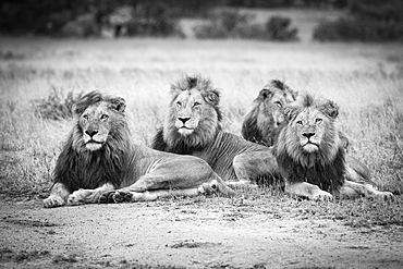
1174-5163 - Four male lions, Panthera leo, lie in short brown grass, looking away, in black and white, Londolozi Game Reserve, Sabi Sands, Greater Kruger National Park, South Africa
1174-5068 - A pride of lions, Panthera leo, lie over a buffalo carcass, Syncerus caffer, looking away, biting neck of bloated buffalo, Londolozi Game Reserve, Sabi Sands, Greater Kruger National Park, South Africa
1174-5162 - Four male lions, Panthera leo, lie in short brown grass in the rain, looking away, Londolozi Game Reserve, Sabi Sands, Greater Kruger National Park, South Africa
1174-5167 - Two leopard cubs, Panthera pardus, lie on a marula tree, Sclerocarya birrea, alert, with their legs draped over the branch, Londolozi Game Reserve, Sabi Sands, Greater Kruger National Park, South Africa
1174-5227 - A rhino mother and calf, Ceratotherium simum, lie side by side, red-billed oxpeckers, Buphagus erythrorhynchus, perch on the rhino, Londolozi Game Reserve, Sabi Sands, Greater Kruger National Park, South Africa
1174-5141 - Two buffalo, Syncerus caffer, wallow and lie in the water, eyes closed, red-billed oxpeckers sit on them, Buphagus erythrorhynchus, Londolozi Game Reserve, Sabi Sands, Greater Kruger National Park, South Africa
1174-5045 - Three male lions, Panthera leo, lie on the ground in a line in a clearing, looking away, wet fur, Londolozi Game Reserve, Sabi Sands, Greater Kruger National Park, South Africa
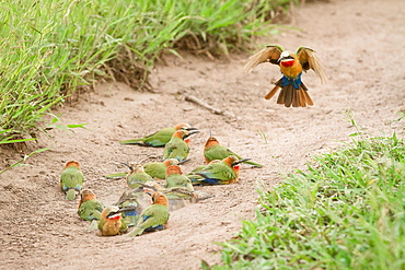
1174-4992 - A flock of white-fronted bee-eaters, Merops bullockoides, lie on sand while one flies down, wings up and tail spread, Londolozi Game Reserve, Sabi Sands, Greater Kruger National Park, South Africa
832-382755 - Cheetah (Acinonyx jubatus) lying on a rock in morning sun, Masai Mara, Kenya, Africa
832-381796 - Sun loungers and parasols by a pool under palm trees, Vomo Island, Mamanuca Islands, Fiji, Oceania
832-381302 - Tourists cooling off in the shade of the Leaning Tower of Pisa, Piazza del Duomo, Piazza dei Miracoli, Pisa, Tuscany, Italy, Europe
832-381828 - Lying golden Buddha in the cave temple Wat Tham Suwan Khuha, Phang Nga, Thailand, Asia
832-381453 - Aubrac cattle herd, Croix-Morand pass, Parc Naturel Regional des Volcans d'Auvergne, Regional Nature Park of the Volcanoes of Auvergne, Puy de Dome, Auvergne, France, Europe
832-382377 - Trunk of an oak tree lying in water, Bay of Greifswald, at back Vilm, sunset, near Putbus, Rugen, Mecklenburg-Western Pomerania, Germany, Europe
832-381535 - Nile Crocodiles (Crocodylus niloticus), swimming, lying on the shore, aerial view, Luangwa River, South Luangwa National Park, Zambia, Africa
832-382103 - Grey Seal (Halichoerus grypus) on the beach, howler, Heligoland, Schleswig-Holstein, Germany, Europe
832-381387 - Lion (Panthera leo), lioness, female, Kruger National Park, South Africa, Africa
832-382327 - Leopard (Panthera pardus), Namibia, Africa
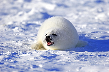
832-381669 - Harp Seal or Saddleback Seal (Pagophilus groenlandicus, Phoca groenlandica), pup on pack ice, Magdalen Islands, Gulf of Saint Lawrence, Quebec, Canada, North America
832-382063 - Fishing boats lying in the sand, on the beach, Jutland, Denmark, Europe
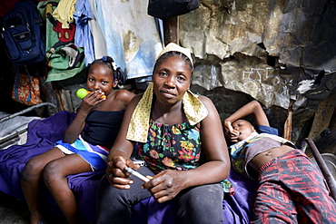
832-381549 - Woman, 40 years, and two children, 8 and 10 years, in barracks, Camp Icare for earthquake refugees, 5 years after the 2010 earthquake, Fort National, Port-au-Prince, Haiti, Central America
832-381827 - Lying golden Buddha in the cave temple Wat Tham Suwan Khuha, Phang Nga, Thailand, Asia
832-381581 - Two Lions (Panthera leo), bloodstained, feeding from Burchell's Zebra (Equus quagga burchellii) carcass, Etosha National Park, Namibia, Africa
832-381433 - Young Snow Leopard (Panthera uncia), captive
832-380056 - Reclining Buddha statue, Aluvihara Rock Cave Temple, Central Province, Sri Lanka, Asia
832-380811 - Young woman lying on a Standup-Paddle Board or SUP, paddling with hands in the lake, Schliersee, Upper Bavaria, Bavaria, Germany, Europe
832-379502 - Cheetah (Acinonyx jubatus), in the morning, backlit, Maasai Mara National Reserve, Narok County, Kenya, Africa
832-379518 - Two young male lions (Panthera leo) observing in shadow of bush, Masai Mara, Narok County, Kenya, Africa
832-379410 - Leopard (Panthera pardus), adult, lying on the ground, attentive, observing, animal portrait, Sabi Sand Game Reserve, Kruger National Park, South Africa, Africa
832-379476 - Leopard (Panthera pardus), resting male, Chobe National Park, Botswana, Africa
832-379399 - Water buffalo (Bubalis bubalis), adult in water, bathing, Bundala National Park, Sri Lanka, Asia
832-379572 - Lioness (Panthera leo) with two cubs, Kgalagadi Transfrontier Park, Northern Cape, South Africa, Africa
832-379629 - Cheetahs (Acinonyx jubatus), six-week-old cheetah cub playing with his mother, Maasai Mara National Reserve, Narok County, Kenya, Africa
832-379608 - Dog in front of Ornate Door, Blue City, Jodhpur, Rajasthan, India, Asia
832-379516 - Lion (Panthera leo), male with wet mane lying in grass, Masai Mara, Narok County, Kenya, Africa
832-379424 - Spotted hyena (Crocuta crocuta), adult lying on ground, alert, Kruger National Park, South Africa, Africa
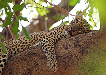
832-379475 - Leopard (Panthera pardus), female, resting in a tree, Chobe National Park, Botswana, Africa
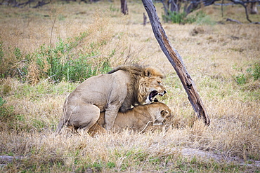
832-379354 - Lion (Panthera leo) mating, Okavango Delta, Botswana, Africa
832-379047 - Leopard (Panthera pardus), lying on tree on the lookout, Peter's Pan, Savuti, Chobe National Park, Chobe District, Botswana, Africa
832-379281 - Lion (Panthera leo), black-maned Kalahari male, on road, Kalahari Desert, Kgalagadi Transfrontier Park, South Africa, Africa
832-379048 - Leopard (Panthera pardus), lying on tree on the lookout, Peter's Pan, Savuti, Chobe National Park, Chobe District, Botswana, Africa
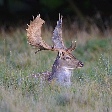
832-378994 - Fallow deer (Dama dama), resting in a meadow, Zealand, Denmark, Europe
832-379262 - White Bengal tiger (Panthera tigris tigris) lying on rock, adult resting, portrait, captive, native to India
832-379282 - Lion (Panthera leo), black-maned Kalahari male, resting, rainy season with green surroundings, portrait, Kalahari Desert, Kgalagadi Transfrontier Park, South Africa, Africa
832-379017 - Leopard (Panthera pardus) resting in tree, South Luangwa National Park, Zambia, Africa
832-379034 - Yacare caiman (Caiman crocodilus yacara) by the water, Pantanal, Mato Grosso do Sul, Brazil, South America
832-378967 - Grey Seal (Halichoerus grypus), pup on beach, portrait, Helgoland, North Sea, Germany, Europe
832-378941 - Wild boars (Sus scrofa), shoats lying close together, North Rhine-Westphalia, Germany, Europe
832-378763 - Continental Bulldog, bitch, 6 months, lies in a meadow with daisies, North Rhine-Westphalia, Germany, Europe
832-378764 - Continental Bulldog, bitch, 6 months, lies in a meadow with daisies, North Rhine-Westphalia, Germany, Europe
1219-218 - Millstones covered in moss lie derelict within the former Bole hill quarry on a misty autumn morning in the Peak District, Derbyshire, England, United Kingdom, Europe
857-94717 - Nimoa Island - here the island mission will impress. The five-sided church features murals of island life and all mission buildings are surrounded by well maintained paths and gardens filled with flowering plants. Edged by jungle-covered mountains, postcard beaches and crystal clear waters - an island paradise indeed! The Louisiade Archipelago is a string of ten larger volcanic islands frequently fringed by coral reefs, and 90 smaller coral islands located 200 km southeast of New Guinea, stretching over more than 160 km and spread over an ocean area of 26,000 km? between the Solomon Sea to the north and the Coral Sea to the south. The aggregate land area of the islands is about 1,790 km? (690 square miles), with Vanatinai (formerly Sudest or Tagula as named by European claimants on Western maps) being the largest. Sideia Island and Basilaki Island lie closest to New Guinea, while Misima, Vanatinai, and Rossel islands lie further east. The archipelago is divided into the Local Level Government (LLG) areas Loui!
857-94720 - Nimoa Island - here the island mission will impress. The five-sided church features murals of island life and all mission buildings are surrounded by well maintained paths and gardens filled with flowering plants. Edged by jungle-covered mountains, postcard beaches and crystal clear waters - an island paradise indeed! The Louisiade Archipelago is a string of ten larger volcanic islands frequently fringed by coral reefs, and 90 smaller coral islands located 200 km southeast of New Guinea, stretching over more than 160 km and spread over an ocean area of 26,000 km? between the Solomon Sea to the north and the Coral Sea to the south. The aggregate land area of the islands is about 1,790 km? (690 square miles), with Vanatinai (formerly Sudest or Tagula as named by European claimants on Western maps) being the largest. Sideia Island and Basilaki Island lie closest to New Guinea, while Misima, Vanatinai, and Rossel islands lie further east. The archipelago is divided into the Local Level Government (LLG) areas Louisiade Rural (western part, with Misima), and Yaleyamba (western part, with Rossell and Tagula islands. The LLG areas are part of Samarai-Murua District district of Milne Bay. The seat of the Louisiade Rural LLG is Bwagaoia on Misima Island, the population center of the archipelago.
857-94718 - Nimoa Island - here the island mission will impress. The five-sided church features murals of island life and all mission buildings are surrounded by well maintained paths and gardens filled with flowering plants. Edged by jungle-covered mountains, postcard beaches and crystal clear waters - an island paradise indeed! The Louisiade Archipelago is a string of ten larger volcanic islands frequently fringed by coral reefs, and 90 smaller coral islands located 200 km southeast of New Guinea, stretching over more than 160 km and spread over an ocean area of 26,000 km? between the Solomon Sea to the north and the Coral Sea to the south. The aggregate land area of the islands is about 1,790 km? (690 square miles), with Vanatinai (formerly Sudest or Tagula as named by European claimants on Western maps) being the largest. Sideia Island and Basilaki Island lie closest to New Guinea, while Misima, Vanatinai, and Rossel islands lie further east. The archipelago is divided into the Local Level Government (LLG) areas Louisiade Rural (western part, with Misima), and Yaleyamba (western part, with Rossell and Tagula islands. The LLG areas are part of Samarai-Murua District district of Milne Bay. The seat of the Louisiade Rural LLG is Bwagaoia on Misima Island, the population center of the archipelago.
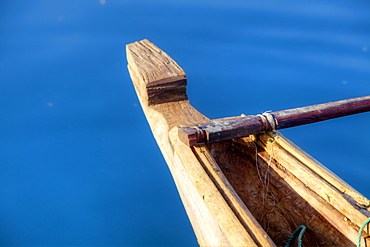
857-94722 - Children playing with a outrigger canoe in the village of Hessessai Bay at PanaTinai (Panatinane)island in the Louisiade Archipelago in Milne Bay Province, Papua New Guinea. The island has an area of 78 km2. The Louisiade Archipelago is a string of ten larger volcanic islands frequently fringed by coral reefs, and 90 smaller coral islands located 200 km southeast of New Guinea, stretching over more than 160 km and spread over an ocean area of 26,000 km? between the Solomon Sea to the north and the Coral Sea to the south. The aggregate land area of the islands is about 1,790 km? (690 square miles), with Vanatinai (formerly Sudest or Tagula as named by European claimants on Western maps) being the largest. Sideia Island and Basilaki Island lie closest to New Guinea, while Misima, Vanatinai, and Rossel islands lie further east. The archipelago is divided into the Local Level Government (LLG) areas Louisiade Rural (western part, with Misima), and Yaleyamba (western part, with Rossell and Tagula islands. The LLG areas are part of Samarai-Murua District district of Milne Bay. The seat of the Louisiade Rural LLG is Bwagaoia on Misima Island, the population center of the archipelago.PanaTinai (Panatinane) is an island in the Louisiade Archipelago in Milne Bay Province, Papua New Guinea.
857-94715 - Nimoa Island - here the island mission will impress. The five-sided church features murals of island life and all mission buildings are surrounded by well maintained paths and gardens filled with flowering plants. Edged by jungle-covered mountains, postcard beaches and crystal clear waters - an island paradise indeed! The Louisiade Archipelago is a string of ten larger volcanic islands frequently fringed by coral reefs, and 90 smaller coral islands located 200 km southeast of New Guinea, stretching over more than 160 km and spread over an ocean area of 26,000 km? between the Solomon Sea to the north and the Coral Sea to the south. The aggregate land area of the islands is about 1,790 km? (690 square miles), with Vanatinai (formerly Sudest or Tagula as named by European claimants on Western maps) being the largest. Sideia Island and Basilaki Island lie closest to New Guinea, while Misima, Vanatinai, and Rossel islands lie further east.
857-94719 - Nimoa Island - here the island mission will impress. The five-sided church features murals of island life and all mission buildings are surrounded by well maintained paths and gardens filled with flowering plants. Edged by jungle-covered mountains, postcard beaches and crystal clear waters - an island paradise indeed! The Louisiade Archipelago is a string of ten larger volcanic islands frequently fringed by coral reefs, and 90 smaller coral islands located 200 km southeast of New Guinea, stretching over more than 160 km and spread over an ocean area of 26,000 km? between the Solomon Sea to the north and the Coral Sea to the south. The aggregate land area of the islands is about 1,790 km? (690 square miles), with Vanatinai (formerly Sudest or Tagula as named by European claimants on Western maps) being the largest. Sideia Island and Basilaki Island lie closest to New Guinea, while Misima, Vanatinai, and Rossel islands lie further east. The archipelago is divided into the Local Level Government (LLG) areas Louisiade Rural (western part, with Misima), and Yaleyamba (western part, with Rossell and Tagula islands. The LLG areas are part of Samarai-Murua District district of Milne Bay. The seat of the Louisiade Rural LLG is Bwagaoia on Misima Island, the population center of the archipelago.
857-94721 - Nimoa Island - here the island mission will impress. The five-sided church features murals of island life and all mission buildings are surrounded by well maintained paths and gardens filled with flowering plants. Edged by jungle-covered mountains, postcard beaches and crystal clear waters - an island paradise indeed! The Louisiade Archipelago is a string of ten larger volcanic islands frequently fringed by coral reefs, and 90 smaller coral islands located 200 km southeast of New Guinea, stretching over more than 160 km and spread over an ocean area of 26,000 km? between the Solomon Sea to the north and the Coral Sea to the south. The aggregate land area of the islands is about 1,790 km? (690 square miles), with Vanatinai (formerly Sudest or Tagula as named by European claimants on Western maps) being the largest. Sideia Island and Basilaki Island lie closest to New Guinea, while Misima, Vanatinai, and Rossel islands lie further east. The archipelago is divided into the Local Level Government (LLG) areas Loui!
857-94716 - Nimoa Island - here the island mission will impress. The five-sided church features murals of island life and all mission buildings are surrounded by well maintained paths and gardens filled with flowering plants. Edged by jungle-covered mountains, postcard beaches and crystal clear waters - an island paradise indeed! The Louisiade Archipelago is a string of ten larger volcanic islands frequently fringed by coral reefs, and 90 smaller coral islands located 200 km southeast of New Guinea, stretching over more than 160 km and spread over an ocean area of 26,000 km? between the Solomon Sea to the north and the Coral Sea to the south. The aggregate land area of the islands is about 1,790 km? (690 square miles), with Vanatinai (formerly Sudest or Tagula as named by European claimants on Western maps) being the largest. Sideia Island and Basilaki Island lie closest to New Guinea, while Misima, Vanatinai, and Rossel islands lie further east. The archipelago is divided into the Local Level Government (LLG) areas Loui!
857-94714 - The Louisiade Archipelago is a string of ten larger volcanic islands frequently fringed by coral reefs, and 90 smaller coral islands located 200 km southeast of New Guinea, stretching over more than 160 km and spread over an ocean area of 26,000 km? between the Solomon Sea to the north and the Coral Sea to the south. The aggregate land area of the islands is about 1,790 km? (690 square miles), with Vanatinai (formerly Sudest or Tagula as named by European claimants on Western maps) being the largest. Sideia Island and Basilaki Island lie closest to New Guinea, while Misima, Vanatinai, and Rossel islands lie further east. The archipelago is divided into the Local Level Government (LLG) areas Louisiade Rural (western part, with Misima), and Yaleyamba (western part, with Rossell and Tagula islands. The LLG areas are part of Samarai-Murua District district of Milne Bay. The seat of the Louisiade Rural LLG is Bwagaoia on Misima Island, the population center of the archipelago.
857-94712 - The Louisiade Archipelago is a string of ten larger volcanic islands frequently fringed by coral reefs, and 90 smaller coral islands located 200 km southeast of New Guinea, stretching over more than 160 km and spread over an ocean area of 26,000 km? between the Solomon Sea to the north and the Coral Sea to the south. The aggregate land area of the islands is about 1,790 km? (690 square miles), with Vanatinai (formerly Sudest or Tagula as named by European claimants on Western maps) being the largest.Sideia Island and Basilaki Island lie closest to New Guinea, while Misima, Vanatinai, and Rossel islands lie further east. The archipelago is divided into the Local Level Government (LLG) areas Louisiade Rural (western part, with Misima), and Yaleyamba (western part, with Rossell and Tagula islands. The LLG areas are part of Samarai-Murua District district of Milne Bay. The seat of the Louisiade Rural LLG is Bwagaoia on Misima Island, the population center of the archipelago.
832-378677 - Man and woman lying in a flower meadow with a view of the North Chain, Patsch, Innsbruck, Austria, Europe
832-378661 - Shipwreck at sunset at Laayoune Plage, Western Sahara, Southwest Morocco, Africa
1179-304 - Shells and rocks lie on the beach of Spearn Bay lit the tropical sun and washed by Caribbean Sea, Antigua, Leeward Islands, West Indies, Caribbean, Central America
832-369955 - Red Panda or Lesser Panda (Ailurus fulgens)
832-377767 - Patient in a physiotherapy practice getting a Hot Stone Massage
832-375593 - Woman lying on the parquet floor and reading a book
832-370041 - Galápagos sea lions (Zalophus wollebaeki), Puerto Villamil, Isabela Island, Galapagos Islands, UNESCO World Heritage Site, Ecuador, South America
832-373653 - Bengal tiger or Royal Bengal tiger (Panthera tigris tigris), adult, India, Asia
832-376850 - Woman, 45 years, in a beach outfit, relaxing on a sun lounger with a piña colada cocktail, Playa Samara, Nicoya Peninsula, Costa Rica, Central America
832-370958 - Woman, 35, in a bathtub with chocolate, Thalasso therapy in a spa resort
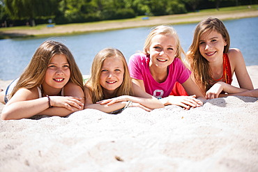
832-374594 - Group of girls sitting on the beach of a lake
832-372803 - Tourist lying on a bed in a hotel room of the ice hotel in Jukkasjaervi, Lappland, Northern Sweden
832-377794 - Young woman lying on a sofa in the living room, books
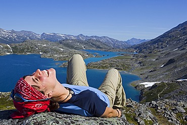
832-374156 - Young woman laughing, lying on a rock, relaxing, hiker enjoying the panorama on summit of historic Chilkoot Pass, Chilkoot Trail, Crater Lake behind, alpine tundra, Yukon Territory, British Columbia, B. C., Canada
832-370596 - Smathers Beach, Key West, Florida Keys, Florida, USA
832-372820 - Two tourists lying on a bed in a bedroom in the ice hotel in Jukkasjaervi, Kiruna, Lappland, northern Sweden, Sweden, Europe
832-372544 - Tiger lying down, Bangkok, Thailand, Asia
832-373774 - Siberian Tiger (Panthera tigris altaica), lying in snow, winter, Asia
832-373028 - Tiger (Panthera tigris), lying in water, Ranthambore National Park, Rajasthan, India, Asia
832-370245 - Pregnant woman lying in the arms of her husband
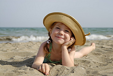
832-375475 - Little girl lies at a sandy beach at the sea
832-377768 - Patient in a physiotherapy practice getting a Hot Stone Massage
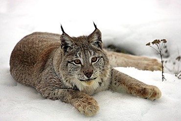
832-373750 - Eurasian lynx (Lynx lynx), adult, lying in the snow, winter, Montana, USA
832-374852 - Siberian Tiger (Panthera tigris altaica), Siberia Tiger Park, Harbin, China, Asia
832-369335 - King penguin (Aptenodytes patagonicus) walking in front of a mating Southern Elephant Seal (Mirounga leonina), St. Andrews Bay, South Georgia Island
832-370954 - Woman, 35, relaxing in a bathtub with rose petals, Thalasso therapy in a spa resort
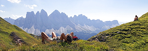
832-377010 - Hikers relaxing and enjoying the view of the Geisler Group, Aferer Geisler Mountains, Villnoesstal valley, province of Bolzano-Bozen, Italy, Europe


