Recent searches
Loading...
1240-401 - Raven, Loop Head, County Clare, Munster, Republic of Ireland, Europe
1240-399 - Raven, Loop Head, County Clare, Munster, Republic of Ireland, Europe
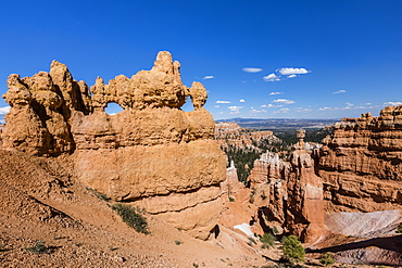
1310-224 - Colourful rock formation in the Queen's Garden beside the Navajo Loop Trail, Bryce Canyon National Park, Utah, United States of America, North America
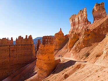
1310-220 - High cliffs towering above the Navajo Loop Trail below Sunset Point, Bryce Canyon National Park, Utah, United States of America, North America
1310-221 - Two hikers heading down the Navajo Loop Trail below Sunset Point, Bryce Canyon National Park, Utah, United States of America, North America
1240-364 - Storm surge, Loop Head, County Clare, Munster, Republic of Ireland, Europe
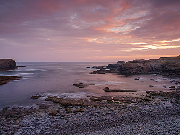
1240-371 - Loop Head, County Clare, Munster, Republic of Ireland, Europe
1240-365 - Storm surge, Loop Head, County Clare, Munster, Republic of Ireland, Europe
832-386227 - Old town in river loop of the Inn at sunrise, moated castle am Inn, aerial view, Upper Bavaria, Bavaria, Germany, Europe
832-384052 - Rock formation Thors Hammer, morning light, snow-covered bizarre rock landscape with Hoodoos in winter, Navajo Loop Trail, Bryce Canyon National Park, Utah, USA, North America
832-384048 - Rock formation Thors Hammer, morning light, bizarre snowy rock landscape with Hoodoos in winter, Navajo Loop Trail, Bryce Canyon National Park, Utah, USA, North America
832-384053 - Morning light, snow-covered bizarre rocky landscape with Hoodoos in winter, Navajo Loop Trail, Bryce Canyon National Park, Utah, USA, North America
832-386228 - Old town in river loop of the Inn at dawn and fog, Red Bridge, moated castle am Inn, aerial view, Upper Bavaria, Bavaria, Germany, Europe
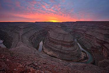
832-384679 - Goosenecks at sunset, river loop, meander of the San Juan River, Goosenecks State Park, Utah, America, USA, North America
1240-339 - Ross, Loop Head, County Clare, Munster, Republic of Ireland, Europe
1240-347 - Loop Head, County Clare, Munster, Republic of Ireland, Europe
1240-338 - Ross, Loop Head, County Clare, Munster, Republic of Ireland, Europe
1218-1113 - Woman in Desert Loop Trail in Carlsbad Caverns National Park, New Mexico, United States of America, North America
844-20738 - View of Loop train at station, Downtown Chicago, Illinois, United States of America, North America
844-20732 - View of Loop train and skyscrapers, Downtown Chicago, Illinois, United States of America, North America
844-20715 - View of Loop Train on North Wabash Avenue, Chicago, Illinois, United States of America, North America
844-20713 - View of Loop Train on North Wabash Avenue, Chicago, Illinois, United States of America, North America
844-20714 - View of Loop Train on North Wabash Avenue, Chicago, Illinois, United States of America, North America
1240-324 - Kilbaha Bay, Loop Head, County Clare, Munster, Republic of Ireland, Europe
1240-323 - Kilbaha Bay, Loop Head, County Clare, Munster, Republic of Ireland, Europe
1240-322 - Loop Head, County Clare, Munster, Republic of Ireland, Europe
1240-310 - Loop Head, County Clare, Munster, Republic of Ireland, Europe
1240-311 - Ross, Loop Head, County Clare, Munster, Republic of Ireland, Europe
1240-307 - Loop Head, County Clare, Munster, Republic of Ireland, Europe
1240-321 - Loop Head, County Clare, Munster, Republic of Ireland, Europe
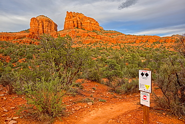
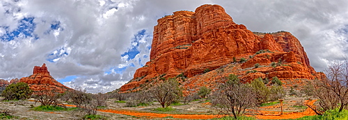
1311-61 - Cathedral Rock at the intersection of upper Baldwin Loop and HiLine Trails with sign warning that the HiLine Trail is for experts only, Sedona, Arizona, United States of America, North America
1311-52 - High angle view of Boulder Creek, the Watson Lake Loop Trail crosses this creek, Prescott, Arizona, United States of America, North America
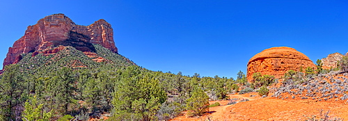
1311-50 - Panorama South view of Courthouse Butte and the Judges Bench from Courthouse Butte Loop Trail in Sedona, Arizona, United States of America, North America
1311-33 - Panorama of Bell Rock and Courthouse Butte, viewed from Big Park Loop Trail, Sedona, Arizona, United States of America, North America
1116-42683 - Makiki Loop Trail, With Sign Showing Direction To Trail Head, Oahu, Hawaii, United States Of America
1116-42685 - State Of Hawaii Division Of Forestry And Wildlife Headquarters At Makiki Loop Trail, Oahu, Hawaii, United States Of America
857-96081 - Rear view of 4x4 car on dirt road in natural setting, Alpine Loop, Colorado, USA
1240-283 - Loop Head, County Clare, Munster, Republic of Ireland, Europe
1240-281 - Ross, Loop Head, County Clare, Munster, Republic of Ireland, Europe
832-380794 - Big Saar loop at sunrise, near Mettlach, Saarland, Germany, Europe
1240-263 - Loop Head, County Clare, Munster, Republic of Ireland, Europe
1240-262 - Loop Head, County Clare, Munster, Republic of Ireland, Europe
1284-44 - Two Chicago CTA L trains near Adams and Wabash station in The Loop, Chicago, Illinois, United States of America, North America
1284-46 - Oriental Theatre, Loop Theater District, Chicago, Illinois, United States of America, North America
1160-3795 - Vineyards in autumn, Loop of Moselle River near Kroev, Rhineland-Palatinate, Germany, Europe
1160-3824 - Loop of Moselle River and vineyards in autumn, Bremm, Rhineland-Palatinate, Germany, Europe
1160-3805 - Loop of Moselle River and vineyards in autumn, Bremm, Rhineland-Palatinate, Germany, Europe
1160-3770 - Loop of Moselle River with Calmont Hill near Bremm, Rhineland-Palatinate, Germany, Europe
1160-3821 - Loop of Moselle River and vineyards in autumn, Bremm, Rhineland-Palatinate, Germany, Europe
1160-3769 - Loop of Moselle River near Bremm with ruined abbey Stuben, Rhineland-Palatinate, Germany, Europe
1160-3788 - Loop of Moselle River at sunset near the town of Kroev, Rhineland-Palatinate, Germany, Europe
1160-3789 - Loop of Moselle River at sunset near the town of Kroev, Rhineland-Palatinate, Germany, Europe
1160-3798 - Loop of Moselle River near the town of Kroev, Rhineland-Palatinate, Germany, Europe
857-94626 - Douglas Fir trees stand tall in the Wall Street section of the Navajo Loop trail in Bryce Canyon National Park.
1240-229 - Loop Head, County Clare, Munster, Republic of Ireland, Europe
1112-3519 - View of hoodoo formations from the Navajo Loop Trail in Bryce Canyon National Park, Utah, United States of America, North America
1112-3523 - View of hoodoo formations from the Navajo Loop Trail in Bryce Canyon National Park, Utah, United States of America, North America
1112-3522 - View of hoodoo formations from the Navajo Loop Trail in Bryce Canyon National Park, Utah, United States of America, North America
1112-3521 - View of Thor's Hammer from the Navajo Loop Trail in Bryce Canyon National Park, Utah, United States of America, North America
1112-3520 - View of Thor's Hammer from the Navajo Loop Trail in Bryce Canyon National Park, Utah, United States of America, North America
1112-3524 - View of The Amphitheater from the Navajo Loop Trail in Bryce Canyon National Park, Utah, United States of America, North America
1240-218 - Ross, Loop Head, County Clare, Munster, Republic of Ireland, Europe
1240-217 - Bridge of Ross, Loop Head, County Clare, Munster, Republic of Ireland, Europe
1240-200 - Sunrise and fog, Loop Head, County Clare, Munster, Republic of Ireland, Europe
1240-201 - Loop Head, County Clare, Munster, Republic of Ireland, Europe
1240-198 - Castle Point, Loop Head, County Clare, Munster, Repbublic of Ireland, Europe
1240-205 - Castle Point, Loop Head, County Clare, Munster, Republic of Ireland, Europe
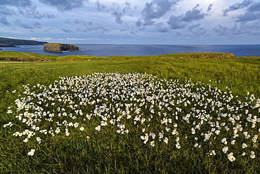
1240-199 - Marsh orchid, Loop Head, County Clare, Munster, Republic of Ireland, Europe
1240-223 - Loop Head, County Clare, Munster, Republic of Ireland, Europe (Drone)
1226-396 - CTA train on the Loop track which runs above ground in downtown Chicago, Illinois, United States of America, North America
396-5317 - Big Loop of Saar River near Orscholz, Mettlach, Saarland, Germany, Europe
396-5093 - Big Loop of Saar River near Orscholz, Mettlach, Saarland, Germany, Europe
396-5098 - Big Loop of Saar River near Orscholz, Mettlach, Saarland, Germany, Europe
1202-112 - The cliffs at Loop Head, near Kilkee, County Clare, Munster, Republic of Ireland, Europe
1240-72 - Loop Head, County Clare, Munster, Republic of Ireland, Europe
1240-20 - Castle Point, Loop Head, County Clare, Munster, Republic of Ireland, Europe
1240-7 - Loop Head, County Clare, Munster, Republic of Ireland, Europe
483-1994 - Quilotoa Loop, volcanic crater lake, Ecuador, South America
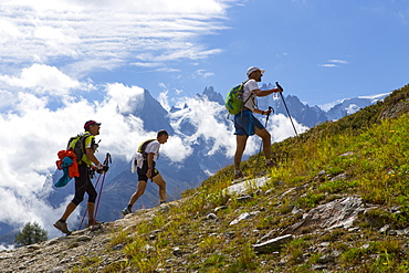
857-92685 - Three participants of the UTMB are running in the hills of Chamonix. The famous peaks of the Mont Blanc range are in the background. The Ultra-Trail du Mont-Blanc (also referred to as UTMB) is a single-stage mountain ultramarathon. It takes place once a year in the Alps, across France, Italy and Switzerland. The distance is approximately 166 kilometres (103 mi), with a total elevation gain of around 9,600 m. It is widely regarded as one of the most difficult foot races in Europe. It's certainly one of the largest with over two thousand starters. The combined participation in all of the events is approaching 10 thousand runners. While the best runners complete the loop in slightly more than 20 hours, most runners take 30 to 45 hours to reach the finish line.
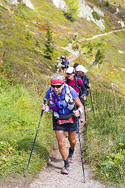
857-92684 - An elderly woman is running in the hills of Chamonix. She is close to finishing the extremely exhausting UTMB race. The Ultra-Trail du Mont-Blanc (also referred to as UTMB) is a single-stage mountain ultramarathon. It takes place once a year in the Alps, across France, Italy and Switzerland. The distance is approximately 166 kilometres (103 mi), with a total elevation gain of around 9,600 m. It is widely regarded as one of the most difficult foot races in Europe. It's certainly one of the largest with over two thousand starters. The combined participation in all of the events is approaching 10 thousand runners. While the best runners complete the loop in slightly more than 20 hours, most runners take 30 to 45 hours to reach the finish line.
799-3230 - Carson Peak, reflected in the mist shrouded waters of Silver Lake on the June Lake Loop, Eastern Sierras, California, United States of America, North America
1160-2787 - Saar Loop (Grosse Saarschleife) seen from Cloef viewing point, Orscholz near, Mettlach, Saarland, Germany, Europe
1160-2784 - Saar Loop (Grosse Saarschleife) seen from Cloef viewing point, Orscholz, near Mettlach, Saarland, Germany, Europe
1160-2785 - Saar Loop (Grosse Saarschleife) seen from Cloef viewing point, Orscholz near Mettlach, Saarland, Germany, Europe
1160-2719 - Vine village Escherndorf and Vogelsburg Castle, Volkacher Mainschleife Loop, Main River, Mainfranken, Lower Franconia, Bavaria, Germany, Europe
857-89709 - Hikers setup camp on a beach along the Colorado River near the plumeting 180-foot Deer Creek Falls in the Grand Canyon outside of Fredonia, Arizona November 2011. The 21.4-mile loop starts at the Bill Hall trailhead on the North Rim and descends 2000-feet in 2.5-miles through Coconino Sandstone to the level Esplanada then descends further into the lower canyon through a break in the 400-foot-tall Redwall to access Surprise Valley. Hikers connect Thunder River and Tapeats Creek to a route along the Colorado River and climb out Deer Creek.
857-89713 - Female hiker cooks dinner on a cliff-pinched patio above camp and the Colorado River near Deer Creek Falls in the Grand Canyon outside of Fredonia, Arizona November 2011. The 21.4-mile loop starts at the Bill Hall trailhead on the North Rim and descends 2000-feet in 2.5-miles through Coconino Sandstone to the level Esplanada then descends further into the lower canyon through a break in the 400-foot-tall Redwall to access Surprise Valley. Hikers connect Thunder River and Tapeats Creek to a route along the Colorado River and climb out Deer Creek.
857-89701 - Hikers on the sandstone Esplanade of the Thunder River Trail below the North Rim of the Grand Canyon outside Fredonia, Arizona November 2011. The 21.4-mile loop descends 2000-feet in 2.5-miles through Coconino Sandstone from the Bill Hall trailhead to connect the Thunder River and Deer Creeks trails. Hikers descend into the lower canyon through a break in the 400-foot-tall Redwall to access Surprise Valley, Deer Creek, Tapeats Creek via Thunder River and even the Colorado River.
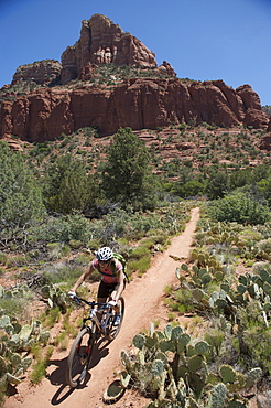
857-89737 - Woman rides the Submarine Rock Loop in South Sedona, Arizona. The trail has everything from slickrock to single track to stairs that lead to Submarine Rock.
857-89710 - Hikers cook dinner on a cliff-pinched patio above camp and the Colorado River near Deer Creek Falls in the Grand Canyon outside of Fredonia, Arizona November 2011. The 21.4-mile loop starts at the Bill Hall trailhead on the North Rim and descends 2000-feet in 2.5-miles through Coconino Sandstone to the level Esplanada then descends further into the lower canyon through a break in the 400-foot-tall Redwall to access Surprise Valley. Hikers connect Thunder River and Tapeats Creek to a route along the Colorado River and climb out Deer Creek.
857-89708 - Hikers swim in the pool below 180-foot Deer Creek Falls in the Grand Canyon outside of Fredonia, Arizona November 2011. The 21.4-mile loop starts at the Bill Hall trailhead on the North Rim and descends 2000-feet in 2.5-miles through Coconino Sandstone to the level Esplanada then descends further into the lower canyon through a break in the 400-foot-tall Redwall to access Surprise Valley. Hikers connect Thunder River and Tapeats Creek to a route along the Colorado River and climb out Deer Creek.
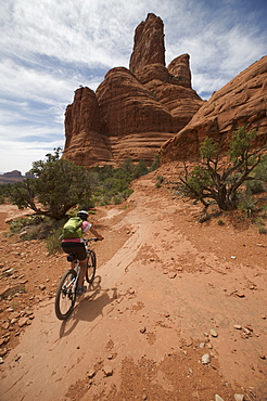
857-89687 - Woman rides the Submarine Rock Loop in South Sedona, Arizona. The trail has everything from slickrock to single track to stairs that lead to Submarine Rock.
857-89717 - Hikers follow a route along the Colorado River that connect Tapeats Creek and Thunder River to Deer Creek in the Grand Canyon outside of Fredonia, Arizona November 2011. The 21.4-mile loop starts at the Bill Hall trailhead on the North Rim and descends 2000-feet in 2.5-miles through Coconino Sandstone to the level Esplanada then descends further into the lower canyon through a break in the 400-foot-tall Redwall to access Surprise Valley. Hikers connect Thunder River and Tapeats Creek to a route along the Colorado River and climb out Deer Creek.
857-89712 - Male hiker filters water on a cliff-pinched patio near Deer Creek Falls in the Grand Canyon outside of Fredonia, Arizona November 2011. The 21.4-mile loop starts at the Bill Hall trailhead on the North Rim and descends 2000-feet in 2.5-miles through Coconino Sandstone to the level Esplanada then descends further into the lower canyon through a break in the 400-foot-tall Redwall to access Surprise Valley. Hikers connect Thunder River and Tapeats Creek to a route along the Colorado River and climb out Deer Creek.
857-89700 - Hikers on the sandstone Esplanade of the Thunder River Trail below the North Rim of the Grand Canyon outside Fredonia, Arizona November 2011. The 21.4-mile loop descends 2000-feet in 2.5-miles through Coconino Sandstone from the Bill Hall trailhead to connect the Thunder River and Deer Creeks trails. Hikers descend into the lower canyon through a break in the 400-foot-tall Redwall to access Surprise Valley, Deer Creek, Tapeats Creek via Thunder River and even the Colorado River.
857-89686 - Woman rides the Submarine Rock Loop in South Sedona, Arizona. The trail has everything from slickrock to single track to stairs that lead to Submarine Rock.
857-89703 - Hikers past small waterfalls along Deer Creek Narrows in the Grand Canyon outside of Fredonia, Arizona November 2011. The 21.4-mile loop starts at the Bill Hall trailhead on the North Rim and descends 2000-feet in 2.5-miles through Coconino Sandstone to the level Esplanada then descends further into the lower canyon through a break in the 400-foot-tall Redwall to access Surprise Valley. Hikers connect Thunder River and Tapeats Creek to a route along the Colorado River and climb out Deer Creek.
857-89711 - Male hiker filters water on a cliff-pinched patio near Deer Creek Falls in the Grand Canyon outside of Fredonia, Arizona November 2011. The 21.4-mile loop starts at the Bill Hall trailhead on the North Rim and descends 2000-feet in 2.5-miles through Coconino Sandstone to the level Esplanada then descends further into the lower canyon through a break in the 400-foot-tall Redwall to access Surprise Valley. Hikers connect Thunder River and Tapeats Creek to a route along the Colorado River and climb out Deer Creek.
857-89702 - Hikers walk along Deer Creek Narrows in the Grand Canyon outside of Fredonia, Arizona November 2011. The 21.4-mile loop starts at the Bill Hall trailhead on the North Rim and descends 2000-feet in 2.5-miles through Coconino Sandstone to the level Esplanada then descends further into the lower canyon through a break in the 400-foot-tall Redwall to access Surprise Valley. Hikers connect Thunder River and Tapeats Creek to a route along the Colorado River and climb out Deer Creek.


