Recent searches
Loading...
1348-4498 - Globe Centred On The North Pole, True Colour Satellite Image
1348-4609 - New Zealand, True Colour Satellite Image. New Zealand, true colour satellite image. This image was compiled from data acquired by LANDSAT 5 & 7 satellites.
1348-3406 - Satellite view of the Great Barrier Reef, Australia, off Mackay's coast. This image was compiled from data acquired in 2014 by Landsat 8 satellite.
1348-4616 - Globe Africa, True Colour Satellite Image. Earth. True colour satellite image of the Earth, centred on Africa
1348-4471 - Shetland, Scotland, Uk, True Colour Satellite Image
1348-4578 - Yangtze River, Shanghai, China, True Colour Satellite Image. Satellite image of the river mouth of the Yangtze river
1348-4435 - Nauru, True Colour Satellite Image. Nauru. True colour satellite image of Nauru, an island nation in Micronesia in the South Pacific. This image was taken on 29 June 1999, by the LANDSAT 7 satellite.
1348-4506 - South America, True Colour Satellite Image. True colour satellite image of South America. This image in Lambert Azimuthal Equal Area projection was compiled from data acquired by LANDSAT 5 & 7 satellites.
1348-4560 - Volcano Tousside In 3D, Chad, True Colour Satellite Image. Pic Tousside, Chad, true colour satellite image. A recent volcano, known as the Pic Tousside, in the Tibesti Mountains in Northwestern tip of Chad (Africa). Composite image dated 2000-2002 using LANDSAT data.
1348-4617 - Globe Oceania, True Colour Satellite Image. Earth. True colour satellite image of the Earth, centred on the region of Oceania
1348-4453 - Caspian Sea, Asia, True Colour Satellite Image. True colour satellite image of the Caspian Sea in Asia. It is bounded by Iran, Russia, Kazakhstan, Turkmenistan and Azerbaijan. The Caspian Sea is the world's largest inland sea. Composite image using LANDSAT 5 data.
1348-3420 - Satellite view of Crete, Greece. Crete is the largest and most populous of the Greek islands. This image was compiled from data acquired by Landsat 8 satellite in 2014.
1348-4431 - Saint Kits And Nevis, True Colour Satellite Image
1348-3371 - Satellite view of Northern Europe showing Scandinavia and the Baltic States. This image was compiled from data acquired by LANDSAT 7 & 8 satellites.
1348-3355 - Satellite view of Tongatapu, the largest island of Tonga archipelago. This image was compiled from data acquired by Landsat 8 satellite in 2014.
1348-4438 - Italy, True Colour Satellite Image With Border. Italy, true colour satellite image with border
1348-3387 - Satellite view of Northern South America. This image was compiled from data acquired by Landsat 7 & 8 satellites.
1348-3372 - Satellite view of Najran University, Saudi Arabia. This image was taken in 2014 by Landsat 8 satellite.
1348-3396 - Satellite view of Moorea, French Polynesia. This image was compiled from data acquired by Landsat 8 satellite in 2014.
1348-3392 - Satellite view of Mount Kilimanjaro, Tanzania. This dormant volcano is the highest mountain in Africa. It is part of the Kilimanjaro National Park. This image was compiled from data acquired by Landsat satellites.
1348-4549 - Long Island Volcano, Papua New Guinea, True Colour Satellite Image
1348-3386 - Satellite view of Nuku Hiva, the largest of the Marquesas Islands in French Polynesia. This image was compiled from data acquired by Landsat 8 satellite in 2014.
1348-4613 - Iceland, True Colour Satellite Image. Iceland, true colour satellite image
1348-4458 - Danube Delta, Romania, True Colour Satellite Image. True colour satellite image of the Danube Delta
1348-3362 - Satellite view of Sulawesi, Indonesia. This image was compiled from data acquired by Landsat satellites.
1348-4484 - Dubai, United Arab Emirates, In 2000, True Colour Satellite Image. True colour satellite image of Dubai, United Arab Emirates. Image size A4, taken on 23 August 2000, using LANDSAT data.
1348-4446 - Agriculture In The Desert, Al Sulail, South Part Of The Riyadh Province, Saudi Arabia, True Colour Satellite Image
1348-3440 - Satellite view of Syr Daria River, Kazakhstan. This image was compiled from data acquired in 2014 by Landsat 8 satellite.
1348-4571 - Aral Sea, Kazakhstan & Uzbekistan, 1989, True Colour Satellite Image. Aral Sea in 1989, it lies between Kazakhstan in the north and Uzbekistan, in the south. Image taken on 17 September 1989 using LANDSAT data.
1348-3374 - Satellite view of Sao Tome. This image was compiled from data acquired by Landsat satellites.
1348-3394 - Satellite view of Eruption at Mount Etna, Sicily. This image was taken on December 3, 2015 by Landsat 8 satellite.
1348-3429 - Satellite view of the Abaco Islands that lie in the northern Bahamas
1348-4460 - Irrawaddy Delta, Myanmar, True Colour Satellite Image
1348-4469 - Tonle Sap Lake, Cambodia, True Colour Satellite Image. True colour satellite image of Tonlé Sap Lake and its floodplain, in Cambodia. Composite image using LANDSAT 7 data.
1348-4495 - Globe Showing Northern America, True Colour Satellite Image. True colour satellite image of the Earth showing Northern America, half in shadow. This image in orthographic projection was compiled from data acquired by LANDSAT 5 & 7 satellites.
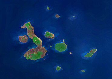
1348-4588 - Galapagos Archipelago, Ecuador, True Colour Satellite Image. True colour satellite image of the Galapagos islands, province of Ecuador
1348-3365 - Satellite view of the Southern Great Barrier Reef and Fraser Island along Queensland's coastline in north-east Australia. This image was compiled from data acquired in 2014 by Landsat 8 satellite.
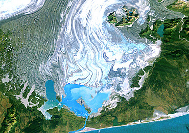
1348-4575 - Bering Glacier, Alaska, Usa, True Colour Satellite Image. Satellite image of the Bering Glacier
1348-3375 - Satellite view of Sao Miguel Island, Azores, Portugal. It is the largest and most populous island in the Azores archipelago. This image was compiled from data acquired by Landsat satellites.
1348-4442 - South Africa, True Colour Satellite Image. South Africa, true colour satellite image. This image was compiled from data acquired by LANDSAT 5 & 7 satellites.
1348-3397 - Satellite view of the Middle East. This image was compiled from data acquired in 2014 by Landsat 8 satellite.
1348-3383 - Satellite view of Pico Island, Azores, Portugal. Volcano Mount Pico, to the West, is the highest point in Portugal, at 2351 m, and the most famous landmark in the Azores. This image was compiled from data acquired by Landsat satellites.
1348-4535 - Tin Bider Meteor Impact Crater, Algeria, True Colour Satellite Image
1348-3347 - Satellite view of Viti Levu Island, Fiji. This is the largest island in the Republic of Fiji and the site of the nation's capital, Suva. This image was compiled from data acquired by Landsat 8 satellite in 2014.
1348-3368 - Satellite view of South America. This image was compiled from data acquired by Landsat 7 & 8 satellites.
1348-4464 - Orinoco Delta, Venezuela, True Colour Satellite Image. True colour satellite image of the Orinoco Delta in eastern Venezuela, The Orinoco river flows into the Atlantic ocean. At top is the island of Trinidad in the Caribbean sea. Composite image using LANDSAT 5 data.
1348-4525 - Sweden, Europe, True Colour Satellite Image With Border. Satellite view of Sweden (with border). This image was compiled from data acquired by LANDSAT 5 & 7 satellites.
1348-3413 - Satellite view of the Fiji Islands. This image was compiled from data acquired by Landsat 8 satellite in 2014.
1348-3410 - Satellite view of Funafuti, an atoll on which the capital of the island nation of Tuvalu is located. This image was compiled from data acquired by Landsat 8 satellite in 2014.
1348-4531 - Wolf Creek Meteor Impact Crater, Australia, True Colour Satellite Image. True colour satellite image of Wolf Creek impact structure, Australia (age : 300 000 years ; diameter : 875 m). Image taken on 27 April 1990 using LANDSAT data.
1348-4620 - Globe North America, True Colour Satellite Image. Earth. True colour satellite image of the Earth, centred on North America
1348-3359 - Satellite view of Tahiti, French Polynesia. This image was compiled from data acquired by Landsat 8 satellite in 2014.
1348-3367 - Satellite view of Southeast Asia. This image was compiled from data acquired by Landsat 7 & 8 satellites.
1348-4510 - Whole Earth At Night With Country Borders, True Colour Satellite Image. True colour satellite image of the whole Earth at night with country borders. This image in Miller projection was compiled from data acquired by LANDSAT 5 & 7 satellites.
1348-4545 - Ararat Volcano, Turkey, True Colour Satellite Image
1348-3381 - Satellite view of Rarotonga, Cook Islands. This is the most populous island of the Cook Islands. This image was compiled from data acquired by Landsat 8 satellite in 2014.
1348-3409 - Satellite view of Futuna and Alofi Islands, part of Wallis and Futuna islands. This image was compiled from data acquired by Landsat 8 satellite in 2014.
1348-3425 - Satellite view of New Providence and Eleuthera Island, Bahamas. New Providence is the most populous island in the Bahamas and it houses the capital city of Nassau
1348-4519 - Sri Lanka, Asia, True Colour Satellite Image. Satellite view of Sri Lanka. This image was compiled from data acquired by LANDSAT 5 & 7 satellites.
1348-3402 - Satellite view of Isabela and Fernandina Islands, Galapagos Islands. This image was compiled from data acquired by Landsat satellites.
1348-4456 - Ebro River Delta, Spain, True Colour Satellite Image. True colour satellite image of the Ebro River Delta in Spain
1348-3358 - Satellite view of Taiwan. This image was compiled from data acquired by Landsat satellites.
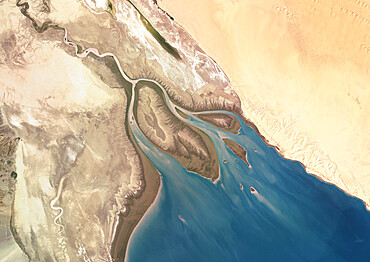
1348-4465 - Colorado River Delta, Mexico, True Colour Satellite Image
1348-4489 - Whole Earth At Night Centred On Pacific Ocean, True Colour Satellite Image. True colour satellite image of the whole Earth at night, centred on the Pacific Ocean. This image in Miller projection was compiled from data acquired by LANDSAT 5 & 7 satellites.
1348-4595 - La Havana, Cuba, True Colour Satellite Image. La Havana, Cuba. True colour satellite image of La Havana, the capital city of Cuba and the largest city of both Cuba and the Carribbean. Image taken on 3 April 2001 using LANDSAT 7 data.
1348-4566 - Hurricane Hernan, Baja California, Mexico, True Colour Satellite Image. Hurricane Hernan, true colour satellite image. Hurricane Hernan off the Baja California peninsula, Mexico, in the Eastern Pacific Ocean (satellite image taken on 1/09/2002).
1348-3349 - Satellite view of Saint Thomas and Saint John, US Virgin Islands. This image was compiled from data acquired by Landsat satellites.
1348-4550 - White Island Volcano'S Smoke Plume, New Zealand, True Colour Satellite Image
1348-4523 - Indonesia, Asia, True Colour Satellite Image With Border. Satellite view of Indonesia (with border). This image was compiled from data acquired by LANDSAT 5 & 7 satellites.
1348-4457 - Don River Delta, Russia, True Colour Satellite Image. True colour satellite image of the Don River Delta in Russia. The Don River flows into the Sea of Azov. Composite image using LANDSAT 7 data.
1348-4570 - Weddell Sea, Antarctica, True Colour Satellite Image. Weddel Sea, Antarctica, true colour satellite image. Pack ice melting in spring time in the Weddel Sea, East of the Antarctica peninsula. Image taken on 21 February 2000 using LANDSAT data.
1348-3421 - Satellite view of the Comoros Archipelago. This image was compiled from data acquired by Landsat satellites.
1348-3400 - Satellite view of Komodo Island, Indonesia. The image shows the whole Komodo National Park that includes the three islands Komodo, Padar and Rinca. This image was compiled from data acquired by Landsat satellites.
1348-4512 - Greenland, True Colour Satellite Image With Mask. Satellite view of Greenland (with mask). This image was compiled from data acquired by LANDSAT 5 & 7 satellites.
1348-3384 - Satellite view of the Persian Gulf. This image was compiled from data acquired in 2014 by Landsat 8 satellite.
1348-3424 - Satellite view of Andros Islands and New Providence, Bahamas. New Providence is the most populous island in the Bahamas and it houses the capital city of Nassau
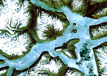
1348-4576 - King Oscar Fjord, Greenland, True Colour Satellite Image. King Oscar Fjord located in Greenland National Park. The pastel blue indicates that the water has turned into ice. Image taken on 21 June 1991 using LANDSAT data.
1348-4583 - Hawooi And Kikori Deltas, Papua New Guinea, True Colour Satellite Image. True colour satellite image of the deltas of the rivers Hawooi (left) and Kikori (right)
1348-3423 - Satellite view of Barbados. This image was compiled from data acquired by Landsat satellites.
1348-3432 - Satellite view of the Arabian Peninsula. This image was compiled from data acquired in 2014 by Landsat 8 satellite.
1348-4532 - Wanapitei Lake Meteor Impact Crater, Manitoba, Canada, True Colour Satellite Image
1348-4454 - Rhone Delta, France, True Colour Satellite Image. True colour satellite image of the Rhone Delta in southern France
1348-3345 - Satellite view of the Central Great Barrier Reef along Queensland's coastline in north-east Australia
1348-3411 - Satellite view of Fuerteventura and Lanzarote, Canary Islands, Spain. This image was compiled from data acquired by Landsat 8 satellite in 2014.
1348-4599 - Dakar, Senegal, True Colour Satellite Image. Dakar, Senegal. True colour satellite image of Dakar, capital city of Senegal. Composite of 2 images taken on 4 & 11 November 1999, using LANDSAT 7 data.
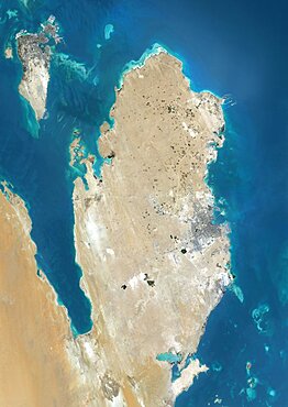
1348-3382 - Satellite view of Qatar and Bahrain. This image was compiled from data acquired by Landsat 8 satellite in 2014.
1348-4564 - Sahara Desert, Africa, True Colour Satellite Image. Sahara desert, true colour satellite image. The Sahara is the world's largest hot desert, made of sand and volcanic mountains. Composite image using data from LANDSAT 5 & 7 satellites.
1348-4604 - Abu Dhabi, United Arab Emirates, True Colour Satellite Image
1348-4470 - Lake Malawi, Africa, True Colour Satellite Image. True colour satellite image of Lake Malawi, an African Great Lake situated between Malawi, Mozambique, and Tanzania. Composite image using LANDSAT 5 data.
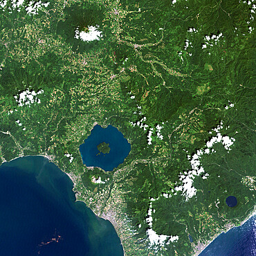
1348-4551 - Usu Volcano, Japan, True Colour Satellite Image
1348-4611 - Madagascar, True Colour Satellite Image. Madagascar, true colour satellite image. This image was compiled from data acquired by LANDSAT 5 & 7 satellites.
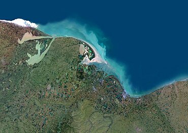
1348-4462 - Indigirka River Delta, Russia, True Colour Satellite Image. True colour satellite image of the Indigirka River Delta in Russia. The river flows into the Kolyma Bay, East Siberian Sea. Composite image using LANDSAT 5 data.
1348-3388 - Satellite view of North America in winter, with partial snow cover and Arctic ice cap. This image was compiled from data acquired by Landsat 7 & 8 satellites.
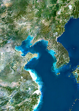
1348-4451 - Yellow Sea, Asia, True Colour Satellite Image
1348-4614 - Globe North Pole, True Colour Satellite Image. Cloudless true colour satellite image of the Earth, centred on the Arctic or north polar region
1348-4574 - Isla De La Juventud, Cuba, True Colour Satellite Image. Satellite image of the Isla de la Juventud, in the Canarreos archipelago, close to the Island of Cuba. Image taken on 31 January 1987 using LANDSAT data.
1348-4511 - Whole Earth With Country Borders, True Colour Satellite Image. True colour satellite image of the whole Earth with country borders
1348-4488 - Canton And Shenzen, China, In 2000, True Colour Satellite Image. True colour satellite image of the cities of Guangzhou (Canton) and Shenzen, China. Image in landscape format, taken on 14 September 2000, using LANDSAT data.


