Recent searches
Loading...
1349-25 - La Niña, Pacific Ocean Temperature Anomalies
1116-49456 - Hispanic woman looking at a route map at a subway station
1116-49671 - Research divers from the MOC Marine Institute map out coral damage at Molokini Marine Preserve off the island of Maui, Hawaii. In the future, data from here will help to determine the health of Hawaii's reefs, Maui, Hawaii, United States of America
1116-49673 - Research divers from the MOC Marine Institute glue broken coral heads back together and map out coral damage at Molokini Marine Preserve off the island of Maui, Hawaii. In the future, data from here will help to determine the health of Hawaii's reefs, Maui, Hawaii, United States of America
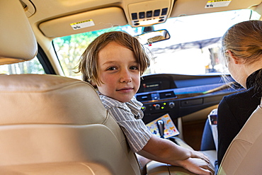
1113-104844 - Two boys reading a map, Makgadikgadi Pans National Park, Botswana
1113-104561 - Roll with fried fish, Lubeck, Schleswig-Holstein, Germany
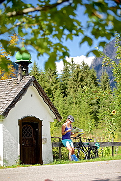
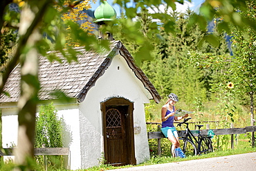
1113-104953 - Young female cyclist having a break to read a map / Tannheimer Tal, Tyrol, Austria
765-854 - Ponte Vecchio, Florence (Firenze), UNESCO World Heritage Site, Tuscany, Italy, Europe
1113-103976 - Person looking at his travel guide, Bastion, Cagliari, Sardinia, Italy
1113-103581 - Young female tourist in front of Cathedral reading map, Florence, Tuscany, Italy
1178-30664 - Studio shot of laboratory vial and syringe with world map in background
1178-30665 - Rows of laboratory vials and syringes with world map in background
1178-30666 - Rows of laboratory vials and syringes on yellow shape of USA
1174-9500 - Tourist map of Florence with the city in the background, Tuscany, Italy
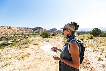
1174-9327 - adult woman hiker, Ghost Ranch, New Mexico, United States of America
809-8084 - Coronavirus (Covid-19), global pandemic, World map with surgical mask and Bible, Koran and Torah, Interreligious dialogue, France, Europe
1116-49827 - Trendy man with a spinal cord injury in wheelchair looking at a subway map of the city
1176-1289 - Two friends, one African and one Caucasian, sharing a map together whilst on holiday, Portugal, Europe
1176-1291 - Two friends, one African and one Caucasian, sharing a map together whilst on holiday, Portugal, Europe
1176-1290 - Two friends, one African and one Caucasian, sharing a map together whilst on holiday, Portugal, Europe
1178-29844 - Digitally generated image of Coronavirus spreading on world map
832-384746 - Girl, teenager, with smartphone in her hand standing at night in the city in front of city map, Cologne, North Rhine-Westphalia, Germany, Europe
832-384747 - Girl, teenager, with smartphone in her hand standing at night in the city in front of city map, Cologne, North Rhine-Westphalia, Germany, Europe
1116-47230 - Female tourist with map at ancient Roman Amphitheatre known as Pula Arena, Pula, Istria, Croatia
1116-47414 - Tourist information sign at The Wherry, Atlantic coast, South Shields, Tyne and Wear, England
1116-48308 - A tourist information sign at Snaefellsjokull National Park in Western Iceland, Iceland
1178-28810 - Digitally generated image of world map with Coronavirus
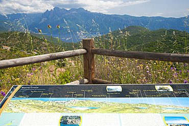
746-89000 - Bocca Croce, D81 road Porto to Piana, Corsica, France, Europe
746-89114 - Calle Gran Via, Madrid, Spain, EuropePalace; Calle; Towers; Modern; Build; Madrid; Spain; Europe; Gran Via; Statue; Cityscape; Architecture; Square; Building; Business; Shopping; Store; Skyscraper; Horizontal; Vertical
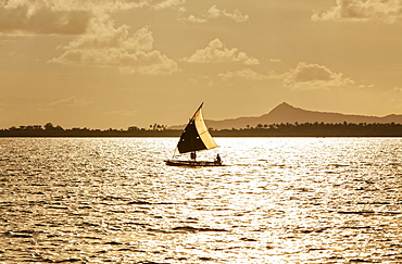
746-88662 - Pulcinella Sailboat, Delphina Resorts, Palau, Bocche di Bonifacio, La Maddalena Archipelago, Sardinia, Italy, Europe
746-89463 - Natural Great Barrier Reef in Queensland. Aerial view of nature paradise with magnificent colors.
1178-28231 - Double exposure of airplane on runway and world map
1178-28232 - Double exposure of airplane flying in sky and world map
1174-7329 - Japanese woman wearing hat and holding map standing outside Buddhist temple, Kyushu, Japan
1174-7328 - Japanese woman wearing hat and holding map standing outside Buddhist temple, Kyushu, Japan
1174-7114 - An adult woman hiker looking at a cross country hikers map
1116-46710 - View Of Susa Valley From Sacra Di San Michele, San Ambrogio Of Turin, Piedmont, Italy
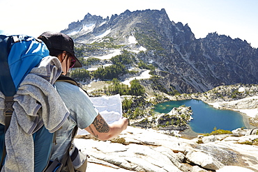
1179-3999 - Woman looking at map sitting on rocks at Eggishorn viewpoint above Aletsch Glacier, Bernese Alps, canton of Valais, Switzerland, Europe
1179-3996 - Woman looking at map sitting on rocks at Eggishorn viewpoint above Aletsch Glacier, Bernese Alps, canton of Valais, Switzerland, Europe
1116-44150 - Woman Sitting On A Step Looking At A Map, Bangkok, Thailand
1131-1240 - Pavement on the Tagus riverbank in front of the Padrao dos Descobrimentos, Compass rose and world map, Belem, Lisbon, Portugal, Europe
1311-106 - Hog Wash (Hog Heaven), the intersection of two trails on the Northwest side of the Twin Buttes in Sedona, Arizona, United States of America, North America
765-2088 - The Jewish Ghetto, Rome, Lazio, Italy, Europe
1174-6226 - Mixed race man reading map on hilltop, Leavenworth, Washington, USA
1174-5792 - Windshield wipers and map on dashboard of car, Olympic Peninsula, Washington, USA
1245-1513 - Madaba Mosaic Map, Greek Orthodox Basilica of Saint George, Madaba, Madaba Governorate, Jordan, Middle East
1245-1514 - Madaba Mosaic Map, Greek Orthodox Basilica of Saint George, Madaba, Madaba Governorate, Jordan, Middle East
857-96010 - A young boy and a young girl stand at model map of Crater Lake with the real Crater Lake in the background, Oregon, USA
1179-3686 - Hiker on cliffs looks at the map next to lighthouse, Mykines island, Faroe Islands, Denmark, Europe
832-382541 - Wooden sign depicting hiking trails of the Central Circuit, Rwenzori Mountains, Uganda, Africa
832-381170 - Young woman with red hair ribbon, sitting on an old suitcase, camera, map and globe spread in front of her, pin-up
1269-311 - Hiker reading map with Marmolada in the background, San Nicolo Pass, Fassa Valley, Trentino, Dolomites, Italy, Europe
1269-318 - Hiker reading map near San Nicolo Pass, Fassa Valley, Trentino, Dolomites, Italy, Europe
857-95299 - Over the shoulder view of single woman checking map, Kittery, Maine, USA
857-95096 - A woman consults her trail map next to a trail sign while hiking in Acadia National Park, Maine.
1113-102631 - Young female cyclist having a break and reading a map, Tannheimer Tal, Tyrol, Austria
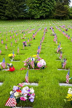
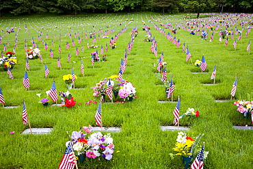
1116-40459 - Memorial Flowers And Flags, Graveyard, Oregon, Usa
1116-40457 - Memorial Flowers And Flags, Graveyard, Oregon, Usa
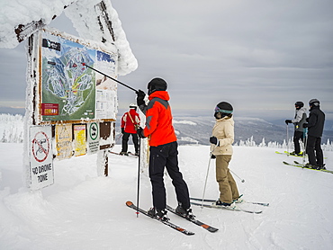
1116-40106 - Skiers look at a map at Sun Peaks ski resort, Kamloops, British Columbia, Canada
1179-3516 - Man looks at map of hiking trails, Aescher-Wildkirchli Gasthaus, Ebenalp, Appenzell Innerrhoden, Switzerland, Europe
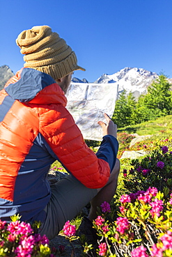
1179-3505 - Hiker surrounded by rhododendrons looks at map, Scermendone Alp, Sondrio province, Valtellina, Rhaetian Alps, Lombardy, Italy, Europe
1179-3506 - Hiker looking at map, Scermendone Alp, Sondrio province, Valtellina, Rhaetian Alps, Lombardy, Italy, Europe
1179-3442 - Hiker with binoculars and map looks towards Rhaetian Alps and Monte Disgrazia from Pizzo Berro, Bitto Valley, Lombardy, Italy, Europe
1179-3441 - Hiker sitting near rhododendrons on Pizzo Berro looks at the compass and map, Bitto Valley, Lombardy, Italy, Europe
1179-3440 - Hiker with map and binoculars looks towards Rhaetian Alps and Monte Disgrazia from Pizzo Berro, Bitto Valley, Lombardy, Italy, Europe
1269-214 - Tourist reading hiking map beside rhododendron flowers, Mount Scermendone, Valmasino, Valtellina, Lombardy, Italy, Europe
1269-213 - Tourist reading hiking map beside rhododendron flowers, Mount Scermendone, Valmasino, Valtellina, Lombardy, Italy, Europe
1176-947 - The painted ceiling in the gallery of Maps, Vatican Museum, UNESCO World Heritage Site, Vatican City, Rome, Lazio, Italy, Europe
1176-946 - The painted ceiling in the gallery of Maps, Vatican Museum, UNESCO World Heritage Site, Vatican City, Rome, Lazio, Italy, Europe
1179-3095 - Hikers looking at maps, Gasadalur, Vagar Island, Faroe Islands, Denmark, Europe
848-1434 - Tourist viewing map, Quinta da Regaleira, Sintra, Portugal, Europe
857-94717 - Nimoa Island - here the island mission will impress. The five-sided church features murals of island life and all mission buildings are surrounded by well maintained paths and gardens filled with flowering plants. Edged by jungle-covered mountains, postcard beaches and crystal clear waters - an island paradise indeed! The Louisiade Archipelago is a string of ten larger volcanic islands frequently fringed by coral reefs, and 90 smaller coral islands located 200 km southeast of New Guinea, stretching over more than 160 km and spread over an ocean area of 26,000 km? between the Solomon Sea to the north and the Coral Sea to the south. The aggregate land area of the islands is about 1,790 km? (690 square miles), with Vanatinai (formerly Sudest or Tagula as named by European claimants on Western maps) being the largest. Sideia Island and Basilaki Island lie closest to New Guinea, while Misima, Vanatinai, and Rossel islands lie further east. The archipelago is divided into the Local Level Government (LLG) areas Loui!
857-94720 - Nimoa Island - here the island mission will impress. The five-sided church features murals of island life and all mission buildings are surrounded by well maintained paths and gardens filled with flowering plants. Edged by jungle-covered mountains, postcard beaches and crystal clear waters - an island paradise indeed! The Louisiade Archipelago is a string of ten larger volcanic islands frequently fringed by coral reefs, and 90 smaller coral islands located 200 km southeast of New Guinea, stretching over more than 160 km and spread over an ocean area of 26,000 km? between the Solomon Sea to the north and the Coral Sea to the south. The aggregate land area of the islands is about 1,790 km? (690 square miles), with Vanatinai (formerly Sudest or Tagula as named by European claimants on Western maps) being the largest. Sideia Island and Basilaki Island lie closest to New Guinea, while Misima, Vanatinai, and Rossel islands lie further east. The archipelago is divided into the Local Level Government (LLG) areas Louisiade Rural (western part, with Misima), and Yaleyamba (western part, with Rossell and Tagula islands. The LLG areas are part of Samarai-Murua District district of Milne Bay. The seat of the Louisiade Rural LLG is Bwagaoia on Misima Island, the population center of the archipelago.
857-94594 - A male hiker is looking at a map to find his route through the mountains. Halfway the Haute Route, a classic multi day trek in Europe.
857-94718 - Nimoa Island - here the island mission will impress. The five-sided church features murals of island life and all mission buildings are surrounded by well maintained paths and gardens filled with flowering plants. Edged by jungle-covered mountains, postcard beaches and crystal clear waters - an island paradise indeed! The Louisiade Archipelago is a string of ten larger volcanic islands frequently fringed by coral reefs, and 90 smaller coral islands located 200 km southeast of New Guinea, stretching over more than 160 km and spread over an ocean area of 26,000 km? between the Solomon Sea to the north and the Coral Sea to the south. The aggregate land area of the islands is about 1,790 km? (690 square miles), with Vanatinai (formerly Sudest or Tagula as named by European claimants on Western maps) being the largest. Sideia Island and Basilaki Island lie closest to New Guinea, while Misima, Vanatinai, and Rossel islands lie further east. The archipelago is divided into the Local Level Government (LLG) areas Louisiade Rural (western part, with Misima), and Yaleyamba (western part, with Rossell and Tagula islands. The LLG areas are part of Samarai-Murua District district of Milne Bay. The seat of the Louisiade Rural LLG is Bwagaoia on Misima Island, the population center of the archipelago.
857-94722 - Children playing with a outrigger canoe in the village of Hessessai Bay at PanaTinai (Panatinane)island in the Louisiade Archipelago in Milne Bay Province, Papua New Guinea. The island has an area of 78 km2. The Louisiade Archipelago is a string of ten larger volcanic islands frequently fringed by coral reefs, and 90 smaller coral islands located 200 km southeast of New Guinea, stretching over more than 160 km and spread over an ocean area of 26,000 km? between the Solomon Sea to the north and the Coral Sea to the south. The aggregate land area of the islands is about 1,790 km? (690 square miles), with Vanatinai (formerly Sudest or Tagula as named by European claimants on Western maps) being the largest. Sideia Island and Basilaki Island lie closest to New Guinea, while Misima, Vanatinai, and Rossel islands lie further east. The archipelago is divided into the Local Level Government (LLG) areas Louisiade Rural (western part, with Misima), and Yaleyamba (western part, with Rossell and Tagula islands. The LLG areas are part of Samarai-Murua District district of Milne Bay. The seat of the Louisiade Rural LLG is Bwagaoia on Misima Island, the population center of the archipelago.PanaTinai (Panatinane) is an island in the Louisiade Archipelago in Milne Bay Province, Papua New Guinea.
857-94715 - Nimoa Island - here the island mission will impress. The five-sided church features murals of island life and all mission buildings are surrounded by well maintained paths and gardens filled with flowering plants. Edged by jungle-covered mountains, postcard beaches and crystal clear waters - an island paradise indeed! The Louisiade Archipelago is a string of ten larger volcanic islands frequently fringed by coral reefs, and 90 smaller coral islands located 200 km southeast of New Guinea, stretching over more than 160 km and spread over an ocean area of 26,000 km? between the Solomon Sea to the north and the Coral Sea to the south. The aggregate land area of the islands is about 1,790 km? (690 square miles), with Vanatinai (formerly Sudest or Tagula as named by European claimants on Western maps) being the largest. Sideia Island and Basilaki Island lie closest to New Guinea, while Misima, Vanatinai, and Rossel islands lie further east.
857-95015 - A young man wearing sunglasses, uses a map to find his way in the province of Groningen, The Netherlands, around the Netwerk Fietsknooppunten, a network of marked junctions of bycicle roads spanning all country Netherlands.
857-94719 - Nimoa Island - here the island mission will impress. The five-sided church features murals of island life and all mission buildings are surrounded by well maintained paths and gardens filled with flowering plants. Edged by jungle-covered mountains, postcard beaches and crystal clear waters - an island paradise indeed! The Louisiade Archipelago is a string of ten larger volcanic islands frequently fringed by coral reefs, and 90 smaller coral islands located 200 km southeast of New Guinea, stretching over more than 160 km and spread over an ocean area of 26,000 km? between the Solomon Sea to the north and the Coral Sea to the south. The aggregate land area of the islands is about 1,790 km? (690 square miles), with Vanatinai (formerly Sudest or Tagula as named by European claimants on Western maps) being the largest. Sideia Island and Basilaki Island lie closest to New Guinea, while Misima, Vanatinai, and Rossel islands lie further east. The archipelago is divided into the Local Level Government (LLG) areas Louisiade Rural (western part, with Misima), and Yaleyamba (western part, with Rossell and Tagula islands. The LLG areas are part of Samarai-Murua District district of Milne Bay. The seat of the Louisiade Rural LLG is Bwagaoia on Misima Island, the population center of the archipelago.
857-94721 - Nimoa Island - here the island mission will impress. The five-sided church features murals of island life and all mission buildings are surrounded by well maintained paths and gardens filled with flowering plants. Edged by jungle-covered mountains, postcard beaches and crystal clear waters - an island paradise indeed! The Louisiade Archipelago is a string of ten larger volcanic islands frequently fringed by coral reefs, and 90 smaller coral islands located 200 km southeast of New Guinea, stretching over more than 160 km and spread over an ocean area of 26,000 km? between the Solomon Sea to the north and the Coral Sea to the south. The aggregate land area of the islands is about 1,790 km? (690 square miles), with Vanatinai (formerly Sudest or Tagula as named by European claimants on Western maps) being the largest. Sideia Island and Basilaki Island lie closest to New Guinea, while Misima, Vanatinai, and Rossel islands lie further east. The archipelago is divided into the Local Level Government (LLG) areas Loui!
857-94716 - Nimoa Island - here the island mission will impress. The five-sided church features murals of island life and all mission buildings are surrounded by well maintained paths and gardens filled with flowering plants. Edged by jungle-covered mountains, postcard beaches and crystal clear waters - an island paradise indeed! The Louisiade Archipelago is a string of ten larger volcanic islands frequently fringed by coral reefs, and 90 smaller coral islands located 200 km southeast of New Guinea, stretching over more than 160 km and spread over an ocean area of 26,000 km? between the Solomon Sea to the north and the Coral Sea to the south. The aggregate land area of the islands is about 1,790 km? (690 square miles), with Vanatinai (formerly Sudest or Tagula as named by European claimants on Western maps) being the largest. Sideia Island and Basilaki Island lie closest to New Guinea, while Misima, Vanatinai, and Rossel islands lie further east. The archipelago is divided into the Local Level Government (LLG) areas Loui!
857-94714 - The Louisiade Archipelago is a string of ten larger volcanic islands frequently fringed by coral reefs, and 90 smaller coral islands located 200 km southeast of New Guinea, stretching over more than 160 km and spread over an ocean area of 26,000 km? between the Solomon Sea to the north and the Coral Sea to the south. The aggregate land area of the islands is about 1,790 km? (690 square miles), with Vanatinai (formerly Sudest or Tagula as named by European claimants on Western maps) being the largest. Sideia Island and Basilaki Island lie closest to New Guinea, while Misima, Vanatinai, and Rossel islands lie further east. The archipelago is divided into the Local Level Government (LLG) areas Louisiade Rural (western part, with Misima), and Yaleyamba (western part, with Rossell and Tagula islands. The LLG areas are part of Samarai-Murua District district of Milne Bay. The seat of the Louisiade Rural LLG is Bwagaoia on Misima Island, the population center of the archipelago.
857-94712 - The Louisiade Archipelago is a string of ten larger volcanic islands frequently fringed by coral reefs, and 90 smaller coral islands located 200 km southeast of New Guinea, stretching over more than 160 km and spread over an ocean area of 26,000 km? between the Solomon Sea to the north and the Coral Sea to the south. The aggregate land area of the islands is about 1,790 km? (690 square miles), with Vanatinai (formerly Sudest or Tagula as named by European claimants on Western maps) being the largest.Sideia Island and Basilaki Island lie closest to New Guinea, while Misima, Vanatinai, and Rossel islands lie further east. The archipelago is divided into the Local Level Government (LLG) areas Louisiade Rural (western part, with Misima), and Yaleyamba (western part, with Rossell and Tagula islands. The LLG areas are part of Samarai-Murua District district of Milne Bay. The seat of the Louisiade Rural LLG is Bwagaoia on Misima Island, the population center of the archipelago.
809-7331 - Frescoes on the ceiling of the Gallery of Maps, Vatican Museum, Rome, Lazio, Italy, Europe
1-41626 - Village school, Deogarh, Rajasthan state, India, Asia
746-63157 - Maritime Museum, Bermuda, Atlantic Ocean, Central America
746-70143 - Middle East, Madaba, Greek Orthodox St George’s Church. Madaba’s most famous site about Mosaics
746-70144 - Middle East, Madaba, Greek Orthodox St George’s Church. Madaba’s most famous site about Mosaics


