Recent searches
Loading...
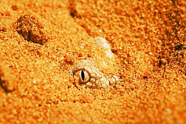
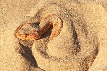
860-291022 - Sahara sand viper (Cerastes vipera) in the sand, From Mauritania to Egypt. Captivity
860-291019 - Horned desert viper (Cerastes cerastes) biting, from Mauritania to Arabian peninsula
860-291021 - Sahara sand viper (Cerastes vipera) sinking into the sand, From Mauritania to Egypt. Captivity
860-291020 - Sahara sand viper (Cerastes vipera) sinking into the sand, From Mauritania to Egypt. Captivity
1351-204 - A group of peculiar rock formations between Kiffa and Ayoun, Mauritania, Sahara Desert, West Africa, Africa
1351-201 - A stretch of white dunes surrounded by canyons near Kamour, Mauritania, Sahara Desert, West Africa, Africa
1351-205 - A group of peculiar rock formations between Kiffa and Ayoun, Mauritania, Sahara Desert, West Africa, Africa
1351-202 - A group of peculiar rock formations between Kiffa and Ayoun, Mauritania, Sahara Desert, West Africa, Africa
1351-203 - A group of peculiar rock formations between Kiffa and Ayoun, Mauritania, Sahara Desert, West Africa, Africa
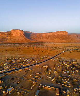
1351-192 - A huge rock cliff and canyon near Kamour, Mauritania, Sahara Desert, West Africa, Africa
1351-194 - A huge rock cliff and canyon near Kamour, Mauritania, Sahara Desert, West Africa, Africa
1351-200 - A crumbling mountain, a river bed, palms, and dunes surround the village of Kamour, Mauritania, Sahara Desert, West Africa, Africa
1351-195 - A huge rock cliff and canyon near Kamour, Mauritania, Sahara Desert, West Africa, Africa
1351-191 - A huge rock cliff and canyon near Kamour, Mauritania, Sahara Desert, West Africa, Africa
1351-198 - The Oasis of Diouk, Mauritania, Sahara Desert, West Africa, Africa
1351-193 - A village near Kamour, Mauritania, Sahara Desert, West Africa, Africa
1351-190 - A village near Kamour, Mauritania, Sahara Desert, West Africa, Africa
1351-199 - A river bed, palms, and dunes surround the village of Kamour, Mauritania, Sahara Desert, West Africa, Africa
1351-196 - The Oasis of Diouk, Mauritania, Sahara Desert, West Africa, Africa
1351-197 - The Oasis of Diouk, Mauritania, Sahara Desert, West Africa, Africa
1351-186 - A man carrying bread at the market of a village near Ayoun El Atrous, Hodh El Gharbi, Mauritania, Sahara Desert, West Africa, Africa
1351-188 - A series of rock formations between Kiffa and Ayoun, Mauritania, Sahara Desert, West Africa, Africa
1351-187 - A series of rock formations between Kiffa and Ayoun, Mauritania, Sahara Desert, West Africa, Africa
1351-189 - A series of rock formations between Kiffa and Ayoun, Mauritania, Sahara Desert, West Africa, Africa
1351-183 - The streets and people of a village between Kiffa and Ayoun, Mauritania, Sahara Desert, West Africa, Africa
1351-185 - The streets and people of a village between Kiffa and Ayoun, Mauritania, Sahara Desert, West Africa, Africa
1351-184 - The streets and people of a village between Kiffa and Ayoun, Mauritania, Sahara Desert, West Africa, Africa
1351-182 - The streets and people of a village between Kiffa and Ayoun, Mauritania, Sahara Desert, West Africa, Africa
1351-181 - A worker with dromedaries, taking water out of a well in a village between Nouakchott and Tidjikdja, Mauritania, Sahara, West Africa, Africa
1351-180 - A worker with his dromedaries, taking water out of a well in a village between Nouakchott and Tidjikdja, Mauritania, Sahara, West Africa, Africa
1351-179 - One of the many towns between Nouakchott and Tidjikdja, Mauritania, Sahara Desert, West Africa, Africa
1351-178 - One of the many towns between Nouakchott and Tidjikdja, Mauritania, Sahara Desert, West Africa, Africa
1351-177 - Livestock in Boutilimit, Mauritania, Sahara Desert, West Africa, Africa
1351-176 - Locals in the streets of Boutilimit, Mauritania, Sahara Desert, West Africa, Africa
1351-175 - Nouakchott Camel Market, Nouakchott, Mauritania, West Africa, Africa
1351-170 - Nouakchott Camel Market, Nouakchott, Mauritania, West Africa, Africa
1351-171 - Nouakchott Camel Market, Nouakchott, Mauritania, West Africa, Africa
1351-172 - Nouakchott Camel Market, Nouakchott, Mauritania, West Africa, Africa
1351-173 - Nouakchott Camel Market, Nouakchott, Mauritania, West Africa, Africa
1351-174 - Nouakchott Camel Market, Nouakchott, Mauritania, West Africa, Africa
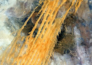
1348-4580 - Desert Erg Iguidi, Algeria, True Colour Satellite Image. True colour satellite image of Erg Iguidi, a sand desert between Algeria and Mauritania. The 250m wide dunes lay in the South on a sand plain, and in the North on a blakek sandstone area. The light blue areas are calcareous and salt crusts left out from the evaporation of the oueds' water. Image taken on 29 March 1987 using LANDSAT data.
1348-4564 - Sahara Desert, Africa, True Colour Satellite Image. Sahara desert, true colour satellite image. The Sahara is the world's largest hot desert, made of sand and volcanic mountains. Composite image using data from LANDSAT 5 & 7 satellites.
1348-4561 - Richat Structure, Mauritania, True Colour Satellite Image. Richat Structure, Mauritania, true colour satellite image
1348-3436 - Satellite view of Africa. This image was compiled from data acquired by Landsat 7 & 8 satellites.
1348-3445 - Satellite view of Senegal River that forms the border between Senegal and Mauritania in West Africa.This image was taken in 2014 by Landsat 8 satellite.
1349-750 - The Richat Structure, Mauritania, satellite image
860-288119 - Lesser cerastes Vipera (Cerastes vipera) on sand, Mauritania
860-288125 - Yellow Fat Tail Scorpion (Androctonus australis) on sand, Mauritania
860-288120 - Lesser cerastes Vipera (Cerastes vipera) on sand, Mauritania
860-288123 - Greater Hoopoe-Lark (Alaemon alaudipes) on ground, Mauritania
860-288122 - Lesser cerastes Vipera (Cerastes vipera) on sand, Mauritania
860-288121 - Lesser cerastes Vipera (Cerastes vipera) in sand, Mauritania
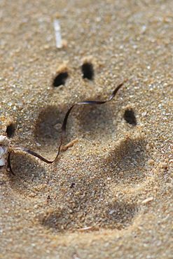
860-288126 - Golden jackal (Canis aureus) footprint in sand, Mauritania
860-288041 - Golden Fringe-fingered lizard (Acanthodactylus aureus) on sand, Mauritania
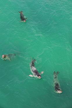
860-287686 - Monk Seal (Monachus monachus) group swimming, Noadibou, Mauritania
860-287685 - Monk Seal (Monachus monachus) group swimming, Nouadhibou, Mauritania
832-381632 - Donkey cart being pushed through the soft sand, Moudjeria, Tagant region, Mauritania, Africa
832-370527 - Portrait of a Mauritanian man, Nouakchott, Mauritania, northwestern Africa
832-126533 - Chinguetti Mosque, Chinguetti, Mauritania, northwestern Africa
832-126560 - The ruins of the world heritage sight of Ouadane, Western Africa, Mauritania, Africa
832-126563 - The ruins of Ouadane, UNESCO World Heritage Site, Mauritania, northwestern Africa
832-126547 - Iron ore train of Zouerat, the longest and heaviest train in the world, Nouadhibou, Mauritania, northwestern Africa
832-126561 - Old door locker at the ruins of Ouadane, UNESCO World Heritage Site, Mauritania, northwestern Africa
832-126534 - Man walking through the sandy lanes of the town of Chinguetti, Mauritania, northwestern Africa
832-126556 - The ruins of Ouadane, UNESCO World Heritage Site, Mauritania, northwestern Africa
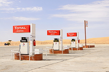
832-126531 - Total fuel station in the Sahara desert, between Nouadhibou and Nouakchott, Mauritania, northwestern Africa
832-126559 - Old manuscripts of the holy Koran, Ouadane, Mauritania, northwestern Africa
832-126546 - Old Renault travelling through the Sahara, Nouakchott, Mauritania, northwestern Africa
832-126548 - Track switch in front of the iron ore train of Zouerat, the longest and heaviest train in the world, Nouadhibou, Mauritania, northwestern Africa
832-126529 - Stranded cargo boat on the shore of Cap Blanc, Nouadhibou, Mauritania, northwestern Africa
832-126552 - Fishermen pushing their boats back onto the beach, Nouakchott, Western Africa, Mauritania, Africa
832-126553 - Trading on the camel market of Nouakchott, Mauritania, northwestern Africa
832-126550 - Veiled women with traditional dress walking near Atar, Mauritania, northwestern Africa
832-126535 - Sandstone houses in the town of Chinguetti, Mauritania, northwestern Africa
832-126562 - The ruins of Ouadane, UNESCO World Heritage Site, Mauritania, northwestern Africa
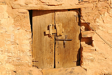
832-126536 - Old wooden door in the town of Chinguetti, Mauritania, northwestern Africa
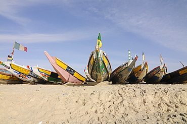
832-126551 - Colourful fishing boats in the fishing harbour of Nouakchott, Mauritania, northwestern Africa
832-126555 - The minaret of the mosque of Nouakchott, Mauritania, northwestern Africa
832-126544 - Trading on the camel market of Nouakchott, Mauritania, northwestern Africa
832-126537 - People collecting metal and other parts of rusting ships left over at the ship cemetery of Nouadhibou, Mauritania, Africa
832-126532 - Sandstone cliffs of Cap Blanc, Nouadhibou, Mauritania, northwestern Africa
832-126549 - Colourful boat in the fishing port of Nouakchott, Mauritania, northwestern Africa
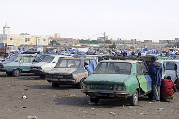
832-126554 - Old Renaults at the central taxi rank of Nouakchott, Mauritania, northwestern Africa
832-126538 - Ship wrecks rusting on the shores of the beach of Nouadhibou, one of the largest ship wreck cemeteries worldwide, Mauritania, northwestern Africa
832-126564 - The ruins of Ouadane, UNESCO World Heritage Site, Mauritania, northwestern Africa
832-126557 - The ruins of Ouadane, UNESCO World Heritage Site, Mauritania, northwestern Africa
832-126558 - Hands holding old manuscripts of the holy Koran, Ouadane, Mauritania, northwestern Africa
832-126543 - Very old rusting Peugeots on the fish market of Nouadhibou, Mauritania, northwestern Africa
832-126530 - Stranded cargo boat on the shore of Cap Blanc, Nouadhibou, Mauritania, northwestern Africa
832-126545 - The minaret of the mosque of Nouakchott, Mauritania, northwestern Africa
971-10 - Baleen whale skull showing baleen plates, Nouamghar, Mauritania (RR)
971-28 - Stranded Bottlenose dolphin (Tursiops truncatus) on beach, Mauritania (RR)
817-88538 - Nomad family eating goat and traditional bread cooked under sand, Chinguetti, Adrar Plateau, Sahara Desert, Mauritania
