Recent searches
Loading...
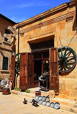
832-397296 - Lefkosa, Lefkosia, Nicosia, in the northern part of the capital of Cyprus, antique shop in the old town, troedel shop, northern Cyprus
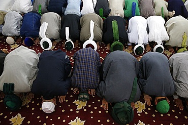
832-397298 - Lefkosa, Lefkosia, Nicosia, in the northern part of the capital of Cyprus, the Selimiye Mosque, St. Sophia's Cathedral in the old town, built between 1209 and the middle of the 14th century Mosque, interior, northern Cyprus
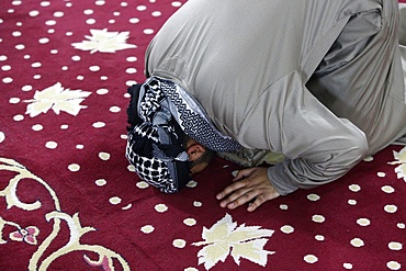
832-397300 - Lefkosa, Lefkosia, Nicosia, in the northern part of the capital of Cyprus, the Selimiye Mosque, St. Sophia's Cathedral in the old town, built between 1209 and the middle of the 14th century Northern Cyprus
832-397297 - Lefkosa, Lefkosia, Nicosia, in the northern part of the capital of Cyprus, in the old town, portal of the Bedesten, bazaar building, in the Middle Ages it was the Byzantine church of St. Nicholas, 12th century, Northern Cyprus
832-397299 - Lefkosa, Lefkosia, Nicosia, in the northern part of the capital of Cyprus, the Selimiye Mosque, St. Sophia's Cathedral in the old town, built between 1209 and the middle of the 14th century Mosque, interior, northern Cyprus
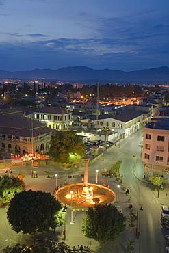
1297-1268 - Phaneromeni Square in Nicosia, Cyprus, Europe
1297-1269 - Modern architecture of the EY building in Nicosia, Cyprus, Europe
1297-1263 - Agios Sozomenos, an abandoned village in Nicosia District, Cyprus, Europe
746-40132 - Statue of Makarios III, Nicosia, Cyprus Island, Greece, Europe
746-40129 - Statue of Makarios III, Nicosia, Cyprus Island, Greece, Europe
746-40131 - Statue of Makarios III, Nicosia, Cyprus Island, Greece, Europe
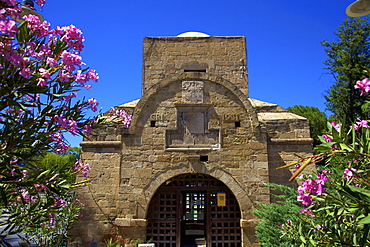
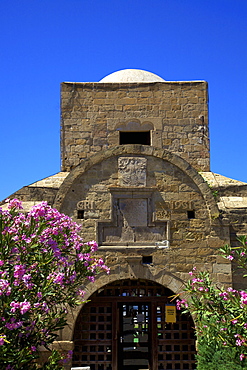
1126-1472 - Famagusta Gate, South Nicosia, Cyprus, Eastern Mediterranean Sea, Europe
809-6787 - Urs of Mawlana Cheikh Muhammad Nazim Adil al-Haqqani praying in Selimye mosque in Nicosia, Cyprus, Europe
809-6786 - Cheikh Mustapha's prayer beads, Urs of Mawlana Cheikh Muhammad Nazim Adil al-Haqqani in Selimye mosque in Nicosia, Cyprus, Europe
809-6788 - Urs of Mawlana Cheikh Muhammad Nazim Adil al-Haqqani praying in Selimye mosque in Nicosia, Cyprus, Europe
832-279656 - Archbishop's Palace, statue archbishop Makarios, Nicosia, Cyprus
832-279664 - Mosaic at the Phaneromeni church, Nicosia, Cyprus
832-279655 - Archbishop's Palace, statue archbishop Makarios, Nicosia, Cyprus
832-279652 - Archbishop's Palace, Icon museum and folk art museum, Nicosia, Cyprus
832-279669 - Pedestrian precinct, old town, Nicosia, Cyprus
832-279672 - Cityscape with Selimiye Mosque, St. Sophia Cathedral, Nicosia, Cyprus
832-279673 - Minaret, Selimiye Mosque, St. Sophia Cathedral, Nicosia, Cyprus
832-238889 - Freedom monument in the south of Nicosia, Lefkosia, Lefkosa, capital of Cyprus, Southern Cyprus, Europe
832-212432 - Fashion shop, jeans trousers, Nicosia, Cyprus, Greece, Europe
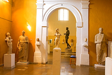
832-212414 - Archaeological Museum of Cyprus, statue of Aphrodite, Nicosia, Cyprus, Greece, Europe
832-212431 - Cos'altro Italian restaurant in the trendy restaurant complex at the Arch, Makarios Avenue, Nicosia, Cyprus, Greece, Europe
832-212429 - Trendy disco Zoo, dj, disc jockey, Nicosia, Cyprus, Greece, Europe
832-212397 - Jo's fashion boutique, window dressing, Nicosia, Cyprus, Greece, Europe
1126-428 - Kyrenia Gate, North Nicosia (Lefkosa), North Cyprus, Cyprus, Europe
1126-433 - Turkish pastries, Lefkosa (Nicosia), North Cyprus, Cyprus, Europe
1126-430 - Tourist Shop, Buyuk Han, North Nicosia (Lefkosa), North Cyprus, Cyprus, Europe
1126-432 - Buyuk Han, North Nicosia (Lefkosa), North Cyprus, Cyprus, Europe
1126-429 - Kyrenia Gate, North Nicosia (Lefkosa), North Cyprus, Cyprus, Europe
1126-431 - Restaurant in Buyuk Han, North Nicosia (Lefkosa), North Cyprus, Cyprus, Europe
832-133443 - Statues of people going from captivity to freedom, Liberty Monument, Podokataro Bastion, Nicosia, Lefkosia, Southern Cyprus, Republic of Cyprus, Mediterranean Sea, Europe
832-133442 - Liberty Monument, Podokataro Bastion, Nicosia, Lefkosia, Southern Cyprus, Republic of Cyprus, Mediterranean Sea, Europe
832-133436 - New statue, white marble, Archbishop and President Makarios III, Archbishop's Palace, Nicosia, Lefkosia, Southern Cyprus, Republic of Cyprus, Mediterranean Sea, Europe
832-135498 - View over North Nicosia, also Lefkosa or Lefkosia, the capital of Northern Cyprus, Turkish Cyprus, South Eastern Europe, Europe
832-133437 - New statue, white marble, Archbishop and President Makarios III, Archbishop's Palace, Nicosia, Lefkosia, Southern Cyprus, Republic of Cyprus, Mediterranean Sea, Europe
832-133441 - Courtyard of the historic Caravanserai Bueyuek Han with a domed tower, Nicosia, Lefkosa, Turkish Republic of Northern Cyprus, Cyprus, Mediterranean Sea, Europe
832-133440 - Islam, Gothic and Muslim, high minaret of Selimiye Mosque, old Gothic Cathedral of St. Sophia, Agia Sofia, religion, Nicosia, Lefkosa, Turkish Republic of Northern Cyprus, Cyprus, Mediterranean Sea, Europe
1113-64466 - People on the market at sunset, Nicosia, Cyprus, Europe
1113-2762 - A group of male folk dancers in traditional costume, Buyuk Han, The Great Inn, Ottoman caravansary, Lefkosia, Nicosia, North Cyprus, Cyprus
1113-2647 - Venetian Column at Atatuerk Meydani, Atatuerk Square, Lefkosia, Nicosia, North Cyprus, Cyprus
1113-2763 - Buyuk Han, The Great Inn, Ottoman caravansary, Lefkosia, Nicosia, North Cyprus, Cyprus
1113-2865 - Mevlevi Tekke, former dervish monastary, figures of dancing dervishes, whirling dervishes, museum, Lefkosia, Nicosia, Cyprus
1113-2639 - People sitting in an outdoor cafe in the evening, Archiepiskopou Makariou Street, nightlife, Lefkosia, Nicosia, South Cyprus, Cyprus
1113-2459 - Jockeys riding race horses at a horse race, Nicosia, Lefkosia, South Cyprus, Cyprus
1113-2461 - Jockeys riding race horses at a horse race, Nicosia, Lefkosia, South Cyprus, Cyprus
1113-2855 - Marble statue of Aphrodite from Soli, Cyprus Archaeological Museum, Lefkosia, Nicosia, Cyprus
1113-2638 - People sitting in an outdoor cafe in the evening, Archiepiskopou Makariou Street, nightlife, Lefkosia, Nicosia, South Cyprus, Cyprus
1113-2764 - Buyuk Han, The Great Inn, Ottoman caravansary, Lefkosia, Nicosia, North Cyprus, Cyprus
1113-2861 - Life in the city, people sitting outside Rimi Restaurant at night enjoying an evening meal, Laiki Geitonia, Lefkosia, Nicosia, Cyprus
1113-2637 - People sitting in an outdoor cafe in the evening, Archiepiskopou Makariou Street, nightlife, Lefkosia, Nicosia, South Cyprus, Cyprus
1113-2631 - Makarios monument in front of Archbishopric Palace, Holy Archbishopric of Cyprus, President Makarios, Lefkosia, Nicosia, South Cyprus, Cyprus
1113-2460 - Jockeys riding race horses at a horse race, Nicosia, Lefkosia, South Cyprus, Cyprus
817-398127 - photomontage, statue of Aphrodite from Soli, 1st century BC of the Archeological Museum of Nicosia and Petra Tou Romiou site, legendary Aphroditea´s birthplace, Cyprus, Eastern Mediterranean Sea island, Eurasia
1188-107 - Cyprus. Abandoned houses along th Green Line in Nicosia dividing the Republic of Cyprus and Turkish controlled northern part. The United Nations Buffer Zone in Cyprus runs for more than 180.5?kilometres (112.2?mi) along what is known as the Green Line and has an area of 346?square kilometres (134?sq?mi). The zone partitions the island of Cyprus into a southern area effectively controlled by the government of the Republic of Cyprus (which is the de jure government for the entire island save for the British Sovereign Base Areas), and the northern area controlled by the Turkish army
1188-339 - Gravestones of Sufi Dervish tombs in the Turkish occupied section of Nicosia in Cyprus
1188-333 - Cyprus. Abandoned houses along th Green Line in Nicosia dividing the Republic of Cyprus and Turkish controlled northern part. The United Nations Buffer Zone in Cyprus runs for more than 180.5?kilometres (112.2?mi) along what is known as the Green Line and has an area of 346?square kilometres (134?sq?mi). The zone partitions the island of Cyprus into a southern area effectively controlled by the government of the Republic of Cyprus (which is the de jure government for the entire island save for the British Sovereign Base Areas), and the northern area controlled by the Turkish army
1188-285 - Cyprus. Abandoned houses along th Green Line in Nicosia dividing the Republic of Cyprus and Turkish controlled northern part. The United Nations Buffer Zone in Cyprus runs for more than 180.5?kilometres (112.2?mi) along what is known as the Green Line and has an area of 346?square kilometres (134?sq?mi). The zone partitions the island of Cyprus into a southern area effectively controlled by the government of the Republic of Cyprus (which is the de jure government for the entire island save for the British Sovereign Base Areas), and the northern area controlled by the Turkish army
1188-89 - Gravestones of Sufi Dervish tombs in the Turkish occupied section of Nicosia in Cyprus
1188-314 - Cyprus. Abandoned houses along th Green Line in Nicosia dividing the Republic of Cyprus and Turkish controlled northern part.
1188-103 - Cyprus. Abandoned houses along the Green Line in Nicosia dividing the Republic of Cyprus and Turkish controlled northern part
1188-310 - Cyprus. 'Resolution' art installation for peace in Lydra street by the Green Line in Nicosia
1188-474 - Cyprus. Abandoned houses along th Green Line in Nicosia dividing the Republic of Cyprus and Turkish controlled northern part.
1188-235 - Cyprus.Children play at school near Green Line in Nicosia dividing the Republic of Cyprus and Turkish controlled north
1188-53 - Cyprus.Children play at school near Green Line in Nicosia dividing the Republic of Cyprus and Turkish controlled north
1188-298 - Photos of Turkish conscript soldiers at a shop in occupied North Cyprus, along the Green Line in Nicosia
1188-415 - Cyprus.Children play at school near Green Line in Nicosia dividing the Republic of Cyprus and Turkish controlled north
1188-123 - Cyprus. 'Resolution' art installation for peace in Lydra street by the Green Line in Nicosia
1188-427 - Cyprus.Children play at school near Green Line in Nicosia dividing the Republic of Cyprus and Turkish controlled north
817-34340 - Buyuk Han, former caravan serai, Nicosia, Cyprus
817-34337 - Statue of Makarios III, archbishop and primate of the Orthodox Church of Cyprus, Nicosia, Cyprus
817-27459 - Bust of Makarios III, archbishop and primate of the Orthodox Church of Cyprus, Nicosia, Cyprus
391-7171 - Mescit (prayer room) on six columns, 16th century Ottoman caravanserai built as a travellers' inn, Buyuk Han, Nicosia, Northern Cyprus, Cyprus, Europe
391-7170 - Selimiye Camii mosque, formerly Gothic Roman Catholic Ayia Sofia Cathedral between 1208 and 1326, minarets were added in 1570, Nicosia, North Cyprus, Europe
391-7185 - Street and rooftops of Turkish Cypriot North Nicosia with Kyrenia mountains in distance, taken from Saray Hotel, Nicosia, North Cyprus, Europe
391-7174 - Minaret and skyline of Turkish Cypriot North Nicosia with Kyrenia mountains in distance, taken from Saray Hotel, Nicosia, North Cyprus, Europe
391-7178 - Column from ancient Salamis put up by Venetians in 1489, stands in Ataturk Square, near former British colonial law courts, Nicosia, North Cyprus, Europe
391-7169 - Close-up of Antiquities shop in area of Selimiye Camii mosque in Nicosia, North Cyprus, Europe
You reached the end of search results
