Recent searches
Loading...
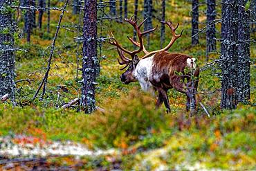
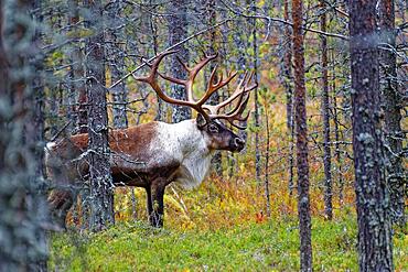
832-404479 - Finnish forest reindeer (Rangifer tarandus fennicus), wild, in the forest, Kuhmo, Kainuu, north-east Finland, Finland, Europe
832-404474 - Finnish forest reindeer (Rangifer tarandus fennicus), wild, in the forest, Kuhmo, Kainuu, north-east Finland, Finland, Europe
1311-826 - The rim trail at Grand Canyon heading east toward Powell Point from Hopi Point, Grand Canyon, UNESCO World Heritage Site, Arizona, United States of America, North America
1311-821 - The paved rim trail along the cliffs of Grand Canyon South Rim between the Trailview Overlook East Vista and the West Vista, Grand Canyon, UNESCO World Heritage Site, Arizona, United States of America, North America
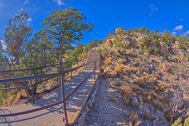
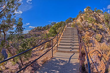
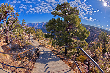
1311-820 - Stairway leading down to the Trailview Overlook East Vista at Grand Canyon South Rim, off Hermit Road, Grand Canyon, Arizona, United States of America, North America
1311-819 - The Trailview Overlook East Vista at Grand Canyon South Rim, just off Hermit Road, Grand Canyon, UNESCO World Heritage Site, Arizona, United States of America, North America
1311-818 - The Trailview Overlook East Vista at Grand Canyon South Rim, just off Hermit Road, Grand Canyon, UNESCO World Heritage Site, Arizona, United States of America, North America
1311-817 - Stairway leading down to the Trailview Overlook East Vista at Grand Canyon South Rim, off Hermit Road, Grand Canyon, Arizona, United States of America, North America
1311-816 - The Trailview Overlook East Vista at Grand Canyon South Rim, just off Hermit Road, Grand Canyon, UNESCO World Heritage Site, Arizona, United States of America, North America
1311-815 - Stairway leading down to the Trailview Overlook East Vista at Grand Canyon South Rim, off Hermit Road, Grand Canyon, UNESCO World Heritage Site, Arizona, United States of America, North America
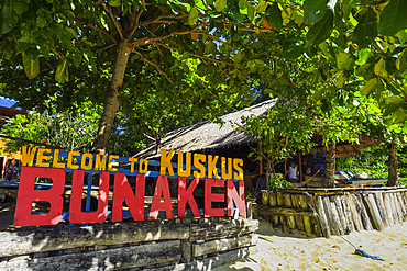
83-13392 - Beach entrance to a resort on the east coast of this coral fringed holiday and diving island, Bunaken Island, North Sulawesi, Indonesia, Southeast Asia, Asia
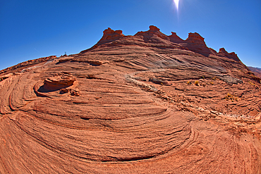
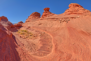
1311-736 - The east rocks of the New Wave along the Beehive Trail in the Glen Canyon Recreation Area near Page, Arizona, United States of America, North America
1311-735 - The east rocks of the New Wave along the Beehive Trail in the Glen Canyon Recreation Area near Page, Arizona, United States of America, North America
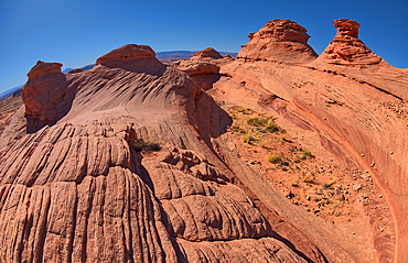
1311-734 - The east rocks of the New Wave along the Beehive Trail in the Glen Canyon Recreation Area near Page, Arizona, United States of America, North America
1311-733 - The east rocks of the New Wave along the Beehive Trail in the Glen Canyon Recreation Area near Page, Arizona, United States of America, North America
1311-732 - The east rocks of the New Wave along the Beehive Trail in the Glen Canyon Recreation Area near Page, Arizona, United States of America, North America
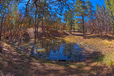
1311-730 - Two of three ponds called the Hearst Tanks, on Grand Canyon South Rim, located one mile east of Grandview Point, Grand Canyon National Park, UNESCO World Heritage Site, Arizona, United States of America, North America
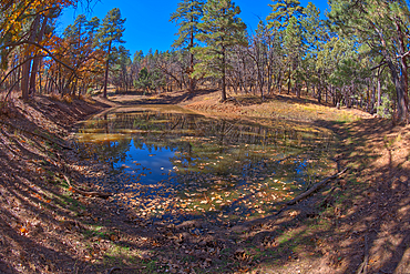
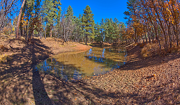
1311-729 - One of three ponds called the Hearst Tanks, on Grand Canyon South Rim, located one mile east of Grandview Point, Grand Canyon National Park, UNESCO World Heritage Site, Arizona, United States of America, North America
1311-728 - One of three ponds called the Hearst Tanks, on Grand Canyon South Rim, located one mile east of Grandview Point, Grand Canyon National Park, UNESCO World Heritage Site, Arizona, United States of America, North America
1311-727 - Two of three ponds called the Hearst Tanks, on Grand Canyon South Rim, located one mile east of Grandview Point, Grand Canyon National Park, UNESCO World Heritage Site, Arizona, United States of America, North America North America
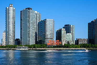
1373-60 - The Pepsi-Cola sign, built in 1940, a neon sign at Gantry Plaza State Park in the Long Island City neighborhood of Queens, visible fromManhattan the East East River, New York City, United States of America, North America
1373-59 - View of the Queensboro Bridge, a cantilever bridge over the East River connecting Long Island City in Queens with East Midtown and Upper East Side neighborhoods in Manhattan, passing over Roosevelt Island, New York City, United States of America, North America
1373-57 - View of the Smallpox Hospital, a historic abandoned hospital located on Rooseevelt Island, an island in the East River, in the borough of Manhattan, New York City, United States of America, North America
1373-56 - View of the Roosevelt Island Tramway, the first commuter aerial tramway in North America, that spans the East River and connects Roosevelt Island to the Upper East Side of Manhattan, New York City, United States of America, North America
1373-55 - Cityscape from Roosevelt Island, an island in the East River, in the borough of Manhattan between Manhattan Island to the west, and the borough of Queens, on Long Island, to the east, New York City, United States of America, North America
1373-54 - View of the Smallpox Hospital, a historic abandoned hospital located on Roosevelt Island, an island in the East River, in the borough of Manhattan, New York City, United States of America, North America
1373-53 - The Pepsi-Cola sign, built in 1940, a neon sign at Gantry Plaza State Park in the Long Island City neighborhood of Queens, visible fromManhattan the East East River, New York City, United States of America, North America
1219-301 - A row of Upper East Side traditional residential town houses including one from the movie Breakfast at Tiffany's, New York City, United States of America, North America
1219-299 - Looking over the length of New York City from the One World Observatory with the Hudson River to the West and Long Island City to the north east, New York City, United States of America, North America
1219-294 - Apartments bordering Park Avenue in New York City's Upper East Side, New York City, United States of America, North America
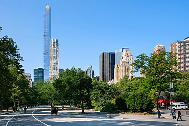
1373-33 - New York City cityscape viewed from the West Drive, the westernmost of Central Park's scenic drives, nestled between Upper West Side and Upper East Side neighborhoods of Manhattan, New York City, United States of America, North America
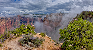
1311-710 - Steamlike fog rising out of Grand Canyon South Rim just east of Grandview Point, Grand Canyon National Park, UNESCO World Heritage Site, Arizona, United States of America, North America
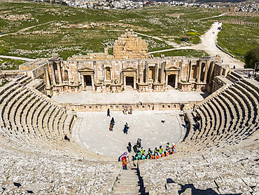
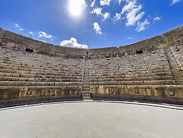
1112-7946 - The great North Theater in the ancient city of Jerash, believed to be founded in 331 BC by Alexander the Great, Jerash, Jordan, Middle East
1112-7933 - The great North Theater in the ancient city of Jerash, believed to be founded in 331 BC by Alexander the Great, Jerash, Jordan, Middle East
1112-7926 - The great North Theater in the ancient city of Jerash, believed to be founded in 331 BC by Alexander the Great, Jerash, Jordan, Middle East
1112-7920 - The great North Theater in the ancient city of Jerash, believed to be founded in 331 BC by Alexander the Great, Jerash, Jordan, Middle East
1112-7916 - Performers at the great North Theater in the ancient city of Jerash, believed to be founded by Alexander the Great, Jerash, Jordan, Middle East
1112-7910 - The great North Theater in the ancient city of Jerash, believed to be founded in 331 B.BC by Alexander the Great, Jerash, Jordan, Middle East
1311-706 - A rock spire just east of Grandview Point at Grand Canyon South Rim, Grand Canyon National Park, UNESCO World Heritage Site, Arizona, United States of America, North America
1311-704 - A gap between a stack of balanced boulders on a cliff east of Grandview Point at Grand Canyon South Rim, Grand Canyon National Park, UNESCO World Heritage Site, Arizona, United States of America, North America
1112-7634 - Sunset over the Cairo Tower from the east side of the Nile River, Cairo, Egypt, North Africa, Africa
1185-387 - Vultures and Hyena (Hyaenidae) on carcass, Mara North, Kenya, East Africa, Africa
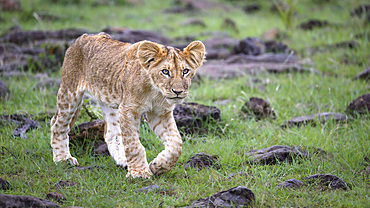
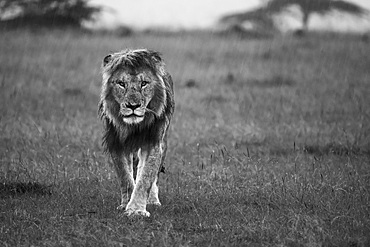
1185-386 - African Lion (Panthera Leo), Mara North, Maasai Mara, Kenya, East Africa, Africa
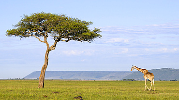
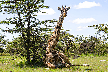
1185-385 - Masai Giraffe (Giraffa tippelskirchi), Maasai Mara, Mara North, Kenya, East Africa, Africa
1185-384 - African Lion (Panthera Leo), Mara North, Maasai Mara, Kenya, East Africa, Africa
1185-382 - Leopard (Panthera Pardus), Maasai Mara, Mara North, Kenya, East Africa, Africa
1185-383 - Ostrich (Struthio Camelus), Maasai Mara, Mara North, Kenya, East Africa, Africa
1185-381 - Hyena (Hyaenidae), Maasai Mara, Mara North, Kenya, East Africa, Africa
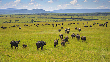
1185-380 - Buffalo (Bubalus Bubalis) (Syncerus caffer), Maasai Mara, Mara North, Kenya, East Africa, Africa
1185-379 - African Lion (Panthera Leo), Mara North, Maasai Mara, Kenya, East Africa, Africa
1185-378 - African Elephant (Loxodonta africana), Maasai Mara, Mara North, Kenya, East Africa, Africa
1185-376 - Leopard (Panthera Pardus), Maasai Mara, Mara North, Kenya, East Africa, Africa
1185-377 - Hartebeest (Alcelaphus Buselaphus), Mara North, Maasai Mara, Kenya, East Africa, Africa
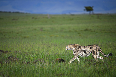
1185-375 - Cheetah (Acinonyx Jubatus), Maasai Mara, Mara North, Kenya, East Africa, Africa
1185-374 - Plains Zebra at dusk (Equus Quagga), Maasai Mara, Mara North, Kenya, East Africa, Africa
1185-373 - Maasai Giraffe, (Giraffa Tippelskirchi), Mara North, Kenya, East Africa, Africa
1185-371 - Cheetah (Acinonyx Jubatus), Mara North, Kenya, East Africa, Africa
1185-372 - African lion (Panthera Leo), Maasai Mara, Mara North, Kenya, East Africa, Africa
1185-370 - Cheetah (Acinonyx Jubatus), Mara North, Kenya, East Africa, Africa
1311-664 - Jupiter Temple, a ridge on the east side of the North Rim, viewed from Cape Final, Grand Canyon National Park, UNESCO World Heritage Site, Arizona, United States of America, North America
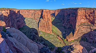
1311-628 - East view of Canyon De Chelly National Monument North Rim from Antelope House Overlook, left fork leads to Many Cherry Canyon, right fork to Black Rock Canyon, Arizona, United States of America, North America
1126-2072 - Feluccas on the River Nile, Aswan, Egypt, North East Africa
1336-830 - North Tetrapylon gate, Roman ruins of Jerash, Jordan, Middle East
1365-172 - Looking east across Bryce Canyon from Sunset Point, Utah, United States of America, North America
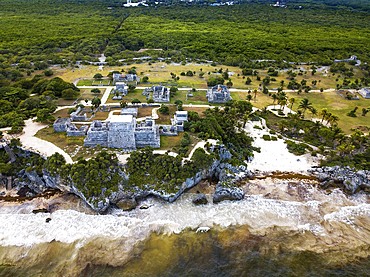
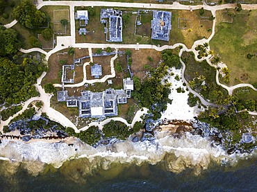
1350-6597 - Aerial views of El Castillo and the Ruins of the Mayan temple grounds at Tulum, Quintana Roo, Yucatan, Mexico. Tulum is the site of a pre-Columbian Mayan walled city which served as a major port for Coba, in the Mexican state of Quintana Roo. The ruins are situated on 12 meter 39 ft tall cliffs along the east coast of the Yucatán Peninsula on the Caribbean Sea in the state of Quintana Roo, Mexico. Tulum was one of the last cities built and inhabited by the Maya; it was at its height between the 13th and 15th centuries and managed to survive about 70 years after the Spanish began occupying Mexico. Old World diseases brought by the Spanish settlers appear to have resulted in very high fatalities, disrupting the society, and eventually causing the city to be abandoned.
1350-6599 - Aerial views of El Castillo and the Ruins of the Mayan temple grounds at Tulum, Quintana Roo, Yucatan, Mexico. Tulum is the site of a pre-Columbian Mayan walled city which served as a major port for Coba, in the Mexican state of Quintana Roo. The ruins are situated on 12 meter 39 ft tall cliffs along the east coast of the Yucatán Peninsula on the Caribbean Sea in the state of Quintana Roo, Mexico. Tulum was one of the last cities built and inhabited by the Maya; it was at its height between the 13th and 15th centuries and managed to survive about 70 years after the Spanish began occupying Mexico. Old World diseases brought by the Spanish settlers appear to have resulted in very high fatalities, disrupting the society, and eventually causing the city to be abandoned.
1350-6531 - A lion's mane jellyfish (Cyanea capillata) with lengthy flowing tentacles photographed against the black background of the dark north east atlantic.
1311-592 - Hermit Canyon at Grand Canyon viewed from the east side of Yuma Point along the Boucher Trail with Pima Point on the upper right, Grand Canyon National Park, UNESCO World Heritage Site, Arizona, United States of America, North America
1311-590 - View of Hermit Canyon from the east side of Yuma Point at Grand Canyon Arizona along the Boucher Trail with Pima Point on the upper right, Grand Canyon National Park, UNESCO World Heritage Site, Arizona, United States of America, North America
1311-530 - Grand Canyon view from cliffs east of the Desert View Point, with Cedar Mountain in the distance on the right, Grand Canyon National Park, UNESCO World Heritage Site, Arizona, United States of America, North America
832-397656 - Panoramic road, gravel road in Monument Valley, prominent rocks, West Mitten Butte, East Mitten Butte, Merrick Butte on the horizon, dusk, film set, Arizona, USA, North America
1311-528 - The Desert View Watchtower at Grand Canyon viewed from below the cliffs east of Navajo Point, Grand Canyon National Park, UNESCO World Heritage Site, Arizona, United States of America, North America
1311-523 - A fisheye view of a deep chasm east of Pinal Point at Grand Canyon, Grand Canyon National Park, UNESCO World Heritage Site, Arizona, United States of America, North America
1311-519 - Ancient Indian Ruins on the edge of a cliff east of Papago Point at Grand Canyon, Grand Canyon National Park, UNESCO World Heritage Site, Arizona, United States of America, North America
1311-516 - Ancient Indian Ruins on the edge of a cliff east of Papago Point at Grand Canyon, Grand Canyon National Park, UNESCO World Heritage Site, Arizona, United States of America, North America
1311-511 - Grand Canyon viewed just east of Zuni Point on a stormy day, Grand Canyon National Park, UNESCO World Heritage Site, Arizona, United States of America, North America
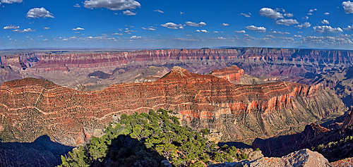
1311-500 - Grand Canyon viewed from the cliffs east of Moran Point, Grand Canyon National Park, UNESCO World Heritage Site, Arizona, United States of America, North America
1311-489 - A deep dropoff at Grand Canyon called Loki's Abyss east of Thor's Hammer Overlook, with Loki's Rock just right of center, Grand Canyon National Park, UNESCO World Heritage Site, Arizona, United States of America, North America
1311-487 - Loki's Rock at Grand Canyon east of Thor's Hammer Overlook, Grand Canyon National Park, UNESCO World Heritage Site, Arizona, United States of America, North America
1311-488 - Loki's Rock at Grand Canyon east of Thor's Hammer Overlook, Grand Canyon National Park, UNESCO World Heritage Site, Arizona, United States of America, North America
1353-227 - The Manhattan Bridge over the East River, at night, Manhattan, New York, United States of America, North America
1353-203 - Brooklyn and Manhattan Bridges over the East River at night, New York, United States of America, North America
1113-107491 - Coast and lighthouse Lange Erik in the north of the island of Öland in the east of Sweden from above in the sun
832-396533 - Sunlit lavender flowers at sunset, backlight, lavender fields Fromhausen, Detmold, East Westphalia-Lippe, Teutoburg Forest, North Rhine-Westphalia, Germany, Europe
860-290894 - Sunset in the Ikateq Fjord. Ammassalik area in East Greenland. North America, Greenland, Danish Territorrry
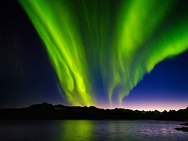
860-290896 - Northern Lights over settlement Kuummiit (formerly spelled Kummiut). Ammassalik area in East Greenland. North America, Greenland, Danish Territorrry
860-290895 - Settlement Kuummiit (formerly spelled Kummiut). Ammassalik area in East Greenland. North America, Greenland, Danish Territorrry
860-290897 - Northern lights over Angmagssalik Fjord near settlement Kuummiit (formerly spelled Kummiut). Ammassalik area in East Greenland. North America, Greenland, Danish Territorrry
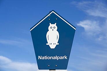
832-396033 - Sign Lower Saxony Wadden Sea National Park, Juist Island, North Sea, East Frisia, Lower Saxony, Germany, Europe
1292-2830 - View from the North-East, Pontremoli, Massa-Carrara, Tuscany, Italy, Europe
1311-440 - Reflective lagoon along East Bay Trail of Willow Lake, gray line on rock is where the water level used to be, Prescott, Arizona, United States of America, North America
1353-28 - Bow Fiddle Rock, near Portknockie, Moray Coast, North East Scotland, Scotland, United Kingdom, Europe
832-394181 - Fjord with drift ice, glacier and wild mountain landscape, Knud Rasmussen Glacier, Tasilaq, East Greenland, Greenland, Arctic, Denmark, North America
832-394182 - Boat in a fjord with drift ice, glacier and wild mountain landscape, Knud Rasmussen Glacier, Tasilaq, East Greenland, Greenland, Arctic, Denmark, North America
1348-3365 - Satellite view of the Southern Great Barrier Reef and Fraser Island along Queensland's coastline in north-east Australia. This image was compiled from data acquired in 2014 by Landsat 8 satellite.
1348-3345 - Satellite view of the Central Great Barrier Reef along Queensland's coastline in north-east Australia
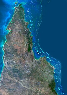
1348-3353 - Satellite view of the Northern Great Barrier Reef along the east coast of Cape York Peninsula in north Australia. This image was compiled from data acquired in 2014 by Landsat 8 satellite.
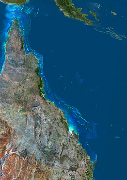
1348-3407 - Satellite view of the Great Barrier Reef. It extends along most of Queensland's coastline in north-east Australia, from Torres Strait and Cape York peninsula down to Fraser Island
1311-361 - Blood red ridges of Bentonite clay on the east side of Tiponi Point in Petrified Forest National Park, Arizona, United States of America, North America
