Recent searches
Loading...
1186-204 - West Rim, Grand Canyon and Colorado River, UNESCO World Heritage Site, Arizona, United States of America, North America
1186-208 - Sunset over Grand Canyon South Rim, UNESCO World Heritage Site, Arizona, United States of America, North America
1186-206 - West Rim, Grand Canyon and Colorado River, UNESCO World Heritage Site, Arizona, United States of America, North America
1186-205 - West Rim, Grand Canyon and Colorado River, UNESCO World Heritage Site, Arizona, United States of America, North America
1186-209 - West Rim, Grand Canyon and Colorado River, UNESCO World Heritage Site, Arizona, United States of America, North America
1186-207 - West Rim, Grand Canyon and Colorado River, UNESCO World Heritage Site, Arizona, United States of America, North America
1186-213 - Sunset over Grand Canyon South Rim, UNESCO World Heritage Site, Arizona, United States of America, North America
1186-203 - West Rim, Grand Canyon and Colorado River, UNESCO World Heritage Site, Arizona, United States of America, North America
1186-212 - Sunset over Grand Canyon South Rim, UNESCO World Heritage Site, Arizona, United States of America, North America
1311-7 - A view of Arizona's Canyon De Chelly from its south rim, Arizona, United States of America, North America
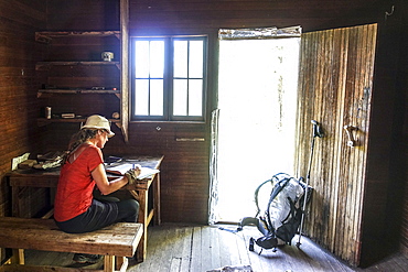
857-96118 - A thru hiker takes a break at Theodore Roosevelts Cabin on the Muav Saddle, far out on the North Rim of the Grand Canyon, and signs a storied trail register, Arizona, USA
857-95869 - Young woman hiker traversing alone massive sandstone features of Grand Canyons North Rim, Grand Canyon, Arizona, USA
832-381017 - View of eroded rock formation Bright Angel, Colorado River Canyon, Grand Canyon National Park, South Rim, Arizona, USA, North America
832-380872 - Landscape, panorama, rock, canyon, Colorado River, aerial view, South Rim, Grand Canyon National Park, Arizona, USA, North America
1225-1210 - Sunrise from the south rim of the Grand Canyon, UNESCO World Heritage Site, Arizona, United States of America, North America
1225-1218 - Sunset from the south rim of the Grand Canyon at Shoshone Point, UNESCO World Heritage Site, Arizona, United States of America, North America
1225-1211 - Sunset from the south rim of the Grand Canyon at Shoshone Point, UNESCO World Heritage Site, Arizona, United States of America, North America
1225-1212 - Sunset from the south rim of the Grand Canyon at Shoshone Point, UNESCO World Heritage Site, Arizona, United States of America, North America
1225-1213 - Sunset from the south rim of the Grand Canyon at Shoshone Point, UNESCO World Heritage Site, Arizona, United States of America, North America
483-2081 - South Rim rock formations, Grand Canyon, UNESCO World Heritage Site, Arizona, United States of America, North America
83-13016 - Mondarruego, Punta Gallinero and Monte Perdido peaks over the Ordesa Valley North rim, Ordesa National Park, Pyrenees, Aragon, Spain, Europe
83-13020 - View west along the Ordesa Valley's north rim to distant Otal Peak, Ordesa National Park, Pyrenees, Aragon, Spain, Europe
801-2023 - Tower, Desert View Point, South Rim, Grand Canyon National Park, UNESCO World Heritage Site, Arizona, United States of America, North America
801-2020 - From Turnout near Mojave Point, South Rim, Grand Canyon National Park, UNESCO World Heritage Site, Arizona, United States of America, North America
801-2021 - From Turnout near Lipan Point, South Rim, Grand Canyon National Park, UNESCO World Heritage Site, Arizona, United States of America, North America
801-2016 - From Maricopa Point, South Rim, Grand Canyon National Park, UNESCO World Heritage Site, Arizona, United States of America, North America
801-2022 - From Lipan Point, South Rim, Grand Canyon National Park, UNESCO World Heritage Site, Arizona, United States of America, North America
801-2017 - From Powell Point, South Rim, Grand Canyon National Park, UNESCO World Heritage Site, Arizona, United States of America, North America
801-2019 - From Monument Creek Vista, South Rim, Grand Canyon National Park, UNESCO World Heritage Site, Arizona, United States of America, North America
801-2018 - From Pima Point, South Rim, Grand Canyon National Park, UNESCO World Heritage Site, Arizona, United States of America, North America
801-2013 - From Grandview Point, South Rim, Grand Canyon National Park, UNESCO World Heritage Site, Arizona, United States of America, North America
801-2015 - Duck Rock, South Rim, Grand Canyon National Park, UNESCO World Heritage Site, Arizona, United States of America, North America
801-2012 - From Mather Point, South Rim, Grand Canyon National Park, UNESCO World Heritage Site, Arizona, United States of America, North America
801-2014 - From Grandview Point, South Rim, Grand Canyon National Park, UNESCO World Heritage Site, Arizona, United States of America, North America
1251-8 - Sunset at Cape Royal, North Rim, Grand Canyon National Park, UNESCO World Heritage Site, Arizona, United States of America, North America
801-1849 - From Bright Angel Point, North Rim, Grand Canyon National Park, UNESCO World Heritage Site, Arizona, United States of America, North America
801-1850 - From Bright Angel Point, North Rim, Grand Canyon National Park, UNESCO World Heritage Site, Arizona, United States of America, North America
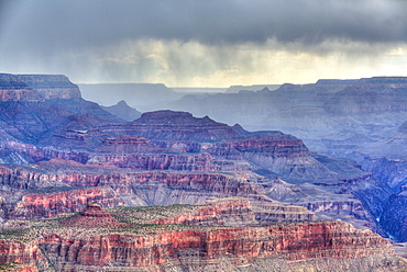
801-1851 - Afternoon thunder shower, from Cape Royal Point, North Rim, Grand Canyon National Park, UNESCO World Heritage Site, Arizona, United States of America, North America
801-1848 - From Bright Angel Point, North Rim, Grand Canyon National Park, UNESCO World Heritage Site, Arizona, United States of America, North America
801-1831 - Afternoon thunderstorm, South Rim, Grand Canyon National Park, UNESCO World Heritage Site, Arizona, United States of America, North America
801-1830 - Sunrise at Mather Point, South Rim, Grand Canyon National Park, UNESCO World Heritage Site, Arizona, United States of America, North America
801-1828 - Colorado River below, South Rim, Grand Canyon National Park, UNESCO World Heritage Site, Arizona, United States of America, North America
801-1829 - Tourists at Mather Point, early morning, South Rim, Grand Canyon National Park, UNESCO World Heritage Site, Arizona, United States of America, North America
801-1827 - South Rim, Grand Canyon National Park, UNESCO World Heritage Site, Arizona, United States of America, North America
801-1826 - Watch Tower, Colorado River below, Desert View Point, South Rim, Grand Canyon National Park, UNESCO World Heritage Site, Arizona, United States of America, North America
718-2083 - People walking through fumaroles on Volcano Gran crater rim, Vulcano Island, Aeolian Islands, UNESCO World Heritage Site, north of Sicily, Italy, Mediterranean, Europe
1189-39 - Grand Canyon viewed from South Rim, Grand Canyon National Park, UNESCO World Heritage Site, Arizona, United States of America, North America
857-89709 - Hikers setup camp on a beach along the Colorado River near the plumeting 180-foot Deer Creek Falls in the Grand Canyon outside of Fredonia, Arizona November 2011. The 21.4-mile loop starts at the Bill Hall trailhead on the North Rim and descends 2000-feet in 2.5-miles through Coconino Sandstone to the level Esplanada then descends further into the lower canyon through a break in the 400-foot-tall Redwall to access Surprise Valley. Hikers connect Thunder River and Tapeats Creek to a route along the Colorado River and climb out Deer Creek.
857-89713 - Female hiker cooks dinner on a cliff-pinched patio above camp and the Colorado River near Deer Creek Falls in the Grand Canyon outside of Fredonia, Arizona November 2011. The 21.4-mile loop starts at the Bill Hall trailhead on the North Rim and descends 2000-feet in 2.5-miles through Coconino Sandstone to the level Esplanada then descends further into the lower canyon through a break in the 400-foot-tall Redwall to access Surprise Valley. Hikers connect Thunder River and Tapeats Creek to a route along the Colorado River and climb out Deer Creek.
857-89701 - Hikers on the sandstone Esplanade of the Thunder River Trail below the North Rim of the Grand Canyon outside Fredonia, Arizona November 2011. The 21.4-mile loop descends 2000-feet in 2.5-miles through Coconino Sandstone from the Bill Hall trailhead to connect the Thunder River and Deer Creeks trails. Hikers descend into the lower canyon through a break in the 400-foot-tall Redwall to access Surprise Valley, Deer Creek, Tapeats Creek via Thunder River and even the Colorado River.
857-89710 - Hikers cook dinner on a cliff-pinched patio above camp and the Colorado River near Deer Creek Falls in the Grand Canyon outside of Fredonia, Arizona November 2011. The 21.4-mile loop starts at the Bill Hall trailhead on the North Rim and descends 2000-feet in 2.5-miles through Coconino Sandstone to the level Esplanada then descends further into the lower canyon through a break in the 400-foot-tall Redwall to access Surprise Valley. Hikers connect Thunder River and Tapeats Creek to a route along the Colorado River and climb out Deer Creek.
857-89708 - Hikers swim in the pool below 180-foot Deer Creek Falls in the Grand Canyon outside of Fredonia, Arizona November 2011. The 21.4-mile loop starts at the Bill Hall trailhead on the North Rim and descends 2000-feet in 2.5-miles through Coconino Sandstone to the level Esplanada then descends further into the lower canyon through a break in the 400-foot-tall Redwall to access Surprise Valley. Hikers connect Thunder River and Tapeats Creek to a route along the Colorado River and climb out Deer Creek.
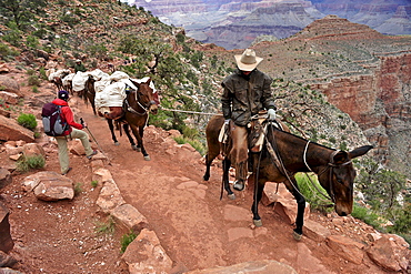
857-89692 - Female hiker waits for pack horses to pass on the South Kaibab Trail in Grand Canyon National Park north of Williams, Arizona May 2011. The South Kaibab Trail starts on the south rim of the Colorado Plateau and follows a ridge out to Skeleton Point allowing for 360-degree views of the canyon then down to the Colorado River. At the Colorado River the trail connects with the North Kaibab trail as part of the Arizona Trail system, that crosses the state of Arizona from Mexico to Utah.
857-89717 - Hikers follow a route along the Colorado River that connect Tapeats Creek and Thunder River to Deer Creek in the Grand Canyon outside of Fredonia, Arizona November 2011. The 21.4-mile loop starts at the Bill Hall trailhead on the North Rim and descends 2000-feet in 2.5-miles through Coconino Sandstone to the level Esplanada then descends further into the lower canyon through a break in the 400-foot-tall Redwall to access Surprise Valley. Hikers connect Thunder River and Tapeats Creek to a route along the Colorado River and climb out Deer Creek.
857-89712 - Male hiker filters water on a cliff-pinched patio near Deer Creek Falls in the Grand Canyon outside of Fredonia, Arizona November 2011. The 21.4-mile loop starts at the Bill Hall trailhead on the North Rim and descends 2000-feet in 2.5-miles through Coconino Sandstone to the level Esplanada then descends further into the lower canyon through a break in the 400-foot-tall Redwall to access Surprise Valley. Hikers connect Thunder River and Tapeats Creek to a route along the Colorado River and climb out Deer Creek.
857-89700 - Hikers on the sandstone Esplanade of the Thunder River Trail below the North Rim of the Grand Canyon outside Fredonia, Arizona November 2011. The 21.4-mile loop descends 2000-feet in 2.5-miles through Coconino Sandstone from the Bill Hall trailhead to connect the Thunder River and Deer Creeks trails. Hikers descend into the lower canyon through a break in the 400-foot-tall Redwall to access Surprise Valley, Deer Creek, Tapeats Creek via Thunder River and even the Colorado River.
857-89703 - Hikers past small waterfalls along Deer Creek Narrows in the Grand Canyon outside of Fredonia, Arizona November 2011. The 21.4-mile loop starts at the Bill Hall trailhead on the North Rim and descends 2000-feet in 2.5-miles through Coconino Sandstone to the level Esplanada then descends further into the lower canyon through a break in the 400-foot-tall Redwall to access Surprise Valley. Hikers connect Thunder River and Tapeats Creek to a route along the Colorado River and climb out Deer Creek.
857-89711 - Male hiker filters water on a cliff-pinched patio near Deer Creek Falls in the Grand Canyon outside of Fredonia, Arizona November 2011. The 21.4-mile loop starts at the Bill Hall trailhead on the North Rim and descends 2000-feet in 2.5-miles through Coconino Sandstone to the level Esplanada then descends further into the lower canyon through a break in the 400-foot-tall Redwall to access Surprise Valley. Hikers connect Thunder River and Tapeats Creek to a route along the Colorado River and climb out Deer Creek.
857-89702 - Hikers walk along Deer Creek Narrows in the Grand Canyon outside of Fredonia, Arizona November 2011. The 21.4-mile loop starts at the Bill Hall trailhead on the North Rim and descends 2000-feet in 2.5-miles through Coconino Sandstone to the level Esplanada then descends further into the lower canyon through a break in the 400-foot-tall Redwall to access Surprise Valley. Hikers connect Thunder River and Tapeats Creek to a route along the Colorado River and climb out Deer Creek.
857-89705 - Hikers walk along Deer Creek Narrows in the Grand Canyon outside of Fredonia, Arizona November 2011. The 21.4-mile loop starts at the Bill Hall trailhead on the North Rim and descends 2000-feet in 2.5-miles through Coconino Sandstone to the level Esplanada then descends further into the lower canyon through a break in the 400-foot-tall Redwall to access Surprise Valley. Hikers connect Thunder River and Tapeats Creek to a route along the Colorado River and climb out Deer Creek.
816-7724 - Horseshoe Bend on the Colorado River at the South Rim, Arizona, United States of America, North America
816-7716 - Sunset over the south rim of the Grand Canyon, UNESCO World Heritage Site, Arizona, United States of America, North America
816-7720 - Sunset over the south rim of the Grand Canyon, UNESCO World Heritage Site, Arizona, United States of America, North America
816-7715 - Desert view stone tower on top of the south rim of the Grand Canyon, UNESCO World Heritage Site, Arizona, United States of America, North America
857-86011 - Hikers walk along Deer Creek Narrows in the Grand Canyon outside of Fredonia, Arizona November 2011. The 21.4-mile loop starts at the Bill Hall trailhead on the North Rim and descends 2000-feet in 2.5-miles through Coconino Sandstone to the level Esplanada then descends further into the lower canyon through a break in the 400-foot-tall Redwall to access Surprise Valley. Hikers connect Thunder River and Tapeats Creek to a route along the Colorado River and climb out Deer Creek.
857-86023 - Male hiker filters water on a cliff-pinched patio near Deer Creek Falls in the Grand Canyon outside of Fredonia, Arizona November 2011. The 21.4-mile loop starts at the Bill Hall trailhead on the North Rim and descends 2000-feet in 2.5-miles through Coconino Sandstone to the level Esplanada then descends further into the lower canyon through a break in the 400-foot-tall Redwall to access Surprise Valley. Hikers connect Thunder River and Tapeats Creek to a route along the Colorado River and climb out Deer Creek.
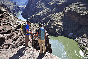
857-86016 - Hikers overlook the Colorado River as they exit the Deer Creek Narrows in the Grand Canyon outside of Fredonia, Arizona November 2011. The 21.4-mile loop starts at the Bill Hall trailhead on the North Rim and descends 2000-feet in 2.5-miles through Coconino Sandstone to the level Esplanada then descends further into the lower canyon through a break in the 400-foot-tall Redwall to access Surprise Valley. Hikers connect Thunder River and Tapeats Creek to a route along the Colorado River and climb out Deer Creek.
857-86021 - Hikers setup camp on a beach along the Colorado River near the plumeting 180-foot Deer Creek Falls in the Grand Canyon outside of Fredonia, Arizona November 2011. The 21.4-mile loop starts at the Bill Hall trailhead on the North Rim and descends 2000-feet in 2.5-miles through Coconino Sandstone to the level Esplanada then descends further into the lower canyon through a break in the 400-foot-tall Redwall to access Surprise Valley. Hikers connect Thunder River and Tapeats Creek to a route along the Colorado River and climb out Deer Creek.
857-86015 - Hikers walk along Deer Creek Narrows in the Grand Canyon outside of Fredonia, Arizona November 2011. The 21.4-mile loop starts at the Bill Hall trailhead on the North Rim and descends 2000-feet in 2.5-miles through Coconino Sandstone to the level Esplanada then descends further into the lower canyon through a break in the 400-foot-tall Redwall to access Surprise Valley. Hikers connect Thunder River and Tapeats Creek to a route along the Colorado River and climb out Deer Creek.
857-86013 - Hikers walk along Deer Creek Narrows in the Grand Canyon outside of Fredonia, Arizona November 2011. The 21.4-mile loop starts at the Bill Hall trailhead on the North Rim and descends 2000-feet in 2.5-miles through Coconino Sandstone to the level Esplanada then descends further into the lower canyon through a break in the 400-foot-tall Redwall to access Surprise Valley. Hikers connect Thunder River and Tapeats Creek to a route along the Colorado River and climb out Deer Creek.
857-86000 - Hikers on the sandstone Esplanade of the Thunder River Trail below the North Rim of the Grand Canyon outside Fredonia, Arizona November 2011. The 21.4-mile loop descends 2000-feet in 2.5-miles through Coconino Sandstone from the Bill Hall trailhead to connect the Thunder River and Deer Creeks trails. Hikers descend into the lower canyon through a break in the 400-foot-tall Redwall to access Surprise Valley, Deer Creek, Tapeats Creek via Thunder River and even the Colorado River.
857-86025 - Hikers follow a route along the Colorado River that connect Tapeats Creek and Thunder River to Deer Creek in the Grand Canyon outside of Fredonia, Arizona November 2011. The 21.4-mile loop starts at the Bill Hall trailhead on the North Rim and descends 2000-feet in 2.5-miles through Coconino Sandstone to the level Esplanada then descends further into the lower canyon through a break in the 400-foot-tall Redwall to access Surprise Valley. Hikers connect Thunder River and Tapeats Creek to a route along the Colorado River and climb out Deer Creek.
857-86007 - Hikers cook dinner along Deer Creek Narrows in the Grand Canyon outside of Fredonia, Arizona November 2011. The 21.4-mile loop starts at the Bill Hall trailhead on the North Rim and descends 2000-feet in 2.5-miles through Coconino Sandstone to the level Esplanada then descends further into the lower canyon through a break in the 400-foot-tall Redwall to access Surprise Valley. Hikers connect Thunder River and Tapeats Creek to a route along the Colorado River and climb out Deer Creek.
857-86027 - Hikers climb out of Surprise Valley to the North Rim of the Grand Canyon outside of Fredonia, Arizona November 2011. The 21.4-mile loop starts at the Bill Hall trailhead on the North Rim and descends 2000-feet in 2.5-miles through Coconino Sandstone to the level Esplanada then descends further into the lower canyon through a break in the 400-foot-tall Redwall to access Surprise Valley. Hikers connect Thunder River and Tapeats Creek to a route along the Colorado River and climb out Deer Creek.
857-86022 - Hikers setup camp on a beach along the Colorado River near the plumeting 180-foot Deer Creek Falls in the Grand Canyon outside of Fredonia, Arizona November 2011. The 21.4-mile loop starts at the Bill Hall trailhead on the North Rim and descends 2000-feet in 2.5-miles through Coconino Sandstone to the level Esplanada then descends further into the lower canyon through a break in the 400-foot-tall Redwall to access Surprise Valley. Hikers connect Thunder River and Tapeats Creek to a route along the Colorado River and climb out Deer Creek.
857-86003 - Hikers descend into Surprise Valley to access the lower canyon through a break in the 400-foot-tall Redwall on the Thunder River Trail in the Grand Canyon outside of Fredonia, Arizona November 2011. The 21.4-mile loop starts at the Bill Hall trailhead on the North Rim and descends 2000-feet in 2.5-miles through Coconino Sandstone to the level Esplanada then descends further into the lower canyon to access Thunder River, Tapeats Creek and Deer Creek.
857-86031 - Campers prepare dinner on the North Rim of the Grand Canyon before a hike down into the ditch outside of Fredonia, Arizona November 2011.
832-374729 - Beefalos or Cattalos, a crossbreed between North American Bison (Bison bison) and Domestic Cattle (Bos taurus), Grand Canyon National Park, North Rim, Arizona, United States of America, USA
832-375657 - Grand Canyon and Colorado River seen from Toroweap Point, Tuweep Area, North Rim, Arizona, USA
832-374726 - Holidaymaker enjoying the view from the terrace of the Grand Canyon Lodge towards Deva Temple, Brahma Temple, Grand Canyon National Park, North Rim, Arizona, United States of America, USA
832-375656 - Grand Canyon and Colorado River seen from Toroweap Point, Tuweep Area, North Rim, Arizona, USA
832-371892 - Mountain biker, Porcupine Rim Trail, Castle Valley, Moab, Utah, USA
832-371894 - Mountain biker, Porcupine Rim Trail, Castle Valley, Moab, Utah, USA
832-371893 - Mountain biker, Porcupine Rim Trail, Castle Valley, Moab, Utah, USA
1167-220 - Hoodoos lit by late afternoon sun with snow, from Rim Trail near Sunset Point, Bryce Canyon National Park, Utah, United States of America, North America
1167-224 - Hoodoos, rim and snow lit by dawn light in winter, Queen's Garden Trail at Sunrise Point, Bryce Canyon National Park, Utah, United States of America, North America
1167-214 - Hoodoos and snowy rim cliffs lit by late afternoon sun, winter, near Sunrise Point, Bryce Canyon National Park, Utah, United States of America, North America
1167-211 - Hoodoos and snowy rim cliffs lit by strong late afternoon sun in winter, near Sunrise Point, Bryce Canyon National Park, Utah, United States of America, North America
1167-218 - Rocks lit by winter late afternoon sun, from Rim Trail near Sunset Point, Bryce Canyon National Park, Utah, United States of America, North America
1167-219 - Hoodoos lit by late afternoon sun with snowy backdrop, from Rim Trail near Sunset Point, Bryce Canyon National Park, Utah, United States of America, North America
1167-225 - Hoodoos, rim and snow lit by strong dawn light, Queen's Garden Trail at Sunrise Point, Bryce Canyon National Park, Utah, United States of America, North America
1167-223 - Hoodoos, rim and snow lit by dawn light in winter, Queen's Garden Trail at Sunrise Point, Bryce Canyon National Park, Utah, United States of America, North America
1167-178 - Rim cliffs and hoodoos lit by late afternoon sun with distant view in winter, Paria View, Bryce Canyon National Park, Utah, United States of America, North America
1167-189 - Hoodoos and cliffs with snow lit by late afternoon sun, from Rim Trail near Sunset Point, Bryce Canyon National Park, Utah, United States of America, North America
1167-184 - Late afternoon sun lights rocks, Rim Trail near Sunset Point, Bryce Canyon National Park, Utah, United States of America, North America
1167-188 - Hoodoos with snow, lit by late afternoon sun, from Rim Trail near Sunset Point, Bryce Canyon National Park, Utah, United States of America, North America
1167-179 - Rim cliffs and hoodoos lit by late afternoon sun in winter, Paria View, Bryce Canyon National Park, Utah, United States of America, North America
1167-185 - Late afternoon sun lights many hoodoos in winter, Rim Trail near Sunset Point, Bryce Canyon National Park, Utah, United States of America, North America
1167-187 - Hoodoos with snow lit by late afternoon sun, from Rim Trail near Sunset Point, Bryce Canyon National Park, Utah, United States of America, North America
1167-164 - Hoodoos and cloudy sky in winter, Rim Trail near Sunrise Point, Bryce Canyon National Park, Utah, United States of America, North America


