Recent searches
Loading...
1384-543 - World's End cliff at Horton Plains national park, Sri Lanka, Asia
1384-541 - Sign warning of danger at World's End cliff at Horton Plains national park, Sri Lanka, Asia
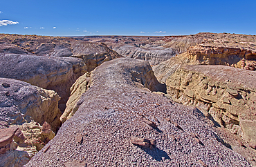
1311-949 - A narrow slot canyon of bentonite on the south end of Petrified Forest National Park Arizona.
1311-948 - Sandstone that has been eroded into forms that resemble clam shells on the south end of Petrified Forest National Park Arizona.
1311-947 - A ridge of gray bentonite viewed from a nearby flat top mesa on the south end of Petrified Forest National Park Arizona.
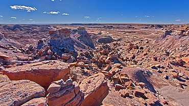
1311-946 - Small mesas with flat tops called Rock Islands on the south end of Petrified Forest National Park Arizona.
1311-945 - A pointed peak of bentonite in Hamilili Valley on the south end of Petrified Forest National Park Arizona.
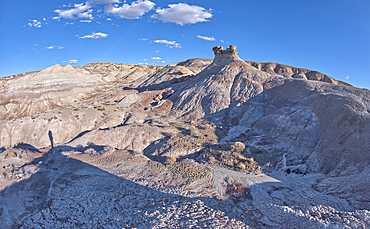
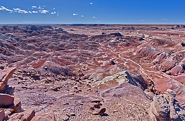
1311-944 - Purple hills of volcanic bentonite near Hamilili Point on the south end of Petrified Forest National Park Arizona.
1311-942 - A small hill of gray bentonite clay that appears to be melting into the purple bentonite of Hamilili Valley on the south end of Petrified Forest National Park Arizona.
1311-940 - A small hill of gray bentonite clay that appears to be melting into the purple bentonite of Hamilili Valley on the south end of Petrified Forest National Park Arizona.
1311-939 - A dry waterfall on the west side of Hamilili Point next to a hoodoo on the south end of Petrified Forest National Park Arizona. Hamilili is a Zuni word that means petrified wood.
1311-937 - A cliff overhang shaped like the head of a Duck west of Hamilili Point on the south end of Petrified Forest National Park Arizona.
1311-936 - View from below a ridge that overlooks the Jim Camp Wash on the south end of Petrified Forest National Park Arizona.
1311-935 - A lone hoodoo rock on the edge of a ridge overlooking the Jim Camp Wash on the south end of Petrified Forest National Park Arizona.
1311-934 - A lone hoodoo rock on the edge of a ridge overlooking the Jim Camp Wash on the south end of Petrified Forest National Park Arizona.
1311-933 - Islands of Rock in Hamilili Valley on the south end of Petrified Forest National Park Arizona.
1373-334 - View of the east front of the iconic Zytglogge (time bell), located at the end of the Kramgasse, one of the principal streets in the Old City of Bern, the medieval city centre of Bern, Switzerland.
1373-331 - View of the east front of the iconic Zytglogge (time bell), located at the end of the Kramgasse, one of the principal streets in the Old City of Bern, the medieval city centre of Bern, Switzerland.
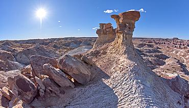
1311-921 - A solitary rock hoodoo in the purple badlands near Hamilili Point on the south end of Petrified Forest National Park Arizona.
1311-920 - A solitary rock hoodoo in the purple badlands near Hamilili Point on the south end of Petrified Forest National Park Arizona.
1311-919 - A solitary rock hoodoo in the purple badlands near Hamilili Point on the south end of Petrified Forest National Park Arizona.
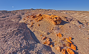
1311-918 - A petrified tree log that has shattered over time. Located on a mesa near Hamilili Point on the south end of Petrified Forest National Park Arizona.
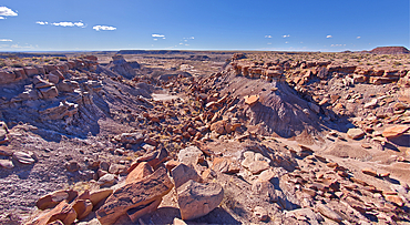
1311-917 - The crumbling cliffs of a mesa near Hamilili Point on the south end of Petrified Forest National Park Arizona.
1311-916 - Rock islands just off a mesa near Hamilili Point on the south end of Petrified Forest National Park Arizona.
1311-915 - Rock islands above the purple badlands near Hamilili Point on the south end of Petrified Forest National Park Arizona.
1311-914 - Purple badlands of bentonite near Hamilili Point on the south end of Petrified Forest National Park Arizona.
1311-913 - Purple badlands of bentonite near Hamilili Point on the south end of Petrified Forest National Park Arizona.
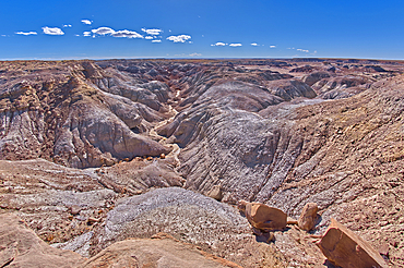
1311-912 - A deep canyon that has eroded thru the hills of purple and gray bentonite clay near Hamilili Point on the south end of Petrified Forest National Park Arizona.
1311-911 - A deep canyon that has eroded thru the hills of purple and gray bentonite clay near Hamilili Point on the south end of Petrified Forest National Park Arizona.
1311-910 - Hills of purple and gray bentonite near Hamilili Point on the south end of Petrified Forest National Park Arizona.
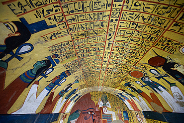
801-3917 - Wall Paintings, Tomb of Roy, TT255, End of Eighteenth Dynasty, Tombs of the Nobles, Ancient Thebes, Luxor, Eygpt
801-3915 - Wall Paintings, Tomb of Roy, TT255, End of Eighteenth Dynasty, Tombs of the Nobles, Ancient Thebes, Luxor, Eygpt
801-3916 - Wall Paintings, Tomb of Roy, TT255, End of Eighteenth Dynasty, Tombs of the Nobles, Ancient Thebes, Luxor, Eygpt
801-3914 - Wall Paintings, Tomb of Roy, TT255, End of Eighteenth Dynasty, Tombs of the Nobles, Ancient Thebes, Luxor, Eygpt
801-3912 - Wall Paintings, Tomb of Roy, TT255, End of Eighteenth Dynasty, Tombs of the Nobles, Ancient Thebes, Luxor, Eygpt
801-3913 - Wall Paintings, Tomb of Roy, TT255, End of Eighteenth Dynasty, Tombs of the Nobles, Ancient Thebes, Luxor, Eygpt
801-3911 - Wall Paintings, Tomb of Roy, TT255, End of Eighteenth Dynasty, Tombs of the Nobles, Ancient Thebes, Luxor, Eygpt
801-3910 - Wall Paintings, Tomb of Roy, TT255, End of Eighteenth Dynasty, Tombs of the Nobles, Ancient Thebes, Luxor, Eygpt
801-3908 - Wall Paintings, Tomb of Roy, TT255, End of Eighteenth Dynasty, Tombs of the Nobles, Ancient Thebes, Luxor, Eygpt
801-3909 - Wall Paintings, Tomb of Roy, TT255, End of Eighteenth Dynasty, Tombs of the Nobles, Ancient Thebes, Luxor, Eygpt
801-3907 - Wall Paintings, Tomb of Roy, TT255, End of Eighteenth Dynasty, Tombs of the Nobles, Ancient Thebes, Luxor, Eygpt
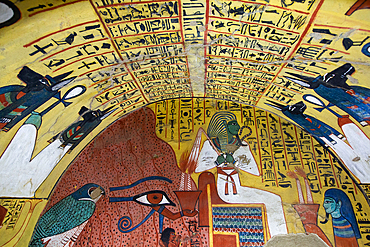
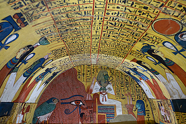
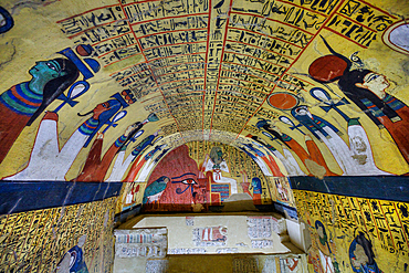
801-3887 - Eye of God Horus with Pharaoh (far end), Tomb of Pashedu, TT3, Deir el-Medina Tombs (Worker Tombs), Thebes, UNESCO World Heritage Site, Luxor, Egypt
801-3873 - Eye of God Horus with Pharaoh (far end), Tomb of Pashedu, TT3, Deir el-Medina Tombs (Worker Tombs), Thebes, UNESCO World Heritage Site, Luxor, Egypt
801-3872 - Eye of God Horus with Pharaoh (far end), Tomb of Pashedu, TT3, Deir el-Medina Tombs (Worker Tombs), Thebes, UNESCO World Heritage Site, Luxor, Egypt
801-3871 - Eye of God Horus with Pharaoh (far end), Tomb of Pashedu, TT3, Deir el-Medina Tombs (Worker Tombs), Thebes, UNESCO World Heritage Site, Luxor, Egypt
801-3870 - Eye of God Horus with Pharaoh (far end), Tomb of Pashedu, TT3, Deir el-Medina Tombs (Worker Tombs), Thebes, UNESCO World Heritage Site, Luxor, Egypt
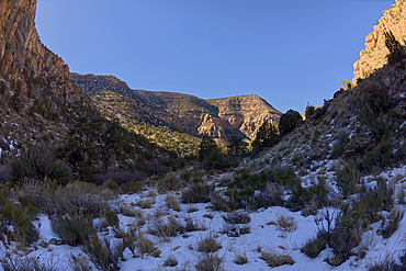
1311-895 - Waldron Canyon at Grand Canyon Arizona viewed from near its end, southwest of Hermit Canyon in winter.
1311-873 - Sign marking the end of the paved Greenway Trail that runs between Monument Creek Vista and Pima Point at Grand Canyon Arizona.
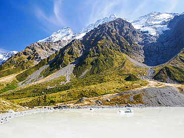
1242-581 - Glacial lake at the end of the Hooker Valley Trail in Aoraki (Mount Cook) National Park, UNESCO World Heritage Site, Southern Alps, South Island, New Zealand, Pacific
1311-858 - The end of Hermit Road, Hermits Rest is just beyond the parking lot, Grand Canyon, Arizona, United States of America, North America
1373-263 - View of the Eminonu waterfront, a major dock for ferries crossing The Bosphorus, at the southern end of the Galata Bridge over the Golden Horn, Istanbul, Turkey,Europe
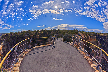
1311-829 - A look back towards the south from the end of the Maricopa Point Overlook, Grand Canyon, UNESCO World Heritage Site, Arizona, United States of America, North America
809-9015 - Ramadan lights in the West End, London, England, United Kingdom, Europe
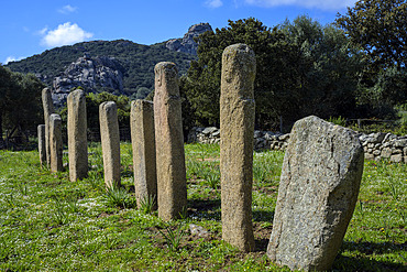
860-292046 - Alignment of statue-menhirs at I Stantari. Cauria megalithic site, located in the commune of Sartene in southern Corsica. The site was occupied from the Early Neolithic to the end of the Bronze Age. Some ten statue-menhirs can be seen in two alignments, on which reliefs (swords, belts, loincloths, faces, arms and hands) can be distinguished.
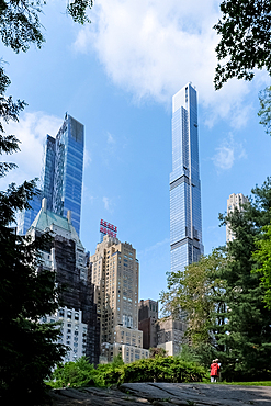
1373-69 - View of Manhattan cityscape as seen from Central Park South (South End), Manhattan, New York City, United States of America, North America
795-701 - Aerial view of the popular high-end tourist town of Elounda, Crete, Greek Islands, Greece, Europe
832-404288 - Two beers on West End beach on Roatan Island. Honduras
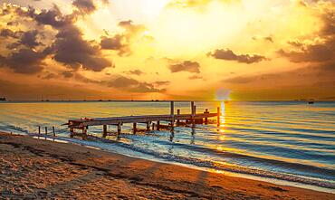
832-404287 - Sunset landscape of West End Beach, Roatan Island. Honduras
832-404248 - Roatan, Honduras », January 2020: a wooden bar over the sea at West End Beach on the island of Roatan at sunset
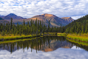
1116-52926 - Scenic view of the serene wilderness at the end of a lake in the remote Yukon Territory with sunrise illuminating the mountain tops creating a beautiful reflection in the still waters, Yukon, Canada
832-402280 - Numerous spectators wait on the banks of the Main for the fireworks to begin at the end of the Mainfest., Altebruecke, Frankfurt am Main, Hesse, Germany, Europe
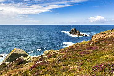
832-402246 - Coastline, heather blossom on the Atlantic coast, view on the South West Coast Path, blue sky in summer, headland Land's End, Lands End, Penzance, Penwith Peninsula, Cornwall, England, Great Britain
832-402237 - House with sign, The First and Last House, Lands End, Penzance, Penwith Peninsula, Cornwall, England, United Kingdom, Europe
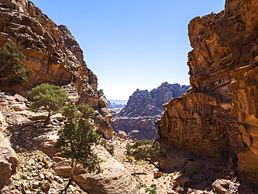
1112-7961 - End of the World view, Petra Archaeological Park, UNESCO World Heritage Site, one of the New Seven Wonders of the World, Petra, Jordan, Middle East
832-401377 - Traditional Batak house, in Indonesian called Rumah Bolon or Jabu, are noted for their distinctive roofs which curve upwards at each end, as a boats hull does and their carving decor
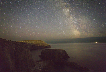
1202-629 - An autumn view of the Milky Way over the Atlantic Ocean, seen from the cliffs of Land's End, the most southwesterly point of Great Britain, Cornwall, England, United Kingdom, Europe
1202-622 - Atlantic shoreline at sunset, Whitesand Bay, Sennen Cove, near Land's End, in the far west of Cornwall, England, United Kingdom, Europe
1202-601 - An autumn view of the Milky Way over the Atlantic Ocean, seen from the cliffs of Land's End, the most southwesterly point of Great Britain, Cornwall, England, United Kingdom, Europe
1202-600 - An autumn view of the Milky Way over the Atlantic Ocean, seen from the cliffs of Land's End, the most southwesterly point of Great Britain, Cornwall, England, United Kingdom, Europe
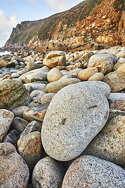
1202-599 - Granite boulders strewn across the shore at Porth Nanven, at the end of Cot Valley, near St. Just, Atlantic coast of the far west of Cornwall, England, United Kingdom, Europe
667-2737 - Taking a photograph at the end of The Cobb at sunset, Lyme Regis, Dorset, England, United Kingdom, Europe
667-2729 - People at the end of The Cobb enjoying the evening light, Lyme Regis, Dorset, England, United Kingdom, Europe
667-2719 - People at the end of The Cobb enjoying the evening light, Lyme Regis, Dorset, England, United Kingdom, Europe
759-10938 - Trip to Lands End at Cabo San Lucas, Cabo San Lucas, Baja California Sur, Mexico
759-10937 - Trip to Lands End at Cabo San Lucas, Cabo San Lucas, Baja California Sur, Mexico
759-10936 - Trip to Lands End at Cabo San Lucas, Cabo San Lucas, Baja California Sur, Mexico
759-10935 - Trip to Lands End at Cabo San Lucas, Cabo San Lucas, Baja California Sur, Mexico
759-10934 - Lands End at Cabo San Lucas, Cabo San Lucas, Baja California Sur, Mexico
759-10933 - Lands End at Cabo San Lucas, Cabo San Lucas, Baja California Sur, Mexico
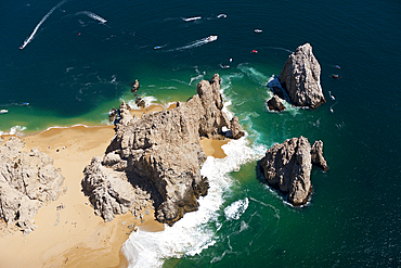
759-10930 - Aerial View of Lands End and Cabo San Lucas, Cabo San Lucas, Baja California Sur, Mexico
759-10929 - Aerial View of Lands End and Cabo San Lucas, Cabo San Lucas, Baja California Sur, Mexico
759-10928 - Lands End at Cabo San Lucas, Cabo San Lucas, Baja California Sur, Mexico
759-10921 - Aerial View of Lands End and Cabo San Lucas, Cabo San Lucas, Baja California Sur, Mexico
759-10907 - Aerial View of Lands End and Cabo San Lucas, Cabo San Lucas, Baja California Sur, Mexico
759-10779 - Coast Playa de Masca at End of Masca Gorge, Tenerife, Canary Islands, Spain
759-10778 - Coast Playa de Masca at End of Masca Gorge, Tenerife, Canary Islands, Spain
1311-636 - View of Spider Rock from the overlook at the end of Canyon De Chelly National Monument South Rim, Arizona, United States of America, North America
1311-630 - The haunted Massacre House Ruins in Canyon del Muerto (Canyon of the Dead), on the north end of Canyon De Chelly, site of a Navajo massacre by Spanish Soldiers in 1825, Arizona, United States of America, North America
1359-905 - End of passage at Cesky Krumlov Castle and Chateau, UNESCO World Heritage Site, Cesky Krumlov, South Bohemian Region, Czech Republic (Czechia), Europe
1359-904 - End of passage at Cesky Krumlov Castle and Chateau, UNESCO World Heritage Site, Cesky Krumlov, South Bohemian Region, Czech Republic (Czechia), Europe
832-399191 - Monument to the Egyptian-Russian Friendship at the west end of the High Dam of Aswan, Aswan, Egypt, Africa
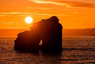
832-398426 - Sunset at Thurlestone Rock, South Milton Sands in Devon
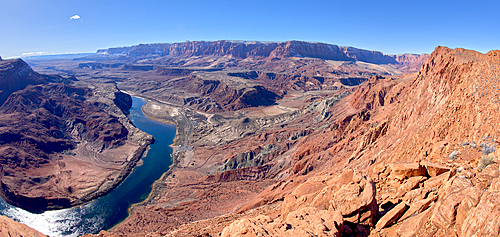
1311-608 - The Vermilion Cliffs adjacent to Glen Canyon Recreation Area viewed from the plateau at the end of Spencer Trail in Marble Canyon with Lee's Ferry on the lower left with the Colorado River, Arizona, United States of America, North America
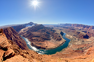
1311-607 - The bend in the Colorado River at Lee's Ferry in Glen Canyon Recreation Area viewed from the plateau at the end of Spencer Trail at Marble Canyon in winter, Arizona, United States of America, North America
1336-788 - Petra Treasury (El Khazneh) monument revealed at the end of the Siq canyon, Petra, UNESCO World Heritage Site, Jordan, Middle East
1243-412 - Aerial view of luxurious residential buildings in Sao Conrado, next to Gavea Beach with Pedra da Gavea visible at the far end, Rio de Janeiro, Brazil, South America
1350-6641 - Själö Church in Seili Island in Väståboland in Pargas in Southwest Finland Turku archipelago. The archipelago ring road or Saariston rengastie is full of things to see, do and do. The Archipelago Trail can be taken clockwise or counter clockwise, starting in the historical city of Turku, and continuing through rural archipelago villages and astonishing Baltic Sea sceneries. The Trail can be taken from the beginning of June until the end of August.
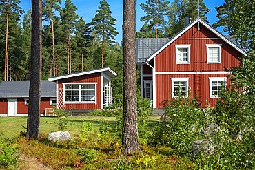
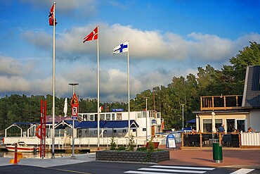
1350-6629 - Typical wooden house in in Nagu village or Nauvo island in Väståboland in Pargas in Southwest Finland Turku archipelago. The archipelago ring road or Saariston rengastie is full of things to see, do and do. The Archipelago Trail can be taken clockwise or counter clockwise, starting in the historical city of Turku, and continuing through rural archipelago villages and astonishing Baltic Sea sceneries. The Trail can be taken from the beginning of June until the end of August.
1350-6626 - Pizzeria Restaurant in Nagu harbour or Nauvo island in Väståboland in Pargas in Southwest Finland Turku archipelago. The archipelago ring road or Saariston rengastie is full of things to see, do and do. The Archipelago Trail can be taken clockwise or counter clockwise, starting in the historical city of Turku, and continuing through rural archipelago villages and astonishing Baltic Sea sceneries. The Trail can be taken from the beginning of June until the end of August.
1350-6624 - Chef William Hellgren at the fabulous Backpocket Restaurant in Hotel Nestor in Korpo or Korppoo island, Korpostrom coast Southwest Finland Turku archipelago. The archipelago ring road or Saariston rengastie is full of things to see, do and do. The Archipelago Trail can be taken clockwise or counter clockwise, starting in the historical city of Turku, and continuing through rural archipelago villages and astonishing Baltic Sea sceneries. The Trail can be taken from the beginning of June until the end of August.


