Recent searches
Loading...
809-7626 - Pastry shop in Nablus, West Bank, Palestine, Middle East
809-7591 - Cocoa harvest in a plantation near Agboville, Ivory Coast, West Africa, Africa
1297-630 - Live seafood for sale at the indoor Banzaan food market in Patong, Phuket, Thailand, Southeast Asia, Asia
805-1266 - Priest arranging puja ceremony inside 7-8th century Parashurameshvara Temple, Bhubaneswar, Odisha, India, Asia
805-1265 - Priest standing at entrance to 7-8th century Parashurameshvara Temple, one of the oldest in Bhubaneswar, Odisha, India, Asia
1297-575 - Thai chapatis being made at the famous Walking Street night market in Phuket old Town, Phuket, Thailand, Southeast Asia, Asia
1245-1565 - Samba Dancer at the Carnival Parade in Rio de Janeiro, Brazil, South America
1245-1562 - Samba Dancer at the Carnival Parade in Niteroi, State of Rio de Janeiro, Brazil, South America
1297-540 - A stall selling various insects in the night market in Kamala in Phuket, Thailand, Southeast Asia, Asia
1109-3686 - Pindaya Cave Festival, Pindaya, Shan State, Myanmar (Burma)
857-96101 - Side view of man crossing stream in Kanaka Creek Regional Park, Maple Ridge, British Columbia, Canada
762-845 - Vendor at food and spice stall at K. R. Market in Banaglore, Karnataka, India, Asia
857-96126 - A tourist on a motorcycle looking at the camera, Siem Reap, Cambodia
857-95992 - A boat captain raises the anchor on a boat along that coast of Krabi, Thailand before a ride to Railay Beach, a popular tourist destination.
857-96048 - An Australian volunteer firefighter patrolling at first light, Guanaba, Queensland, Australia
848-1707 - Man pouring traditional tea in Accra, Ghana, Africa
1184-3032 - Man standing by sign at North Pole, Arctic
1111-62 - Man in Indian traditional clothing sitting in alcove on Panna Meena Ka Kund in Jaipur, India, Asia
857-95932 - View of adventurous man cliff jumping from waterfall in cerrado, Chapada dos Veadeiros, Goias, Brazil
857-95970 - Mid adult man sitting on rocky edge with beautiful natural cerrado landscape on the background, Mirante da Janela hike, Chapada dos Veadeiros, Goias, central Brazil
857-95962 - Hiker wearing wooly hat taking cell phone picture in mountain in winter, Whiteface, New Hampshire, USA
857-95939 - Portrait of bearded man wearing sunglasses riding ferry to Peaks Island, Portland, Maine, USA
857-95931 - View of adventurous man cliff jumping from waterfall in cerrado, Chapada dos Veadeiros, Goias, Brazil
857-95883 - Male backpacker hiking in Yoho National Park with scenic landscape in background, Field, British Columbia, Canada
857-95880 - Man crouching on harbor and setting up solar panel to recharge battery, Washego, Ontario, Canada
857-95801 - An over the shoulder viw of a young man driving the Ring Road as the sun begins to set, in North Iceland.
857-95723 - A fisherman catching small fish in the Shire river in Nsanje, Malawi.
857-95682 - Ifugao tribesman dancing against black background, Banaue, Ifugao, Philippines
857-95599 - Raft guide with cooking steaks on grill in outdoor kitchen during Green River rafting trip, Desolation/Gray Canyon, Utah, USA
857-95573 - Professional surfer Jonathan Gonzalez paddling back to peak as sun sets, Tenerife, Canary Islands, Spain
857-95083 - Rear view of male hiker standing with backpack on empty dirt road of Otal Valley, Torla, Huesca, Spain
857-95092 - Silhouette of backpacker standing against starry night sky and Milky Way galaxy visible from inside of pitched tent, New South Wales, Australia
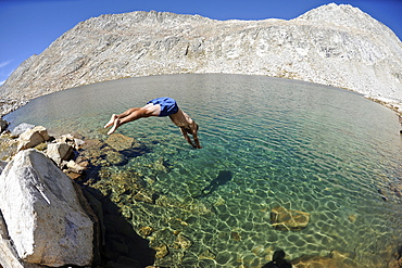
857-95087 - Man diving into La Salle Lake while hiking on a two-week trek of the Sierra High Route in the John Muir Wilderness in California. The 200-mile route roughly parallels the popular John Muir Trail through the Sierra Nevada Range of California from Kings Canyon National Park to Yosemite National Park.
857-94599 - A hiker is looking at a sign post near Courmayeur, half way the Tour du Mont Blanc, a classic multi day hike around the highest mountain of the European Alps. The trek takes about 10 days and goes through France, Italy and Switzerland.
857-94600 - A male hiker is taking a bath in a mountain lake near Courmayeur in the Italian Alps, with Mont Blanc in the back ground. This is halfway the Tour du Mont Blanc, a classic trekking that goes through France, Italy and Switzerland.
1178-26162 - USA, California, San Francisco, California, Man walking on coastline road at sunset
857-94717 - Nimoa Island - here the island mission will impress. The five-sided church features murals of island life and all mission buildings are surrounded by well maintained paths and gardens filled with flowering plants. Edged by jungle-covered mountains, postcard beaches and crystal clear waters - an island paradise indeed! The Louisiade Archipelago is a string of ten larger volcanic islands frequently fringed by coral reefs, and 90 smaller coral islands located 200 km southeast of New Guinea, stretching over more than 160 km and spread over an ocean area of 26,000 km? between the Solomon Sea to the north and the Coral Sea to the south. The aggregate land area of the islands is about 1,790 km? (690 square miles), with Vanatinai (formerly Sudest or Tagula as named by European claimants on Western maps) being the largest. Sideia Island and Basilaki Island lie closest to New Guinea, while Misima, Vanatinai, and Rossel islands lie further east. The archipelago is divided into the Local Level Government (LLG) areas Loui!
857-94815 - Photograph of surfer in sea with blood on shoulder, Lakey Peak, central Sumbawa, Indonesia
857-94739 - Captain navigating ferry between Lombok and Sumbawa islands, Indonesia
857-94826 - Photograph of man snorkeling underwater in Indian Ocean, Permuteran, Bali, Indonesia
857-94850 - Man herding Blacknose sheep in Swiss Alps, Zermatt, Valais, Switzerland
857-94821 - Side view of man snorkeling underwater in Indian Ocean, Permuteran, Bali, Indonesia
857-94957 - Photograph of man snorkeling in Cenote Chikin Ha, Playa del Carmen, Mayan Riviera, Yucatan Peninsula, Mexico
857-94765 - Shirtless man taking underwater selfie in Poco Verde (Green Pool), Guapimirim Sector of Serra dos Orgaos National Park, Rio de Janeiro, Brazil
857-94958 - Photograph of man snorkeling in Cenote Chikin Ha, Playa del Carmen, Mayan Riviera, Yucatan Peninsula, Mexico
857-94928 - Man standing under waterfall with open arms, Guapiacu Ecological Reserve, Rio de Janeiro, Brazil
857-94789 - Man of cliff edge overlooking Bay of Fundy Atlantic Ocean from Campobello Island New Brunswick
857-94813 - Photograph of silhouette of surfer swimming in sea at sunrise, Lakey Peak, central Subawa, Indonesia
857-94759 - Personal perspective view from quad motorcycle on dirt road in tropical scenery with palm trees, Taipu de Fora Beach, South Bahia, Barra Grande, Brazil
857-94716 - Nimoa Island - here the island mission will impress. The five-sided church features murals of island life and all mission buildings are surrounded by well maintained paths and gardens filled with flowering plants. Edged by jungle-covered mountains, postcard beaches and crystal clear waters - an island paradise indeed! The Louisiade Archipelago is a string of ten larger volcanic islands frequently fringed by coral reefs, and 90 smaller coral islands located 200 km southeast of New Guinea, stretching over more than 160 km and spread over an ocean area of 26,000 km? between the Solomon Sea to the north and the Coral Sea to the south. The aggregate land area of the islands is about 1,790 km? (690 square miles), with Vanatinai (formerly Sudest or Tagula as named by European claimants on Western maps) being the largest. Sideia Island and Basilaki Island lie closest to New Guinea, while Misima, Vanatinai, and Rossel islands lie further east. The archipelago is divided into the Local Level Government (LLG) areas Loui!
857-94640 - A mountaineers is melting snow to get drinking water, inside a tent at High Camp on Denali in Alaska. Early morning they are going for a summit push to the highest mountain of Northern America.
857-94601 - A hiker is scrambling on a spectacular rock formation near the Col des Fours above la Ville des Glaciers. This is halfway the Tour du Mont Blanc, a classic trekking around the highest peak of the Alps, that goes through France, Italy and Switzerland.
857-94330 - Man sitting on a rock and looking towards Mattehorn peak illuminated at sunrise.
857-94336 - Man standing on the edge of a grassy ledge, with a backpack on his back, looking contemplatively in the distance.
857-94327 - Male hiker sitting on a ledge above the ocean looking at the distant mountains while a seagull passes by.
857-94332 - Male photographer, holding a camera in his right hand, looking contemplatively into distance in a pristine and wild landscape. He's looking towards a mountain range with storm clouds above his head. On his right, closer to the camera, there is a lenga beech tree.
857-94333 - Man with waterproof jacket and beanie sitting on rock looking from a high viewpoint towards mountains and fjords at sunrise. Below, there is a village visible.
857-94334 - Man with beanie standing at the edge of a rocky beach and looking contemplatively towards a mountain in the distance.
857-94422 - Male hiker nears Parriott Mesa in Castle Valley near Moab, Utah
857-94419 - Make hiker at Hope Point in Chugach National Forest Alaska overlooking Turnagain Arm
857-94221 - A Man Climbing In Jilotepec, Estado De Mexico, Mexico
857-94133 - A Person Looking At View During Sunrise On North Eolus
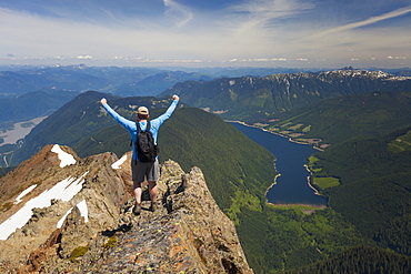
857-93997 - Hiker celebrating in victory pose after climbing Lady Peak in Cheam Mountain Range
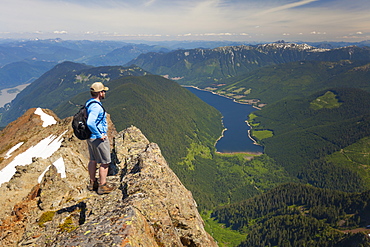
857-93998 - Hiker looking down on Jones Lake from top of Lady Peak in Cheam Mountain Range
857-94135 - Man Enjoying Twin Lakes In Upper Chicago Basin
857-94036 - Silhouette of kite surfer enjoying a sunny winter day in Rhode Island
857-94060 - Trees Along The Trail At Inspiration Point In Yosemite National Park, California
857-94100 - A Man Skis Deep Powder On A Stormy Day At Whistler Blackcomb Ski Resort In British Columbia
1172-2765 - Young Japanese Couple Wearing Yukata at Summer Festival
1172-2763 - Young Japanese Couple Wearing Yukata at Summer Festival
1172-2766 - Young Japanese Couple Wearing Yukata at Summer Festival
1172-2767 - Young Japanese Couple Wearing Yukata at Summer Festival
857-93841 - A Backpacker Checks His Phone While Hiking In North Cascades National Park
857-93836 - Male Hiker In North Cascades National Park With The View Of Mount Baker
857-93842 - Man Hiking In North Cascades National Park With View Of Mount Baker
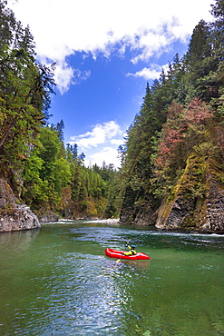
857-93843 - Adam Palmer Packrafting The Chehalis River In British Columbia, Canada
857-93837 - Male Hiker Exploring The Rocky Terrain Of The North Cascades National Park, Washington, Usa
857-93838 - Backpacker Exploring Mount Baker While Hiking In North Cascades National Park
857-93683 - Man Fly Fishing On The Colorado River In The Grand Canyon
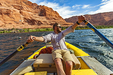
857-93686 - Man Rows Through The Grand Canyon Near The Glen Canyon Dam In Arizona
857-93767 - Professional Windsurfer On The Freezing Waters Of The Faroe Islands
857-93658 - Male Surfer On The Wave Of The Alberton Gorge Section Of The Clark Fork River
857-93357 - A Mountain Biker Is Drinking Water While Standing At A Beautiful Mountain Lake
857-93583 - Male Skier Makes A Deep Powder Turn On Snowy Landscape In Whitefish, Montana, Usa
857-93580 - Man Jumping On Rock Into The River At Sand Harbor State Park
857-93353 - Successful Mountain Biker Reach The Top Of Mountain In Switzerland
857-93418 - Male Hiker Walking On Boardwalk Surrounded By Grassyland In Forest
857-93479 - Man Mountain Biking In Tropical Forest Of Bali, Indonesia
857-93415 - Man Walking On Boardwalk With His Dog While Hiking In White Mountains
857-93356 - A Mountain Biker Riding Downhill In An Alpine Meadow Landscape
857-93582 - Male Skier Hiking On Snowy Landscape In Whitefish, Montana, Usa
857-93416 - Man Walking On Boardwalk While Hiking In White Mountains


