Recent searches
Loading...
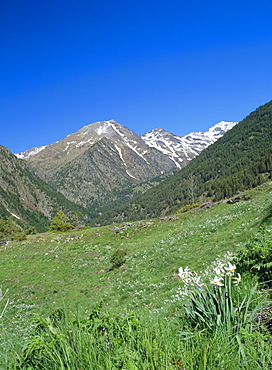
860-292130 - Lac de l'Orceyrette (1927 m), from left to right Pic de Roche Noire (2707 m), Pic de Maravoise (2704 m), Crete du Grand Clausis (2631 m) and Pic du Haut Mouriare (2808 m), Villar-Saint-Pancrace, Hautes-Alpes, France
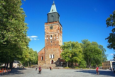
1350-6655 - Turku Cathedral is Mother Church of the Evangelical Lutheran in Finland
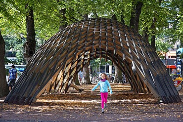
1350-6651 - Wood structure of Venice Biennale 2012: New Forms in Wood display now at the city Hall Park at Turku. European capital of culture 2011 was held at 19th of August 2011. The pavilion was the result of a workshop that was a joint collaboration with the students from both Oulu and Columbia Universities. Eero Lundv�n and Markus Wikar were coordinating the student���s efforts in Finland.
Guest lecturers at the opening ceremony included Phillip Anzalone (Columbia University) and professor Rainer Mahlamv�ki (University of Oulu). For panel discussion, also Emmi Keskisarja (Tampere University of Technology) and Toni v�sterlund (University of Oulu) were present.
1350-6647 - Old town hall and buildings on the banks of the River Aura in Turku Finland.
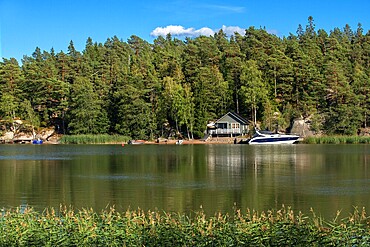
1350-6641 - Själö Church in Seili Island in Väståboland in Pargas in Southwest Finland Turku archipelago. The archipelago ring road or Saariston rengastie is full of things to see, do and do. The Archipelago Trail can be taken clockwise or counter clockwise, starting in the historical city of Turku, and continuing through rural archipelago villages and astonishing Baltic Sea sceneries. The Trail can be taken from the beginning of June until the end of August.
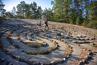
1350-6634 - Jungfrudansen stone labyrinth in Finby near Nagu Archipelago trail Finland Southwest Finland Turku archipelago. Nature walk to a turf maze know as a ���virgin dance���. This is part of St Olav Waterway, a new long distance pilgrims hiking path from Turku to Trondheim in Norway. Trondheim was the Nordic Santiago de Compostela in the Middle Ages.
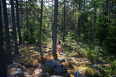
1350-6632 - Wild nature forest near Jungfrudansen stone labyrinth in Finby near Nagu Archipelago trail Finland Southwest Finland Turku archipelago. Nature walk to a turf maze know as a ���virgin dance���. This is part of St Olav Waterway, a new long distance pilgrims hiking path from Turku to Trondheim in Norway. Trondheim was the Nordic Santiago de Compostela in the Middle Ages.
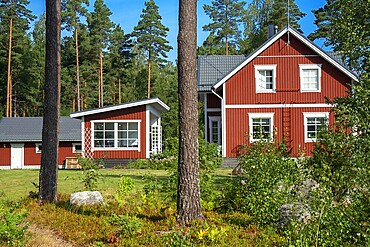
1350-6629 - Typical wooden house in in Nagu village or Nauvo island in Väståboland in Pargas in Southwest Finland Turku archipelago. The archipelago ring road or Saariston rengastie is full of things to see, do and do. The Archipelago Trail can be taken clockwise or counter clockwise, starting in the historical city of Turku, and continuing through rural archipelago villages and astonishing Baltic Sea sceneries. The Trail can be taken from the beginning of June until the end of August.
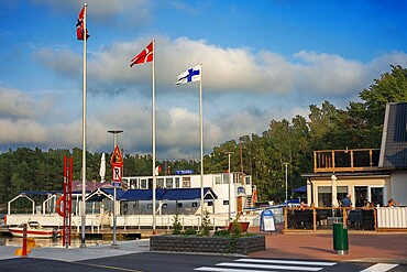
1350-6626 - Pizzeria Restaurant in Nagu harbour or Nauvo island in Väståboland in Pargas in Southwest Finland Turku archipelago. The archipelago ring road or Saariston rengastie is full of things to see, do and do. The Archipelago Trail can be taken clockwise or counter clockwise, starting in the historical city of Turku, and continuing through rural archipelago villages and astonishing Baltic Sea sceneries. The Trail can be taken from the beginning of June until the end of August.
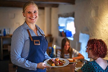
1350-6624 - Chef William Hellgren at the fabulous Backpocket Restaurant in Hotel Nestor in Korpo or Korppoo island, Korpostrom coast Southwest Finland Turku archipelago. The archipelago ring road or Saariston rengastie is full of things to see, do and do. The Archipelago Trail can be taken clockwise or counter clockwise, starting in the historical city of Turku, and continuing through rural archipelago villages and astonishing Baltic Sea sceneries. The Trail can be taken from the beginning of June until the end of August.
1350-6619 - Fresh tomatoes in Isaksson���s farm on the road to the Korpo ferry in Houtskv�r in an array of colours at the farm shop. There are no staff here, simply weigh your vegetables and place the appropriate amount in the moneybox. Southwest Finland archipelago near Kustavin Savipaja. The archipelago ring road or Saariston rengastie is full of things to see, do and do. The Archipelago Trail can be taken clockwise or counter clockwise, starting in the historical city of Turku, and continuing through rural archipelago villages and astonishing Baltic Sea sceneries. The Trail can be taken from the beginning of June until the end of August.
1350-6622 - Backpocket Restaurant in Hotel Nestor in Korpo or Korppoo island, Korpostrom coast Southwest Finland Turku archipelago. The archipelago ring road or Saariston rengastie is full of things to see, do and do. The Archipelago Trail can be taken clockwise or counter clockwise, starting in the historical city of Turku, and continuing through rural archipelago villages and astonishing Baltic Sea sceneries. The Trail can be taken from the beginning of June until the end of August.
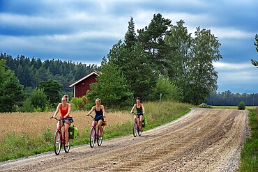
1350-6618 - Riding a bicycle in Nagu or Nauvo island in Väståboland in Pargas in Southwest Finland Turku archipelago. The archipelago ring road or Saariston rengastie is full of things to see, do and do. The Archipelago Trail can be taken clockwise or counter clockwise, starting in the historical city of Turku, and continuing through rural archipelago villages and astonishing Baltic Sea sceneries. The Trail can be taken from the beginning of June until the end of August.
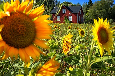
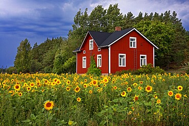
1350-6613 - Typical houses and sunflowers field in Korpo or Korppoo island, Korpostrom coast Southwest Finland Turku archipelago. The archipelago ring road or Saariston rengastie is full of things to see, do and do. The Archipelago Trail can be taken clockwise or counter clockwise, starting in the historical city of Turku, and continuing through rural archipelago villages and astonishing Baltic Sea sceneries. The Trail can be taken from the beginning of June until the end of August.
1350-6617 - Riding a bicycle in Nagu or Nauvo island in Väståboland in Pargas in Southwest Finland Turku archipelago. The archipelago ring road or Saariston rengastie is full of things to see, do and do. The Archipelago Trail can be taken clockwise or counter clockwise, starting in the historical city of Turku, and continuing through rural archipelago villages and astonishing Baltic Sea sceneries. The Trail can be taken from the beginning of June until the end of August.
1350-6612 - Typical houses and sunflowers field in Korpo or Korppoo island, Korpostrom coast Southwest Finland Turku archipelago. The archipelago ring road or Saariston rengastie is full of things to see, do and do. The Archipelago Trail can be taken clockwise or counter clockwise, starting in the historical city of Turku, and continuing through rural archipelago villages and astonishing Baltic Sea sceneries. The Trail can be taken from the beginning of June until the end of August.
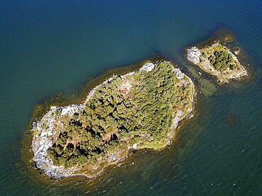
1350-6604 - Aerial view of the islands in front Mossala Island Resort Southwest Finland archipelago. The archipelago ring road or Saariston rengastie is full of things to see, do and do. The Archipelago Trail can be taken clockwise or counter clockwise, starting in the historical city of Turku, and continuing through rural archipelago villages and astonishing Baltic Sea sceneries. The Trail can be taken from the beginning of June until the end of August.
1350-6605 - Aerial view of small island in front Mossala Island Resort Southwest Finland archipielago. The archipelago ring road or Saariston rengastie is full of things to see, do and do. The Archipelago Trail can be taken clockwise or counter clockwise, starting in the historical city of Turku, and continuing through rural archipelago villages and astonishing Baltic Sea sceneries. The Trail can be taken from the beginning of June until the end of August.
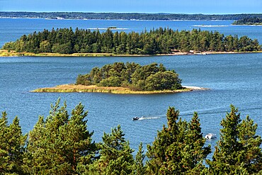
1350-6601 - Southwest Finland archipelago near Kustavin Savipaja. The archipelago ring road or Saariston rengastie is full of things to see, do and do. The Archipelago Trail can be taken clockwise or counter clockwise, starting in the historical city of Turku, and continuing through rural archipelago villages and astonishing Baltic Sea sceneries. The Trail can be taken from the beginning of June until the end of August.
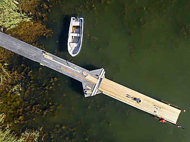
1350-6600 - Aerial view of small dock in Korpo or Korppoo island, Korpostrom coast Southwest Finland Turku archipelago. The archipelago ring road or Saariston rengastie is full of things to see, do and do. The Archipelago Trail can be taken clockwise or counter clockwise, starting in the historical city of Turku, and continuing through rural archipelago villages and astonishing Baltic Sea sceneries. The Trail can be taken from the beginning of June until the end of August.
1350-6594 - Aerial view of Kustavi small islands in Southwest Finland archipielago. The archipelago ring road or Saariston rengastie is full of things to see, do and do. The Archipelago Trail can be taken clockwise or counter clockwise, starting in the historical city of Turku, and continuing through rural archipelago villages and astonishing Baltic Sea sceneries. The Trail can be taken from the beginning of June until the end of August.
1348-4560 - Volcano Tousside In 3D, Chad, True Colour Satellite Image. Pic Tousside, Chad, true colour satellite image. A recent volcano, known as the Pic Tousside, in the Tibesti Mountains in Northwestern tip of Chad (Africa). Composite image dated 2000-2002 using LANDSAT data.
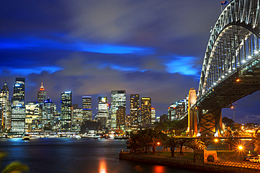
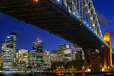
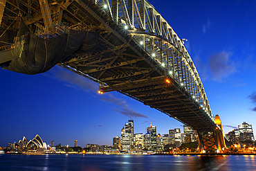
1350-3815 - Side view of Sydney Harbour bridge architectural landmark and city at sunset. Illuminated arch of the bridge reflecting in blurred waters Sydney, New South Wales, Australia
1350-3748 - World famous Sydney Opera House and Harbour bridge at sunset. Blurred clouds and lights of landmarks reflect in blurred waters of Harbour. Sydney, New South Wales, Australia
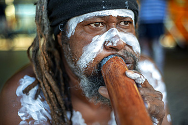
1350-3812 - Australian Aboriginal dressed man selling music cd in The Rocks area at Circular Quay in Sydney New South Wales, Australia
1350-3750 - Side view of Sydney Harbour bridge architectural landmark and city at sunset. Illuminated arch of the bridge reflecting in blurred waters Sydney, New South Wales, Australia
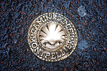
1350-3773 - Water sewer in Montpellier France
A symbol on the ground warns us that the Camino de Santiago Way of St. James also passes through Montpellier. The Via Tolosana is the Latin name for one of the four routes in France on the Camino de Santiago, the southernmost. It passes through Toulouse (in Spanish and Occitan, Tolosa, hence its name), but its meeting point and starting point is Arles.
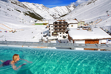
1350-3786 - Kuhtai sky resort village and ski slopes near Innsbruck Tyrol Austria. Swimming pool of the Mooshaus Hotel.
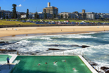
1350-3788 - Bondi Icebergs swimming pool, Bondi Beach, Sydney, New South Wales, Australia. The Bondi beach to Coogee walk is a coastal walk in Sydney New South Wales, Australia
1350-3817 - Side view of Sydney Harbour bridge Opera House and city CBD at sunset. Illuminated arch of the bridge reflecting in blurred waters Sydney, New South Wales, Australia
1350-3764 - Chicken with potatoes and beetroot. Typical dish of Tyrolean cuisine. Fischerhäusl Restaurant on 8 Herrengasse Street. Innsbruck Tyrol Austria
1350-3797 - Australian Aboriginal dressed man selling boomerangs in The Rocks area at Circular Quay in Sydney New South Wales, Australia
1350-3759 - Inside MCA, Museum of Contemporary Art Sydney Australia
1350-3794 - The Battle of the Year Breakdance and Hip Hop competition in Montpellier France.
Each year is a great time of Hip Hop culture lies ahead for the final of Battle of the Year, this Breakdance competition puts face to face the best crews of France. Beyond the competition, the Festival A change of direction means a whole week of evenings, debates, exhibitions, graffiti, and Bboy battles Bgirl...
1350-2278 - The Observatory Of Pic Du Midi De Bigorre, Hautes Pyrenees, Midi Pyrenees, France
1350-2279 - The Observatory Of Pic Du Midi De Bigorre, Hautes Pyrenees, Midi Pyrenees, France
1350-846 - Lucha Libre. After the show. A follower is photographed with cholitas fighters. Down Julieta, Celia la Simpatica, and Dina with blue dress , cholitas females wrestlers ,Sports center La Ceja, El Alto, La Paz, Bolivia
1350-2270 - View point of The Observatory Of Pic Du Midi De Bigorre, Hautes Pyrenees, Midi Pyrenees, France. The 12m Ponton dans le ciel, a glass walkway high above the Pyrenees at Pic du Midi de Bigorre, a 2877m mountain in the French Pyrenees, home to an astronomical observatory and visitors centre. The observatory is acccessible from the village of La Mongie by cablecar. Tourists often visit in time for the spectacular sunset across the mountains.
1350-737 - Clock tower on Schlossberg, castle hill, Graz, Austria
1350-2274 - Sunset Mountain views in front of The Observatory Of Pic Du Midi De Bigorre, Hautes Pyrenees, Midi Pyrenees, France. The Col du Tourmalet is the highest paved mountain pass in the French Pyrenees second only to the Col de Portet. So in contrast to frequent claims.
1350-2277 - The Observatory Of Pic Du Midi De Bigorre, Hautes Pyrenees, Midi Pyrenees, France
1350-845 - Lucha Libre. After the show. A follower is photographed with cholitas fighters. At left Julieta, in the middle Celia la Simpatica, and Dina , cholitas females wrestlers ,Sports center La Ceja, El Alto, La Paz, Bolivia
1350-2276 - The Observatory Of Pic Du Midi De Bigorre in sunset time, Hautes Pyrenees, Midi Pyrenees, France
1350-2271 - View point of The Observatory Of Pic Du Midi De Bigorre, Hautes Pyrenees, Midi Pyrenees, France. The 12m Ponton dans le ciel, a glass walkway high above the Pyrenees at Pic du Midi de Bigorre, a 2877m mountain in the French Pyrenees, home to an astronomical observatory and visitors centre. The observatory is acccessible from the village of La Mongie by cablecar. Tourists often visit in time for the spectacular sunset across the mountains.
1350-995 - Taj Mahal, UNESCO World Heritage Site, Agra, Uttar Pradesh, India
1350-2268 - View point of The Observatory Of Pic Du Midi De Bigorre, Hautes Pyrenees, Midi Pyrenees, France. The 12m Ponton dans le ciel, a glass walkway high above the Pyrenees at Pic du Midi de Bigorre, a 2877m mountain in the French Pyrenees, home to an astronomical observatory and visitors centre. The observatory is acccessible from the village of La Mongie by cablecar. Tourists often visit in time for the spectacular sunset across the mountains.
1350-1462 - Tourist, at Emerald Buddha Wat Phra Kaeo temple, Grand Palace, Bangkok, Thailand
1350-2269 - View point of The Observatory Of Pic Du Midi De Bigorre, Hautes Pyrenees, Midi Pyrenees, France. The 12m Ponton dans le ciel, a glass walkway high above the Pyrenees at Pic du Midi de Bigorre, a 2877m mountain in the French Pyrenees, home to an astronomical observatory and visitors centre. The observatory is acccessible from the village of La Mongie by cablecar. Tourists often visit in time for the spectacular sunset across the mountains.
1350-1698 - students visiting Prem Mandir ( love temple) Temple of Divine Love, Vrindavan, Mathura, Uttar Pradesh, India
1350-2273 - Traditional dinner on the sunset in The Observatory Of Pic Du Midi De Bigorre, Hautes Pyrenees, Midi Pyrenees, France
1350-2275 - Sunset Mountain views in front of The Observatory Of Pic Du Midi De Bigorre, Hautes Pyrenees, Midi Pyrenees, France. The Col du Tourmalet is the highest paved mountain pass in the French Pyrenees second only to the Col de Portet. So in contrast to frequent claims.
1350-2272 - La Mongie lake of Oncet and a cable car rising to The Observatory Of Pic Du Midi De Bigorre, Hautes Pyrenees, Midi Pyrenees, France
1350-1697 - Show, street artist and spontaneous photographer, Street scene, in Historical Center,Vrindavan, Mathura, Uttar Pradesh, India
860-287800 - Pic blanc, Moutain in the sun setting in the alps, France
832-383121 - Entrance to the Oktoberfest, Munich, Upper Bavaria, Bavaria, Germany, Europe
832-383122 - Chairoplane or swing ride, Oktoberfest, Munich, Upper Bavaria, Bavaria, Germany, Europe
1225-1267 - Walkers descend from the top of Pic Peyreget while hiking the GR10 trekking trail, Pyrenees Atlantiques, France, Europe
1225-1253 - Walkers admire the view of Pic du Midi d'Ossau from the top of Col d'Ayous on the GR10 trekking route, Pyrenees Atlantiques, France, Europe
1225-1250 - Walkers descend from the top of Pic Peyreget while hiking the GR10 trekking trail, Pyrenees Atlantiques, France, Europe
1225-1247 - Camped beside Lac Gentau with views of Pic du Midi d'Ossau on the GR10 trekking route in the French Pyrenees, Pyrenees Atlantiques, France, Europe
1225-1251 - Lac du Miey and Pic Midi d'Ossau seen from the GR10 hiking trail in the French Pyrenees, Pyrenees Atlantiques, France, Europe
83-13035 - The 2885m Pic du Midi d'Ossau mountain on the French side of the border with Spain, Col du Pourtalet Pass, Pyrenees, Huesca, Spain, Europe
857-94080 - Woman takes smart phone pic over lake, Villarica volcano
733-7342 - Hikers walking to Pic Boby, Andringitra National Park, Ambalavao, central area, Madagascar, Africa
857-86065 - Schloss Ort castle, Lake Traunsee, Gmunden, Austria.
832-346903 - Water slide tower, hot springs Lutzmannsburg, Burgenland, Austria
832-346906 - Castle Jormannsdorf Education center in the range of health care, Burgenland, Austria
832-346896 - Waterslide towers of the Spa in Lutzmannsburg, Burgenland, Austria
832-346905 - Ferry boat stops at a stopover, Lake Como, Lago di Como, Italy
832-251831 - Grand Gabison, Pic Lalate, Pic Sanctus and Pic Ger, pyrenees seen from the Col d'Aubisque, Aquitaine, France, Europe
832-251439 - View of the Grand Gabizon, Pic Ger, from Col d'Aubisque, Pyrenees, Aquitaine, France, Europe
1160-739 - Pic Lombarduccio reflecting in Lac de Melo, Gorges de la Restonica, Haute Corse, Corsica, France, Europe
1160-78 - Pic Lombarduccio reflecting in Lac de Melo, Gorges de la Restonica, Haute Corse, Corsica, France, Mediterranean, Europe
832-86020 - Grand Canal, Venice, Veneto region, Italy, Europe
832-86021 - St. Mark's Square, Venice, Veneto region, Italy, Europe
832-56168 - Electric locomotive, Series E 186 TRAXX F140 MS
1116-15098 - Skiers, Pic de l'aube, Gaspesie National Park, Quebec
1116-15846 - Auberge Sur La Cote at Sunrise, Pointe-au-Pic, Quebec
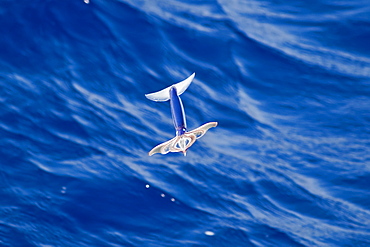
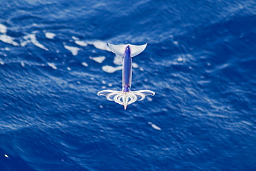
917-407 - Flying Squid Species in mid-air (Ommastrephes bartramii). Extremely rare unusual image. South Atlantic Ocean. MORE INFO: Flying Squid use membranes between their tentacles (visible on pic) & two fins at the rear of the mantle to glide through the air in a similar way to flying fish. These unique adaptations allow them to avoid predation more easily. Ommastrephid squids are among the strongest swimmers in the Cephalopoda. A number of species are fished commercially. This particular species (Ommastrephes bartramii), is commonly known as "Neon Flying Squid" due to its colouration and its ability to glide over the ocean surface as seen in the photographs. Please note that this is a genuine image of a wild animal in its natural environment. It is not a digital manipulation.
917-227 - Flying Squid Species in mid-air, roughly 100 nm North of Tristan Da Cunha, South Atlantic Ocean. Flying Squid use membranes between their tentacles (visible on pic) & two fins at the rear of the mantle to glide through the air in a similar way to flying fish.
917-406 - Flying Squid Species in mid-air (Ommastrephes bartramii). Extremely rare unusual image. South Atlantic Ocean. MORE INFO: Flying Squid use membranes between their tentacles (visible on pic) & two fins at the rear of the mantle to glide through the air in a similar way to flying fish. These unique adaptations allow them to avoid predation more easily. Ommastrephid squids are among the strongest swimmers in the Cephalopoda. A number of species are fished commercially. This particular species (Ommastrephes bartramii), is commonly known as "Neon Flying Squid" due to its colouration and its ability to glide over the ocean surface as seen in the photographs. Please note that this is a genuine image of a wild animal in its natural environment. It is not a digital manipulation.
917-230 - Flying Squid Species in mid-air, roughly 100 nm North of Tristan Da Cunha, South Atlantic Ocean. Flying Squid use membranes between their tentacles (visible on pic) & two fins at the rear of the mantle to glide through the air in a similar way to flying fish.
917-228 - Flying Squid Species in mid-air, roughly 100 nm North of Tristan Da Cunha, South Atlantic Ocean. Flying Squid use membranes between their tentacles (visible on pic) & two fins at the rear of the mantle to glide through the air in a similar way to flying fish.
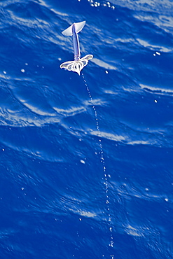
917-231 - Flying Squid Species in mid-air leaving a water trail behind it, roughly 100 nm North of Tristan Da Cunha, South Atlantic Ocean. Flying Squid use membranes between their tentacles (visible on pic) & two fins at the rear of the mantle to glide through the air in a similar way to flying fish.
917-405 - Flying Squid Species in mid-air (Ommastrephes bartramii). Extremely rare unusual image. South Atlantic Ocean. MORE INFO: Flying Squid use membranes between their tentacles (visible on pic) & two fins at the rear of the mantle to glide through the air in a similar way to flying fish. These unique adaptations allow them to avoid predation more easily. Ommastrephid squids are among the strongest swimmers in the Cephalopoda. A number of species are fished commercially. This particular species (Ommastrephes bartramii), is commonly known as "Neon Flying Squid" due to its colouration and its ability to glide over the ocean surface as seen in the photographs. Please note that this is a genuine image of a wild animal in its natural environment. It is not a digital manipulation.
917-229 - Flying Squid Species in mid-air, roughly 100 nm North of Tristan Da Cunha, South Atlantic Ocean. Flying Squid use membranes between their tentacles (visible on pic) & two fins at the rear of the mantle to glide through the air in a similar way to flying fish.
390-2442 - View across the bay to the village and Pic du Cap Roux, Antheor, Corniche de l'Esterel, Var, Cote d'Azur, Provence, France, Mediterranean, Europe
816-2253 - People walking along a street in the background Pic Bobby (Pic d'Imarivolanitra) in the Andringitra National Park, Madagascar, Africa
797-5802 - Vallee de Lutour looking south with snow covered peak of Pic de Labas 2927 m / 9586 ft and Tuc de Mounges cliff south of Cauterets, Fast flowing river in foreground, Hautes-Pyrenees, Midi-Pyrenees, France
797-5801 - Vallee de Lutour, View south over lower valley with central snow covered peak of Pic de Labas 2927 m / 9586 ft south of Cauterets, Sparkling river and trees, Hautes-Pyrenees, Midi-Pyrenees, France
390-2467 - View across bay to the village of Antheor, and Pic du Cap Roux, Corniche de l'Esterel, Var, Cote d'Azur, French Riviera, Provence, France, Mediterranean, Europe
733-1377 - Hiker on climbing trail in hiking area of Pic de Coma Pedrosa, Andorra's highest mountain, Parish of La Massana, Andorra, Pyrenees, Europe
733-1412 - Hikers on bridge in hiking area of Pic de Coma Pedrosa, Parish of La Massana, Andorra, Pyrenees, Europe
733-1413 - Mountain lake, hiking area of Pic de Coma Pedrosa, Parish of La Massana, Andorra, Pyrenees, Europe
586-1125 - View north west across the Arinsal Valley to Pic de Coma Pedrosa in early summer, Percanela, Arinsal, Andorra
255-7694 - Cirque de Gavarnie from Pic de Tantes, Pyrenees mountains, Haute-Pyrenees, Midi-Pyrenees, France, Europe

