Recent searches
Loading...
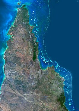
1348-3353 - Satellite view of the Northern Great Barrier Reef along the east coast of Cape York Peninsula in north Australia. This image was compiled from data acquired in 2014 by Landsat 8 satellite.
1348-3087 - Color satellite image of Copenhagen, capital city of Denmark. The Oresund Bridge which is a combination of tunnel and bridge, connects Copenhagen to the Swedish city of Malmo. Image collected on May 27, 2017 by Sentinel-2 satellites.
1348-3082 - Color satellite image of Manama, capital city of Bahrain. Image collected on October 17, 2017 by Sentinel-2 satellites.
1348-3065 - Color satellite image of Orlando, Florida, United States. Image collected on February 18, 2018 by Sentinel-2 satellites.
1348-3379 - Satellite view of Saint Lucia. This image was compiled from data acquired by Landsat satellites.
1348-4502 - Asia At Night, True Colour Satellite Image. True colour satellite image of Asia at night. This image in Lambert Azimuthal Equal Area projection was compiled from data acquired by LANDSAT 5 & 7 satellites.
1348-3083 - Color satellite image of Manama, capital city of Bahrain. Image collected on October 17, 2017 by Sentinel-2 satellites.
1348-3433 - Satellite view of Antigua And Barbuda. This image was compiled from data acquired by Landsat satellites.
1348-3385 - Satellite view of Oceania. This image was compiled from data acquired by Landsat 7 & 8 satellites.
1348-3060 - Color satellite image of Sydney, Australia. Image collected on August 23, 2017 by Sentinel-2 satellites.
1348-3444 - Satellite view of Moreton Bay, Queensland, Australia. This image was compiled from data acquired in 2014 by Landsat 8 satellite.
1348-3447 - Satellite image of Abu Dhabi, United Arab Emirates, taken on June 26, 2014 by the satellite Landsat 8. The territory covered is 78 km x 55 km.
1348-3045 - Color satellite image of Lake Ontario, North America. Image collected on May 1, 2016 by Landsat 8 satellite.
1348-3412 - Satellite view of Mayotte. This image was compiled from data acquired by Landsat satellites.
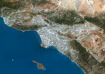
1348-3072 - Color satellite image of Greater Los Angeles, California, United States. Image collected on June 13, 2017 by Sentinel-2 satellites.
1348-3043 - Color satellite image of the Amazon Delta, Brazil. Image collected by Landsat satellites.
1348-3416 - Satellite view of Chikurachki Volcano that erupted on February 17, 2015. The volcano is located in the Kuril Islands in Russia. This image was taken by Landsat 8 satellite.
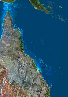
1348-3407 - Satellite view of the Great Barrier Reef. It extends along most of Queensland's coastline in north-east Australia, from Torres Strait and Cape York peninsula down to Fraser Island
1348-3103 - Color satellite image of Tunis, capital city of Tunisia. Image collected on August 19, 2017 by Sentinel-2 satellites.
1348-3376 - Satellite view of Samoa that consists of two large islands, Upolu and Savaii. This image was compiled from data acquired by Landsat 8 satellite in 2014.
1348-3115 - Carbon Dioxide Hazard Area warning sign around Horseshoe Lake, Inyo National Forest
1348-3422 - Satellite view of Christmas Island, Kiribati. This image was compiled from data acquired by Landsat 8 satellite in 2014.
1348-3062 - Color satellite image of Melbourne, Australia. Image collected on March 9, 2017 by Sentinel-2 satellites.
1348-4501 - Globe Centred On The Americas, True Colour Satellite Image
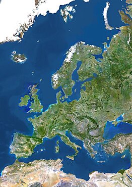
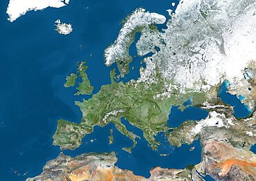
1348-4509 - Europe, True Colour Satellite Image. True colour satellite image of Europe. This image in Lambert Conformal Conic projection was compiled from data acquired by LANDSAT 5 & 7 satellites.
1348-3431 - Satellite view of Australia. This image was compiled from data acquired by Landsat 8 satellite in 2014.
1348-4490 - Whole Earth Centred On Pacific Ocean, True Colour Satellite Image
1348-3428 - Satellite view of Andros, New Providence and Eleuthera Islands, Bahamas. New Providence is the most populous island in the Bahamas and it houses the capital city of Nassau. This image was compiled from data acquired by Landsat satellites.
1348-4496 - Globe Showing Asia, True Colour Satellite Image
1348-3352 - Satellite view of Turks and Caicos Islands. This image was compiled from data acquired by Landsat satellites.
1348-3448 - Satellite image of Japan at night. This satellite image shows urban and industrial lights.
1348-3078 - Color satellite image of the Bosphorus Strait, Turkey
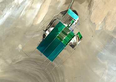
1348-3443 - The satellite image shows potash evaporation ponds in Lop Nur, a former salt lake in the Xinjiang Region, that spread over 20 kilometers
1348-3095 - Color satellite image of Mumbai and Navi Mumbai, India. Navi Mumbai is a planned township located East of Mumbai. Both cities are connected by the Vashi bridge, also called Thane Creek Bridge
1348-4491 - Globe Showing Asia, True Colour Satellite Image. True colour satellite image of the Earth showing Asia and Oceania, half in shadow, and the sun. This image in orthographic projection was compiled from data acquired by LANDSAT 5 & 7 satellites.
1348-3414 - Satellite view of Europe in winter, with partial snow cover. This image was compiled from data acquired by Landsat 7 & 8 satellites.
1348-4503 - Oceania With Country Borders And Major Rivers, True Colour Satellite Image
1348-3426 - Satellite view of Grand Bahama, Bahamas. This image was compiled from data acquired by Landsat satellites.
1348-3435 - Satellite view of Algeria, Morocco and Tunisia. This image was compiled from data acquired in 2014 by Landsat 8 satellite.
1348-3401 - Satellite view of the Kerguelen Islands, a group of islands in the southern Indian Ocean that is part of the French Southern and Antarctic Lands
1348-3096 - Color satellite image of Mumbai, India. Image collected on May 03, 2017 by Sentinel-2 satellites.
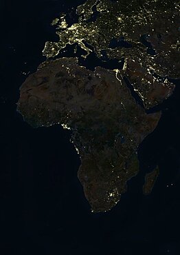
1348-4504 - Africa At Night, True Colour Satellite Image. True colour satellite image of Africa at night. This image in Lambert Azimuthal Equal Area projection was compiled from data acquired by LANDSAT 5 & 7 satellites.
1348-3090 - Color satellite image of the eastern part of Singapore. Singapore Changi Airport is at the eastern end of the city. Image collected on July 10, 2017 by Sentinel-2 satellites.
1348-3419 - Satellite view of Cuba and Jamaica. This image was compiled from data acquired by Landsat satellites.
1348-3346 - Satellite view of Wallis Island, part of Wallis and Futuna Islands. This image was compiled from data acquired by Landsat 8 satellite in 2014.
1348-3068 - Color satellite image of San Francisco to Los Angeles, California, United States
860-289800 - Piton de la Fournaise, one of the most active volcanoes on the planet, Reunion, overseas department and region of the French Republic and an Indian Ocean island in East Africa
860-289981 - Jupiter, Saturn and the Milky Way over the Jura Mountains, Crêtes du Grand Colombier, South of the Jura Massif, France
1178-34513 - Clouds in Earth atmosphere viewed from space
1349-738 - Jupiter Icy Moons Explorer JUICE mission, artwork
1349-925 - Venus, Three Dimensional Perspective of Gula Mons
1349-939 - Cassini's Saturn Orbit Insertion Maneuver
1349-837 - Mars, Valles Marineris Canyon, Melas Chasma
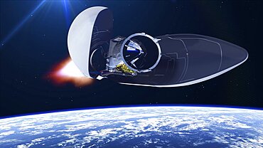
1349-716 - ADM-Aeolus satellite launching, illustration
1349-737 - Eurostar Neo communications satellite, computer artwork
1349-864 - Margaritifer Terra and Erythraeum Chaos, Mars
1349-871 - Perseverance Rover Landing on Mars, Illustration

