Recent searches
Loading...
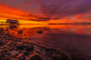
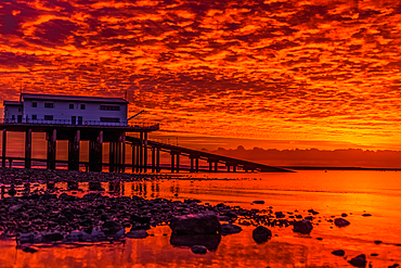
1376-55 - Storm clouds gather over the Irish Sea, worn sea defences from South Walney at sunset from the Cumbrian Coast, Cumbria, England, United Kingdom, Europe
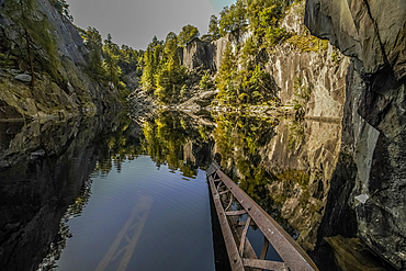
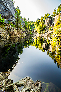
1376-46 - Reflections from Hodge Close Quarry, Coniston, Lake District National Park, UNESCO World Heritage Site, Cumbria, England, United Kingdom, Europe
1376-47 - Reflections from Hodge Close Quarry, Coniston, Lake District National Park, UNESCO World Heritage Site, Cumbria, England, United Kingdom, Europe
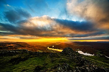
1376-45 - Dramatic sunset from Gummers How and view across Windermere towards the Furness fells, Lake District National Park, UNESCO World Heritage Site, Cumbria, England, United Kingdom, Europe
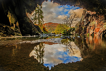
1376-44 - Sunshine and showers with autumn colours from Rydal Cave, Lake District National Park, UNESCO World Heritage Site, Cumbria, England, United Kingdom, Europe
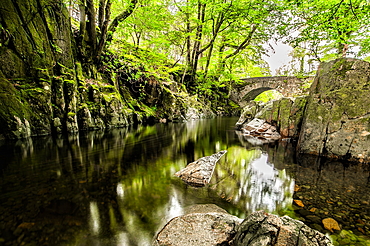
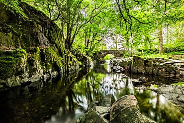
1376-40 - Overcast day in the Eskdale Valley with calm and cold waters from Trough House Bridge and the stunning River Esk, Lake District National Park, UNESCO World Heritage Site, Cumbria, England, United Kingdom, Europe
1376-39 - Overcast day in the Eskdale Valley with calm and cold waters from Trough House Bridge and the stunning River Esk, Lake District National Park, UNESCO World Heritage Site, Cumbria, England, United Kingdom, Europe
1376-36 - View towards Church Beck which runs down the Coppermines Valley into Coniston Water, Lake District National Park, UNESCO World Heritage Site, Cumbria, England, United Kingdom, Europe
1376-37 - View towards Church Beck which runs down the Coppermines Valley into Coniston Water, Lake District National Park, UNESCO World Heritage Site, Cumbria, England, United Kingdom, Europe
1376-35 - View towards Church Beck which runs down the Coppermines Valley into Coniston Water, Lake District National Park, UNESCO World Heritage Site, Cumbria, England, United Kingdom, Europe
1376-34 - View towards Church Beck which runs down the Coppermines Valley into Coniston Water, Lake District National Park, UNESCO World Heritage Site, Cumbria, England, United Kingdom, Europe
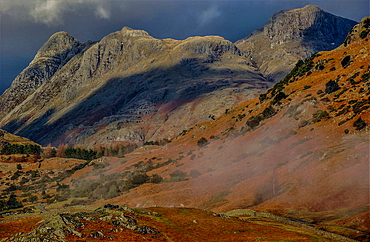
1376-25 - View towards the dramatic Langdale Pikes from Little Langdale Valley, Lake District National Park, UNESCO World Heritage Site, Cumbria, England, United Kingdom, Europe
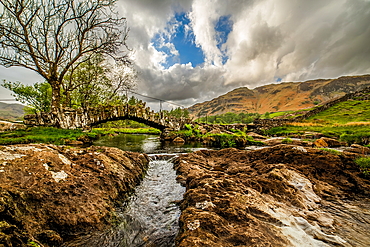
1376-23 - Slaters Bridge, Little Langdale Valley, Lake District National Park, UNESCO World Heritage Site, Cumbria, England, United Kingdom, Europe
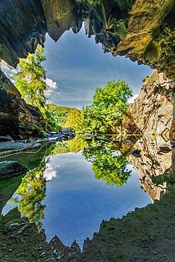
1376-22 - Reflections from Rydal Cave, Lake District National Park, UNESCO World Heritage Site, Cumbria, England, United Kingdom, Europe
1376-19 - Sunrise from Roa Island, Rampside, Cumbrian Coast, Cumbria, England, United Kingdom, Europe
1376-18 - Sunrise from Roa Island, Rampside, Cumbrian Coast, Cumbria, England, United Kingdom, Europe
1376-11 - Sunrise from Gummers How in the English Lake District, UNESCO World Heritage Site, Cumbria, England, United Kingdom, Europe
1376-3 - Sunrise view from Gummers How in the Lake District National Park, UNESCO World Heritage Site, Cumbria, England, United Kingdom, Europe
1376-1 - Reflections from Rydal Cave in the Lake District National Park, UNESCO World Heritage Site, Cumbria, England, United Kingdom, Europe
844-29431 - View of Town Hall and fountain in Passeig de s'Alamera, Santa Eularia des Riu, Ibiza, Balearic Islands, Spain, Mediterranean, Europe
1292-1941 - Town Hall Square, Modica, Ragusa, Val di Noto, UNESCO World Heritage Site, Sicily, Italy, Europe
1292-1942 - Town Hall Square, Modica, Ragusa, Val di Noto, UNESCO World Heritage Site, Sicily, Italy, Europe
1184-6404 - Aerial of the Maraya Concert Hall, Al Ula, Kingdom of Saudi Arabia, Middle East
1184-6403 - Aerial of the Maraya Concert Hall, Al Ula, Kingdom of Saudi Arabia, Middle East
1184-6392 - Maraya Concert Hall, Al Ula, Kingdom of Saudi Arabia, Middle East
1184-6393 - Maraya Concert Hall, Al Ula, Kingdom of Saudi Arabia, Middle East
1184-6400 - Maraya Concert Hall, Al Ula, Kingdom of Saudi Arabia, Middle East
1184-6402 - Maraya Concert Hall, Al Ula, Kingdom of Saudi Arabia, Middle East
1184-6391 - Maraya Concert Hall, Al Ula, Kingdom of Saudi Arabia, Middle East
1184-6397 - Maraya Concert Hall, Al Ula, Kingdom of Saudi Arabia, Middle East
1184-6394 - Maraya Concert Hall, Al Ula, Kingdom of Saudi Arabia, Middle East
1184-6406 - Aerial of the Maraya Concert Hall, Al Ula, Kingdom of Saudi Arabia, Middle East
1184-6395 - Maraya Concert Hall, Al Ula, Kingdom of Saudi Arabia, Middle East
1116-50740 - Bas Reliefs, Hypostyle Hall, Temple of Khnum; Esna, Egypt
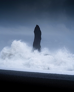
832-389498 - Sharp rock with strongly breaking waves on a volcanic beach, Vik, Iceland, Europe
1306-669 - Kelly Hall Tarn and view of Coniston Old Man reflected, Lake District National Park, UNESCO World Heritage Site, Cumbria, England, United Kingdom, Europe
1116-43316 - Farmer Planting Cover Crop Over Soybean Stubble In Kent County, Rock Hall, Maryland, United States Of America
1226-347 - Brooklyn Bridge and Manhattan skyline seen from Brooklyn Bridge Park, Brooklyn, New York City, United States of America, North America
1226-345 - Brooklyn Bridge and Lower Manhattan skyline viewed from Brooklyn side of East River, New York City, United States of America, North America
1226-312 - Waterfall, Parc de la Colline de Chateau, Nice, Alpes Maritimes, Cote d'Azur, Provence, France, Europe
1226-311 - City walls, Antibes, Alpes Maritimes, Cote d'Azur, Provence, France, Mediterranean, Europe
1116-39032 - Aerial view of a tractor in a field pulling a grain wagon loaded with freshly harvested soybeans in Kent County; Rock Hall, Maryland, United States of America
1116-39031 - Aerial view of a combine harvesting soybeans in Kent County; Rock Hall, Maryland, United States of America
1116-39030 - Aerial view of a combine harvesting soybeans in Kent County; Rock Hall, Maryland, United States of America
1226-134 - View from the Breakwater to the city skyline across the Gulf, Abu Dhabi, United Arab Emirates, Middle East
1226-92 - Restaurant overlooking the skyline across the Gulf, Abu Dhabi, United Arab Emirates, Middle East
808-1563 - Seven Sisters Waterfall, named for the seven separate streams that comprise it, Geirangerfjord, UNESCO World Heritage Site, Norway, Scandinavia, Europe
808-1564 - Seven Sisters Waterfall, named for the seven separate streams that comprise it, Geirangerfjord, UNESCO World Heritage Site, Norway, Scandinavia, Europe
808-1556 - Overlook on small waterfall in Geiranger, Norway, Scandinavia, Europe
857-89709 - Hikers setup camp on a beach along the Colorado River near the plumeting 180-foot Deer Creek Falls in the Grand Canyon outside of Fredonia, Arizona November 2011. The 21.4-mile loop starts at the Bill Hall trailhead on the North Rim and descends 2000-feet in 2.5-miles through Coconino Sandstone to the level Esplanada then descends further into the lower canyon through a break in the 400-foot-tall Redwall to access Surprise Valley. Hikers connect Thunder River and Tapeats Creek to a route along the Colorado River and climb out Deer Creek.
857-89713 - Female hiker cooks dinner on a cliff-pinched patio above camp and the Colorado River near Deer Creek Falls in the Grand Canyon outside of Fredonia, Arizona November 2011. The 21.4-mile loop starts at the Bill Hall trailhead on the North Rim and descends 2000-feet in 2.5-miles through Coconino Sandstone to the level Esplanada then descends further into the lower canyon through a break in the 400-foot-tall Redwall to access Surprise Valley. Hikers connect Thunder River and Tapeats Creek to a route along the Colorado River and climb out Deer Creek.
857-89701 - Hikers on the sandstone Esplanade of the Thunder River Trail below the North Rim of the Grand Canyon outside Fredonia, Arizona November 2011. The 21.4-mile loop descends 2000-feet in 2.5-miles through Coconino Sandstone from the Bill Hall trailhead to connect the Thunder River and Deer Creeks trails. Hikers descend into the lower canyon through a break in the 400-foot-tall Redwall to access Surprise Valley, Deer Creek, Tapeats Creek via Thunder River and even the Colorado River.
857-89712 - Male hiker filters water on a cliff-pinched patio near Deer Creek Falls in the Grand Canyon outside of Fredonia, Arizona November 2011. The 21.4-mile loop starts at the Bill Hall trailhead on the North Rim and descends 2000-feet in 2.5-miles through Coconino Sandstone to the level Esplanada then descends further into the lower canyon through a break in the 400-foot-tall Redwall to access Surprise Valley. Hikers connect Thunder River and Tapeats Creek to a route along the Colorado River and climb out Deer Creek.
857-89700 - Hikers on the sandstone Esplanade of the Thunder River Trail below the North Rim of the Grand Canyon outside Fredonia, Arizona November 2011. The 21.4-mile loop descends 2000-feet in 2.5-miles through Coconino Sandstone from the Bill Hall trailhead to connect the Thunder River and Deer Creeks trails. Hikers descend into the lower canyon through a break in the 400-foot-tall Redwall to access Surprise Valley, Deer Creek, Tapeats Creek via Thunder River and even the Colorado River.
857-89703 - Hikers past small waterfalls along Deer Creek Narrows in the Grand Canyon outside of Fredonia, Arizona November 2011. The 21.4-mile loop starts at the Bill Hall trailhead on the North Rim and descends 2000-feet in 2.5-miles through Coconino Sandstone to the level Esplanada then descends further into the lower canyon through a break in the 400-foot-tall Redwall to access Surprise Valley. Hikers connect Thunder River and Tapeats Creek to a route along the Colorado River and climb out Deer Creek.
857-89711 - Male hiker filters water on a cliff-pinched patio near Deer Creek Falls in the Grand Canyon outside of Fredonia, Arizona November 2011. The 21.4-mile loop starts at the Bill Hall trailhead on the North Rim and descends 2000-feet in 2.5-miles through Coconino Sandstone to the level Esplanada then descends further into the lower canyon through a break in the 400-foot-tall Redwall to access Surprise Valley. Hikers connect Thunder River and Tapeats Creek to a route along the Colorado River and climb out Deer Creek.
857-89702 - Hikers walk along Deer Creek Narrows in the Grand Canyon outside of Fredonia, Arizona November 2011. The 21.4-mile loop starts at the Bill Hall trailhead on the North Rim and descends 2000-feet in 2.5-miles through Coconino Sandstone to the level Esplanada then descends further into the lower canyon through a break in the 400-foot-tall Redwall to access Surprise Valley. Hikers connect Thunder River and Tapeats Creek to a route along the Colorado River and climb out Deer Creek.
857-89705 - Hikers walk along Deer Creek Narrows in the Grand Canyon outside of Fredonia, Arizona November 2011. The 21.4-mile loop starts at the Bill Hall trailhead on the North Rim and descends 2000-feet in 2.5-miles through Coconino Sandstone to the level Esplanada then descends further into the lower canyon through a break in the 400-foot-tall Redwall to access Surprise Valley. Hikers connect Thunder River and Tapeats Creek to a route along the Colorado River and climb out Deer Creek.
1178-8003 - USA, Ohio, Rock and Roll Hall of Fame and Museum across frozen lake at dusk
1178-8164 - USA, Ohio, Cleveland, Rock and Roll Hall of Fame
808-1410 - Manhattan Bridge spanning the East River, New York City, United States of America, North America
857-86011 - Hikers walk along Deer Creek Narrows in the Grand Canyon outside of Fredonia, Arizona November 2011. The 21.4-mile loop starts at the Bill Hall trailhead on the North Rim and descends 2000-feet in 2.5-miles through Coconino Sandstone to the level Esplanada then descends further into the lower canyon through a break in the 400-foot-tall Redwall to access Surprise Valley. Hikers connect Thunder River and Tapeats Creek to a route along the Colorado River and climb out Deer Creek.
857-86015 - Hikers walk along Deer Creek Narrows in the Grand Canyon outside of Fredonia, Arizona November 2011. The 21.4-mile loop starts at the Bill Hall trailhead on the North Rim and descends 2000-feet in 2.5-miles through Coconino Sandstone to the level Esplanada then descends further into the lower canyon through a break in the 400-foot-tall Redwall to access Surprise Valley. Hikers connect Thunder River and Tapeats Creek to a route along the Colorado River and climb out Deer Creek.
857-86013 - Hikers walk along Deer Creek Narrows in the Grand Canyon outside of Fredonia, Arizona November 2011. The 21.4-mile loop starts at the Bill Hall trailhead on the North Rim and descends 2000-feet in 2.5-miles through Coconino Sandstone to the level Esplanada then descends further into the lower canyon through a break in the 400-foot-tall Redwall to access Surprise Valley. Hikers connect Thunder River and Tapeats Creek to a route along the Colorado River and climb out Deer Creek.
857-86000 - Hikers on the sandstone Esplanade of the Thunder River Trail below the North Rim of the Grand Canyon outside Fredonia, Arizona November 2011. The 21.4-mile loop descends 2000-feet in 2.5-miles through Coconino Sandstone from the Bill Hall trailhead to connect the Thunder River and Deer Creeks trails. Hikers descend into the lower canyon through a break in the 400-foot-tall Redwall to access Surprise Valley, Deer Creek, Tapeats Creek via Thunder River and even the Colorado River.
857-86007 - Hikers cook dinner along Deer Creek Narrows in the Grand Canyon outside of Fredonia, Arizona November 2011. The 21.4-mile loop starts at the Bill Hall trailhead on the North Rim and descends 2000-feet in 2.5-miles through Coconino Sandstone to the level Esplanada then descends further into the lower canyon through a break in the 400-foot-tall Redwall to access Surprise Valley. Hikers connect Thunder River and Tapeats Creek to a route along the Colorado River and climb out Deer Creek.
857-86003 - Hikers descend into Surprise Valley to access the lower canyon through a break in the 400-foot-tall Redwall on the Thunder River Trail in the Grand Canyon outside of Fredonia, Arizona November 2011. The 21.4-mile loop starts at the Bill Hall trailhead on the North Rim and descends 2000-feet in 2.5-miles through Coconino Sandstone to the level Esplanada then descends further into the lower canyon to access Thunder River, Tapeats Creek and Deer Creek.
832-221564 - Hands of fans at the sold-out concert of the US-metal-rock band W.A.S.P. live in Schueuer, Lucerne, Switzerland
808-1132 - Beaulieu-sur-Mer, Alpes-Maritimes, Provence, Cote d'Azur, French Riviera, France, Europe
832-200258 - Entrance, Hard Rock Cafe, Surfers Paradise, Gold Coast, New South Wales, Australia
832-162006 - The American punk rock singer and musician Iggy Pop live at the Blue Balls Festival in the Luzernersaal hall of the KKL venue in Lucerne, Switzerland
832-127098 - Cave complex town of Uplistsikhe, since 10th Century BC, hall of Tamara, Georgia, Eurasia
1113-75534 - View over illuminated roof deck of restaurant Hotel Stein to old town with Salzburg Cathedral, St. Peter's Archabbey, Franciscan Church, City Hall Tower and Hohensalzburg Fortress, largest, fully-preserved fortress in central Europe, in the evening, Salzburg, Salzburg, Austria, Since 1996 historic centre of the city part of the UNESCO World Heritage Site
1113-65804 - Cafe in the cupola hall of Kunsthistorisches Museum Art History Museum, Vienna, Austria
1113-12977 - Concert in volcanic cave, Cueva de los Verdes, concert hall, architect Cesar Manrique, Lanzarote, Canary Islands, Spain, Europe
808-697 - The Exquisite Jade Rock, Yu Yuan (Yuyuan) Gardens, Shanghai, China, Asia
808-695 - Rockery, Yu Yuan (Yuyuan) Gardens, Shanghai, China, Asia
808-699 - Rockery, Yu Yuan (Yuyuan) Gardens, Shanghai, China, Asia
808-694 - Yanshan Hall, Yu Yuan (Yuyuan) Gardens, Shanghai, China, Asia
808-484 - Burj Khalifa, the tallest man made structure in the world at 828 metres, Downtown Dubai, Dubai, United Arab Emirates, Middle East
829-943 - View of the walls and ceiling of Van Zyl's Hall in the Cango Caves near Oudtshoorn in South Africa's Western Cape Province.
817-53010 - Rock and Roll Hall of Fame and Museum, Cleveland, USA
817-52997 - Rock and Roll Hall of Fame and Museum, Cleveland, USA
829-942 - View of Botha's Hall in the Cango Caves near Oudtshoorn in South Africa's Western Cape Province. To the left of centre is the Double Petrified column, in the centre is the Leaning Tower of Pisa and behind that is the Petrified Weeping Willow. On the right are the Frozen Victoria Falls.
808-168 - Belvedere Castle, Central Park, New York City, New York, United States of America, North America
808-167 - Belvedere Castle, Central Park, New York City, New York, United States of America, North America
808-34 - Turtle Pond, Central Park, Manhattan, New York City, New York, United States of America, North America
808-113 - Brooklyn Bridge and Manhattan Bridge spanning the East River, from Empire-Fulton Ferry State Park, Brooklyn, New York City, New York, United States of America, North America
462-2468 - Praia da Marinha, Algarve, Portugal, Europe
777-1879 - Rock and Roll Hall of Fame, Cleveland, Ohio, United States of America, North America
777-1878 - Rock and Roll Hall of Fame, Cleveland, Ohio, United States of America, North America
777-1877 - Rock and Roll Hall of Fame, Cleveland, Ohio, United States of America, North America
252-11221 - The Radhus (City Hall), an angular construction of concrete, glass and carved lava, Lake Tjorn, Central area, Reykjavik, Iceland, Polar Regions
252-11220 - The Radhus (City Hall), an angular construction of concrete, glass and carved lava, Lake Tjorn, Central area, Reykjavik, Iceland, Polar Regions
462-1885 - Granite outcrops in Central Park, Manhattan, New York City, New York, United States of America, North America
462-1879 - Tourists looking at the Empire State Building and Manhattan skyline from the Top of the Rock on the Rockefeller Center, New York City, New York, United States of America, North America
462-1878 - Young tourist looking at the Empire State Building and Manhattan skyline from the Top of the Rock on the Rockefeller Center, New York City, New York, United States of America, North America
120-480 - Great Hypostyle Hall, Karnak Temple, Luxor, Egypt

