Recent searches
Loading...
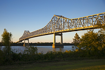
1161-8728 - State route 70 bridge over Mississippi River at crossing point near Union & Burnside. Vacherie, Louisiana, USA
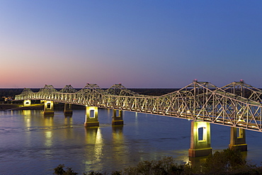
1161-8743 - Nighttime scene of illuminated iron cantilever Natchez - Vidalia Bridge road bridge across the Mississippi River in Louisiana, USA
857-91583 - Professional italian climber Gabriele Moroni climbing an 8c route in Margalef, Spain.
857-91586 - Professional italian climber Gabriele Moroni climbing an 8c route in Margalef, Spain.
29-5391 - Landwasser Viaduct, Filisur, Albula railway on the Glacier Express route, UNESCO World Heritage Site, Switzerland, Europe
975-298 - Mountainous landscape along the south coast of the island, Icelandic road trip along route 1, the Icelandic ring road, Iceland, Polar Regions
975-296 - Mountainous landscape along the south coast of the island, Icelandic road trip along route 1, the Icelandic ring road, Iceland, Polar Regions
975-295 - Mountainous landscape along the south coast of the island, Icelandic road trip along route 1, the Icelandic ring road, Iceland, Polar Regions
975-297 - Mountainous landscape along the south coast of the island, Icelandic road trip along route 1, the Icelandic ring road, Iceland, Polar Regions
1104-494 - Ancient Appian Way, ancient Roman road, Rome, Lazio, Italy, Europe
1104-495 - Ancient Appian Way, ancient Roman road, Rome, Lazio, Italy, Europe
747-1716 - Detachment of Mounted Guard in the Mall en route to Trooping of the Colour, London, England, United Kingdom, Europe
747-1714 - Guards Military Band marching past Buckingham Palace en route to the Trooping of the Colour, London, England, United Kingdom, Europe
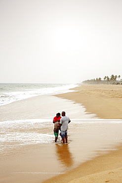
1113-101264 - Family standing at beach, Ouidah, Route des Peches, Atlantique Department, Benin
1113-101263 - School class at beach, Ouidah, Route des Peches, Atlantique Department, Benin
663-822 - Steam train on route between Llanberis and the summit of Mount Snowdon in Snowdonia National Park, Gwynedd, Wales, United Kingdom, Europe
663-823 - Steam train on route between Llanberis and the summit of Mount Snowdon in Snowdonia National Park, Gwynedd, Wales, United Kingdom, Europe
663-821 - Steam train on route between Llanberis and the summit of Mount Snowdon in Snowdonia National Park, Gwynedd, Wales, United Kingdom, Europe
857-90702 - Hurricane route marker in Florida, USA, United States of America
857-90703 - Hurricane route marker in Florida, USA, United States of America
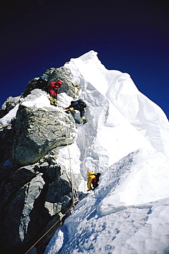
857-90580 - Mountaineers navigating through the Hillary Step on Mount Everest. The Hillary Step is a nearly vertical part (height around 40 ft) of upper Mount Everest. It lies almost at the top of the mountain, halfway from the "south summit" to the summit top, and is the last real challenge before the summit. It is reached by climbing the South East route. It was named after Sir Edmund Hillary, who was the first person, along with Tenzing Norgay, who passed it to reach the summit, Nepal
857-90084 - A highway converging at a silhouette of some mountains, California, USA, United States
801-1577 - Teabo Convent of Saints Peter and Paul, built in late 17th century, Route of the Convents, Yucatan, Mexico, North America
801-1575 - Virgin of Assumption Convent, completed 1751, Tecoh, Route of the Convents, Yucatan, Mexico, North America
801-1576 - Church and Convent of San Miguel Arcangel, established in 1549, Mani, Route of the Convents, Yucatan, Mexico, North America
857-89709 - Hikers setup camp on a beach along the Colorado River near the plumeting 180-foot Deer Creek Falls in the Grand Canyon outside of Fredonia, Arizona November 2011. The 21.4-mile loop starts at the Bill Hall trailhead on the North Rim and descends 2000-feet in 2.5-miles through Coconino Sandstone to the level Esplanada then descends further into the lower canyon through a break in the 400-foot-tall Redwall to access Surprise Valley. Hikers connect Thunder River and Tapeats Creek to a route along the Colorado River and climb out Deer Creek.
857-89713 - Female hiker cooks dinner on a cliff-pinched patio above camp and the Colorado River near Deer Creek Falls in the Grand Canyon outside of Fredonia, Arizona November 2011. The 21.4-mile loop starts at the Bill Hall trailhead on the North Rim and descends 2000-feet in 2.5-miles through Coconino Sandstone to the level Esplanada then descends further into the lower canyon through a break in the 400-foot-tall Redwall to access Surprise Valley. Hikers connect Thunder River and Tapeats Creek to a route along the Colorado River and climb out Deer Creek.
857-89710 - Hikers cook dinner on a cliff-pinched patio above camp and the Colorado River near Deer Creek Falls in the Grand Canyon outside of Fredonia, Arizona November 2011. The 21.4-mile loop starts at the Bill Hall trailhead on the North Rim and descends 2000-feet in 2.5-miles through Coconino Sandstone to the level Esplanada then descends further into the lower canyon through a break in the 400-foot-tall Redwall to access Surprise Valley. Hikers connect Thunder River and Tapeats Creek to a route along the Colorado River and climb out Deer Creek.
857-89708 - Hikers swim in the pool below 180-foot Deer Creek Falls in the Grand Canyon outside of Fredonia, Arizona November 2011. The 21.4-mile loop starts at the Bill Hall trailhead on the North Rim and descends 2000-feet in 2.5-miles through Coconino Sandstone to the level Esplanada then descends further into the lower canyon through a break in the 400-foot-tall Redwall to access Surprise Valley. Hikers connect Thunder River and Tapeats Creek to a route along the Colorado River and climb out Deer Creek.
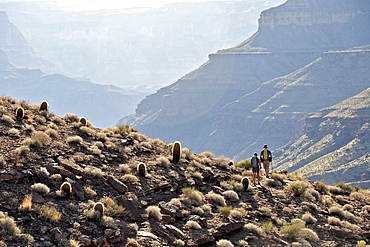
857-89717 - Hikers follow a route along the Colorado River that connect Tapeats Creek and Thunder River to Deer Creek in the Grand Canyon outside of Fredonia, Arizona November 2011. The 21.4-mile loop starts at the Bill Hall trailhead on the North Rim and descends 2000-feet in 2.5-miles through Coconino Sandstone to the level Esplanada then descends further into the lower canyon through a break in the 400-foot-tall Redwall to access Surprise Valley. Hikers connect Thunder River and Tapeats Creek to a route along the Colorado River and climb out Deer Creek.
857-89712 - Male hiker filters water on a cliff-pinched patio near Deer Creek Falls in the Grand Canyon outside of Fredonia, Arizona November 2011. The 21.4-mile loop starts at the Bill Hall trailhead on the North Rim and descends 2000-feet in 2.5-miles through Coconino Sandstone to the level Esplanada then descends further into the lower canyon through a break in the 400-foot-tall Redwall to access Surprise Valley. Hikers connect Thunder River and Tapeats Creek to a route along the Colorado River and climb out Deer Creek.
857-90040 - Climber talking on a phone while hiking to a nearby climbing route, north Iceland.
857-89703 - Hikers past small waterfalls along Deer Creek Narrows in the Grand Canyon outside of Fredonia, Arizona November 2011. The 21.4-mile loop starts at the Bill Hall trailhead on the North Rim and descends 2000-feet in 2.5-miles through Coconino Sandstone to the level Esplanada then descends further into the lower canyon through a break in the 400-foot-tall Redwall to access Surprise Valley. Hikers connect Thunder River and Tapeats Creek to a route along the Colorado River and climb out Deer Creek.
857-89711 - Male hiker filters water on a cliff-pinched patio near Deer Creek Falls in the Grand Canyon outside of Fredonia, Arizona November 2011. The 21.4-mile loop starts at the Bill Hall trailhead on the North Rim and descends 2000-feet in 2.5-miles through Coconino Sandstone to the level Esplanada then descends further into the lower canyon through a break in the 400-foot-tall Redwall to access Surprise Valley. Hikers connect Thunder River and Tapeats Creek to a route along the Colorado River and climb out Deer Creek.
857-89702 - Hikers walk along Deer Creek Narrows in the Grand Canyon outside of Fredonia, Arizona November 2011. The 21.4-mile loop starts at the Bill Hall trailhead on the North Rim and descends 2000-feet in 2.5-miles through Coconino Sandstone to the level Esplanada then descends further into the lower canyon through a break in the 400-foot-tall Redwall to access Surprise Valley. Hikers connect Thunder River and Tapeats Creek to a route along the Colorado River and climb out Deer Creek.
857-89705 - Hikers walk along Deer Creek Narrows in the Grand Canyon outside of Fredonia, Arizona November 2011. The 21.4-mile loop starts at the Bill Hall trailhead on the North Rim and descends 2000-feet in 2.5-miles through Coconino Sandstone to the level Esplanada then descends further into the lower canyon through a break in the 400-foot-tall Redwall to access Surprise Valley. Hikers connect Thunder River and Tapeats Creek to a route along the Colorado River and climb out Deer Creek.
83-12909 - Typical flowering shade tree Arabica coffee plantation in highlands en route to Jinotega, Matagalpa, Nicaragua, Central America
857-89356 - A man climbing 'La tentación de seguir,' a hard route full of monofinger in Sierra de Guara
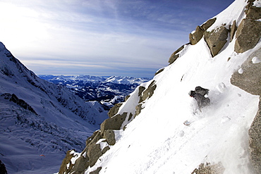
802-293 - A snowboarder descends an extreme off piste route down Mont Blanc, Chamonix, Haute Savoie, France, Europe
1178-16582 - Storm clouds over Route 145 outside Telluride Colorado USA
857-87726 - Belgium climber Siebe Vanheeat grabbing a hold as he is climbing a psicobloc route at the 2014 The North Face Kalymnos Climbing Festival; Greece.
857-87801 - A woman wearing a red tank top and striped pants climbs The Rapture (5.8) on Lower Gibraltar Rock in Santa Barbara, California on. The Rapture is a very nice and unbelievably well protected route on the left arête of Lower Gibraltar Rock.
857-87800 - A woman wearing a red tank top and striped pants climbs The Rapture (5.8) on Lower Gibraltar Rock in Santa Barbara, California. The Rapture is a very nice and unbelievably well protected route on the left arête of Lower Gibraltar Rock.
857-87802 - A woman wearing a red tank top crimps down on a small hold while climbing The Rapture (5.8) on Lower Gibraltar Rock in Santa Barbara, California. The Rapture is a very nice and unbelievably well protected route on the left arête of Lower Gibraltar Rock.
857-87803 - A woman wearing a red tank top and striped pants clips a quick draw while climbing The Rapture (5.8) on Lower Gibraltar Rock in Santa Barbara, California. The Rapture is a very nice and unbelievably well protected route on the left arête of Lower Gibraltar Rock.
857-87799 - A woman wearing a tank top and striped pants reaches for chalk while climbing The Rapture (5.8) on Lower Gibraltar Rock in Santa Barbara, California. The Rapture is a very nice and unbelievably well protected route on the left arête of Lower Gibraltar Rock.
857-87804 - A woman wearing a red tank top and striped pants climbs The Rapture (5.8) on Lower Gibraltar Rock in Santa Barbara, California. The Rapture is a very nice and unbelievably well protected route on the left arête of Lower Gibraltar Rock.
911-10724 - Mastiles Lane, an ancient green lane in the Yorkshire Dales, UK.
1178-9739 - Evacuation route sign, Bandon Beach, Oregon
857-86996 - Loick Peyron onboard the Maxi Trimaran Solo Banque Populaire VII in preparation for "La Route du Rhum".
857-87006 - Loick Peyron onboard the Maxi Trimaran Solo Banque Populaire VII in preparation for "La Route du Rhum".
857-86997 - Loick Peyron onboard the Maxi Trimaran Solo Banque Populaire VII in preparation for "La Route du Rhum".
1178-2176 - Side angle view of tractor trailer on highway
911-10197 - Solar panels on a visitor centre in the Vallon de la Lex Blanche below Mont Blanc, Italy, on the Tour de Mont Blanc long distance footpath.
911-10201 - Looking down on Courmayeur in the Italian Alps below Mont Blanc.
911-10128 - Looking towards Mont Blanc and the Glacier du Miage from above Val Veny, Italy.
911-10129 - Walkers on the Tour de Mont Blanc ascending out of the Vallon de la Lex Blanche in Italy, below Mont Blanc.
1178-654 - View of desert along Route 66, USA, California, Mojave Desert
797-11500 - Nepal, Himalayas, Pokhara, Girl sat in a shop doorway on a trekking route with western snacks for sale.
857-86406 - Mountaineers climbing up the Khumbu Icefall on the route up Everest, Everest Base Camp, Khumbu, Nepal
857-86404 - Mountaineers climbing up the Khumbu Icefall on the route up Everest, Everest Base Camp, Khumbu, Nepal
857-86399 - Mountaineers climbing up the Khumbu Icefall on the route up Everest, Everest Base Camp, Khumbu, Nepal
857-86400 - Mountaineers climbing up the Khumbu Icefall on the route up Everest, Everest Base Camp, Khumbu, Nepal
857-86402 - Mountaineers climbing up the Khumbu Icefall on the route up Everest, Everest Base Camp, Khumbu, Nepal
857-86405 - Mountaineers climbing up the Khumbu Icefall on the route up Everest, Everest Base Camp, Khumbu, Nepal
1179-50 - A tourist contemplating the landscape of Lake Como from a path in the High Route of Monti Lariani, with the village of Bellagio, Lombardy, Italy, Europe
83-12834 - View southwest to Mount Cardon and Pico de la Zarza beyond en route from La Pared to Pajara, Cardon, Fuerteventura, Canary Islands, Spain, Europe
857-86011 - Hikers walk along Deer Creek Narrows in the Grand Canyon outside of Fredonia, Arizona November 2011. The 21.4-mile loop starts at the Bill Hall trailhead on the North Rim and descends 2000-feet in 2.5-miles through Coconino Sandstone to the level Esplanada then descends further into the lower canyon through a break in the 400-foot-tall Redwall to access Surprise Valley. Hikers connect Thunder River and Tapeats Creek to a route along the Colorado River and climb out Deer Creek.
857-86023 - Male hiker filters water on a cliff-pinched patio near Deer Creek Falls in the Grand Canyon outside of Fredonia, Arizona November 2011. The 21.4-mile loop starts at the Bill Hall trailhead on the North Rim and descends 2000-feet in 2.5-miles through Coconino Sandstone to the level Esplanada then descends further into the lower canyon through a break in the 400-foot-tall Redwall to access Surprise Valley. Hikers connect Thunder River and Tapeats Creek to a route along the Colorado River and climb out Deer Creek.
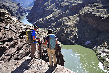
857-86016 - Hikers overlook the Colorado River as they exit the Deer Creek Narrows in the Grand Canyon outside of Fredonia, Arizona November 2011. The 21.4-mile loop starts at the Bill Hall trailhead on the North Rim and descends 2000-feet in 2.5-miles through Coconino Sandstone to the level Esplanada then descends further into the lower canyon through a break in the 400-foot-tall Redwall to access Surprise Valley. Hikers connect Thunder River and Tapeats Creek to a route along the Colorado River and climb out Deer Creek.
857-86021 - Hikers setup camp on a beach along the Colorado River near the plumeting 180-foot Deer Creek Falls in the Grand Canyon outside of Fredonia, Arizona November 2011. The 21.4-mile loop starts at the Bill Hall trailhead on the North Rim and descends 2000-feet in 2.5-miles through Coconino Sandstone to the level Esplanada then descends further into the lower canyon through a break in the 400-foot-tall Redwall to access Surprise Valley. Hikers connect Thunder River and Tapeats Creek to a route along the Colorado River and climb out Deer Creek.
857-86015 - Hikers walk along Deer Creek Narrows in the Grand Canyon outside of Fredonia, Arizona November 2011. The 21.4-mile loop starts at the Bill Hall trailhead on the North Rim and descends 2000-feet in 2.5-miles through Coconino Sandstone to the level Esplanada then descends further into the lower canyon through a break in the 400-foot-tall Redwall to access Surprise Valley. Hikers connect Thunder River and Tapeats Creek to a route along the Colorado River and climb out Deer Creek.
857-86013 - Hikers walk along Deer Creek Narrows in the Grand Canyon outside of Fredonia, Arizona November 2011. The 21.4-mile loop starts at the Bill Hall trailhead on the North Rim and descends 2000-feet in 2.5-miles through Coconino Sandstone to the level Esplanada then descends further into the lower canyon through a break in the 400-foot-tall Redwall to access Surprise Valley. Hikers connect Thunder River and Tapeats Creek to a route along the Colorado River and climb out Deer Creek.
857-86025 - Hikers follow a route along the Colorado River that connect Tapeats Creek and Thunder River to Deer Creek in the Grand Canyon outside of Fredonia, Arizona November 2011. The 21.4-mile loop starts at the Bill Hall trailhead on the North Rim and descends 2000-feet in 2.5-miles through Coconino Sandstone to the level Esplanada then descends further into the lower canyon through a break in the 400-foot-tall Redwall to access Surprise Valley. Hikers connect Thunder River and Tapeats Creek to a route along the Colorado River and climb out Deer Creek.
857-86007 - Hikers cook dinner along Deer Creek Narrows in the Grand Canyon outside of Fredonia, Arizona November 2011. The 21.4-mile loop starts at the Bill Hall trailhead on the North Rim and descends 2000-feet in 2.5-miles through Coconino Sandstone to the level Esplanada then descends further into the lower canyon through a break in the 400-foot-tall Redwall to access Surprise Valley. Hikers connect Thunder River and Tapeats Creek to a route along the Colorado River and climb out Deer Creek.
857-86027 - Hikers climb out of Surprise Valley to the North Rim of the Grand Canyon outside of Fredonia, Arizona November 2011. The 21.4-mile loop starts at the Bill Hall trailhead on the North Rim and descends 2000-feet in 2.5-miles through Coconino Sandstone to the level Esplanada then descends further into the lower canyon through a break in the 400-foot-tall Redwall to access Surprise Valley. Hikers connect Thunder River and Tapeats Creek to a route along the Colorado River and climb out Deer Creek.
857-86022 - Hikers setup camp on a beach along the Colorado River near the plumeting 180-foot Deer Creek Falls in the Grand Canyon outside of Fredonia, Arizona November 2011. The 21.4-mile loop starts at the Bill Hall trailhead on the North Rim and descends 2000-feet in 2.5-miles through Coconino Sandstone to the level Esplanada then descends further into the lower canyon through a break in the 400-foot-tall Redwall to access Surprise Valley. Hikers connect Thunder River and Tapeats Creek to a route along the Colorado River and climb out Deer Creek.
1161-8429 - Black grapes on a vine along Ruta del Vino wine route in the Rioja region of Spain, Europe
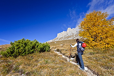
832-371076 - Ascent of Piz Boe Mountain on the Piazzetta Climbing Route, Dolomites, Alto Adige, Italy, Europe
832-375345 - View over the blue cupolas of Mir-i Arab Madrasah and roofs of the city from minaret Kalon Bukhara Uzbekistan
