Recent searches
Loading...
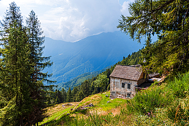
1372-154 - Rural alpine life with a cabin above a vast mountain valley, Italian Alps, Italy, Europe
1366-1180 - Europe, Netherlands, South Holland, Lisse. April 26, 2022. Sculpture Levenboom, Tree of Life, by Jo Naus and Marjan Tabak.
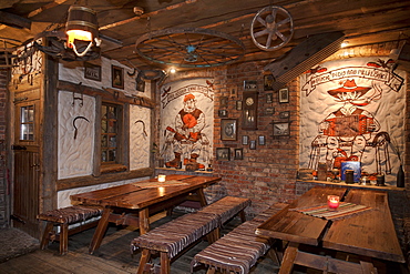
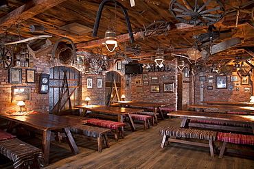
1174-11181 - A hotel bar with old fashioned retro styled rooms, and rustic objects.
1350-5516 - Fog at dawn. Liendo Valley. Cantabria, Spain, Europe.
1350-4716 - Farmer and oxen ploughing paddy fields, near Mandalay, Myanmar, (Burma)
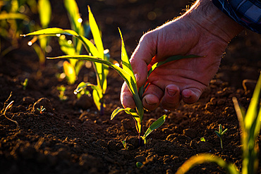
746-90120 - Farmer touching his crop with his hand, Italy, Europe
746-90121 - A farmer sprinkles his plants with soil, Italy, Europe
1350-4784 - Elderly lady collecting straw in a field, near Minnanthu village, Bagan, Myanmar, (Burma)
1113-105544 - A traditional wooden hut with a grass roof, Tällberg, Dalarna, Sweden
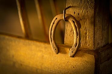
1113-105621 - Horseshoes in an old stable, Upper Bavaria, Bavaria, Germany; Europe
1113-105625 - Old barns in Kochelmoos in the morning mist in November, Kochel am See, Upper Bavaria, Bavaria, Germany, Europe
1113-105542 - Large, yellow Swedish house in deep winter, Dorotea, Västerbottens Län, Sweden
1113-105618 - Cow on an alpine meadow, Bavaria, Germany, Europe
1113-106137 - The huts of Vorsaas in the Loetschental, Valais, Switzerland.
1113-105543 - Small holiday home in the winter sun in the forest, Slagnäs, Lapland, Sweden
1350-3425 - Flock of sheep and shepherd in a cereal land. Tierra Estella county. Navarre, Spain, Europe
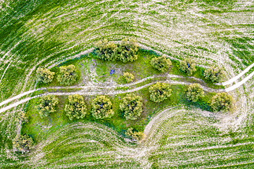
1350-3480 - Agricultural aerial landscape, Tierra Estella, Navarre, Spain, Europe
1350-3503 - Farmland with watering. Aerial view. Navarre, Spain, Europe
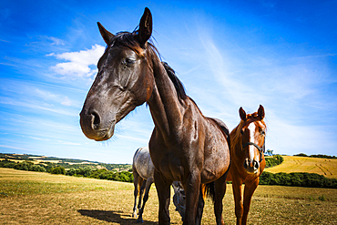
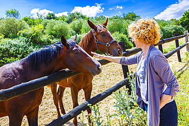
1350-3423 - Horses on a farm. Dicastillo. Tierra Estella, Navarre. Spain, Europe
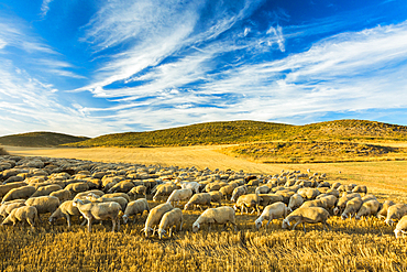
1350-3424 - Flock of sheep in a cereal land. Tierra Estella county. Navarre, Spain, Europe
1350-3426 - Cereal land. Tierra Estella county, Navarre, Spain, Europe
1350-3442 - Cyclist and sunflowers crop, Sorlada village and San Gregorio monastry. Tierra Estella. Navarre, Spain, Europe
1350-3490 - Farmland with vineyard and road. Iguzquiza, Navarre, Spain, Europe
1350-3479 - Agricultural aerial landscape, Tierra Estella, Navarre, Spain, Europe
1350-3422 - Horses on a farm. Dicastillo. Estella comarca, Navarre. Spain, Europe
1350-3478 - Agricultural aerial landscape, Tierra Estella, Navarre, Spain, Europe
1350-3439 - Sunset. Tierra Estella. Navarre, Spain, Europe
1174-10406 - A hotel with retro styled rooms, and rustic objects.
1174-10407 - A hotel with modern and retro styled rooms.
1174-10408 - A hotel with modern and retro styled rooms.
1350-2094 - Tahitian man with her daughter carrying baguettes while riding a bicycle on the island of Tahiti, French Polynesia, Tahiti Nui, Society Islands, French Polynesia, South Pacific.
1113-103705 - Farmer with donkey chart, Muselievo, Bulgaria, Europe
1113-104205 - Mother carrying toddler girl in field
1113-103546 - Traditional farmhouse with flower decorations, Kals, Glockner range, Hohe Tauern, East Tyrol, Tyrol, Austria
1113-103947 - Young woman relaxing in hammock, legs hanging over side
1113-104119 - Woman picking boquet of marguerites, Provence, France
1113-103545 - Traditional farmhouse with flower decorations, Kals, Glockner range, Hohe Tauern, East Tyrol, Tyrol, Austria
1174-9098 - A hotel with old fashioned retro styled rooms, and rustic objects, staine glass, exposed brick and old photographs, Estonia
1174-9095 - A hotel with old fashioned retro styled rooms, and rustic objects, Estonia
1174-9099 - A hotel with old fashioned retro styled rooms, and rustic objects, corridor with patterned carpet, room doors, Estonia
1174-9091 - A hotel with old fashioned retro styled rooms, and rustic objects, bar table and stools, Estonia
1174-9092 - A hotel with old fashioned retro styled rooms, and rustic objects, bench and tables, Estonia
1174-9096 - A hotel with old fashioned retro styled rooms, and rustic objects, open lit fire with large stonework chimney and wooden floor, Estonia
1174-9093 - A hotel with old fashioned retro styled rooms and rustic objects, door to the sauna, Estonia
1174-9100 - A hotel with old fashioned retro styled rooms, and rustic objects, sofa and chairs and television, Estonia
1174-9097 - A hotel with old fashioned retro styled rooms, and rustic objects, cafe with tables and benches, Estonia
1174-9090 - A hotel with old fashioned retro styled rooms, and rustic objects, bar with horse harness, Estonia
1174-9094 - A hotel with old fashioned retro styled rooms, and rustic objects, exposed stone wall and table and chairs, Estonia
1174-9102 - Bar with exposed brickwork and cart wheel, basket and old photographs at night, Estonia
1174-9101 - A hotel with old fashioned retro styled rooms, bar with two bar stools and striped wallpaper, Estonia
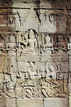
252-4826 - Stone bas reliefs depicting scenes of rural life and historical events on the walls of Angkor Wat, UNESCO World Heritage Site, Siem Reap, Cambodia, Indochina, Southeast Asia, Asia
252-4834 - Stone bas-reliefs depicting scenes of rural life and historical events, in the Bayon Temple complex, Angkor, Siem Reap, Cambodia
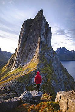
1178-28770 - Norway, Senja, Man standing in front of Segla mountain at sunrise
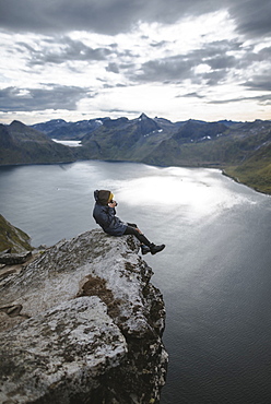
1178-28766 - Norway, Senja, Man taking photo sitting on edge of steep cliff on top of mountain Segla
1116-46132 - Infant Boy Playing With Little Pigs On A Farm In Northeast Iowa In Summertime, Iowa, United States Of America
1116-46300 - Infant Boy Playing With Young Pigs On A Farm In Northeast Iowa, Iowa, United States Of America
1116-42729 - Agriculture - Young farm girl and boy wearing cowboy hats and rubber boots swing on a metal gate, hanging by their hands and legs and laughing / Northwest Missouri, USA.
1116-42727 - Agriculture - Silhouette on the side of a barn in late afternoon light of a farm boy operating a hand pump water well while his young sister washes her hands / Northwest Missouri, USA.
1116-42726 - Agriculture - Silhouette on the side of a barn in late afternoon light of a farm woman, and mother, tossing her young child into the air while their dog watches / Northwest Missouri, USA.
1116-42728 - Agriculture - A young farm girl wearing a cowboy hat and rubber boots swings on a metal gate, hanging by her hands and legs and laughing / Northwest Missouri, USA.
1116-42643 - Girl Sleeping In Hammock With Headphones, Ontario, Canada
832-383527 - Welcome sign on a highway, ""Welcome to Utah, Life elevated"", Utah, USA, North America
1116-41938 - Middle aged couple travelling by motorboat in the lake of the woods at sunset, kenora ontario canada
1116-41940 - A deck on a lake with a decorative flower pot in the shape of a bicycle, kenora ontario canada
832-380294 - Local children ride bicycles, way to school, Angkor Archaeological Park, Siem Reap Province, Cambodia, Asia
832-380022 - Woman with toddler sitting in front of mud hut on the ground, Hamer tribe, Turmi, region of southern nations, Ethiopia, Africa
832-380379 - View of hilly landscape with farmhouse, near St Märgen, Black Forest, Baden-Württemberg, Germany, Europe
1116-40423 - Large Tree On The Beach Of Lake Wakatipu, New Zealand
857-94720 - Nimoa Island - here the island mission will impress. The five-sided church features murals of island life and all mission buildings are surrounded by well maintained paths and gardens filled with flowering plants. Edged by jungle-covered mountains, postcard beaches and crystal clear waters - an island paradise indeed! The Louisiade Archipelago is a string of ten larger volcanic islands frequently fringed by coral reefs, and 90 smaller coral islands located 200 km southeast of New Guinea, stretching over more than 160 km and spread over an ocean area of 26,000 km? between the Solomon Sea to the north and the Coral Sea to the south. The aggregate land area of the islands is about 1,790 km? (690 square miles), with Vanatinai (formerly Sudest or Tagula as named by European claimants on Western maps) being the largest. Sideia Island and Basilaki Island lie closest to New Guinea, while Misima, Vanatinai, and Rossel islands lie further east. The archipelago is divided into the Local Level Government (LLG) areas Louisiade Rural (western part, with Misima), and Yaleyamba (western part, with Rossell and Tagula islands. The LLG areas are part of Samarai-Murua District district of Milne Bay. The seat of the Louisiade Rural LLG is Bwagaoia on Misima Island, the population center of the archipelago.
857-94718 - Nimoa Island - here the island mission will impress. The five-sided church features murals of island life and all mission buildings are surrounded by well maintained paths and gardens filled with flowering plants. Edged by jungle-covered mountains, postcard beaches and crystal clear waters - an island paradise indeed! The Louisiade Archipelago is a string of ten larger volcanic islands frequently fringed by coral reefs, and 90 smaller coral islands located 200 km southeast of New Guinea, stretching over more than 160 km and spread over an ocean area of 26,000 km? between the Solomon Sea to the north and the Coral Sea to the south. The aggregate land area of the islands is about 1,790 km? (690 square miles), with Vanatinai (formerly Sudest or Tagula as named by European claimants on Western maps) being the largest. Sideia Island and Basilaki Island lie closest to New Guinea, while Misima, Vanatinai, and Rossel islands lie further east. The archipelago is divided into the Local Level Government (LLG) areas Louisiade Rural (western part, with Misima), and Yaleyamba (western part, with Rossell and Tagula islands. The LLG areas are part of Samarai-Murua District district of Milne Bay. The seat of the Louisiade Rural LLG is Bwagaoia on Misima Island, the population center of the archipelago.
857-94719 - Nimoa Island - here the island mission will impress. The five-sided church features murals of island life and all mission buildings are surrounded by well maintained paths and gardens filled with flowering plants. Edged by jungle-covered mountains, postcard beaches and crystal clear waters - an island paradise indeed! The Louisiade Archipelago is a string of ten larger volcanic islands frequently fringed by coral reefs, and 90 smaller coral islands located 200 km southeast of New Guinea, stretching over more than 160 km and spread over an ocean area of 26,000 km? between the Solomon Sea to the north and the Coral Sea to the south. The aggregate land area of the islands is about 1,790 km? (690 square miles), with Vanatinai (formerly Sudest or Tagula as named by European claimants on Western maps) being the largest. Sideia Island and Basilaki Island lie closest to New Guinea, while Misima, Vanatinai, and Rossel islands lie further east. The archipelago is divided into the Local Level Government (LLG) areas Louisiade Rural (western part, with Misima), and Yaleyamba (western part, with Rossell and Tagula islands. The LLG areas are part of Samarai-Murua District district of Milne Bay. The seat of the Louisiade Rural LLG is Bwagaoia on Misima Island, the population center of the archipelago.
1178-25113 - Two horses pulling cart, USA, Colorado
1178-25108 - Two horses in front of barn, USA, Colorado
1178-24517 - New Castle, Scenic view of winter landscape, New Castle, Colorado
869-5420 - white solid stone mill windmill Pueblo Los Llanos de la Concepcion with six wings without fabric cover seen against blue cloudless sky outdoors calendar motif Fuerteventura Island Province Las Palmas Canary Islands Spain Europe
869-5426 - vine Malvasia grapes harvested in three yellow boxes in vineyard with plants growing on volcanic soil outdoors La Geria Isla Lanzarote Province Las Palmas Canary Islands Spain Europe (Vitis vinifera)
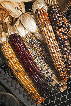
1174-1431 - A variety of Indian corn cobs, with different natural colours and patterns. Maize, Accord, New York, USA
1174-1438 - A woman holding a bowl of fresh produce, purple sprouting broccoli. Flowering plants. Crysanthemums, Woodstock, New York, USA
1174-1435 - Organic Farmer at Work. A woman working ona farm stand, witha display of fresh produce. Green plants and bowls of apples, Accord, New York, USA
1174-1434 - Organic Farmer at Work. A woman carrying a box of large oranges, Accord, New York, USA
1174-1440 - A field of pumpkins growing, Woodstock, New York, USA
1174-1436 - Organic Farmer at Work. A young man arranging a row of punnets of tomatoes, Accord, New York, USA
832-281263 - House at the river and sailing boat, Spanish tiles, azulejos, Altea, Costa Blanca, Spain
832-281262 - House at the river, Spanish tiles, azulejos, Altea, Costa Blanca, Spain
832-281264 - House at the river, Spanish tiles, azulejos, Altea, Costa Blanca, Spain
1161-5101 - Unoccupied home in Hindu village of Dhudaly in Rajasthan, Northern India
1161-5183 - Farmer using pair of oxen to turn water wheel to draw water from well for irrigation at Samad in Pali District of Rajasthan, Western India
1161-5095 - Indian Bishnoi woman carrying water pot near Rohet in Rajasthan, Northern India
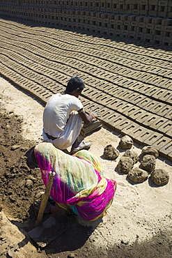
1161-5120 - Indian family forming bricks made from mud clay at Khore Bricks Factory, Rajasthan, Northern India
1161-5098 - Hindu woman in traditional blue painted home in Hindu Brahman high caste village of Dhudaly in Rajasthan, Northern India
