Recent searches
Loading...
832-380865 - Nelson's Dockyard, English Harbour, West Indies, Antigua, Antigua and Barbuda, Central America
832-380438 - Yacht in lagoon, South Pacific, Raiatea, French Polynesia, Oceania
832-380441 - Catamaran in turquoise lagoon, Raiatea, South Pacific, French Polynesia, Oceania
832-380821 - Sunrise, sailboat in the sea, Lovina Beach, Bali, Indonesia, Asia
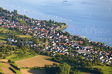
832-380340 - Allensbach, Lake Constance, Baden-Württemberg, Germany, Europe
832-380712 - Calanque de Port Pin in front of Soubeyranes cliffs, Cassis, Calanques National Park, Provence, France, Europe
832-380708 - Yacht in the Blue Lagoon, Comino, Malta, Europe
832-380707 - Yacht in the Blue Lagoon, Comino, Malta, Europe
832-379828 - Marina Venice Yacht Club, marina, motor boats, sailboats, Admiralty Way, Marina del Rey, Los Angeles County, California, USA, North America
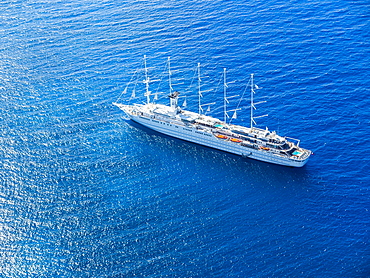
832-380165 - Luxury sailing ship Club Med 2 in front of English Harbour, West Indies, Caribbean, Antigua and Barbuda, Central America
1299-79 - Tourist at Idro Port, Idro Lake in Valle Sabbia, Brescia province, Lombardy, Italy, Europe
1299-78 - Plaque at the port of Idro, Idro Lake in Valle Sabbia, Brescia province, Lombardy, Italy, Europe
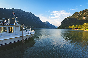
1299-77 - Boat on the lake, Lago D'Idro, Valle Sabbia, Brescia province, Lombardy, Italy, Europe
1299-69 - Sailboats on Lake Idro, Valle Sabbia, Brescia Province, Lombardy, Italy, Europe
857-95154 - Distant view of catamaran sailing in sea, Bourg de Saintes, Isles des Saintes, Guadeloupe
857-95152 - Scenic view of island of Iles des Saintes at sunset, Guadeloupe
857-95193 - Majestic view of beautiful scenery with mountains, Unnartoq island, Greenland
857-95165 - Silhouette of single sailboat in sea at sunset, Bouillante, Basse Terre, Guadeloupe
857-95168 - View of sailboat deck, Bourg de Saintes, Isles des Saintes, Guadeloupe
857-95159 - Low section view with feet of woman sunbathing on sailboat sailing in sea
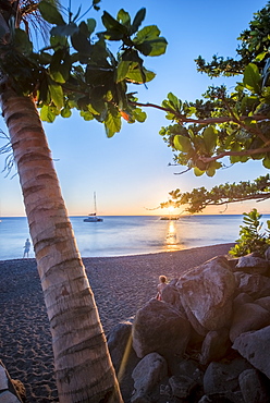
857-95157 - View of beach at sunset with palm trees, tourists and sailboat in distance, Black Sand Beach, Basse Terre, Guadeloupe
857-95167 - View of table, seats and chairs on deck of catamaran
857-95153 - Scenic view from catamaran sailing in Bourg de Saintes, Isles des Saintes, Guadeloupe
857-95158 - Scenic view of coastline with sailboats in sea, Basse Terre, Guadeloupe
857-95163 - Scenic view of coastline with anchored sailboats with rainbow in background, Bouillante, Basse Terre, Guadeloupe
857-95155 - View of sailboats in sea, Bourg de Saintes, Isles des Saintes, Guadeloupe
857-95161 - View of sailboats anchored in sea near beach at night, Black Sand Beach, Basse Terre, Guadeloupe
857-95164 - Scenic view of coastline with anchored sailboats, Bouillante, Basse Terre, Guadeloupe
857-95170 - View of single sailboat anchored in sea, Gosier, Guadeloupe
857-95106 - A single sail boat sails past Light House Park in West Vancouver, British Columbia on a beautiful late summer day. The mountains of Vancouver Island can be seen in the distance. Vancouver, British Columbia, Canada
1116-40128 - Sailing in the Great Bear Rainforest, Hartley Bay, British Columbia, Canada
1116-39755 - Skyline of residential buildings along the waterfront with boats in the harbour at dusk, Vancouver, British Columbia, Canada
1116-39661 - Shops and homes in Fisherman's Wharf in the Inner Harbour of Victoria, Vancouver Island, Victoria, British Columbia, Canada
1116-40129 - Man looking through a pair of binoculars with his sailboat in the distance, Great Bear Rainforest, Hartley Bay, British Columbia, Canada
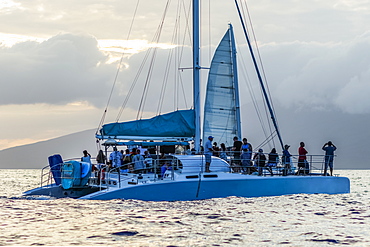
1116-40050 - Tourists whale watching from sailboat, Lahaina, Maui, Hawaii, United States of America
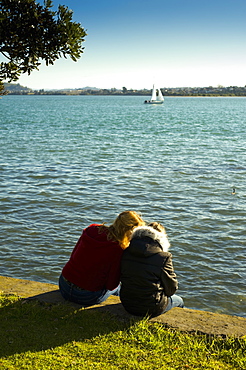
1116-41272 - Two Girls Sitting On A Retaining Wall At The Water's Edge, Auckland, New Zealand
1116-39754 - Skyline of residential buildings along the waterfront with boats in the harbour at dusk, Vancouver, British Columbia, Canada
1116-39811 - Sailing from the Ala Wai boat harbor past Waikiki and Diamond Head, Honolulu, Oahu, Hawaii, United States of America
1116-39812 - Sailing towards the Ala Wai boat harbor past Waikiki and Diamond Head, Honolulu, Oahu, Hawaii, United States of America
1116-39630 - City of Toronto skyline from Trillium Park, Toronto, Ontario, Canada
1116-40300 - Sunrise At Roundstone Harbour With 12 Bens, Galway, Ireland
1116-40320 - Sailboat On A Misty Morning, Killala, County Mayo, Ireland
1116-40685 - Dungarvan, Co Waterford, Ireland, Boats In The Harbour
1116-39651 - Tourists on Hanalei pier at sunset, Hanalei, Kauai, Hawaii, United States of America, Hanalei, Kauai, Hawaii, United States of America
1116-39650 - Hanalei Pier, bay and valley, Hanalei, Kauai, Hawaii, United States of America
1116-39813 - Sailing from the Ala Wai boat harbor, Waikiki, Honolulu, Oahu, Hawaii, United States of America
1116-39631 - City of Toronto skyline from Trillium Park, Toronto, Ontario, Canada
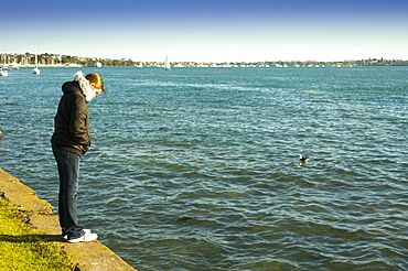
1116-41271 - A Woman Standing On The Retaining Wall At The Water's Edge, Auckland, New Zealand
1116-40127 - Sailing in the Great Bear Rainforest, Hartley Bay, British Columbia, Canada
1116-40131 - A Humpback whale (Megaptera novaeangliae) surfaces near the sailboat in the Great Bear Rainforest and a man photographs the whale, Hartley Bay, British Columbia, Canada
1269-243 - Sailboat on the lake in front Mandello del Lario, Province of Lecco, Lake Como, Italian Lakes, Lombardy, Italy, Europe
1269-252 - Sailboat on the lake in front Mandello del Lario, Province of Lecco, Lake Como, Italian Lakes, Lombardy, Italy, Europe
1269-139 - Moored sailboats at tourist port of Malcesine, Lake Garda, Verona province, Veneto, Italian Lakes, Italy, Europe
1269-142 - Sailboat on the lake, Malcesine, Lake Garda, Verona Province, Veneto, Italian Lakes, Italy, Europe
1286-41 - Sailboats at sunrise in Aberdour with Edinburgh in the background, Fife, Scotland, United Kingdom, Europe
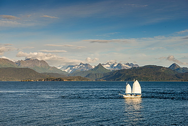
796-2370 - Scenery, Homer, Harding Icefield, Kachemak Bay, Kenai Fjords National Park, Alaska, United States of America, North America
1256-38 - Silhouetted tourist sailboat at sunrise anchored near Chinese Hat island in Galapagos National Park, Ecuador, South America
1174-4523 - Moored boats on beach at dusk, Llafranc, Costa Brava, Catalonia, Spain, Spain
1267-136 - Sydney Harbour Bridge with city skyline, Sydney, New South Wales, Australia, Pacific
1179-2626 - Sailboat in the turquoise sea, Porto Azzurro, Elba Island, Livorno Province, Tuscany, Italy, Europe
857-94768 - View from Sugar Loaf Mountain during dusk to Botafogo Beach in Rio de Janeiro, Brazil
857-94715 - Nimoa Island - here the island mission will impress. The five-sided church features murals of island life and all mission buildings are surrounded by well maintained paths and gardens filled with flowering plants. Edged by jungle-covered mountains, postcard beaches and crystal clear waters - an island paradise indeed! The Louisiade Archipelago is a string of ten larger volcanic islands frequently fringed by coral reefs, and 90 smaller coral islands located 200 km southeast of New Guinea, stretching over more than 160 km and spread over an ocean area of 26,000 km? between the Solomon Sea to the north and the Coral Sea to the south. The aggregate land area of the islands is about 1,790 km? (690 square miles), with Vanatinai (formerly Sudest or Tagula as named by European claimants on Western maps) being the largest. Sideia Island and Basilaki Island lie closest to New Guinea, while Misima, Vanatinai, and Rossel islands lie further east.
857-94828 - Rainbow over a sail boat in Prickly Pear Island, British Virgin Islands
857-94714 - The Louisiade Archipelago is a string of ten larger volcanic islands frequently fringed by coral reefs, and 90 smaller coral islands located 200 km southeast of New Guinea, stretching over more than 160 km and spread over an ocean area of 26,000 km? between the Solomon Sea to the north and the Coral Sea to the south. The aggregate land area of the islands is about 1,790 km? (690 square miles), with Vanatinai (formerly Sudest or Tagula as named by European claimants on Western maps) being the largest. Sideia Island and Basilaki Island lie closest to New Guinea, while Misima, Vanatinai, and Rossel islands lie further east. The archipelago is divided into the Local Level Government (LLG) areas Louisiade Rural (western part, with Misima), and Yaleyamba (western part, with Rossell and Tagula islands. The LLG areas are part of Samarai-Murua District district of Milne Bay. The seat of the Louisiade Rural LLG is Bwagaoia on Misima Island, the population center of the archipelago.
857-94712 - The Louisiade Archipelago is a string of ten larger volcanic islands frequently fringed by coral reefs, and 90 smaller coral islands located 200 km southeast of New Guinea, stretching over more than 160 km and spread over an ocean area of 26,000 km? between the Solomon Sea to the north and the Coral Sea to the south. The aggregate land area of the islands is about 1,790 km? (690 square miles), with Vanatinai (formerly Sudest or Tagula as named by European claimants on Western maps) being the largest.Sideia Island and Basilaki Island lie closest to New Guinea, while Misima, Vanatinai, and Rossel islands lie further east. The archipelago is divided into the Local Level Government (LLG) areas Louisiade Rural (western part, with Misima), and Yaleyamba (western part, with Rossell and Tagula islands. The LLG areas are part of Samarai-Murua District district of Milne Bay. The seat of the Louisiade Rural LLG is Bwagaoia on Misima Island, the population center of the archipelago.
1174-4466 - Nyhavn, the 17th century waterfront with row of colourful historic buildings, promenade and moored sailing ships in Copenhagen, Denmark, Copenhagen, Denmark
718-2243 - View of Cala Macarelleta and sailboats, Menorca, Balearic Islands, Spain, Mediterranean, Europe
1104-794 - View of The River Nile and Nubian village on Elephantine Island, Aswan, Upper Egypt, Egypt, North Africa, Africa
1104-792 - View of The River Nile from the Nubian village on Elephantine Island, Aswan, Upper Egypt, Egypt, North Africa, Africa
1104-795 - View of The River Nile and Nubian village on Elephantine Island, Aswan, Upper Egypt, Egypt, North Africa, Africa
1104-782 - View of River Nile and the Botanical Gardens on Kitchener Island, Aswan, Upper Egypt, Egypt, North Africa, Africa
1104-780 - View of Aswan and River Nile, Aswan, Upper Egypt, Egypt, North Africa, Africa
1104-777 - View of Aswan and River Nile, Aswan, Upper Egypt, Egypt, North Africa, Africa
857-94358 - Classic wooden catboats sailing on Narragansett Bay during a summer afternoon
857-94291 - winter sunset over the harbor of Sanary-sur-Mer in the South of France with several boats docking, among which three wooden boats in the foreground of the picture.
857-94290 - aerial view on a sailing boat and rescue boat crossing the Geneva Lake, with mountains in the background, trees on the lake's banks and a marina in Villeneuve, Vaud Canton, Switzerland
857-94359 - Anchorage of boats at Mackerel Cove in Jamestown
857-94360 - Young kids sailing a dinghy in Newport Harbor
857-94347 - Sailing cruise through the Windward Islands of the Lesser Antilles of the Caribbean
857-94288 - Thomas Coville and the Ultime Class 100' VPLP designed trimaran Sodebo in Rio de Janeiro, Brazil. Thomas Coville (FRA) and his 31m maxi trimaran Sodebo Ultim? has successfully broken the solo round the world record, completing the 28400 nm route in 49 days 3 hours 7 minutes and 38 seconds.
746-78791 - Marina, Krka National Park, Zaton, Dalmatia, Croatia, Europe
746-77937 - Murals in port of Horta, Fajal, Azores Island, Portugal, Europe
746-77938 - Murals in port of Horta, Fajal, Azores Island, Portugal, Europe
746-78042 - Vulcano Island, Aeolian Islands, Sicily, Italy
746-50113 - Beach, North Coast, Playa Santa Lucia, Cuba, West Indies, Central America
1179-2015 - A sail boat in the clear sea around the village of Ile Rousse at sunset, Balagne Region, Corsica, France, Mediterranean, Europe
1179-2016 - A sail boat in the clear sea around the village of Ile Rousse at sunset, Balagne Region, Corsica, France, Mediterranean, Europe
857-93876 - A Sailboat Moored Off An Uninhabited Islet Of The British Virgin Islands In The Caribbean
1240-183 - Dalkey Island, County Dublin, Republic of Ireland, Europe
1174-4359 - Traditional sailing boats off the coast of the estuary on the River Fal, Falmouth, Cornwall, Fal Estuary, Cornwall, England
1174-4355 - Traditional Sustainable Oyster Fishing, A man sorting oysters on a boat deck, Fal Estuary, Cornwall, England
1174-4354 - Sailing boats and motorboats moored in the Fal estuary, A fisherman in a small boat, Fal Estuary, Cornwall, England
1174-4358 - Traditional Sustainable Oyster Fishing, River Fal, A fisherman tipping shells into the water, Fal Estuary, Cornwall, England
1174-4356 - Traditional Sustainable Oyster Fishing, A fisherman opening a fishing creel on a boat deck, Fal Estuary, Cornwall, England


