Recent searches
Loading...
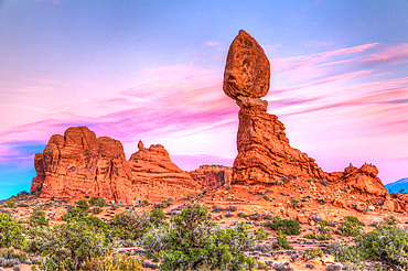
1350-6443 - Sun rays in a cloudy morning view of Balanced Rock in Arches National Park, Moab, Utah.
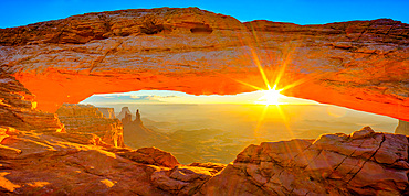
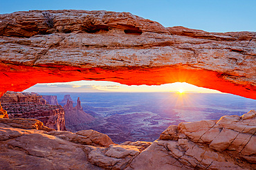
1350-6442 - Mesa Arch at sunrise with the Washer Woman Arch, Monster Tower & Airport Tower. Canyonlands National Park, Utah.
1350-6444 - Tourists around Balanced Rock in Arches National Park, Moab, Utah.
1350-6441 - Mesa Arch at sunrise with the Washer Woman Arch, Monster Tower & Airport Tower. Canyonlands National Park, Utah.
1350-6440 - Mesa Arch at sunrise with the Washer Woman Arch, Monster Tower & Airport Tower. Canyonlands National Park, Utah.
1350-6439 - Above the clouds of a winter temperature inversion in Canyonlands National Park, Moab, Utah. Viewed from Buck Canyon Overlook, Island in the Sky District.
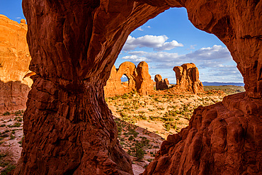
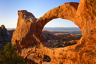
1350-6438 - The Parade of Elephants and the back of Double Arch framed by Cove Arch in Arches National Park, Moab, Utah.
1350-6437 - First light at sunrise on the Wingate cliffs of Junction Butte & Grandview Point with a sea of clouds below. Canyonlands NP, Utah. A winter temperature inversion produce this weather phenomenon.
1350-6436 - The Petrified Dunes in Arches National Park with the snow-capped La Sal Mountains behind. Moab, Utah.
1350-6435 - Double Arch at night with the MIlky Way & artificial light painting with a hand-held spotlight. Arches National Park, Moab, Utah.
1350-6433 - Saturn, Jupiter and the Milky Way over Balanced Rock in Arches National Park near Moab, Utah.
1350-6431 - Cloudy sunrise over Buck Canyon, the White Rim & the La Sal Mountains, Canyonlands National Park, Moab, Utah. Viewed from the Buck Canyon Overlook in the Island in the Sky District of Canyonlands NP.
1350-6429 - An unnamed Entrada sandstone rock spire with colorul sunset sky in Arches National Park, Moab, Utah.
1350-6430 - A group of photographers in a photo workshop taking pictures at night in Monument Valley Navajo Tribal Park, Arizona.
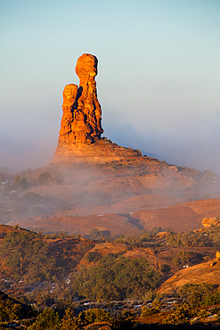
1350-6428 - An unnamed Entrada sandstone rock spire in a sea of fog in a winter temperature inversion in Arches National Park, Moab, Utah.
1350-6427 - Moon rising in the North Window, an Entrada sandstone arch in the WIndows Section of Arches National Park, Moab, Utah.
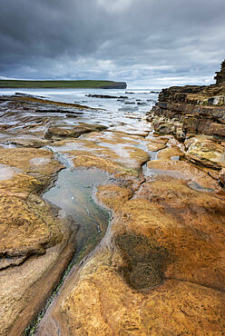
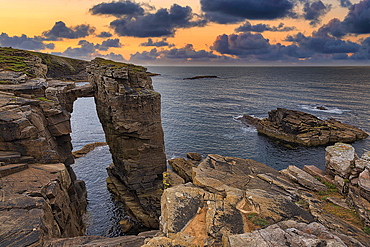
799-4544 - Old Red Sandstone ledges at the Bay of Skaill, Mainland, Orkney Islands, Scotland, United Kingdom, Europe
1184-7810 - Aerial of multicoloured layers of sandstone, Kyzylkup, Mangystau, Kazakhstan
1184-7808 - Aerial of multicoloured layers of sandstone, Kyzylkup, Mangystau, Kazakhstan
1184-7806 - Aerial of multicoloured layers of sandstone, Kyzylkup, Mangystau, Kazakhstan
1184-7805 - Aerial of multicoloured layers of sandstone, Kyzylkup, Mangystau, Kazakhstan
1184-7803 - Multicoloured layers of sandstone, Kyzylkup, Mangystau, Kazakhstan
1184-7804 - Aerial of multicoloured layers of sandstone, Kyzylkup, Mangystau, Kazakhstan
1184-7802 - Multicoloured layers of sandstone, Kyzylkup, Mangystau, Kazakhstan
1184-7800 - Multicoloured layers of sandstone, Kyzylkup, Mangystau, Kazakhstan
1184-7801 - Multicoloured layers of sandstone, Kyzylkup, Mangystau, Kazakhstan
1311-562 - A giant petrified log balanced on a sandstone pedestal in Petrified Forest National Park Arizona along the Red Basin Trail.
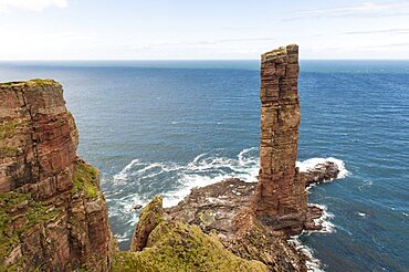
832-397849 - Surf pier, geology red sandstone on basalt, Old Man of Hoy, near Moorfea, Rackwick, Hoy, Orkney Islands, Scotland, Great Britain
832-397718 - Decorated wall in Qutub complex. Delhi, India, Asia
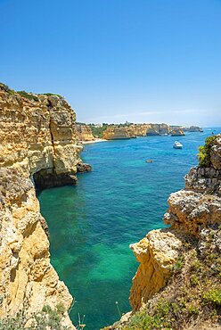
832-397748 - Turquoise sea, steep coast, Praia da Marinha beach, rugged rocky coast of sandstone, rock formations in the sea, Algarve, Lagos, Portugal, Europe
832-397749 - Turquoise sea, steep coast, Praia da Marinha beach, rugged rocky coast of sandstone, rock formations in the sea, Algarve, Lagos, Portugal, Europe
1174-11238 - Sunrise at Mesa Arch in Canyonlands National Park at sunrise, the sun lighting the glowing sandstone underside of the arch
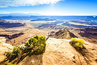
1174-11240 - View from above of the messas and rock formations of Canyonlands National Park, and view to Horseshoe Bend and the Colorado River
1174-11239 - Canyonlands National Park, the view of a zigzag path from the canyon floor up the steep hillside
832-397600 - Rock gorge on the Mullerthal Trail, hiking trail through wild rocky landscape with sandstone rocks, Little Luxembourg Switzerland, Mullerthal or Mullerthal, German-Luxembourg nature Park, Grand Duchy of Luxembourg
832-397599 - Narrow rocky gorge on the Mullerthal Trail, hiking trail through wild rocky landscape with sandstone rocks, Little Luxembourg Switzerland, Mullerthal or Mullerthal, German-Luxembourg nature Park, Grand Duchy of Luxembourg
860-291086 - Petroglyphs. With a "Atlal" (Spear-thrower) Probably "Gypsum people". between 2000B.C. -200A.D. Valley of fire Nevada.
860-291087 - Petroglyphs. With a "Atlal" (Spear-thrower) Probably "Gypsum people". between 2000B.C. -200A.D. Valley of fire Nevada.
1184-7262 - Multiple coloured landscape, Kyzylkup, Mangystau, Kazakhstan, Central Asia, Asia
1184-7261 - Multicoloured layers of sandstone, Kyzylkup, Mangystau, Kazakhstan, Central Asia, Asia
1184-7265 - Multiple coloured landscape, Kyzylkup, Mangystau, Kazakhstan, Central Asia, Asia
1184-7264 - Multiple coloured landscape, Kyzylkup, Mangystau, Kazakhstan, Central Asia, Asia
1184-7260 - Multiple coloured landscape, Kyzylkup, Mangystau, Kazakhstan, Central Asia, Asia
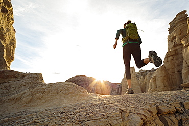
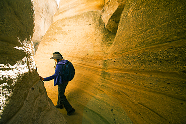
1178-43319 - Woman running in canyon wearing backpack
1184-6946 - Colourful sandstone formations, Zabriskie Point Death valley, California, USA
1184-6943 - Hiker in the colourful sandstone formations, Zabriskie Point Death valley, California, USA
1184-6947 - Hikers in the Colourful sandstone formations, Zabriskie Point Death valley, California, USA
1184-6944 - Hiker in the colourful sandstone formations, Zabriskie Point Death valley, California, USA
1113-107331 - Delicate Arch, Arches National Park, Moab, Utah, United States of America,
1113-107330 - Delicate Arch, Arches National Park, Moab, Utah, United States of America,
1113-107329 - Horseback rider, Bryce Canyon, Bryce Canyon National Park, Utah, USA
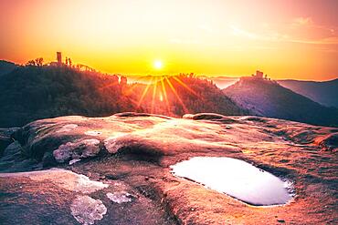
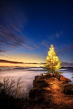
1113-107529 - Morning mist, pine tree and cross on the sandstone cliffs, Dahner Felsenland, Palatinate Forest, Rhineland-Palatinate, Germany
1178-42842 - United States, Utah, Bryce Canyon National Park, Senior hiker standing in sandstone archway
1178-42775 - United States, Utah, Escalante, Senior female hiker standing in canyon
1178-42841 - United States, Utah, Bryce Canyon National Park, Hoodoo rock formations in canyon
1178-42837 - United States, Utah, Escalante, Senior female hiker sitting on rock in canyon
1178-42839 - United States, Utah, Bryce Canyon National Park, Hoodoo rock formations in canyon
1178-42838 - United States, Utah, Bryce Canyon National Park, Hoodoo rock formations in canyon
1178-42836 - United States, Utah, Escalante, Senior female hiker exploring canyon
1178-42840 - United States, Utah, Bryce Canyon National Park, Single tree on canyon edge
1178-42776 - United States, Utah, Escalante, Senior hiker walking in sandstone canyon
1178-42843 - United States, Utah, Escalante, Senior hiker exploring sandstone cliff
746-91099 - Quebrada de las Conchas also called Quebrada de Cafayate. A canyon with colorful rock formations created by Rio de las Conchas. South America, Argentina, November
746-91097 - Routa 68. Quebrada de las Conchas also called Quebrada de Cafayate. A canyon with colorful rock formations created by Rio de las Conchas. South America, Argentina, November
746-91098 - Routa 68. Quebrada de las Conchas also called Quebrada de Cafayate. A canyon with colorful rock formations created by Rio de las Conchas. South America, Argentina, November
746-91096 - Routa 68. Quebrada de las Conchas also called Quebrada de Cafayate. A canyon with colorful rock formations created by Rio de las Conchas. South America, Argentina, November
1179-5717 - Man enjoying the view standing inside the sandstone canyons, Barranco de las Penitas, Fuerteventura, Canary Islands, Spain, Atlantic, Europe
1350-6338 - Double O Arch in Arches National Park, Utah.
1350-6343 - Last light on Delicate Arch; Arches National Park, Utah.
832-395765 - Sunrise at the Bastei Bridge, Bastei near Rathen, Elbe Sandstone Mountains, National Park Saxon Switzerland, Saxony, Germany, Europe
832-395612 - Viewpoint on a sandstone, in autumn and winter sunrise in the morning, Dahn, Palatinate Forest, Rhineland-Palatinate, Germany, Europe
832-395611 - View from the sandstone rock Wachtfelsen to the sunrise, morning atmosphere with great landscape in the fog, Wernersberg, Rhineland-Palatinate, Germany, Europe
832-395764 - Schrammsteine with Falkenstein and Koenigstein at sunrise, Saxon Switzerland National Park, Elbe Sandstone Mountains, Saxony, Germany, Europe
832-395761 - Schrammsteine with Falkenstein and Koenigstein at sunrise, Saxon Switzerland National Park, Elbe Sandstone Mountains, Saxony, Germany, Europe
832-395832 - Sacrament box, built 1493-96, by Adam Kraft, St. Lorenzkirche, a 20, 11 metre high tabernacle made of sandstone, Nuremberg, Middle Franconia, Bavaria, Germany, Europe
1311-422 - Wide angle view of Glen Canyon Dam from the wavy sandstone mesa of an area called the Chains, Arizona, United States of America, North America
1178-42004 - Japanese woman hiking between canyon walls
1311-413 - Wavy sandstone formation called Beehive Rock in Glen Canyon Recreation Area, The New Wave near Beehive campground, Arizona, United States of America, North America
1311-412 - Wavy sandstone formation called Beehive Rock in Glen Canyon Recreation Area, The New Wave near Beehive campground, Arizona, United States of America, North America
1350-5067 - An historic building at My Son, Quang Nam province, Vietnam
1350-4847 - Carved Cham stone relief exhibit at My Son, Quang Nam province, Vietnam
1350-4762 - Monastery of the Holy Trinity, Meteora, Thessaly, Greece
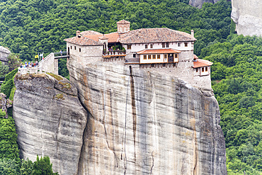
1350-4895 - Holy Monastery of Roussanou, Meteora, Thessaly, Greece
1350-4936 - A kalan, an historic building at My Son, Quang Nam province, Vietnam
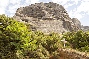
1350-4942 - Rock formation at Meteora, Thessaly, Greece
832-395007 - Rock Needle with Bridge, Old Red Sandstone Cliffs, Yesnaby Coastal Walk, Sunset, Sandwick, Mainland, Orkney, Scotland, United Kingdom, Europe
832-395006 - Rock Needle with Bridge, Old Red Sandstone Cliffs, Yesnaby Coastal Walk, Sunset, Sandwick, Mainland, Orkney, Scotland, United Kingdom, Europe
832-395005 - Cliffs of Old Red Sandstone, Yesnaby Coastal Walk, Sandwick, Mainland, Orkney, Scotland, United Kingdom, Europe
1174-10762 - Rocky jagged coastline, eroded sandstone rock, view out to the ocean, De Kelders, Western Cape, South Africa
1310-312 - Golden sandstone facade of the Cathedral of Santa Maria, sunrise, Ciutadella (Ciudadela), Menorca, Balearic Islands, Spain, Mediterranean, Europe
1184-6431 - Sandstone scenery, Al Ula, Kingdom of Saudi Arabia, Middle East
1184-6412 - Sandstone scenery, Al Ula, Kingdom of Saudi Arabia, Middle East
1184-6417 - Aerial of a sandstone canyon, Al Ula, Kingdom of Saudi Arabia, Middle East
1184-6411 - Beautiful sandstone scenery, Al Ula, Kingdom of Saudi Arabia, Middle East
1184-6416 - Aerial of a sandstone canyon, Al Ula, Kingdom of Saudi Arabia, Middle East
1184-6418 - Aerial of a sandstone canyon, Al Ula, Kingdom of Saudi Arabia, Middle East
1184-6414 - Sandstone scenery, Al Ula, Kingdom of Saudi Arabia, Middle East
1184-6407 - Sandstone scenery, Al Ula, Kingdom of Saudi Arabia, Middle East
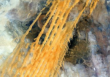
1348-4580 - Desert Erg Iguidi, Algeria, True Colour Satellite Image. True colour satellite image of Erg Iguidi, a sand desert between Algeria and Mauritania. The 250m wide dunes lay in the South on a sand plain, and in the North on a blakek sandstone area. The light blue areas are calcareous and salt crusts left out from the evaporation of the oueds' water. Image taken on 29 March 1987 using LANDSAT data.
1116-51427 - Milky Way over a rock formation; Tres Cruces, Jujuy Province, Argentina

