Recent searches
Loading...
1348-3421 - Satellite view of the Comoros Archipelago. This image was compiled from data acquired by Landsat satellites.
1348-3400 - Satellite view of Komodo Island, Indonesia. The image shows the whole Komodo National Park that includes the three islands Komodo, Padar and Rinca. This image was compiled from data acquired by Landsat satellites.
1348-4512 - Greenland, True Colour Satellite Image With Mask. Satellite view of Greenland (with mask). This image was compiled from data acquired by LANDSAT 5 & 7 satellites.
1348-3384 - Satellite view of the Persian Gulf. This image was compiled from data acquired in 2014 by Landsat 8 satellite.
1348-3424 - Satellite view of Andros Islands and New Providence, Bahamas. New Providence is the most populous island in the Bahamas and it houses the capital city of Nassau
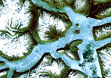
1348-4576 - King Oscar Fjord, Greenland, True Colour Satellite Image. King Oscar Fjord located in Greenland National Park. The pastel blue indicates that the water has turned into ice. Image taken on 21 June 1991 using LANDSAT data.
1348-3351 - Satellite view of Typhoons Goni and Atsani in 2015 over the Pacific Ocean. Image taken on August 24, 2015.
1348-4583 - Hawooi And Kikori Deltas, Papua New Guinea, True Colour Satellite Image. True colour satellite image of the deltas of the rivers Hawooi (left) and Kikori (right)
1348-3423 - Satellite view of Barbados. This image was compiled from data acquired by Landsat satellites.
1348-3432 - Satellite view of the Arabian Peninsula. This image was compiled from data acquired in 2014 by Landsat 8 satellite.
1348-4532 - Wanapitei Lake Meteor Impact Crater, Manitoba, Canada, True Colour Satellite Image
1348-3063 - Color satellite image of Brisbane, Australia. Image collected on July 24, 2017 by Sentinel-2 satellites.
1348-3048 - Color satellite image of Lake Erie, North America. Image collected on May 1, 2016 by Landsat 8 satellite.
1348-4454 - Rhone Delta, France, True Colour Satellite Image. True colour satellite image of the Rhone Delta in southern France
1348-3345 - Satellite view of the Central Great Barrier Reef along Queensland's coastline in north-east Australia
1348-3411 - Satellite view of Fuerteventura and Lanzarote, Canary Islands, Spain. This image was compiled from data acquired by Landsat 8 satellite in 2014.
1348-4599 - Dakar, Senegal, True Colour Satellite Image. Dakar, Senegal. True colour satellite image of Dakar, capital city of Senegal. Composite of 2 images taken on 4 & 11 November 1999, using LANDSAT 7 data.
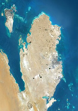
1348-3382 - Satellite view of Qatar and Bahrain. This image was compiled from data acquired by Landsat 8 satellite in 2014.
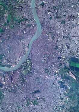
1348-3097 - Color satellite image of Kolkata, India. The city is located on the east bank of the Hooghly River. Image collected on March 16, 2017 by Sentinel-2 satellites.
1348-4564 - Sahara Desert, Africa, True Colour Satellite Image. Sahara desert, true colour satellite image. The Sahara is the world's largest hot desert, made of sand and volcanic mountains. Composite image using data from LANDSAT 5 & 7 satellites.
1348-4604 - Abu Dhabi, United Arab Emirates, True Colour Satellite Image
1348-4470 - Lake Malawi, Africa, True Colour Satellite Image. True colour satellite image of Lake Malawi, an African Great Lake situated between Malawi, Mozambique, and Tanzania. Composite image using LANDSAT 5 data.
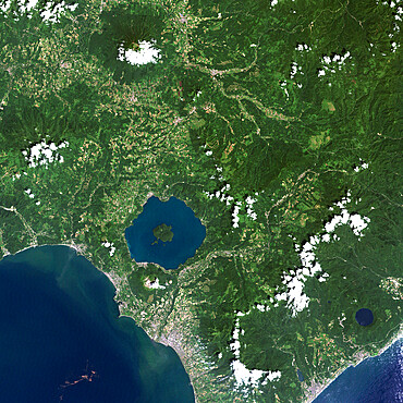
1348-4551 - Usu Volcano, Japan, True Colour Satellite Image
1348-4611 - Madagascar, True Colour Satellite Image. Madagascar, true colour satellite image. This image was compiled from data acquired by LANDSAT 5 & 7 satellites.
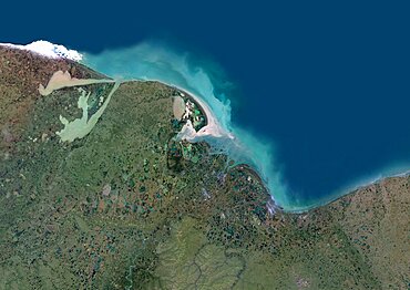
1348-4462 - Indigirka River Delta, Russia, True Colour Satellite Image. True colour satellite image of the Indigirka River Delta in Russia. The river flows into the Kolyma Bay, East Siberian Sea. Composite image using LANDSAT 5 data.
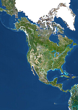
1348-3388 - Satellite view of North America in winter, with partial snow cover and Arctic ice cap. This image was compiled from data acquired by Landsat 7 & 8 satellites.
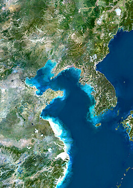
1348-4451 - Yellow Sea, Asia, True Colour Satellite Image
1348-4614 - Globe North Pole, True Colour Satellite Image. Cloudless true colour satellite image of the Earth, centred on the Arctic or north polar region
1348-4574 - Isla De La Juventud, Cuba, True Colour Satellite Image. Satellite image of the Isla de la Juventud, in the Canarreos archipelago, close to the Island of Cuba. Image taken on 31 January 1987 using LANDSAT data.
1348-4511 - Whole Earth With Country Borders, True Colour Satellite Image. True colour satellite image of the whole Earth with country borders
1348-4488 - Canton And Shenzen, China, In 2000, True Colour Satellite Image. True colour satellite image of the cities of Guangzhou (Canton) and Shenzen, China. Image in landscape format, taken on 14 September 2000, using LANDSAT data.
1348-3366 - Satellite view of Southern Africa. It shows the African Great Lakes region. This image was compiled from data acquired by Landsat 7 & 8 satellites.
1348-3106 - Color satellite image of Conakry, capital city of Guinea. Image collected on March 03, 2017 by Sentinel-2 satellites.
1348-3354 - Satellite view of Trinidad and Tobago. This image was compiled from data acquired by Landsat satellites.
1348-3058 - Color satellite image of Iceland. Image collected on August 30, 2017 by Sentinel-2 satellites.
1348-4473 - Queen Charlotte Islands, Canada, True Colour Satellite Image. True colour satellite image of Queen Charlotte Islands, an archipelago on the British Columbia Coast, Canada, in the Pacific ocean. Image using LANDSAT 7 data.
1348-3067 - Color satellite image of Cape Canaveral, Florida, United States
1348-3104 - Color satellite image of Omdurman, Sudan. The city lies on the western banks of the River Nile, opposite the capital Khartoum. Image collected on October 25, 2017 by Sentinel-2 satellites.
1348-3378 - Satellite view of Saint Vincent. This image was compiled from data acquired by Landsat satellites.
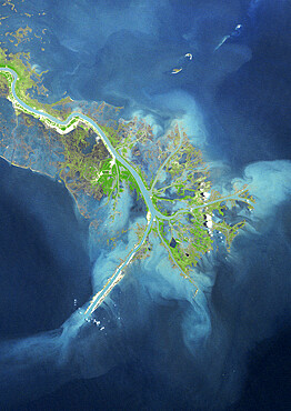
1348-4487 - Mississippi River Delta, Louisiana, Us, In 1976, True Colour Satellite Image. True colour satellite image of the Mississippi River Delta, Louisiana, USA
1348-4561 - Richat Structure, Mauritania, True Colour Satellite Image. Richat Structure, Mauritania, true colour satellite image
1348-4522 - Iran, Middle East, Asia, True Colour Satellite Image With Border And Mask. Satellite view of Iran (with border and mask). This image was compiled from data acquired by LANDSAT 5 & 7 satellites.
1348-4585 - Ganges Delta, India And Bangladesh, True Colour Satellite Image
1348-4605 - Re And Oleron Islands, France, True Colour Satellite Image. Ré & Oleron Islands, France. True colour satellite image of Ré & Oléron islands, that are off the west coast of France near La Rochelle. This image was compiled from data acquired by LANDSAT 5 & 7 satellites.
1348-4579 - Betsiboka River, Madagascar, True Colour Satellite Image. Betsiboka river, the major river of Madagascar, goes into the Mozambique canal, close to the city of Mahajanga.
1348-4586 - Pack Ice In Siberia, Russia, True Colour Satellite Image
1348-3434 - Satellite view of Ambrym, a volcanic island in the archipelago of Vanuatu. This image was compiled from data acquired by Landsat 8 satellite in 2014.
1348-3393 - Satellite view of Mount Erebus, the tallest volcano in Antarctica. Situated on Ross Island, just off the coast of West Antarctica, Erebus is the southernmost active volcano on Earth. This image was taken on December 31, 2013 by Landsat 8 satellite.
1348-3417 - Satellite view of Efate, Vanuatu. It is the most populous island of Vanuatu archipelago. This image was compiled from data acquired by Landsat 8 satellite in 2014.
1348-4505 - South America At Night, True Colour Satellite Image. True colour satellite image of South America at night. This image in Lambert Azimuthal Equal Area projection was compiled from data acquired by LANDSAT 5 & 7 satellites.
1348-4596 - Hong Kong, China, True Colour Satellite Image. Hong Kong, People's Republic of China. True colour satellite image of the city of Hong Kong
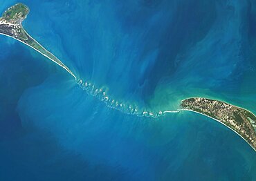
1348-3438 - Satellite view of Adam's Bridge. This chain of limestone shoals connects Sri Lanka to India. This image was taken in 2014 by Landsat 8 satellite.
1348-4430 - Saint Vincent And The Grenadines, True Colour Satellite Image
1348-3446 - Colour satellite image of mountainous area in North Pakistan. Image taken on May 1st, 2014 by Landsat 8 satellite.
1348-3357 - Satellite view of Tasmania, Australia. This image was compiled from data acquired by Landsat 8 satellite in 2014.
1348-4468 - Lake Balkhash, Kazakhstan, True Colour Satellite Image
1348-4444 - Cozumel Island, Mexico, True Colour Satellite Image
1348-4572 - Lake Yamma, Queensland, Australia, True Colour Satellite Image. The Lake Yamma is a salted lake located in a semi-arid area
1348-4499 - Globe Centred On Europe And Africa, True Colour Satellite Image
1348-4543 - Barringer Meteor Impact Crater, Arizona, Usa, True Colour Satellite Image
1348-4518 - Guadeloupe, French Overseas, Caribbean, True Colour Satellite Image. Satellite view of Guadeloupe, France. This image was compiled from data acquired by LANDSAT 5 & 7 satellites.
1348-3427 - Satellite view of Eleuthera Island, Bahamas. This image was compiled from data acquired by Landsat satellites.
1348-4607 - Chile And Argentina, True Colour Satellite Image. Chile & Argentina, true colour satellite image. This image was compiled from data acquired by LANDSAT 5 & 7 satellites.
1348-3052 - Color satellite image of Volcanoes on Kamchatka Peninsula, Russia. Klyuchevskaya, to the right, the tallest and most active volcano on the peninsula
1348-4516 - Comoros, Africa, True Colour Satellite Image. Satellite view of the Comoros islands. This image was compiled from data acquired by LANDSAT 5 & 7 satellites.
1348-4441 - China, True Colour Satellite Image. People's Republic of China, true colour satellite image. This image was compiled from data acquired by LANDSAT 5 & 7 satellites.
1348-3439 - Colour satellite image of Phnom Penh, Cambodia. This image was taken on January 15, 2015 by Landsat 8 satellite.
1348-4562 - Shark'S Bay, Australia, True Colour Satellite Image. Shark's Bay, Australia, true colour satellite image
1348-3436 - Satellite view of Africa. This image was compiled from data acquired by Landsat 7 & 8 satellites.
1348-3107 - Color satellite image of Bissau, capital city of Guinea-Bissau. Image collected on April 25, 2017 by Sentinel-2 satellites.
1348-4601 - Bangkok, Thailand, True Colour Satellite Image. Bangkok, Thailand. True colour satellite image of Bangkok, capital city of Thailand. Image taken on 2 September 2001 using LANDSAT 7 data.
1348-3442 - Satellite view of Turkmenbashi Gulf on the Caspian Sea in Turkmenistan. This image was compiled from data acquired in 2014 by Landsat 8 satellite.
1348-4507 - North America With Country Borders And Major Rivers, True Colour Satellite Image
1348-4547 - Karymsky Volcano, Russia, True Colour Satellite Image. Karymsky volcano, Russia, true colour satellite image
1348-4554 - Kelimutu Volcano, Indonesia, True Colour Satellite Image
1348-4440 - Haiti And Dominican Republic, True Colour Satellite Image. Haiti and Dominican Republic, true colour satellite image. This image was compiled from data acquired by LANDSAT 5 & 7 satellites.
1348-4449 - Agriculture In The Desert In 1998, Saudi Arabia, True Colour Satellite Image
1348-4524 - Bahrain, Middle East, Asia, True Colour Satellite Image. Satellite view of Bahrain . This image was compiled from data acquired by LANDSAT 5 & 7 satellites.
1348-3039 - Color satellite image of Pine Island Glacier, Antarctica on September 21, 2017.
1348-3373 - Satellite view of the King Fahd Causeway, a series of bridges and causeways connecting Saudi Arabia and Bahrain. This image was compiled from data acquired in 2014 by Landsat 8 satellite.
1348-3437 - Satellite view of part of the Aeolian Islands, Italy. The image shows the islands of Salina, Lipari, Vulcano, Panarea and Basiluzzo. This image was compiled from data acquired by Landsat satellites.
1348-4445 - Agriculture In The Murzuq Desert In 2005, Libya, True Colour Satellite Image
1348-4478 - Hurricane Wilma, Atlantic Ocean, On 24/10/2005, True Colour Satellite Image. Hurricane Wilma on 24 October 2005 over Florida, US. True-colour satellite image using MODIS data.
1348-4538 - Meteor Impact Crater, Libya, True Colour Satellite Image. True colour satellite image of an impact structure North of Koufra Oasis in the Libyan desert
1348-4539 - Lonar Meteor Impact Crater, India, True Colour Satellite Image. True colour satellite image of Lonar impact structure, India (diameter : 1,83 km). Image taken on 4 November 1992 using LANDSAT data.
1348-4558 - Teide Volcano, Canary Islands, Spain, True Colour Satellite Image
1348-4475 - Typhoon Mitag, Philippine Sea, Asia, In 2002, True Colour Satellite Image. Typhoon Mitag on 6 March 2002 in the Philippine Sea, north of the Philippines (lower left-hand corner of the image). True-colour satellite image using MODIS data.
1348-4439 - Ireland And Northern Ireland, True Colour Satellite Image With Border. Ireland and Northern Ireland
1348-3350 - Satellite view of Saint Croix, US Virgin Islands. This image was compiled from data acquired by Landsat satellites.
1348-4500 - Globe Centred On Asia And Oceania, True Colour Satellite Image. True colour satellite image of the Earth centred on Asia and Oceania
1348-4568 - Mount Egmont, New-Zealand, True Colour Satellite Image
1348-4515 - Tahiti, French Polynesia, French Overseas, Oceania, True Colour Satellite Image
1348-4494 - Globe Showing Europe, True Colour Satellite Image. True colour satellite image of the Earth showing Greenland, the North Pole and Europe. This image in orthographic projection was compiled from data acquired by LANDSAT 5 & 7 satellites.
1348-3044 - Color satellite image of Lake Superior, North America. Image collected on May 1, 2016 by Landsat 8 satellite.
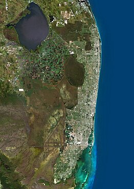
1348-3071 - Color satellite image of Miami Metropolitan Area, Florida, United States. The Everglades natural region is at west and Biscayne National Park at south. Image collected on January 06, 2017 by Sentinel-2 satellites.
1348-4443 - Pisa And Livorno, Italy, True Colour Satellite Image
1348-3093 - Color satellite image of Tokyo, capital city of Japan. Image collected on May 08, 2017 by Sentinel-2 satellites.
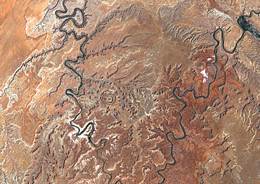
1348-4533 - Upheaval Dome Meteor Impact Crater, Utah, Usa, True Colour Satellite Image. True colour satellite image of Upheaval Dome impact structure, Utah, US (age : 65 million years ; diameter : 5 km). Image taken on 17 June 1989 using LANDSAT data.


