Recent searches
Loading...
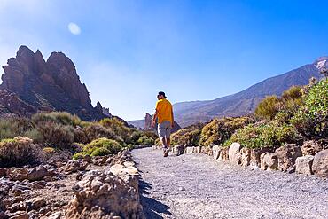
832-404402 - A tourist walking on the path between Roques de Gracia and Roque Cinchado in the natural area of Teide in Tenerife, Canary Islands
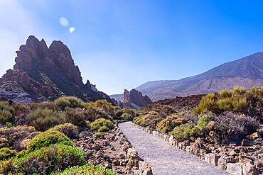
832-404401 - Beautiful path between the Roques de Gracia and the Roque Cinchado in the natural area of Teide in Tenerife, Canary Islands
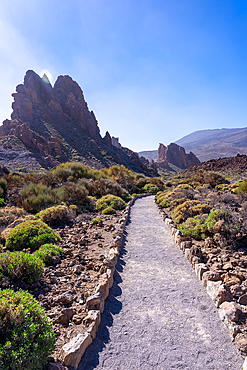
832-404400 - Beautiful path between the Roques de Gracia and the Roque Cinchado in the natural area of Teide in Tenerife, Canary Islands
832-404191 - Milky way on the Roque Cinchado next to Teide in the natural park of Tenerife, Canary Islands. Spain
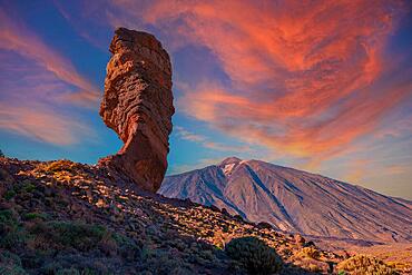
832-404190 - Sunset at Roque Cinchado next to Teide in the natural park of Tenerife, Canary Islands. Spain
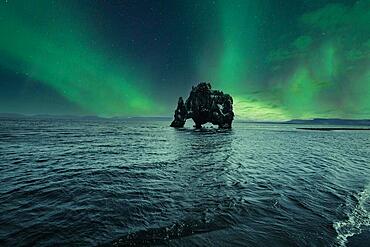
832-404185 - Hvitserkur landscape at night with beautiful Northern Lights. Iceland
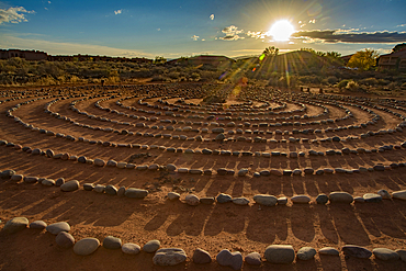
1116-52816 - Hiking trail through Snow Canyon, with circles of stones in a meeting area behind the Red Mountain Spa, with meditation maze and Snow Canyon Mountain Range in the background. Red Cliffs Desert Reserve around St George Town with bright sunburst in a blue sky, St George, Utah, United States of America
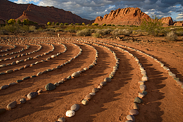
1116-52815 - Hiking trail through Snow Canyon, with circles of stones in a meeting area behind the Red Mountain Spa, with meditation maze and Snow Canyon Mountain Range in the background. Red Cliffs Desert Reserve around St George Town with rock cliffs and dark clouds in a blue sky, St George, Utah, United States of America
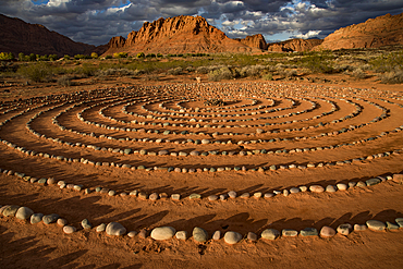
1116-52814 - Hiking trail through Snow Canyon, with circles of stones in a meeting area behind the Red Mountain Spa, with meditation maze and Snow Canyon Mountain Range in the background. Red Cliffs Desert Reserve around St George Town with rock cliffs and dark clouds in a blue sky, St George, Utah, United States of America
832-404092 - Morning red at the Hamburg coat of arms, belongs to the Teufelsmauer, Timmenrode, Saxony-Anhalt, Germany, Europe
832-404091 - Sandstone cave, Hamburg coat of arms, part of the Teufelsmauer, Timmenrode, Saxony-Anhalt, Germany, Europe
832-404090 - Sunrise at the Hamburg coat of arms, part of the Devil's Wall, sandstone cave, Timmenrode, Saxony-Anhalt, Germany, Europe
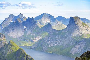
832-403584 - Mountain landscape with steep rocky peaks and lake Tennesvatnet, Krokvatnet and Fjerddalsvatnet, in the back peak of Hermannsdalstinden, view from the top of Munken, Moskenesoya, Lofoten, Nordland, Norway, Europe
832-403583 - Mountain landscape with steep rocky peaks fjords and sea, view from the top of Munken to Reinefjorden, Moskenesoya, Lofoten, Nordland, Norway, Europe
832-403582 - Mountain landscape with steep rocky peaks fjords and sea, view from the top of Munken to Reinefjorden, Moskenesoya, Lofoten, Nordland, Norway, Europe
832-403539 - Bajandsag, also Flaming Cliffs, Gobi Desert, Oemnoe-Gobi Aimag, Mongolia, Asia
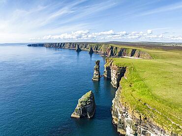
832-403083 - Aerial view of the rugged coastal landscape at Duncansby Head with rock tower, behind it the Duncansby Stacks, County Caithness, Scotland, Great Britain
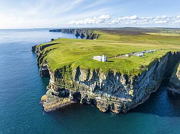
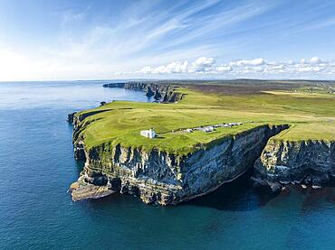
832-403082 - Aerial view of the rugged coastal landscape at Duncansby Head with the lighthouse and the Duncansby Stacks rock formation behind, Scotland's north-eastern point, County Caithness, Scotland, United Kingdom, Europe
832-403081 - Aerial view of the rugged coastal landscape at Duncansby Head with the lighthouse and the Duncansby Stacks rock formation behind, Scotland's north-eastern point, County Caithness, Scotland, United Kingdom, Europe
832-402999 - Earth pyramids, spring, Lengmoos, Mittelberg am Ritten, near Bolzano, Dolomites, South Tyrol, Italy, Europe
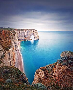
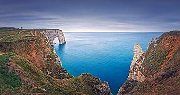
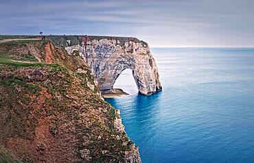
832-402980 - Sightseeing view to the famous rock Aiguille of Etretat in Normandy, France. Limestone cliffs Falaise d'Aval washed by La Manche channel waters. Beautiful coastline scenery
832-402979 - Idyllic view to Porte d'Aval natural arch at Etretat famous cliffs washed by Atlantic ocean, Normandy, France. Sightseeing coastline scenery, beautiful natural bay with sand beach
832-402978 - Beautiful panorama of the Porte d'Aval natural arch at Etretat famous cliffs, Normandy, France, Europe
832-402977 - Sightseeing view to the Porte d'Aval natural arch cliff washed by Atlantic ocean waters at Etretat, Normandy, France. Beautiful coastline scenery with famous Falaise d'Aval
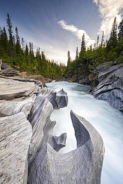
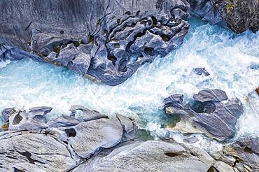
832-402603 - Marble Lottet, Marble Castle, Marble Gorge, Glomaga River, Mo I Rana, Nordland, Norway, Europe
832-402598 - Marble Lottet, Marble Castle, Marble Gorge, Glomaga River, Mo I Rana, Nordland, Norway, Europe
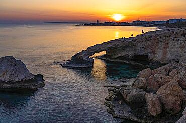
832-402488 - The natural rock bridge Love Bridge in the sunset, Agia Napa, Cyprus, Europe
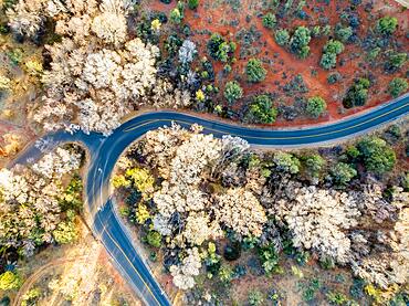
832-402432 - Aerial view of a rural landscape with a curvy road running through it in Sedona, Arizona. Drone photograph
832-402431 - Beautiful rock formations in the desert of the American Southwest from above using a drone
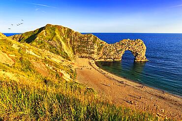
832-402227 - Coastline with bathing beach at Durdle Door, limestone rock bridge, UNESCO World Heritage Site, Dorset landmark, England, United Kingdom, Europe
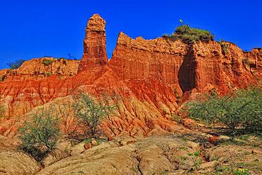
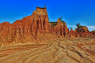
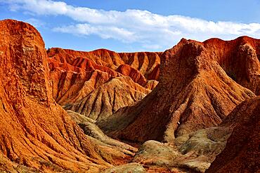
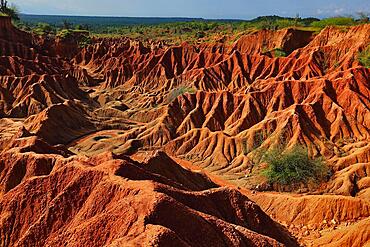
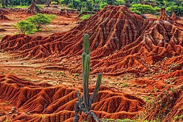
832-401982 - Republic of Colombia, Tatacoa Desert, landscape in the department of Huila, Desierto de la Tatacoa, Tatacoa Desert is a desert of about 330 km² in Colombia, in the northern part of the province of Huila in the valley of the Rio Magdalena, a dry basin at the foot of the Eastern Cordillera, tropical dry forest, playful rock cones, washed-out gorges and rock formations, Colombia, South America
832-401981 - Republic of Colombia, Tatacoa Desert, landscape in the department of Huila, Desierto de la Tatacoa, Tatacoa Desert is a desert of about 330 km² in Colombia, in the northern part of the province of Huila in the valley of the Rio Magdalena, a dry basin at the foot of the Eastern Cordillera, tropical dry forest, playful rock cones, washed-out gorges and rock formations, Colombia, South America
832-401980 - Republic of Colombia, Tatacoa Desert, landscape in the department of Huila, Desierto de la Tatacoa, Tatacoa Desert is a desert of about 330 km² in Colombia, in the northern part of the province of Huila in the valley of the Rio Magdalena, a dry basin at the foot of the Eastern Cordillera, tropical dry forest, playful rock cones, washed-out gorges and rock formations, Colombia, South America
832-401979 - Republic of Colombia, Tatacoa Desert, landscape in the department of Huila, Desierto de la Tatacoa, Tatacoa Desert is a desert of about 330 km² in Colombia, in the northern part of the province of Huila in the valley of the Rio Magdalena, a dry basin at the foot of the Eastern Cordillera, tropical dry forest, playful rock cones, washed-out gorges and rock formations, Colombia, South America
832-401978 - Republic of Colombia, Tatacoa Desert, landscape in the department of Huila, Desierto de la Tatacoa, Tatacoa Desert is a desert of about 330 km² in Colombia, in the northern part of the province of Huila in the valley of the Rio Magdalena, a dry basin at the foot of the Eastern Cordillera, tropical dry forest, playful rock cones, washed-out gorges and rock formations, Colombia, South America
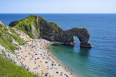
832-401713 - Bathing beach at the famous rock bridge Durdledoor, West Lulworth, Dorset, England Great Britain
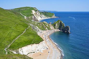
832-401714 - View over the chalk coast with the famous rock bridge Durdledoor, West Lulworth, Dorset, England Great Britain
832-401712 - Walk along the chalk coast with the famous rock bridge Durdledoor, West Lulworth, Dorset, England Great Britain
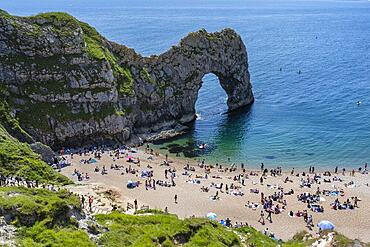
832-401711 - Bathing beach at the famous rock bridge Durdledoor, West Lulworth, Dorset, England Great Britain
832-401710 - Bathing beach at the famous rock bridge Durdledoor, West Lulworth, Dorset, England Great Britain
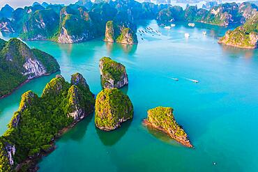
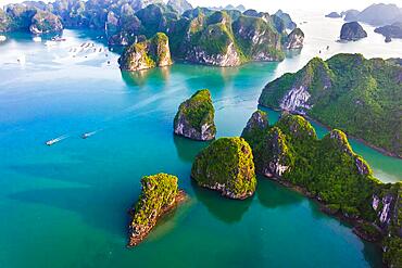
832-401497 - Aerial view of Ha Long Bay, Vietnam, Asia
832-401492 - Aerial view of Ha Long Bay, Vietnam, Asia
832-401491 - Aerial view of Ha Long Bay, Vietnam, Asia
832-401484 - Aerial view of Ha Long Bay, Vietnam, Asia
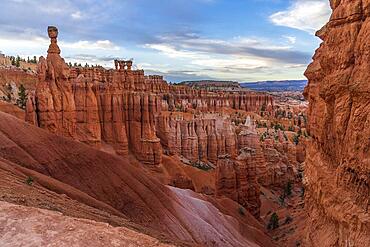
832-401310 - Thor's Hammer, Bryce Amphitheatre, Bryce Canyon National Park, Utah, USA, North America
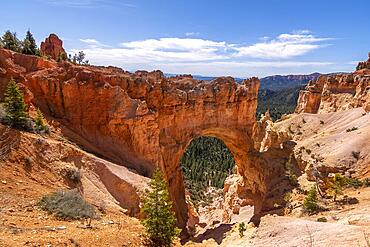
832-401309 - Rock arch at Natural Bridge viewpoint, Bryce Canyon National Park, Utah, USA, North America
759-10713 - Pumice Stone Formation near Vilaflor, Tenerife, Canary Islands, Spain
832-401197 - Tourist icon of the island of El Hierro called El Roque de la Bonanza, Canary Islands, Spain, Europe
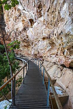
832-400909 - Overhanging cliffs at Pedra Furada, Unesco site Serra da Capivara National Park, Piaui, Brazil, South America
832-400907 - Overhanging cliffs at Pedra Furada, Unesco site Serra da Capivara National Park, Piaui, Brazil, South America
832-400894 - Overhanging cliffs at Pedra Furada, Unesco site Serra da Capivara National Park, Piaui, Brazil, South America
832-400895 - Overhanging cliffs at Pedra Furada, Unesco site Serra da Capivara National Park, Piaui, Brazil, South America
832-400737 - Loch im Felsen, Papago Park, Phoenix, Arizona, USA, North America
832-400736 - Loch im Felsen, Papago Park, Phoenix, Arizona, USA, North America
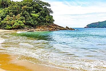
832-400230 - Dense vegetation of the tropical forest by the sea of transparent waters in Trindade on the south coast of Rio de Janeiro, Brasil
832-399605 - Coastal landscape, cliffs and sea, Miradouro da Ponta do Rosto, rugged coast with rock formations, Cape Ponta de Sao Lourenco, Madeira, Portugal, Europe
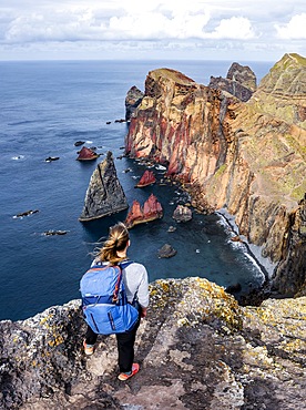
832-399876 - Hiker, coastal landscape, cliffs and sea, rugged coast with rock formations, Cape Ponta de Sao Lourenco, Madeira, Portugal, Europe
832-399877 - Coastal landscape, cliffs and sea, Miradouro da Ponta do Rosto, rugged coast with rock formations, Cape Ponta de Sao Lourenco, Madeira, Portugal, Europe
832-399878 - Hiker, coastal landscape, cliffs and sea, Miradouro da Ponta do Rosto, rugged coastline with rock formations, Cape Ponta de Sao Lourenco, Madeira, Portugal, Europe
832-399579 - View over Emsworthy Mire from a drone, Haytor Rocks, Dartmoor National Park, Devon, England, UK
832-400011 - Rock formation at the Bastei Bridge, Bastei, Lohmen, Saxon Switzerland, Elbe Sandstone Mountains, Saxony, Germany, Europe
832-400010 - Evening mood, sunset, view to the new Basteiaussicht and the river Elbe, Lohmen, Saxon Switzerland, Elbe Sandstone Mountains, Saxony, Germany, Europe
832-399349 - Chalk cliffs, rock needle Aiguille and Porte dAval at the Falaise dAval in the evening light, Etretat, Alabaster Coast, La Cote dAlbatre, Normandy, France, Europe
832-399207 - Red granite rocks, Tafoni, Calanches de Piana, Porto Bay, Porto, UNESCO World Heritage Site, Haute-Corse Department, West Coast, Corsica, Mediterranean Sea, France, Europe
832-399206 - Red granite rocks, Tafoni, Calanches de Piana, sunset, Porto Bay, Porto, UNESCO World Heritage Site, Haute-Corse department, west coast, Corsica, Mediterranean Sea, France, Europe
832-398923 - Morning atmosphere, coastal landscape, cliffs and sea, Miradouro da Ponta do Rosto, rugged coast with rock formations, Cape Ponta de Sao Lourenco, Madeira, Portugal, Europe
832-398924 - Morning atmosphere, coastal landscape, cliffs and sea, Miradouro da Ponta do Rosto, rugged coast with rock formations, Cape Ponta de Sao Lourenco, Madeira, Portugal, Europe
832-398922 - Aerial view, coastal landscape, cliffs and sea, Miradouro da Ponta do Rosto, rugged coastline with rock formations, Cape Ponta de Sao Lourenco, Madeira, Portugal, Europe
832-398635 - View from Cape Dyrholaey, rock formations Reynisdrangar and Mount Reynisfjall, Vik i Myrdal, Suourland, Iceland, Europe
832-398634 - View from Cape Dyrholaey at sunrise, rock formations Reynisdrangar and Mount Reynisfjall, Vik i Myrdal, Suourland, Iceland, Europe
832-398633 - View from Cape Dyrholaey at sunrise, rock formations Reynisdrangar and Mount Reynisfjall, Vik i Myrdal, Suourland, Iceland, Europe
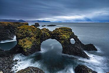
832-398617 - Gatklettur at sunrise, rock arch in the sea, Arnarstapi, Snaefellsnes Peninsula, West Iceland, Iceland, Europe
832-398369 - Sunrise in the mountains with a rocky peak in the foreground, Rathen, Saxon Switzerland, Saxony, Germany, Europe
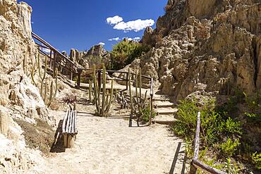
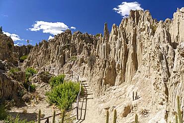
832-398365 - Circuit, visitor trail, Valle de la Luna, Moon Valley formed by erosion, also Killa Qhichwa, La Paz, Bolivia, South America
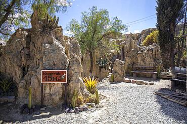
832-398364 - Tour 15 min in Valle de la Luna, Moon Valley formed by erosion, also Killa Qhichwa, La Paz, Bolivia, South America
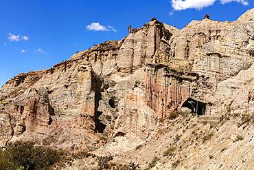
832-398367 - Red sandstone with erosion forms, near Valle de la Luna, La Paz, Bolivia, South America
832-398366 - Circuit, visitor trail, Valle de la Luna, Moon Valley formed by erosion, also Killa Qhichwa, La Paz, Bolivia, South America
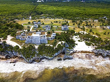
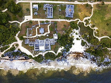
1350-6597 - Aerial views of El Castillo and the Ruins of the Mayan temple grounds at Tulum, Quintana Roo, Yucatan, Mexico. Tulum is the site of a pre-Columbian Mayan walled city which served as a major port for Coba, in the Mexican state of Quintana Roo. The ruins are situated on 12 meter 39 ft tall cliffs along the east coast of the Yucatán Peninsula on the Caribbean Sea in the state of Quintana Roo, Mexico. Tulum was one of the last cities built and inhabited by the Maya; it was at its height between the 13th and 15th centuries and managed to survive about 70 years after the Spanish began occupying Mexico. Old World diseases brought by the Spanish settlers appear to have resulted in very high fatalities, disrupting the society, and eventually causing the city to be abandoned.
1350-6599 - Aerial views of El Castillo and the Ruins of the Mayan temple grounds at Tulum, Quintana Roo, Yucatan, Mexico. Tulum is the site of a pre-Columbian Mayan walled city which served as a major port for Coba, in the Mexican state of Quintana Roo. The ruins are situated on 12 meter 39 ft tall cliffs along the east coast of the Yucatán Peninsula on the Caribbean Sea in the state of Quintana Roo, Mexico. Tulum was one of the last cities built and inhabited by the Maya; it was at its height between the 13th and 15th centuries and managed to survive about 70 years after the Spanish began occupying Mexico. Old World diseases brought by the Spanish settlers appear to have resulted in very high fatalities, disrupting the society, and eventually causing the city to be abandoned.
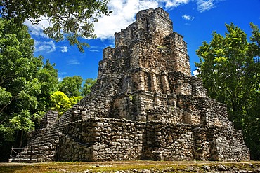
1350-6596 - Estructura 8I-13 El Castillo at Chunyaxche Muyil Maya ruins, rainforest near Tulum, Yucatan Peninsula, Quintana Roo, Mexico
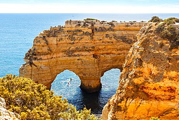
832-398168 - Algarve beach Praia da Marinha by the sea Rock formation in the shape of a heart Ocean in Praia da Marinha, Portugal, Europe
832-397659 - Impressive rock formations in Grand Canyon National Park, aerial view, Arizona, USA, North America
832-397708 - Long tail boat on tropical beach with limestone rock, Krabi, Thailand. Vintage style, cross process
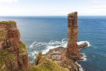
832-397849 - Surf pier, geology red sandstone on basalt, Old Man of Hoy, near Moorfea, Rackwick, Hoy, Orkney Islands, Scotland, Great Britain
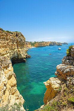
832-397748 - Turquoise sea, steep coast, Praia da Marinha beach, rugged rocky coast of sandstone, rock formations in the sea, Algarve, Lagos, Portugal, Europe
832-397657 - Striking rocks, rock needles in Monument Valley, illuminated by the evening sun, film set, Arizona, USA, North America
832-397749 - Turquoise sea, steep coast, Praia da Marinha beach, rugged rocky coast of sandstone, rock formations in the sea, Algarve, Lagos, Portugal, Europe
832-397385 - Sombrerillo limestone rock formations at dawn, El Torcal nature reserve, Torcal de Antequera, Malaga province, Andalucia, Spain, Europe
832-397382 - Sombrerillo limestone rock formations, El Torcal nature reserve, Torcal de Antequera, Malaga province, Andalusia, Spain, Europe
832-397383 - Limestone rock formations in the morning light, El Torcal nature reserve, Torcal de Antequera, Malaga province, Andalusia, Spain, Europe
832-397384 - Sombrerillo limestone rock formations at sunrise, El Torcal nature reserve, Torcal de Antequera, Malaga province, Andalusia, Spain, Europe
1113-107331 - Delicate Arch, Arches National Park, Moab, Utah, United States of America,
1113-107344 - Callanish Stones stone circle, Isle of Lewis, Hebrides, Outer Hebrides, Scotland UK
1113-107330 - Delicate Arch, Arches National Park, Moab, Utah, United States of America,
832-396342 - Carved wooden figure at the Devil's Wall rock formation near Weddersleben, Harz Mountains, Saxony-Anhalt, Germany, Europe
832-396419 - Volcanic rock formations, Ilheus da Rib rock needle, Ribeira da Janela cliff, Lanceiros, Madeira, Portugal, Europe
832-395765 - Sunrise at the Bastei Bridge, Bastei near Rathen, Elbe Sandstone Mountains, National Park Saxon Switzerland, Saxony, Germany, Europe
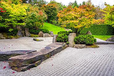
832-395807 - Japanese garden with gravel bed and stone formation, Berlin, Germany, Europe
832-395764 - Schrammsteine with Falkenstein and Koenigstein at sunrise, Saxon Switzerland National Park, Elbe Sandstone Mountains, Saxony, Germany, Europe
832-395806 - Japanese garden with gravel bed and stone formation, Berlin, Germany, Europe
