Recent searches
Loading...
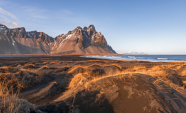
832-382241 - Evening atmosphere, Black sand beach, dunes with dry grass, mountains Klifatindur, Eystrahorn and Kambhorn, headland Stokksnes, massif Klifatindur, Austurland, East Iceland, Iceland, Europe
832-382218 - View of the Mount Otemanu volcano, Bora Bora, French Polynesia, Oceania
832-381377 - Boardwalk through the solfatara field Bumpass Hell, Lassen Volcanic National Park, California, USA, North America
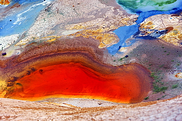
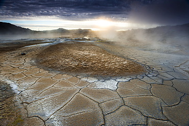
832-381275 - Winding river in the geothermal area Hverarönd, also Hverir or Namaskard, Northern Iceland, Iceland, Europe
832-380838 - Reflection in Pouakai Tarn lake, pink clouds around stratovolcano Mount Taranaki or Mount Egmont at sunset, Egmont National Park, Taranaki, New Zealand, Oceania
832-380145 - Sunrise, smoking volcano, Gunung Bromo, Mount Batok, Mount Kursi, Mount Semeru, Bromo Tengger Semeru National Park, Java, Indonesia, Asia
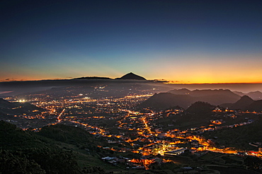
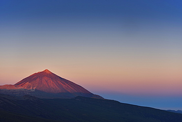
832-380269 - View over San Cristobal de La Laguna to Mount Teide at sunset, Tenerife, Spain, Europe
832-380834 - Reflection in Puakai Tarn, stratovolcano Mount Taranaki or Mount Egmont at sunset, Egmont National Park, Taranaki, New Zealand, Oceania
832-380791 - Road through the Atacama desert, behind volcanoes, Andean highlands, road B-357, Talabre, San Pedro de Atacama, El Loa province, Antofagasta region, Norte Grande de Chile, Chile, South America
832-380422 - Hikers climbing through volcanic landscape, Volcano Etna, Province of Catania, Silzilia, Italy, Europe
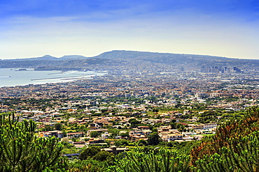
832-380643 - Cityscape taken from Vesuvius volcano, Naples, Campania, Italy, Europe
832-380574 - Svartifoss Waterfall, Black Falls, River Stórilækur, basalt pillars, Skaftafell National Park, Suðurland, Southern Region, Iceland, Europe
832-380582 - Road through lava fields, Reykjanes, Iceland, Europe
832-380836 - Reflection in Pouakai Tarn, stratovolcano Mount Taranaki or Mount Egmont, Egmont National Park, Taranaki, New Zealand, Oceania
832-380927 - Krafla volcanic area, sulfur springs, Leirhnjúkur, Reykjahlíð, Mývatni, Island
832-380884 - Emerald Lakes, crater lakes, volcanic landscape, Tongariro Alpine Crossing, Tongariro National Park, North Island, New Zealand, Oceania
832-380581 - Road through lava fields, Reykjanes, Iceland, Europe
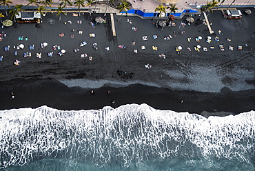
832-380451 - Surf, bathing people on black lava beach, Puerto Naos, La Palma, Canary Islands, Spain, Europe
832-380966 - Volcano cone and street at sunrise, dramatic lighting scene, island of Pico, Azores, Portugal, Europe
832-380925 - Krafla volcanic area, sulfur springs, Leirhnjúkur, Reykjahlíð, Mývatni, Island
832-380314 - Hohenstoffeln Volcano, Hegau, Lake Constance, Baden-Württemberg, Germany, Europe
832-380833 - Reflection in Pouakai Tarn, stratovolcano Mount Taranaki or Mount Egmont with cloud, Egmont National Park, Taranaki, New Zealand, Oceania
832-380835 - Reflection in Pouakai Tarn, stratovolcano Mount Taranaki or Mount Egmont at dusk, Egmont National Park, Taranaki, North Island, New Zealand, Oceania
832-380573 - Svartifoss Waterfall, Black Falls, River Stórilækur, basalt pillars, Skaftafell National Park, Suðurland, Southern Region, Iceland, Europe
832-380926 - Woman on volcano Leirhnjúkur, Krafla Volcanic area, Reykjahlíð, Mývatni, Island
832-380450 - Surf, bathing people on black lava beach, Puerto Naos, La Palma, Canary Islands, Spain, Europe
832-380837 - Reflection in Pouakai Tarn lake, pink clouds around stratovolcano Mount Taranaki or Mount Egmont at sunset, Egmont National Park, Taranaki, New Zealand, Oceania
832-381032 - Milky Way above Halema'uma'u crater eruption, Kilauea volcano, Hawai'i Volcanoes National Park, Big Island of Hawai'i, USA, North America
832-381034 - Lava entering ocean, Kalapana, Hawai'i Volcanoes National Park, Big Island, Hawai'i, USA, North America
832-380804 - Two tourists standing beside steaming fumarole, solfatara in Hverarond, also Hverir or Namaskard, geothermal area, North Iceland, Iceland, Europe
832-380999 - Volcanic beach, Timanfaya National park, Lanzarote, Canary Islands, Spain, Europe
832-380614 - Street TF21 through volcanic landscape with volcano Teide, Teide National Park, Tenerife, Canary Islands, Spain, Europe
832-381033 - Lava entering ocean, Kalapana, Hawai'i Volcanoes National Park, Big Island, Hawai'i, USA, North America
832-380808 - Boardwalk over steaming ground, mineral deposits, Seltun geothermal area, Krysuvik volcanic system, Reykjanesfolkvangur conservation area, Iceland, Europe
832-380822 - Sunset, smoking volcano Gunung Bromo, Mount Batok in front, Mount Kursi at back, Mount Gunung Semeru, Bromo Tengger Semeru National Park, Java, Indonesia, Asia
832-380615 - Mount Teide at sunrise, Teide National Park, Tenerife, Canary Islands, Spain, Europe
832-380617 - Pico del Teide at sunrise, Mount Teide, Teide National Park, Tenerife, Canary Islands, Spain, Europe
832-380820 - Sunrise, smoking volcano, Gunung Bromo, Mount Batok, Mount Kursi, Mount Semeru, Bromo Tengger Semeru National Park, Java, Indonesia, Asia
832-381011 - Porto di Levante and Vulcanello, Vulcano Island, Aeolian Islands, Tyrrhenian Sea, Italy, Europe
832-381010 - Sulfur vapor, Vulcano Island, Aeolian Islands, Italy, Europe
832-380607 - Road TF21, volcanic landscape, Teide National Park, Tenerife, Canary Islands, Spain, Europe
832-380807 - Rising steam, Hverarond, also Hverir or Namaskard, geothermal area, North Iceland, Iceland, Europe
832-380272 - Santorini Caldera, seen from Akrotiri, Santorini, Cyclades Islands, Greece, Europe
832-379224 - 360 panorama with the green sulphurous Emerald Lakes and volcanio Mt Tongariro, Tongariro National Park, Manawatu-Wanganui, North Island, New Zealand, Oceania
832-379233 - Ruins of the amphitheater, Teatro Antico di Taormina, with a view of volcano Etna, Taormina, Sicily, Italy, Europe
832-379139 - 360 degree panorama of volcano Pico Verde, Masca Gorge, Teno mountains, volcano Pico del Teide, Tenerife, Canary Islands, Spain, Europe
832-379146 - Llamas (lama glama) off Sajama Volcano, snow covered, Sajama National Park, Altiplano, Bolivia, South America
832-379223 - 360 panorama with the green sulphurous Emerald Lakes and volcanio Mt Tongariro, Tongariro National Park, Manawatu-Wanganui, North Island, New Zealand, Oceania
832-379083 - Vicunas (Vicugna vicugna) in front of Laguna Verde and the volcano Licancabur, Reserva Nacional de Fauna Andina Eduardo Abaroa, Sur Lipez, Potosi, Bolivia, South America
832-379232 - Ruins of the amphitheater, Teatro Antico di Taormina, with a view of volcano Etna, Taormina, Sicily, Italy, Europe
832-379145 - Snow covered volcanoes Pomerape and Parinacota with Guanaco (Lama guanicoe), Sajama National Park, Bolivian Bolivia border Chile
832-379137 - Volcano Kawah Ijen, volcanic crater with crater lake and steaming vents, morning light, Banyuwangi, Sempol, Jawa Timur, Indonesia, Asia
832-379144 - Llamas (lama glama) at river in front of volcano Sajama, covered with snow, Sajama National Park, Altiplano, Bolivia, South America
832-379136 - Young man with raised arms in front of volcanic landscape, view in Tengger Caldera, smoking volcano Gunung Bromo, in front Mt. Batok, in the back Mt. Kursi, Mt. Gunung Semeru, National Park Bromo-Tengger-Semeru, Java, Indonesia, Asia
832-379135 - Young man in front of volcanic landscape, view in Tengger Caldera, smoking volcano Gunung Bromo, in front Mt. Batok, behind Mt. Kursi, Mt. Gunung Semeru, National Park Bromo-Tengger-Semeru, Java, Indonesia, Asia
358-658 - The surfers' paradise and volcanic black sand beach at Piha, showing Lion Rock, a monolith housing many Maori carvings, Auckland area, North Island, New Zealand, Pacific
857-94717 - Nimoa Island - here the island mission will impress. The five-sided church features murals of island life and all mission buildings are surrounded by well maintained paths and gardens filled with flowering plants. Edged by jungle-covered mountains, postcard beaches and crystal clear waters - an island paradise indeed! The Louisiade Archipelago is a string of ten larger volcanic islands frequently fringed by coral reefs, and 90 smaller coral islands located 200 km southeast of New Guinea, stretching over more than 160 km and spread over an ocean area of 26,000 km? between the Solomon Sea to the north and the Coral Sea to the south. The aggregate land area of the islands is about 1,790 km? (690 square miles), with Vanatinai (formerly Sudest or Tagula as named by European claimants on Western maps) being the largest. Sideia Island and Basilaki Island lie closest to New Guinea, while Misima, Vanatinai, and Rossel islands lie further east. The archipelago is divided into the Local Level Government (LLG) areas Loui!
857-94720 - Nimoa Island - here the island mission will impress. The five-sided church features murals of island life and all mission buildings are surrounded by well maintained paths and gardens filled with flowering plants. Edged by jungle-covered mountains, postcard beaches and crystal clear waters - an island paradise indeed! The Louisiade Archipelago is a string of ten larger volcanic islands frequently fringed by coral reefs, and 90 smaller coral islands located 200 km southeast of New Guinea, stretching over more than 160 km and spread over an ocean area of 26,000 km? between the Solomon Sea to the north and the Coral Sea to the south. The aggregate land area of the islands is about 1,790 km? (690 square miles), with Vanatinai (formerly Sudest or Tagula as named by European claimants on Western maps) being the largest. Sideia Island and Basilaki Island lie closest to New Guinea, while Misima, Vanatinai, and Rossel islands lie further east. The archipelago is divided into the Local Level Government (LLG) areas Louisiade Rural (western part, with Misima), and Yaleyamba (western part, with Rossell and Tagula islands. The LLG areas are part of Samarai-Murua District district of Milne Bay. The seat of the Louisiade Rural LLG is Bwagaoia on Misima Island, the population center of the archipelago.
857-94718 - Nimoa Island - here the island mission will impress. The five-sided church features murals of island life and all mission buildings are surrounded by well maintained paths and gardens filled with flowering plants. Edged by jungle-covered mountains, postcard beaches and crystal clear waters - an island paradise indeed! The Louisiade Archipelago is a string of ten larger volcanic islands frequently fringed by coral reefs, and 90 smaller coral islands located 200 km southeast of New Guinea, stretching over more than 160 km and spread over an ocean area of 26,000 km? between the Solomon Sea to the north and the Coral Sea to the south. The aggregate land area of the islands is about 1,790 km? (690 square miles), with Vanatinai (formerly Sudest or Tagula as named by European claimants on Western maps) being the largest. Sideia Island and Basilaki Island lie closest to New Guinea, while Misima, Vanatinai, and Rossel islands lie further east. The archipelago is divided into the Local Level Government (LLG) areas Louisiade Rural (western part, with Misima), and Yaleyamba (western part, with Rossell and Tagula islands. The LLG areas are part of Samarai-Murua District district of Milne Bay. The seat of the Louisiade Rural LLG is Bwagaoia on Misima Island, the population center of the archipelago.
857-94722 - Children playing with a outrigger canoe in the village of Hessessai Bay at PanaTinai (Panatinane)island in the Louisiade Archipelago in Milne Bay Province, Papua New Guinea. The island has an area of 78 km2. The Louisiade Archipelago is a string of ten larger volcanic islands frequently fringed by coral reefs, and 90 smaller coral islands located 200 km southeast of New Guinea, stretching over more than 160 km and spread over an ocean area of 26,000 km? between the Solomon Sea to the north and the Coral Sea to the south. The aggregate land area of the islands is about 1,790 km? (690 square miles), with Vanatinai (formerly Sudest or Tagula as named by European claimants on Western maps) being the largest. Sideia Island and Basilaki Island lie closest to New Guinea, while Misima, Vanatinai, and Rossel islands lie further east. The archipelago is divided into the Local Level Government (LLG) areas Louisiade Rural (western part, with Misima), and Yaleyamba (western part, with Rossell and Tagula islands. The LLG areas are part of Samarai-Murua District district of Milne Bay. The seat of the Louisiade Rural LLG is Bwagaoia on Misima Island, the population center of the archipelago.PanaTinai (Panatinane) is an island in the Louisiade Archipelago in Milne Bay Province, Papua New Guinea.
857-94715 - Nimoa Island - here the island mission will impress. The five-sided church features murals of island life and all mission buildings are surrounded by well maintained paths and gardens filled with flowering plants. Edged by jungle-covered mountains, postcard beaches and crystal clear waters - an island paradise indeed! The Louisiade Archipelago is a string of ten larger volcanic islands frequently fringed by coral reefs, and 90 smaller coral islands located 200 km southeast of New Guinea, stretching over more than 160 km and spread over an ocean area of 26,000 km? between the Solomon Sea to the north and the Coral Sea to the south. The aggregate land area of the islands is about 1,790 km? (690 square miles), with Vanatinai (formerly Sudest or Tagula as named by European claimants on Western maps) being the largest. Sideia Island and Basilaki Island lie closest to New Guinea, while Misima, Vanatinai, and Rossel islands lie further east.
857-94719 - Nimoa Island - here the island mission will impress. The five-sided church features murals of island life and all mission buildings are surrounded by well maintained paths and gardens filled with flowering plants. Edged by jungle-covered mountains, postcard beaches and crystal clear waters - an island paradise indeed! The Louisiade Archipelago is a string of ten larger volcanic islands frequently fringed by coral reefs, and 90 smaller coral islands located 200 km southeast of New Guinea, stretching over more than 160 km and spread over an ocean area of 26,000 km? between the Solomon Sea to the north and the Coral Sea to the south. The aggregate land area of the islands is about 1,790 km? (690 square miles), with Vanatinai (formerly Sudest or Tagula as named by European claimants on Western maps) being the largest. Sideia Island and Basilaki Island lie closest to New Guinea, while Misima, Vanatinai, and Rossel islands lie further east. The archipelago is divided into the Local Level Government (LLG) areas Louisiade Rural (western part, with Misima), and Yaleyamba (western part, with Rossell and Tagula islands. The LLG areas are part of Samarai-Murua District district of Milne Bay. The seat of the Louisiade Rural LLG is Bwagaoia on Misima Island, the population center of the archipelago.
857-94721 - Nimoa Island - here the island mission will impress. The five-sided church features murals of island life and all mission buildings are surrounded by well maintained paths and gardens filled with flowering plants. Edged by jungle-covered mountains, postcard beaches and crystal clear waters - an island paradise indeed! The Louisiade Archipelago is a string of ten larger volcanic islands frequently fringed by coral reefs, and 90 smaller coral islands located 200 km southeast of New Guinea, stretching over more than 160 km and spread over an ocean area of 26,000 km? between the Solomon Sea to the north and the Coral Sea to the south. The aggregate land area of the islands is about 1,790 km? (690 square miles), with Vanatinai (formerly Sudest or Tagula as named by European claimants on Western maps) being the largest. Sideia Island and Basilaki Island lie closest to New Guinea, while Misima, Vanatinai, and Rossel islands lie further east. The archipelago is divided into the Local Level Government (LLG) areas Loui!
857-94716 - Nimoa Island - here the island mission will impress. The five-sided church features murals of island life and all mission buildings are surrounded by well maintained paths and gardens filled with flowering plants. Edged by jungle-covered mountains, postcard beaches and crystal clear waters - an island paradise indeed! The Louisiade Archipelago is a string of ten larger volcanic islands frequently fringed by coral reefs, and 90 smaller coral islands located 200 km southeast of New Guinea, stretching over more than 160 km and spread over an ocean area of 26,000 km? between the Solomon Sea to the north and the Coral Sea to the south. The aggregate land area of the islands is about 1,790 km? (690 square miles), with Vanatinai (formerly Sudest or Tagula as named by European claimants on Western maps) being the largest. Sideia Island and Basilaki Island lie closest to New Guinea, while Misima, Vanatinai, and Rossel islands lie further east. The archipelago is divided into the Local Level Government (LLG) areas Loui!
857-94714 - The Louisiade Archipelago is a string of ten larger volcanic islands frequently fringed by coral reefs, and 90 smaller coral islands located 200 km southeast of New Guinea, stretching over more than 160 km and spread over an ocean area of 26,000 km? between the Solomon Sea to the north and the Coral Sea to the south. The aggregate land area of the islands is about 1,790 km? (690 square miles), with Vanatinai (formerly Sudest or Tagula as named by European claimants on Western maps) being the largest. Sideia Island and Basilaki Island lie closest to New Guinea, while Misima, Vanatinai, and Rossel islands lie further east. The archipelago is divided into the Local Level Government (LLG) areas Louisiade Rural (western part, with Misima), and Yaleyamba (western part, with Rossell and Tagula islands. The LLG areas are part of Samarai-Murua District district of Milne Bay. The seat of the Louisiade Rural LLG is Bwagaoia on Misima Island, the population center of the archipelago.
857-94712 - The Louisiade Archipelago is a string of ten larger volcanic islands frequently fringed by coral reefs, and 90 smaller coral islands located 200 km southeast of New Guinea, stretching over more than 160 km and spread over an ocean area of 26,000 km? between the Solomon Sea to the north and the Coral Sea to the south. The aggregate land area of the islands is about 1,790 km? (690 square miles), with Vanatinai (formerly Sudest or Tagula as named by European claimants on Western maps) being the largest.Sideia Island and Basilaki Island lie closest to New Guinea, while Misima, Vanatinai, and Rossel islands lie further east. The archipelago is divided into the Local Level Government (LLG) areas Louisiade Rural (western part, with Misima), and Yaleyamba (western part, with Rossell and Tagula islands. The LLG areas are part of Samarai-Murua District district of Milne Bay. The seat of the Louisiade Rural LLG is Bwagaoia on Misima Island, the population center of the archipelago.
746-41667 - Tongarito national park, Taupo region, North Island, New Zealand, Pacific
1184-986 - Smokey Iozan (sulfur mountain) active volcano area, Akan National Park, Hokkaido, Japan, Asia
1184-990 - Sulphur pieces on Iozan (sulfur mountain) active volcano area, Akan National Park, Hokkaido, Japan, Asia
1184-985 - Sulphur pieces on Iozan (sulfur mountain) active volcano area, Akan National Park, Hokkaido, Japan, Asia
1113-102196 - Sinter terraces at Orakei Korako (Hidden Valley) geothermal area, Taupo Volcanic Zone, North Island, New Zealand
832-378511 - El Tatio geyser field, Atacama Desert, Antofagasto region, Chile, South America
797-12956 - African Buffalo in Ngorongoro Conservation Area, Ngorongoro crater, the world's largest inactive, intact, and unfilled volcanic caldera, Tanzania.
911-9946 - Brown Bluff, a Tuya, or flat topped volcano that erupted under the ice on the Antarctic Peninsular. This area is one of the most rapidly warming areas of the planet.
83-12894 - Mud pots, fumaroles and dormant Volcan Santa Clara at the San Jacinto volcanic thermal area north of Leon, Leon, Nicaragua, Central America
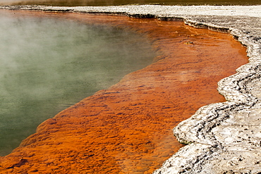
1113-96182 - Champagne Pool, Waio-tapu crater lake, Geothermal area near Rotorua, North Island, New Zealand
832-368248 - Eruption of the Fimmvoer√∞uh√°ls Volcano, between M√Ωrdalsjoekull and Eyjafjallajoekull, Highland, Iceland, Europe
832-372460 - Wine-growing, dryland agriculture on lava, volcanic landscape at La Geria, Lanzarote, Canary Islands, Spain, Europe
832-368319 - Hot spring, sinter terraces, Hveravellir high-temperature or geothermal region, Highlands, Iceland, Europe
832-368299 - Solfataras, fumaroles, mud pools, sulfur and other minerals, viewing platform, steam, Hveraroend geothermal area, N√°mafjall mountains, M√Ωvatn area, Nor√∞urland eystra, the north-east region, Iceland, Europe
832-368316 - Blue water pool, Bl√°hver hot spring, Hveravellir high-temperature or geothermal region, Highlands, Iceland, Europe
832-368301 - Krafla volcano on lake Viti, steam from a geothermal power plant, Myvatn area, Nordurland eystra, north-east region, Iceland, Europe
832-368298 - Solfataras, fumaroles, mud pools, sulfur and other minerals, steam, Hveraroend geothermal area, N√°mafjall mountains, M√Ωvatn area, Nor√∞urland eystra, the north-east region, Iceland, Europe
832-367478 - Guanacos (Llama guanicoe), Parinacota Volcano, Lake Chungara, Lauca National Park, Altiplano, Norte Grande, Northern Chile, Chile, South America
832-368252 - View from M√Ωrdalsjoekull Glacier towards the volcanic ash cloud from the eruption of the Fimmvoer√∞uh√°ls Volcano, between M√Ωrdalsjoekull and Eyjafjallajoekull, Highland, Iceland, Europe
832-373434 - Flamingos (Phoenicopteriformes, Phoenicopteridae) in a blue lagoon in front of volcanic mountains, Uyuni, Bolivia, South America
832-372461 - Wine-growing, dryland agriculture on lava, volcanic landscape at La Geria, Lanzarote, Canary Islands, Spain, Europe
832-376982 - 360 ° panorama of the Pico Viejo volcano and Pico del Teide mountain with a woman standing at the edge of a crater, Teide National Park, Tenerife, Canary Islands, Spain, Europe
832-368317 - Blue water pool, Bl√°hver hot spring, Hveravellir high-temperature or geothermal region, Highlands, Iceland, Europe
832-368297 - Solfataras, fumaroles, mud pools, sulfur and other minerals, steam, Hveraroend geothermal area, N√°mafjall mountains, M√Ωvatn area, Nor√∞urland eystra, the north-east region, Iceland, Europe
832-372209 - Two woman standing on the bow of the ship, Reina Silvia, volcanic mountains, northern tip of Ponta de Sao Vicente, Isabella Island, Galapagos Archipelago, Ecuador, South America, Pacific Ocean
832-368251 - Evacuation from the glacier, eruption of the Fimmvoer√∞uh√°ls Volcano, between M√Ωrdalsjoekull and Eyjafjallajoekull, Highland, Iceland, Europe
832-368247 - People with Super-Jeeps observing the lava flow from the eruption of the Fimmvoer√∞uh√°ls Volcano, between M√Ωrdalsjoekull and Eyjafjallajoekull, Highland, Iceland, Europe
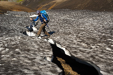
832-368235 - Female hiker walking on a snow slab, on the Laugavegur hiking trail, Hrafntinnusker-Álftavatn, Fjallabak Nature Reserve, Highlands of Iceland, Iceland, Europe
832-372462 - Worker in a lava field, dryland agriculture on lava, volcanic landscape at La Geria, Lanzarote, Canary Islands, Spain, Europe
832-368250 - View from M√Ωrdalsjoekull Glacier towards the volcanic ash cloud from the eruption of the Fimmvoer√∞uh√°ls Volcano, between M√Ωrdalsjoekull and Eyjafjallajoekull, Highland, Iceland, Europe
832-368324 - Aerial view, rhyolite mountains partially covered with snow, Landmannalaugar, Fjallabak conservation area, Icelandic Highlands, Iceland, Europe
832-368249 - Eruption of the Fimmvoer√∞uh√°ls Volcano, between M√Ωrdalsjoekull and Eyjafjallajoekull, Highland, Iceland, Europe
832-368314 - Mineral field, iron deposits, Brennisteinsalda volcano with the Laugahraun lava field, rhyolite mountains, Landmannalaugar, Fjallabak Nature Reserve, Highlands, Iceland, Europe
832-376984 - 360° panorama of the striking volcanic vent Roque El Cano, Vallehermoso, La Gomera, Canary Islands, Spain, Europe
