Recent searches
Loading...
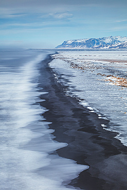
746-90099 - Sun Halo over DyrhÛlaey Promontory, Iceland, North Atlantic Ocean
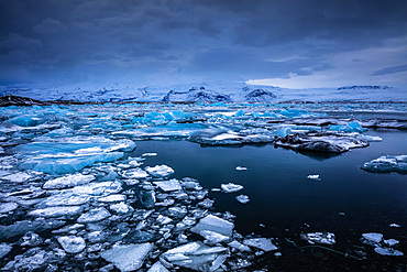
746-90101 - Jˆkuls·rlÛn glacier lagoon, Iceland, North Atlantic Ocean
746-90029 - Night eruption of Etna volcano seen from Zafferana Etnea village, Etna National Park, UNESCO, World Heritage Site, Sicily, Italy, Europe
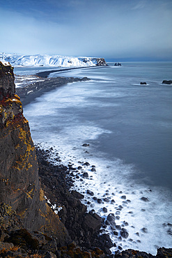
746-90100 - DyrhÛlaey Promontory, Iceland, North Atlantic Ocean
746-90098 - DyrhÛlaey Promontory, Iceland, North Atlantic Ocean
832-394594 - Rainbow and clouds, flank of table volcano Heroubreio or Herdubreid, Icelandic highlands, Iceland, Europe
832-394587 - Tent lit from inside, moonrise, Askja volcano, Icelandic highlands, Iceland, Europe
832-394592 - Volcanic landscape, Odaoahraun, Icelandic highlands, Iceland, Europe
832-394636 - Backlight, sunset, dirt road leads through moss-covered volcanic landscape, Laki Crater or Lakagigar, Highlands, South Iceland, Suourland, Iceland, Europe
832-394553 - Colored rhyolite mountains, Graenihryggur, Landmannalaugar, Fjallabak, Icelandic highlands, Iceland, Europe
832-394586 - Moonrise over Snaefell Volcano, Eastern Highlands, Iceland, Europe
832-394593 - Rainbow and clouds at the table volcano Heroubreio or Herdubreid, Icelandic Highlands, Iceland, Europe
832-394582 - Porsteinsskali hut, Heroubreioarlindir oasis, Heroubreio or Herdubreid table volcano in the background, Icelandic Highlands, Iceland, Europe
832-394585 - Moonrise over Snaefell Volcano, Eastern Highlands, Iceland, Europe
832-394588 - Man with headlamp standing in front of tent lit from inside, moonrise, Askja volcano, Icelandic highlands, Iceland, Europe
832-394595 - Green tent braced with lava rock, Askja volcano, Icelandic highlands, Iceland, Europe
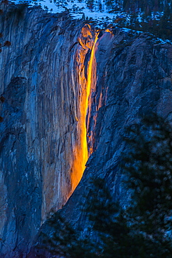
1178-37835 - Horsetail Falls in Yosemite National Park, Yosemite, California, United States
1218-1522 - View of Mount Rainier, a stratovolcano in the Cascade Range of the Pacific Northwest, located in Mount Rainier National Park, Washington State, United States of America, North America
1218-1523 - View of Mount Rainier, a stratovolcano in the Cascade Range of the Pacific Northwest, located in Mount Rainier National Park, Washington State, United States of America, North America
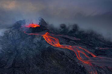
832-394013 - Aerial view, erupting volcano with lava fountains and lava field, crater with erupting lava and lava flow, Fagradalsfjall, Reykjanes Peninsula, Iceland, Europe
832-394178 - Tent in front of volcanic cone and lava, barren landscape, Vogar, Hverfjall, Myvatn, Iceland, Europe
832-394192 - Geothermal lake and volcano, steam vapour, moon-like landscape, Myvatn, Iceland, Europe
832-394011 - Aerial view, erupting volcano with lava fountains and lava field, crater with erupting lava and lava flow, Fagradalsfjall, Reykjanes Peninsula, Iceland, Europe
832-394014 - Aerial view, erupting volcano with lava fountains and lava field, crater with erupting lava and lava flow, Fagradalsfjall, Reykjanes Peninsula, Iceland, Europe
832-393982 - Caldera volcano with pumice fields, yellow coloured sulphur stones, Alexandros crater, Nisyros, Dodecanese, Greece, Europe
832-394170 - Lava fountains bubbling in a volcanic crater, Fagradalsfjall, Reykjanes, Grindavik, Iceland, Europe
832-394012 - Aerial view, erupting volcano with lava fountains and lava field, crater with erupting lava and lava flow, Fagradalsfjall, Reykjanes Peninsula, Iceland, Europe
832-394015 - Aerial view, erupting volcano with lava fountains and lava field, crater with erupting lava and lava flow, Fagradalsfjall, Reykjanes Peninsula, Iceland, Europe
832-394168 - Stone desert and active volcano in the background, Glowing lava fountains, Fagradalsfjall, Reykjanes, Grindavik, Sudurnes, Iceland, Europe
832-394016 - Aerial view, erupting volcano with lava fountains and lava field, crater with erupting lava and lava flow, Fagradalsfjall, Reykjanes Peninsula, Iceland, Europe
1160-4780 - Randecker Maar, former volcanic pipe, Ochsenwang, Swabian Alps, Baden-Wurttemberg, Germany, Europe
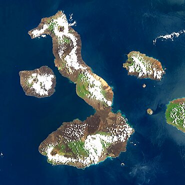
1348-4557 - Galapagos Volcanoes, Ecuador, True Colour Satellite Image. Galapagos Archipelago, Ecuador, true colour satellite image. Galapagos Archipelago is situated 1000 km West of the Ecuadorian coast. The largest and most volcanically active island in the archipelago is Isabela (6 volcanoes). On the left of image, the island of Fernandina (one volcano). Image taken on 16 March 2001 using LANDSAT data. Print size 30 x 30 cm.
1348-4573 - Easter Island, Chile, True Colour Satellite Image. Satellite image of Easter Island or Rapa Nui, territory of Chile, is an isolated island in the South Pacific ocean, West of Chile.The image used LANDSAT data.
1348-4559 - Augustine Volcano, Alaska, Usa, True Colour Satellite Image. Augustine Volcano, Alaska, true colour satellite image. Augustine is a volcano 1227 m high conical-shaped island stratovolcano located in Alaska's Cook Inlet. Image taken on 16 August 2000 using LANDSAT data. Print size 30 x 30 cm.
1348-3398 - Satellite view of Mauna Kea Volcano, Island of Hawaii. This image was compiled from data acquired by Landsat 8 satellite in 2014.
1348-3356 - Satellite view of Tenerife, Canary Islands, Spain. It is the largest and most populous island of the seven Canary Islands. Volcano Mount Teide at center is the highest point of Spain, at 3718 m. This image was compiled from data acquired by Landsat 8 satellite in 2014.
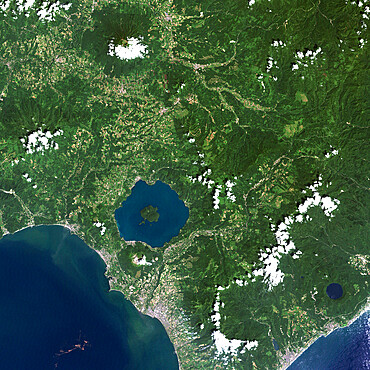
1348-4552 - Unzen Volcano In 2001, Japan, True Colour Satellite Image
1348-3053 - Color satellite image of Volcanoes on Kamchatka Peninsula, Russia. Klyuchevskaya, to the right, the tallest and most active volcano on the peninsula
1348-3404 - Satellite view of the State of Hawaii, USA. The main islands are Kauai, Oahu, Maui and the Island of Hawaii. This image was compiled from data acquired by Landsat 8 satellite in 2014.
1348-3405 - Satellite view of the Island of Hawaii, USA. The island is formed of five volcanoes, Mauna Loa being the largest. This image was compiled from data acquired by Landsat 8 satellite in 2014.
1348-4560 - Volcano Tousside In 3D, Chad, True Colour Satellite Image. Pic Tousside, Chad, true colour satellite image. A recent volcano, known as the Pic Tousside, in the Tibesti Mountains in Northwestern tip of Chad (Africa). Composite image dated 2000-2002 using LANDSAT data.
1348-3392 - Satellite view of Mount Kilimanjaro, Tanzania. This dormant volcano is the highest mountain in Africa. It is part of the Kilimanjaro National Park. This image was compiled from data acquired by Landsat satellites.
1348-4549 - Long Island Volcano, Papua New Guinea, True Colour Satellite Image
1348-3394 - Satellite view of Eruption at Mount Etna, Sicily. This image was taken on December 3, 2015 by Landsat 8 satellite.
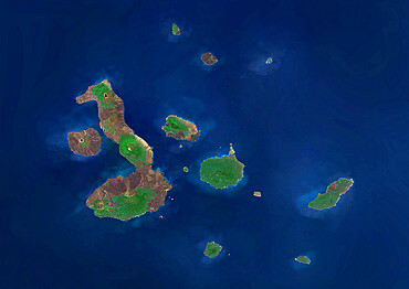
1348-4588 - Galapagos Archipelago, Ecuador, True Colour Satellite Image. True colour satellite image of the Galapagos islands, province of Ecuador
1348-3383 - Satellite view of Pico Island, Azores, Portugal. Volcano Mount Pico, to the West, is the highest point in Portugal, at 2351 m, and the most famous landmark in the Azores. This image was compiled from data acquired by Landsat satellites.
1348-4545 - Ararat Volcano, Turkey, True Colour Satellite Image
1348-3402 - Satellite view of Isabela and Fernandina Islands, Galapagos Islands. This image was compiled from data acquired by Landsat satellites.
1348-4550 - White Island Volcano'S Smoke Plume, New Zealand, True Colour Satellite Image
1348-4523 - Indonesia, Asia, True Colour Satellite Image With Border. Satellite view of Indonesia (with border). This image was compiled from data acquired by LANDSAT 5 & 7 satellites.
1348-4564 - Sahara Desert, Africa, True Colour Satellite Image. Sahara desert, true colour satellite image. The Sahara is the world's largest hot desert, made of sand and volcanic mountains. Composite image using data from LANDSAT 5 & 7 satellites.
1348-4551 - Usu Volcano, Japan, True Colour Satellite Image
1348-3058 - Color satellite image of Iceland. Image collected on August 30, 2017 by Sentinel-2 satellites.
1348-2834 - Edge of Lava Flow Sign in Tongariro National Park, North Island, New Zealand
1348-4561 - Richat Structure, Mauritania, True Colour Satellite Image. Richat Structure, Mauritania, true colour satellite image
1348-3434 - Satellite view of Ambrym, a volcanic island in the archipelago of Vanuatu. This image was compiled from data acquired by Landsat 8 satellite in 2014.
1348-3393 - Satellite view of Mount Erebus, the tallest volcano in Antarctica. Situated on Ross Island, just off the coast of West Antarctica, Erebus is the southernmost active volcano on Earth. This image was taken on December 31, 2013 by Landsat 8 satellite.
1348-3052 - Color satellite image of Volcanoes on Kamchatka Peninsula, Russia. Klyuchevskaya, to the right, the tallest and most active volcano on the peninsula
1348-4516 - Comoros, Africa, True Colour Satellite Image. Satellite view of the Comoros islands. This image was compiled from data acquired by LANDSAT 5 & 7 satellites.
1348-4547 - Karymsky Volcano, Russia, True Colour Satellite Image. Karymsky volcano, Russia, true colour satellite image
1348-4554 - Kelimutu Volcano, Indonesia, True Colour Satellite Image
1348-3437 - Satellite view of part of the Aeolian Islands, Italy. The image shows the islands of Salina, Lipari, Vulcano, Panarea and Basiluzzo. This image was compiled from data acquired by Landsat satellites.
1348-4558 - Teide Volcano, Canary Islands, Spain, True Colour Satellite Image
1348-4568 - Mount Egmont, New-Zealand, True Colour Satellite Image
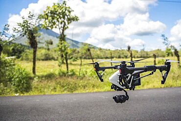
1348-2868 - Flying a drone at Arenal Volcano, Alajuela Province, Costa Rica, Central America
1348-4544 - Ardoukoba Volcano, Djibouti, True Colour Satellite Image. Ardoukoba, Djibouti, true colour satellite image. Ardoukoba is a volcano located close to Assal Lake in Djibouti. Image taken on 13 May 2000 using LANDSAT data. Print size 30 x 30 cm.
1348-3395 - Satellite view of Mount Raung, one of the most active volcanoes on the island of Java in Indonesia. This image was taken on July 27, 2015 by Landsat 8 satellite.
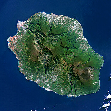
1348-4548 - Piton De La Fournaise Volcano, Reunion island, French overseas, true colour satellite image
1348-3369 - Satellite view of Sicily, Italy. Mount Etna, on the East coast of Sicily, is the largest active volcano in Europe. This image was compiled from data acquired by Landsat satellites.
1348-4556 - Mauna Loa Volcano, Hawai, Usa, True Colour Satellite Image
1348-3416 - Satellite view of Chikurachki Volcano that erupted on February 17, 2015. The volcano is located in the Kuril Islands in Russia. This image was taken by Landsat 8 satellite.
1348-4520 - Philippines, Asia, True Colour Satellite Image. Satellite view of the Philippines. This image was compiled from data acquired by LANDSAT 5 & 7 satellites.
1348-4553 - Mount Etna'S Smoke Plume In 1987, Italy, True Colour Satellite Image
1348-4546 - Niuafo'Ou Volcano, Tonga Islands, True Colour Satellite Image
1348-4563 - Santorini Island, Greece, True Colour Satellite Image. Santorini island, Greece, true colour satellite image. Santorini island is part of the Cyclades archipelago, Southeast of Greece. Image taken on 8 August 1999 using LANDSAT data.
1348-4555 - Bromo Volcano, Java Island, Indonesia, True Colour Satellite Image
1112-6303 - The northwest coast of Isabela Island, Galapagos, UNESCO World Heritage Site, Ecuador, South America
846-3111 - Volcanic coastline with waves crashing into sea caves, Los Hervideros, Timanfaya National Park, Lanzarote, Canary Islands, Spain, Atlantic, Europe
846-3108 - View over the volcanic landscape of Parque Natural de Los Volcanes, La Geria, Lanzarote, Canary Islands, Spain, Atlantic, Europe
1112-6252 - Llamas (Lama glama), feeding near Coqueza, a small town near the Thunupa Volcano, Salar de Uyuni, Bolivia, South America
1112-6255 - Llamas (Lama glama), feeding near Coqueza, a small town near the Thunupa Volcano, Salar de Uyuni, Bolivia, South America
1112-6254 - Llamas (Lama glama), feeding near Coqueza, a small town near the Thunupa Volcano, Salar de Uyuni, Bolivia, South America
1112-6253 - Llamas (Lama glama), feeding near Coqueza, a small town near the Thunupa Volcano, Salar de Uyuni, Bolivia, South America
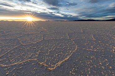
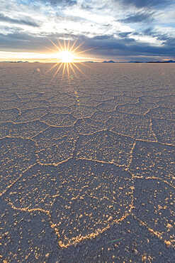
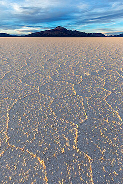
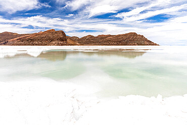
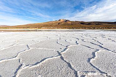
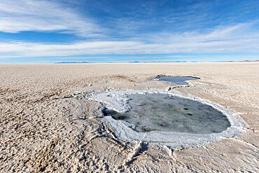
1112-6203 - The salt flats near Coqueza, a small town near the Thunupa Volcano, Salar de Uyuni, Daniel Campos Province, Bolivia, South America
1112-6202 - The salt flats near Coqueza, a small town near the Thunupa Volcano, Salar de Uyuni, Daniel Campos Province, Bolivia, South America
1112-6204 - The salt flats near Coqueza, a small town near the Thunupa Volcano, Salar de Uyuni, Daniel Campos Province, Bolivia, South America
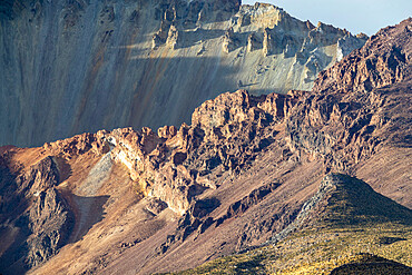
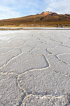
1112-6198 - The Thunupa Volcano, Salar de Uyuni, Daniel Campos Province, Bolivia, South America
1112-6178 - The salt flats near Coqueza, a small town near the Thunupa Volcano, Salar de Uyuni, Daniel Campos Province, Bolivia, South America
1112-6176 - Abandoned village near Coqueza, a small town near the Thunupa Volcano, Salar de Uyuni, Bolivia, South America
1112-6177 - Abandoned village near Coqueza, a small town near the Thunupa Volcano, Salar de Uyuni, Bolivia, South America
1112-6173 - The salt flats near Coqueza, a small town near the Thunupa Volcano, Salar de Uyuni, Daniel Campos Province, Bolivia, South America
1112-6174 - The salt flats near Coqueza, a small town near the Thunupa Volcano, Salar de Uyuni, Daniel Campos Province, Bolivia, South America
1112-6175 - The salt flats near Coqueza, a small town near the Thunupa Volcano, Salar de Uyuni, Daniel Campos Province, Bolivia, South America
1112-6179 - Salt workers near Coqueza, a small town near the Thunupa Volcano, Salar de Uyuni, Daniel Campos Province, Bolivia, South America
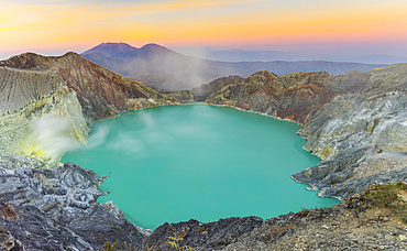
1116-51691 - Sunrise at Ijen Volcano crater; East Java, Java, Indonesia
1116-50839 - Sol de Manana Geysers, Eduardo Avaroa National Park; Potosi Department, Bolivia
1116-52157 - A beautiful sunset in the Tongariro National Park. The volcanic Mount Doom (Mount Ngauruhoe) can be seen in the background, with a roadside sign in the foreground; Manawatu-Wanganui, New Zealand
1116-52099 - Scenic view overlooking Monte Brasil and the capital city of Angra do Heroismo, with the sunset reflecting warm light on the whitewashed buildings and the brilliant blue Atlantic Ocean; Terceira, Azores
1116-51710 - Sulphur smoke inside Ijen Volcano crater; East Java, Java, Indonesia

