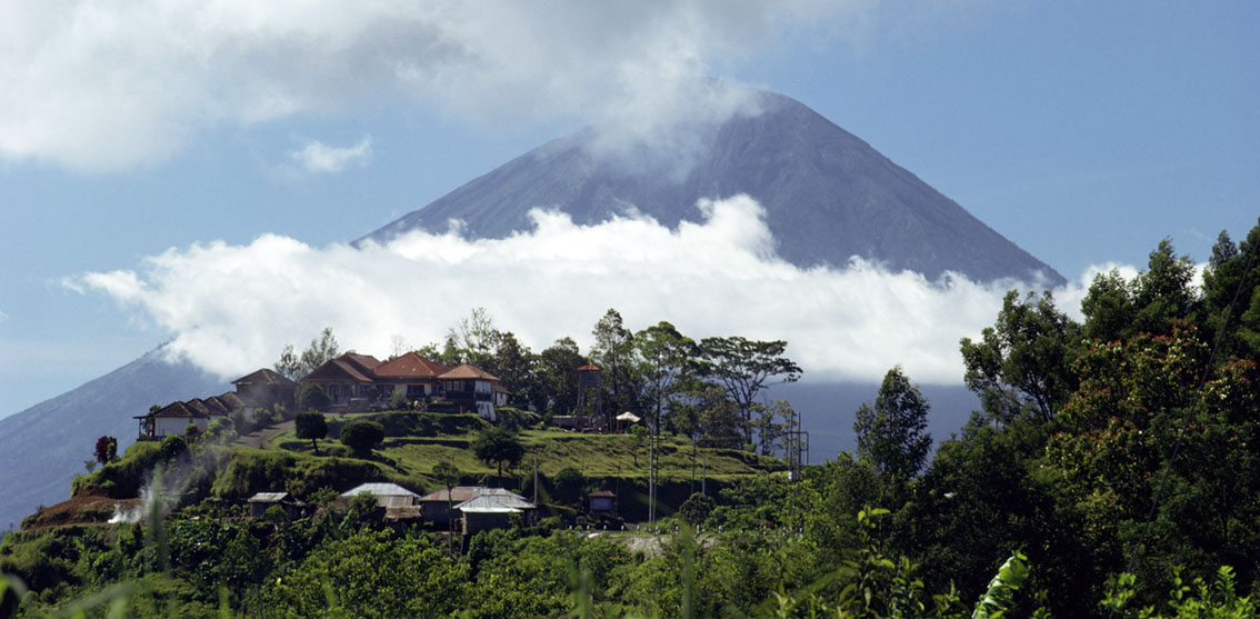
Last month tremors began on Mount Agung, Bali’s highest volcano, causing volcanologists to warn that it could erupt within a matter of hours or days. Thousands of people have been evacuated from the surrounding regions with an exclusion zone imposed of up to 12km from the mountain. Plans are also in place to redirect flights. The last time Mount Agung erupted, in 1963, around 1600 people were killed. So far, there has been no eruption, but locals are justifiably afraid.

Stock photo of sunrise over Mount Gunung Agung, Bali
Sunrise seen from the summit of Gunung Agung (3142m), the highest volcano on the island of Bali, Indonesia

The Balinese believe that Mount Agung is a replica of Mount Meru, the central axis of the universe. According to one legend the mountain is a fragment of Meru that was brought to Bali by the first Hindus. The most important temple on Bali, Pura Besakih, is located on the volcano’s slopes.

Stock photo of Pura Besakih temple, Bali
Overlook over the Pura Besakih temple complex, on the slopes of Mount Agung, Bali, Indonesia, Southeast Asia
Stock travel photo of of Mount Agung and Jemulek beach, Bali
View of Mount Agung (3142m) and Jemulek beach and hamlet near Amed on the northeastern coast of Bali, Indonesia
Stock travel photo of the village of Penelokan and the volcano of Mount Agung, Bali
Village of Penelokan with the volcano of Mount Agung behind, Bali, Indonesia, Southeast Asia
Stock photo of Agung mountain at dusk, Bali
The sacred mountain of Agung silhouetted at dusk, Bali, Indonesia, Asia

See more stock travel photos of Bali

error: All Images and Video is copyrighted and available to license from www.robertharding.com