Recent searches
Loading...
1384-400 - Tagine dish on white plate with potato carrot aubergine courgette and beef, Morocco, north Africa
1372-400 - Colorful houses kyanjin gompa, Lang Tang Valley Trek, Himalayas, Nepal. Towering summits of Langtang Lirung in the backround
1278-400 - Habsburg coat of arms emblem with sculptures on the roof of Hofburg Palace - Reich Chancellery wing - in Vienna, Austria.
860-292269 - The Upper Antelope Canyon, 2 to 3 m wide and 400 m long, managed by the Navajo Indian tribe. Antelope Canyon. Arizona. USA.
860-292268 - Antelope Canyon. The Upper Antelope Canyon, 2 to 3 m wide and 400 m long, managed by the Navajo Indian tribe, Arizona, USA.
860-292267 - Tourists visiting the Upper Antelope Canyon, 2 to 3 m wide and 400 m long, managed by the Navajo Indian tribe. Antelope Canyon. Arizona. USA.
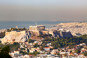
1265-400 - View over city to the Acropolis, Athens, Greece, Europe
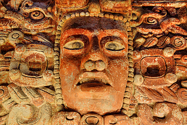
801-3792 - El Frisco de Placeres, (400-600 AD), from Los Placersos, Campeche, National Museum of Anthropology, Mexico City, Mexico
801-3793 - El Frisco de Placeres, (400-600 AD), from Los Placersos, Campeche, National Museum of Anthropology, Mexico City, Mexico
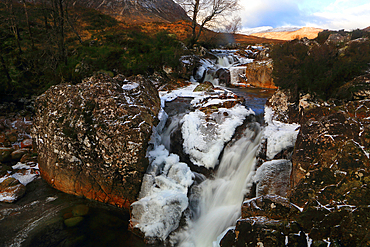
1365-400 - River Coupall in winter, Rannoch Moor, Scotland, UK
1361-400 - Car travels the icy and empty road crossing the boreal snowy forest at sunrise, Swedish Lapland, Sweden, Scandinavia, Europe
1360-400 - Church of Our Lady of the Marsh, Sterzing, Sudtirol (South Tyrol) (Province of Bolzano), Italy, Europe
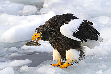
1185-400 - Stellers Sea Eagle (Haliaeetus pelagious), Rausu, Hokkaido, Japan, Asia
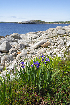
1241-400 - Wild Iris flowers on the rocky coastline by the Atlantic Ocean, Dr. Bill Freedman Nature Preserve, Nature Conservancy of Canada, Nova Scotia, Canada, North America
1353-400 - Y Lliwedd, Llyn Llydaw and the Miners Track route to Snowdon in winter, Cwm Dyli, Eryri, Snowdonia National Park, North Wales, United Kingdom, Europe
1359-400 - Tree reflecting in Taung Tha Man Lake near U-Bein bridge at sunset, Amarapura, Mandalay, Myanmar (Burma), Asia
1366-400 - Luxor, Egypt. View from a hot air balloon in Luxor.
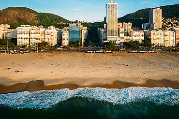
1243-400 - Aerial drone view of Leme Beach and Copacabana Beaches at sunrise with Princesa Isabel Avenue at centre, UNESCO World Heritage Site, Rio de Janeiro, Brazil, South America
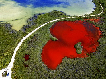
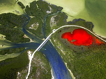
1350-6627 - Aerial view of Punta Allen Sian Ka'an Reserve, Yucatan Peninsula, Mexico. Red lagoon near Boca Paila Bridge.
In the language of the Mayan peoples who once inhabited this region, Sian Ka'an means Origin of the Sky. Located on the east coast of the Yucatán peninsula, this biosphere reserve contains tropical forests, mangroves and marshes, as well as a large marine section intersected by a barrier reef. It provides a habitat for a remarkably rich flora and a fauna comprising more than 300 species of birds, as well as a large number of the region's characteristic terrestrial vertebrates, which cohabit in the diverse environment formed by its complex hydrological system.
Along its roughly 120 kilometres of coastline, the property covers over 400,000 hectares of land ranging from sea level to only ten m.a.s.l. The property boasts diverse tropical forests, palm savannah, one of the most pristine wetlands in the region, lagoons, extensive mangrove stands, as well as sandy beaches and dunes. The 120,000 hectares of marine area protect a valuable part of the Mesoamerican Barrier Reef and seagrass beds in the shallow bays. The lush green of the forests and the many shades of blue of the lagoons and the Caribbean Sea under a wide sky offer fascinating visual impressions.
1350-6623 - Aerial view of Punta Allen Sian Ka'an Reserve, Yucatan Peninsula, Mexico. Red lagoon near Boca Paila Bridge.
In the language of the Mayan peoples who once inhabited this region, Sian Ka'an means Origin of the Sky. Located on the east coast of the Yucatán peninsula, this biosphere reserve contains tropical forests, mangroves and marshes, as well as a large marine section intersected by a barrier reef. It provides a habitat for a remarkably rich flora and a fauna comprising more than 300 species of birds, as well as a large number of the region's characteristic terrestrial vertebrates, which cohabit in the diverse environment formed by its complex hydrological system.
Along its roughly 120 kilometres of coastline, the property covers over 400,000 hectares of land ranging from sea level to only ten m.a.s.l. The property boasts diverse tropical forests, palm savannah, one of the most pristine wetlands in the region, lagoons, extensive mangrove stands, as well as sandy beaches and dunes. The 120,000 hectares of marine area protect a valuable part of the Mesoamerican Barrier Reef and seagrass beds in the shallow bays. The lush green of the forests and the many shades of blue of the lagoons and the Caribbean Sea under a wide sky offer fascinating visual impressions.
1350-6625 - Aerial view of Punta Allen Sian Ka'an Reserve, Yucatan Peninsula, Mexico. Red lagoon near Boca Paila Bridge.
In the language of the Mayan peoples who once inhabited this region, Sian Ka'an means Origin of the Sky. Located on the east coast of the Yucatán peninsula, this biosphere reserve contains tropical forests, mangroves and marshes, as well as a large marine section intersected by a barrier reef. It provides a habitat for a remarkably rich flora and a fauna comprising more than 300 species of birds, as well as a large number of the region's characteristic terrestrial vertebrates, which cohabit in the diverse environment formed by its complex hydrological system.
Along its roughly 120 kilometres of coastline, the property covers over 400,000 hectares of land ranging from sea level to only ten m.a.s.l. The property boasts diverse tropical forests, palm savannah, one of the most pristine wetlands in the region, lagoons, extensive mangrove stands, as well as sandy beaches and dunes. The 120,000 hectares of marine area protect a valuable part of the Mesoamerican Barrier Reef and seagrass beds in the shallow bays. The lush green of the forests and the many shades of blue of the lagoons and the Caribbean Sea under a wide sky offer fascinating visual impressions.
1350-6620 - Aerial view of Punta Allen Sian Ka'an Reserve, Yucatan Peninsula, Mexico. Red lagoon near Boca Paila Bridge.
In the language of the Mayan peoples who once inhabited this region, Sian Ka'an means Origin of the Sky. Located on the east coast of the Yucatán peninsula, this biosphere reserve contains tropical forests, mangroves and marshes, as well as a large marine section intersected by a barrier reef. It provides a habitat for a remarkably rich flora and a fauna comprising more than 300 species of birds, as well as a large number of the region's characteristic terrestrial vertebrates, which cohabit in the diverse environment formed by its complex hydrological system.
Along its roughly 120 kilometres of coastline, the property covers over 400,000 hectares of land ranging from sea level to only ten m.a.s.l. The property boasts diverse tropical forests, palm savannah, one of the most pristine wetlands in the region, lagoons, extensive mangrove stands, as well as sandy beaches and dunes. The 120,000 hectares of marine area protect a valuable part of the Mesoamerican Barrier Reef and seagrass beds in the shallow bays. The lush green of the forests and the many shades of blue of the lagoons and the Caribbean Sea under a wide sky offer fascinating visual impressions.
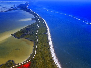
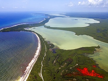
1350-6616 - Aerial view of Punta Allen Sian Ka'an Reserve, Yucatan Peninsula, Mexico.
In the language of the Mayan peoples who once inhabited this region, Sian Ka'an means Origin of the Sky. Located on the east coast of the Yucatán peninsula, this biosphere reserve contains tropical forests, mangroves and marshes, as well as a large marine section intersected by a barrier reef. It provides a habitat for a remarkably rich flora and a fauna comprising more than 300 species of birds, as well as a large number of the region's characteristic terrestrial vertebrates, which cohabit in the diverse environment formed by its complex hydrological system.
Along its roughly 120 kilometres of coastline, the property covers over 400,000 hectares of land ranging from sea level to only ten m.a.s.l. The property boasts diverse tropical forests, palm savannah, one of the most pristine wetlands in the region, lagoons, extensive mangrove stands, as well as sandy beaches and dunes. The 120,000 hectares of marine area protect a valuable part of the Mesoamerican Barrier Reef and seagrass beds in the shallow bays. The lush green of the forests and the many shades of blue of the lagoons and the Caribbean Sea under a wide sky offer fascinating visual impressions.
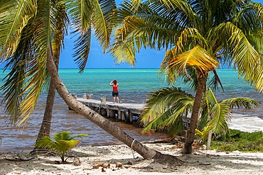
1350-6615 - Palms and old pier in Punta Allen Sian Ka'an Reserve, Yucatan Peninsula, Mexico.
In the language of the Mayan peoples who once inhabited this region, Sian Ka'an means Origin of the Sky. Located on the east coast of the Yucatán peninsula, this biosphere reserve contains tropical forests, mangroves and marshes, as well as a large marine section intersected by a barrier reef. It provides a habitat for a remarkably rich flora and a fauna comprising more than 300 species of birds, as well as a large number of the region's characteristic terrestrial vertebrates, which cohabit in the diverse environment formed by its complex hydrological system.
Along its roughly 120 kilometres of coastline, the property covers over 400,000 hectares of land ranging from sea level to only ten m.a.s.l. The property boasts diverse tropical forests, palm savannah, one of the most pristine wetlands in the region, lagoons, extensive mangrove stands, as well as sandy beaches and dunes. The 120,000 hectares of marine area protect a valuable part of the Mesoamerican Barrier Reef and seagrass beds in the shallow bays. The lush green of the forests and the many shades of blue of the lagoons and the Caribbean Sea under a wide sky offer fascinating visual impressions.
1264-400 - Nuvolau in autumn, Falzarego Pass, Dolomites, Veneto, Italy, Europe
1336-400 - Medieval castle of Vignola with fortified tower, framed by tree branches, Vignola, Emilia Romagna, Italy, Europe
1311-400 - An area south of the Tepees in Petrified Forest National Park known as the Little Tepees, Arizona, United States of America, North America
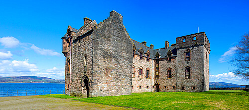
1237-400 - Newark Castle, Port Glasgow, Inverclyde, Scotland, United Kingdom, Europe
1350-9 - Taken with 90mm Stowaway AP Refractor, with Borg .85x compressor/flattener for f/5.6. With Canon 20Da camera at ISO 400 for 13 second exposure. on Skywatcher HEQ5 mount tracking at Lunar rate. Exposure kept long to bring out star background. original = 1
1350-28 - The Carina Nebula (aka Eta Carinae) in the southern sky, shot December 11, 2012 from Timor Cottage, Coonabarabran, NSW, Australia. This is a stack of 5 x 12 minute exposures at ISO 400 with the Canon 5D MkII (filter modified) and Astro-Physics 105mm Traveler apo refractor and 6x7 field flattener.
1350-400 - Hands pouring water from beaker into a test tube in lab at UMCP Greenhouse
1350-1133 - Morihisa Suzuki is reviewing the quality of work in a new iron teapot or tetsubin , the only woman who has made iron teapots in the nearly 400 years of history that has molten iron crafts in Iwate, in Workshop of Morihisha Suzuki,craftsmen since 1625, nanbu tekki, Morioka, Iwate Prefecture, Japan
1350-1137 - Morihisa Suzuki is putting the finishing touches at iron teapot or tetsubin, the only woman who has made teapots in the nearly 400 years of history that has molten iron crafts in Iwate, in Workshop of Morihisha Suzuki,craftsmen since 1625, nanbu tekki, Morioka, Iwate Prefecture, Japan
1350-1138 - Morihisa Suzuki is putting the finishing touches at iron teapot or tetsubin, the only woman who has made teapots in the nearly 400 years of history that has molten iron crafts in Iwate, in Workshop of Morihisha Suzuki,craftsmen since 1625, nanbu tekki, Morioka, Iwate Prefecture, Japan
1350-37 - Total eclipse of the Moon, December 20/21, 2010, taken from home with 130mm AP apo refractor at f/6 and Canon 7D at ISO 400. An HDR composite of 9 images from 1/125 second to 2 seconds, composited in Photoshop CS5. Vibrancy increased to show bring out the colour variations across the shadow and at the edge of the shadow. Taken at about 12:21 am MST on Dec 21, about 20 minutes before totality began, during the partial phase.
1350-38 - Total eclipse of the Moon, December 20/21, 2010, taken from home with 130mm AP apo refractor at f/6 and Canon 7D at ISO 400 for 4 seconds, single exposure, shortly after totality began.
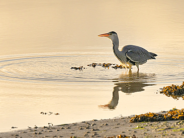
1240-400 - Grey Heron (Ardea cinerea), County Clare, Munster, Republic of Ireland, Europe
1200-400 - Icelandic horse (Equus ferus caballus), Gullfoss, Iceland, Polar Regions
1202-400 - Rolling farmland and the village of Brompton Regis, near Wimbleball Lake, in Exmoor National Park, Somerset, England, United Kingdom, Europe
1242-400 - Forest trail, Sleeping Bear Dunes National Park, Glen Arbor, Michigan, United States of America, North America
1306-400 - Three Guanaco in Pinturas Canyon, Patagonia, Argentina, South America
1186-400 - Batad, UNESCO World Heritage Site, Luzon, Philippines, Southeast Asia, Asia
1267-400 - Wild Konik horses at the riverbank of Monks Lode on Wicken Fen, Wicken, near Ely, Cambridgeshire, England, United Kingdom, Europe
805-1237 - Ocean going dhow, constructed by hand from Sal wood in 400 year old tradition, on the Rukmavati River, Mandvi, Gujarat, India, Asia
805-1236 - Ocean going dhow, constructed by hand from Sal wood in 400 year old tradition, on the Rukmavati River, Mandvi, Gujarat, India, Asia
1216-400 - The Broken Heart of Rodel, Rodel, Isle of Harris, Outer Hebrides, Scotland, United Kingdom, Europe
1269-400 - Church by Matterhorn in Zermatt, Switzerland, Europe
1297-400 - Marble Arch, London, England, United Kingdom, Europe
1292-400 - Dublinia and Christ Church, Dublin, Republic of Ireland, Europe
1276-400 - View of Welcome to Fabulous Las Vegas sign on The Strip, Las Vegas Boulevard, Las Vegas, Nevada, United States of America, North America
1207-400 - Horse and carriage, Old Town, Warsaw, Poland, Europe
1283-400 - View to Lokrum Island at sunset, Dubrovnik, Croatia, Europe
802-400 - The wild coastline near Seixal, northwest Madeira, Portugal, Atlantic Ocean, Europe
1251-400 - Lodges with Gerold lake and Karwendel Alps in the background, Krun, Upper Bavaria, Bavaria, Germany, Europe
1245-400 - Moais in Ahu Tongariki, Rapa Nui National Park, UNESCO World Heritage Site, Easter Island, Chile, South America
746-70092 - Middle East, Jordan, Dead Sea, 400 metres below sea level
746-70210 - Middle East, Jordan, Wadi Mujib, a wonderful gorge which enters the Dead Sea at about 400 meters below the sea level
1132-400 - View of the London Financial District, City Hall, The Shard and River Thames, London, England, United Kingdom, Europe
1226-400 - Sightseeing boat passing under DuSable Bridge on the Chicago River with Wrigley Building behind, Chicago, Illinois, United States of America, North America
1225-400 - A Fernando Botero sculpture at the Museo Botero, Bogota, Colombia, South America
1184-400 - Old cannons in front of the Citadelle Laferriere, UNESCO World Heritage Site, Cap Haitien, Haiti, Caribbean, Central America
857-92992 - Tunisia, Ksar Ouled Soltane, former fortress and its 400 Ghorfas
857-92991 - Tunisia, Ksar Ouled Soltane, former fortress and its 400 Ghorfas
1218-400 - The Italian fishing village of Portofino, Liguria, Italy, Europe
1176-400 - Devotees paying obeisance at the Shwedagon pagoda complex in Yangon (Rangoon), Myanmar (Burma), Southeast Asia
1199-400 - Female Orangutan Sumatra with babies (Pongo abelii), Indonesia, Southeast Asia
1212-400 - Fisherman mending nets, Alghero, Sardinia, Europe
857-89709 - Hikers setup camp on a beach along the Colorado River near the plumeting 180-foot Deer Creek Falls in the Grand Canyon outside of Fredonia, Arizona November 2011. The 21.4-mile loop starts at the Bill Hall trailhead on the North Rim and descends 2000-feet in 2.5-miles through Coconino Sandstone to the level Esplanada then descends further into the lower canyon through a break in the 400-foot-tall Redwall to access Surprise Valley. Hikers connect Thunder River and Tapeats Creek to a route along the Colorado River and climb out Deer Creek.
857-89713 - Female hiker cooks dinner on a cliff-pinched patio above camp and the Colorado River near Deer Creek Falls in the Grand Canyon outside of Fredonia, Arizona November 2011. The 21.4-mile loop starts at the Bill Hall trailhead on the North Rim and descends 2000-feet in 2.5-miles through Coconino Sandstone to the level Esplanada then descends further into the lower canyon through a break in the 400-foot-tall Redwall to access Surprise Valley. Hikers connect Thunder River and Tapeats Creek to a route along the Colorado River and climb out Deer Creek.
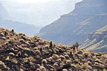
857-89701 - Hikers on the sandstone Esplanade of the Thunder River Trail below the North Rim of the Grand Canyon outside Fredonia, Arizona November 2011. The 21.4-mile loop descends 2000-feet in 2.5-miles through Coconino Sandstone from the Bill Hall trailhead to connect the Thunder River and Deer Creeks trails. Hikers descend into the lower canyon through a break in the 400-foot-tall Redwall to access Surprise Valley, Deer Creek, Tapeats Creek via Thunder River and even the Colorado River.
857-89710 - Hikers cook dinner on a cliff-pinched patio above camp and the Colorado River near Deer Creek Falls in the Grand Canyon outside of Fredonia, Arizona November 2011. The 21.4-mile loop starts at the Bill Hall trailhead on the North Rim and descends 2000-feet in 2.5-miles through Coconino Sandstone to the level Esplanada then descends further into the lower canyon through a break in the 400-foot-tall Redwall to access Surprise Valley. Hikers connect Thunder River and Tapeats Creek to a route along the Colorado River and climb out Deer Creek.
857-89708 - Hikers swim in the pool below 180-foot Deer Creek Falls in the Grand Canyon outside of Fredonia, Arizona November 2011. The 21.4-mile loop starts at the Bill Hall trailhead on the North Rim and descends 2000-feet in 2.5-miles through Coconino Sandstone to the level Esplanada then descends further into the lower canyon through a break in the 400-foot-tall Redwall to access Surprise Valley. Hikers connect Thunder River and Tapeats Creek to a route along the Colorado River and climb out Deer Creek.
857-89717 - Hikers follow a route along the Colorado River that connect Tapeats Creek and Thunder River to Deer Creek in the Grand Canyon outside of Fredonia, Arizona November 2011. The 21.4-mile loop starts at the Bill Hall trailhead on the North Rim and descends 2000-feet in 2.5-miles through Coconino Sandstone to the level Esplanada then descends further into the lower canyon through a break in the 400-foot-tall Redwall to access Surprise Valley. Hikers connect Thunder River and Tapeats Creek to a route along the Colorado River and climb out Deer Creek.
857-89712 - Male hiker filters water on a cliff-pinched patio near Deer Creek Falls in the Grand Canyon outside of Fredonia, Arizona November 2011. The 21.4-mile loop starts at the Bill Hall trailhead on the North Rim and descends 2000-feet in 2.5-miles through Coconino Sandstone to the level Esplanada then descends further into the lower canyon through a break in the 400-foot-tall Redwall to access Surprise Valley. Hikers connect Thunder River and Tapeats Creek to a route along the Colorado River and climb out Deer Creek.
857-89700 - Hikers on the sandstone Esplanade of the Thunder River Trail below the North Rim of the Grand Canyon outside Fredonia, Arizona November 2011. The 21.4-mile loop descends 2000-feet in 2.5-miles through Coconino Sandstone from the Bill Hall trailhead to connect the Thunder River and Deer Creeks trails. Hikers descend into the lower canyon through a break in the 400-foot-tall Redwall to access Surprise Valley, Deer Creek, Tapeats Creek via Thunder River and even the Colorado River.
857-89703 - Hikers past small waterfalls along Deer Creek Narrows in the Grand Canyon outside of Fredonia, Arizona November 2011. The 21.4-mile loop starts at the Bill Hall trailhead on the North Rim and descends 2000-feet in 2.5-miles through Coconino Sandstone to the level Esplanada then descends further into the lower canyon through a break in the 400-foot-tall Redwall to access Surprise Valley. Hikers connect Thunder River and Tapeats Creek to a route along the Colorado River and climb out Deer Creek.
857-89711 - Male hiker filters water on a cliff-pinched patio near Deer Creek Falls in the Grand Canyon outside of Fredonia, Arizona November 2011. The 21.4-mile loop starts at the Bill Hall trailhead on the North Rim and descends 2000-feet in 2.5-miles through Coconino Sandstone to the level Esplanada then descends further into the lower canyon through a break in the 400-foot-tall Redwall to access Surprise Valley. Hikers connect Thunder River and Tapeats Creek to a route along the Colorado River and climb out Deer Creek.
857-89702 - Hikers walk along Deer Creek Narrows in the Grand Canyon outside of Fredonia, Arizona November 2011. The 21.4-mile loop starts at the Bill Hall trailhead on the North Rim and descends 2000-feet in 2.5-miles through Coconino Sandstone to the level Esplanada then descends further into the lower canyon through a break in the 400-foot-tall Redwall to access Surprise Valley. Hikers connect Thunder River and Tapeats Creek to a route along the Colorado River and climb out Deer Creek.
857-89705 - Hikers walk along Deer Creek Narrows in the Grand Canyon outside of Fredonia, Arizona November 2011. The 21.4-mile loop starts at the Bill Hall trailhead on the North Rim and descends 2000-feet in 2.5-miles through Coconino Sandstone to the level Esplanada then descends further into the lower canyon through a break in the 400-foot-tall Redwall to access Surprise Valley. Hikers connect Thunder River and Tapeats Creek to a route along the Colorado River and climb out Deer Creek.
989-400 - Grey squirrel (Sciurus carolinensis) biting into a peach stone left by a tourist on a lawn in St. James's Park, London, England, United Kingdom, Europe
1179-400 - Sunset on the surreal Skagsanden beach surrounded by snow covered mountains, Flakstad, Lofoten Islands, Arctic, Norway, Scandinavia, Europe
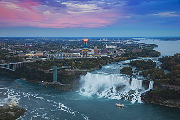
1104-400 - View of Rainbow Bridge and The American Falls, Niagara Falls, Niagara, border of New York State, and Ontario Canada, North America
857-86011 - Hikers walk along Deer Creek Narrows in the Grand Canyon outside of Fredonia, Arizona November 2011. The 21.4-mile loop starts at the Bill Hall trailhead on the North Rim and descends 2000-feet in 2.5-miles through Coconino Sandstone to the level Esplanada then descends further into the lower canyon through a break in the 400-foot-tall Redwall to access Surprise Valley. Hikers connect Thunder River and Tapeats Creek to a route along the Colorado River and climb out Deer Creek.
857-86023 - Male hiker filters water on a cliff-pinched patio near Deer Creek Falls in the Grand Canyon outside of Fredonia, Arizona November 2011. The 21.4-mile loop starts at the Bill Hall trailhead on the North Rim and descends 2000-feet in 2.5-miles through Coconino Sandstone to the level Esplanada then descends further into the lower canyon through a break in the 400-foot-tall Redwall to access Surprise Valley. Hikers connect Thunder River and Tapeats Creek to a route along the Colorado River and climb out Deer Creek.
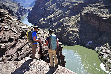
857-86016 - Hikers overlook the Colorado River as they exit the Deer Creek Narrows in the Grand Canyon outside of Fredonia, Arizona November 2011. The 21.4-mile loop starts at the Bill Hall trailhead on the North Rim and descends 2000-feet in 2.5-miles through Coconino Sandstone to the level Esplanada then descends further into the lower canyon through a break in the 400-foot-tall Redwall to access Surprise Valley. Hikers connect Thunder River and Tapeats Creek to a route along the Colorado River and climb out Deer Creek.
857-86021 - Hikers setup camp on a beach along the Colorado River near the plumeting 180-foot Deer Creek Falls in the Grand Canyon outside of Fredonia, Arizona November 2011. The 21.4-mile loop starts at the Bill Hall trailhead on the North Rim and descends 2000-feet in 2.5-miles through Coconino Sandstone to the level Esplanada then descends further into the lower canyon through a break in the 400-foot-tall Redwall to access Surprise Valley. Hikers connect Thunder River and Tapeats Creek to a route along the Colorado River and climb out Deer Creek.
857-86015 - Hikers walk along Deer Creek Narrows in the Grand Canyon outside of Fredonia, Arizona November 2011. The 21.4-mile loop starts at the Bill Hall trailhead on the North Rim and descends 2000-feet in 2.5-miles through Coconino Sandstone to the level Esplanada then descends further into the lower canyon through a break in the 400-foot-tall Redwall to access Surprise Valley. Hikers connect Thunder River and Tapeats Creek to a route along the Colorado River and climb out Deer Creek.
857-86013 - Hikers walk along Deer Creek Narrows in the Grand Canyon outside of Fredonia, Arizona November 2011. The 21.4-mile loop starts at the Bill Hall trailhead on the North Rim and descends 2000-feet in 2.5-miles through Coconino Sandstone to the level Esplanada then descends further into the lower canyon through a break in the 400-foot-tall Redwall to access Surprise Valley. Hikers connect Thunder River and Tapeats Creek to a route along the Colorado River and climb out Deer Creek.
857-86000 - Hikers on the sandstone Esplanade of the Thunder River Trail below the North Rim of the Grand Canyon outside Fredonia, Arizona November 2011. The 21.4-mile loop descends 2000-feet in 2.5-miles through Coconino Sandstone from the Bill Hall trailhead to connect the Thunder River and Deer Creeks trails. Hikers descend into the lower canyon through a break in the 400-foot-tall Redwall to access Surprise Valley, Deer Creek, Tapeats Creek via Thunder River and even the Colorado River.
857-86025 - Hikers follow a route along the Colorado River that connect Tapeats Creek and Thunder River to Deer Creek in the Grand Canyon outside of Fredonia, Arizona November 2011. The 21.4-mile loop starts at the Bill Hall trailhead on the North Rim and descends 2000-feet in 2.5-miles through Coconino Sandstone to the level Esplanada then descends further into the lower canyon through a break in the 400-foot-tall Redwall to access Surprise Valley. Hikers connect Thunder River and Tapeats Creek to a route along the Colorado River and climb out Deer Creek.
857-86007 - Hikers cook dinner along Deer Creek Narrows in the Grand Canyon outside of Fredonia, Arizona November 2011. The 21.4-mile loop starts at the Bill Hall trailhead on the North Rim and descends 2000-feet in 2.5-miles through Coconino Sandstone to the level Esplanada then descends further into the lower canyon through a break in the 400-foot-tall Redwall to access Surprise Valley. Hikers connect Thunder River and Tapeats Creek to a route along the Colorado River and climb out Deer Creek.
857-86027 - Hikers climb out of Surprise Valley to the North Rim of the Grand Canyon outside of Fredonia, Arizona November 2011. The 21.4-mile loop starts at the Bill Hall trailhead on the North Rim and descends 2000-feet in 2.5-miles through Coconino Sandstone to the level Esplanada then descends further into the lower canyon through a break in the 400-foot-tall Redwall to access Surprise Valley. Hikers connect Thunder River and Tapeats Creek to a route along the Colorado River and climb out Deer Creek.
857-86022 - Hikers setup camp on a beach along the Colorado River near the plumeting 180-foot Deer Creek Falls in the Grand Canyon outside of Fredonia, Arizona November 2011. The 21.4-mile loop starts at the Bill Hall trailhead on the North Rim and descends 2000-feet in 2.5-miles through Coconino Sandstone to the level Esplanada then descends further into the lower canyon through a break in the 400-foot-tall Redwall to access Surprise Valley. Hikers connect Thunder River and Tapeats Creek to a route along the Colorado River and climb out Deer Creek.
857-86003 - Hikers descend into Surprise Valley to access the lower canyon through a break in the 400-foot-tall Redwall on the Thunder River Trail in the Grand Canyon outside of Fredonia, Arizona November 2011. The 21.4-mile loop starts at the Bill Hall trailhead on the North Rim and descends 2000-feet in 2.5-miles through Coconino Sandstone to the level Esplanada then descends further into the lower canyon to access Thunder River, Tapeats Creek and Deer Creek.
801-906 - Petroglyph National Monument, petroglyphs carved into volcanic rock by American Indians 400 to 700 years ago, New Mexico, United States of America, North America
832-370321 - Man in Abraham Lincoln costume, Fourth of July celebrations (Independence Day) in Gustavus: population 400, Alaska, USA, North America
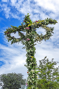
10-400 - Maypole decorated with flowers in celebration of Midsummer's Day, Sweden's most celebrated festival, Sweden, Scandinavia, Europe


