Recent searches
Loading...
1384-261 - If You Are Looking For a Sign This is It, advert for Mango Y Chile restataurant, Bacalar, Quintana Roo, Yucatan Peninsula, Mexico
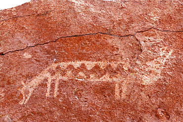
860-291990 - Pre-Hispanic petroglyphs. Stopover for caravans linking the altiplano to the Pacific coast. Hierbas Buenas, Atacama Desert, Chile.
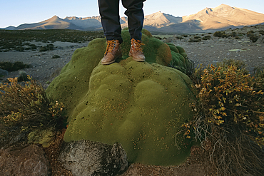
1116-52923 - Hiker stands on a moss-covered rock in the Atacama desert, Chile
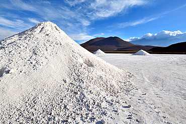
860-291575 - First industrial solar power plant in South America in Calama: Calama Solar 3 is the first industrial plant of its kind to be built in South America. Province of Loa, Antofagasta region. Chile.
860-291574 - El Cebollar cobalt mine. Antofogasta Region N. Chile
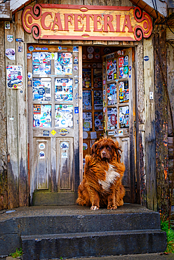
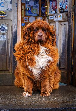
1111-237 - Patagonian mountain dog outside cafeteria near Torres del Paine National Park, Chile, South America
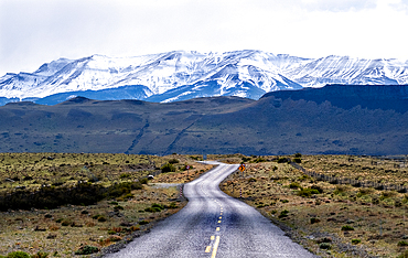
1111-236 - Highway leading to snow covered mountains, Torres del Paine National Park, Chile, South America
1111-235 - Sunrays falling over Cape Horn, Chile, South America
1111-234 - Patagonian mountain dog outside cafeteria near Torres del Paine National Park, Chile, South America
1111-233 - Colourful houses in Castro, Chile, South America
1111-231 - Salto Grande Waterfall, Torres del Paine National Park, southern Chile, South America
1111-230 - Torres del Paine National Park, southern Chile, South America
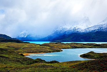
1111-229 - Blue lakes, Torres del Paine National Park, southern Chile, South America
1359-856 - Grave of Pablo Neruda, exterior of Pablo Neruda Museum, Isla Negra, Chile, South America
1359-855 - Exterior of Pablo Neruda Museum, Isla Negra, Chile, South America
1359-854 - Exterior of Pablo Neruda Museum, Isla Negra, Chile, South America
1359-853 - Elevated view of Quirilluca beach, Puchuncavi, Valparaiso Province, Valparaiso Region, Chile, South America
1359-852 - Coastal road by rocky coastline near Roca Oceanica, Concon, Valparaiso Province, Valparaiso Region, Chile, South America
1359-851 - Rocks at Pablo Neruda beach below Pablo Neruda Museum, Isla Negra, Chile, South America
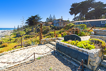
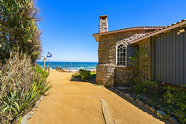
1359-850 - Pablo Neruda beach house and garden, Pablo Neruda Museum, Isla Negra, Chile, South America
1359-849 - High angle view of Corral de los Perros beach, Puchuncavi, Valparaiso Province, Valparaiso Region, Chile, South America
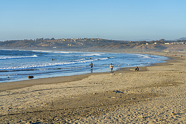
1359-848 - La Boca beach, Concon, Valparaiso Province, Valparaiso Region, Chile, South America
1359-847 - High angle view of Corral de los Perros beach, Puchuncavi, Valparaiso Province, Valparaiso Region, Chile, South America
1359-846 - Bahamas beach and highrise buildings in background, Concon, Valparaiso Province, Valparaiso Region, Chile, South America
1359-845 - Traditionally dressed huaso riding horse on field, Colina, Chacabuco Province, Santiago Metropolitan Region, Chile, South America
1359-844 - Traditionally dressed huaso riding horse on field, Colina, Chacabuco Province, Santiago Metropolitan Region, Chile, South America
1359-843 - Huaso riding horse on street on sunny day, Colina, Chacabuco Province, Santiago Metropolitan Region, Chile, South America
1359-842 - Sand dunes, Concon, Valparaiso Province, Valparaiso Region, Chile, South America
1359-841 - Elevated view of Quirilluca beach, Puchuncavi, Valparaiso Province, Valparaiso Region, Chile, South America
1359-840 - Huaso riding horse at ranch on sunny day, Colina, Chacabuco Province, Santiago Metropolitan Region, Chile, South America
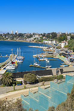
1359-839 - Elevated view of boats at Caleta Higuerillas, Concon, Valparaiso Province, Valparaiso Region, Chile, South America
1359-838 - Footprints in sand at Quirilluca beach, Puchuncavi, Valparaiso Province, Valparaiso Region, Chile, South America
1359-837 - Elevated view of Quirilluca beach, Puchuncavi, Valparaiso Province, Valparaiso Region, Chile, South America
1359-836 - Exterior of Pablo Neruda Museum, Isla Negra, Chile, South America
1359-835 - Young Chilean horseman (huaso) preparing white horse at ranch, Colina, Chacabuco Province, Santiago Metropolitan Region, Chile, South America
1359-834 - Black beach (Playa Negra), Concon, Valparaiso Province, Valparaiso Region, Chile, South America
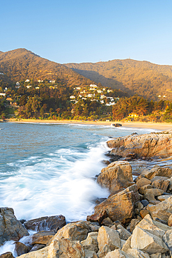
1359-832 - Cliffs along the coast with distant views of Maitencillo, Puchuncavi, Valparaiso Province, Valparaiso Region, Chile, South America
1359-833 - Black beach (Playa Negra), Concon, Valparaiso Province, Valparaiso Region, Chile, South America
1359-831 - Huaso riding horse in field, Colina, Chacabuco Province, Santiago Metropolitan Region, Chile, South America
1359-829 - Chilean cowboys (huaso) training rodeo at stadium, Colina, Chacabuco Province, Santiago Metropolitan Region, Chile, South America
1359-830 - Elevated view of Quirilluca beach, Puchuncavi, Valparaiso Province, Valparaiso Region, Chile, South America
1359-828 - La Boca beach, Concon, Valparaiso Province, Valparaiso Region, Chile, South America
1359-827 - Young Chilean horseman (huaso) preparing white horse at ranch, Colina, Chacabuco Province, Santiago Metropolitan Region, Chile, South America
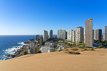
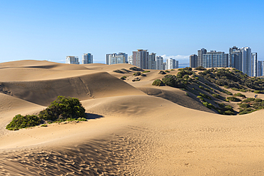
1359-826 - Sand dunes and residential high-rise buildings, Concon, Valparaiso Province, Valparaiso Region, Chile, South America
1359-825 - Young Chilean horseman (huaso) preparing white horse at ranch, Colina, Chacabuco Province, Santiago Metropolitan Region, Chile, South America
1359-823 - Chilean cowboys (huaso) training rodeo at stadium, Colina, Chacabuco Province, Santiago Metropolitan Region, Chile, South America
1359-824 - Two pelicans perching on rock, Caleta Higuerillas, Concon, Valparaiso Province, Valparaiso Region, Chile, South America
1359-822 - Sand dunes and residential high-rise buildings, Concon, Valparaiso Province, Valparaiso Region, Chile, South America
1359-821 - Sand dunes and residential high-rise buildings, Concon, Valparaiso Province, Valparaiso Region, Chile, South America
1359-820 - Rocks at Playa Cau Cau at sunset, Horcon, Puchuncavi, Valparaiso Province, Valparaiso Region, Chile, South America
1359-819 - Huaso in traditional clothing riding horse by cactus on hill, Colina, Chacabuco Province, Santiago Metropolitan Region, Chile, South America
1359-818 - Rocky coastline with Sheraton Miramar hotel, Vina del Mar, Valparaiso Region, Chile, South America
1359-817 - Elevated view of Quirilluca beach, Puchuncavi, Valparaiso Province, Valparaiso Region, Chile, South America
1359-816 - Rocky coastline and ships on sea, Caleta Abarca beach, Vina del Mar, Valparaiso Region, Chile, South America
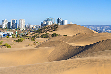
1359-815 - Sand dunes and distant view of Vina del Mar and Valparaiso, Concon, Valparaiso Province, Valparaiso Region, Chile, South America
1359-814 - Footprints in sand at Quirilluca beach, Puchuncavi, Valparaiso Province, Valparaiso Region, Chile, South America
1359-813 - Huaso riding horse at ranch on sunny day, Colina, Chacabuco Province, Santiago Metropolitan Region, Chile, South America
1359-812 - Young Chilean horseman (huaso) preparing white horse at ranch, Colina, Chacabuco Province, Santiago Metropolitan Region, Chile, South America
1359-811 - Birds at Quirilluca beach, Puchuncavi, Valparaiso Province, Valparaiso Region, Chile, South America
1359-810 - Vineyards with The Andes mountains on horizon, Haras de Pirque winery, Pirque, Maipo Valley, Cordillera Province, Santiago Metropolitan Region, Chile, South America
1359-808 - Vineyards with The Andes mountains on horizon, Haras de Pirque winery, Pirque, Maipo Valley, Cordillera Province, Santiago Metropolitan Region, Chile, South America
1359-809 - Chilean palm trees against Cerro La Campana at Sector Palmas de Ocoa, La Campana National Park, Cordillera De La Costa, Quillota Province, Valparaiso Region, Chile, South America
1359-807 - Cactus and Chilean palm trees, Sector Palmas de Ocoa, La Campana National Park, Cordillera De La Costa, Quillota Province, Valparaiso Region, Chile, South America
1359-806 - Chilean palm tree against Cerro La Campana at Sector Palmas de Ocoa, La Campana National Park, Cordillera De La Costa, Quillota Province, Valparaiso Region, Chile, South America
1359-805 - Chilean palm tree against Cerro La Campana at Sector Palmas de Ocoa, La Campana National Park, Cordillera De La Costa, Quillota Province, Valparaiso Region, Chile, South America
1359-804 - Facade of El Principal winery on sunny day, Pirque, Maipo Valley, Cordillera Province, Santiago Metropolitan Region, Chile, South America
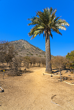
1359-803 - Native Chilean wine palm tree against mountain covered with palm trees, Sector Palmas de Ocoa, La Campana National Park, Cordillera De La Costa, Quillota Province, Valparaiso Region, Chile, South America
1359-802 - Chilean palm trees against Cerro La Campana at Sector Palmas de Ocoa, La Campana National Park, Cordillera De La Costa, Quillota Province, Valparaiso Region, Chile, South America
1359-801 - Vineyards with The Andes mountains on horizon, El Principal winery, Pirque, Maipo Valley, Cordillera Province, Santiago Metropolitan Region, Chile, South America
1359-800 - Cactuses and Chilean palm trees against Cerro La Campana at Sector Palmas de Ocoa, La Campana National Park, Cordillera De La Costa, Quillota Province, Valparaiso Region, Chile, South America
1359-799 - Vineyards with The Andes mountains on horizon, Haras de Pirque winery, Pirque, Maipo Valley, Cordillera Province, Santiago Metropolitan Region, Chile, South America
1359-798 - Native Chilean wine palm tree against mountain covered with palm trees, Sector Palmas de Ocoa, La Campana National Park, Cordillera De La Costa, Quillota Province, Valparaiso Region, Chile, South America
1359-797 - Las Cujas beach, Cachagua, Zapallar, Petorca Province, Valparaiso Region, Chile, South America
1359-796 - Chilean palm tree against mountains, Sector Palmas de Ocoa, La Campana National Park, Cordillera De La Costa, Quillota Province, Valparaiso Region, Chile, South America
1359-795 - Zapallar beach, Zapallar, Petorca Province, Valparaiso Region, Chile, South America
1359-793 - Native Chilean wine palm trees against mountain covered with palm trees, Sector Palmas de Ocoa, La Campana National Park, Cordillera De La Costa, Quillota Province, Valparaiso Region, Chile, South America
1359-794 - Chilean palm tree, Sector Palmas de Ocoa, La Campana National Park, Cordillera De La Costa, Quillota Province, Valparaiso Region, Chile, South America
1359-792 - Zapallar beach at sunset, Zapallar, Petorca Province, Valparaiso Region, Chile, South America
1359-791 - Hiking trail, Sector Palmas de Ocoa, La Campana National Park, Cordillera De La Costa, Quillota Province, Valparaiso Region, Chile, South America
1359-790 - Las Cujas beach, Cachagua, Zapallar, Petorca Province, Valparaiso Region, Chile, South America
1359-789 - Zapallar beach, Zapallar, Petorca Province, Valparaiso Region, Chile, South America
1359-788 - Zapallar beach, Zapallar, Petorca Province, Valparaiso Region, Chile, South America
1359-787 - Wine cellar with barrels and crates with grapes, El Principal winery, Pirque, Maipo Valley, Cordillera Province, Santiago Metropolitan Region, Chile, South America
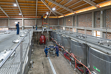
1359-786 - Fermentation tanks, El Principal winery, Pirque, Maipo Valley, Cordillera Province, Santiago Metropolitan Region, Chile, South America
1359-785 - Fermentation tanks, Haras de Pirque winery, Pirque, Maipo Valley, Cordillera Province, Santiago Metropolitan Region, Chile, South America
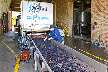
1359-784 - Worker sorting and processing of grapes in El Principal winery, Pirque, Maipo Valley, Cordillera Province, Santiago Metropolitan Region, Chile, South America
1359-783 - Zapallar beach, Zapallar, Petorca Province, Valparaiso Region, Chile, South America
1359-782 - Detail of red grapes at Haras de Pirque winery, Pirque, Maipo Valley, Cordillera Province, Santiago Metropolitan Region, Chile, South America
1359-781 - Fermentation tanks, El Principal winery, Pirque, Maipo Valley, Cordillera Province, Santiago Metropolitan Region, Chile, South America
1359-780 - Zapallar beach, Zapallar, Petorca Province, Valparaiso Region, Chile, South America
1359-779 - Chilean palm trees, Sector Palmas de Ocoa, La Campana National Park, Cordillera De La Costa, Quillota Province, Valparaiso Region, Chile, South America
1359-778 - Zapallar beach at sunset, Zapallar, Petorca Province, Valparaiso Region, Chile, South America
1359-777 - Detail of red grapes at Haras de Pirque winery, Pirque, Maipo Valley, Cordillera Province, Santiago Metropolitan Region, Chile, South America
1359-776 - Detail of red grapes at Haras de Pirque winery, Pirque, Maipo Valley, Cordillera Province, Santiago Metropolitan Region, Chile, South America
1359-775 - Zapallar beach at sunset, Zapallar, Petorca Province, Valparaiso Region, Chile, South America
1359-774 - Wine cellar with barrels where wine does malolactic fermentation, El Principal winery, Pirque, Maipo Valley, Cordillera Province, Santiago Metropolitan Region, Chile, South America
1359-773 - Fermentation tanks, El Principal winery, Pirque, Maipo Valley, Cordillera Province, Santiago Metropolitan Region, Chile, South America
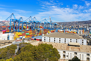
1359-772 - Cranes and cargo containers stacked at Port of Valparaiso, Valparaiso, Valparaiso Province, Valparaiso Region, Chile, South America
1359-771 - Painted mural with text saying Plante amor (Plant love) and heart at Cerro La Florida, Valparaiso, Valparaiso Province, Valparaiso Region, Chile, South America
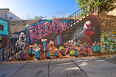
1359-770 - Painted mural at Pasaje Atahualpa, Cerro Carcel, Valparaiso, Valparaiso Province, Valparaiso Region, Chile, South America

