Recent searches
Loading...
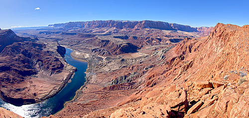
1311-608 - The Vermilion Cliffs adjacent to Glen Canyon Recreation Area viewed from the plateau at the end of Spencer Trail in Marble Canyon with Lee's Ferry on the lower left with the Colorado River, Arizona, United States of America, North America
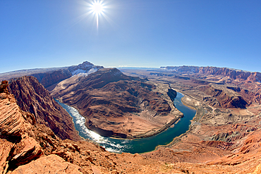
1311-607 - The bend in the Colorado River at Lee's Ferry in Glen Canyon Recreation Area viewed from the plateau at the end of Spencer Trail at Marble Canyon in winter, Arizona, United States of America, North America
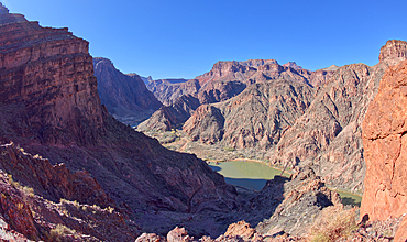
1311-587 - The South Kaibab Trail winding down to the Black Bridge that spans the Colorado River at Grand Canyon Arizona. Phantom Ranch is just left of center.
832-388069 - Starting point Bright Angel Trail, sign Bright Angel Trailhead, Colorado Plateau, Grand Canyon Village, Grand Canyon National Park, Arizona, USA, North America
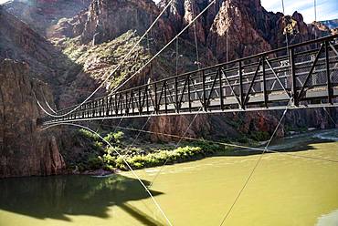
832-385420 - Suspension Bridge Kaibab Suspension Bridge over Colorado River, South Kaibab Trail, Grand Canyon National Park, Arizona, USA, North America
1116-44820 - Woman Sitting On The Edge Of A Rock Canyon Cliff Looking Over The Colorado River With Canyon Walls In The Background, Colorado, United States Of America
857-95985 - The distant Gore Range is one of many views along Colorado's Trail Ridge Road Scenic Byway as it crosses both the Continental Divide and the width of Rocky Mountain National Park, USA
1178-26348 - Woman hiking on Loveland Pass, Colorado, West Ridge Trail, Loveland Pass, Colorado, USA
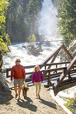
857-95217 - Front view shot of mother, daughter and dog hiking near waterfall, Steamboat Springs, Colorado, USA
857-95219 - Beautiful nature photograph of adult and young moose (Alces alces) on lakeshore, Lily Lake Trail, Rocky Mountain National Park, Estes Park, Colorado, USA
857-94106 - Mother and daughter hiking on Colorado Trail near Trout Lake and Kennebac Pass in San Juan National Forest
857-94102 - A woman mountain biking on the Horse Gulch Trail System, Durango, Colorado
1178-26101 - USA, Colorado, Silhouette of hiker on rock ledge along Chicago Lakes Trail in Mount Evans Wilderness Area
1178-26100 - USA, Colorado, Silhouette of hiker on rock ledge along Chicago Lakes Trail in Mount Evans Wilderness Area
857-93833 - Two Female Hikers Smiling While Walking On A Trail Beneath The Flatirons In Colorado
857-93834 - Portrait Of Two Female Hiker Smiling While Hiking On Trail In Colorado
857-93852 - Trail Light Passing On Road In The Shape Of A Question Mark On Colorado Highway
857-93832 - Two Female Hikers Walking On A Trail Beneath The Flatirons In Colorado
857-93552 - A Female Hiker Hiking On A Forest Trail In Rocky Mountain National Park, Colorado
857-93139 - Person Mountain Biking On Trail In Desert Landscape
857-92868 - A man hikes up the trail to the Jackal Hut, White River National Forest, Colorado.
857-92551 - Two women mountain biking on the Boggy Draw Trail near Dolores, Colorado.
857-91896 - A man mountain biking across a green tundra scene in Colorado.
857-91898 - A man sitting on his mountain bike in a field of purple flowers and stormy grey clouds enjoying the view.
857-91897 - A man riding his mountain bike across a field of purple flowers on a stormy day.
857-89701 - Hikers on the sandstone Esplanade of the Thunder River Trail below the North Rim of the Grand Canyon outside Fredonia, Arizona November 2011. The 21.4-mile loop descends 2000-feet in 2.5-miles through Coconino Sandstone from the Bill Hall trailhead to connect the Thunder River and Deer Creeks trails. Hikers descend into the lower canyon through a break in the 400-foot-tall Redwall to access Surprise Valley, Deer Creek, Tapeats Creek via Thunder River and even the Colorado River.
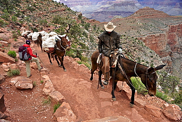
857-89692 - Female hiker waits for pack horses to pass on the South Kaibab Trail in Grand Canyon National Park north of Williams, Arizona May 2011. The South Kaibab Trail starts on the south rim of the Colorado Plateau and follows a ridge out to Skeleton Point allowing for 360-degree views of the canyon then down to the Colorado River. At the Colorado River the trail connects with the North Kaibab trail as part of the Arizona Trail system, that crosses the state of Arizona from Mexico to Utah.
857-89700 - Hikers on the sandstone Esplanade of the Thunder River Trail below the North Rim of the Grand Canyon outside Fredonia, Arizona November 2011. The 21.4-mile loop descends 2000-feet in 2.5-miles through Coconino Sandstone from the Bill Hall trailhead to connect the Thunder River and Deer Creeks trails. Hikers descend into the lower canyon through a break in the 400-foot-tall Redwall to access Surprise Valley, Deer Creek, Tapeats Creek via Thunder River and even the Colorado River.
857-88915 - A mother and daughter walking over the Animas River on a bridge on the Animas River Trail in Durango, Colorado.
857-88916 - A woman running over the Animas River on a bridge on the Animas River Trail in Durango, Colorado.
857-88914 - A young girl reading a book while sitting on a bridge over the Animas River on the Animas River Trail in Durango, Colorado.
857-88913 - A mother and daughter mountain biking over the Animas River on a bridge on the Animas River Trail in Durango, Colorado.
1178-23111 - Vapor trail on clear sky above mountains, Colorado, USA
1178-5285 - Male mountain biker on trail, Colorado, USA
857-86397 - Adult male trail running through a snow covered trail high in the mountains above Telluride Colorado on a beautiful spring afternoon, Telluride, Co, USA
857-86398 - Adult male trail running through a snow covered trail high in the mountains above Telluride Colorado on a beautiful spring afternoon, Telluride, Co, USA
857-86396 - Adult male trail running through a grassy trail high in the mountains above Telluride Colorado on a beautiful spring afternoon, Telluride, Co, USA
857-86544 - Pine trees interspersed on bell mountain trail on Aspen Mountain in Aspen, Colorado, USA, Aspen, Colorado, USA
816-7930 - View over the Colorado River from the Slickrock trail, Moab, Utah, United States of America, North America
816-7929 - View over the Colorado River from the Slickrock trail, Moab, Utah, United States of America, North America
857-86000 - Hikers on the sandstone Esplanade of the Thunder River Trail below the North Rim of the Grand Canyon outside Fredonia, Arizona November 2011. The 21.4-mile loop descends 2000-feet in 2.5-miles through Coconino Sandstone from the Bill Hall trailhead to connect the Thunder River and Deer Creeks trails. Hikers descend into the lower canyon through a break in the 400-foot-tall Redwall to access Surprise Valley, Deer Creek, Tapeats Creek via Thunder River and even the Colorado River.
832-371875 - Mountain bikers, Colorado River, White Rim Trail, Moab, Utah, USA
1113-93604 - Jeep driving at brim above Colorado River, White Rim Drive, White Rim Trail, Island in the Sky, Canyonlands National Park, Moab, Utah, Southwest, USA, America
1113-93603 - Jeep standing at brim above Colorado River, White Rim Drive, White Rim Trail, Island in the Sky, Canyonlands National Park, Moab, Utah, Southwest, USA, America
832-136161 - The Chapel of All Saints, at the end of a trail with sculptures showing the Stations of the Cross, on a hill above town, San Luis, Colorado, USA
1125-117 - Indian Gardens along the Bright Angel trail, Colorado, United States of America, North America
1125-98 - Agave on the Bright Angel trail, Colorado, United States of America, North America
857-62349 - Yvonne Joyce trail running in Vail, Colorado.
857-81595 - Lupine flowers along the Lupine Loop Trail with the town of Crested Butte, Whetstone Mountain adn the Slate River in the background, Colorado.
857-81592 - A young girl mountain biking past wildflowers on the Lupine Loop Trail in Crested Butte, Colorado.
857-81591 - A woman trail running past wildflowers on the Lupine Trail in Crested Butte, Colorado.
857-81631 - A young girl mountain biking on a trail through Gambrel Oak in orange fall color, La Plata Mountains, Mayday, Colorado.
857-81589 - A young girl follows her mother while mountain biking the Valley Trail in Telluride, Colorado.
857-74396 - Two young women trail running in the mountains on an early morning.
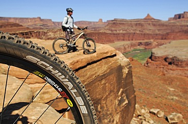
857-80306 - Mountain bikers riding on a trail overlooking the Colorado River near Moab Utah.
857-81593 - A woman mountain biking past wildflowers on the Lupine Loop Trail in Crested Butte, Colorado.
857-81594 - A woman trail running past wildflowers on the Lupine Trail in Crested Butte, Colorado.
857-52310 - A man standing by his mountain bike watching a colorful sunset from Sargents Mesa on the Colorado Trail in Colorado.
857-36588 - Jessica Reilly biking Deer Creek trail, Crested Butte, Colorado.
857-30475 - Bill Ward mountain biking on the Jud Wiebe trail above Telluride, Colorado
857-30428 - Rolando Garibotti skis with a pack on the Boreas Pass trail which crosses the Rocky Mountains from Breckenridge to Como, Colorado. The trail is part of the Rails to Trails system and follows an old railroad grade. The trail is also part of the 10th Mountain Division Hut System, with a hut called the Section House located along the trail at the top of Boreas Pass. The trail is within Pike-San Isabel National Forest
857-30429 - A father, Brad Piehl, watches while his daughter, Jenna, snowshoes for the first time, on the snow covered Boreas Pass Road, a popular winter recreation trail for cross country skiers and snowshoers. The road becomes a trail, and is part of the Rails to Trails system. It follows an old railroad grade southeast over the mountains to the town of Como.
733-4741 - Hiker on Longs Peak Trail, Rocky Mountain National Park, Colorado, United States of America, North America
764-2220 - Lane through fall aspens, Ophir Pass, Uncompahgre National Forest, Colorado, United States of America, North America
764-2219 - Lane through fall aspens, Ophir Pass, Uncompahgre National Forest, Colorado, United States of America, North America
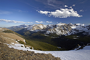
764-1222 - Snow-covered mountains in the spring from Trail Ridge Road, Rocky Mountain National Park, Colorado, United States of America, North America
764-1220 - Snow-covered mountains in the spring from Trail Ridge Road, Rocky Mountain National Park, Colorado, United States of America, North America
733-1929 - Mules taking tourists along the Colorado River Trail, Grand Canyon, Arizona, United States of America, North America
733-2008 - A trail marker below the Gore mountains at Vail Ski Resort, Vail, Colorado, United States of America, North America
You reached the end of search results
