Recent searches
Loading...
1350-3552 - Hawksbill turtle portrait, Eretmochelys imbricata, Komodo National Park, Nusa Tenggara, Indonesia, Pacific Ocean
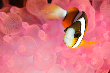
1350-3551 - Clark's Anemonefish, Amphiprion clarkii, in pink bubble tip anemone, Sangeang Volcanic Island, Nusa Tenggara, Indonesia, Pacific Ocean
1350-2547 - Reef wall covered with soft corals and gorgonians, mainly orange cup coral, Tubastrea faulkneri, Verde Island, Philippines.
1350-3566 - A magnificent anemone, Heteractis magnifica, in a shallow hard coral garden featuring several species of hard coral including finger and plate corals such as Porites sp., and Acropora sp., Komodo National Park, Nusa Tenggara, Indonesia, Pacific Ocean Komodo National Park, Nusa Tenggara, Indonesia, Pacific Ocean
1350-3582 - Split photo of branching staghorn corals, Acropora sp., and islands in the background, Loloda Selatan, Spice Islands, Maluku Region, Halmahera, Indonesia, Pacific Ocean
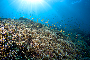
1350-3580 - Anthias, Pseudanthias sp., swim over a hard coral garden with a variety of different hard corals including table, branching, cabbage or lettuce, staghorn, and leather varieties, Acropora sp., Porites sp., Echinopora sp., Sarcophyton sp., Spice Islands, Maluku Region, Halmahera, Indonesia, Pacific Ocean
1350-3565 - A magnificent anemone, Heteractis magnifica, in a shallow hard coral garden featuring several species of hard coral including finger and plate corals such as Porites sp., and Acropora sp., Komodo National Park, Nusa Tenggara, Indonesia, Pacific Ocean Komodo National Park, Nusa Tenggara, Indonesia, Pacific Ocean
1350-2159 - Tropical palm trees and lagoon of Fakarava, Tuamotus Archipelago French Polynesia, Tuamotu Islands, South Pacific. Summer vacation concept. Tropical coconut palm trees, coral gardens, beautiful turquoise clear water and blue sky with some white clouds. Fakarava, an atoll in the west of the Tuamotu group, French Polynesia
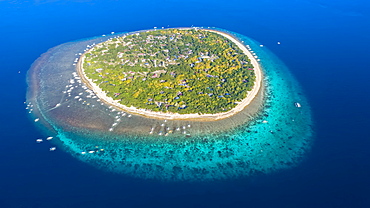
1116-49711 - An aerial view of Balicasag Island, a tiny island in South West Bohol in the central Philippines. It is famous for scuba diving on the deep, vertical walls and there are some fantastic hard coral gardens at snorkeling depths, Balicasag Island, Philippines
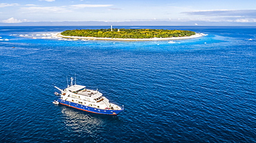
1116-49712 - An aerial view of the live aboard vessel Infiniti for scuba diving off Balicasag Island, a tiny island in South West Bohol in the central Philippines. It is famous for scuba diving on the deep, vertical walls and there are some fantastic hard coral gardens at snorkeling depths, Balicasag Island, Philippines
1116-42625 - Caribbean Whiptail Stingray (Himantura Schmardae), Utila, Bay Islands, Honduras
1116-42624 - Caribbean Whiptail Stingray (Himantura Schmardae), Utila, Bay Islands, Honduras
857-94717 - Nimoa Island - here the island mission will impress. The five-sided church features murals of island life and all mission buildings are surrounded by well maintained paths and gardens filled with flowering plants. Edged by jungle-covered mountains, postcard beaches and crystal clear waters - an island paradise indeed! The Louisiade Archipelago is a string of ten larger volcanic islands frequently fringed by coral reefs, and 90 smaller coral islands located 200 km southeast of New Guinea, stretching over more than 160 km and spread over an ocean area of 26,000 km? between the Solomon Sea to the north and the Coral Sea to the south. The aggregate land area of the islands is about 1,790 km? (690 square miles), with Vanatinai (formerly Sudest or Tagula as named by European claimants on Western maps) being the largest. Sideia Island and Basilaki Island lie closest to New Guinea, while Misima, Vanatinai, and Rossel islands lie further east. The archipelago is divided into the Local Level Government (LLG) areas Loui!
857-94720 - Nimoa Island - here the island mission will impress. The five-sided church features murals of island life and all mission buildings are surrounded by well maintained paths and gardens filled with flowering plants. Edged by jungle-covered mountains, postcard beaches and crystal clear waters - an island paradise indeed! The Louisiade Archipelago is a string of ten larger volcanic islands frequently fringed by coral reefs, and 90 smaller coral islands located 200 km southeast of New Guinea, stretching over more than 160 km and spread over an ocean area of 26,000 km? between the Solomon Sea to the north and the Coral Sea to the south. The aggregate land area of the islands is about 1,790 km? (690 square miles), with Vanatinai (formerly Sudest or Tagula as named by European claimants on Western maps) being the largest. Sideia Island and Basilaki Island lie closest to New Guinea, while Misima, Vanatinai, and Rossel islands lie further east. The archipelago is divided into the Local Level Government (LLG) areas Louisiade Rural (western part, with Misima), and Yaleyamba (western part, with Rossell and Tagula islands. The LLG areas are part of Samarai-Murua District district of Milne Bay. The seat of the Louisiade Rural LLG is Bwagaoia on Misima Island, the population center of the archipelago.
857-94718 - Nimoa Island - here the island mission will impress. The five-sided church features murals of island life and all mission buildings are surrounded by well maintained paths and gardens filled with flowering plants. Edged by jungle-covered mountains, postcard beaches and crystal clear waters - an island paradise indeed! The Louisiade Archipelago is a string of ten larger volcanic islands frequently fringed by coral reefs, and 90 smaller coral islands located 200 km southeast of New Guinea, stretching over more than 160 km and spread over an ocean area of 26,000 km? between the Solomon Sea to the north and the Coral Sea to the south. The aggregate land area of the islands is about 1,790 km? (690 square miles), with Vanatinai (formerly Sudest or Tagula as named by European claimants on Western maps) being the largest. Sideia Island and Basilaki Island lie closest to New Guinea, while Misima, Vanatinai, and Rossel islands lie further east. The archipelago is divided into the Local Level Government (LLG) areas Louisiade Rural (western part, with Misima), and Yaleyamba (western part, with Rossell and Tagula islands. The LLG areas are part of Samarai-Murua District district of Milne Bay. The seat of the Louisiade Rural LLG is Bwagaoia on Misima Island, the population center of the archipelago.
857-94715 - Nimoa Island - here the island mission will impress. The five-sided church features murals of island life and all mission buildings are surrounded by well maintained paths and gardens filled with flowering plants. Edged by jungle-covered mountains, postcard beaches and crystal clear waters - an island paradise indeed! The Louisiade Archipelago is a string of ten larger volcanic islands frequently fringed by coral reefs, and 90 smaller coral islands located 200 km southeast of New Guinea, stretching over more than 160 km and spread over an ocean area of 26,000 km? between the Solomon Sea to the north and the Coral Sea to the south. The aggregate land area of the islands is about 1,790 km? (690 square miles), with Vanatinai (formerly Sudest or Tagula as named by European claimants on Western maps) being the largest. Sideia Island and Basilaki Island lie closest to New Guinea, while Misima, Vanatinai, and Rossel islands lie further east.
857-94719 - Nimoa Island - here the island mission will impress. The five-sided church features murals of island life and all mission buildings are surrounded by well maintained paths and gardens filled with flowering plants. Edged by jungle-covered mountains, postcard beaches and crystal clear waters - an island paradise indeed! The Louisiade Archipelago is a string of ten larger volcanic islands frequently fringed by coral reefs, and 90 smaller coral islands located 200 km southeast of New Guinea, stretching over more than 160 km and spread over an ocean area of 26,000 km? between the Solomon Sea to the north and the Coral Sea to the south. The aggregate land area of the islands is about 1,790 km? (690 square miles), with Vanatinai (formerly Sudest or Tagula as named by European claimants on Western maps) being the largest. Sideia Island and Basilaki Island lie closest to New Guinea, while Misima, Vanatinai, and Rossel islands lie further east. The archipelago is divided into the Local Level Government (LLG) areas Louisiade Rural (western part, with Misima), and Yaleyamba (western part, with Rossell and Tagula islands. The LLG areas are part of Samarai-Murua District district of Milne Bay. The seat of the Louisiade Rural LLG is Bwagaoia on Misima Island, the population center of the archipelago.
857-94721 - Nimoa Island - here the island mission will impress. The five-sided church features murals of island life and all mission buildings are surrounded by well maintained paths and gardens filled with flowering plants. Edged by jungle-covered mountains, postcard beaches and crystal clear waters - an island paradise indeed! The Louisiade Archipelago is a string of ten larger volcanic islands frequently fringed by coral reefs, and 90 smaller coral islands located 200 km southeast of New Guinea, stretching over more than 160 km and spread over an ocean area of 26,000 km? between the Solomon Sea to the north and the Coral Sea to the south. The aggregate land area of the islands is about 1,790 km? (690 square miles), with Vanatinai (formerly Sudest or Tagula as named by European claimants on Western maps) being the largest. Sideia Island and Basilaki Island lie closest to New Guinea, while Misima, Vanatinai, and Rossel islands lie further east. The archipelago is divided into the Local Level Government (LLG) areas Loui!
857-94716 - Nimoa Island - here the island mission will impress. The five-sided church features murals of island life and all mission buildings are surrounded by well maintained paths and gardens filled with flowering plants. Edged by jungle-covered mountains, postcard beaches and crystal clear waters - an island paradise indeed! The Louisiade Archipelago is a string of ten larger volcanic islands frequently fringed by coral reefs, and 90 smaller coral islands located 200 km southeast of New Guinea, stretching over more than 160 km and spread over an ocean area of 26,000 km? between the Solomon Sea to the north and the Coral Sea to the south. The aggregate land area of the islands is about 1,790 km? (690 square miles), with Vanatinai (formerly Sudest or Tagula as named by European claimants on Western maps) being the largest. Sideia Island and Basilaki Island lie closest to New Guinea, while Misima, Vanatinai, and Rossel islands lie further east. The archipelago is divided into the Local Level Government (LLG) areas Loui!
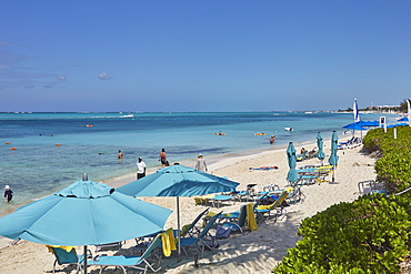
1202-153 - A view of Grace Bay at the Coral Garden Resort and Somewhere Restaurant, Providenciales, Turks and Caicos, in the Caribbean, West Indies, Central America
1202-154 - A view of Grace Bay at the Coral Garden Resort and Somewhere Restaurant, Providenciales, Turks and Caicos, in the Caribbean, West Indies, Central America
860-282431 - Hard coral garden on reef, Moluccus Banda Sea Indonesia
1113-83836 - Luxurious homes in Coral Gables, Miami, Florida, United States of America, USA
1113-83835 - Luxurious homes in Coral Gables, Miami, Florida, United States of America, USA
1113-83834 - Luxurious homes in Coral Gables, Miami, Florida, United States of America, USA
465-1705 - Colourful Crinoids and Solt Corals at Hanging Gardens, Sipadan Island, Sabah, Malaysia
You reached the end of search results

